username
X
password
register
for free!
help
ArticlesGuidesRoutes
 
Photosets
 
 Comments
triplogs   photosets   labels comments more
20 triplogs
login for filter options
Aug 06 2016
avatar

 Photos 24
 Triplogs 20

45 male
 Joined Oct 20 2005
 Mesa, AZ
Houston Brothers Trail - Aspen Spring AccessPayson, AZ
Payson, AZ
Hiking avatar Aug 06 2016
Dirt4dinnerTriplogs 20
Hiking1.00 Miles 150 AEG
Hiking1.00 Miles
150 ft AEG
 no routes
1st trip
Linked   none no linked trail guides
Partners none no partners
Took my son on his first backpacking trip! The only thing I want to add to the current description is a little better explanation of the actual parking spot and where you begin hiking. When you make the turn onto 139G (kind of easy to miss, but obvious that you've missed it if you get to higher letters...like I did). It's about .5-.7 miles to the parking spot on the LEFT. The road is very faint, as it's been closed for a long time. There are two posts, and a sign with # 9738N.

Aside from a little wandering finding out spot. The meadow and camp site are just AMAZING. We saw a young couple cruise by on friday evening evening aroun 5:30pm and then a larger group of 5-6 well after dark at 8:45pm, both groups across the creek from the cabin on the main trail. Firewood will be tricky, but there is a nice fire pit. The cabin is a TERRIFIC spot to get some cover (shade/ rain) while packing unpacking. I didn't see any signs of wild critters in it like some cabins in the back country.

Water was REALLY shallow, but fairly clear and easy enough to scope a little out with a cup. Saw a MASSIVE crawdad in there, so it apparently never dries up. We boiled the water and enjoyed.

Absolutely the PERFECT first hike for my 3 year old. I did have to hold his hand while hiking because the road is pretty steep and rocky...but for .5 mile I am happy to hold his hand.
_____________________
*****Dirt4Dinner***** - I like anything fast enough to do something stupid on.
 
Apr 17 2010
avatar

 Photos 24
 Triplogs 20

45 male
 Joined Oct 20 2005
 Mesa, AZ
Haunted Canyon #203Globe, AZ
Globe, AZ
Hiking avatar Apr 17 2010
Dirt4dinnerTriplogs 20
Hiking7.80 Miles 1,766 AEG
Hiking7.80 Miles
1,766 ft AEG
 no routesno photosets
1st trip
Partners partners
ABC - Event
HAZ - Event
te_wa
Topo the dog
TOASTY WARM OUT THERE! The thermometer on my pack said 91 this afternoon when we got back to the car. This is a TERRIFIC hike though! We found out as soon as we pulled into the parking area, that we weren't going to be alone on this trip! There were something like 35 or 40 boy scouts out at the cabin as well. We stayed about a quarter mile from the cabin in a nice grove of trees (terrific for all 5 hammocks on this trip!). On the way back, we attempted to follow the creek all the way through the narrows that is bypassed by a trek up a large hillside. We found out pretty quick why the trail goes the way it does...a 40 or 50 mandatory swim is why! The canyon narrows to about 8 ft. wide and the water was roughly 6 feet deep. We thought about it for a few minutes, and then decided to go ahead and stay dry and just use the trail. I wouldn't mind doing this though sometime, there is some good exploring to be done one this first water hole is complete. I didn't personally see any rattle snakes this trip, but we did see a large Bull Snake on the hike in, and then some of our group got up close and personal with a green rattle snake (see Te-Wa's photos). The boy scouts also reported a black rattler on the trail as well.

We also climbed up and poked around Skull Cave, which was very neat! A little spooky in there, but after all it is in Haunted Canyon!
_____________________
*****Dirt4Dinner***** - I like anything fast enough to do something stupid on.
 
Apr 10 2010
avatar

 Photos 24
 Triplogs 20

45 male
 Joined Oct 20 2005
 Mesa, AZ
Reavis Ranch via 109 NorthGlobe, AZ
Globe, AZ
Hiking avatar Apr 10 2010
Dirt4dinnerTriplogs 20
Hiking18.60 Miles 2,824 AEG
Hiking18.60 Miles   6 Hrs   30 Mns   2.86 mph
2,824 ft AEG
 no routes
Linked   none no linked trail guides
Partners partners
HAZ - Event
Topo the dog
Great weekend to be out at the Ranch...even the low was a shocking 35 degrees overnight! The water was flowing nicely through the area. I ended up out there with Topo and 3 others from ABC (Angelo, Jason and Sara). The hike was incredibly quick both in and out...I felt like it was over in the blink of an eye.

Only issue we had...and it's a BIG ONE! My 4Runner got broken into while we were out there. Only...they didn't "break in". The truck was locked, but apparently they slim jimmed it or something, because there was no signes of forced entry. Thankfully for me, they left all my stuff alone. However they did grab Jason and Angelo's wallets. Nothing else! Not the Solio Charger, not the big knife laying on the back seat, not the inverter, stereo, amp, sub, hi-jack lift...CDs...nothing, just those two wallets. Pretty big Buzz kill after a good hike, so keep your belongs with you when you hike.
_____________________
*****Dirt4Dinner***** - I like anything fast enough to do something stupid on.
 
Apr 04 2010
avatar

 Photos 24
 Triplogs 20

45 male
 Joined Oct 20 2005
 Mesa, AZ
Cave Trail #233Phoenix, AZ
Phoenix, AZ
Hiking avatar Apr 04 2010
Dirt4dinnerTriplogs 20
Hiking5.00 Miles 1,400 AEG
Hiking5.00 Miles   3 Hrs   40 Mns   1.36 mph
1,400 ft AEG
 no routesno photosets
1st trip
Linked   none no linked trail guides
Partners none no partners
LOVE IT LOVE IT LOVE IT! What a great hike! We did just like the description said. The only times that I got confused was when I kept wanting to drop down ravines to the Bluff Spring Trail (I could see the trail, and people hiking on it, and I kept trying to follow cairns down the small ravines to the trail, but my wife stayed on the main trail and made me follow). So, when you're in the home stretch and you start seeing the Bluff Spring Trail, just stay the course, you will be running perfectly parallel with Bluff Spring Trail and with Paralta, almost on top of the ridge. Just follow the trail all the way to the end of the ridge and it drops you right on top of the Bluff Spring Trail.

The photos from Joe were helpful, but I was able to follow the trail without much problem. I will do this again for sure, it's a tough little dayhike. Lots of elevation, but the scenery and views are priceless.

This made for 22 miles for Topo and I this weekend...he will be sleeping on the couch if you need him!
_____________________
*****Dirt4Dinner***** - I like anything fast enough to do something stupid on.
 
Apr 03 2010
avatar

 Photos 24
 Triplogs 20

45 male
 Joined Oct 20 2005
 Mesa, AZ
Marsh Valley LoopPhoenix, AZ
Phoenix, AZ
Hiking avatar Apr 03 2010
Dirt4dinnerTriplogs 20
Hiking16.00 Miles 1,540 AEG
Hiking16.00 Miles   6 Hrs   15 Mns   2.56 mph
1,540 ft AEG
 no routesno photosets
1st trip
Linked   none no linked trail guides
Partners partners
HAZ - Event
BobP
joebartels
Mike_Fels
Topo the dog
Terrific weather, great company and a fast pace! This was the receipt for a very nice day hike. There was water in every creek we crossed. We missed the turn off for Calvary Trail somehow (apparently not well marked), so we slightly motified this loop, but keep the basic idea in check.
_____________________
*****Dirt4Dinner***** - I like anything fast enough to do something stupid on.
 
Jan 17 2009
avatar

 Photos 24
 Triplogs 20

45 male
 Joined Oct 20 2005
 Mesa, AZ
Taylor Cabin via Dogie Trail - Sycamore CanyonSedona, AZ
Sedona, AZ
Backpack avatar Jan 17 2009
Dirt4dinnerTriplogs 20
Backpack20.00 Miles
Backpack20.00 Miles
 no routesno photosets
1st trip
Linked   none no linked trail guides
Partners partners
HAZ - Event
drewboy
rushthezeppelin
te_wa
Topo the dog
What a fun trip, but a humpbuster for sure!

Lots of climbing, lots of rock hopping, plenty of snow, and to much mud. I would do it again :)
_____________________
*****Dirt4Dinner***** - I like anything fast enough to do something stupid on.
 
Jan 02 2009
avatar

 Photos 24
 Triplogs 20

45 male
 Joined Oct 20 2005
 Mesa, AZ
Tule TH to Tortilla Road (Hwy 88), AZ 
Tule TH to Tortilla Road (Hwy 88), AZ
 
Backpack avatar Jan 02 2009
Dirt4dinnerTriplogs 20
Backpack31.20 Miles
Backpack31.20 Miles3 Days         
 no routesno photosets
1st trip
Linked   none no linked trail guides
Partners none no partners
Hike started on Friday at Tule TH, stayed that night at a camp site along Pine Creek off the Reavis Gap Trail, stayed Saturday Night in Angel Basin, and hiked out to HWY 88 at Tortilla Traihead on Sunday. Cold, windy and SOAKED from rain...not to mention bleeding from head to two from hiking on 20+ miles of very unmaintained trails.
_____________________
*****Dirt4Dinner***** - I like anything fast enough to do something stupid on.
  2 archives
Jul 12 2008
avatar

 Photos 24
 Triplogs 20

45 male
 Joined Oct 20 2005
 Mesa, AZ
Canyon Creek - Tonto NFPayson, AZ
Payson, AZ
Backpack avatar Jul 12 2008
Dirt4dinnerTriplogs 20
Backpack5.00 Miles 250 AEG
Backpack5.00 Miles
250 ft AEG
 no routesno photosets
1st trip
Linked   none no linked trail guides
Partners partners
te_wa
tkknc
Took a nice leisurely stroll down the flat trail, then down the flat road into the BEAUTIFUL Canyon Creek area. We set up camp as the thunderheads rolled in, and enjoyed a nice Saturday afternoon nap in the hammock while the rain passed through. Fishing was tough, but we managed to pull a few Brown Trout out of the creek. Sunday morning, after a 12 hour rain, we enjoyed over cast skies as we fished our way back up the creek all the way to the bridge. This would be a great hike for anyone, who wants scenery, solitude and fishing at the cost of zero effort.

We did get lucky (if you consider this lucky) and found a baby rattle snake hanging out in the rocks near our camp site. That was neat to see...but should be considered for future hikers. He will get bigger someday...and probably has friends in the area!
_____________________
*****Dirt4Dinner***** - I like anything fast enough to do something stupid on.
 
Jun 29 2008
avatar

 Photos 24
 Triplogs 20

45 male
 Joined Oct 20 2005
 Mesa, AZ
Tramway Trail #32Payson, AZ
Payson, AZ
Hiking avatar Jun 29 2008
Dirt4dinnerTriplogs 20
Hiking1.00 Miles 750 AEG
Hiking1.00 Miles
750 ft AEG
 no routes
1st trip
Linked   none no linked trail guides
Partners partners
HAZ - Event
Crocodile Ryan
fairweather8588
te_wa
tkknc
Headed out for a super quick overnight fishing trip. Fishing was pathetic, but the scenery made up for it 10 fold. This is a terrific hike for anyone who can handle a step trail. It's pretty technical, but it's over as soon as you think your legs are going to give out...and worth the effort.

Bring the camera!
_____________________
*****Dirt4Dinner***** - I like anything fast enough to do something stupid on.
 
Mar 22 2008
avatar

 Photos 24
 Triplogs 20

45 male
 Joined Oct 20 2005
 Mesa, AZ
Piestewa Peak Summit Trail #300Phoenix, AZ
Phoenix, AZ
Hiking avatar Mar 22 2008
Dirt4dinnerTriplogs 20
Hiking2.40 Miles 1,200 AEG
Hiking2.40 Miles
1,200 ft AEG
 no routesno photosets
Linked   none no linked trail guides
Partners none no partners
Took the in laws up this morning. I made it up in 36 minutes today, then waited around for nearly an hour before heading down to find them. I found them about 1/4 of the way down, turned around and went back to the top with them. It was to hot to be going that slow...we spent nearly 3 hours out there today! I like to do this hike in about an hour round trip usually. Anyways, beautiful day, and the views were to be expected!
_____________________
*****Dirt4Dinner***** - I like anything fast enough to do something stupid on.
 
Mar 14 2008
avatar

 Photos 24
 Triplogs 20

45 male
 Joined Oct 20 2005
 Mesa, AZ
Rogers Canyon - JF Trail LoopGlobe, AZ
Globe, AZ
Backpack avatar Mar 14 2008
Dirt4dinnerTriplogs 20
Backpack14.00 Miles 2,600 AEG
Backpack14.00 Miles2 Days         
2,600 ft AEG
 no routesno photosets
1st trip
Linked   none no linked trail guides
Partners none no partners
Tyler - Dirt4dinner
Ryan - CrocodileRyan
Steve (first time backpacking)- Needs to sign up on HAZ!

What a GREAT TRIP! We started at Woodbury Trail Head, and did the loop backwards. We also skipped the whole shuttle nonsense, and just hoofed it from the Roger's Trough Trail Head back down FSR 172, and then jumped onto FT 114 back down to JF Ranch, then back to the car at Woodbury (the road SUCKED...and killed our already tired feet) but it was worth it to make the complete loop from Woodbury, back to Woodbury.

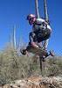
We stayed the night at a terrific camp site just East of Angel Basin near the creek (which was flowing from trail head to trail head. We left the car at about 6 pm and didn't get to camp until after 10pm. We had a new backpacker with us, and he suffered up the climb to Tortilla Pass and was slow getting down the backside because of fatigue. A nice dinner at camp and a terrific night sleep in surprisingly warm conditions refreshed all of our energy for the hike out. We broke camp and headed out at about 8:30, we were the first ones to the Roger's Canyon Ruins, and spent about 40 minutes climbing around the different caves and taking loads of photos! What a terrific destination, I was so impressed with this historic site. If you haven't been there...get out of the house and make it happen, you will be happy you did!

On the hike out after the ruins, we ran into 3 boy scout groups, and at least another 20 hikers coming down for the day from Roger's Trough Trail Head. Once we got the that trail head, we had a sit down, and snagged a cold bottle of water from a group that was just getting ready to hit the trail. Then we started the march up the road.

One side note to this trail, the section of Roger's Trail, just west of Angel Basin is in bad shape. It's severely over grown with all kinds of spiny plants, and ducking down low to get under branches was frequent. However, don't let that scare you away, it's a great loop!

One more note, there are many more camping spots between the ruins and Roger's Trough Trail Head if you are looking for some solitude as it appears Angel Basin gets pretty busy on the weekends. We had the place to ourselves on Friday night, but there were at least 3 or 4 parties headed in for Saturday night.
_____________________
*****Dirt4Dinner***** - I like anything fast enough to do something stupid on.
 
Feb 17 2008
avatar

 Photos 24
 Triplogs 20

45 male
 Joined Oct 20 2005
 Mesa, AZ
Reavis Falls HikeGlobe, AZ
Globe, AZ
Hiking avatar Feb 17 2008
Dirt4dinnerTriplogs 20
Hiking13.80 Miles 3,169 AEG
Hiking13.80 Miles
3,169 ft AEG
 no routes
1st trip
Linked   none no linked trail guides
Partners none no partners
I was going to write this yesterday (the day of the hike), but I figured I would see exactly how bad I felt today before I made any lasting statements. I feel GREAT today! My hips are a little sore, but that's it. This was the longest hike I have ever done in one day. A milestone to say the least. I am sure I could have found something with a little less climbing for my distance record, but that wouldn't be that fun!

I was pushed to my limits by these guys on this hike. In fact I might still be sleeping under a tree trailside if I hadn't had people to keep up with.

Everything about this hike was terrific. It might be a long day on the trail, but it's a day well spent!
 Flora
 Flora [ checklist ]
[ checklist ]  Red Maids
 Named place
 Named place [ checklist ]
[ checklist ]  Reavis Falls
_____________________
*****Dirt4Dinner***** - I like anything fast enough to do something stupid on.
 
Feb 10 2008
avatar

 Photos 24
 Triplogs 20

45 male
 Joined Oct 20 2005
 Mesa, AZ
Reavis Ranch via 109 NorthGlobe, AZ
Globe, AZ
Backpack avatar Feb 10 2008
Dirt4dinnerTriplogs 20
Backpack18.60 Miles 2,824 AEG
Backpack18.60 Miles
2,824 ft AEG
 no routes
Linked   none no linked trail guides
Partners none no partners
My first hike with other members of HAZ. Te-Wa, and Hoffman took me on the guided tour to Reavis Ranch via Trail #109. It was a terrific hike, and check out the photos of our furry little camping friend that pestered us all night! Have you ever had a Ring Tail's Tail smack you in the face in the middle of the night? I HAVE!
 Fauna
 Fauna [ checklist ]
[ checklist ]  Ringtail
_____________________
*****Dirt4Dinner***** - I like anything fast enough to do something stupid on.
 
Jan 06 2008
avatar

 Photos 24
 Triplogs 20

45 male
 Joined Oct 20 2005
 Mesa, AZ
Piestewa Circumference - Freedom Trail #302Phoenix, AZ
Phoenix, AZ
Hiking avatar Jan 06 2008
Dirt4dinnerTriplogs 20
Hiking3.74 Miles 1,359 AEG
Hiking3.74 Miles
1,359 ft AEG
 no routesno photosets
1st trip
Linked   none no linked trail guides
Partners none no partners
Checked this trail off my list right after doing the summit trail.
_____________________
*****Dirt4Dinner***** - I like anything fast enough to do something stupid on.
 
Jan 06 2008
avatar

 Photos 24
 Triplogs 20

45 male
 Joined Oct 20 2005
 Mesa, AZ
Piestewa Peak Summit Trail #300Phoenix, AZ
Phoenix, AZ
Hiking avatar Jan 06 2008
Dirt4dinnerTriplogs 20
Hiking2.40 Miles 1,200 AEG
Hiking2.40 Miles
1,200 ft AEG
 no routesno photosets
Linked   none no linked trail guides
Partners none no partners
Did this hike, which kind of kicked my butt to be honest. However, on the way down, I was feeling froggy so I took a right and did the Freedom trail going clockwise back to the parking lot. I found two GeoCaches while on this hike too. Terrific hike, great weather, and a nice little cardio workout on the way up!
_____________________
*****Dirt4Dinner***** - I like anything fast enough to do something stupid on.
 
Jan 05 2008
avatar

 Photos 24
 Triplogs 20

45 male
 Joined Oct 20 2005
 Mesa, AZ
Butcher Jones Trail #463Phoenix, AZ
Phoenix, AZ
Hiking avatar Jan 05 2008
Dirt4dinnerTriplogs 20
Hiking6.50 Miles 400 AEG
Hiking6.50 Miles
400 ft AEG
 no routesno photosets
1st trip
Linked   none no linked trail guides
Partners none no partners
Took the wife and my dog and loved this hike. We made it out to the cove at the end of the trail, did a little wading, then worked our way back. I highly recommend this trail!

p.s.- There is NO self serve parking permit kiosk at this trail head...like my hiking book says.
_____________________
*****Dirt4Dinner***** - I like anything fast enough to do something stupid on.
 
Jan 01 2008
avatar

 Photos 24
 Triplogs 20

45 male
 Joined Oct 20 2005
 Mesa, AZ
Picketpost Mountain SummitGlobe, AZ
Globe, AZ
Hiking avatar Jan 01 2008
Dirt4dinnerTriplogs 20
Hiking4.00 Miles 1,921 AEG
Hiking4.00 Miles
1,921 ft AEG
 no routesno photosets
1st trip
Linked   none no linked trail guides
Partners none no partners
HAPPY NEW YEAR! Oh my God...my legs hurt! This thing was crazy, but loved it. I parked the car, got out and looked up "where the heck is the trail...there is nothing but cliffs!". Well, there is a trail...kind of. I brought my dog on this hike, not knowing what I was getting into. Thankfully she carries 15 feet of climbing rope with a carabiner on each end for just such a hike. I had to hoist her up and down several times to get her through this hike. I think she might hate me now...:)
_____________________
*****Dirt4Dinner***** - I like anything fast enough to do something stupid on.
 
Dec 25 2007
avatar

 Photos 24
 Triplogs 20

45 male
 Joined Oct 20 2005
 Mesa, AZ
Camelback Summit - Cholla TrailPhoenix, AZ
Phoenix, AZ
Hiking avatar Dec 25 2007
Dirt4dinnerTriplogs 20
Hiking3.00 Miles 1,275 AEG
Hiking3.00 Miles   2 Hrs   45 Mns   1.09 mph
1,275 ft AEG
 no routesno photosets
1st trip
Linked   none no linked trail guides
Partners none no partners
Merry Christmas from the top of Phoenix. My dog and I did this one after opening presents. Terrific day for a hike and loads of people on the trail!
_____________________
*****Dirt4Dinner***** - I like anything fast enough to do something stupid on.
 
Dec 23 2007
avatar

 Photos 24
 Triplogs 20

45 male
 Joined Oct 20 2005
 Mesa, AZ
Hieroglyphics Trail #101Phoenix, AZ
Phoenix, AZ
Hiking avatar Dec 23 2007
Dirt4dinnerTriplogs 20
Hiking3.00 Miles 588 AEG
Hiking3.00 Miles
588 ft AEG
 no routesno photosets
1st trip
Linked   none no linked trail guides
Partners none no partners
What a great hike! I love this trail!
_____________________
*****Dirt4Dinner***** - I like anything fast enough to do something stupid on.
 
Aug 05 2006
avatar

 Photos 24
 Triplogs 20

45 male
 Joined Oct 20 2005
 Mesa, AZ
Mount AjoSouthwest, AZ
Southwest, AZ
Hiking avatar Aug 05 2006
Dirt4dinnerTriplogs 20
Hiking9.00 Miles 2,800 AEG
Hiking9.00 Miles
2,800 ft AEG
 no routesno photosets
1st trip
Linked   none no linked trail guides
Partners none no partners
Did this hike with the Friends Hike Arizona group. This was a little out of my experience level, and I paid the price. I could barely make it back to the car...but what a terrific summit! The scenery was unreal, and had I been in a tad better shape at the time, I would have had no trouble with this long scramble to the summit. I will go back and do it again!
_____________________
*****Dirt4Dinner***** - I like anything fast enough to do something stupid on.
 
average hiking speed 1.97 mph

WARNING! Hiking and outdoor related sports can be dangerous. Be responsible and prepare for the trip. Study the area you are entering and plan accordingly. Dress for the current and unexpected weather changes. Take plenty of water. Never go alone. Make an itinerary with your plan(s), route(s), destination(s) and expected return time. Give your itinerary to trusted family and/or friends.

helpcommentissue

end of page marker