|
| | | Washington Park - Cabin Loop, AZ | | | |
|
|
Washington Park - Cabin Loop, AZ
| | |
| |
|
| Hiking | 30.00 Miles |
|
| | Hiking | 30.00 Miles | | | |
| | | |
| |
| Partners |
|
none
[ show ]
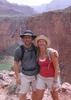
| no partners | | Had been wanting to do this trip for some time and decided to finally do it last weekend. Got a late start out of Phoenix Saturday morning and made our way up to the Washington Park trailhead. It was a warm day! Plenty of elevation right off the bat on the Colonel Devin trail. First part of the trail paralleled the pipeline then broke off into switchbacks climbing the rim to some looser rock closer to the top. Nothing terrible. Just got the heart rate up and the legs warm. From there we traveled over to the General Springs cabin and up the Haught trail. We were looking for good water sources up the trail but never found anything significant. The trail itself is easy to follow and the scenery was beautiful. Just not much in the way of water. Therefore we hauled it over to the Pinchot cabin then down Houston Brothers to Aspen Springs for the night, where we knew there would be water. Day 2 we ventured South on Houston Brothers down to Barbershop. Given that we needed to head back early Monday we were looking to place camp as close to the Houston Brothers/Barbershop junction as possible. We found a perfect spot at Barbershop Spring, just 10 minutes from the junction. We made camp, set up the tent and day hiked for the rest of the day. We took Barbershop over to Dane Canyon, then decided to head north to explore. Given how dry it has been, the canyon itself was very easy to navigate. I could see when the area gets wetter how difficult this area could get. There are many faint game trails and multiple ways to get around in there. We came across 7 elk in one area - a beautiful site. The day was getting late and we had decided to try and exit the canyon near Dane Springs. From the canyon, about 0.2 miles from the Springs we located a faint trail up the canyon - we took it up and it popped us out on the U-Bar about 1000 feet South of Dane Springs. We reloaded on water there - this is an awesome spring with an excellent flow of water. Back south on the U-Bar over to Barbershop and back to Camp.
Monday morning an early start and back on the Barbershop over to Houston Brothers and then General Crook/Rim Road. In thinking about all of our mileage, I thought to myself - the section from Dane Canyon on Barbershop west all the way to Houston Brothers to Rim Road is pretty brutal. Constant up/down. The trail runs perpendicular to the land contour, so you are constantly going in and out of drainages. Feel the burn!!
The crook trail. This trail is a nightmare. Tried following it using posted coordinates, and in places it is so overgrown or has dead and downed trees that it is almost impossible. There are white markers in some sections then in other areas there is nothing. It really was hard not to just go to the road and say the heck with it, but we stayed on the trail as much as possible, until the trail veered away from the tunnel/Colonel Devin trail. We took the road directly back to that trail and cut off the half mile back to the Springs cabin and then over to the marked tunnel trail.
Overall it was a great weekend. Water was available, but mainly on the Central and Eastern side of the loop. Saw very few people up there and I feel like this area is a true gem for us Phoenix folks looking for a getaway in the Summer months.  |
| _____________________
| | |
|
|
|
 Route Editor