Hike Arizona urges anyone interested in searching to post or join an event.
If you go out, please track your hike on a GPS and post it for the benefit of future searches. Simply post it upon return. (if you need help ask the webmaster) Hike Arizona will see that it gets linked to a master map. If you have multiple variations in your group, please post all tracks. As more info is posted the map will evolve and the overlaps will be removed.
November 16, 2010
Tonto Rim Search and Rescue volunteers and Gila County Sheriff officers are currently searching for an overdue hiker.
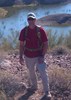
The man, whose name has not been released, was last heard from nine days ago and is believed to be hiking near the Mt. Peeley trail or Sheep Mountain, off Forest Road 201, southwest of Payson.
The Gila County Sheriff’s Office first received a call that the man was overdue Monday, Nov. 15 about 9 p.m.
“The hiker has not been heard from since Nov. 7 and frequents the Mazatzal Mountain Wilderness area,” according to a press release from the sheriff’s office.
The missing hiker’s vehicle was located at the Mt. Peeley trailhead.
Six TRSAR volunteers are currently searching the ground. Earlier Tuesday, a Department of Public Safety Ranger helicopter did an aerial search of the area, but found no signs of the man
Dawn
--On the loose to climb a mountain, on the loose where I am free. On the loose to live my life the way I think my life should be...For we only have a moment and a whole world yet to see...I'll be looking for tomorrow on the loose. ---unknown--
Yea, we may have to wait for spring for this effort but they say this might be a dry winter and maybe if there's a warm December weekend a handful of us could go and hammer it out.
Yea, canyoneering is an extreme sport... EXTREMELY dramatic!!! =p
Has anyone searched along Joe's LAST CHANCE route as he was onto something given the northern chute we photographed? Vaporman has a photo of the chute which wouldn't necessarily need to be climbed as it looks pretty open...
My day went total FUBAR starting first thing this morning and was not able to make it out there to search today. Looks like I'm not going to be able to make it tomorrow as well. I am going to try to make it out on Wed.
Sweet! Thanks to David of CAMRA, our own Joe Bartels & allanalxndr for tracking down his cables in case I needed them, my tracks from this weekend are finally up.
Here's a photo of that northern chute of Sheep Mt that may have been Joe's LAST CHANCE route. It's steep for sure, but looks class 2 or 3 at worst and would be worth checking out when we have a quicker way to summit Sheep via a cleared path. As of right now, it'd take too long too reach the peak to have extra time to check this chute out... http://www.hikearizona.com/photo.php?ZIP=168105
Yea, canyoneering is an extreme sport... EXTREMELY dramatic!!! =p
As nice as it would be to move more easily along the ridgeline, I think that clearing a path would really detract from the rewards of the adventure of the hike. I'd imagine that the challenge and the beauty of this hike are what drew Joe back again and again; if it were easy, what would be the point? Sorry, but I think that the best way to memorialize Joe and his efforts is to leave the route as he found it.. don't destroy his reasons to return.
Interesting... Again that 3/4 ridge seemed to have the most evidence of recent travel of the 4 ridges I hiked this weekend & had a fair amount of buzzard activity in the area though they never focused on any one spot. If Joe made it to Sheep Mt and didn't want to battle back along the ridgeline, then looking from atop the summit that 3/4 ridge looks like a great way to bail off until you hit the 5600ft mark and have to battle thru Manzanita Hell...
Yea, canyoneering is an extreme sport... EXTREMELY dramatic!!! =p
suzaz wrote:by suzaz » Nov 29 2010 10:15 pm http://hikearizona.com/t2010/11/27/9333 ... 0.jpg?FCR=
We found this at the top of ravine #7 and we know Joe went through that one a year ago.
not sure if these images are going to show up but wanted to toss them out to see if anyone would like to comment?
I'll just say that as one of his hiking partners (Gabriele should also have some comments on this), that when he and I have hiked together where to me, it even with a GPS, just made sense to build a cairn there, and I would, but I don't ever recall seeing GPSjoe build cairns.. he always defaulted to me and just never seemed interested in doing so as long as I hiked with him. Maybe to him a cairn was just a duplication of effort because he had his trusty GPS and he certainly did know how to use it. ;)
Brian,
I'm interested in clearing a route to Sheep Mountain along the ridge. I see your point though, Liz. Maybe we could just cut a narrow path through the brush to temporarily allow easier access for searchers. The brush regrowth will destroy our work within a year or two, easily. Minimal cutting would be easier for us anyway. Mazatzal brush is the worst kind of Hell!
"…you never know when a hike might break out" -Jim Gaffigan
Yea to clarify, I was just thinking of trimming the manzanita back some with hand tools to allow a quicker route to the summit so searchers can reach it quicker and many others can enjoy the amazing views from the peak. Though perhaps there's better ways to honor Joe. ;)
Yea, canyoneering is an extreme sport... EXTREMELY dramatic!!! =p
Central Arizona Mountain Rescue Association will be conducting a 2-day Wilderness First Aid Certification course on January 29 & 30 (Saturday / Sunday), 2011.
This two day/16 hour course provides classroom and hands-on instruction on how to prevent and respond to medical situations while in the backcountry.
If you venture into the backcountry you are the first responder and your response to a medical situation can truly make the difference between life and death.
Class size is limited to provide a beneficial student/instructor ratio.
Vaporman wrote:Yea to clarify, I was just thinking of trimming the manzanita back some with hand tools to allow a quicker route to the summit so searchers can reach it quicker and many others can enjoy the amazing views from the peak. Though perhaps there's better ways to honor Joe. ;)
I think that cairns well placed would be a great help in pointing people to the existing small routes through the Manzanita. These small holes could be trimmed up as Brian suggests and we would have the best of both worlds - reasonable access, respect for the uniqueness of the wilderness hike and keeping people channeled so that the whole ridge doesnt get trampled.
Reading Hanks comment about cairns, we would have to decide if Joe would view a cairned route as a positive.
Central Arizona Mountain Rescue Association will be conducting a 2-day Wilderness First Aid Certification course on January 29 & 30 (Saturday / Sunday), 2011.
This two day/16 hour course provides classroom and hands-on instruction on how to prevent and respond to medical situations while in the backcountry.
If you venture into the backcountry you are the first responder and your response to a medical situation can truly make the difference between life and death.
Class size is limited to provide a beneficial student/instructor ratio.
johnr1 wrote:reading Hanks comment about cairns, we would have to decide if Joe would view a cairned route as a positive.
Good point and I'm really not sure how he might view a cairned route if he saw it? I did not get the impression from reading Susan's and Brian's cairn viewing on the ridges/drainages they were on, that these routes were actually cairned, only that they spotted those ~two cairns posted in their pic sets.
Vaporman wrote:Yea to clarify, I was just thinking of trimming the manzanita back some with hand tools to allow a quicker route to the summit so searchers can reach it quicker and many others can enjoy the amazing views from the peak. Though perhaps there's better ways to honor Joe. ;)
I have a tendency to lean with Liz and Airic on this one. We are not even certain he resides somewhere on or just off the ridgeline route thus dedicating our limited, qualified, and valuable searchers to now building cairns, cutting back vegetation to make a more visible, maybe faster path in, in my way of thinking this effort would now be using up valuable time and resources in our effort to find Joe ASAP and bring him home to rest for his loving and caring family, and friends. He could still be somewhere in-between the ridgeline and Mt. Peeley Summit (and this area does need more search attention), possibly still on one of the 10 home page pictured southern ravines/drainages, or on that LAST CHANCE route that he attempted on 11/5/10, and may have gone back to on his last Mon-11/8 seeing this route as his real LAST CHANCE. Also, I know our GPSjoe enjoyed this area and kept going back due to exactly these reasons previously stated "I'd imagine that the challenge and the beauty of this hike are what drew Joe back again and again; if it were easy, what would be the point? Sorry, but I think that the best way to memorialize Joe and his efforts is to leave the route as he found it.. don't destroy his reasons to return. "
Central Arizona Mountain Rescue Association will be conducting a 2-day Wilderness First Aid Certification course on January 29 & 30 (Saturday / Sunday), 2011.
This two day/16 hour course provides classroom and hands-on instruction on how to prevent and respond to medical situations while in the backcountry.
If you venture into the backcountry you are the first responder and your response to a medical situation can truly make the difference between life and death.
Class size is limited to provide a beneficial student/instructor ratio.
Thanks for the info! Hopefully I can fit it into my schedule and budget...
"The only thing we did was wrong was staying in the wilderness to long...the only thing we did was right was the day we started to fight..."
-Old Spiritual
My book, The Marauders on Lulu and Amazon
 Route Editor