| |
| Mount Lemmon Snowshoe, AZ | | -
-
-
-
| |  |
|
1 |
-
-
-
| 1 label |  |
|
|
-
-
-
-
-
-
-
-
|
| | Mount Lemmon Snowshoe, AZ | | | |
|
|
Mount Lemmon Snowshoe, AZ
| | |
|
| Snowshoeing | 5.50 Miles |
1,200 AEG |
| | Snowshoeing | 5.50 Miles | 5 Hrs | | 1.38 mph |
| 1,200 ft AEG | | 10 LBS Pack | | |
|
|
| |
| Partners |
|
[ show ]
| partners | | My yearly snowshoe trip on Mount Lemmon. I joined Preston, as I technically rode up with him as we expected the road to be open to 4x4 only, but it seemed it was open to everyone by the time we were on it. The road was clear and dry.
The day was very cold and slightly windy, except near exposed areas where it was very windy. Biter cold that is atypical for the Sky Islands and Tucson was the experience. I may not like 110 anymore, but cold wind and 25 isn't much fun, either. At least I know this and was dressed for it.
My vehicle could have made it with no problems, but there was a Subaru which was stuck on a thin piece of ice in the parking lot. It appeared the AWD failed, and only 1 wheel was spinning. It was the one on the ice, of course.
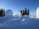
The snow level is rather high, but it is also deep once you are over 8000'. Ski the Lemmon appeared to be in great shape, and they reported 24 inches of snow from the storm. It seemed like it was at least that much, as the snow near the base of the resort was deeper than my ice axe is long. On the exposed south facing area off the Meadow Trail, the snow was as deep as my axe. About 24 inches. Snow remained intact and deep for the entire hike, even on the road section of trail #5, and radio ridge. Usually, those melt or blow off.
We hiked up the route of the Aspen Draw to Radio Ridge, over to the summit of Mount Lemmon, back down to the Meadow Trail, over to a view stop above Quartzite Spring, down to the Mount Lemmon Trail, and back to the road from there. Then down the way we came up, but cut out most of the trail and dropped directly down the drainage to the trail near the trailhead. |
    |
Quartzite Spring |
Gallon + per minute |
Gallon + per minute |
| | | Gushing! The pipe was flowing heavily, and the water was running very heavily from the slope and rock above the pipe and spring house. Deep snow all around, but there was flowing water on the road from the heavy spring discharge. Should be good into summer. | | _____________________
| | |
|
|
|
|
|
| |
