|
| | | |
| |
|
| Backpack | 29.80 Miles |
12,000 AEG |
| | Backpack | 29.80 Miles | 24 Hrs 54 Mns | | 1.20 mph |
| 12,000 ft AEG | | | | |
|
|
| |
| Partners |
|
none
[ show ]
| no partners | | Grand Canyon trip, April 6 - 11, 2006
This trip was the second solo of the year. The first, in February, was a shake down of light and ultra-light equipment. In that trip, I went on a multi-day loop of Horseshoe Mesa, never being more than a day hike from the rim. If some critical equipment failed or proved disastrously inappropriate, I could bail out and not be at significant risk. I have cut my pack weight from a dry weight of around 35 lbs to a much more age appropriate weight of around 14 ½ Lbs. Here are the gear details:
Category Item Weight (oz)
Back Pack
Osprey Atmos 50 (3000 cu. in.) 46
Pack Cover 2.4
Bathroom Towel 1.8
TP 2
Trowel 2
Clothes (packed)
Fleece beanie Hat 2.2
Sun Hat 2.4
Hurricane Pants 8.4
Hyperion down Vest 7.8
Marmot Precip Jacket 12.4
Ski Gloves 5.6
SmartWool socks & liners 9.34
TU - Zeo-Line MW shirt 6.2
Crampons Camp 6 point light 10.2
First Aid Emergency Kit (space blanket, mirror, etc.) 5
First Aid Kit (BactiBan, gauze, Band-Aids, duct tape, etc.) 6.4
Hydration Platy hose kit 2.4
2 L Platy Water Tank 2
4 L Platy Water Tank 2.5
Aquamira Water Treatment 3.4
Pur Explorer Water Filter (I was not convinced on the chemical treatment) 9
Kitchen Solo Kit (1 .8L Ti. Pot, 1 cup Alcohol stove, wind screen, Spoon and fork) 11.4
Misc. Hyperion Vest bag (Makes for a nice down pillow) 0.6
Light (LED head lamp) 3.2
Spares & repairs 4.2
Stuff Sacks 3 2
Shelter Luna Footprint 2
Lunar Solo 29
Bed room Montbel SS Hugger #3 (30^) 24.6
Pad - NiteLite insulated air mattress 7.5
Total Weight Items oz. (Lbs) 234 oz. (14.6 lbs)
I carried 20 oz. of food per full day and 15 for the walk out. It was Instant Oatmeal and coffee for breakfast, Probars, beef jerky and trail mix for snacks, Ultralight Joe's Moose Goo (good stuff, go look it up) and tortillas for lunch and a large serving, freeze-dried main course for dinner. I wore trail runners and convertible pants with mid length gators for the legs and synthetic long sleeve shirt and Graphite hiking poles (11 oz.)
4/6/06
Arrived at the South Rim around 4:30 pm, check the BCO for any updates and headed off to park my car. I am going from the SK to the Grandview. I wanted my car to be there when I got out. Parked at the hiker's section at the Grandview trailhead and asked for a ride back to Mather's campground. After terrorizing tourists from all parts of the world, a pair of old (my age, 52) hippies took me back to the village. Found my camp spot, setup camp and wandered off to eat before bed. I am packing light, but am confident in my gear. The only item I had second thoughts on are the crampons. I figure it is still early enough in the year to make them good insurance. They are tempered aluminum six point and only weigh 10 oz. My pack with food for 5 days and 6 L of water weighs in at 34.3 Lbs. on the BCO scale.
0 miles, 0' gain/loss
4/7/06
I awoke at 4 am very cold. It is 22 degrees and I need to put more clothes on, the upside is the tent is now freezing the condensation so it stopped dripping! Around 6:30 I am up and freezing my hands packing frost covered gear. I get a quick breakfast and catch a bus to the South Kaibab trailhead.
8:05 I have watered up and I am heading down. I am going to Lonetree for the night. I expect water there, but do not have a solid conformation. I pack a full 6L water load. The trail will be muddy later, but right now it is frozen solid. Big ice ponds where the mules gouged out the trails.
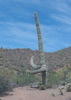
8:50 I am below Cedar Ridge. The trail is all chewed up and hard to maneuver. I hate to walk in mule piss mud and am relegated to the edges of the trail. I have shed some clothes and am down to a good fighting weight now that it has warmed up. Near Skeleton Point there is a well defined trail heading west-northwest down to the springs on the Tonto. It starts between the two large cliff sections where you get a view to the west after you start the drop off Skeleton Point. From up here, it looks quite passable to the top of the Redwall.
11:00 I have started east on the Tonto. I have a lunch of Moose Goo on Tortillas at the top of the drop-off down to the floor of the Tonto. There are two large cairns marking the trail down and a large camp area down near the bottom. These mark the use boundaries
By 1:47 I am through the three branches of Cremation and contouring around Pattie Butte. What a bear they are! You drop down 150 - 250 feet and scramble back up what is little more that dirt cliffs. All three branches were dry, but the western most on had damp earth and might yield water in a pinch. There is a good shelter cave near the trail crossing here too. Coming down the SK, there is a ridge going off the eastern most switchback, part way down the Redwall. You could head east and bypass all three of the Cremation branches. Even though you would be off trail, I think it would be easier than this was. I have 3 or 4 miles to go till camp.
3:45 I arrive at Lonetree and setup camp. There is a good flow of water, and it is sweet tasting. Much better that Hance or Cottonwood. By 6:00 I have had a freeze-dried dinner, pumped water for tomorrow, and wander to explore. This is a lovely spot surrounded by unbroken Redwall cliffs. The Redbud trees are blooming and there is a steady buzz of bees making the last round of the day. I had a high of around 83 and it is now around 70 degrees. Sunset is around 6:30 and it is very peaceful. I passed a single party of two Germans hikers around the middle Cremation crossing. It is nice to be away from the hubbub of the SK.
10.0 miles +1310'/-4800'
4/8/06 @ 5:45 am Nature called me awake. It was a nice cool night and I have the right amount of sleeping bag. It got to around 40 last night. I made an Oatmeal breakfast, and a cup of powdered gourmet coffee. No blisters and only a little sore of knee and calf. By 6:20 the sun starts to illuminate the highest peaks. I am on the trail at 7:05; it is 52 degrees and a clear sunny day. Grapevine is the next camp. At 8:00 I take a break at the drop-off to the river and watch the little ripples of Grapevine rapids. I can hear the roar of 85 Mile rapids.
9:25 I am in Boulder. I stop for a break and to put the poles away. The Tonto Trail is very flat and easy hiking. I passed a party of three men my age (early 50s) heading west to camp in Cremation. By 11:00, I break for lunch on top of the slow rise before the trail heads south into Grapevine. I set my pack down on my water bladder's bite valve and used most of my water to help the local flora! The caucuses are happy, I am less so! I have a little less that a liter, but water is just a few miles away. It is starting to get warm and I sit in the shade of a large boulder in one of the minor side drainages in Grapevine to cool off. I can see the Redbud trees a mile ahead at the creek. I explore the Hotel de Willow Creek in the west branch of Grapevine. There is a slow flow in the creel bed, and I pump a liter and drink a few cups of water. At 2:50 I am at the lovely oasis that is the main Grapevine. The water is deep enough to bath in so I -whoa- it is COLD!!! It is 82 at around 3:25. I fill up on some water for a dry camp. I am permitted for BH9, Grapevine, but I will camp out on the Tonto near the Use Area border. I prefer camping on the Tonto over camping in the washes because the views are better. 5:45 PM, I have made camp on a nice flat. It is rather breezy and I have found some rocks to anchor my tent. My legs are sore tonight, both on the front and backs. I will sleep well tonight!
8.7 miles +1200'/-1280'
4/9/06 Up at 5:45 and off to reconnoiter after Oatmeal. It looks like there is a route up the face of the ridge between Grapevine and Cottonwood. I go up and poke around some. If I were not solo, I think it would be passable. By 7:45 I have had breakfast and am on the trail again. This will be an easy hike to Cottonwood, and I plan to explore some. I have made the west branch of Cottonwood and am heading upstream. I plan to make the top of the Redwall between the two forks of Cottonwood, and possibly camp there. I start off in the stream bead but climb up the east bank for easier walking. Someone has come down recently. There are boot prints in the sand, I make my way up to 4100' and am heading up the top of the drainage that is the east fork of the dry stream bead. The surface is very loose and footing is poor. You need to stay away from the drop off into the stream because a fall would be easy to arrange. The better route would be to head uphill around the 4000' mark and head for the small cliff bands near where the canyon chokes off. I make the cliff bands and stop for a drink and a snack in the shade. There is a spring several hundred feet below. By noon, I am at 4550' and through the narrow point in the drainage. This is a traveled section and there is a clear trail. Most of the traffic is downhill and sections are torn up from folks "dirt skiing" down. Near the top, you can go due South or East, both are easy. I go east and top out of the Redwall, to the left of the large rock outcropping around 1:00. The view is from the point is stunning. You can see both branches of Cottonwood and the camping areas, the Tonto stretching out to the ease and west, Horseshoe Mesa to the east and people exploring the cave. The Redwall curves around to the west from here and climes a couple of hundred feet on the other side of the fault that makes the cut I ascended. There is also a route from the rim to here that makes for a good off trail descent.
I have decided to not camp up here. There aren't any good areas near the edge that have been used. I do not like to camp on places that are new. One does too much damage to the soil. It is also too late to contour around the top of the Redwall to the west to get to the old mine I have heard is up here. I have a bite to eat and start to head down the way I came up. It took only 35 minutes to go back down to the Cottonwood stream bead.
4:20 and I am back at the Tonto crossing. I am heading to the main cottonwood to camp. By 4:45 and I have made the main branch/Tonto crossing. I see a tent set up at one of the camp spots and go look for one for me to use. When I arrived I went down stream to see if it was OK with the couple camping there if I camped 500' feet upstream. They said it was fine with them. After dinner, they wandered up and offered me a glass of wine and a cigar. We sat and talked, finished off their bottle and smoked our cigars. They had flown in from Buffalo and had hiked down for the night, out in the morning. By 7:30, I have had dinner, hung my food and pack. Tomorrow I plan to do a day hike to explore a route down to Cottonwood near the drop off to the Colorado.
9.8 miles (including off trail) +3980'/-4050'
4/10/06 @ 8:00 After the requisite Oatmeal, I have put together my day pack and am dead north of the west arm of Horseshoe. From here you go strait to the edge of the drop off. There is an old trail, probably the old Tonto Trail that follows the edge of the Tonto around to the east. The trail can not be seen from the current Tonto Trail, but is very clear when you get there. It is also marked with cairns here and there. By 8:20 I have reached the last break before the edge of the Tonto curves to the south and is over the Colorado. This is where I will descend to the Cottonwood. The old trail continues around, following the edge. I start on the south side of the wash to the first choke point. The descent is easy as the ground us firm and offers good footing. I see not other foot prints here. I reach 3670'; there are a couple of minor dry falls that are easily bypassed on the left. You can see the stream below now.
8:45, 3550' the red granite starts with a 40' falls. I work my around to the right. The drop from here is around 45 degrees and I have put my poles away. I need my hands to scramble down. Bypass the last falls to the right to avoid thorny trees.
9:10 I am at the stream bead, so I know this descent goes through! It is just about 2 miles from the Tonto/Cottonwood crossing to the bottom of this cut. I am starting up Cottonwood. At 9:30 I have come to an impassable falls with a possible bypass on each side. I go back down stream to look at the two ways around. I set my pack down right next to a cairn on the east side. This must be the bypass. At 10:00 I am at the top of the bypass and can see the confluence of the main and west branch. It looks like the bypass comes back to the stream bed a little before that. From here, it is clear that I have taken the harder of the two bypasses; the one on the west looks like a harder ascent, but is shorter with an easier descent. The decent back down to the stream is hairy and I need to be careful. It is a little too close to real rock climbing. If I had a partner, I would be less concerned. If someone can remove the eastern cairn, and make a nice western one, it would be helpful. Coming up to the confluence, there is a thick stand of what I think is willows. There clearly has not been a big flash flood for several years. The confluence is like a green paradise in the desert. A dozen mature Cottonwood trees, cool shade, and a flowing stream. It is a truly a lovely spot. I stop for a snack and to enjoy the place.
About 1/4 mile upstream on the west side there is a developed cave with 4 rooms and some surviving walls. By 11:10 and I am into some dark sandstone. The stream bead gets very narrow through here. The stream continues up with no difficulty. I get back to the Tonto and gather up the rest of my gear. I am permitted for tonight in BE9, Hance use Area. I plan to camp on the Tonto again at the place I found in February, near the boarder. Tomorrow I am heading out. It is very windy and I put big rocks on top of rocks on top of my tent stakes. Hope it holds! Not much sunset due to the incoming high clouds. It looks like snow is on the way.
4.6 miles +1230'/-1010'
4/11/06 Up to watch a pretty sunrise. It's funny, at home I hate early mornings, but while camping I see every sunrise and love it. It is 42 degrees and partly cloudy. The tent held up find with a lot of wind. I recommend it as a very light weight shelter. It is not freestanding, but the weight saving is worth the hassle of pounding stakes. I am heading up the middle (northern) Horseshoe Mesa trail. By 6:30 I am at the big Iron bar that marks the start of the ascent. The trail is in good shape despite the lack us use. After 8 switchbacks you can see the old trail work. Stacked stone walls to keep the mule trails in place. After several more sets of switchbacks the trail heads for the break in the top of the Redwall. Near the top, the trail branches. The right seems to head to the northern part of Horseshoe, I take the left. 7:35 I am up and take a break. There is a nice view down into Cottonwood from here. I have a break and have oatmeal!
10:15 I have made the saddle between Cottonwood and Hance. I take a break and enjoy the blue birds that are hanging around. I really like this spot with the views into both Cottonwood and Hance drainages. By 12:15 I top out and go find the car, happy I hassled the parking and ride at the start of the trip. I find the keys, always a good thing, and the rental starts right up! After checking in at the BCO (yeah, I am old school and let them know I am out. I do not think they care, but I always do it.) I wonder off for fresh coffee and a brew and a burger. I drive off to Phoenix and get my room. I fly back out east around noon tomorrow.
4.5 miles +4460'/-500'
This was, yet another, good trip with a pair of nice off trail excursions. I can hardily recommend both the trips up and down from Cottonwood. Thanks for reading. |
| _____________________
If men were angels, no government would be necessary. If angels were to govern men, neither external nor internal controls on government would be necessary.
James Madison |
| | |
|
|
|
 Route Editor