username
X
password
register
for free!
help
ArticlesGuidesRoutes
 
Photosets
 
 Comments
triplogs   photosets   labels comments more
Red Tanks Super Loop - Peralta TH - 6 members in 20 triplogs have rated this an average 3.7 ( 1 to 5 best )
20 triplogs
login for filter options
Jan 17 2022
avatar

 Routes 386
 Photos 49
 Triplogs 792

43 female
 Joined Jun 23 2015
 Phoenix, AZ
Red Tanks Super Loop - Peralta THPhoenix, AZ
Phoenix, AZ
Backpack avatar Jan 17 2022
emilystardustTriplogs 792
Backpack22.09 Miles 2,903 AEG
Backpack22.09 Miles   28 Hrs   56 Mns   2.00 mph
2,903 ft AEG
 
no photosets
1st trip
Route Scout Route Recorded  on Route Scout | Pop | Map | Popup | MapDEX
Lots of water out there still. Red Tanks is pretty messy still, but a good overnight trip (minus the back issues).
_____________________
 
Jan 15 2022
avatar

 Photos 60
 Triplogs 10

male
 Joined May 14 2020
 Tempe
Red Tanks Super Loop - Peralta THPhoenix, AZ
Phoenix, AZ
Backpack avatar Jan 15 2022
WataugaTriplogs 10
Backpack27.00 Miles 2,870 AEG
Backpack27.00 Miles2 Days   3 Hrs      
2,870 ft AEG18 LBS Pack
 no routes
1st trip
Linked   none no linked trail guides
Partners none no partners
Holy catclaw, Batman!

This hike started on Saturday morning with relatively clear skies and a whipping wind. Dutchman to Coffee Flat was cruisy and easy to follow. Our first encounter with water was at Reed's, however it was very low and stagnant under the windmill. Shortly there after we turned up Randolph Canyon and hiked along flowing water all the way until the camp at Dripping Spring. Once I dropped my pack at camp, another member of the group and I continued up Fraser Canyon for a couple of miles. We passed Musk Hog and Wet Rock canyons, both of which had water flowing into Fraser. We passed a large Red-Tailed Hawk while hiking out and then once again on the way back to camp. EDIT: There was a great cave just to the north of camp. I completely forgot about it until I went to upload the photos. The opening was pretty wide, but only a few feet tall. I didn't expect much when we first spotted it. Once we scrambled up and climbed inside it really opened up. There was a large main room where I could stand all the way up (6') and two shorter rooms that extended further back. It was a great surprise.

The second day started with clear skies and very little wind, a nice change from the previous morning. We made our way up Red Tanks, mostly staying in the creek until turning NW to continue in to Red Tanks Canyon. The trail was easy to follow from there up to the bottom of the divide. This is where some fire damage and the start of our catclaw adventures slowed us down a bit. Once we reached the top of the divide the trail became faint and we had to rely upon our GPX tracks a bit more. The CC continued to be thick and present until we reached the Hoolie Bacon junction and began working our way through upper LaBarge Box. This was my first time in the area and I was blown away by the views of the canyon as we hiked down the trail. It was steep, rocky and loose in several places but was still a very enjoyable section. After stopping for a short break at the Whiskey Springs junction we continued along Red Tanks towards LaBarge Spring. The first halfish mile of this section was nice and smooth, but we quickly entered what was eventually dubbed "The Stabrynth." A mile+ section of trail that was full of fire damage, a weaving path and lots of tall and thick catclaw. Once we made it through the Stabrynth we set up camp at LaBarge. I didn't make it up to the actual spring as we had water flowing by camp.

Day three was relatively straightforward compared to the one before. We were able to maintain a nice pace up Dutchman and Bluff Spring. The trail had some rough erosion spots along Dutchman and loose/rocky areas around the Terrapin junction but was in decent shape and free of catclaw. It was cool and cloudy for most of the ~2 hour hike back to Peralta.

I've camped at LaBarge Spring before, but this was my first time out along the eastern end of the super loop and I absolutely loved it. I've gotten very familiar with the area between FW and Weaver's so it was nice to experience some new canyons a bit further to the East. Water was very plentiful thanks to the holiday rains. I never had to carry more than two liters. The low on both nights was 40°, per my Thermodrop. This was a great trip and I'll be keeping my eye out for a heavy spring rain so that I can do it again in a few months.
 Fauna
 Fauna [ checklist ]
[ checklist ]  Red-tailed Hawk
 Meteorology
 Meteorology [ checklist ]
[ checklist ]  Halo

water 1 out of 5water 2 out of 5water 3 out of 5water less than max Musk Hog Canyon Medium flow Medium flow

water 1 out of 5water 2 out of 5water 3 out of 5water less than max Randolph Canyon Medium flow Medium flow

water 1 out of 5water 2 out of 5water 3 out of 5water less than max Red Tanks Canyon Medium flow Medium flow

water 1 out of 5water 2 out of 5water 3 out of 5water less than max Upper LaBarge Box Canyon Medium flow Medium flow
  3 archives
Dec 05 2020
avatar

 Guides 38
 Routes 182
 Photos 1,602
 Triplogs 232

40 male
 Joined Dec 09 2014
 Gilbert, AZ
Red Tanks Super Loop - Peralta THPhoenix, AZ
Phoenix, AZ
Hiking avatar Dec 05 2020
jacobemerickTriplogs 232
Hiking21.30 Miles 2,923 AEG
Hiking21.30 Miles   9 Hrs   14 Mns   3.09 mph
2,923 ft AEG   2 Hrs   20 Mns Break
 
1st trip
Route Scout Route Recorded  on Route Scout | Pop | Map | Popup | MapDEX
The chance to walk three burn areas in one loop? Sure, why not.

Five cars at Peralta TH at 5:30am. Didn't see any camps along my route, maybe they all went to Charlebois. Cardiac Hill is a great way to keep warm on cold December mornings. Ridgeline Fire burned chunks of Bluff Springs trail, was hard to follow the trail in the dark through Barks. Stopped by Bluff Spring, pipe is broken but still trickling higher up. Forest above the pipe saw heavy damage, wonder if the hill / spring will sustain in the years to come.

Final drop into La Barge was chilly. La Barge Spring is still flowing like a champ. Trees within the creekbed are all fine, anything up on the banks got burned in Sawtooth and are falling over, some of the campsites on the eastern bank are unsafe / covered in deadfall. Took a quick break here to munch on some snacks and shiver before continuing on Red Tanks, which seemed to be in relatively good condition.

Climbing Upper La Barge is just straight fun. Woodbury damage was very apparent at top, the whole slope coming down Coffee Flat is a lot less green now. Some patches of living forest here and there within the creek. Grass is coming back strong and looks quite flammable. Paused at Red Tanks Divide for a luxurious coffee break and got buzzed by the B-52? that frequents the area.

The heat finally kicked in during the descent. Some bad burn sections with deadfall / tread washout that caused mild confusion, mostly it's just a well-trod grassy path still. I was getting impatient by the time I reached Randolph and spent most of the time walking the creek. While polishing off my water at Reed's a large squadron of javelina strolled past, at least 30 of them, and I got some amateur video of the ridiculously cute reds trotting behind parents.

Saw three groups, two backpacking between the Divide and Coffee Flat, last one dayhiking in Barkley. Only sighted 17 monoliths, so this is still a pretty remote area.
 Culture
 Culture [ checklist ]
[ checklist ]  Ghost?

water 1 out of 5water less than maxwater less than maxwater less than max Barks Canyon Pools to trickle Pools to trickle
One sad, lonely pool.

water 1 out of 5water less than maxwater less than maxwater less than max Bluff Spring Dripping Dripping
Steady trickle. Pipe has broken so once you find it, follow it up until you smell the stagnant water.

water 1 out of 5water less than maxwater less than maxwater less than max Fraser Canyon Pools to trickle Pools to trickle
Dripping Wall was dripping. Would take a while to collect enough to drink.

water 1 out of 5water 2 out of 5water 3 out of 5water less than max LaBarge Spring Gallon per minute Gallon per minute
Dependable.

dry Randolph Canyon Dry Dry
Bone dry from Reed's to Red Tanks junction.

water 1 out of 5water 2 out of 5water less than maxwater less than max Red Tanks Canyon Light flow Light flow
Several tanks of water above Randolph Canyon confluence.

water 1 out of 5water 2 out of 5water less than maxwater less than max Reeds Water 26-50% full 26-50% full
Well had water. Some boards have fallen into well, it'd be challenging to snake down a bucket / cup.

dry Trap Canyon Dry Dry
Dry at crossing.

dry Upper LaBarge Box Canyon Dry Dry
Dry at trail crossing.
_____________________
  1 archive
Dec 07 2019
avatar

 Guides 8
 Routes 70
 Photos 3,208
 Triplogs 273

59 male
 Joined Oct 07 2017
 Chandler, AZ
Red Tanks Trail #107Globe, AZ
Globe, AZ
Hiking avatar Dec 07 2019
YoderTriplogs 273
Hiking14.20 Miles 2,511 AEG
Hiking14.20 Miles   7 Hrs   24 Mns   2.21 mph
2,511 ft AEG      58 Mns Break10 LBS Pack
 
no photosets
1st trip
Combine parts of
Bluff Springs Trail(235) --3.4miles- :next: Dutchman Trail(104) --2.5 miles- :next: Red Tanks Trail --2.2miles- :next: Whiskey Spring Trail(238) --3.6miles- :next: Dutchman Trail(104) 2.7miles
for this 14.2 mile loop. I'll Post the GPS track, its name is Red Tanks Cutoff Loop

We started 7am and finished at 2:30pm. The weather was perfect, and we ran into one other person on the trail for the whole hike, it was great! We did see about a dozen other folks on other trails or camped out.

Water in just about all the streams due to the rains last week I expect.

Hit Burn-out area from the Woodbury Fire(Spring 2019) shortly after getting on the Red Tanks trail. This continued until near the end of the Whiskey Spring leg. This section of the hike was also the most difficult because the trail was not so apparent in many parts due to the burn-out, runoff, and many stream crossings. Seems like the cat-claw type plants are first to recover from these fires, so this also made things less enjoyable.

Great view once we reached the highpoint of this hike near the end of the Whiskey Springs leg of the hike.
A enjoyable hike
_____________________
J. Yoder
  2 archives
Feb 15 2019
avatar

 Photos 392
 Triplogs 25

38 male
 Joined Apr 01 2018
 Phoenix, AZ
Red Tanks Super Loop - Peralta THPhoenix, AZ
Phoenix, AZ
Backpack avatar Feb 15 2019
bretinthewildTriplogs 25
Backpack20.00 Miles 2,870 AEG
Backpack20.00 Miles3 Days         
2,870 ft AEG
 no routes
1st trip
Linked   linked  
Partners none no partners
Water, water everywhere! Took a friend into the Supes this weekend. We did the Red Tanks Super Loop clockwise with a twist. Started Friday night by going up cardiac hill on Bluff Spring and made it to camp by dusk. Saturday we looped around to Dripping Spring via Dutchman, Whiskey Spring and Red Tanks. I hiked this loop the opposite direction a couple years ago and was glad to be going downhill after Red Tanks divide. Sunday we had a nice stroll back on Coffee Flat and Dutchman through Barkley Basin. Great to see so much moving water in the mountains!
 Culture
 Culture [ checklist ]
[ checklist ]  Windmill
 Named place
 Named place [ checklist ]
[ checklist ]  Whiskey Spring
 
Jan 19 2019
avatar

 Routes 5
 Photos 920
 Triplogs 69

69 female
 Joined Mar 16 2009
 apache junction,
Red Tanks Super Loop - Peralta THPhoenix, AZ
Phoenix, AZ
Backpack avatar Jan 19 2019
sandyfortnerTriplogs 69
Backpack19.00 Miles 2,870 AEG
Backpack19.00 Miles3 Days         
2,870 ft AEG30 LBS Pack
 no routes
1st trip
Linked   none no linked trail guides
Partners none no partners
7 of us enjoyed the 3 day weekend with a loop in the Supes. We started at Peralta TH, headed up past Freement Saddle, with a goal of staying at White Rock Spring that evening. There appeared to be no water at White Rock so we turned onto the Dutchman and continued towards Charlebois. We found nice camping about 1/4 mile from Charlebois - stopping there because we thought that the spring area may be a tad busy on the 3 day weekend. Set up camp and a few people went and gathered enough water to hold us until we hiked to the spring in the morning. Played a couple games of Wolf, then tucked in for the night. It was pretty damp, therefore cooler all night. Turns out that Charlebois wasn't too overrun, but we were happy with the camping spot we had. A couple backpackers we knew came through camp Sunday morning and visited for a few. Good to see you, Corwin and Alex! Headed to Charlebois - didn't go to the spring as there were pools with running water right on the Dutchman. Continued towards Whiskey Spring - our destination for Sunday night. We passed several large pools, many with running water along the way. We were pleasantly surprised to run into few people out on the trail since the parking / jump off area at Peralta had been PACKED! From the Dutchman we hooked up to Red Tanks and then to Whiskey Springs trails. Made it to Whiskey Spring, which had water in the box but it was really discolored from leaves and didn't appear to be running. Instead we filtered from pools along the stream bed. We were able to see the eclipse although there were times when the clouds obscured a clear view. Packed up and on the trail at a leisurely 9am Monday morning. Nice hike out as the wind picked up and kept us cooled off.
 Flora
 Flora [ checklist ]
[ checklist ]  Perezia
wildflower observationwildflower observationwildflower observationwildflower observationwildflower observation
Wildflowers Observation Light
A few globe mallow, some purple flowers, something that looked similar to milkweed and smelled REALLY good, brittle brush

water 1 out of 5water 2 out of 5water less than maxwater less than max Trap Canyon Light flow Light flow
Plenty of pools - most with running water - all along

water 1 out of 5water less than maxwater less than maxwater less than max Whiskey Spring Canyon Pools to trickle Pools to trickle
Whiskey Spring box had water but it was discolored from leaves and not running. Pools along the creek were plenty to filter from. Some green setting in in spots, but plenty of good water if you looked around.
_____________________
:M2C: Goldilocks
 
Jan 01 2019
avatar

 Guides 110
 Routes 2,246
 Photos 8,982
 Triplogs 2,600

45 female
 Joined Dec 24 2007
 Ahwatukee, AZ
Red Tanks Super Loop - Peralta THPhoenix, AZ
Phoenix, AZ
Hiking avatar Jan 01 2019
LindaAnnTriplogs 2,600
Hiking21.29 Miles 3,153 AEG
Hiking21.29 Miles   10 Hrs      2.19 mph
3,153 ft AEG      18 Mns Break
 
Route Scout Route Recorded  on Route Scout | Pop | Map | Popup | MapDEX
Lots of snow, And when there wasn't snow, there was mud. I thought of bailing out early a couple of times, but I'm glad I stuck with the full loop.

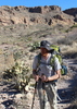
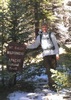
I started from Peralta just after 7:30am. It had been raining while I was driving through Apache Junction & Gold Canyon, but nothing since then. Dark and gloomy at the trailhead, lots of low clouds, and just a few cars there. I headed up a very slick Bluff Springs trail, and within about 5-6 minutes of starting, it started to snow. And kept snowing. Two guys who started just ahead of me turned around at 1.5 miles. At about 2.5 miles, the snow started to stick, and small breaks in the clouds gave peeks of the winter wonderland on all the mountaintops. Bluff Springs trail is a little brushier in places than I remembered, maybe instead of the never-ending trail maintenance on Peralta they could branch out to some of the other trails.

At Dutchman, I considered heading back out and making a short loop, but I really didn't want my day to end that early, so I kept going. The tall grass on Dutchman soaked my pants legs within minutes, but the snowfall had ended for the day for me. I wore waterproof shoes, but they are so old, they were letting in water where the toes bend. Dutchman is almost always a bore for me, so I was glad that part went quickly. My pants dried within about 20 minutes as I kept walking. I saw one backpacker on his way out, he looked cold.

At the junction with Red Tanks, the sun was peeking out, so I found a flat rock and took off my shoes to let them & my socks dry out a little, and had a snack while I waited. After about 10 minutes, the socks were dry, so I kept hiking. The catclaw is growing back in on Red Tanks again. At the junction with Whiskey Springs trail, I once again considered making a shorter loop, but the sun was out and I could see snow beckoning up ahead, so once again, I continued with my original plan. I ran into another hiker at the top of Upper LaBarge--he was making the same loop as me, but in the opposite direction. He asked what the trail was like ahead for him, I said it was fine, that there was a little snow on Bluff Springs but that it was probably already melting off. He said that the snow was crazy further up on Red Tanks and that at times he couldn't see more than a foot or two in front of him. For a second, I considered turning around, but them some credibility was lost when he said there were wolf tracks everywhere.

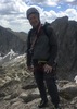
Shortly after the Hoolie Bacon junction, I was on a snow covered trail. It was about an inch deep, and getting deeper as I climbed. The trail wasn't visible in a lot of places, and cairns were difficult to make out as everything was covered in snow. Luckily the hiker I had passed had done a good job of staying on trail and I was able to follow his footprints in conjunction with spotting cairns--this saved me a ton of time. Lots of animal prints in the snow, but I didn't see anything except for one rabbit. At the Divide, the snow was about 4" deep, and my socks were soaked again. The beautiful snow covered desert made up for any discomfort. I stopped to take pictures every few feet at times. The snow was melting quickly, and once over the Divide, it disappeared on the trail within about 0.5 miles. The trail is in crap condition though, poor footing and brushy.

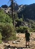
Once at Coffee Flats, it felt like autumn again, as the trees were still hanging on to their golden leaves. It was a relief to be back on an easy trail again, and the walk along Coffee Flats seemed to go by quickly. Back at Dutchman, it was another boring few miles back to the trailhead. Temps were dropping quickly, and I was annoyed at the nonstop bicycle track in the mud of the trail. Finished up just a few minutes minutes after sunset to a parking lot full of yelling people. I'm sure Peralta trail was a mob scene all day. Great day in the Supes, and especially a treat to be out there in all that snow.

water 1 out of 5water less than maxwater less than maxwater less than max Bark at Dutchman Crossing Pools to trickle Pools to trickle

water 1 out of 5water less than maxwater less than maxwater less than max Barks Canyon Pools to trickle Pools to trickle
Pools of water, light trickle

water 1 out of 5water less than maxwater less than maxwater less than max Dripping Spring Dripping Dripping

water 1 out of 5water less than maxwater less than maxwater less than max Fraser Canyon Pools to trickle Pools to trickle

water 1 out of 5water less than maxwater less than maxwater less than max Red Tanks Canyon Pools to trickle Pools to trickle

water 1 out of 5water less than maxwater less than maxwater less than max Trap Canyon Pools to trickle Pools to trickle

water 1 out of 5water less than maxwater less than maxwater less than max Upper LaBarge Box Canyon Pools to trickle Pools to trickle
_____________________
Stop crying and just go do the hike.
 
Feb 23 2018
avatar

 Photos 490
 Triplogs 189

69 male
 Joined Feb 06 2012
 Mesa, AZ
Red Tanks Super Loop - Peralta THPhoenix, AZ
Phoenix, AZ
Hiking avatar Feb 23 2018
DennisWilliamsTriplogs 189
Hiking18.40 Miles 2,500 AEG
Hiking18.40 Miles   10 Hrs   40 Mns   2.03 mph
2,500 ft AEG   1 Hour   35 Mns Break18 LBS Pack
 no routes
1st trip
Linked   none no linked trail guides
Partners none no partners
A fine day out in the Supers, deep into the wilderness. Did this loop as a CCW lasso out of Peralta, going out Dutchman to Coffee Flat, to Red Tanks, north past the Hoolie Bacon junction to Whiskey Spring, then back on the Dutchman to Peralta. Finally got 5.6 miles of new trail out on the southern side.

Departed the TH just before dawn. Love that spot where you top out and all of Barkley Basin is spread before you. As mentioned before, Barkley Basin is the parade ground of the 194,308th Saguaro Division, AKA the "Big Green One". Continue past Sisyphus Rock, the cluster of spires just east of the Miner's Needle. Mountain Project indicates that there are some 5.7, 5.8 multi-pitch trad climbs there. Would love to do that sometime.

Going further east over a little rise takes you into Coffee Flat Basin, another lovely basin just south of impressive Coffee Flat Mountain, a mighty uplift ringed by stacked cliffs. Starting to get into areas that see little traffic. Reed's Water is a nice spot. Continue on through Randolph Canyon to Dripping Spring. Every time I have been there it barely drips, but it does. Past the spring bang a left on the Red Tanks trail and head north and then northwest. Terrific country in there. Never seen it before. The trail is a little sketchy at times but I never lost it. More views of the east side of Coffee Flat Mountain. The pull up to Red Tanks Divide is a little bit of a puffer but not too bad. After the Hoolie Bacon junction veer west on through the Upper La Barge Box. Very cool. The north side of Picacho Butte has some of the most jagged cliffs I can think of. Loved threading the box along the north side of the canyon. I could not stop making mental compliments to it's creator like "I love this place! Nice job! Way to go!"

The tank at Whiskey Spring was full. In fact, most all of the larger canyons had small pockets of water, but nothing actually flowing. Roll back on up and over the Miner's Summit and pick up the Dutchman for the march back through Barkley's. Overall a terrific loop and not much AEG. Can pretty much cruise the whole thing. One of the easier big loops in the western Supers with very little traffic and views of things that few people ever see.
wildflower observationwildflower observationwildflower observationwildflower observationwildflower observation
Wildflowers Observation None
A few ocotillo starting to show.

water 1 out of 5water less than maxwater less than maxwater less than max Randolph Canyon Pools to trickle Pools to trickle

water 1 out of 5water less than maxwater less than maxwater less than max Red Tanks Canyon Pools to trickle Pools to trickle

water 1 out of 5water less than maxwater less than maxwater less than max Upper LaBarge Box Canyon Pools to trickle Pools to trickle

water 1 out of 5water less than maxwater less than maxwater less than max Whiskey Spring Canyon Pools to trickle Pools to trickle
_____________________
"Aequanimitas."

- Antoninus Pius
  1 archive
Feb 03 2018
avatar

 Routes 54
 Photos 1,508
 Triplogs 325

39 male
 Joined Mar 18 2015
 Payson, AZ
Red Tanks Super Loop - Peralta THPhoenix, AZ
Phoenix, AZ
Hiking avatar Feb 03 2018
The_NTriplogs 325
Hiking23.90 Miles 4,135 AEG
Hiking23.90 Miles   8 Hrs   8 Mns   3.01 mph
4,135 ft AEG      12 Mns Break
 
1st trip
Clockwise loop from Peralta. I actually parked at Lost Gold Mine TH. Headed up Bluff Springs, passed a handful of backpackers on the way. Ran into a group camp near LaBarge Spring, which was flowing. Crossed paths with a solo backpacker who informed about water at Reed's Windmill. Dripping Spring was indeed dripping. From there, I shared the trail with a bunch of cattle for a half mile. At the fence they started to panic and tried to force their way through. I backed off and approched from the side, which flushed them off-trail so I could pass through the gate. A few nasty pools in Red Tanks Canyon. Not much water out there, as expected. Tread isn't the best. Rocky and loose in spots, especially the downhills. There were stretches of Red Tanks Trail that were very clear, and some parts were scratchy. Easy to follow, though. Felt like the entire hike was sun exposed. Every morsel of shade was appreciated. Personally, I wouldn't do this loop on any day much warmer than what I saw today. Fun hike, though. Great geology. Saw a bunch of lizards and a few cardinals. Not much else for wildlife.
_____________________
If there is no struggle, there is no progress.
  1 archive
Apr 05 2017
avatar

 Triplogs 2

60 male
 Joined Feb 13 2017
 Arlington, VA
Red Tanks Super Loop - Peralta THPhoenix, AZ
Phoenix, AZ
Hiking avatar Apr 05 2017
gardelTriplogs 2
Hiking20.00 Miles 2,870 AEG
Hiking20.00 Miles
2,870 ft AEG
 no routesno photosets
1st trip
Partners none no partners
I did this a bit differently: Peralta Trailhead to Dutchman's Trail to Charlebois Spring, then to La Barge Spring and from there ro Dripping Spring

Day 1
Taking care of a few last errands left me with a late start at the Peralta trailhead. There were two rangers posted there. I discussed my route, and they gave me the latest water report.

The climb up to Fremont Saddle taxed me more than I expected -- I've been preparing with high-elevation-gain day hikes, but it's a different story with full pack and 3 1/2 liters of water.

Lunch at the saddle refreshed me, and the gentle descent was easy on my legs.  I encountered a few people in the two miles after the saddle, but after that, my sole encounter was with a small (but exuberant) group of Boy Scouts.  Peralta Canyon was beautiful, with wildflowers in a profusion of colors. Along the way, I passed a huge four person tent, empty except for the tent bag, a half a box of macaroni, and a half-filled jar of Ragu spaghetti sauce. I'm sure there's a story there.

At the junction of Peralta and Dutchman trails, so I watered up and headed east. I reached Charlebois Spring at 4:30, and set up camp.  Although the area is said to be popular, I was alone for the night.

Day 2
I woke up at 4:30, and hit the road at 7:30. I filtered water at La Barge Spring, which was as plentiful and good as its reputation. While there, I met Curtis, who was there with a trail maintenance crew that worked on the Red Tanks Trail. He gave me several suggestions, which were all excellent.

The crew's work was top notch -- for the three miles of the Red Tanks Trail that they covered,  I encountered none of  the catsclaw that so many people complain of.  I also had few difficulties navigating.  And the scenery was stunning. Water was readily available.

La Barge Canyon was even prettier, but quite a workout.  Although the trail description emphasized the narrow trail and high drop-off, I didn't find them particularly disturbing.

The remaining four miles of the trail were a trial.  Catclaw and other spiny flora frequently grew into the trail, and at a few spots, nearly obstructed it.  Water was rare, and fairly nasty, until I reached the canyon floor, where it was running nicely, and tasted decent. There were several lovely campsites near the intersection with the Coffee Flat Trail.

Day 3
I headed east on the Coffee Flat trail. There was quite a bit of stream crossing, but most of it was well marked. The water remained plentiful fot the first mile or so, before the trail broke away from the streambed. After that, views were stunning, and wildflowers plentiful, but there was no shade.

I continued on the Dutchman's Trail to the Peralta Trailhead. The trail was well groomes and eady to follow. There was one small pool along the way. It looked decent, but could dry up any day.
wildflower observationwildflower observationwildflower observationwildflower observationwildflower observation
Wildflowers Observation Substantial
As I've never been to the Superstitions before, I have no way to gauge in comparison, but they seemed abundant and varied.

water 1 out of 5water 2 out of 5water less than maxwater less than max LaBarge Spring Quart per minute Quart per minute

water 1 out of 5water 2 out of 5water less than maxwater less than max Peralta Canyon Light flow Light flow

water 1 out of 5water 2 out of 5water 3 out of 5water less than max Randolph Canyon Medium flow Medium flow
Water was running pretty quickly.

water 1 out of 5water 2 out of 5water less than maxwater less than max Red Tanks Canyon Light flow Light flow
Easy water in the lower portion of the canyon.

water 1 out of 5water less than maxwater less than maxwater less than max Upper LaBarge Box Canyon Pools to trickle Pools to trickle
_____________________
 
Mar 04 2017
avatar

 Guides 110
 Routes 2,246
 Photos 8,982
 Triplogs 2,600

45 female
 Joined Dec 24 2007
 Ahwatukee, AZ
Red Tanks Super Loop - Peralta THPhoenix, AZ
Phoenix, AZ
Hiking avatar Mar 04 2017
LindaAnnTriplogs 2,600
Hiking22.24 Miles 3,455 AEG
Hiking22.24 Miles   10 Hrs   43 Mns   2.24 mph
3,455 ft AEG      48 Mns Break
 
Did the loop clockwise. Plenty of water flowing everywhere, so I didn't have to carry much water, just filtered a liter every so often. Lots of people camping along Bluff Springs Trail, including a group of about 30! people. I didn't see too many people after I reached Dutchman. Took a snack break at the Dutchman/Red Tanks jct, then continued on Red Tanks. There were lots of creek crossings along Red Tanks, but my shoes never got wet--trekking poles were invaluable in accomplishing that feat. There were two spots along Red Tanks where the trail didn't seem to match the official gps routes. I was definitely on the right trail, but at one point, I seemed so far off the official track, I doubted myself, backtracked a short distance, then decided I was fine and continued along the trail, which wasted a good 15 minutes. Catclaw was never a problem along Red Tanks, I wore pants, but would have been okay in shorts. Near the Red Tanks/Coffee Flat junction, I scared the daylights out of a guy sleeping in a hammock. He was right on the trail, and I was trying to make noise as I approached, but he didn't notice me until I was right next to him, it was almost comical. The last four or five miles back to the car was kind of boring, but maybe I was just ready to be done. I finished up just before sunset, then got to enjoy the Renaissance traffic on my way home. Saw a couple of cardinals, one deer, and plenty of lizards, but that was it on the wildlife.
 Fauna
 Fauna [ checklist ]
[ checklist ]  Cardinal
_____________________
Stop crying and just go do the hike.
 
Feb 10 2017
avatar

 Photos 281
 Triplogs 222

45 male
 Joined Aug 03 2008
 Chandler, AZ
Red Tanks Super Loop - Peralta THPhoenix, AZ
Phoenix, AZ
Hiking avatar Feb 10 2017
knmurphyTriplogs 222
Hiking21.30 Miles 2,870 AEG
Hiking21.30 Miles   9 Hrs   32 Mns   2.57 mph
2,870 ft AEG   1 Hour   15 Mns Break
 no routesno photosets
Mostly enjoyable day hike that was maybe a good idea.

Dutchman trail was in good shape as usual and Coffee Flat trail wasn't bad, managed to stay on the trail this time. Red Tanks was actually in much better condition than I've ever seen from the start to a little after the Whiskey springs junction. It looks like the canyon flashed during the recent rains and thus a lot of the carins at the many crossings are gone, Smooth sailing after LaBarge spring.

Big thanks to The Arizona Backpacking Club for all their hard work on Red Tanks, I managed to only bleed a little this time through.

water 1 out of 5water 2 out of 5water less than maxwater less than max Barks Canyon Light flow Light flow

water 1 out of 5water 2 out of 5water less than maxwater less than max Bluff Spring Canyon Light flow Light flow

water 1 out of 5water 2 out of 5water 3 out of 5water less than max Brads Canyon Medium flow Medium flow

water 1 out of 5water 2 out of 5water 3 out of 5water 4 out of 5 Crystal Spring Gallon + per minute Gallon + per minute
Water flow in the creek

water 1 out of 5water 2 out of 5water 3 out of 5water 4 out of 5 Dripping Spring Gallon + per minute Gallon + per minute
Significant flow in the creek.

water 1 out of 5water 2 out of 5water 3 out of 5water 4 out of 5 Holmes Spring Gallon + per minute Gallon + per minute
Water flow in the creek

water 1 out of 5water 2 out of 5water 3 out of 5water less than max LaBarge Spring Gallon per minute Gallon per minute

water 1 out of 5water 2 out of 5water 3 out of 5water less than max Reeds Water 51-75% full 51-75% full
Water flowing in the creek nearby.

water 1 out of 5water 2 out of 5water 3 out of 5water less than max Trap Canyon Medium flow Medium flow

water 1 out of 5water 2 out of 5water 3 out of 5water less than max Upper LaBarge Box Canyon Medium flow Medium flow

water 1 out of 5water 2 out of 5water 3 out of 5water less than max Whiskey Spring Canyon Medium flow Medium flow
_____________________
  2 archives
Nov 07 2015
avatar

 Photos 281
 Triplogs 222

45 male
 Joined Aug 03 2008
 Chandler, AZ
Red Tanks Super Loop - Peralta THPhoenix, AZ
Phoenix, AZ
Backpack avatar Nov 07 2015
knmurphyTriplogs 222
Backpack20.00 Miles 2,870 AEG
Backpack20.00 Miles2 Days         
2,870 ft AEG
 no routesno photosets
Great trip. The Red Tanks trail is pretty rough.
_____________________
 
Jan 24 2015
avatar

 Routes 67
 Photos 2,708
 Triplogs 755

89 male
 Joined Mar 28 2008
 Phoenix, AZ
Red Tanks Super Loop - Peralta THPhoenix, AZ
Phoenix, AZ
Backpack avatar Jan 24 2015
Tough_BootsTriplogs 755
Backpack21.50 Miles 3,611 AEG
Backpack21.50 Miles2 Days         
3,611 ft AEG
 
The original plan was an overnight in the Skull Mesa area but unfortunately my partner couldn't make it so I left that one on the "to-do" list and headed into the Supes with my trusty steed (or mutt).

The Peralta TH was slammed on Saturday morning. I had to park in the overflow lot and we got started around 9:30. We passed a couple groups on the Dutchman and then even a group on Coffee Flat. The Coffee Flat trail is probably in the best shape I've seen it. We saw no cattle but plenty of pies. The Dripping Springs side of the private land boundary seemed pretty cow pie free so I would recommend anyone who needs water to hold off until then. Then there was a large group at Dripping Springs-- so many groups these days :o .

Lily was feeling good as we headed up Red Tanks. I kept thinking how it was also in the best condition I've ever seen it. Once you get out of Red Tanks Canyon-- it makes a change for worst. No one gets off the Red Tanks in one piece. My arms are pretty shredded. Lily did alright though-- the 18 inches or so closest to the ground were pretty clear :D

I came across of pair of ladies hiking the other direction. I told them they were about to hit the thick stuff. They told me I was about to hit the thick stuff. Good ol' Red Tanks...

We made it through more thick stuff and then came across a couple backpackers meeting a larger group out there. They weren't so keyed in on their route but I'm pretty sure they had a much longer day ahead of them than expected :o

My goal was to make it to Upper LaBarge Canyon and camp in that pretty little spot. Everytime I hike through there I say, "someday I'm gonna camp there". So that's what we did. We made it to camp at about 3:30. There's an easy path to water below from the site, too. I set up camp, made dinner, and watched the sun go down. It seemed a little silly to make a fire just for myself and a lot of effort to find enough to burn so I went to bed pretty early. Around 10 or 11 the winds picked up just as I had kind of worried about. They whipped through the canyon making it a little difficult to sleep. Luckily it wasn't really very cold, too.

I didn't wake up until around 7. I made some coffee, ate breakfast, broke camp, and headed out around 9:30. This section of Red Tanks was cake compared to the day before. I knew there would be plenty of water so I didn't have to carry any for Lily. That combined with her eating the last of her food-- my pack was feeling much nicer.

I didn't see anyone until LaBarge Spring. There were two groups camped there. We made pretty good time all day and stopped for a break at the Bluff Spring / Terrapin junction. Then we made way. We passed a few groups. Lily did a real solid two days but was pretty happy to see my truck. She has since been treated to some boiled chicken and a very deep nap.

Lots of water out there!
_____________________
  1 archive
Jan 11 2014
avatar

 Routes 93
 Photos 7,758
 Triplogs 1,691

64 male
 Joined Mar 11 2003
 AZ
Dripping Springs Super LoopPhoenix, AZ
Phoenix, AZ
Hiking avatar Jan 11 2014
wallyfrackTriplogs 1,691
Hiking20.40 Miles 4,856 AEG
Hiking20.40 Miles   10 Hrs   12 Mns   2.00 mph
4,856 ft AEG
 
Linked   linked  
Partners none no partners
With a nice day forecast I wanted to check out a few side canyons east of Coffee Flat Mountain. I started at 7:30 and got ahead of a large group. The trail was clear into Reeds Water and I stopped to look at the large saguaro. After a few minutes I heard voices coming so I continued on toward Dripping Springs. As I past through one area with tree I half excepted Topohiker would walk out of the trees. That's where I first ran into him on the trail in 2008. I looked up at a few interesting spots along the trail and continued on to the Red Tanks trail. Once on the Red Tanks trail I took side canyons and explored much of the way until I was past upper La Barge spring. The brush was thick at that point and I had to plow through to get back to the trail. Near the intersection of Hoolie Bacon & Red Tanks I stopped to eat. It was nearing 3pm so I realized I would need to start moving to make it back before dark. The sun was getting low as I hiked down the Dutchman trail but I made it to the hill above Peralte TH right at sun set. No stone houses were discovered on this trip.
 Flora
 Flora [ checklist ]
[ checklist ]  Saguaro
 Geology
 Geology [ checklist ]
[ checklist ]  Natural Arch
 Named place
 Named place [ checklist ]
[ checklist ]  Coffee Flat Mountain
 Meteorology
 Meteorology [ checklist ]
[ checklist ]  Sunset
_____________________
  2 archives
Apr 06 2013
avatar

 Routes 3
 Photos 330
 Triplogs 9

40 male
 Joined Feb 08 2013
 Oaxaca, Oaxaca
Red Tanks Super Loop - Peralta THPhoenix, AZ
Phoenix, AZ
Hiking avatar Apr 06 2013
mike_bergTriplogs 9
Hiking20.00 Miles 2,870 AEG
Hiking20.00 Miles   12 Hrs      1.82 mph
2,870 ft AEG   1 Hour    Break27 LBS Pack
 no routes
1st trip
Linked   none no linked trail guides
Partners none no partners
Executed this solo as a day hike, counterclockwise, hitting the trail at 7am and returning to the car, completely worn out, at 7pm (doing ten sets of squats at the gym the day before turned out to be a poor decision). Wasn't sure I'd find water on the trip, so started out carrying two gallons. As it turned out, finding water on the trail wasn't a problem. However, carrying that much water for the first seven or eight miles took a toll.

This was my first solo hike in the wilderness (moved here last fall so I've only been hiking the area for a few months), and I felt a bit anxious at times (particularly when I heard, much louder than I'd imagined it would be, the ominous rattle of a nearby snake for the very first time :scared: ). For the remainder of the hike--the snake was somewhere around the halfway point--I had a slight fear of being bitten, or possibly eaten, by one or more rattlesnakes. The fact that in many spots on the trail I had to walk through tall grass obscuring my vision of the ground below did not help to mollify my fear. I ended up hearing one more rattler close by (10-15 feet), and another farther off, but saw neither these two nor the first. Somehow I'm ok with that.

Felt quite secluded for the entire trip. Passed a group of four on Dutchman Trail just twenty minutes after leaving the trailhead; didn't see anybody on Coffee Flat Trail; saw solo guy on Red Tanks Trail (he remarked that it was unusual to see anyone out there). Two campers near intersection of Dutchman Trail and Bluff Spring Trail. Three people half a mile from the parking lot on Bluff Spring Trail.

This was the first time I've seen the desert really alive: butterflies, caterpillars, bees, ants, beetles, wildflowers, (rattlesnakes), and it was quite cool to be essentially the lone human observer of nature's grand design that day, to be the outsider. :D

I made really great time (4 mph) on certain sections when the trail was easy to follow, but lost the trail a few times (or the trail forced me to claw through cat's claw or crawl or climb, etc.) and trudged at a measly 1-1.5 mph for significant, and frustrating, portions. Often I traveled at 0 mph as I scratched my head wondering how I'd lost the trail and how to navigate through and over trees, brush, and boulders. Of course turning back to relocate the trail was not an option. I pressed relentlessly forward and have more than enough scratches to prove it. I stopped to filter water twice and I sat down to eat meals twice for about fifteen minutes each time, but other than that took no rests other than stopping for a minute or so on the trail during climbs (when my quads simply refused to cooperate anymore ;)).

When I got about a half mile from the trailhead I experienced a delightful endorphin rush upon realizing that I'd succeeded. Or perhaps it was just a wave of relief :y:
 Culture
 Culture [ checklist ]
[ checklist ]  Fraley Pose  Windmill
wildflower observationwildflower observationwildflower observationwildflower observationwildflower observation
Wildflowers Observation Substantial

water 1 out of 5water 2 out of 5water 3 out of 5water less than max Fraser Canyon Medium flow Medium flow

water 1 out of 5water 2 out of 5water less than maxwater less than max Randolph Canyon Light flow Light flow

water 1 out of 5water less than maxwater less than maxwater less than max Red Tanks Canyon Pools to trickle Pools to trickle

water 1 out of 5water 2 out of 5water less than maxwater less than max Whiskey Spring Canyon Light flow Light flow
_____________________
 
Nov 03 2012
avatar

 Routes 67
 Photos 2,708
 Triplogs 755

89 male
 Joined Mar 28 2008
 Phoenix, AZ
Red Tanks Super Loop - Peralta THPhoenix, AZ
Phoenix, AZ
Hiking avatar Nov 03 2012
Tough_BootsTriplogs 755
Hiking19.30 Miles 3,871 AEG
Hiking19.30 Miles
3,871 ft AEG
 
Linked   linked  
Partners partners
John9L
If you happened to feel a breeze today and upon that breeze rode yelps of pain and uncensored cursing-- that was me and John on Red Tanks. Everything has thorns and needles and they are all unavoidable.

Other than that, it was a beautiful day and we made really good time. Dripping Springs was dripping and Whiskey Springs surprisingly had clear and cold water in the spring box.

water 1 out of 5water less than maxwater less than maxwater less than max Dripping Spring Dripping Dripping
_____________________
 
Mar 11 2012
avatar

 Guides 6
 Routes 183
 Photos 5,612
 Triplogs 1,647

male
 Joined Mar 12 2004
 Scottsdale, AZ
Red Tanks Super Loop - Peralta THPhoenix, AZ
Phoenix, AZ
Hiking avatar Mar 11 2012
John9LTriplogs 1,647
Hiking20.76 Miles 3,612 AEG
Hiking20.76 Miles
3,612 ft AEG
 no routes
1st trip
Partners partners
Tough_Boots
Had an awesome day out on the trails with Kyle! We covered some serious ground and only saw a few people. Most of this hike was new for me. Some of the sections are amazing & the views are spectacular! There were lot of good camp spots as well. I made mental notes for a future return. There was water along the hike but it was intermittent. I ended up pumping some at La Barge Spring. From there we made good time back to the car. It was a long day but well worth the effort!
_____________________
 
Mar 11 2012
avatar

 Routes 67
 Photos 2,708
 Triplogs 755

89 male
 Joined Mar 28 2008
 Phoenix, AZ
Red Tanks Super Loop - Peralta THPhoenix, AZ
Phoenix, AZ
Hiking avatar Mar 11 2012
Tough_BootsTriplogs 755
Hiking20.76 Miles 3,612 AEG
Hiking20.76 Miles
3,612 ft AEG
 
Linked   linked  
Partners partners
John9L
This was a good long one! We made plans to do the Dripping Springs Super Loop but knew we wanted to extend it a little bit. We decided that all was to be decided on the trail. Our options for extension would be to take Red Tanks out to where it dead ends at the Dutchman and come back Bluff Springs at around 21 miles... or if we were feeling like supermen, we would take Red Tanks out to Dutchman and basically combine the loop with the Bluff Spring Mtn Loop and come back via the Terrapin and then Bluff Springs at a wopping 25 miles.

As we hiked, I kept envisioning the horror of ascending up the Terrapin after already hiking 20 miles and was able to scare John into the shorter extension pretty quickly. Later when we eventually reached the trail head again, we were both happy to not have those four extra miles to go.

As the the actual hike, it was fantastic. The temps were nice and warm but not uncomfortable warm-- just warm enough to really appreciate dipping a handkerchief or hat into any available cold pool of water. Upper LaBarge was the highlight as it usually is. We also made sure to point out caves and alcoves that Wally has probably already been in. :)

Water along this loop in disappearing quickly. There's still filterable pools out there but I wouldn't trust them for long.
_____________________
 
Dec 20 2008
avatar

 Routes 2
 Triplogs 27

76 male
 Joined Sep 22 2002
 Gilbert, AZ
Red Tanks Super Loop - Peralta THPhoenix, AZ
Phoenix, AZ
Backpack avatar Dec 20 2008
r4gl7qTriplogs 27
Backpack20.00 Miles 4,000 AEG
Backpack20.00 Miles2 Days         
4,000 ft AEG
 
no photosets
1st trip
Linked   none no linked trail guides
Partners none no partners
We did the Peralta TH - Dripping Springs - Red Tanks - Whiskey Springs - TH loop as a 2 day backpack trip. The trip from the trailhead to dripping springs was great. Trail was easy to follow. With all the water in Randolph canyon, it makes you look that much harder for a trail that keeps you from getting wet. There always is one. We had lunch at dripping springs thinking we could get to our campsite near the Hoolie Bacon intersection by mid afternoon. That didn't happen. Going up the Red Tanks was a real challenge. The catclaw and the general vegetation overgrowth was pretty bad. I think we were on the trail most of the time. At least one time I'm pretty sure we weren't, as I don't remember the need for class 5 rock climbing skills the last time I did this. We did a lot re-tracing our steps, a lot of searching and a lot of "oh well, we need to get to the top and we're going up". Going down the red tanks into Brad's water was a bit easier. However, once we got near Brad's water we completely lost the trail. It was 4:30 so we decided to set-up camp and find the trail in the morning. We followed the GPS and plowed through dense vegetation and finally reconnected with the trail. (a cairn can be a beautiful sight!). The rest of trip was like a "superstitions super highway" compared to the red tanks. Hey, in couple weeds I'll forget how miserable it was and do another one just as bad.
_____________________
  1 archive
average hiking speed 2.13 mph

WARNING! Hiking and outdoor related sports can be dangerous. Be responsible and prepare for the trip. Study the area you are entering and plan accordingly. Dress for the current and unexpected weather changes. Take plenty of water. Never go alone. Make an itinerary with your plan(s), route(s), destination(s) and expected return time. Give your itinerary to trusted family and/or friends.

helpcommentissue

end of page marker