username
X
password
register
for free!
help
ArticlesGuidesRoutes
 
Photosets
 
 Comments
triplogs   photosets   labels comments more
Tonto Trail: Grandview Trail to South Kaibab - 15 members in 40 triplogs have rated this an average 3.8 ( 1 to 5 best )
1, 2  Next
40 triplogs
login for filter options
Mar 09 2025
avatar

 Guides 59
 Routes 1,100
 Photos 1,191
 Triplogs 1,290

male
 Joined Jan 01 2023
 Arizona
Grandview-Bright Angel via Hance CreekNorthwest, AZ
Northwest, AZ
Backpack avatar Mar 09 2025
pseudalpineTriplogs 1,290
Backpack
Backpack3 Days         
 
1st trip
Route Scout Route Recorded  on Route Scout | Pop | Map | Popup | MapDEX
 Culture
 Culture [ checklist ]
[ checklist ]  Aircraft
 Meteorology
 Meteorology [ checklist ]
[ checklist ]  Snow

dry Boulder Creek Dry Dry


water 1 out of 5water 2 out of 5water less than maxwater less than max Burro Spring Quart per minute Quart per minute

water 1 out of 5water 2 out of 5water less than maxwater less than max Cottonwood Creek Light flow Light flow

water 1 out of 5water 2 out of 5water 3 out of 5water less than max Garden Creek Medium flow Medium flow

water 1 out of 5water 2 out of 5water less than maxwater less than max Grapevine Creek Light flow Light flow

water 1 out of 5water less than maxwater less than maxwater less than max Lonetree Creek - GC Pools to trickle Pools to trickle

water 1 out of 5water 2 out of 5water 3 out of 5water 4 out of 5 Pipe Spring Gallon + per minute Gallon + per minute
  6 archives
May 09 2022
avatar

 Routes 5
 Photos 435
 Triplogs 119

female
 Joined Mar 26 2022
 Flagstaff, AZ
Grapevine Creek - Grand CanyonNorthwest, AZ
Northwest, AZ
Backpack avatar May 09 2022
shelby147Triplogs 119
Backpack30.00 Miles 6,500 AEG
Backpack30.00 Miles3 Days         
6,500 ft AEG25 LBS Pack
 no routes
Partners none no partners
Caught some cool weather and went down from Grandview to explore lower Grapevine creek and visit the Grapevine beach camp. Grapevine creek was gorgeous - flowing water, green vegetation, and so many tadpoles. The ravine I scrambled over to access the beach was challenging with an overnight pack. Lots of loose talus, some big chockstones, and thorny plants. It was a windy night so of course, sand all over my gear for the rest of the trip. Best sunset I've ever seen from the river, though!

On my way out on day 2 I explored up the eastern arm of Grapevine until reaching the top of the tapeats. Looks fairly well traveled there. Water at the Grapevine/ Tonto crossing was shallow and green, I preferred the water about 20 mins above/ below. This day was hot so I hustled over to Cottonwood without my planned detour on lower Old Grandview to rest in the shade. Here, I nearly couldn't sleep for the frogs. Then it was an early hike out the next morning, and good thing because food poisoning laid me low as soon as I got home.

I saw so many critters on this trip - tadpoles, bats, and birds, and my first rattler and tarantula hawk (very glad I saw the latter two before walking into them)! And I saw condors every day - it seems there's a pair + mature offspring hanging around Grandview point.

water 1 out of 5water 2 out of 5water less than maxwater less than max Cottonwood Creek Light flow Light flow

water 1 out of 5water less than maxwater less than maxwater less than max Grapevine 3,648 Dripping Dripping

water 1 out of 5water less than maxwater less than maxwater less than max Grapevine Creek Pools to trickle Pools to trickle
Better water above and below Tonto crossing area
  3 archives
Dec 28 2019
avatar

 Guides 12
 Routes 192
 Photos 863
 Triplogs 356

42 male
 Joined Nov 30 2015
 Phoenix, AZ
S Kaibab to Lone Tree, AZ 
S Kaibab to Lone Tree, AZ
 
Backpack avatar Dec 28 2019
ShatteredArmTriplogs 356
Backpack19.30 Miles 5,100 AEG
Backpack19.30 Miles1 Day   4 Hrs   41 Mns   
5,100 ft AEG
 
1st trip
Partners none no partners
With over a week off of work, I wanted to do something kind of fun, but didn't really have a chance to plan out anything epic. So I made a sort-of-last-minute decision to do a 4 night hike in the Grand Canyon. Believe it or not, this would be my first ever solo backpacking trip.

Apparently I didn't learn my lesson from 5 years ago, when I vowed to never again camp in the canyon during the winter. It turned out to be a pretty ill-fated weekend.

Thing that went wrong #1: Originally planned on leaving on Thursday, but...weather. Decided to postpone till Saturday to let the winter storm pass.

The original plan was to do two nights at Hance Creek, explore down to Sockdolager Rapids as a day hike, then wander over to Cottonwood for a couple of nights, with a day hike over to Grapevine (turns out the Cottonwood Creek area got burned up this fall due to an illegal campfire, for which the culprits are being federally prosecuted).

Thing that went wrong #2: Desert View Drive closed

When I got to the canyon, the road to Grandview was still closed due to ice, and the notice as of 10am said it "may" open in the afternoon. Decided not to risk it, and just booked an alternate itinerary with 1st and 3rd nights in Cremation use area, and 2nd in Grapevine.

Parking at the visitor center was a complete pumpkinshow, but I managed to squeeze in a spot and got to the TH by 11:45am. Put on some yaktrax just in case, and made quick time down to Tipoff. Wasn't sure whether I'd camp in Cremation or Lone Tree (both are in the same use area), but since I was making such good time, I figured I may as well shorten the mileage to Grapevine the next day. Got to Lone Tree with a full two hours of daylight left, set up camp, hiked the quarter mile or so down to the namesake tree, back up to camp, and... made dinner. While making dinner, I realized I had forgotten to bring spare fuel for my JetBoil, like I usually do.

Made plans in my head, if I at least made it to Grapevine before running out, and got a hot dinner there, I could manage the rest of the trip eating the stuff that doesn't require heating.

As the sun set, I crawled into the tent for the rest of the night and finished a flask of whiskey and the book I was reading.

Thing that went wrong #3: Out of fuel

Sunday morning was absolutely frigid. My sleeping bag was just on the verge of not being able to handle the temperature - my guess, based on how fast stuff was freezing, is that it got down to about 20F. Made coffee while still in the sleeping bag, then started heating up water for breakfast, and... flame dies. Took inventory of the food I had, and I had two servings of granola, some salmon I could eat for dinner, and an assortment of meal bars, gels, nuun tablets, meat sticks, and plenty of whiskey. Coffee would've been the biggest problem (maybe I could cold brew it?), but ultimately I decided, with those temperatures, this was just a sign I should pull the plug on the rest of the trip.

So out I went. At 10:45am temperatures were still below freezing at Lone Tree, and the hike out was much slower. The middle and west branches of Cremation seemed even steeper than before, and even the flats seemed to take longer. Pushed up to the rim and a steady pace, with minimal breaks. Just wanted to get out of there with a little bit of daylight left, so I can beat the worst of the traffic out of the park.

Even though almost everything went wrong, it was still a good experience overall. Saw a new place, got a solid 24 hours with no human contact, and enjoyed some cool scenery along the way.

dry Cremation Creek Dry Dry
West and Middle branches had a few pools in the narrows below the trail.

water 1 out of 5water 2 out of 5water less than maxwater less than max Lonetree Creek - GC Light flow Light flow
Light flow at the trail crossing, only took a few minutes to fill 3L. Spring at the tree downstream had a little less flow.
_____________________
 
Sep 28 2017
avatar

 Routes 67
 Photos 966
 Triplogs 694

51 female
 Joined Jan 05 2012
 Phoenix,AZ
Tonto Trail: Grandview Trail to South KaibabNorthwest, AZ
Northwest, AZ
Backpack avatar Sep 28 2017
slowandsteadyTriplogs 694
Backpack39.09 Miles 9,550 AEG
Backpack39.09 Miles4 Days         
9,550 ft AEG
 no routesno photosets
1st trip
Old Grandview is pretty steep. I did a good portion as a butt scoot. Hiking back up was much easier than going down. We did see a bighorn on the trail.
_____________________
 
Sep 28 2017
avatar

 Guides 4
 Routes 491
 Photos 10,890
 Triplogs 1,257

55 male
 Joined Nov 20 2012
 Phoenix, AZ
Tonto Trail: Grandview Trail to South KaibabNorthwest, AZ
Northwest, AZ
Backpack avatar Sep 28 2017
BiFrostTriplogs 1,257
Backpack39.09 Miles 9,550 AEG
Backpack39.09 Miles4 Days         
9,550 ft AEG
 
1st trip
Back to the Grand Canyon to finish some more Tonto Trail and check out Old Grandview Trail. Took a taxi from GC Visitor Center to Grandview TH…$24 one way for anyone considering the option. First night the goal was camp at Cottonwood Creek from Grandview TH so we only had to hike about 6.8 miles. Starting about 130 we made it camp by 530. Being the drier part of the year there was no water at the crossing of Cottonwood so dropped the pack and ventured upstream and found some small pools about ¼ mile up as well as nice camp close by among some cottonwoods.

Day 2 we wanted to check out Old Grandview Trail down to the Colorado River which is about 2.5 miles from Cottonwood Creek. There is a large cairn marking the junction which drops abruptly from the rim towards the river. The first part is not too bad but the bottom half is very steep and loose scree and boulders abound. Once at the river we took a nice long break spending over an hour. Two boat crews passed by and one offered a beverage which is always welcome :) After the break we headed back up which was much easier going up the scree and took about 30 minutes less. Back at the junction it’s 3 miles over to Grapevine Canyon and camp for the second night. Again no water at the crossing but there were some clear pools downstream a few hundred yards.

Day 3 the camp was at Lonetree Canyon continuing west bound on Tonto Trail but our main concern was water. So we headed out early with the goal of spending the afternoon searching for water. Fortunately we found it about 3 or 4 tenths of mile downstream from the trail crossing. The source is a spring that’s probably reliable all year and is marked by a lone cottonwood tree. We rested in the shade and filtered water with the relief that the search was easier than expected. Then headed back to camp and relaxed rest of the afternoon.

Day 4 just needed to make it out of the canyon with little more 10 miles to South Kaibab TH. Of course there were very few people seeing only 3 in 23 miles from Horseshoe Mesa below Grandview to the Tip Off at South Kaibab. Once on the SK it was back to the crowds but nice to do this trip in 4 days with plenty of time to enjoy Old Grandview Trail and Tonto Trail.
 Culture
 Culture [ checklist ]
[ checklist ]  Costume

dry Boulder Creek Dry Dry
no water

dry Burro Creek - GC Dry Dry
no water

water 1 out of 5water less than maxwater less than maxwater less than max Cottonwood Creek Pools to trickle Pools to trickle
Dry at the crossing. Went upstream about 1/4 mile and found small pools.

dry Cremation Creek Dry Dry
no water

water 1 out of 5water less than maxwater less than maxwater less than max Grapevine 3,648 Dripping Dripping
small pools across and above the trail from the spring

water 1 out of 5water less than maxwater less than maxwater less than max Grapevine Creek Pools to trickle Pools to trickle
no water at the crossing but several pools few hundred yards downstream.

water 1 out of 5water less than maxwater less than maxwater less than max Lonetree Creek - GC Pools to trickle Pools to trickle
dry at the crossing. spring about 3 to 4 tenths of mile downstream that looks reliable under lone cottonwood tree
_____________________
  3 archives
Dec 24 2016
avatar

 Guides 1
 Routes 1
 Triplogs 22

male
 Joined Jan 03 2016
 Flagstaff, AZ
Tonto Trail: Grandview Trail to South KaibabNorthwest, AZ
Northwest, AZ
Backpack avatar Dec 24 2016
flagscottTriplogs 22
Backpack30.00 Miles 2,424 AEG
Backpack30.00 Miles
2,424 ft AEG
 no routesno photosets
1st trip
Linked   linked  
Partners none no partners
Being both heathens and scrooges, the wife and I decided to disappear into the Canyon for a few days over the weekend. This was our first trip on the Grandview and our first extended walk on the Tonto. We loved both of them!

Grandview was terrific--a bit icy but no problem with Microspikes. We made it to the end of Horseshoe Mesa before the storm really hit. But then we had cold rain for the last few miles to Cottonwood. Luckily, we've dealt with cold rain plenty of times on our thru hikes, so we didn't have any trouble. We pitched the tent, changed into warm clothes, spent a few hours reading, cooked dinner in our tarp vestibule, and managed to stay nice and warm despite the hours of constant cold rain outside.

Amazingly, despite the rain continuing well into Saturday night, we woke to an xmas miracle on Sunday--a dry tarp! Thank you, gusty winds that blew our tarp around all night. The Tonto was great, especially the area around Grapevine, and we really enjoyed the walking all day. The snow level was down to around 5,000, which was nice to see without being in it. We camped at Lone Tree, which is technically part of the Cremation use area now. Unfortunately, the super short daylight hours didn't give us any time to explore the canyons we crossed. We're saving that for another trip.

Total sightings on the Grandview and Tonto: 5 mule deer, 7 bighorn sheep, 0 people. That's just the ratio of wildlife to human sightings that we prefer.

The lower part of South Kaibab was a muddy, gross mess, and I swore to myself that I will never hike that trail again shortly after a storm. The upper part was mostly packed snow, no ice yet. But this was just 2 days after the storm. We didn't need use the Microspikes on the way up, but you might think about traction devices if you're planning a trip here in the near future--it will be icy soon enough. Anyway, we made great time on the way out...until the trailhead. The bus and the visitors' center parking lot were absolutely mobbed, and it took us 15 minutes just to get from our parking spot to the park road! I guess Boxing Day is prime time for park visits.

Anyway, a great time, and we'll be back soon.

(FYI: note that our water reports were all from immediately after two big, wet storms.)

water 1 out of 5water less than maxwater less than maxwater less than max Boulder Creek Pools to trickle Pools to trickle
There were pools visible below the trail on the way down there.

water 1 out of 5water 2 out of 5water 3 out of 5water less than max Cottonwood Creek Medium flow Medium flow
Good flow. Great tasting water.

water 1 out of 5water less than maxwater less than maxwater less than max Cremation Creek Pools to trickle Pools to trickle
Saw a few pools downstream from the crossing on the way down.

water 1 out of 5water 2 out of 5water less than maxwater less than max Grapevine Creek Light flow Light flow
Decent flow at the trail crossing.

water 1 out of 5water less than maxwater less than maxwater less than max Lonetree Creek - GC Pools to trickle Pools to trickle
Plenty of good pools to get water from. There was some flow in places.
_____________________
  4 archives
Sep 30 2016
avatar

 Routes 78
 Triplogs 93

male
 Joined Nov 11 2011
 
Grandview to South Kiabab, AZ 
Grandview to South Kiabab, AZ
 
Backpack avatar Sep 30 2016
charlomechfryTriplogs 93
Backpack31.19 Miles 5,580 AEG
Backpack31.19 Miles3 Days         
5,580 ft AEG
 
no photosets
1st trip
Partners none no partners
_____________________
  1 archive
Apr 23 2015
avatar

 Guides 6
 Photos 346
 Triplogs 225

69 male
 Joined May 13 2002
 Tempe, AZ
Tonto Trail: Grandview Trail to South KaibabNorthwest, AZ
Northwest, AZ
Hiking avatar Apr 23 2015
hikeazTriplogs 225
Hiking20.75 Miles 2,424 AEG
Hiking20.75 Miles
2,424 ft AEG
 no routes
1st trip
Partners none no partners
Nice jaunt across the Tonto - stops at the lower caves in Cottonwood (water flowing in the canyon), Grapevine; (extensively explored up and down-canyon from the crossing)(water flowing there as well - and the unnamed side canyon on the east side of Grapevine Canyon also had flowing water), Lonetree;(rained quite a bit, but visited (jealously) for quite a while with 2 'Haydukers' on the last leg of their trip, Cremation; again explored up and down canyon for a full day and had a layover day to hike down to Phantom for a beer (they have added Grand Canyon Amber to the standard Bud & Tecate offerings)and some cards and then back to Cremation. NOTE: the western boundary of the Cremation camping 'zone' has been moved eastward to the bottom of the western arm of Cremation - even had a BC L/E ranger pop in (where do they FIND these guys?) Why they moved the boundary is a mystery, but as there was no rain in the vicinity, camping in the drainage was pretty nice!
Rim-bound, used the cut-off route igallery/image_page.php?id=4590 to avoid the tip-off (much better going DOWN this shortcut) then up the SK to the Rim. SK is getting a lot of mule traffic as the NPS has moved trips from the BA and unfortunately the trail shows it.
Nice, somewhat blustery days were perfect for backpacking the Tonto. Prickley-Pears were blooming like crazy! Globemallows, etc. as well. REALLY pretty time to be in the Canyon!
wildflower observationwildflower observationwildflower observationwildflower observationwildflower observation
Wildflowers Observation Substantial

water 1 out of 5water 2 out of 5water 3 out of 5water less than max Cottonwood Creek Medium flow Medium flow
Flowing at the Tonto Crossing and above

water 1 out of 5water less than maxwater less than maxwater less than max Cremation Creek Pools to trickle Pools to trickle
No flow whatsoever. Pools in the narrows (center arm) just downstream of the Tonto crossing, will likely not last long.

water 1 out of 5water 2 out of 5water 3 out of 5water less than max Grapevine Creek Medium flow Medium flow
Flowing at the crossing - MUCHO water upstream in the narrows section

water 1 out of 5water 2 out of 5water less than maxwater less than max Lonetree Canyon Light flow Light flow
Slight flow at the Tonto crossing- Real spring is down-canyon about 10/15 minutes, creek right
_____________________
"The censorship method ... is that of handing the job over to some frail and erring mortal man, and making him omnipotent on the assumption that his official status will make him infallible and omniscient."
George Bernard Shaw
  1 archive
May 24 2014
avatar

 Guides 13
 Routes 38
 Photos 1,651
 Triplogs 577

60 male
 Joined Nov 15 2005
 Jackson, CA
Cottonwood Creek - Grand CanyonNorthwest, AZ
Northwest, AZ
Canyoneering avatar May 24 2014
toddakTriplogs 577
Canyoneering15.00 Miles 5,500 AEG
Canyoneering15.00 Miles   11 Hrs      1.36 mph
5,500 ft AEG
Canyon Hiking - Non-technical; no rope; easy scrambling; occasional hand use
A - Dry or little water; shallow or avoidable water; no wet/dry suit
II - Normally requires a half day
 no routes
1st trip
Still a usable trickle at the Tonto crossing, probably won't last long. Not much water in the canyon below the Tonto, although earlier in the season and/or after a wetter winter it would likely be flowing more.

The second bypass in particular is long and gnarly, climbing way up above the canyon floor while crossing multiple ridges and loose slopes. The third bypass down to the river is also steep and loose. Fortunately I brought my packraft along and floated down about a half mile to exit on the Old Grandview trail instead of having to return up Cottonwood and reverse the bypasses.

Overall a similar canyon to nearby Hance and Grapevine, but a bit harder to negotiate and somewhat less scenic.
_____________________
  1 archive
Jan 05 2013
avatar

 Guides 13
 Routes 38
 Photos 1,651
 Triplogs 577

60 male
 Joined Nov 15 2005
 Jackson, CA
Old Grandview Trail - LowerNorthwest, AZ
Northwest, AZ
Hiking avatar Jan 05 2013
toddakTriplogs 577
Hiking16.00 Miles 5,000 AEG
Hiking16.00 Miles   10 Hrs   30 Mns   1.52 mph
5,000 ft AEG
 no routes
1st trip
Partners none no partners
Thanks to Chumley for the inspiration on this one! Old Grandview would make a nice side trip if hiking the Tonto, or maybe a day trip from Cottonwood campground.

Snow on the upper Grandview was still nicely compacted but not icy yet. Returned around the north side of Horseshoe and up between the arms of the mesa.
 Named place
 Named place [ checklist ]
[ checklist ]  Cottonwood Creek
_____________________
 
Nov 30 2012
avatar

 Guides 6
 Routes 183
 Photos 5,612
 Triplogs 1,647

male
 Joined Mar 12 2004
 Scottsdale, AZ
Grandview TrailNorthwest, AZ
Northwest, AZ
Backpack avatar Nov 30 2012
John9LTriplogs 1,647
Backpack31.50 Miles 6,084 AEG
Backpack31.50 Miles3 Days         
6,084 ft AEG
 
Partners partners
chumley
ultrazona
Solid trip into the canyon with Vince & Todd. We spent three days below the rim and had the perfect weather for the trip. The hiking was moderate and the views were wonderful as always. With this hike, I have now completed the entire eastern portion of the Tonto all the way from Hermit to New Hance. I hope to finish the western portion in 2013. Finally, a big thanks to Larry (Squatpuke) on this one. He picked up the permits and let us stay at his house in Flag on our first night. He also drove up to the SK trailhead and did a short hike and then shuttled us back to my jeep at Grandview. This trip would not have happened without his help! Thanks again!

See photos descriptions for more details on this trip.
 Culture
 Culture [ checklist ]
[ checklist ]  Campsite
 Named place
 Named place [ checklist ]
[ checklist ]  Grapevine Rapids
_____________________
  2 archives
Nov 30 2012
avatar

 Guides 94
 Routes 842
 Photos 22,068
 Triplogs 1,994

52 male
 Joined Sep 18 2002
 Tempe, AZ
Grandview TrailNorthwest, AZ
Northwest, AZ
Backpack avatar Nov 30 2012
chumleyTriplogs 1,994
Backpack34.36 Miles 8,367 AEG
Backpack34.36 Miles2 Days   4 Hrs   40 Mns   
8,367 ft AEG37 LBS Pack
 
1st trip
Partners partners
John9L
ultrazona
Another Grand Adventure!

Thanks to Larry for doing all the permit work, giving us a place to crash, and coming up on Sunday for the shuttle. Of course none of these trips would ever happen without 9L doing the planning, and thanks to Vince for making sure there was always somebody in camp in a condition capable of handling any situation that might have come up. Safety first! :)

Stats (for anybody doing research on this route):
Day 1 - Grandview to Grapevine 10.2 miles, 5:00
Day 2 - Grapevine to Lonetree 8.8 miles, 3:05
Day 3 - Lonetree to SKTH 9.2 miles, 4:16 (I was slow)

Water Sources:
Day 1 - Cottonwood Creek at 4.2mi
west fork Cottonwood Creek at 5.7mi
Grapevine Creek at 10.2mi
Day 2 - Boulder Creek at 5.8mi +.25mi up the west fork to reach the water.
Lonetree Canyon at 8.8mi +.5mi up or down canyon to reach the water.
Day 3 - No water after leaving Lonetree canyon.

Story:
Originally 9L and Squat and I were going to do this trip, but when the Nutcracker got a firm grasp on Squat's jewels he had to cancel and take care of daddily obligations. Hippy was going to take his place but after a month or so she finally figured out that hiking on a sprained ankle hasn't served her very well. Luckily Vince was able to go and we still had an ideal group of 3.

To get an early start Friday, we drove to Flag after work Thursday and crashed on the floor at chez squat. Our pre-dawn departure for the canyon went just fine until arriving at the entrance gate where little miss ranger lady had clearly woken up on the wrong side of the bed. 9Ls smooth moves with the ladies were just not cutting it, and $80 later we proceeded toward the trailhead firmly planted 10mph below the limit.

It was surprisingly cold. The clouds were at rim level, leaving us in a thick, cold, wet fog. It was tough to get all geared up and ready to go due to the chill, and we all knew this would be the coldest it would be all weekend. There was maybe one other car at Grandview, which was a nice change from the typical tourist-for-all that you experience up there. Somehow we managed to drop off the rim before 9 and quickly dropped out of the cloud layer.

Not more than 500 yards down the trail we encountered trash in the middle of the trail -- a McCafe coffee cup. With no shyness we discussed with some colorful expletives what kind of dbs would do something like this, followed by a couple of insults of the brand of drink they had chosen. Of course, we rounded the next switchback to meet the people who dropped the cup. They intended to pick it up on their way out, and also had heard everything we said. And they also had a dog on the trail, so I don't think we really cared. But we laughed about it for a while.

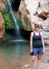
We passed a group of 3 near the saddle between the switchback sections, and they were the last people we saw until reaching South Kaibab on Sunday morning. We took a snack break at Horseshoe Mesa before dropping into Cottonwood Canyon. There was plenty of water running in both the main and west forks and we stopped only briefly at each for a couple of photos. The Cottonwoods were all golden during this first weekend of December.

Once on the Tonto, we cruised around to Grapevine and were pleasantly surprised to see and hear plenty of water flowing down the creek adjacent to where we decided to set up camp.

With plenty of time left in the day, Vince and I headed up canyon for a mile or so and I later realized that the Grapevine drainage begins on the west side of Grandview Point, where our day had begun! It was a great canyon, with a steady stream of water flowing, awesome rock formations, colors, narrow slots, short falls, and a few Cottonwoods and other foliage with autumn colors. I could easily have camped here an extra night just to explore this canyon both up and downstream! Just downstream of the Tonto crossing there is a junction to a west fork of the canyon, and that was a fun place to explore too. I always like to have some near-camp exploration options. Even after a long hiking day, I'm not ready to sit or sleep just yet!

We spent the evening enjoying a beverage or two and taking silly night photos featuring stars, headlamps, tents, and party lights. I slept solid!

Saturday morning we topped off our water and headed back out on the Tonto. After having read the triplogs from last fall when Joe, Bruce, Wally, and Denny did this hike as a DAYTRIP, I had gotten the sense that the Tonto is basically a neverending journey into and out of every drainage. Luckily we were only doing it in pieces, and the views truly are awesome. When the trail parallels the inner gorge the ruggedness of the rock and the views and sounds of the river amaze, and when it leaves the gorge for the various canyons, each provides a different canyon experience.

Our first main crossing was Boulder Canyon, which we were pleasantly surprised to find with a reasonable trickle of water about 1/4 mile up the west fork. Plenty of pools for filtering if needed. The east fork was dry as far up as I ventured. We stopped and took a break here before continuing on toward Lonetree. Upon arriving there, I was a bit concerned not to find any water. None of us was prepared to spend the night and hike the next day without further water, and we were fairly certain that this was the last chance. Would we have to backtrack to Boulder Canyon?

I dropped my pack at the presumed campsite and headed up canyon looking for pools or any sign of flow like we had found in Boulder. Nothing. Dry, dry, dry. I found a sandy pool that might have had 2 liters in it. That wouldn't be enough. I kept going. Finally I reached an area with a lone pine tree and some low shrubs and some grasses. The hillside revealed what I recognized as the markings of a seep, though it was dry. I climbed uphill from here and slowly became encouraged by a little bit of squishy earth under my feet. After fighting some shrubs and tree branches, I emerged face-to-face with a cliff wall and a nice patch of healthy green moss and a few steady streams of water flowing out of the rock. Bonus!

I of course had not brought a water container with me, and the only catch here was that I had hiked at least half an hour from our camp. Oh well. I timed my hike back and reached the others in 20 minutes. I found out that 9L had discovered water down canyon as well. Also about a 20 minute walk. It was definitely easier to get to the spring down canyon from the crossing, but the spring up canyon was pure out of the rock and doesn't need filtering (Your mileage may vary. Proceed at your own risk.)

With the water issue solved, we set up camp and settled in with only a bit more exploring. I was stung by some kind of canyon bug that caused me to lose motor skills, and despite potentially injuring myself, I made it into my tent for a night of sleep and recovery.

Sunday we didn't get on the trail until after 9 because I had to get more water, which is basically an hourlong process with the hike to and from. We set out on the Tonto, and this section is totally different from the section before Lonetree. Instead of a mostly flat trail, it now dives in and out of the canyons it traverses. Just adding a few hundred feet of AEG here and there to the upcoming climb out SK.

Eventually, the bright white switchbacks of SK appear in the distance ... a few miles and a couple of canyons from actually getting there. I cut off the Tonto about half a mile before the junction, and blazed up an easy ridgeline and met up with the SK just below the start of the switchbacks. It shaved about 20 minutes and .9 miles off the hike. There's no trail, and no cairns, but was clearly used by others and in places a faint trail exists.

From here it was just slow going for me since I just couldn't get my energy up despite my hydration and food intake. So I just made my own pace, taking short breaks when needed. The views from SK really are amazing, and there were very few people on the trail, even above Cedar Ridge, so I wasn't annoyed by tourons. There was a mule train behind me the whole way, but it never caught up so I was not even subjected to the dust and bodily excretions thereof. :)

When I got to the top Vince was waiting for me as 9L and Squat had gone to get the car from Grandview. We packed up and headed to Flagstaff for pizza and wings before the long drive back to the valley and a ridiculously early bedtime.

Yeah. Sweet trip! :y:
 Fauna
 Fauna [ checklist ]
[ checklist ]  Bighorn Sheep
 Culture
 Culture [ checklist ]
[ checklist ]  Cag Shot
foliage observationfoliage observationfoliage observationfoliage observationfoliage observation
Autumn Foliage Observation Isolated

water 1 out of 5water 2 out of 5water less than maxwater less than max Boulder Creek Light flow Light flow
No flow at crossing. Some pools up the west drainage about 1/4 mile, with light flow eventually appearing.

dry Burro Creek - GC Dry Dry
Nothing. No sign of water.

water 1 out of 5water 2 out of 5water less than maxwater less than max Cottonwood Creek Light flow Light flow
Nice flow. No problem filtering here.

dry Cremation Creek Dry Dry
No sign of water.

water 1 out of 5water 2 out of 5water less than maxwater less than max Grapevine 3,648 Quart per minute Quart per minute
More flow from the south spring, with filterable pools.

water 1 out of 5water less than maxwater less than maxwater less than max Grapevine 3,673 Dripping Dripping
Some moisture from the north spring, but not much.

water 1 out of 5water 2 out of 5water less than maxwater less than max Grapevine Creek Light flow Light flow
I'd be tempted to say medium flow, but I don't know what to compare it to. Slept listening to it gurgling over the rocks if that helps!

water 1 out of 5water 2 out of 5water less than maxwater less than max Lonetree Creek - GC Light flow Light flow
No flow at Tonto Crossing. There is no spring as marked on the topo maps. There is a seep/spring .4 miles down canyon that has light flow and filterable pools. There is a spring that flows out of the rock .5 miles up canyon that was running at a bit over 1 quart per minute. There is no pool for filtering at the upper spring, just the streams/drips out of the rock. See my photoset for geotags and info. This looks fairly reliable but may be dry during periods of hot/dry weather.
_____________________
I'm not sure what my spirit animal is, but I'm confident it has rabies.
 
Nov 30 2012
avatar

 Routes 8
 Photos 2,243
 Triplogs 204

38 male
 Joined Mar 07 2009
 Colorado Springs
Grandview TrailNorthwest, AZ
Northwest, AZ
Hiking avatar Nov 30 2012
ultrazonaTriplogs 204
Hiking4.00 Miles 3,500 AEG
Hiking4.00 Miles
3,500 ft AEG3 Days       Break
 no routes
1st trip
Partners partners
chumley
John9L
After a long day of work the three of us set out Thursday night for Flagstaff. Arriving late at Squatpuke's cave :thanx: we chatted for some time and hit the sack.

The morning came early and we sad goodbye to a sad Squatpuke. :cry: We arrived at The Grandview trailhead and jumped out of the jeep. We quickly scrambled for our hats, gloves, "puffy jackets" and layers. :scared: After a few last minutes rearranging gear we headed off. Two minutes into our hike we stumble across a MD coffee mug sitting in the middle of the trail. :x Some words were expressed between us (along the lines of who the :pk: would leave that there and they can't even afford the good stuff) and we carried on. Thirty seconds down trail we find the owner of the cup (who also had a unfriendly dog [-X ). We jokingly asked if he heard our conversation and he of course did. :guilty: After feeling like a bunch of real :pk: , we carried on.

We passed a group of day hikers within the first twenty minutes, and these would be the last people we could see till we hit the SK trail. We meandered down the trail, chatting like a bunch of teen girls. :GB: After descending for some time we passed through the Cottonwood camp area. The are was lush with available trees to hang, plenty of tent spaces, gentle streams and lots of colors. It was tempting to stop here and enjoy the campsite, but it wasn't far enough for us.

After some sketchy passes along 1000 foot drops we arrived at our campsite for the night. There were three solid tent spots, a tree to hang stuff from and a few more spots down stream. The water was flowing decently here and provided an ideal mood for the campsite. :worthy: Although the trees were limited, with a little creativity it would be possible to find a spot to hang (possibly hanging from a tree and somewhere off the rock walls). The campsite was free of ravens, mice and we only had to deal with nats for a few hours. Chumley and I cruised upstream to locate the source for the stream. We were unsuccesful, but did find the ram skull and plenty of photo ops along the way. :y: The dark came quick that evening, but did provide a great canvas to practice some light trail photos. While attempting to get a camp night shot I stumbled across a small group of deer in the darkness. :scared: After realizing they were deer I relaxed and continued on. They would be the only wildlife we would see in this campsite, at least until the ravens arrived in the morning.

The next day took us farther down the Tonto trail. The conversation dwindled as we enjoyed the views. Shortly after beginning our hike we stumbled upon the group of deer from the evening. After a few miles of winding out of this particular canyon we hit the Tonto super highway and kicked it in full throttle. :PMIC: Before we knew it we stumbled into our second campsite at Lone Tree. We were concerned with the dry creek bed that passed through camp. The campsite was ideal, with the exception of the water. There were multiple tent spots and with more creative hanging it would be possible to hang from rock and a tree. (bring extra rope). Shortly after arriving Chumley headed upstream to find water and John9L headed down.....stream :sl: . Both came back with water reports. There was a spring 20 minutes up and 15 minutes down. The one above involved some bush wacking : rambo : . Both were decent but if you needed to pump the one downstream was ideal.

The next morning (or afternoon for Chumley :zzz: ) we hit the Tonto highway again and really hammered down. Holding a solid speed for some time we spread out across the trail. The deer were out grazing and we startled a few. With time the SK trail came into view and my pace picked up. : rambo : After a few steep crossings we hit the SK trail. Halfway up I stopped to chat with Squatpuke just long enough, and before my heart rate could drop I pushed on for the top. The top was in site and I blazed past a few more day hikers and tossed my pack off. :wlift:

Overall the trip was a blast. The trail was interesting, but parts of the Tonto were boring. The hike is ideal for tent, bivy, or tarp hikers. It can be done hanging, but have a back up plan, especially if there are multiple hangers.
 Meteorology
 Meteorology [ checklist ]
[ checklist ]  Moon
_____________________
 
Oct 29 2012
avatar

 Guides 26
 Routes 21
 Photos 562
 Triplogs 1,393

female
 Joined Jan 04 2011
 Las Vegas, NV
Grandview TrailNorthwest, AZ
Northwest, AZ
Backpack avatar Oct 29 2012
autumnstarsTriplogs 1,393
Backpack42.43 Miles 5,762 AEG
Backpack42.43 Miles6 Days         
5,762 ft AEG
 no routesno photosets
1st trip
A leisurely autumn backpack along the Tonto Trail.
Completing this trip leaves me but one section of this fascinating trail yet to hike - the Gems.

Day 0
Quick visit to the backcountry office to get the latest water reports and figure out where to leave my bike (aka, shuttle "vehicle").
Got a site at Mather Campground and then walked out to the rim to watch sunset from near the Geology Museum. The paved trail was fairly crowded, but the tourists at this time of year always seem so much more mellow than in summer.

Day 1
Last-minute packing and the drive to the Grandview trailhead, followed by a quick breakfast of champions (a mixed berry muffin plus Rockstar juice drink), and I was on my way down the Grandview Trail. Smoke from managed fires on the north rim had settled into the top reaches of the canyon overnight, making the highest buttes, mesas, and towers look like mountain peaks rising through thick cloud cover. A very different perspective than usual!

The hike down to Houseshoe Mesa seemed to go quickly, with a few ravens for company and improving views as the smoke moved out. Just at the mesa, a 3-person group was eating lunch under some of the trees - they would be staying in Cottonwood. I pushed on with a more shaded location in mind for lunch, as the temperature was decidedly rising. The trail across the mesa has been re-routed somewhat to avoid taking you very close to most of Pete Berry's mine shafts, while the ones you still go by now sport fresh new radiation and/or bat signs. Hance Creek is a great place to camp, and I enjoyed chatting with a fellow backpacker. It was interesting to hear his stories from before Grand Canyon instituted the permit system for backpackers :o

Day 2
Hiked around Horseshoe Mesa to Cottonwood Creek. The creek was flowing well, making it a great place to spend time relaxing and filtering water. Saw 5 people day-hiking from their base camps on Horseshoe Mesa or in Cottonwood. Dry camp on a point just after coming out of the Cottonwood drainage - a site with an amazing view. A deer or bighorn got quite a start when he/she almost ran into my tent in the dark! Guess it kinda startled me, too. :scared:

Day 3
Spent many hours hiking around and through Grapevine Canyon. Grapevine is a very extensive side canyon, meaning extensive "Tontouring." Encountered a grand canyon rattlesnake today :) and a very friendly young couple hiking east. Dry camp in Boulder Canyon - very quiet and relaxed night.

Day 4
Hiked from Boulder Canyon to Cremation, with a side-trip down Lonetree for water. Saw zero people today :D. Dry camp in the middle arm of Cremation. Super quiet night - since this drainage is always dry, there were not many insects singing.

Day 5
Hiked from Cremation to Indian Gardens. The climbs up out of the arms of Cremation are pretty steep and rocky. Nothing serious, but easier done up than down. Grinding up out of the most western arm, I noticed a female bighorn watching from atop the nearby cliffs. Also noted some great-looking camping spots west of Cremation. Overall nice hike the rest of the way to Indian Gardens, where there were simply hoards of people compared with what I had become used to over the last several days. Hiked out to Plateau Point for sunset, where I talked with a very nice ranger. She was hanging out waiting to haze a young condor away from the point.

Day 6
Hiked up the Bright Angel Trail to the rim. This hike always results in quite the shock as you encounter more and more tourists the higher you climb. Slow and steady is the key on this trail, since it is graded for mules it is never too steep just unrelenting. Water at both resthouses has been turned off for the year.

After hiking out, it was straight to the backcountry office to provide water reports. They kindly let my stow my pack in a closet while I rode my bike back to the Grandview trailhead to get my vehicle. They are always so nice. :)

Overall, this was a spendid trip.
foliage observationfoliage observationfoliage observationfoliage observationfoliage observation
Autumn Foliage Observation Isolated
wildflower observationwildflower observationwildflower observationwildflower observationwildflower observation
Wildflowers Observation Isolated

dry Boulder Creek Dry Dry
Stayed the night, but didn't see any water.
Didn't look very hard, though.


water 1 out of 5water 2 out of 5water 3 out of 5water less than max Burro Spring Gallon per minute Gallon per minute
Great flow right across Tonto crossing.
The cottonwoods along this spring outflow are numerous and healthy.

water 1 out of 5water 2 out of 5water 3 out of 5water less than max Cottonwood Creek Medium flow Medium flow
Good flow at Tonto crossing. Pools deep enough for a filter hard to find, but one good one right at crossing.

dry Cremation Creek Dry Dry
Dry, dry, dry!

water 1 out of 5water 2 out of 5water 3 out of 5water less than max Garden Creek Medium flow Medium flow
Normal strong flow. Nice cold water.

water 1 out of 5water 2 out of 5water 3 out of 5water less than max Grapevine Creek Medium flow Medium flow
Good flow in the east arm at the Tonto crossing with good bedrock pools.
A few spots of bedrock in the west arm damp, at best.

water 1 out of 5water 2 out of 5water 3 out of 5water less than max Hance Creek Medium flow Medium flow
Good flow with lots of tadpoles in the pools.

water 1 out of 5water 2 out of 5water 3 out of 5water less than max Lonetree Creek - GC Medium flow Medium flow
Two stagnant (and scummy) pools in the bedrock just below Tonto crossing.
Good flow at spring approx 20-30 minutes down-canyon near 2 cottonwood trees.
Well worth the quick jaunt down this fabulous canyon for better water.

water 1 out of 5water 2 out of 5water 3 out of 5water 4 out of 5 Pipe Spring Gallon + per minute Gallon + per minute
Strong flow at Tonto crossing.
_____________________
"Let it ride / Let it roll / Let it go"
 
Apr 13 2012
avatar

 Photos 106
 Triplogs 88

53 female
 Joined Sep 06 2010
 Tucson, AZ
Tonto Trail: Grandview Trail to South KaibabNorthwest, AZ
Northwest, AZ
Hiking avatar Apr 13 2012
IHikeTriplogs 88
Hiking19.75 Miles 590 AEG
Hiking19.75 Miles
590 ft AEG
 no routesno photosets
1st trip
Linked   linked  
Partners partners
ElCaminante
Phel Hyker
Descended Grandview on Friday morning and made our way to Grapevine via the Tonto under overcast skies. What a treat to not be in full sun. Grapevine was beautiful. Experienced intermittent wind gusts and rain showers throughout the night. Awoke on Saturday to find the clouds hovering low and snow covering the rim... words cannot describe the canyon beauty I witnessed on this trip. Hiked to Cremation from Grapevine experienced rain, light hail and frozen rain (snow?). Once in camp the weather let up just long enough to pitch tent. For the first time I cooked dinner inside my tent then snuggled in my bag for the night. Sunday arrived too soon but greeted us with fairly clear skies for the hike out South Kaibab. Despite the rain or because of the rain this was one of my all time favorite trips through the canyon. Absolutely beautiful!
_____________________
  1 archive
Apr 01 2012
avatar

 Guides 13
 Routes 38
 Photos 1,651
 Triplogs 577

60 male
 Joined Nov 15 2005
 Jackson, CA
Grapevine Creek - Grand CanyonNorthwest, AZ
Northwest, AZ
Canyoneering avatar Apr 01 2012
toddakTriplogs 577
Canyoneering26.00 Miles 5,000 AEG
Canyoneering26.00 Miles   12 Hrs   30 Mns   2.08 mph
5,000 ft AEG
Canyon Hiking - Non-technical; no rope; easy scrambling; occasional hand use
A - Dry or little water; shallow or avoidable water; no wet/dry suit
II - Normally requires a half day
 no routes
1st trip
Partners none no partners
A fine day, sunny and breezy, with no ice on the way down Grandview, lots of water in all the usual places, pretty good wildflowers, some wildlife (3 young and bold mule deer) and a fun little canyon route. Then a late afternoon squall blows in suddenly with howling winds and I end the day with a dusting of snow falling on the Rim!
 Flora
 Flora [ checklist ]
[ checklist ]  American Vetch
wildflower observationwildflower observationwildflower observationwildflower observationwildflower observation
Wildflowers Observation Moderate
_____________________
 
Mar 04 2012
avatar

 Guides 107
 Routes 249
 Photos 2,067
 Triplogs 514

male
 Joined Nov 18 2005
 Phoenix, AZ
New Hance TrailNorthwest, AZ
Northwest, AZ
Backpack avatar Mar 04 2012
nonotTriplogs 514
Backpack45.00 Miles 11,100 AEG
Backpack45.00 Miles4 Days         
11,100 ft AEG40 LBS Pack
 
no photosets
1st trip
3.5 Days:

Broke trail down the New Hance, it appears several had walked to the head of the trail and turned around after finding it unbroken. I hit all the right moves. The trail was seldom seen for the first two hours, and spotty all the way to the Redwall. Drifts up to 2 feet, but surprisingly, it wasn't bad at all until below the Coconino. Very little ice but a lot of snow, I'm glad I had my yaktrax.

Hit the river, found the beach empty - but no time to waste. Climb back up and head for Hance Creek. Along the way I am hobbled by leg cramps, too much for my body in one day after lack of training for this trip due to illness and other issues. Made it to Hance by 9PM. The moon was my guide, didn't really use the headlamp.

Day 2: Climbed up the Miners Spring route to an empty Horseshoe Mesa, and down to Cottonwood. My quads are still complaining, badly, and I'm making poor time. I consider camping at Cottonwood, but press on for Grapevine. Spent a beautiful, but cold night in Grapevine next to the creek.

Day 3: Hobble my way along to the Tonto, pausing at Lonetree to collect water. The going is good until I get to Cremation. What the hell happened to the nice Tonto trail as you near Cremation? It's like someone from an insane asylum took over trail routing. I think I will try Butchart's route next time, if ever, and avoid the mess.

Day 4: Out the South Kaibob with the hiker shortcut, 3.5 hours to the rim from starting. Legs somewhat better. Hiked to highway 64 and continue for about a mile until I finally hitched a ride with some lovely German exchange students back to my car.


Updated water report for this last weekend:

Red Canyon: water flowing mid canyon where the trail comes down, however it dries up a mile before the beach.

Hance Creek: Mild flow @ Tonto crossing, not as strong as the last time I was there in previous years, but should be good for at least several weeks, I would guess.

Cottonwood: Mild flow of main west fork (last 3/4 mile of Cottonwood trail to the Tonto), not as strong as the last time I was there, but should be good for at least several weeks, I would guess. Main east fork barely a trickle and would be difficult to collect with a filter, impossible with a bottle.

Grapevine: Good Flow in a western side-tributary and the main west fork is flowing very strongly, east fork was dry. Grapevine was the winner for the most water, by far.

Burro: Dry

Boulder: There are 2 small shallow puddles downstream of the trail crossing, one is almost fully evaporated, the other won't last more than a week. I didn't walk upcanyon to check, but didn't see anything promising from looking at it from the Tonto. Others with more experience describe it as likely, but from my perspective it didn't appear promising unless one was willing to hike at least a half hour upcanyon.

Lonetree: Slight flow, a bit more than a trickle, but there are big pools at the trail crossing.

Cremation Forks: Dry, dry, and dry.
wildflower observationwildflower observationwildflower observationwildflower observationwildflower observation
Wildflowers Observation Isolated

dry Boulder Creek Dry Dry


water 1 out of 5water 2 out of 5water less than maxwater less than max Cottonwood Creek Light flow Light flow

dry Cremation Creek Dry Dry

water 1 out of 5water 2 out of 5water 3 out of 5water less than max Grapevine Creek Medium flow Medium flow

water 1 out of 5water 2 out of 5water less than maxwater less than max Hance Creek Light flow Light flow

water 1 out of 5water 2 out of 5water less than maxwater less than max Lonetree Creek - GC Light flow Light flow
Slight flow, a bit more than a trickle, but there are big pools at the trail crossing.

water 1 out of 5water 2 out of 5water 3 out of 5water less than max Page Spring Gallon per minute Gallon per minute
Seeping nicely

water 1 out of 5water 2 out of 5water less than maxwater less than max Red Canyon Creek - GC Light flow Light flow
water flowing mid canyon where the trail comes down, however it dries up a mile before the beach.
_____________________
http://hikearizona.com/garmin_maps.php

Hike Arizona it is full of sharp, pointy, ankle-twisting, HAZmaster crushing ROCKS!!
Hike Arizona it is full of sharp, pointy, shin-stabbing, skin-shredding plants!
Hike Arizona it is full of striking, biting, stabbing, venomous wildlife!
 
Feb 11 2012
avatar

 Guides 3
 Routes 4
 Photos 8,687
 Triplogs 931

46 male
 Joined Mar 28 2005
 Gilbert, AZ
Boulder Canyon - Grand CanyonNorthwest, AZ
Northwest, AZ
Canyoneering avatar Feb 11 2012
VapormanTriplogs 931
Canyoneering24.00 Miles 5,000 AEG
Canyoneering24.00 Miles2 Days         
5,000 ft AEG
Intermediate Canyoneering - Difficult or dangerous; Tech Climb; rope reqd; descent anchor; exit technical;
A - Dry or little water; shallow or avoidable water; no wet/dry suit
VI - Two or more days
 no routes
1st trip
Partners partners
azrocketchick
markyarch
Another great backpackaraftacanyoneering trip! :y: But this time we did it with some ropes in the upper Granite Gorge as opposed to previous trips up in Marble Canyon or that non-technical Clear Creek Loop. Even while doing exhausting wild trips in the Grand Canyon, I still find it best to ever so slowly increase the difficulty so that we're only facing 1-2 new challenges per trip. This being my first technical canyon thru the Vishnu Schist and my buddies first packrafting trip thru the upper Granite Gorge requiring a few portages around the gnarly rapids. :sweat:

The route is fairly straight forward yet quite challenging. We got an early start on the hikers' express shuttle to the S Kaibab TH and dropped down that slightly icy trail. Thankfully the ice soon cleared as we quickly dropped down that scenic trail. Before we knew it we were taking the shortcut down to the Tonto, which was rather warm for February as we were climbing in & out of the few upper forks of Cremation Canyon. Cremation is also a technical canyon in Todd's new book which could probably be done in a long day though he only gave it two stars... Back on the Tonto trail we soon crossed Lonetree canyon, another technical side canyon, and soon afterwards we reached the non-technical side canyon of Boulder Canyon. A few down climbs, with one of them above a bighorn skeleton, brought us down to the wide middle Boulder canyon. Soon we were dropping into beautiful Vishnu Schist upper narrows which were descended with some easy down climbs, a short rappel, followed by a cool 40ft rappel, and bypassing a 30ft waterfall. The lower narrows just kept getting better & better with another 40ft trickling falls rappel, with a double drop hallway rappel of 125ft from a deadman anchor, followed by an awkward yet sweet 120ft tight crack rappel. :o Be mindful of how the rope runs over that top rock and how the rappel line runs past the chockstones in the crack. We got the ropes stuck fairly good requiring me to ascend back up that tight crack and my solution was to run the pullside over the rockface outside of the crack and re-direct the rappel line so it better avoided the chockstones in the crack. That of course ate up some time so we were making that final 30ft rappel in the dark and we were super excited when we reached the mouth of Boulder Canyon with perfect sandy beach to camp on. :DANCE:

Now when you're carrying packrafts, wetsuits, oars, PFDs, ropes, and canyoneering gear you really don't have much left over room for camping gear. So it's no surprise that we've all streamlined our sleeping gear down to small goose bags & inflatable Big Agnes pads. :) Freshly pumped water, the churning Colorado River in the background, near perfect weather on that warm evening, a warm Mountain House dinner, and a soft sandy beach to sleep on all made for yet another super amAZing night in the Grand Canyon. :D It was overcast and lightly sprinkling the next morning while we were packing up, pumping up the rafts, and putting on our wetsuits and PFDs. Now we may all be experienced Grand Canyon hikers and canyoneers who are just recently putting those two together, but we're all rather new to packrafting down the Colorado River and this would be our most riskiest float yet. :o We had three gnarly rapids to bypass this time, small by GC standards, and I spent the most time in planning for the trip by memorizing the river layout. ;) Within a mile of putting in the river, we were bypassing 83-mile rapid on the left which was the toughest portage since the current is moving rather quickly and you can't see them until you get rather close. Thankfully the same forces from the side canyons that form the rapids usually also leave from rock on the side to get out and walk around the rapids. :sweat: A half mile down river, we passed Clear Creek canyon and plowed thru some medium riffles before making the much easier portage around Zoraster rapids on the left. We put back on the river quite briefly before again were bypassing on the right side of 85-mile rapid. This rapid wasn't too intense if you could aim for the right side but if you sucked down the middle you'd be sucked into a few 3-6ft deep holes. :o No thanks, I'll bypass. :lol: Back on the river, we hit a few more rough sections which easily swap our pool toys but after Cremation rapids it's smooth sailing to baoters' beach just past the Black Bridge. Some NPS river rangers caught up to us just after Cremation and wanted to see my permits, so I actually finised up the float on their raft while digging out the permits and having a friendly & informative chat with them. :) They of course thought we were flipping crazy for rafting the river in glorified pool toys. :whistle:

Once back at the beach, we had the slow process of getting out of the wet gearing and putting on dry clothes, deflating & packing away the river gear, drying out the ropes & wetsuits a bit and grabbing lunch while warming back up under the warm sun. :GB: The hike out with 40-50 pound wets packs up the gradual Bright Angel trail was prob the quiestest and least enjoyable part of the trip but at least it wasn't too warm with the overcast and sometimes rainy weather. The ice was melted and turned into slush and the north rim was quite scenic while watching the clouds and walls of rains plowing thru it's many canyons & temples. I slowed down quite a bit near the end but at least I topped out just after sunset. :sweat:
_____________________
Yea, canyoneering is an extreme sport... EXTREMELY dramatic!!! =p
 
Nov 20 2011
avatar

 Routes 29
 Photos 1,548
 Triplogs 1,802

49 male
 Joined Jan 25 2009
 Phoenix, AZ
Tonto Trail Grandview to Bright Angel, AZ 
Tonto Trail Grandview to Bright Angel, AZ
 
Hiking avatar Nov 20 2011
Dave1Triplogs 1,802
Hiking36.78 Miles 6,040 AEG
Hiking36.78 Miles   11 Hrs   37 Mns   3.41 mph
6,040 ft AEG      50 Mns Break18 LBS Pack
 no routesno photosets
1st trip
I had perfect weather for this hike! Low 60s, breezy with cloud cover. A few sprinkles but just barely. Heard it snowed a bit on the rim while I was down on the Tonto.

Went down on the east side of Horseshoe Mesa by Page Spring and picked up the Tonto there. Wow, Grapevine is epic Tonto contouring! That part never ends, took me 1:35 to clear it. I planned on exiting at S. Kaibab but by the time I got to the junction I still felt good so I continued on to Bright Angel.

3.25 liters
_____________________
  3 archives
Nov 18 2011
avatar

 Guides 11
 Routes 88
 Photos 2,649
 Triplogs 243

93 male
 Joined May 16 2005
 Scottsdale, AZ
Tonto Trail: Grandview Trail to South KaibabNorthwest, AZ
Northwest, AZ
Backpack avatar Nov 18 2011
Al_HikesAZTriplogs 243
Backpack32.00 Miles 7,000 AEG
Backpack32.00 Miles4 Days         
7,000 ft AEG40 LBS Pack
 no routes
1st trip
Partners partners
cindyl
writelots
Thursday 11-17-11 - Drove to Grand Canyon. At Kolb Studio got in on a special tour of the Kolb Residence with Ranger Marna Bastian. First such tour since February. They might add more of these tours during the Winter season.

Friday 11-18-11 -Nice hike down Grandview. Some ice in shaded areas. The trail has been rerouted away from the mine and radioactive signs have been installed. A Protected Environment area for bats has been added. Winds kicking up. Ate at the mess hall and proceeded to look for Cave of Domes junction. Found it and went down to Cave of Domes. Trail a little sporty, especially in the wind. Explored the cave. Now I get it - figured out why it is named what it is named. Hiked out toward the end of western end of Horseshoe Mesa and take the trail down to the Tonto instead of backtracking to Cottonwood Trail. The Trail down to the Tonto is a kneebuster. Got to the Tonto and headed around to Cottonwood for camping. Found a nice, little used descent into a great Cottonwood Campground. Plenty of water. The winds really kicked up during the night and really roar down the canyon. Very gusty, probably mid 30knot.

Saturday 11-19-11 - Proceeded across the Tonto and around Grapevine Canyon. Decided to press on to Boulder Canyon for a possibility of Water. Boulder had some water up drainage from the trail. There is a reason it is called Boulder Canyon. Hard finding decent camping sites. Winds ended.

Sunday 11-20-11 - Proceeded across the Tonto. A dayhiker jetted by. We found water in Lonetree Canyon from a tinaja about 100 meters down the drainage. Wendy & Nate went to the Lonetree and reported that it was running, but slow. Went to middle Cremation. Dry camped.

Monday 11-21-11 - The Tonto looks so much flatter from up above. Got to the Tipoff and met Ranger (non-commissioned) Megan Smith checking and stocking SAR equipment and supplies in the brown container under the porch. Did some extra mileage on the SK (sweep sherpa).

On the way home I stopped at Bellemont for gas. Then I went across the road to the Route 66 Rodehouse. Enjoyed the restaurant. Fun place, good food. Helen the bartendress explained menu and arrangements. $8.99 for a 1/3 lb Black Angus patty or a 1/3 lb chicken breast. Then you grill them yourself on the big grill. Includes an all you can eat salad bar and fixin's.

Lessons - add small Hand Sanitizer to hygiene bag. Always check all batteries before trip. Wendy's Platypus gravity filter seemed to work great.

Great group on the hike. Wendy Lotze, Cindy Laughlin, Mike Janes, Mark Happe (Mr. Happy), Nate Freddy, Eugene, and Bojan (my legs hurt) Milhovic
foliage observationfoliage observationfoliage observationfoliage observationfoliage observation
Autumn Foliage Observation Isolated
_____________________
Anybody can make a hike harder. The real skill comes in making the hike easier.
life is like a roll of toilet paper. The closer it gets to the end, the faster it goes. Andy Rooney
 
average hiking speed 1.66 mph
1, 2  Next

WARNING! Hiking and outdoor related sports can be dangerous. Be responsible and prepare for the trip. Study the area you are entering and plan accordingly. Dress for the current and unexpected weather changes. Take plenty of water. Never go alone. Make an itinerary with your plan(s), route(s), destination(s) and expected return time. Give your itinerary to trusted family and/or friends.

helpcommentissue

end of page marker