|
| | | |
| |
|
| Hiking | 22.53 Miles |
5,600 AEG |
| | Hiking | 22.53 Miles | 7 Hrs 40 Mns | | 3.07 mph |
| 5,600 ft AEG | 20 Mns Break | | | |
|
|
| |
| Partners |
|
none
[ show ]
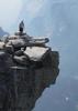
| no partners | | Left Phoenix at 11:30pm on Saturday in order to beat the sun by a few hours and avoid the heat down low in the canyon but also to see some stars. Parked close to the Bright Angel Trailhead at 3:20am and headed in the direction of The South Rim/South Kaibab TH. Used a headlamp in the dark and took roads and some stretches of the Rim Trail. The canyon was completely black, and because the moon was off to the horizon and obscured by clouds, the stars lived up to the hype. The band of the Milky Way was visible, as were shooting stars from the Perseid meteor shower about every ten or twenty seconds. Turns out the climax was to be the nights of the 12th and 13th.
It was a 5.5 mile walk to the S Kaibab Trailhead. Headlamps bobbed in the darkness below, splashing light on the canyon walls. Headed down as pre-dawn light lit the trail. Got stuck behind some mules bringing supplies for Phantom Ranch, but they let me pass at the first opening. The air was cool until just passed the Tip Off as the trail dropped down toward the black bridge. Only a few groups of people on Kaibab that early, mostly going down, but one coming up who had gotten an early start on Bright Angel.
Passed a mule train on the black bridge, but from there to Bright Angel I didn't see anyone. It's a strange feeling being on the bottom of The Grand Canyon, especially with no one in sight. From the river to Indian Gardens there were several groups of backpackers coming up and people making a mid-day trip down to the river and back. I was surprised how many people do this. Overall, not too many people until the last two and a half miles. From there I fought against the current of tourists who were mostly all apparently very much in a hurry.
Temperatures were a little warm on the ascent of Bright Angel, but with water at all the stops it's a non-factor with an early start. That said, I planned on bringing all the water I would need and brought 5.5 liters. Drank it all plus a little at the camp by the river.
If I were to do this one again I would do it as a shuttle and try to include a trip to Phantom Ranch/Plateau Point. I think either/both would be very doable without the extra mileage of crossing on foot along the rim. |
| | |
|
|
|
 Route Editor


 Thankfully my noisey neighbors made sure I didn't get too much sleep. Next day went up to Utah Flats and then explored around Phantom and Haunted Canyons. Spent a cold night (21 degrees) below Cheops. Hiked out on the 3rd day.


