|
| | | Two Ways Around Willow Springs Lake, AZ | | | |
|
|
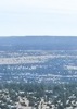
Two Ways Around Willow Springs Lake, AZ
| | |
| |
|
| Hiking | 11.81 Miles |
377 AEG |
| | Hiking | 11.81 Miles | 5 Hrs 47 Mns | | 2.08 mph |
| 377 ft AEG | 6 Mns Break | | | |
|
|
| |
| Partners |
|
none
[ show ]
| no partners | | I've been meaning to head up to the rim to check out Willow Springs Lake after a friend mentioned how much she enjoyed it earlier this year. I simply hadn't been able to muster the enthusiasm to head up on my own - when some other friends suggested spending a day up there this past weekend, I figured it would be a perfect opportunity to go check it out!
The day was off to a slightly rocky start when I got to the meetup location and realized I was the only one there...it seems whatever ick has been making the rounds took out my partners and I failed to catch the notifications since my phone was still in sleep mode when I left the house. Oops. Since I had all my gear with me, and was already a ways away from home, I figured I may as well head up and check things out anyway, so after a brief detour to fuel up my car, I was on my way.
The drive up, as anticipated for a holiday weekend, had its share of snarls - the most noteable was upon hitting the first few sets of lights entering Payson. I'm sure it only got worse as the day went on. When I arrived at the lake, the hum of portable compressors filled the air as a number of folk were inflating their boards. I was able to nab a fairly close parking spot near the boat ramp for easier access to the water - the lake level looked to be down by quite a bit, and parking in some of the other areas looked to have a rather rocky entry.
With my parking secured, I grabbed my hiking gear to circumnavigate the lake. Since I had passed a trailhead sign, I had mistakenly thought there might be an actual trail.  Alas, I was wrong - there is a "bike route" that follows some forest roads....but there is no actual hiking trail - I wound my way around the lake above the high water mark, sometimes picking up sections of forest roads, and other times heading off cross country amidst the pines. I didn't see anyone else out wandering with the intent to walk around the lake, but there were a decent number of people along various parts of the shoreline. I saw some turkey vulture, some ravens and crows, a few ducks, and a number of squirrels while exploring. The highlight for the day was seeing an osprey splash down in persuit of a fish - unfortunately it was much too fast to capture. Alas, I was wrong - there is a "bike route" that follows some forest roads....but there is no actual hiking trail - I wound my way around the lake above the high water mark, sometimes picking up sections of forest roads, and other times heading off cross country amidst the pines. I didn't see anyone else out wandering with the intent to walk around the lake, but there were a decent number of people along various parts of the shoreline. I saw some turkey vulture, some ravens and crows, a few ducks, and a number of squirrels while exploring. The highlight for the day was seeing an osprey splash down in persuit of a fish - unfortunately it was much too fast to capture.
After picking my way around the lake, I headed to my car to find the parking area turned into a bit of a zoo. I dashed the hopes of a number of people as they drove by asking if I was leaving. After swapping out my gear, I portaged my boat down to the shoreline to check things out from the water. Given the physical shape of Willow Springs Lake, there were some congested areas in the narrow arms, but it was possible to get some semblance of solitude in some areas of the lake. Most of the traffic was comprised of kayakers or paddleboarders with a only a few motor boats. Motor boats are limited to those with electric motors or gas engines with 10hp or less.
If you're there when there are a number of people fishing from the shoreline, keep an eye open for unattended fishing rods - I thought I was far enough out to not clothesline myself, but had to maneuver quickly in one area to not catch some lines - spotting the hazards was made more difficult since many don't seem to fish with bobbers.
Overall, a pleasant day out. The drive home was less congested than the drive up since I started my way back towards the valley in mid afternoon.
Technically, 5 of my miles can be attributed to kayaking. |
|
Wildflowers Observation Light
A decent number of flowers up on the rim, though with the harsh lighting, many of my photos were blurry. Alas. |
|
  |
Willow Springs Lake |
51-75% full |
51-75% full |
| | | Down at least 10 feet from full pool - the overflow spillway wall was almost completely out of the water. | | _____________________
| Happier when hiking....I may not move fast (and I'm often distracted by wildflowers), but I'll get there eventually |
| | |
|
|
|
 Route Editor


 Alas, I was wrong - there is a "bike route" that follows some forest roads....but there is no actual hiking trail - I wound my way around the lake above the high water mark, sometimes picking up sections of forest roads, and other times heading off cross country amidst the pines. I didn't see anyone else out wandering with the intent to walk around the lake, but there were a decent number of people along various parts of the shoreline. I saw some turkey vulture, some ravens and crows, a few ducks, and a number of squirrels while exploring. The highlight for the day was seeing an osprey splash down in persuit of a fish - unfortunately it was much too fast to capture.


](https://hikearizona.com/dex2/images/smilies/eusa_wall.gif "Brick wall")