|
| | | Woods Canyon Lake - Rim Vista Loop, AZ | | | |
|
|
Woods Canyon Lake - Rim Vista Loop, AZ
| | |
| |
|
| Hiking | 13.61 Miles |
914 AEG |
| | Hiking | 13.61 Miles | 5 Hrs 44 Mns | | 2.42 mph |
| 914 ft AEG | 7 Mns Break | | | |
|
|
| |
| Partners |
|
none
[ show ]
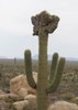
| no partners | | I was craving a long hike on the rim with varying scenery and this one I found in the rim vista alt routes fit the bill! I parked off FR 195 at an open campsite close to the sign that read “trail” then followed that down a ways. Quickly I saw a flock of wild turkeys (I think?), so that was cool! You make your way down to woods canyon lake and it brings you around the less populated side of the lake. Only saw one guy swimming and a few people kayaking, but it was nice and quiet and I was loving it! This route only follows the lake for a bit before it heads off trail into a canyon area. This part of the route was more of a choose your own path type thing, since there wasn’t much of a trail for the majority of it. There were a lot of burned plants, so I’m not sure what happened there. There were some spots with water, but mostly was dry creek bed. Things were getting a bit thick, and then I heard of lot of rustling noises; also, it kinda felt eerie since there was nobody around so I took a quick snack break and tried to survey the best path. Shortly after I continued on, I came across a large pile of FRESH bear poop.  Next up, I saw a large paw print in the mud. I quickly realized I had to get out of that canyon area ASAP. As much as I’d love to see a bear, I’d rather not be solo hiking for my first time. Next up, I saw a large paw print in the mud. I quickly realized I had to get out of that canyon area ASAP. As much as I’d love to see a bear, I’d rather not be solo hiking for my first time.  Anyway, I quickly exited the canyon and got into a more flat wooded area. There was still no trail, but it was heading towards one, so I was all good. This path linked up with the military sinkhole trail and goes by some pretty rim vista viewpoint spots. The path became paved for a bit and I was not a fan. I moved very quickly on this section just to get it over with. There was an intersection that was following what looked like an old road, so I headed that way (ultimately choosing same as the route I was following instead of staying on the paved path). The path quickly faded and it was just random walking on overgrown grassy areas. I did get to see a couple of aspens that were just starting to turn yellow! Anyway, I quickly exited the canyon and got into a more flat wooded area. There was still no trail, but it was heading towards one, so I was all good. This path linked up with the military sinkhole trail and goes by some pretty rim vista viewpoint spots. The path became paved for a bit and I was not a fan. I moved very quickly on this section just to get it over with. There was an intersection that was following what looked like an old road, so I headed that way (ultimately choosing same as the route I was following instead of staying on the paved path). The path quickly faded and it was just random walking on overgrown grassy areas. I did get to see a couple of aspens that were just starting to turn yellow!  Any signs of Fall are always promising! Anyways, the random path dumped me out on rim road, which I crossed then followed a different trail a little ways before finally making it back to the forest road I had parked on. I was suuuuper happy to see Lexi the off road sedan! On the way back, I saw a completely torched RV with caution/crime scene tape. Really happy that got contained and didn’t start a larger fire. Overall, great day on the rim! Any signs of Fall are always promising! Anyways, the random path dumped me out on rim road, which I crossed then followed a different trail a little ways before finally making it back to the forest road I had parked on. I was suuuuper happy to see Lexi the off road sedan! On the way back, I saw a completely torched RV with caution/crime scene tape. Really happy that got contained and didn’t start a larger fire. Overall, great day on the rim! |
|
Autumn Foliage Observation Light
|
|
|
Wildflowers Observation Isolated
|
|
| _____________________
| Restless between adventures... |
| | |
|
|
|
 Route Editor


 . I came across a family hiking the other direction and they showed me a fire that they put out. They ground around a small pine tree was scored! The ground was still smoldering. They told me that a there was a some people camping in that spot the night before. The family was heading out to the Woods Canyon store to report the fire. I continued to the rim and upon my return, There was 3 forest service fire trucks dousing the area. One of the rangers questioned me. I told them what I knew and the ranger though it was a carless cigarette thrown out into the woods.
 ! A pickup truck (with no doors) chased the Elk down a side street. The pickup had a retro 70's police siren. One Elk came back and stood still about 30 feet from the Jeep. The pickup came back and chased it down the side street. It was too dark for a picture.

 I forgot to put my wallet back in back and close it up when I applied the blister tape.
 ](https://hikearizona.com/dex2/images/smilies/eusa_wall.gif "Brick wall") I looked in a 50 foot radius in case it flung off when I put my pack on. The sun came out so I took my rain gear off.
I looked in a 50 foot radius in case it flung off when I put my pack on. The sun came out so I took my rain gear off.