username
X
password
register
for free!
help
ArticlesGuidesRoutes
 
Photosets
 
 Comments
triplogs   photosets   labels comments more
Peak 3660 - White Canyon Wilderness - 3 members in 5 triplogs have rated this an average 4.3 ( 1 to 5 best )
5 triplogs
login for filter options
Feb 17 2024
avatar

 Photos 268
 Triplogs 17

female
 Joined Mar 12 2021
 Seattle, WA
White / wood / 3660 double loop, AZ 
White / wood / 3660 double loop, AZ
 
Backpack avatar Feb 17 2024
rubywranglerTriplogs 17
Backpack20.00 Miles 4,100 AEG
Backpack20.00 Miles2 Days         
4,100 ft AEG
 no routes
1st trip
A combination of the "white and wood canyon wander" and "white canyon center loop" routes. I was a little hesitant of fire damage on this route, but the cow damage was much more annoying. Are they supposed to be in the wilderness? All the fences were trampled. Otherwise White canyon is so beautiful and very fun. I roughly followed the route on Joe's track to bypass a couple pouroffs and then quickly found an obvious trail down into the canyon. It was not marked from below. Short side trip through pretty narrows up to the pouroff and a waterfall in a side canyon, then downcanyon and west up another side canyon halfway to peak 3660 for golden hour. Camped on a flattish spot about halfway between Wood and this side canyon. In the morning I looped around and over peak 3660 and back to camp. Lower White is brushier and slower. Was surprised to run into a group of 3 heading for the cave. I cut out a little bit of distance and elevation by following the wilderness boundary rather than going all the way to the lower white TH. The old road was cruiser and welcome after brushy rock hopping but had more cows. After crossing over 3660' and dropping back into White, packed up camp and headed out Wood. Past the wilderness boundary I located and lost the trail several times. It is getting pretty overtaken by sharp things in a few stretches. The area between Wood and the trailhead is toast but the trail is in decent shape mostly.
  1 archive
Jan 07 2017
avatar

 Guides 44
 Routes 162
 Photos 24,784
 Triplogs 2,417

75 male
 Joined May 04 2004
 Mesa, AZ
White Canyon Promontory Y Loop, AZ 
White Canyon Promontory Y Loop, AZ
 
Hiking avatar Jan 07 2017
CannondaleKidTriplogs 2,417
Hiking9.90 Miles 3,022 AEG
Hiking9.90 Miles   7 Hrs   50 Mns   1.31 mph
3,022 ft AEG      15 Mns Break25 LBS Pack
 no routes
1st trip
Just over 4 years ago we ate lunch at the end of the promontory across from Battle Axe Butte so it was about time for a return trip... with a little more distance thrown in.

Our 'loop' would actually be shaped like the outline around a small letter 'y'. We began from Battle Axe Road heading NNW on the GET #3 until reaching the saddle NW of Peak 3660. From there we rounded-the-corner to the east where we ascended a gorge before turning back west to pass the summit of Peak 3660.

The summit log for Peak 3660 was nowhere to be found. In fact, the spot where the log was on my last visit was now a large divot. And next to the divot was a large piece of the rock that had been on the summit.
:-k
How did it get that way? I thought it possible there may have been moisture underneath and it was struck by lightning, blowing the rock out and throwing it over. The only other explanation I could think of was someone pried it out, but there was no evidence of any tool to pry the rock out. Oh well, the mystery unsolved, time to move on.

From Peak 3660 we headed southwest over hill-and-dale on the way to the southern end of the promontory. I was quite surprised the route I planned on Route Manager worked out so well. In one area where we would have to ascend through a ridge of large boulders, I marked waypoints at two 'possible' locations based on satellite and Topo views and we were fortunate the first one was the perfect spot.
:DANCE:
And that's pretty much how our hike went... 'on-the-top' anyway. We made it to the southern end in time for our Battle Axe-view lunch spot.
:y:
Once we descended into White Canyon at the northeast end of our small 'y' we knew we had our work cut out for us. With plenty of water flow the pools that on previous occasions had been either dry or barely wet were now too deep to even wade through.
](*,)
Being already committed to following the canyon back to Battle Axe Road we just got-on-with-it. And by taking on some pretty serious bushwhacking we only had to step in ankle-deep water one time. I didn't take many photos in the canyon... we were too focused on simply getting through.

But no matter the trials and tribulations in White Canyon, the rest of the hike more than made up for it with the awesome views and terrain we traversed. Not many folks pass through this area.
 Fauna
 Fauna [ checklist ]
[ checklist ]  Cow
 Named place
 Named place [ checklist ]
[ checklist ]  Battle Axe Butte - 3531ft
_____________________
CannondaleKid
 
Dec 17 2016
avatar

 Guides 264
 Routes 2,798
 Photos 14,514
 Triplogs 5,895

55 male
 Joined Nov 20 1996
 
White Canyon Wilderness - Center Loop, AZ 
White Canyon Wilderness - Center Loop, AZ
 
Hiking avatar Dec 17 2016
joebartelsTriplogs 5,895
Hiking15.80 Miles 3,640 AEG
Hiking15.80 Miles   10 Hrs   35 Mns   1.63 mph
3,640 ft AEG      55 Mns Break
 
1st trip
Bruce put this loop together by routes from Hank & Mark. When I saw it I knew it would be a great hike. While Brown's Peak got me hiking, White Canyon taught me how to sing.

Bruce drove in 0.4 miles off SR177 on FR319 to the safe 2WD parking. The road was recently graded. Arnett Creek was already starting a narrow yet deep crevice across the road so some may prefer to walk it.

43 degrees and windy, with a predicted high of 54. I started off wearing three long sleeve shirts and pants due to the temps. Pants are a good idea if you don't like any scratches. 10 degrees warmer and I'd be in shorts. It rained a bit last night and there was a very light flow in a couple area. All avoidable if careful. Some of the terrain was easy scrambling.

4-5 miles is road or use trail. Over half of the road walk is within the wilderness and very scenic. The majority of the hike is off trail through the canyon. The high canyon walls of White Canyon are impressive. Especially the eastern wall which is white. The water sculptured rock and narrows in multiple areas are spectacular. Any one of them would be worthy of a hike alone. 2 miles is out of the canyon to ride a ridge back to make the loop. It is a hearty 600 ft climb to the highpoint 3635 atop the ridge. Excellent views down the entire ridge. This loop is just a smorgasbord of bells and whistles. The less exciting final 2.8 miles went by quick.

Geology rocks a very short, semi boring, video starring Off_trail_Eagle.
foliage observationfoliage observationfoliage observationfoliage observationfoliage observation
Autumn Foliage Observation Light
In isolated areas it was moderate and fading.

water 1 out of 5water 2 out of 5water less than maxwater less than max White Water Spring Quart per minute Quart per minute
crystal clear full tank with a very light flow
_____________________
- joe
 
Dec 17 2016
avatar

 Guides 41
 Routes 1,627
 Photos 14,983
 Triplogs 2,762

69 male
 Joined Jan 20 2009
 Far NE Phoenix,
White Canyon Loop - White Canyon Wilderness, AZ 
White Canyon Loop - White Canyon Wilderness, AZ
 
Hiking avatar Dec 17 2016
The_EagleTriplogs 2,762
Hiking16.16 Miles 3,626 AEG
Hiking16.16 Miles   10 Hrs   30 Mns   1.64 mph
3,626 ft AEG      40 Mns Break15 LBS Pack
 
1st trip
Six years ago while hiking the old route of AZT 16 in this area, Joe made a comment that stuck with me. "I don't know why they didn't route the AZT through White Canyon. That area is incredible." That always stuck with me, but it took me this long to draw something up that visited this area.

An easy mile road walk gets you into the northern arm of White Canyon, close to White Water Spring. This canyon gets more impressive the farther you get in.

At 3 miles in, you will have a decision point. Staying in the canyon (without equipment) is not an option, as we'd find out later. We went up to the left and enjoyed the views into the canyon from above. We ultimately dropped back in at mile 4.75. There is plenty to explore up top..

THIS IS A SPECIAL AREA

We continued down the canyon until we hit the FR and then continued to the old routing of AZT 16. After some lunch, we made the decision to climb straight up to unnamed Peak 3635. It was steep and loose, but not too bad. Then it was a matter of following the ridge line back down to White Canyon.

youtube.com/watch?v ... csms

The plan was to follow the canyon back to where we'd originally gotten out of it. Plenty of water and small falls, pools, and a few areas we had to traverse around. Plenty of geology lessons and even a bat cave.

Getting close, we came to a point we could not get through. We contemplated swimming it, but luckily decided against it. We went high right to get out, with no luck. Back down in the canyon, we went high left, and this worked. Looking at the bypass area from above, there were a few swimmers and no friendly exits.

The rest was just pushing daylight getting back to the Truck. It was a chilly 41 when we finished.

This is a sweet area to explore.....
 Culture
 Culture [ checklist ]
[ checklist ]  Height of Light

water 1 out of 5water 2 out of 5water less than maxwater less than max White Water Spring Quart per minute Quart per minute
Trough was full of cool clean water
_____________________
There is a very fine line between "hobby" and "mental illness."
Dave Barry 🦅
  1 archive
Nov 29 2011
avatar

 Guides 44
 Routes 162
 Photos 24,784
 Triplogs 2,417

75 male
 Joined May 04 2004
 Mesa, AZ
Peak 3660 - White Canyon WildernessGlobe, AZ
Globe, AZ
Hiking avatar Nov 29 2011
CannondaleKidTriplogs 2,417
Hiking8.55 Miles 2,417 AEG
Hiking8.55 Miles   7 Hrs   38 Mns   1.75 mph
2,417 ft AEG   2 Hrs   45 Mns Break27 LBS Pack
 
1st trip
Partners partners
trixiec
Three days earlier we hiked up White Canyon with hopes of crossing west up a long ravine to connect with the Arizona Trail #16 and make a loop hike out of it. We didn't quite make it, but came away with a new plan to climb up to the highest peak on the plateau between the two canyons I'll hereafter refer to as the heart of the White Canyon Wilderness.

Already having scouted out an easy escape route near the upper right side of the heart on the previous hike, all I hoped to find was another route up from the Arizona Trail side. In the few days in between trips I pored over numerous topo and satellite maps then spent time drawing out possible routes, and we were ready for another adventure in the WC Wilderness.

This time we started from a parking spot along Battle Axe Road where the Arizona Trail #16 heads northwest just below the bottom tip of the heart. The hike north along the AZT provided a number of different types of terrain each with their own dangers. The loose baby-head threatened us with sprained ankles, the brushier area provided plenty of chances for thorny encounters, and of course both the prickly-pear and chain-fruit cholla forests kept us awake, lest we step too close and pay for the encounter.

All along the route up the west side of the heart we were taking photos, not only to document our trip but to seek out another safe route up. Only one area held some promise near the end of the AZT #16 segment but we continued to the end in hopes of finding something easier just around the top-left ventricle of the heart. Steep cliffs greeted us there as well, so we climbed up the easiest slope up to the base of the cliffs with hopes to follow the base southward to the spot that help promise. Unfortunately we only went about a hundred yards along the cliff before the footing became too loose, threatening to give way and we'd be tumbling down. Nope, this was enough for Tracey, and for once I agreed it was more than I cared to deal with too. So we turned around and headed back up and around the upper left corner.

Not yet willing to admit defeat (at least I wasn't) we decided to continue along the slope as long as we could hoping for another sot at the top. After checking out a few narrow gaps that provided no access, we were just about to head down to the ravine and loop eastward to link up to our path from the other side three days ago, when I noticed some light game trails heading up through some thick brush. I figured if they were that defined, there likely was a route up through there somewhere, so I said, it's now-or-never and pushed through the heavy brush. Thankfully it was just jojoba and holly so no lasting holes in the skin. After breaking through the thickest layer we were treated to some rock climbing, traversing across some loose ground again and finally up one rock that Tracey absolutely would not want to go back down, which meant we better find the rest of the way up. Thankfully moments later I reached the top and the efforts were all worth it. Awesome views all around as well as a new look at Battle Axe completely different than any I'd had before! Wow!

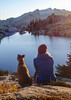
Greeted by this vast upper plateau area complete with hills, cliffs and valleys for a moment all I could think of is where should we explore first? But being within 500 feet from Peak 3660, the one absolute goal I set for the day, the choice was easy. The peak is right at the edge of the steep cliffs so we stopped to take some photos over the Arizona Trail. I was there for only a few moments when I noticed a small Rx capsule in a small cairn of rocks. We opened it and pulled out a summit log. The one-and-only entry was well over 10 years old! Wow! Such an honor to be among the few! So of course we added our names to the log.

With the major goal achieved we set off to traverse across the center of the heart. Surprisingly the track I drew the night before as the most likely route to take turned out to be almost an exact duplicate of the actual path of least resistance down the various levels as we progressed eastward. Every so often we'd approach what appeared to be a steep drop, only to look over and find it wasn't that bad after all. It got to the point we no longer worried if we'd be cliffed out and continued merrily along our way. As we approached the bowl area that I had explored three days earlier it was time to decide if we had enough time to try what could be the quickest way down, or head north through the bowl and use the escape route I had used before. If we could get down this way it would save about 90 minutes and 1.5 miles of hiking, so we took the gamble.

Unfortunately, we took a clockwise path around a peak toward the hoped-for exit only to be cliff'ed out. We continued the loop a bit more hoping to be able to see the bottom but were unable to. So not knowing if we'd be treated to a quick and easy escape route by going all the way back around the peak counter-clock-wise, we went for the known-good escape route through the bowl. As we approached the bowl we passed through an area that was reminiscent of sandy beaches. Although it looked like sand it was simply crushed white rock... probably why this area is named White Canyon.

Once down the escape route we were back in the White Canyon with the familiar route of boulder-hopping just waiting for us. Being our third trip through in three days some of the areas went quite smoothly, others we tried different routes over, around, between and in one case under the large boulders. It wasn't long and we were back at the car. What a great feeling of accomplishing the main goals we had set for the day and then some. And for me, wonder of wonders, almost the only hike in years that I did not spot an empty Bud Light can... ANYWHERE! Hopefully this area continues to be inaccessible enough to those who care nothing for the environment that it stays that way.

Tons of photos but posting them all on HAZ would probably dilute the value of each so I'll put the rest on my own site when I get around to it.
_____________________
CannondaleKid
  1 archive
average hiking speed 1.58 mph

WARNING! Hiking and outdoor related sports can be dangerous. Be responsible and prepare for the trip. Study the area you are entering and plan accordingly. Dress for the current and unexpected weather changes. Take plenty of water. Never go alone. Make an itinerary with your plan(s), route(s), destination(s) and expected return time. Give your itinerary to trusted family and/or friends.

helpcommentissue

end of page marker