username
X
password
register
for free!
help
ArticlesGuidesRoutes
 
Photosets
 
 Comments
triplogs   photosets   labels comments more
Mesquite Canyon - Waddell - Ford Canyon Loop - 24 members in 55 triplogs have rated this an average 3.6 ( 1 to 5 best )
1, 2, 3  Next
55 triplogs
login for filter options
Mar 01 2025
avatar

 Guides 2
 Routes 207
 Photos 93
 Triplogs 204

male
 Joined Aug 08 2020
 Phx az
Mesquite Canyon - Waddell - Ford Canyon LoopPhoenix, AZ
Phoenix, AZ
Hiking avatar Mar 01 2025
ScaredyCatTriplogs 204
Hiking11.55 Miles 1,855 AEG
Hiking11.55 Miles   5 Hrs   29 Mns   2.49 mph
1,855 ft AEG      51 Mns Break
 
no photosets
1st trip
Linked   linked  
Partners none no partners
Route Scout Route Recorded  on Route Scout | Pop | Map | Popup | MapDEX
Finally recd a stronger response posting to the far W side. Had 10 on list but the two I'm friends with dropped the nt b4. At TH 2 decided this outing would be too much so branched off for a shorter route. Still works lets roll.

Ended up breaking off into 2 groups of 3. I waited at all intersections. We did the loop in rev. so most of the EG was on Mesquite. The back of the park is interesting going through the wash + boulder navigating.

Think this was a perf balance for Meetup of challenge, being different yet not over the top difficult. I & the others felt comfortable despite high of 81. Will post another loop variation next year.
 
Feb 02 2025
avatar

 Guides 13
 Photos 15,617
 Triplogs 323

male
 Joined Oct 23 2010
 mesa
Mesquite Canyon - Waddell - Ford Canyon LoopPhoenix, AZ
Phoenix, AZ
Hiking avatar Feb 02 2025
gummoTriplogs 323
Hiking10.00 Miles 1,529 AEG
Hiking10.00 Miles   4 Hrs   15 Mns   2.38 mph
1,529 ft AEG      3 Mns Break
 no routes
1st trip
Linked   none no linked trail guides
Partners none no partners
Decent loop. I wasn't well enough to do Harquahala, so I opted for this hike. I haven't done this one in 25 years.

It was dry with a few puddles. Not much wildlife on the trail. A few side-blotches lizards were out and my computer won't upload my bird photos from my Canon.

I'm going to Cibola tomorrow. I probably need someone to look at my laptop to see why I can't upload my photos.

Edit: I fixt my computer
 Fauna
 Fauna [ checklist ]
[ checklist ]  Canyon Towhee
_____________________
  1 archive
Jan 25 2025
avatar

 Guides 110
 Routes 2,246
 Photos 8,982
 Triplogs 2,600

45 female
 Joined Dec 24 2007
 Ahwatukee, AZ
Barry Goldwater Peak - White Tank MountainsPhoenix, AZ
Phoenix, AZ
Hiking avatar Jan 25 2025
LindaAnnTriplogs 2,600
Hiking15.68 Miles 3,053 AEG
Hiking15.68 Miles   7 Hrs   37 Mns   2.26 mph
3,053 ft AEG      41 Mns Break
 
Route Scout Route Recorded  on Route Scout | Pop | Map | Popup | MapDEX
Got started from Area 7 around 0730 with Jill & Janelle. Took Waddell north. West on Ford Canyon. My favorite wall of dudleya is looking very dry.

At the end of Ford Canyon, continued south on Goat Camp, then the ridge up towards Barry Goldwater Peak. There were three guys ahead of us, and I chatted with them at the summit for a few minutes. They’re training for Rim to Rim. Had a snack break, then headed back down. Was almost chilly while walking the road. I survived in a shirt and shorts, but Jill looked like an Eskimo.

Retraced our steps back north to the Ford/Willow Canyon jct. East on Willow, short stop at the spring (bone dry) then continued east, Finished up on Mesquite to close out the loop.

Nice cloud cover and breeze most of the day. Easy mileage. I finally remembered to put a new hat in my truck, which I wore, but the stupid thing gave me some welt/blister across my forehead, which now looks awesome 🙄

dry Willow Spring - White Tank Mountains Dry Dry
Completely dry
_____________________
Stop crying and just go do the hike.
  2 archives
Mar 08 2023
avatar

 Guides 8
 Routes 70
 Photos 3,208
 Triplogs 273

59 male
 Joined Oct 07 2017
 Chandler, AZ
Mesquite Canyon - Waddell - Ford Canyon LoopPhoenix, AZ
Phoenix, AZ
Hiking avatar Mar 08 2023
YoderTriplogs 273
Hiking9.50 Miles 1,650 AEG
Hiking9.50 Miles   3 Hrs   35 Mns   2.82 mph
1,650 ft AEG      13 Mns Break10 LBS Pack
 no routes
Linked   none no linked trail guides
Partners none no partners
We hoped we would get some nice wildflowers on this hike with all the rains. In particular, back in 2017 we did this hike and whole mountain sides were yellow with the brittle bush in bloom. No such luck this time around. There were some patches at the beginning/end of the loop, but a bit of a disappointment. Looking back at the 2017 hike, we took that on 03/23, so maybe the end of the month may be better.
 Flora
 Flora [ checklist ]
[ checklist ]  Fiddleneck
 Fauna
 Fauna [ checklist ]
[ checklist ]  Cactus Wren
wildflower observationwildflower observationwildflower observationwildflower observationwildflower observation
Wildflowers Observation Isolated
Poppies, Lupin, Fiddleneck
_____________________
J. Yoder
  1 archive
Feb 11 2023
avatar

 Guides 25
 Routes 376
 Photos 5,897
 Triplogs 346

40 male
 Joined Mar 01 2018
 Chandler, AZ
Mesquite-Waddell-Ford Cyn Loop & Goldwater, AZ 
Mesquite-Waddell-Ford Cyn Loop & Goldwater, AZ
 
Hiking avatar Feb 11 2023
John10sTriplogs 346
Hiking16.22 Miles 3,051 AEG
Hiking16.22 Miles   8 Hrs   4 Mns   2.26 mph
3,051 ft AEG      54 Mns Break
 
1st trip
Route Scout Route Recorded  on Route Scout | Pop | Map | Popup | MapDEX
We did a short hike to the Verrado Petroglyph site first thing in the morning [ triplog ] , then drove over to the regional park for this one. That meant a later start than usual, and we had to wait in a line of vehicles at the park entrance. I assumed White Tanks gets plenty of traffic on typical weekends and hoped we wouldn't be battling additional Super Bowl tourists staying in the west valley for the game tomorrow. I don't know what level of busyness constitutes "normal" here, but we were able to get a spot right near Waddell Trailhead in Area 7, so that was an encouraging start.

We hiked the loop clockwise, starting on Mesquite Trail. The first few miles had a steady incline and passed in a repetitious blur as were constantly trying to make our around groups of hikers, which was annoying but not unexpected. The traffic started to thin out past the Willow Canyon intersection and continued to improve from there. We were doing well time-wise, so we took Goat Camp Trail up to Barry Goldwater Peak. All the way up, and even from the peak, Radio Summit looks like it's higher than Goldwater, but judging <100 feet of elevation difference from that distance is tough. The views from the top are nice but mostly obstructed by the towers and utility buildings, so I didn't spend much time up there, and I didn't see the red jar with the summit register mentioned in the guide.

We returned on Goat Camp Trail and resumed the clockwise loop on Ford Canyon Trail. That was especially enjoyable once the trail dropped down into the creek bed and we got into the stretch with the white granite slabs and the tanks. I vaguely remembered hiking through there from the opposite direction one winter years ago when the tanks were mostly empty and partially frozen. There's some fun scrambling in that area, and we somehow missed one of the signs where the trail leaves the creek bed and bypasses the steep drop-offs in the canyon.

[ youtube video ]

A little past the missed turnoff, it immediately became more difficult to get around the pools, and we were facing some 20+ downclimbs that I certainly didn't remember going up last time...seemed like a bit much for an official trail in a regional park, and a quick look at the GPS confirmed we'd missed a turn a few hundred feet back. Ford Canyon was more impressive than I remembered, but I suppose I appreciated it more after a closer look at some the rougher sections.

After the canyon opened up again, the city came into view, and I could read the giant "Super Bowl LVII" sign on State Farm Stadium when I zoomed in. We eventually reconnected with Waddell Trail and finished off the loop around 5:30PM. Between this hike and Verrado Petroglyphs in the morning, we finished with ~20 miles for the day. Other than the first few miles on the loop, the crowds weren't too bad, and traffic wasn't especially bad on the drive home...we weren't sure what to expect the night before the Super Bowl. The weather was perfect today, in the mid-70s, and it was nice to get back to the White Tanks after a 5-6 year hiatus.
 Fauna
 Fauna [ checklist ]
[ checklist ]  Rock Squirrel
  1 archive
Nov 28 2022
avatar

 Guides 11
 Routes 31
 Photos 1,578
 Triplogs 25

80 male
 Joined Nov 19 2012
 Reno, Nevada
Mesquite Canyon - Waddell - Ford Canyon LoopPhoenix, AZ
Phoenix, AZ
Hiking avatar Nov 28 2022
AZClaimjumperTriplogs 25
Hiking10.60 Miles 1,921 AEG
Hiking10.60 Miles   8 Hrs   39 Mns   1.23 mph
1,921 ft AEG12.5 LBS Pack
 
1st trip
28Nov2022 - Monday; My first real hike in the nearby White Tanks Maricopa County Park, a clockwise loop that includes approximately 1,900’ of accumulated elevation gain & 11 miles in length that begins & ends at the Mesquite Canyon/Waddell trail Trailhead, 1,542’ elevation (N33° 35.551' W112° 30.664’).

Numerous Panoramic photos are featured in this photoset.

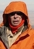
0647 - Overcast skies, 2 liters of water/electrolyte, & a lightweight long sleeve Icebreaker Merino wool top was my base layer, which is all I needed all day. With my GPS compass calibrated & my backpack shouldered I began today’s real-life outdoor adventure into the boonies, a slight refreshing breeze & temperatures in the high 50º’s.

0651 - a mere 400’ along the Waddell trail & I arrive at the Waddell trail/Mesquite Canyon trail junction, I turn left (West) & start up the Mesquite Canyon trail. (see photos)

0718/1,863’; I start up a series of switchbacks, fence has been built at several to discourage shortcutting the switchbacks

0738/2,090’; I take photos of deer. So far I’ve only seen 4 other hikers. This trail is very well maintained.

0816/2,207’; I’m at the Willow Creek trail/sign, which goes to the right. I continue straight ahead on the Mesquite Canyon trail. (see photos)

0836/2,375’; I see & take photos of more deer. Beautiful scenery at each turn of the trail & the sun is now shinning.

0950/2,856’; I arrive at the Mesquite Canyon, Ford Canyon trail junction & turn right onto the Ford Canyon trail. (see photos). At this point I’ve hiked 4.3 miles & gained approximately 1,500’ in elevation. I wanted to get most of the elevation gain at the first part of my hike which is why I’m hiking clockwise up an average 6% grade. This would be a turn around point if you wanted to hike up & back down just the Mesquite Canyon trail.

From this point I’ll hike down a series of switchbacks down to 2,523’, pass the Ford Canyon/Willow Creek trail junction then hike up to 2,822’, a distance of 1.4 miles

1028/2,558’ - I arrive at the Ford Canyon/Willow Creek trail junction. (see photos)

1101/2,822’ I top out here, from here on the trail will be mostly downhill. (see photos)

1136/2,407’ - I’ve descended approx 420’,a distance of .7 miles & reached the Ford Canyon WASH. (see photos). The was is soft & sandy, you’ll be glad if you donned a pair of Dirty Girl Gaiters to keep sand out of you boots/shoes. Keep a sharp look out for trail posts & cairns for trail guidance if you’ve not downloaded a track of this hike into your GPS off hikearizona.com.

1236/2,254’ - I reached the Dam (see photos), a distance of .9 miles & descended approx 200’ in elevation while tromping in the soft sandy soil of this WASH.

1302/2,139’ - I reached the 4mile marker, a distance of .5miles down the WASH & descended approx 120’ in elevation. (see photo).

1307/2,112’ - a mere 5 minutes later is where I miss a trail sign off to the right & mistakenly continue down the wash. This an easy mistake, enter these co cords into your GPS (N33° 36.664' W112° 32.473’) they are the co ords of the trail signpost you want to look for, it will take you out of the WASH & up onto a narrow trail built into a vertical rock wall.

1337/2,054’ - Thanks to the track I downloaded off hikearizona.com I scramble out of the canyon & up onto the narrow trail some 40’ above me.
The narrow trail that was built along the vertical rock face is something you will well remember. It will be part of a hike you will eagerly look forward to hiking again
.

1416/1,729’ - Down the narrow trail along the vertical rock wall, down to a normal trail & a warning sign, a distance of .8 miles.

1420/1,689’; Arrived at 3 mile marker. (see photos). I’m now hiking along a normal scenic trail.

1457/1,625’; Arrived at Ford Canyon/Waddell trail junction. Ford Canyon trail turns left, I continue straight ahead on the Waddell trail.

1527/1,532’; I arrive back at the trailhead/parking area, shed my back pack & head for the restrooms which are clean, fully stocked, indoor plumbing with flush toilets, real mirrors, ceramic fixtures & an electric blow dryer after washing my hands.
_____________________
 
Apr 02 2022
avatar

 Guides 1
 Routes 209
 Photos 1,231
 Triplogs 196

male
 Joined Mar 14 2015
 Phoenix, AZ
Mesquite Canyon - Waddell - Ford Canyon LoopPhoenix, AZ
Phoenix, AZ
Hiking avatar Apr 02 2022
astrobrewerTriplogs 196
Hiking10.88 Miles 1,855 AEG
Hiking10.88 Miles   4 Hrs   58 Mns   2.26 mph
1,855 ft AEG      9 Mns Break
 
1st trip
Route Scout Route Recorded  on Route Scout | Pop | Map | Popup | MapDEX
First hike in the White Tank Mountains. Decided to take the loop counter-clockwise starting with Waddell, then Ford Canyon, and finishing with Mesquite Canyon. That was a good choice. Waddell is just a flat connector along the base of the mountains connecting the various canyon trails. Easy walking. Saw a horned toad which was pretty cool. It has been years since I last saw one of these. He posed for us and let me get several pictures. The Ford Canyon trail started out fairly level with just a gentle rise. This continued for a mile or two until we got to a scary looking warning sign saying that the trail beyond this point is hazardous! At first that seemed unwarranted, but then the trail started climbing. There were several places where the trail was steep boulders. Nothing too scary, but not something to try on a bike. The trail gained elevation quickly in this area and eventually ended up in going right up the granite waterfall.

For the next couple of miles the "trail" was really just the wash. It was either sandy or boulder-y and there were several little waterfalls along the way that had to be climbed. There were several places along the way that I thought that we were finally going to leave the wash but we kept following the wash. Yuck. Finally after way too long in the wash there was a real trail. Yay.

The rest of the Ford Canyon Trail was a regular trail heading up and out of the canyon and down the other side. Along this section the hillside was bright yellow with blooming brittlebrush. Very pretty. Also there were hedgehog cacti with pretty purple blooms. The cholla had buds that hadn't opened yet. After hiking down a ways the trail headed back uphill again. It leveled off once we got on the Mesquite Canyon Trail. It climbed a little at first, then gently went downhill. The trail got steeper in the last couple of miles. In the canyon it felt hot in the sun, but a lot of the trail had a pleasant cool breeze.

All in all a very pleasant day in a very nice area. Glad to finally hike the White Tank Mountains.
wildflower observationwildflower observationwildflower observationwildflower observationwildflower observation
Wildflowers Observation Substantial
Not much at the bottom of the mountain, but once we got up a ways there was blooming brittlebrush and some orange and purple flowers.
_____________________
 
Apr 01 2022
avatar

 Guides 21
 Routes 1,182
 Photos 36,858
 Triplogs 1,570

69 female
 Joined Feb 26 2004
 Phoenix, AZ
Mesquite Canyon - Waddell - Ford Canyon LoopPhoenix, AZ
Phoenix, AZ
Hiking avatar Apr 01 2022
tibberTriplogs 1,570
Hiking9.72 Miles 1,484 AEG
Hiking9.72 Miles   4 Hrs   53 Mns   2.13 mph
1,484 ft AEG      19 Mns Break
 
1st trip
Route Scout Route Recorded  on Route Scout | Pop | Map | Popup | MapDEX
I was lucky enough to get an invite for a hike from Linda. I haven't been in this area since Dec 2011 so I was certainly due. I had done the Mesquite-Willow Canyon Loop both ways but nothing else out here. However, I don't remember a lot of it even though I actually did some video in 2011 and in 2010, I forgot my camera :o ; the last time that ever happened. Anyway, for my reference here are those trip reports: https://hikearizona.com/x.php?I=4&ZTN=2242&UID=11058

Linda offered an earlier start, my choice. I compromised but should have opted for an earlier start as it was a bit warm at the beginning and end. I had not hiked the Waddell Trail. It was very typical desert hiking except you had a glyph rock and a gorilla face. Linda has hiked out here a lot, especially in the 90s so it was great to hear all of her stories and she knew where all the highlights were.

It takes quite a while to get back into Ford Canyon. On the way there, Linda pointed out these two poles high atop a hill and had always wondered what they were so I zoomed in and have posted the picture to see if someone has any ideas. We also saw 3 USAF jets fly over and we would see/hear them two more times. We finally got to Ford Canyon Trail where we started one of the smaller climbs of the day that also involved some welcome shade. We also saw a few flowers including some delphinium which we would see a few times today.

We would maneuver our way up the canyon and around some pools of water enjoying the fabulous geology along the way. It was particularly striking today set against the bright blooming brittlebush. Linda showed me Dudleya Wall which I would have totally missed. I haven't seen a Dudleya for a couple years at least. These weren't blooming but still very pretty. Their choice of residence seemed perfect for them. We continued up the canyon traversing the various rock obstacles we encountered. Some of the rockery seemed Catalina-like to me and Linda commented it was very gneiss, took me awhile to catch on :lol: . It's a bit cumbersome walking in the sand of the wash but not too bad.

And now it was time to exit for our hike up the hill and here we would start seeing poppies and lupine and even some desert chicory. And not only that, the trail crew had apparently just been through as the tread was in great condition. We continued up the nice grade and got brushed by a nice breeze. The opposite hill's side was covered in Brittlebush. We also commented that the McDowell Preserve North is at 2700 feet or so which is the elevation we would reach when we topped out at the saddle. We would get to see more poppies and lupine on the way up but also some Miniature Wool Star which I also haven't seen for a few years.

The saddle was covered in Brittlebush and of course, the views are pretty spectacular. As you head down the south side you can see the trail you will be following. It's steeper than it looks. We finally hooked up with the Willow Canyon Trail. Hiking here we were rewarded with lots of smelly Desert Lavender and some big bloomed Desert Marigolds. We had seen Lavender earlier in Ford Canyon too but it is hard to photograph. The flower color over here seemed more intense for some reason. There was even some more delphinium.

We stopped at the old cabin remnants and then as we looked over across the way we noticed a bunch of tents which would be for the work crew. Linda took me over to one of her old stomping grounds, Willow Springs. It had water in it but she told me back in the day how much bigger the pond was; to the point they used to be able to jump in it from above. There was one big dead javelina above near the little cave and other bones down by the spring pond. The workers also had all their water filter devices hanging from a tree in the area. Anyway, we sat down and enjoyed the shade and the coolness of the boulder we were sitting on.

We headed back out and Linda pointed out the old rock wall above the trail. We would see another one later across the wash that was long and extensive on the Mesquite Canyon Trail. She's not sure what it was established for and the only thing I could think of was to keep the sheep from going up the hill. She pointed out one of the old mind adits. We would encounter a few hikers on this trail. We were glad of the little breeze we would get and anticipated getting to the bottom where we could stretch our stride. There was also pretty good-sized barb-wire fences set up at various switchbacks to prevent people from switching where they wanted.

Ya, it was a little warm the last couple miles, my bad. The hike was a little tougher than I thot plus Linda had to put up with some of my whining so thank you. However, it was great fun to catch up on things. Thx for slowing your pace. Under the shade of the ramada, we split a beer I've brought before. There was also a very cool bird eating off the Brittlebush, a nice ending to a very awesome hike. I think I need to add this to my yearly list; a decade is too long to wait.

WATCH: 9.4 miles (2712 highest elevation, 1436 lowest) avg 139 bpm/ max 168 bpm (14% Zone 4 Anaerobic, 64% Zone 3, 21% Zone 2 weight control) burning 2,051. Starting temp 68 clear and 32% humidity finishing at 1:08 PM. Finishing temp 82.
 Culture
 Culture [ checklist ]
[ checklist ]  Unidentified Culture
wildflower observationwildflower observationwildflower observationwildflower observationwildflower observation
Wildflowers Observation Light
_____________________
For me, sometimes it's just as much about the journey as the destination.
Oh, and once in awhile, don't forget to look back at the trail you've traveled.
 
Apr 01 2022
avatar

 Guides 110
 Routes 2,246
 Photos 8,982
 Triplogs 2,600

45 female
 Joined Dec 24 2007
 Ahwatukee, AZ
Mesquite Canyon - Waddell - Ford Canyon LoopPhoenix, AZ
Phoenix, AZ
Hiking avatar Apr 01 2022
LindaAnnTriplogs 2,600
Hiking9.50 Miles 1,458 AEG
Hiking9.50 Miles   4 Hrs   53 Mns   2.10 mph
1,458 ft AEG      21 Mns Break
 
1st trip
Route Scout Route Recorded  on Route Scout | Pop | Map | Popup | MapDEX
Met up with Angela at the Area 7 parking lot a little before 0815 and got started. North on Waddell, which is the least interesting part of this loop, but easy. Looked at some petroglyphs.

West on Ford Canyon, which is my favorite part of the loop. Warm as we climbed uphill, but some shade through the steepest parts. Once in the wash, we enjoyed the sights. The geology is neat, and there was plenty of vegetation. The wall of dudleya was growing nicely this year. With the breeze, the climb out of the wash wasn’t too bad, and the trail has seen some very recent maintenance, so it was in great shape.

East on Willow Canyon, with a stop at Willow Spring, which is no longer marked on park maps. The trail crew had set up their base camp in the old corral. I’m thinking a cougar is living/hunting near the spring and feasting on unsuspecting prey that visit for water—lots of remains scattered around. After a nice break in the shade and on the cool rocks, we continued downhill, then east on Mesquite Canyon to finish out the loop. Toasty by the time we finished. Great to see Angela again and to hear about her upcoming Hawaii vacation. Not many people on the trails, but typical for a warmish weekday.
 Flora
 Flora [ checklist ]
[ checklist ]  Dudleya
wildflower observationwildflower observationwildflower observationwildflower observationwildflower observation
Wildflowers Observation Light
Large variety of wildflowers along the loop.

water 1 out of 5water less than maxwater less than maxwater less than max Willow Spring - White Tank Mountains Dripping Dripping
Large pool of filterable water.
_____________________
Stop crying and just go do the hike.
 
Feb 15 2021
avatar

 Guides 34
 Routes 138
 Photos 931
 Triplogs 111

68 male
 Joined Dec 26 2018
 Phoenix, AZ
Barry Goldwater Peak via Mesquite CanyonPhoenix, AZ
Phoenix, AZ
Hiking avatar Feb 15 2021
GrangerGuyTriplogs 111
Hiking16.20 Miles 3,346 AEG
Hiking16.20 Miles   9 Hrs   14 Mns   2.36 mph
3,346 ft AEG   2 Hrs   22 Mns Break10 LBS Pack
 
1st trip
Presidents' Day 2021, I had had my second Covid shot just a couple days before. I thought I would take something a little less adventurous than my usual lonely wilderness trip; do something with people around just in case, you know. :)

I started at 7 am at the Area 9 trailhead for the Ford trail, and headed out, capturing a few nice pictures before the light got lousy. There are several Geocaches along this section as well, which was an additional incentive for doing this trip. I was amused by the map at the trailhead suggesting the section of Ford Canyon in the wash might be a little rugged, and the additional signs along the trail telling horses and bikers effectively, "I'd turn back if I were you."

The canyon was beautiful. Truly shows how the White Tanks got their name. I had to stop at every pond and take a few pictures. You only get one in my photoset, though. I leapfrogged up the canyon with a couple of women about my age. I would stop for a picture or a Geocache, and they would go by. They would stop for a short break and I would go by. Finally lost them at the last couple Caches.

At the first pass at the top, after leaving the canyon, there is a nice rock just off to the left of the trail overlooking the valley and peaks, and a good place to refresh. From there, I could here voices carrying more than 1000 yards away from the Waddell and Mesquite trails (remember this, you noisy chatterers). Then down 250 feet and back up to the end of the Ford Canyon Trail at its intersection with the ends of the Mesquite Trail and Goat Canyon Trails.

I turned right on Goat Canyon, and headed toward Barry Goldwater Peak. Eventually, a couple of cairns mark the departure of the way trail to the peak from the Goat Canyon trail. The official log calls this a jeep trail. Not any more. It is a faint singletrack. I put waypoints in my track for some of the cairns along it. You will see in my track I diverged from it for a bit; it is easy to do. Maybe the waypoints will help you stay on task. The cholla is a constant threat in this section.

Eventually you hit the road to the summit. I have to say the summit is a little disappointing. Yes, from different vantage points, you can see forever in all directions. In fact, so forever the major peaks seem tiny. But the towers, the wires, and the noise from the A/C units, detract from the victory somewhat. I had my lunch on the pad of one of the towers. Forgot to look for the summit register.

I returned to my car via the Mesquite trail and Waddell trail. The farther down I got, the more people I saw. Probably altogether saw 45 people on the Mesquite Trail. The lower I got, the more they were huffing and puffing. I was astounded by the fences put up to protect the trail from people cutting switchbacks. I have never seen this before. It shows just how ill behaved some people are who hike this trail.

I'll give this trip 4 stars. Five stars for Ford Canyon and two stars for Mesquite Trail and the summit.
wildflower observationwildflower observationwildflower observationwildflower observationwildflower observation
Wildflowers Observation None
There is evidence of recent rain. The Ocatillo are just starting to green up. There is quite a bit of green grass. The flowers should be out soon.
 
Dec 05 2020
avatar

 Guides 110
 Routes 2,246
 Photos 8,982
 Triplogs 2,600

45 female
 Joined Dec 24 2007
 Ahwatukee, AZ
Barry Goldwater Peak - White Tank MountainsPhoenix, AZ
Phoenix, AZ
Hiking avatar Dec 05 2020
LindaAnnTriplogs 2,600
Hiking15.65 Miles 3,084 AEG
Hiking15.65 Miles   7 Hrs   11 Mns   2.24 mph
3,084 ft AEG      11 Mns Break
 
Route Scout Route Recorded  on Route Scout | Pop | Map | Popup | MapDEX
Got started from the #7 parking area just before 0700. North on Waddell Trail, which is generally flat and boring. Headed up Ford Canyon, which is really the best part of the entire hike. No water at all in Ford Canyon, which made for easier travel, although I still prefer to see water in this canyon.

Once at the junction with Goat Camp, we took that south to the turn to Barry Goldwater Peak. The route along the ridge is clearly defined, then the road portion to the summit is the steepest part of the hike. Some haze, but nice views in all directions. You really can see a huge part of the state from this summit.

Easy hike back down, taking Goat Camp back north to Willow Canyon. Quick stop at the spring, which sadly was dry. I miss the days when I could swim in the pool at the base of the waterfall. Right now, it’s just sand. After that, we continued down Willow, then Mesquite Canyon, back to the parking lot. Lots of people on the last 2-3 miles, which I expected, but the park was not as full as a typical winter weekend.

Nice day, with good temps. Very little breeze though, and not a single cloud in the sky.
 Flora
 Flora [ checklist ]
[ checklist ]  Dudleya

dry Willow Spring - White Tank Mountains Dry Dry
Dry. The dirt in the spring was barely damp.
_____________________
Stop crying and just go do the hike.
 
Dec 05 2020
avatar

 Routes 174
 Photos 471
 Triplogs 184

51 male
 Joined Mar 16 2019
 Phoenix
Barry Goldwater Peak, AZ 
Barry Goldwater Peak, AZ
 
Hiking avatar Dec 05 2020
AugustWestTriplogs 184
Hiking16.17 Miles 3,270 AEG
Hiking16.17 Miles   7 Hrs   14 Mns   2.32 mph
3,270 ft AEG      16 Mns Break
 
1st trip
Route Scout Route Recorded  on Route Scout | Pop | Map | Popup | MapDEX
Since moving to Arizona the views for me have mostly been from the east with the White Tanks as bookends to the valley to the west. Its easy to miss out and skip this stretch of mountains, but I think this is a mistake. The canyons, creekbeds and peaks hold enough beauty to keep me coming back and exploring more in this direction.

The real start to the day was in Ford Canyon which is a rugged, currently dry waterway that is defined by the uniquely beautiful white granite that could easily be mistaken for Central Texas limestone. The geological formations up and down the canyon really hold some treasures that would be worth checking out after a good rainfall.

The path up Goat Tank Trail was enjoyable, but the rewards were the views to the East. Seeing the McDowell's, Supe's, Mazzie's, Camelback, PHX Mt. Preserve and the valley from the West gave new appreciation for these mountains. At the summit of Barry Goldwater Peak my eyes were really opened.

There are a lot of different mountain chains and standalone pinnacles in Arizona! The views from the summit are eye opening. Placing names for all the geography would be impossible for me, but the realm of possibility to explore was widened today in ways that are hard to describe. We are very lucky to live in this state and the 360 degree perspective from the apex shows off Arizona in its glory.

Willow Spring and the shepherd ruins in that area was the real highlight of the day. The dry waterfall had a Barnhardt feel to it and to see it running in its full glory would be amazing.

These were easy miles on well maintained trails, in fantastic mountains. We didn't see too many people and those we did see were friendly and happy to be out on a day that few are lucky to experience in early December like we get here in Arizona.
_____________________
Wildflower seed in the sand and wind
May the four winds blow you home again
 
Oct 24 2020
avatar

 Guides 27
 Routes 669
 Photos 12,096
 Triplogs 856

56 male
 Joined Jul 05 2006
 Mesa, AZ
Mesquite Canyon - Waddell - Ford Canyon LoopPhoenix, AZ
Phoenix, AZ
Hiking avatar Oct 24 2020
DarthStillerTriplogs 856
Hiking11.08 Miles 1,844 AEG
Hiking11.08 Miles   4 Hrs   39 Mns   2.38 mph
1,844 ft AEG
 
1st trip
With the weather finally cooling off, I headed out to the White Tanks to finish the last section of trails I hadn't recorded wth a GPS. Got an early 6:30am start at the trailhead and headed up Ford Canyon first.

I was feeling pretty good, more energy and hiked faster than usual lately. I was expecting the bouldering uphill to be a bit of a slog, but it was actually a breeze. Passed several hikers and one biker who were sitting taking breaks. Once the trail got past the bouldering and into the wash, I passed a couple who weren't sure if they were on the trail or not. I told them to follow me and they did. I even managed to keep my speed up enough that they never passed later on.

The clouds were out until my last few miles down Mesquite Canyon. The lower I got on Mesquite, the more hiking and biking traffic there was. I was able to pass almost all the hikers also heading downhill. Just below the junction of Mesquite and Willow Canyon Trails, I spotted a family of deer, both parents and a fawn. Never usually seem them like that it seems. They were in the wash below the trail looking for food and water and not having much luck.

Finished up after 11am and had lunch that I packed at a picnic table with a shade structure.
 Fauna
 Fauna [ checklist ]
[ checklist ]  Mule Deer
_____________________
 
Mar 01 2020
avatar

 Guides 8
 Routes 12
 Photos 1,918
 Triplogs 662

39 female
 Joined Dec 02 2009
 Grand Canyon
Mesquite Canyon - Waddell - Ford Canyon LoopPhoenix, AZ
Phoenix, AZ
Hiking avatar Mar 01 2020
HippyTriplogs 662
Hiking13.20 Miles 2,107 AEG
Hiking13.20 Miles
2,107 ft AEG
 no routes
Linked   none no linked trail guides
Partners none no partners
No time for TL. Just assume was beautiful.
Flowers everywhere.
_____________________
Canyon Freak Adventures!
  1 archive
May 11 2019
avatar

 Routes 26
 Triplogs 282

39 male
 Joined Apr 14 2019
 Phoenix, AZ
Mesquite Canyon - Waddell - Ford Canyon LoopPhoenix, AZ
Phoenix, AZ
Hiking avatar May 11 2019
richvoskoTriplogs 282
Hiking
Hiking
 
no photosets
1st trip
Linked   none no linked trail guides
Partners none no partners
 
Mar 16 2019
avatar

 Routes 189
 Photos 7,236
 Triplogs 1,740

57 male
 Joined Apr 25 2011
 Goodyear, AZ
Ford Canyon Trail - White Tank MountainsPhoenix, AZ
Phoenix, AZ
Hiking avatar Mar 16 2019
NightstalkerTriplogs 1,740
Hiking9.80 Miles 1,630 AEG
Hiking9.80 Miles   4 Hrs   58 Mns   2.26 mph
1,630 ft AEG      38 Mns Break13 LBS Pack
 
Did the Ford canyon loop with Carey this morning. Lots of pools of water along the route. Almost stepped on a rattlesnake about 2 miles from the parking lot. Be careful out there!
wildflower observationwildflower observationwildflower observationwildflower observationwildflower observation
Wildflowers Observation Substantial

water 1 out of 5water 2 out of 5water less than maxwater less than max Willow Spring - White Tank Mountains Quart per minute Quart per minute
Pool was full
_____________________
 
Mar 16 2019
avatar

 Guides 8
 Routes 70
 Photos 3,208
 Triplogs 273

59 male
 Joined Oct 07 2017
 Chandler, AZ
Mesquite Canyon - Waddell - Ford Canyon LoopPhoenix, AZ
Phoenix, AZ
Hiking avatar Mar 16 2019
YoderTriplogs 273
Hiking10.60 Miles 1,921 AEG
Hiking10.60 Miles
1,921 ft AEG
 no routes
Linked   none no linked trail guides
Partners none no partners
We had heard the wildflowers going good in White Tanks right now so we decided to go check it out. We got a nice early start as usual to avoid crowds, and because we like early hikes anyway.

We did this hike back in 2017 one week earlier, and the Brittle bush were in full bloom. This made for a great sight of the mountains when coming out of the Ford Canyon hike, whole mountainsides turned yellow. It appears this year we were a bit early, probably got another month before they bloom. there were other wild flowers, but not as many as I had hoped. It appears the West side of the valley has not received nearly as much as the east side; Superstitions are completely green, not so much with White tanks. There was a small trickle in the Ford Canyon drainage in some areas, but for the most part the drainage is dry.

Still a nice hike, and we did this in a clockwise motion going from the Mesquite trail to the Ford trail; I think that was a good move since I expected more crowds later in the day in the Mesquite trail. Given that it was a weekend, we actually didn't run into too many folks till the end of the hike.

It's peak hiking season, and I'm getting behind on the photos, I'll have to post this set later.
wildflower observationwildflower observationwildflower observationwildflower observationwildflower observation
Wildflowers Observation Moderate
Poppies are popping. To early for the brittle bush.
_____________________
J. Yoder
 
Feb 24 2019
avatar

 Guides 110
 Routes 2,246
 Photos 8,982
 Triplogs 2,600

45 female
 Joined Dec 24 2007
 Ahwatukee, AZ
Barry Goldwater Peak-Ford Cyn-Willow Spring, AZ 
Barry Goldwater Peak-Ford Cyn-Willow Spring, AZ
 
Hiking avatar Feb 24 2019
LindaAnnTriplogs 2,600
Hiking16.06 Miles 3,188 AEG
Hiking16.06 Miles   6 Hrs   58 Mns   2.45 mph
3,188 ft AEG      25 Mns Break
 
1st trip
Route Scout Route Recorded  on Route Scout | Pop | Map | Popup | MapDEX
Started from the Ramada 7 area around 7am. Went north on Waddell to Ford Canyon, then up Ford. Muddy trail, lots of wildflowers. There was a good amount of water flowing in Ford Canyon, but it was pretty easy to keep our shoes dry. One bypass around some big pools, but that was it. Started seeing snow along the trail once we were on Goat Camp, then more snow along the ridge between Goat Camp and the service road. No human prints or tire tracks in the snow on the road, but a lot of animal prints. It was windy at the top of Barry Goldwater Peak, so we took some pics and headed back down. Once back to Goat Camp, we headed back north to Willow Canyon and took that easy. There was a nice amount of water at the spring, and one little patch of snow. Continued east to Mesquite Canyon and then took that back to the parking lot. Saw no one on Ford Canyon, a few people on Goat Camp, more people on Willow, and a ton of people on Mesquite. The parking lot was packed when we finished, and the Waterfall parking was a mob scene; I don't even want to think about how many people were packed onto that trail.
 Flora
 Flora [ checklist ]
[ checklist ]  Dudleya
wildflower observationwildflower observationwildflower observationwildflower observationwildflower observation
Wildflowers Observation Moderate
A lot of flowers along all the trails, especially poppies. The higher elevations suffered from the snow, and the brittlebush is past prime.
_____________________
Stop crying and just go do the hike.
 
Feb 23 2019
avatar

 Routes 5
 Photos 162
 Triplogs 18

31 female
 Joined Nov 26 2018
 Phoenix, AZ
Mesquite Canyon - Waddell - Ford Canyon LoopPhoenix, AZ
Phoenix, AZ
Hiking avatar Feb 23 2019
WalworthjordynTriplogs 18
Hiking9.80 Miles 1,921 AEG
Hiking9.80 Miles
1,921 ft AEG
 no routes
1st trip
Linked   none no linked trail guides
Partners none no partners
Took my mom for our first time to the White Tanks after a snowy week! The highest peak was covered in a dusting, looked beautiful. We took Mesquite to Willow Springs (which was running more than I expected) to Ford Canyon to Waddell. Logged just under 10 miles. What a unique canyon! Quite a bit of water held in areas, really did love it!
 
Feb 02 2019
avatar

 Guides 41
 Routes 1,626
 Photos 14,983
 Triplogs 2,760

69 male
 Joined Jan 20 2009
 Far NE Phoenix,
Ford -Willow - Mesquite Loop, AZ 
Ford -Willow - Mesquite Loop, AZ
 
Hiking avatar Feb 02 2019
The_EagleTriplogs 2,760
Hiking11.19 Miles 1,814 AEG
Hiking11.19 Miles   5 Hrs   7 Mns   2.36 mph
1,814 ft AEG      23 Mns Break12 LBS Pack
 
1st trip
It's been 3 years since I was last out to the White Tanks. I don't know whay I don't come out here more often.

Ford Canyon Trail is my favorite out there. Seems to be in the best shape I've ever seen it. Saw 2 hikers and 1 runner on this section

Willow Canyon Trail We stopped at the spring and had an early lunch. Nobody else there.
Once back on trail we began running into happy hikers. The views to the valley from this well groomed trail are pretty sweet.

Mesquite Canyon Trail. At the Willow - Mesquite intersection, a group of equestrian riders and their steeds, were enjoying a break. Mesquite is also in great shape and equally nice views. I remembered the lower section to be rough and rocky. none of that today.

Perfect weather, got sprinkled on just a bit.
 Flora
 Flora [ checklist ]
[ checklist ]  Owl Clover
_____________________
There is a very fine line between "hobby" and "mental illness."
Dave Barry 🦅
 
average hiking speed 2.27 mph
1, 2, 3  Next

WARNING! Hiking and outdoor related sports can be dangerous. Be responsible and prepare for the trip. Study the area you are entering and plan accordingly. Dress for the current and unexpected weather changes. Take plenty of water. Never go alone. Make an itinerary with your plan(s), route(s), destination(s) and expected return time. Give your itinerary to trusted family and/or friends.

helpcommentissue

end of page marker