username
X
password
register
for free!
help
ArticlesGuidesRoutes
 
Photosets
 
 Comments
triplogs   photosets   labels comments more
Alamo Canyon - AZT #17 - 31 members in 128 triplogs have rated this an average 3.6 ( 1 to 5 best )
1, 2, 3, 4, 5 ... 7  Next
128 triplogs
login for filter options
Mar 19 2025
avatar

 Guides 44
 Routes 162
 Photos 24,766
 Triplogs 2,411

75 male
 Joined May 04 2004
 Mesa, AZ
Old to New AZT #17, AZ 
Old to New AZT #17, AZ
 
Hiking avatar Mar 19 2025
CannondaleKidTriplogs 2,411
Hiking8.35 Miles 1,243 AEG
Hiking8.35 Miles   3 Hrs   47 Mns   2.21 mph
1,243 ft AEG18 LBS Pack
 no routes
1st trip
Linked   linked  
Partners partners
trixiec
Just two days after our attempted (and disastrous) rerun of a hike from well-in-the-past, why not take on another one, this time a hike from just short of 9 years ago? And so we did.

Rather than starting out on the current AZT #17 route, we left the Picketpost TH on the administrative road, which ultimately leads to Mesa Tank, passing Picket Mill Tank along the way. The first 4.5 miles of the admin road is the same as the 'original' AZT Passage #17. At that point the road turns 90° left on the way toward Mesa Tank, while the old AZT #17 continues South up Alamo Canyon another few miles before reaching Forest Road #4.

We turned left and followed the admin route until it made a 90° right turn uphill toward Mesa Tank. Since the tank was not our destination, we followed cowpaths due East down a ridge until reaching the current AZT #17, where we turned left to begin our return leg to the TH.

Almost immediately we met two mountain bikers, one of whom appeared to be an experienced rider while the other most likely a newbie as his movements were very tentative. Based on how little gear they had, we figured they were just doing an out-and-back ride.

Barely a few minutes later we met an older couple who were bike-packing to Kelvin. The rest of our hike we would only meet one hiker, who was just wrapping up a short break. A few minutes after we passed him he caught and passed us heading to the Picketpost TH.

Shortly after he passed us, we decided to skip the excessive winding of the current AZT back to the TH dropped into the wash and follow very distinct cowpaths until reconnecting with the old AZT/admin road, which we took back to the TH. Since we had taken a bit of a shortcut, I overheard the hiker (who left us in the dust earlier) on the phone to secure a ride into Superior.

Although the constant climb on the first part of the hike was a butt-kicker (particularly the steep uphills), the rest of the hike seemed like a breeze, so much so we didn't even begin to consume our 'lunch' until back to the car... and I didn't finish mine until after we got home.

Although every bit of the are we covered today was supposedly well inside the perimeter of the Telegraph Fire of 2021, we didn't encounter anything that appeared to have been burned. Which, after our walk through the black devastation in Wood Canyon a few days ago, was very welcome.
_____________________
CannondaleKid
 
Feb 13 2025
avatar

 Guides 99
 Routes 1,484
 Photos 16,072
 Triplogs 1,374

male
 Joined Jan 07 2017
 Fountain Hills,
Picketpost Mountain SummitGlobe, AZ
Globe, AZ
Hiking avatar Feb 13 2025
DixieFlyerTriplogs 1,374
Hiking4.81 Miles 2,027 AEG
Hiking4.81 Miles   4 Hrs   7 Mns   1.42 mph
2,027 ft AEG      44 Mns Break
 
Partners partners
SecretMtnLover
Route Scout Route Recorded  on Route Scout | Pop | Map | Popup | MapDEX
It had been 2.5 years since I had hiked to Picketpost, so I was a bit overdue.

We got to the TH about 7:15 and the parking lot was empty when we arrived. It was 38 degrees when we started the hike, but we warmed up quickly.

The ascent and descent went well, probably better than the previous 5 times that I have done this hike.

We had the summit to ourselves so we hung out there for a bit. The mailbox is still there.

It was a nice day to do this hike. On the way back down we met a few coming up. There were a few obvious snowbirds -- it's a giveaway when someone asks if you have seen any snakes on a winter morning in the 40's.
_____________________
Civilization is a nice place to visit but I wouldn't want to live there
 
Jan 13 2025
avatar

 Routes 43
 Photos 2,120
 Triplogs 81

female
 Joined Dec 09 2024
 
Picketpost Circumnavigation, AZ 
Picketpost Circumnavigation, AZ
 
Hiking avatar Jan 13 2025
DesertNymphTriplogs 81
Hiking9.14 Miles 815 AEG
Hiking9.14 Miles   4 Hrs   53 Mns   1.94 mph
815 ft AEG      11 Mns Break
 
1st trip
I've summited Picketpost many years past, but never thought to take a wander around the mountain's base. I had anticipated having interesting views of the many faces of Picketpost, but was pleasantly surprised by how scenic the surroundings are. The hike started at Picketpost trailhead, heading south along the Arizona Trail, climbing moderately while affording lovely views of Picketpost rising above a sea of golden grass. Looking north, there are fantastic views of the Superstitions with the unmistakable silhouette of Weaver's Needle rising in the distance.

The trail curves eastward as it rounds the southern portion of Picketpost, and when the Arizona trail veers sharply to the south, this adventure continues onward, roughly following a drainage to connect with FR4. When FR4 hops out of the watercourse, the path continues onward along the Telegraph Canyon Trail, staying alongside the drainage. I was surprised to discover pools of water and even areas where it was flowing well enough to make a bit of noise. Because the area is well shaded and temps have been down to freezing, we even stumbled across a bit of ice! While there were some muddy areas, there wasn't sufficient water to cause any difficulties with keeping feet dry when we had to cross...though if we get some rain, that may well change.

The hike continued down Telegraph Canyon, eventually meeting up with Arnett Creek and the Arnett Canyon Trail which subsequently joins the L.O.S.T Trail, which closes the loop back to the parking area.

While the Arizona Trail was solid and pleasant to walk upon, the areas in Arnett and Telegraph can be loose and dusty. The area is popular for horseback riding, and there is also evidence of cattle grazing so watch your step if you don't care to step in 💩

Saw plenty of saguaro and was surprised by several extremely healthy palm trees. Not much in the way of flowers yet, though I did capture a photo of a happy fleabane. It was interesting to discover a couple chronolog stations placed to monitor the recovery after the Telegraph fire of 2021 (you can go to chronolog.io to view time lapse of submitted photos from the monitor points).

Saw a large group headed out as I was hiking in, got lapped by a group of horses (with riders and a dog) and one other hiker....then encountered a few hikers possibly doing the loop in the opposite direction. Overhead, there was some military jet traffic along with someone enjoying the day in a fixed wing glider.
 Flora
 Flora [ checklist ]
[ checklist ]  Fleabane
 Named place
 Named place [ checklist ]
[ checklist ]  Finger Rock - Arnett Canyon
wildflower observationwildflower observationwildflower observationwildflower observationwildflower observation
Wildflowers Observation Isolated

water 1 out of 5water less than maxwater less than maxwater less than max Telegraph Canyon Pools to trickle Pools to trickle
_____________________
Happier when hiking....I may not move fast (and I'm often distracted by wildflowers), but I'll get there eventually 😆
  3 archives
May 04 2024
avatar

 Guides 27
 Routes 669
 Photos 12,096
 Triplogs 856

56 male
 Joined Jul 05 2006
 Mesa, AZ
Picketpost Mountain SummitGlobe, AZ
Globe, AZ
Hiking avatar May 04 2024
DarthStillerTriplogs 856
Hiking4.72 Miles 2,293 AEG
Hiking4.72 Miles   4 Hrs   35 Mns   1.16 mph
2,293 ft AEG      30 Mns Break
 
Partners partners
wallyfrack
Finally got back to the top after 20 years and 2 attempts where I bailed. I did this nearly 10 years ago with my family when my kids were 7 and 8, not sure what I was thinking. Getting to where we bailed that day made me more impressed that we got that far.

Wally and I got a start around 6:17am, which made for a mostly shady ascent as we got higher and then headed into the canyon. A few spots seemed like they had exposure until you got near them, then it wasn't so bad. The ascent into the canyon got vertical and very steep to where there was some mild exposure.

As we got out of the canyon and to the plateau, I lost the trail for a bit but then picked it up again. On the way back I stayed on it. The views up there are really nice, especially to the south and southeast, where you never get a bird's eye view of that area. I put my hiking sticks away as we got to the more vertical part and once we got to the plateau I realized I lost one. Fortunately a hiker behind us grabbed it and returned it to me at the summit.

New mailbox there dated April 2023. Several notebooks to sign in, and a pack of seaweed snacks, which I passed on. On the way down we followed a spur trail to the other summit on the south side which faded away before the summit. When I was up there 20 years ago, I had done more exploring around the plateau to see more views, but at this time of years the foxtails were out in full force and I could feel them digging into my ankles after just a few feet of the trail fading away.

The descent was slow, had to be very careful not to wipe out. Put my sticks away again and held onto rocks and vegetation as necessary. My knee was just starting to feel normal after the 5057 hike 2 weeks ago, and on the way up and down the steep section it started acting up again. At the one bare rock washout I was getting off the trail and headed right into the exposed area and had to hike back up to avoid cliffing out.

Once we were on the trail it was very nice to be back on level ground, and the hike back to the parking lot took hardly any time. The early start really helped with avoiding the heat. Feeling much better after the steep hikes after doing the big one to 5057 2 weeks ago, but that one had much more AEG.
 Culture
 Culture [ checklist ]
[ checklist ]  Benchmark
_____________________
 
May 04 2024
avatar

 Routes 93
 Photos 7,758
 Triplogs 1,691

64 male
 Joined Mar 11 2003
 AZ
Picketpost Mountain SummitGlobe, AZ
Globe, AZ
Hiking avatar May 04 2024
wallyfrackTriplogs 1,691
Hiking4.72 Miles 2,293 AEG
Hiking4.72 Miles   4 Hrs   35 Mns   1.16 mph
2,293 ft AEG      30 Mns Break
 no routes
Partners partners
DarthStiller
Chris needed some AEG and I was in. That last time I hiked to Picketpost summit was 2008 with some guy named Denny. It seemed steeper than I remember but a lot of the terrain was familiar. We started early and it was nice and cool. We rode the mountain shadow up the side and didn't catch sunshine until the ascending upper section. There were a few other hikers with us on top but the trail was not busy at at all. The hike down was steep but the footing seemed better to me than coming that down Hiero from 5057. Once hiking out on the normal trail the breeze kept it nice.
 Culture
 Culture [ checklist ]
[ checklist ]  Benchmark
_____________________
  2 archives
Feb 18 2024
avatar

 Routes 386
 Photos 49
 Triplogs 792

43 female
 Joined Jun 23 2015
 Phoenix, AZ
Gila River Canyons - AZT #16Globe, AZ
Globe, AZ
Backpack avatar Feb 18 2024
emilystardustTriplogs 792
Backpack39.16 Miles 4,424 AEG
Backpack39.16 Miles   33 Hrs   56 Mns   2.40 mph
4,424 ft AEG
 
no photosets
1st trip
Linked   linked  
Partners none no partners
Route Scout Route Recorded  on Route Scout | Pop | Map | Popup | MapDEX
16 and 17 this weekend. We decided not to stay in a second night so long day out today. Rain water collector was still full from last week. One or two unexpected drainage flows about half a mile before the collector/end of 16 as well.
_____________________
  1 archive
Jan 27 2024
avatar

 Routes 12
 Photos 571
 Triplogs 25

male
 Joined Feb 11 2023
 
Alamo Canyon - AZT #17Globe, AZ
Globe, AZ
Backpack avatar Jan 27 2024
TooOld2Hike_EPTriplogs 25
Backpack12.03 Miles 937 AEG
Backpack12.03 Miles1 Day   10 Hrs      
937 ft AEG32 LBS Pack
 
1st trip
Linked   none no linked trail guides
Partners none no partners
Route Scout Route Recorded  on Route Scout | Pop | Map | Popup | MapDEX
The important stuff first:

- The drive from Phx to Picketpost TH on US 60 is nice and smooth. 1 hour, 15 min from N. Phx.

- I saw a recent Picketpost hike video about a speed trap where the speed limit drops to 50 mph along the way. But if you drive the limit, no problem. I saw a Trooper seize/stop a driver during my return to Phx.

- Good signage signaling the Picketpost TH.

- The two short "Forest Roads" to the TH were fine, even after the rain of previous days. (Starts off asphalt, turns to dirt.)

- There is a sign at the TH that says "Day Use Only." But a Ranger told me - after the fact - that you can park overnight if you sign in at a Kiosk. More on that below.

- There are bathrooms/outhouses at the TH.

- When I arrived early Saturday morning, someone had left a couple gallon jugs of water for the taking. Nothing Sunday evening.

- Trail from the TH to the Water Collector (AZT # 17) is easy to follow.

- Very little water along the trail Saturday. Virtually none Sunday.

- There are about four or five campsites along the way. But none close to water. (Save for camping at the Water Collector itself.) All were exposed.

- No snakes that I heard or saw. No bears or bear scat that I saw. (But maybe a bear footprint? And I don't know if bear scat has berries in it in the winter.)

- Many hikers on the Picketpost loop early Saturday morning. But that number dropped to 1 - me - after the turn off along the AZT.

- About 10 mountain bikers, mostly sobo, on the trail Saturday. A couple on Sunday, both ways. Two northbound thru-hikers Sunday. I ran into a quartet on horseback Saturday, who were traveling nobo while I sobo.

- I learned that it's good to talk to spooked horses.

- I met some AZT Stewards and volunteers at the Collector Saturday night. (They had all mountain-biked there.)

- Due to uncertainty over the "Day Use" signage (above), I left my vehicle in Dispersed Camping. (Which, according to posted signage, could still be a problem.) Eerily quiet, animal-wise, at night. No crickets. No bird calls. One owl for a half hour. Some coyotes howling early in the evening. But a lot of road noise from Rt 60. (That quieted down after 11 pm.) But a nice fire pit.

The "Los Hermanos" Restaurant in Superior serves a good breakfast for not much money. (Corrected an error & mispelling.)
----------------------------------------------
Already a too long trip report, even tho trying to keep it short. (Am already two hours preparing all this at start.) So I've broken this down into two sections. Personal stuff, and the Trip itself. Skip ahead if you want. (Or don't read at all.)

Well, as usual, I'm still committing the newbie mistake of "Doing too much, too soon."

I initially intended to hike from Picketpost TH along the AZT to the Gila River, then east to Walnut Canyon, then the GET #3 to loop back to the AZT # 17 to Picketpost. Two - possibly three - overnights. Yeah, right.

I thought that this would be easy for a few reasons: 1) I saw a trip report here where one of you hiked #17 out and back in one day. 2) I saw another trip report where on of you (J.B.) hiked half of #17 to the GET, to White Canyon and back in one day. 3) RouteScout shows that the Elevation Gain along #17 is only 683 feet. But apparently that's nobo only. My actual sobo Track shows a gain of 2,300 ft. 4) I had been training for two months before this trip, hiking about two to three times a week, often 4 miles, with lately 30 lbs on my back with no problem. 5) I thought that this trip had to be easier than my trip last May from Barnhardt, Cross Y, MDT to Bear Spring, then to Chilson, then down Barnhardt trail in 3 days. That trip was hotter, higher and I hadn't been training much at all. Maybe this trip was easier than this one. Perhaps I am simply becoming too old. (TMI, as the kids say, but I also have a congenital birth defect where I have only 85% of normal lung capacity.)

In the end, I ended up hiking AZT # 17 (a.k.a. Alamo Canyon - that it was a canyon should have captured my attention) to the Water Collector, overnighting, and returning the next day.

Part of the reason for that was because I was afraid that my vehicle would be gone when I returned. That's because when I arrived at the Picketpost TH there was a sign saying "Day Use Only," with hours from "Sunset to Sunrise." (IIRC, I saw another sign later about 6 am to 10:30 pm.) And a Notice on the sign board there saying that any vehicle left in camping unattended for more than 24 hours would be considered "abandoned." Yikes!

So for sure I didn't want to leave my vehicle at the TH proper. So I parked at the closest dispersed camping site. (About 700 feet away.) Although not in the TH proper, I was still worried that the federal govt might consider my vehicle abandoned. So I was under a cloud of "I have to be back before Sunday night." If I had known that it was okay to park longer, I might have spent a couple more nights on the trail.

(I called the Ranger Station this morning. While this could be like calling the FAA - talk to 3 feds, get 3 different answers - the Ranger said to sign in a "kiosk" (a booklet south of the sign boards that I might have seen, but thought was a Guest Book) and everything would be okay. I explained that I decided to park in Dispersed, with a note on my vehicle, and he said that that was okay too. And I asked the AZT Stewards and volunteers that I met at the Collector. They hadn't noticed any of the signage and said that they routinely park overnight at the TH without incident.)

If it weren't for my vehicle, I might have continued south the next day to the Gila (for water and to overnight). And that that would be easy. After all, the lowest point of the AZT is along that trail.

But the AZT'ers I met at the Water Collector (Mike, Maxwell, Mike & Nancy), who were doing maintenance on 16E, told me that the trip south had some hard climbs. There was a nice meadow about 4 miles away to stop. But no water there.

(As a side note, they said that the Gila was "low." About knee deep.)

And Nancy was concerned that I was thinking of backpacking the GET without a satellite communicator. (There were enough people - mostly mountain bikers - on # 17 that if I broke a leg, someone would have tripped across me. (On weekends, anyway.))

But to be frank, I was exhausted from my trip Saturday night. I could barely walk uphill on the way back to Picketpost Sunday. And two days later, the back of my calves still hurt. And I almost fall over when I roll out of bed onto my feet in the morning.

I dunno. One the one hand, this was my "Personal Best" so far - about 12 miles each day. (I had backpacked 12 miles in one day on the Sunflower trail in November - but that was with a lighter (20 lb) pack.) On the other, there was a 40-year old woman with a small pack training for a Thru-hike on the AZT who wanted to ask me about my equipment while hiking. She took the lead at first, but I couldn't keep up. And on my return to Picketpost downhill, where I thought I was going fast, a couple in their 20's sped past me.

----------------------
The Trip itself

I started Saturday morning about 8:45 am. The weather was about as good as it could be, 56 degrees to start. Not much hotter (65?) in the afternoon. My only complaint was sometimes bone chilling wind gusts on parts of the trail. (I read here in a Trip Report that it starts to be too hot for this trip in March.)

There was still some water near the trail from the 3 days of rain three days before. But most all of it had dried up/been absorbed by Sunday.

Lots of traffic on the first part that is also Picketpost Loop. After that, mostly solo as far as backpackers were concerned. A bunch of mountain bikers tho. And one incident with horses.

While coming around a switchback, I apparently spooked a horse. The horse started to turn downhill into the canyon. With its rider. Yikes!

It was a quartet on horseback. I climbed uphill off the narrow trail to let them pass. All four horses where still spooked by my presence. (I think it's my broad-brimmed hat.) One of the riders suggested that I talk to the horses, that hearing my human voice would calm them down. (Now I'm wondering if I should have turned my gaze away too?)

I stopped for a half hour just after noon to eat a bit. I trudged my way to the Water Collector at 3: 45 pm. About 8 hours from start to finish.

Overnight was fine. The wind picked up around 9 pm with gusts to 20 mph or so.

It's interesting to hear the wind howl as it swirls in the canyons, coming and going.

I was slow packing up in the morning, repacking my back a few times in the wind. Probably scatterbrained from exhaustion.

So I didn't start back north until 11 am. Kinda late, and I didn't want to hike in the evening.

So I tried to hustle. But there was initially some uphill climbs where I would move 100 feet forward, stop, wait 10 seconds, and trudge another 100 feet. I thought about just stopping at one of the campsites along the way to continue the next day. But no water anywhere. Fortunately, after about 4 miles of this, the trail was mostly downhill and I think I made 3 mph. (I presume that there's a way to analyze my track to break down speed.)

And speaking of water, on my way sobo Saturday, I drank only 0.7 liters of water. I was carrying 3. So, knowing this, I cut back on the water I took with me the next day nobo to save a pound. That was a mistake.

For reasons unknown to me, I was really thirsty on the trip nobo and drank 2.25 liters. (The OAT was only a few degrees higher, but with high cirrus cloud cover.) That left me with only 0.5 liters when I arrived at Picketpost. (I had water in my vehicle though.)

I was back at the TH by about 5:30. So six hours to backpack 12 miles. (And so I'm attaching my nobo Track because it makes me look better than my sobo trip. (Also my nobo is more accurate, since I remembered to hit the "Pause" button more.))

Then another 20 minutes of trudging up the road to my campsite at dispersed camping.

A peaceful night there. When I drove in on Saturday morning, about half of the dispersed camping was taken. But the place was a ghost down Sunday morning.

I didn't feel like eating dinner that night and went to sleep early. But about 11 pm, I started to feel chilled.

I knew that the OAT wasn't lower than it was up at the Water Collector. And it wasn't windy. Yet I was on the verge of shivering.

I thought about it and concluded that I was probably starving for calories, having only eaten walnuts along the trail that day. So I rekindled the fire, ate some walnuts and an apple. That seems to have been enough. Went back to sleep and was fine for the rest of the night.

Drove the short 4 miles to Superior Monday morning. Not many restaurants are still in business there. One of them not open on Monday. But Los Dos Hermanos was open and served a fine breakfast.

Maybe I'll try again in February.
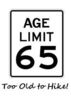
_____________________
Be careful. It really is "a jungle out there."
  2 archives
Jan 13 2024
avatar

 Routes 39
 Photos 64
 Triplogs 42

58 male
 Joined Mar 29 2015
 Chandler, AZ
Picketpost trail - AZT, AZ 
Picketpost trail - AZT, AZ
 
Hiking avatar Jan 13 2024
AndrewrdcTriplogs 42
Hiking10.38 Miles 1,212 AEG
Hiking10.38 Miles   4 Hrs   26 Mns   2.71 mph
1,212 ft AEG      36 Mns Break10 LBS Pack
 
no photosets
1st trip
Linked   linked  
Partners none no partners
Route Scout Route Recorded  on Route Scout | Pop | Map | Popup | MapDEX
Chilly 32 degrees this morning so I got a bit of a late start. Got to trailhead at 9am and the LAST spot in the parking lot! Headed south past picket post Mnt on the AZ Trail… always fun to hike on the AZT. Given the full lot, strangely saw nobody on the trail untill I got to my turnaround point at mile 5. Passed about a dozen hikers on the way back though.

Nothing particularly outstanding about this section south of PP Mnt… just a nice, peaceful trail in some beautiful wilderness. Just what the doctor ordered!
_____________________
 
Dec 28 2023
avatar

 Routes 7
 Photos 3
 Triplogs 35

51 male
 Joined Sep 12 2006
 Phoenix, AZ
Alamo Canyon - AZT #17Globe, AZ
Globe, AZ
Hiking avatar Dec 28 2023
kaiboxerTriplogs 35
Hiking6.55 Miles 1,292 AEG
Hiking6.55 Miles   4 Hrs   9 Mns   1.58 mph
1,292 ft AEG29 LBS Pack
 no routesno photosets
1st trip
Linked   none no linked trail guides
Partners none no partners
Training hike for the GC, and second backpacking trip for my Godson. We went SB from Picketpost TH and planned to overnight at Picketpost Mill. There was NO water at the Mill, it must not be producing anymore. We made the decision to hike back, and just car camp near Reymert.

dry Picket Mill Well Dry Dry
The well was dry, the trough was dry, the tank was just mud (eww).
_____________________
 
Dec 12 2023
avatar

 Guides 110
 Routes 2,246
 Photos 8,982
 Triplogs 2,600

45 female
 Joined Dec 24 2007
 Ahwatukee, AZ
Alamo Canyon - AZT #17Globe, AZ
Globe, AZ
Hiking avatar Dec 12 2023
LindaAnnTriplogs 2,600
Hiking24.39 Miles 2,921 AEG
Hiking24.39 Miles   8 Hrs   55 Mns   2.98 mph
2,921 ft AEG      44 Mns Break
 
1st trip
Linked   none no linked trail guides
Partners partners
trekkin_gecko
Route Scout Route Recorded  on Route Scout | Pop | Map | Popup | MapDEX
Kelly invited me to join her on another out & back segment of the AZT. We got to the Picketpost trailhead a few minutes before 0700 and headed south. Good trail conditions the entire way as we meandered back & forth and up & down. Never steep, so it was pretty easy going. Saw several cows, they all looked rather hungry, kind of sad. Views were excellent, and high clouds made for nice lighting.

Once at the south end of the segment, we turned around and headed back north. Again, nice views to enjoy the entire way. Finished up just before 1600. Saw only one other hiker, near the trailhead as we were finishing. Great day, and nice to get some good mileage. Thanks for the invitation, Kelly!
_____________________
Stop crying and just go do the hike.
 
Dec 12 2023
avatar

 Guides 10
 Routes 673
 Photos 7,281
 Triplogs 4,660

67 female
 Joined Nov 17 2008
 phoenix, az
Alamo Canyon - AZT #17Globe, AZ
Globe, AZ
Hiking avatar Dec 12 2023
trekkin_geckoTriplogs 4,660
Hiking24.39 Miles 2,921 AEG
Hiking24.39 Miles   8 Hrs   55 Mns   2.98 mph
2,921 ft AEG      44 Mns Break
 no routes
1st trip
Linked   none no linked trail guides
Partners partners
LindaAnn
after our successful hike of AZT #13, i thought linda and i could do an out and back on this one, too
we arrived at picketpost a little before 0700, and set out soon after
temps in low 50s with cloud cover
the trail goes south along the west side of picketpost
we passed the intersection with the circumference trail
from there, the trail contours around several drainages
went through a burn area, then down into a wash and up to the tonto boundary
returned the same way
trail was in excellent shape which made for easy travel
the elevation gains were gradual, with most of the gain on the way out
scenery was great with close up views of the terrain visible from the top of picketpost
buttes, rock ridges, apache leap and picketpost
very enjoyable passage, better than anticipated
we took three breaks, one about every six miles, which helped refresh
this was my longest hike for the year
the miles went by quickly with good conversation and company
nice to get another passage done, and nice of linda to do it with me - thanks!
_____________________
hazhole
 
Apr 27 2023
avatar

 Guides 264
 Routes 2,797
 Photos 14,494
 Triplogs 5,894

55 male
 Joined Nov 20 1996
 
Picketpost CircumferenceGlobe, AZ
Globe, AZ
Hiking avatar Apr 27 2023
joebartelsTriplogs 5,894
Hiking8.68 Miles 631 AEG
Hiking8.68 Miles   3 Hrs   31 Mns   2.79 mph
631 ft AEG      24 Mns Break
 
1st trip
Route Scout Route Recorded  on Route Scout | Pop | Map | Popup | MapDEX
Planned on hiking Reavis to check on the Apple blossoms, yet the road to Rogers Trough was blocked off cuz they're burning the forest down during the windy season through the 29th. These notices are easy to find on the HAZ Forum [ photo ] . In retrospect, we might have been able to get in from the east on FS357-Magnum Hewitt Station Rd as the closure is a tiny area before the turn onto FS172 Hewitt Canyon Rd.

We invested 20 seconds researching an alternative. Not on my top hundred favorites list, but an intriguing hike with plenty of geology and desert flora. Effort to reward is better than average in nice weather. The creek flow was better than anticipated, yet easy crossings.

The current/original HAZ route meanders on old alignments. Bruce had an appointment with his beautician and kept shortening the arduous hike on inner options as we went. For the best, I'm not in prime fitness.

Borderline too warm for most. Seemed like pretty nice weather to me. Good to get out.
wildflower observationwildflower observationwildflower observationwildflower observationwildflower observation
Wildflowers Observation Light
Extreme if you haven't hiked much in the last couple months but I'll go with light based on photos that I've seen others posting recently.
_____________________
- joe
 
Feb 25 2023
avatar

 Guides 25
 Routes 376
 Photos 5,897
 Triplogs 346

40 male
 Joined Mar 01 2018
 Chandler, AZ
Alamo Canyon - AZT #17Globe, AZ
Globe, AZ
Hiking avatar Feb 25 2023
John10sTriplogs 346
Hiking24.03 Miles 2,735 AEG
Hiking24.03 Miles   9 Hrs   14 Mns   2.79 mph
2,735 ft AEG      38 Mns Break
 
1st trip
Linked   linked  
Partners partners
TboneKathy
Route Scout Route Recorded  on Route Scout | Pop | Map | Popup | MapDEX
We chose this one last minute the day before the hike...I've been up Picketpost a few times but hadn't hiked in the area around it, so we started from Picketpost TH on an out-and-back on AZT #17/GET #3 to see how far we could with the time we had. I was a little worried this might be a letdown--from what I'd read, the northern part of GET #3 is the least scenic, flattest, and easiest portion, and we'd miss the best parts further south in the White Canyon Wilderness.

As we pulled up to the trailhead, there were special event signs for an Aravaipa Running trail race that unfortunately coincided with our route. Starting out, I was underwhelmed with the hike as it met the low expectations. Picketpost is always impressive, but it's surrounded by some fairly nondescript hills. Over the first few miles, it felt like we were just looking at Picketpost from slightly different angles as we followed a relatively flat trail through semi-burned landscape, crossing terrain that smelled like a farm and dodging piles of horse and cow poop. It was a cloudy, dreary morning, and the creek had more mud than water. Not the most impressive start...

We passed a lot of flags and signs marking the race course, and as we approached the intersection for the Picketpost Circumference route, I joked that we should move a few signs and divert the runners off our route before they showed up. We hoped the race was starting at 9AM so we'd have a decent head start, but the first runner passed us ~8:50AM...then gradually a few more...then the floodgates opened. The runners were friendly, but it got old constantly looking over my shoulder and stepping off the trail every minute or two to let more of them pass. We finally asked one of the runners if they knew how many racers had signed up, hoping the traffic might end soon. They didn't know exactly but guessed the entry limit was 400 but didn't think the race had sold out...so we could expect up to 400 people passing us.

The landscape started get more interesting 5-6 miles in, with deeper canyons and more intriguing geology and cliffs. We kept a decent pace despite stepping off the trail so often, and we were happy to leave the runners behind when the course turned onto Telegraph Road around eight miles in. We took our first break at the 10-mile mark, just past an Arizona Trail gate. At that point, we were close enough to the end of the AZT segment that I wanted to finish it off...if I ever decide to hike the full AZT, I wanted to avoid repeating this one just to complete that last short stretch.

TBoneKathy waited there, and I left most of my stuff behind and ran/hiked the last two miles to the end of AZT #17. It would've been nice to have more time to explore around there...I was just getting into an intriguing area with Ajax and the various numbered peaks near that intersection, but I needed to get going, so I raced back and we started the hiking out.

As underwhelmingly as the day started, it ended much more positively, and the return trip was far more enjoyable--the sun finally came out, and the views looking north at the Superstition Ridgeline in the afternoon shadows were fantastic. The trail runners were gone by mid-afternoon, so we weren't constantly stepping off the trail, and it was a very pleasant hike out. We didn't get into the White Canyon Wilderness area farther south along GET #3, but it still turned into a good day. I didn't plan to complete the whole AZT segment, but that ended up working out well...42 to go? :)
 Fauna
 Fauna [ checklist ]
[ checklist ]  Cow
  1 archive
Feb 10 2023
avatar

 Guides 1
 Routes 148
 Photos 9,924
 Triplogs 3,652

63 male
 Joined Apr 02 2005
 Mesa, AZ
Alamo Canyon - AZT #17Globe, AZ
Globe, AZ
Hiking avatar Feb 10 2023
Tortoise_HikerTriplogs 3,652
Hiking5.20 Miles 757 AEG
Hiking5.20 Miles   2 Hrs   1 Min   2.58 mph
757 ft AEG
 no routes
Linked   none no linked trail guides
Partners none no partners
I just did a little out and back from Picket Post trailhead. Trail in great shape. A little trickle in the creek bed a couple miles in. Breeze felt good today! A few cows here and there. Hope they don’t eat all the green!
_____________________
Tortoise Hiking. Stop and smell the Petrichor.
 
Aug 07 2022
avatar

 Guides 99
 Routes 1,484
 Photos 16,072
 Triplogs 1,374

male
 Joined Jan 07 2017
 Fountain Hills,
Picketpost Mountain SummitGlobe, AZ
Globe, AZ
Hiking avatar Aug 07 2022
DixieFlyerTriplogs 1,374
Hiking4.82 Miles 2,084 AEG
Hiking4.82 Miles   3 Hrs   27 Mns   1.83 mph
2,084 ft AEG      49 Mns Break
 
Route Scout Route Recorded  on Route Scout | Pop | Map | Popup | MapDEX
This is one of my favorite hikes in the Valley, and it had been almost a year since I last did this one, so I decided to give it a shot today.

It rained a bit as I driving through Gold Canyon, and I could see some lightning in the distance, so I was wondering if we'd be able to do the hike. We got to the TH at 5:30 and there were dark clouds to the east and north. I checked radar and it looked like the storm would move off to the north, which is what it did. We waited a bit just to be sure about the weather, and got started a little after 6:00. While we were waiting a nice double rainbow appeared just to the west of us.

This wound up being a great hike. We took an efficient route up, and the weather turned out great -- cloudy, decent temperatures, and a nice breeze. We hung out at the summit for about 40 minutes, and then headed back down.

As we descended, about a mile from the TH we met a hiker coming up the trail. He was the only person that we saw on the hike.

The vegetation up at the summit was very green, so it looks like there has been some monsoon precipitation in the area.
 Meteorology
 Meteorology [ checklist ]
[ checklist ]  Double Rainbow
_____________________
Civilization is a nice place to visit but I wouldn't want to live there
  1 archive
Mar 31 2022
avatar

 Guides 1
 Routes 148
 Photos 9,924
 Triplogs 3,652

63 male
 Joined Apr 02 2005
 Mesa, AZ
Alamo Canyon - AZT #17Globe, AZ
Globe, AZ
Hiking avatar Mar 31 2022
Tortoise_HikerTriplogs 3,652
Hiking6.30 Miles 754 AEG
Hiking6.30 Miles   2 Hrs   31 Mns   2.50 mph
754 ft AEG
 no routes
Linked   none no linked trail guides
Partners none no partners
I headed south on the AZT from Picketpost trailhead. Just a few miles out and back the way I came. Temps were comfortable at 8:00am when I got going. Not sure why there is a host here or why they lock the gate but the bathrooms were clean and the gate was open by now! Trail is in pretty good shape. Some of the washes had a little pooled water. The south side of the rolling hills had a good splash of Brittlebush just a little past their prime. The Globemallow we’re representing quite nicely with some meek Fairydusters here and there. A few Hedgehog blooms with most of the buds not open yet. Saw a few day hikers, a few horseback riders and 1 guy doing the GET trail. He had the catclaw marks from the Supes section. 😳. Said he got poured on too. He was trying to make it to the Gila today. He said he did the AZT last year in 29 days. Nice to be on the AZT and reminisce about hiking it. Nice day to be out!
 Flora
 Flora [ checklist ]
[ checklist ]  Desert Marigold
_____________________
Tortoise Hiking. Stop and smell the Petrichor.
 
Mar 18 2022
avatar

 Guides 1
 Routes 61
 Photos 604
 Triplogs 79

male
 Joined May 28 2019
 Phoenix, AZ
Gila River Canyons - AZT #16Globe, AZ
Globe, AZ
Backpack avatar Mar 18 2022
kyleGChikerTriplogs 79
Backpack40.27 Miles 7,777 AEG
Backpack40.27 Miles2 Days   4 Hrs   53 Mns   
7,777 ft AEG38 LBS Pack
 
1st trip
Linked   linked  
Partners none no partners
This brings us to recent history! This past weekend, mom and I went hiking for another AZT passage. This time it was the combination of #16 (Gila River Canyon) and #17 (Alamo Canyon).
The Drive: The drive was nice, and actually with a vehicle and Picketpost Mountain TH and the other at Kelvin, this was probably the shortest AZT drive you can get! Both trailheads are easily accessible with a passenger car.
The hike: Let me just start by saying, this is a strenuous hike! It is not for your average "Joe backpacker" who does normal trips. While the trail is in exceptionally good condition, two things make this trip difficult: Heat and minimal water. First, the heat makes this trip very challenging. We went in mid-March when the weather is usually pretty good. But not here. On this trip, you hit the lowest elevation of any point on the Arizona Trail at ~1600 feet. Day-time highs in Superior were supposed to be around 70-75. But we consistently saw temperatures around 80-85 on our little thermometer. I think several factors play into this, including the Gila River gorge acting like a trap for the heat, similar to the inner gorge of the Grand Canyon. Also, the entire climb northbound from the Gila to the top of the mountains is exposed south-facing rock. There is very little vegetation, and very little shade. There were a few times we were ready for a break, but we had to keep hiking a good half hour before we found any substantial shade to rest in. Finally, getting to the lack of water part. Along the Gila River, there are a few access points, and it was flowing pretty clear and filtered well, so that was no problem on this trip. However, I've read about people whose filters clogged almost immediately from the muddy Gila River, and that could land you in a lot of trouble. Once you leave the Gila River, there's no more water until the rainwater collector, and even then, you're depending on reports from other people to know that it hasn't all dried up (hint: it's not a water source; it's a water collector. When it runs out, it's gone!)
With that warning to adequately prepare finished, the hike was amazing! This is one of the most beautiful sections we've done on the AZT, though the section from the rainwater collector to Picketpost was less than stellar in places due to the past fire activity. Cactus everywhere, wildflowers in abundance, and again, a smooth trail all made this a great hike. I can't wait till I have an opportunity to mountain bike this one! We'll just hope I don't have as bad of luck as one guy we saw. He got a flat tire around mile 18, literally half way from either trailhead! Hope he made it out okay--he had some buddies he was riding with who were aware of the problem.
 Fauna
 Fauna [ checklist ]
[ checklist ]  Gila Monster
 Named place
 Named place [ checklist ]
[ checklist ]  Picketpost Mountain
wildflower observationwildflower observationwildflower observationwildflower observationwildflower observation
Wildflowers Observation Moderate
All different kinds - probably around 3,000 feet is perfect for wildflowers right now.

dry Martinez Well Dry Dry
The well/tank was dry, but the AZT rainwater collector had plenty of water as always.

water 1 out of 5water 2 out of 5water 3 out of 5water 4 out of 5 Walnut Canyon Heavy flow Heavy flow
I think this is referring to Gila River access, in which case the Gila River was flowing strong.
 
Jan 16 2022
avatar

 Guides 12
 Routes 192
 Photos 863
 Triplogs 356

42 male
 Joined Nov 30 2015
 Phoenix, AZ
AZT Passages 16-17, AZ 
AZT Passages 16-17, AZ
 
Run/Jog avatar Jan 16 2022
ShatteredArmTriplogs 356
Run/Jog38.10 Miles 5,800 AEG
Run/Jog38.10 Miles   10 Hrs   5 Mns   4.00 mph
5,800 ft AEG      34 Mns Break
 no routesno photosets
1st trip
Partners none no partners
Decided to continue on my multi-year AZT south-to-north in chunks project with the next passage, Kelvin to Picketpost. I had debated splitting this in two, but getting to an access point in the middle seemed like a lot of work. I hadn't done any run longer than ~15 miles or so in about four months, but the opportunity (i.e. another sucker dumb enough to do a 38 mile run on short notice) presented itself, so I went for it.

I was kinda worried about daylight, so we dropped a car right outside the gate at picketpost (apparently they lock it at night), the got to the parking lot at Riverside a little after 7am. I think we started running by around 7:30am, with temperatures still a little brisk. Made good time of the 16 mile Gila River stretch, most of which is easy running, and got to the turn at Cochran within 3hrs 10 minutes. At this point I was feeling pretty confident about not needing lights.

The next ~7 miles is mostly uphill, but generally not steep, so we covered 3-4mph in this stretch, and took a little break at the saddle overlooking Martinez Canyon. Nice view from here, and the next couple miles to the rainwater collector was my favorite stretch of both passages.

Took a break at the rainwater collector, refilled water, then started the final 12 mile stretch. All things considered, I was feeling much better at this point than I could've been. A few of the drainages over the ensuing 4 miles actually had a trickle, so we wouldn't have been totally screwed without the rainwater collector!

I would say the last four miles was really where most of the suffering took place. Despite being mostly downhill, we still only managed the 3-4mph we were doing on the uphill. But we made it back to the car before sunset, so...mission accomplished.

Multiple people have told me this is their very favorite stretch of the AZT. Hard disagree from me, outside of the couple miles south of the rainwater collector, I could take it or leave it...
_____________________
 
Sep 04 2021
avatar

 Guides 99
 Routes 1,484
 Photos 16,072
 Triplogs 1,374

male
 Joined Jan 07 2017
 Fountain Hills,
Picketpost Mountain SummitGlobe, AZ
Globe, AZ
Hiking avatar Sep 04 2021
DixieFlyerTriplogs 1,374
Hiking5.00 Miles 1,975 AEG
Hiking5.00 Miles   3 Hrs   33 Mns   2.10 mph
1,975 ft AEG   1 Hour   10 Mns Break
 
I decided to get out and do this hike again today -- it is one of my favorite short hikes.

We started early and did not see anyone until we got almost to the top, and 4 hikers were coming down from the summit. On the way back we were less than a mile from the TH and met 2 hikers coming up. So we mostly had the place to ourselves.

Once you climbed up to the saddle that is not far from the summit, there was lots of waist high grass to plow through. It wasn't too bad, but you couldn't see the trail. We managed to persevere though.

There were the usual nice views at the summit.

I like this hike and should do it more often.
 Culture
 Culture [ checklist ]
[ checklist ]  Benchmark
_____________________
Civilization is a nice place to visit but I wouldn't want to live there
 
May 29 2021
avatar

 Guides 27
 Routes 669
 Photos 12,096
 Triplogs 856

56 male
 Joined Jul 05 2006
 Mesa, AZ
LOST - Arnett Canyon SegmentGlobe, AZ
Globe, AZ
Hiking avatar May 29 2021
DarthStillerTriplogs 856
Hiking10.43 Miles 1,076 AEG
Hiking10.43 Miles   4 Hrs   17 Mns   2.50 mph
1,076 ft AEG      7 Mns Break
 
1st trip
Partners partners
adilling
Route Scout Route Recorded  on Route Scout | Pop | Map | Popup | MapDEX
I haven't hiked any of the LOST trails yet, so this seemed like a good opportunity to do that. Andy hiked part of this before so he was interested.

We started from the Picketpost TH and hiked east into the canyon. The temperature was very cool and breezy with the shade and riparian environment. There are a lot of very nice views of Picketpost and the rock formations inside the canyon along the creek. After a mile or two, the vegetation and cottonwoods was pretty dominant.

We got to the junction with Telegraph Canyon and decided to walk down that. We got sidetracked on some fainter trails that head up over to Perlite Road, but then got back down into Telegraph Canyon. I had planned to hike in maybe 5 miles or so and then turn around. Once we got to the end of Telegraph Canyon to the road, it made more sense to just complete the loop around Picketpost since we had already hiked about halfway. The connecting trail from the road over to the AZT is very well marked and easy to follow.

Once we got to the TH again, we had only hiked about 9 miles, so we took the bypass route mini loop into Arnett Canyon again and added another mile and a bit more. It was a little warm when we finished, but not really hot. Still breezy here and there the whole time. Looking forward to hiking more of the LOST trails in this area over to Superior.
_____________________
 
average hiking speed 2.21 mph
1, 2, 3, 4, 5 ... 7  Next

WARNING! Hiking and outdoor related sports can be dangerous. Be responsible and prepare for the trip. Study the area you are entering and plan accordingly. Dress for the current and unexpected weather changes. Take plenty of water. Never go alone. Make an itinerary with your plan(s), route(s), destination(s) and expected return time. Give your itinerary to trusted family and/or friends.

helpcommentissue

end of page marker