username
X
password
register
for free!
help
ArticlesGuidesRoutes
 
Photosets
 
 Comments
triplogs   photosets   labels comments more
Cockscomb Trail - Sedona - 7 members in 20 triplogs have rated this an average 3.1 ( 1 to 5 best )
20 triplogs
login for filter options
Apr 04 2020
avatar

 Routes 189
 Photos 7,244
 Triplogs 1,742

57 male
 Joined Apr 25 2011
 Goodyear, AZ
Cockscomb Loop, AZ 
Cockscomb Loop, AZ
 
Mtn Biking avatar Apr 04 2020
NightstalkerTriplogs 1,742
Mtn Biking10.90 Miles 997 AEG
Mtn Biking10.90 Miles   3 Hrs   18 Mns   5.45 mph
997 ft AEG   1 Hour   18 Mns Break13 LBS Pack
 no routesno photosets
1st trip
Partners none no partners
Went up to Sedona today for a mtb bike ride with SCA. Found many trail heads closed with a big "STAY HOME" sign. Was planning on parking at Mescal, but everything along Long Canyon road was closed. Drove over to Fay Canyon and parking there was open. Made an impromptu plan B and hit the trails. Fantastic day. Also rode Canyon of Fools - that was FUN!
_____________________
 
Aug 10 2019
avatar

 Guides 69
 Routes 37
 Photos 3,010
 Triplogs 2,387

55 male
 Joined Oct 24 2010
 Phoenix,Az
Cockscomb Trail - SedonaSedona, AZ
Sedona, AZ
Hiking avatar Aug 10 2019
mt98dewTriplogs 2,387
Hiking5.85 Miles 382 AEG
Hiking5.85 Miles   1 Hour   17 Mns   4.56 mph
382 ft AEG
 no routesno photosets
1st trip
Linked   none no linked trail guides
Partners none no partners
This was my second hike up in Sedona. I chose this trail without first reading the the trail description.....And it is probably a good thing that I did. I feel that the trail that I did and the trail that was described from 2007 are two different trails. I got to the TH around 7am. (The TH is the same one used for the Fay Canyon Trail. Side note: This is a paid parking area. 7$ for one time use or 15$ for an annual pass....do the math. Enough parking for 30 cars, but there were only 6 cars while I was there. There are bathroom facilities, but no water. Oddly enough, there is also a bike station there where one can air up flat tires (I think)).

Unlike some of the earlier triplogs, the trail is easy to follow and well signed. Trail goes in about .15 miles where there is a signed juncture with the Aerie Trail. I wanted to do this trail as a loop, so I continued in a clockwise direction on the Cockscomb. The trail loses some elevation initially as it turns southward along the lower slopes of Doe Mountain. About 1 mile in the Cockscomb briefly joined up with the Dawa Trail before each going their separate ways. Staying on the Cockscomg the trail did a little bit of climbing, but remained relatively flat for the next mile. Up until this point I wasn't really impressed. The trail was ok...it interacted with the environment and kept me interested, but the foliage was sparse and the views (for Sedona) not awesome. BUT, once the trail got above the surrounding landscape the views opened up and I got some beautiful views of the vistas off to the east. Really a nice treat :D There was even a small canyon that opened up at one of the trail bends that was deserving of a Kodak moment. About 2 miles in the trail intersects with the Rupp Trail. Again, well signed. The trail does some moderate climbing as it swings to the west going around some very nice homes. It then crosses a paved road that leads to this community. At this point the trail is between Cockscomb and Doe Mountain and this is where the trail changes drastically from the itiial trail description. There is no signed trail or spur that climbs up toward the Cockscomb. (I wasn't looking for this "ascent to the Cockscomb", but I want to say that right after the road, there was a side trail. I will have to go back and follow up on this). Instead, the trail continues to wrap around the private homes and starts to circle the west side of Doe Mountain. Just over 3 miles in, I came upon a new signed trail called the Outer Limits Trail. It is so new, that it hadn't been added to any of the area maps. New trails :y: Love it! :D Hit the Aerie TH around 3.5 miles. From here, I hopped on the Aerie Trail. There was a moderate gain in elevation as the Aerie crossed the Doe Trail before beginning a switchback drop to connect to the Cockscomb Trail, closing my loop.

Pretty nice loop. Trail definitely offered more than I anticipated. Sorry I didn't get to play in the Cockscombs, but glad to be able to do the trail as it is now designed. May have to come back to see if there are any user trails worth exploring. No wildlife. Encountered 1 hiker and 12 bikers.
_____________________
 
Oct 02 2016
avatar

 Guides 107
 Routes 249
 Photos 2,067
 Triplogs 514

male
 Joined Nov 18 2005
 Phoenix, AZ
Doe Mountain Trail #60Sedona, AZ
Sedona, AZ
Hiking avatar Oct 02 2016
nonotTriplogs 514
Hiking15.00 Miles 2,900 AEG
Hiking15.00 Miles
2,900 ft AEG
 no routesno photosets
1st trip
_____________________
http://hikearizona.com/garmin_maps.php

Hike Arizona it is full of sharp, pointy, ankle-twisting, HAZmaster crushing ROCKS!!
Hike Arizona it is full of sharp, pointy, shin-stabbing, skin-shredding plants!
Hike Arizona it is full of striking, biting, stabbing, venomous wildlife!
  2 archives
Jul 03 2016
avatar

 Routes 39
 Photos 353
 Triplogs 128

37 male
 Joined Sep 30 2015
 Carrboro, NC
Cockscomb Trail - SedonaSedona, AZ
Sedona, AZ
Mtn Biking avatar Jul 03 2016
afrankieTriplogs 128
Mtn Biking5.30 Miles 382 AEG
Mtn Biking5.30 Miles
382 ft AEG
 
no photosets
1st trip
Linked   none no linked trail guides
Partners none no partners
Looking for a low mileage and mild-moderate ride I stumbled upon this loop. Starting at the Aerie trailhead I rode over to the Doe trailhead, dropped the bike and took a sidetrack hike. The ride along Aerie to that point (only about a mile) wasn't very eventful, and I wasn't sure that I wold even continue on with the loop. I got on the bike and took the long way home, which was just what I was looking for. Cocksomb offered more exposure as it wrapped to the east and south, with more speed and some slick rock areas. This is a winner as far as trails go that you show most sides of Sedona and is mild if not looking for elevation.
_____________________
Good judgment comes from experience. Experience comes from bad judgment.
Evan Hardin

Footloose adventures are documented instagram @afrankie8.
  4 archives
May 03 2015
avatar

 Photos 4,529
 Triplogs 200

66 male
 Joined Jun 19 2011
 Phoenix, Az
Cockscomb Trail - SedonaSedona, AZ
Sedona, AZ
Hiking avatar May 03 2015
rrshortTriplogs 200
Hiking2.00 Miles 382 AEG
Hiking2.00 Miles   2 Hrs      1.00 mph
382 ft AEG
 no routes
1st trip
Linked   none no linked trail guides
Partners none no partners
I joined my brother and a small group of his friends on another foray into the Red Rock country of Sedona. While they tackled the Cockscomb-Aerie loop I did a short out and back jaunt on the Cockscomb Trail.Got underway aboyt 9:45am on a beautiful day. Even this short trip provided me with ample Red Rock vistas to look at. There were a goodly amount of wildflowers and some cactus blooms. Puffy clouds moved across the blue sky providing an occasional respite from the sun. This part of the trail was mostly flat with minor ups and downs along the way. The trail head has no amenities but is balanced out by not requiring a fee to park. Another great day in Sedona!
wildflower observationwildflower observationwildflower observationwildflower observationwildflower observation
Wildflowers Observation Moderate
_____________________
 
Jun 16 2013
avatar

 Guides 9
 Routes 33
 Photos 780
 Triplogs 4,634

44 male
 Joined Nov 25 2008
 Scottsdale, AZ
Cockscomb Trail - SedonaSedona, AZ
Sedona, AZ
Run/Jog avatar Jun 16 2013
BoonemanTriplogs 4,634
Run/Jog16.50 Miles 882 AEG
Run/Jog16.50 Miles   2 Hrs   10 Mns   7.62 mph
882 ft AEG
 no routesno photosets
1st trip
I was dropped off this morning at the Bear Canyon Trailhead and ran out to the Palatki Ruins on FR152. Then I ran back to the Fay Canyon Trailhead and hit the trails back to 89A near Dry Creek Road.
_____________________
 
Apr 13 2013
avatar

 Photos 6
 Triplogs 10

50 male
 Joined Feb 22 2004
 Tucson, AZ
Cockscomb Trail - SedonaSedona, AZ
Sedona, AZ
Hiking avatar Apr 13 2013
jawilderTriplogs 10
Hiking2.50 Miles 382 AEG
Hiking2.50 Miles
382 ft AEG
 no routesno photosets
1st trip
Linked   none no linked trail guides
Partners none no partners
I was a little thrown off by all the confusion about routes up the Cockscomb described on this site. Clearly, the area has undergone some changes in the last few years. However, the shortest and easiest way up the Cockscomb is now really easy (April 2013): park at the Aerie Trailhead (turn south off Boynton Pass Road just beyond the Doe Mountain Trailhead), follow the well-signed Cockscomb Trail until you get to a saddle just below the north shoulder of the Cockscomb, look for a cairned path to the summit, and enjoy!

Views from the summit are stellar. With a bit of exploration there are some hidden ruins that can be found. The short length and fun scrambling at the summit made this a hit with my 5 & 7 year olds - this went down as one of their all-time favorites.
wildflower observationwildflower observationwildflower observationwildflower observationwildflower observation
Wildflowers Observation Moderate
_____________________
 
Mar 25 2012
avatar

 Routes 17
 Photos 2,773
 Triplogs 249

53 female
 Joined May 15 2009
 Phoenix and Tucs
Doe Mountain Loop, AZ 
Doe Mountain Loop, AZ
 
Hiking avatar Mar 25 2012
cindylTriplogs 249
Hiking9.00 Miles 800 AEG
Hiking9.00 Miles
800 ft AEG
 no routes
1st trip
Partners partners
rwstorm
i was just looking through some old photos and realized i never posted a triplog or a photoset for this one. i had to re-read randy's triplog so i could remember it a little. i remember going the wrong way on a couple of different trails, but making our way back - never truly lost, just not ending up going the way we intended. i wanted to go up cockscomb after reading about it in the cosmic ray hiking book that randy brought. i just liked the way it sounded. maybe someday i'll go back and hike up that one, since we didn't get to it on this particular day.
wildflower observationwildflower observationwildflower observationwildflower observationwildflower observation
Wildflowers Observation Light
_____________________
There are just two switchbacks left. And another half-mile to the destination...
 
Mar 25 2012
avatar

 Guides 1
 Routes 136
 Photos 22,415
 Triplogs 1,041

77 male
 Joined Feb 28 2003
 Tucson, AZ
Doe Mountain Loop, AZ 
Doe Mountain Loop, AZ
 
Hiking avatar Mar 25 2012
rwstormTriplogs 1,041
Hiking9.00 Miles 800 AEG
Hiking9.00 Miles
800 ft AEG
 no routes
1st trip
Partners partners
cindyl
After camping at Dead Horse Ranch State Park and breakfast in Old Town Cottonwood, Cindy and I headed up to Sedona to hike. I have only done two hikes in the area, so I brought a copy of Cosmic Ray's book along and told Cindy to pick something that interested her. Since it is still chilly with probable lingering snow up at the 6000 feet plus level, we were looking for something lower down. She picked the Cockscomb hike and we proceeded to the Dawa Trailhead, parked along the road and headed in. We didn't know which was Cockscomb or Doe Mountain, and since there are a maze of trails there, it made for a fun little adventure. After about a mile we hit the intersection with the Cockscomb Trail. Had we turned left here we would have headed straight for Cockscomb, but we went right and hiked to end of the trail at the large parking area across from the Fay Canyon Trail. Here we were able to look at the map on the info board and see that we were next to Doe Mountain. We decided to make a loop out of it, and backtracked a short distance and took the Aerie Trail around the mountain. Gaining some elevation the views became outstanding. As we rounded the mountain, we passed the side trail to the summit, then crossed a road by the newer parking lot for the hike to Cockscomb. Soon thereafter we got a good view of the Cockscomb, as the trail skirted some private land and headed for a saddle on its north side. Cindy really wanted to climb it, but by this time I didn't feel like bushwhacking the 600 feet or so up the thing, so we just went down a side trail along the northeast side to see if we could spot a route up for perhaps another time. I heard voices and sure enough, there were some folks working their way up. We found the faint unmarked spot where they departed the trail. We backtracked to the main trail and soon came to the junction for the Rupp and Cockscomb Trails. I wasn't sure which way to go, so we started out on the Rupp, but within about half mile we realized we needed to go back and take the Cockscomb. No problem, as it is all easy hiking. Once back on the Cockscomb we continued on to the junction with the Dawa Trail and then back to the truck.

We encountered very few hikers, but lots of mountain bikers, as these trails are perfect for that. The trails are very good and junctions signed, but mileage and other info is not given. However, someone has taken the time to post some handwritten mileage and added details on many of the signposts at junctions, which is very helpful.

Then it was off to the Oak Creek Brewery for a cold one, before Mexican food in Oak Creek Village and the drive back to Tucson.
 Culture
 Culture [ checklist ]
[ checklist ]  Aircraft
wildflower observationwildflower observationwildflower observationwildflower observationwildflower observation
Wildflowers Observation Light
_____________________
 
Dec 06 2010
avatar

 Routes 144
 Photos 1,145
 Triplogs 1,238

77 male
 Joined Sep 09 2004
 Scottsdale, AZ
Cockscomb Trail - SedonaSedona, AZ
Sedona, AZ
Hiking avatar Dec 06 2010
Sun_RayTriplogs 1,238
Hiking6.00 Miles 565 AEG
Hiking6.00 Miles   2 Hrs   15 Mns   2.67 mph
565 ft AEG
 no routesno photosets
1st trip
Linked   none no linked trail guides
Partners none no partners
Judy and I are in Sedona for 3 days of hiking. We have been using the paperback book 'Sedona Hikes' by Richard & Sherry Mangum as our guide when we are in the area. We are meeting some friends for an afternoon hike so selected an easy one for the AM trek. We parked at the Fay Canyon Trail lot on 152C just past the Boynton Canyon Rd turn off. The TH is marked but it is about 50 feet up the road on the left. The trail is easy to follow and well marked except when you near the end. Here you follow the trail along the Cockscomb hill until you see you are by it and headed west. Here we turned around and went back the same way. You can add more miles by taking sections of Dawa Trail or Rupp Trail that you pass along your way.
_____________________
Brian
Monday, Tuesday, Wednesday, Thursday, Friday, Saturday......there is no SOMEDAY!
 
Nov 07 2010
avatar

 Guides 4
 Photos 2,750
 Triplogs 402

60 male
 Joined Nov 13 2005
 Cave Creek, AZ
Cockscomb Trail - SedonaSedona, AZ
Sedona, AZ
Hiking avatar Nov 07 2010
cabelTriplogs 402
Hiking6.00 Miles 600 AEG
Hiking6.00 Miles
600 ft AEG
 no routesno photosets
1st trip
Linked   none no linked trail guides
Partners none no partners
_____________________
All who wander are not lost...just me.
 
Jul 07 2010
avatar

 Triplogs 2

65 male
 Joined Jul 13 2010
 Arlington, VA
Cockscomb Trail - SedonaSedona, AZ
Sedona, AZ
Hiking avatar Jul 07 2010
GherveyTriplogs 2
Hiking3.00 Miles 600 AEG
Hiking3.00 Miles   2 Hrs      1.50 mph
600 ft AEG
 no routesno photosets
1st trip
Linked   none no linked trail guides
Partners none no partners
Completed the hike to the summit of the Cockscomb on July 7, 2010, which took a little less than an hour. I saw no one else on the hike (too hot...).

The trail from the parking lot off of Aerie Road is now very clearly marked and almost impossible to miss. This is the "Cockscomb Trail," which is not to be confused with the "Cockscomb Summit Trail," which branches off of the Cockscomb trail.

The Cockscomb trail was apparently marked relatively recently by the Forest Service; the tall brown plastic trail markers look pretty new.

To get to the summit, follow the directions in the initial posting in this series, which are still accurate.

Once you get past the fence around the new development, the Cockscomb Trail bends to the left. Start looking for the Summit Trail, which is the first real trail off to the right. Is it not marked by the Forest Service, and is quite plainly not maintained by the Forest Service, either. But, it has been marked by various hikers with a cairns and can be found if you are paying attention.

Other posters have noted that there is only one way to the top. I believe it. The trail is relatively well marked by cairns left by hikers, but the trail does take some unexpected turns. Therefore, if you find that you have gone some distance without seeing a cairn, and it you are not sure whether you are on a trail, you are probably not on the trail. My suggestion is to stop at a cairn and look if you see another one before heading off. While this is good advice for any uphill hike, the Cockscomb is relatively small and steep, so you can get into trouble easily if you are not paying attention.

Also, I noted that some cairns are misleading and were apparently left by hikers who got off the main trail themselves and left cairns for their own benefit or because they thought they were being helpful, or because they were being mean, who knows?

There were a few short scrambles near the top. The summit itself is reached by standing on a series of rocks piled by previous hikers inside a wide, shallow chute about 8 feet tall. I needed to brace my feet against the walls in order to haul myself up.

The top is pretty small. The views are great, but not really any better in my estimation that those from Doe Mesa. Although you can get a good closeup look at the other parts of the Cockscomb formation that cannot be seen from the ground. On balance, I was pleased to have made the summit, but did not find the summit itself to be all that interesting. The top of Doe Mesa is more interesting, and will be more interesting to children (not to mention the fact that children will have a much easier time getting up Doe Mesa). (Frankly, I would not take smaller kids up the Cockscomb, but I know there are many parents, and kids, that are a lot more adventuresome that I am.)

Coming down I ran into a little trouble. Although I started to descend the way I had climbed up, it soon became apparent that I must have missed part of the trail on the way up in the first place. I ended up following some smaller cairns that someone had (carelessly? intentionally?) left that did not lead to the trail. Instead, I went about 20 years down some scree and slick rock to an area without an exit. The only way out was a drop of several dozen yards or a mad scramble back the way I came. So, I literally ran back up the hill as fast as I could with hands and feet, kicking out plenty of scree, until I could get back to where I started. It was a bit of a scare, not to mention the fact that I was totally winded from the uphill dash at an altitude I was not used to.

I went another way and finally regained the trail, where I discovered that I had completely missed a turn when I was coming up. That turn was a sharp turn to my right (on the way up), and I would not have seen it without turning my head to look for it. So, when I came back down, I was looking for the way that I came up, which was the wrong way.

Anyway, it worked out. Bottom line: it was nice to reach the summit, but the top did not knock my socks off. It is not bad, but I will probably not try this one again because there are many other hikes around Sedona that are much better. It is one that I can check off the list. Maybe I would have liked it better if I had stayed on the right trail?? If you try this one, just keep a close eye out for the real cairns and the real trail.

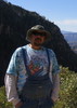
Geoffrey Hervey, Arlington, Virginia.
_____________________
Geoffrey T. Hervey Arlington VA
 
Feb 15 2010
avatar

 Routes 1
 Triplogs 15

60 male
 Joined May 20 2003
 Flagstaff, AZ
Cockscomb Trail - SedonaSedona, AZ
Sedona, AZ
Hiking avatar Feb 15 2010
Flag_Mtn_HkrsTriplogs 15
Hiking3.00 Miles 600 AEG
Hiking3.00 Miles
600 ft AEG
 
no photosets
1st trip
Linked   none no linked trail guides
Partners none no partners
My boy and I hit this today. Very quiet trail on a Presidents day weekend. Really easy to find route until you miss the turn off like described. We finally got back on track and figured out where we went wrong. Had fun and ate a little snack up top.
_____________________
 
Jan 10 2010
avatar

 Guides 9
 Routes 28
 Photos 211
 Triplogs 20

88 male
 Joined Mar 10 2002
 Sedona, AZ
Cockscomb Trail - SedonaSedona, AZ
Sedona, AZ
Hiking avatar Jan 10 2010
pbaenzigTriplogs 20
Hiking3.00 Miles 600 AEG
Hiking3.00 Miles   2 Hrs   30 Mns   1.20 mph
600 ft AEG
 
no photosets
Linked   none no linked trail guides
Partners none no partners
Sometime during 2009 the Forest Service built the official Cockscomb Trail starting at the "new" Cockscomb trail head off Aerie Road. It is now easy to follow, a lot easier than the previous ribbon markers. The trail merges with the existing social bike trail and the only trick is to not walk past the turn-off to go up onto Cockscomb proper.

It is now a very pleasant half day or less hike with only a short simple scramble at the very end. The views are incredible.
_____________________
Peter B
 
Apr 27 2009
avatar

 Guides 25
 Routes 36
 Photos 2,890
 Triplogs 658

39 male
 Joined May 30 2008
 Peoria, AZ
Cockscomb Trail - SedonaSedona, AZ
Sedona, AZ
Hiking avatar Apr 27 2009
hippiepunkpirateTriplogs 658
Hiking4.00 Miles 750 AEG
Hiking4.00 Miles   2 Hrs   45 Mns   1.45 mph
750 ft AEG
 no routes
1st trip
Linked   none no linked trail guides
Partners none no partners
An early morning haze cast gloom over the 7 canyons, as well as Capitol Butte, so I opted out of doing Devil's Bridge early, which paid off in the end. I hit the trailhead for the Cockscomb at 7:30, and it was already warm outside. I set out cross-country toward the monument, and had to negotiate the arroyos, cactus and fragile desert soil to reach it. The scramble up the north face was a blast, and the views of Bear Mountain and Doe Mountain behind me were sweet. I rounded the east face of the Cockscomb, and eventually I found the final climb up to the top! By then the haze was clearing off of Capitol, which allowed me to do Devil's Bridge afterward. Heading back I took the trail that parallels the fenceline with "The Aerie." When I hit the road, I decided to bushwack back to the car anyway...it was more trouble than it was worth because I walked right by the trailhead and wasted a good 20 minutes that I could have spent at Devil's Bridge. Oh well, it was a great climb anyway!
wildflower observationwildflower observationwildflower observationwildflower observationwildflower observation
Wildflowers Observation Moderate
_____________________
My blog: Mountain Tripper
My book: Arizona: A Photographic Journey
 
Jan 13 2008
avatar

 Photos 7
 Triplogs 177

45 male
 Joined Nov 14 2007
 Phoenix
Cockscomb Trail - SedonaSedona, AZ
Sedona, AZ
Hiking avatar Jan 13 2008
kgmolsonTriplogs 177
Hiking3.00 Miles 600 AEG
Hiking3.00 Miles   1 Hour   15 Mns   2.40 mph
600 ft AEG
 no routesno photosets
1st trip
Linked   none no linked trail guides
Partners none no partners
_____________________
 
Nov 29 2007
avatar

 Guides 9
 Routes 28
 Photos 211
 Triplogs 20

88 male
 Joined Mar 10 2002
 Sedona, AZ
Cockscomb Trail - SedonaSedona, AZ
Sedona, AZ
Hiking avatar Nov 29 2007
pbaenzigTriplogs 20
Hiking4.50 Miles 850 AEG
Hiking4.50 Miles   2 Hrs   20 Mns   1.93 mph
850 ft AEG
 
no photosets
Linked   none no linked trail guides
Partners none no partners
Late in 2006, if I remember correctly, Boynton Pass Road was improved and paved because of a development called "The Aerie." When the road was improved, new trail heads were put in: Fay Canyon trail head, Doe/Bear Mountain trail head and finally a new trail head designed to access Cockscomb.

This new trail head is past the Doe/Bear Mountain trail head. You turn left (South) when coming from Sedona onto Aerie Road, a new paved road leading to the development. After about half a mile, the road splits -- the left branch leading to the gate of the development and the right branch to the new trail head.

At the far end of the trail head (already trashed, beer bottles everywhere)you can find faint markings of a new trail. A yet non-existent trail that the Forest Service will build when it gets around to it. In the meantime, the route is marked with red paint and fading yellow ribbons. Enough people have hiked the route so that the non-existing trail is relatively easy to follow.

If you do lose the route, not a major problem. The route essentially leads south, following the terrain contours. Your goal, the north end of Cockscomb is always visible. To the left of you is initially the road leading to the Aerie, then the fence circling the property. As you get closer to the Cockscomb, the Forest Service route merges with existing distinct social trails leading to the start of the ascent. The climb up to the top of the mountain is unchanged and I don't know if the Forest Service ever will develop that part of the hike.

If you hike from the new trail head to the top of Cockscomb, it's about 3 miles RT and maybe 600 ft CEC. We extended the hike a bit by making a counter clockwise loop around Cockscomb before going up to the top. The little hill almost due SW from the trail head gives you some great views. The seemingly flat grass land between you and the Cockscomb is anything but flat; it crisscrossed with deep gullies. As you hike around the Cockscomb you'll come across many stretches of social trail, so the hiking is quite easy.

Overall, a pleasant half-day hike even when looping around.

The old description is now obsolete.
_____________________
Peter B
 
Sep 27 2005
avatar

 Triplogs 34

male
 Joined Mar 27 2007
 flagstaff, az
Cockscomb Trail - SedonaSedona, AZ
Sedona, AZ
Hiking avatar Sep 27 2005
mgermansenTriplogs 34
Hiking5.50 Miles 600 AEG
Hiking5.50 Miles
600 ft AEG
 no routesno photosets
1st trip
Linked   none no linked trail guides
Partners none no partners
_____________________
 
Jul 17 2004
avatar

 Guides 9
 Routes 28
 Photos 211
 Triplogs 20

88 male
 Joined Mar 10 2002
 Sedona, AZ
Cockscomb Trail - SedonaSedona, AZ
Sedona, AZ
Hiking avatar Jul 17 2004
pbaenzigTriplogs 20
Hiking5.50 Miles 600 AEG
Hiking5.50 Miles   3 Hrs      1.83 mph
600 ft AEG
 
no photosets
Linked   none no linked trail guides
Partners none no partners
The following served as the Hike Summary from 07/24/04 to 11/29/07

The official Cockscomb Trail and the social trail leading to the top of Cockscomb have changed a bit since Joe's original description more than four years ago. I think Joe hiked what I call the back entrance to the Cockscomb Butte, following initially FR 9583. This is also the route outlined in Mangum's book, "Sedona Hikes."

I followed the newly refurbished Cockscomb Trail. Upto two years ago the first mile or so of the trail was torn up by off-road vehicles. The area is now blocked off by heavy rocks and the Forest Service started to renaturalize all the vehicle damage. The trail is easy to follow, heading initially mostly south, then turning to the right (south west) until you get to a really squeaky gate. The distance to the gate is about half a mile. After the gate, you'll soon come to a powerline and underground telephone track. Cockscomb trail follows the straight power line heading southeast, crossing lots of erosion gullies. This is the most ugliest part of the trail, particularly since I think the powerline is a non-functional powerline and really should be removed. The powerline stretch is a bit longer than half a mile.

The Cockscomb Trail leaves the powerline when the marked Dawa trail joins it and starts going in a southwesterly direction. The Dawa Trail leaves the Cockscomb Trail a scant hundred yards further on. The trail continues to work its way around Doe Mountain on the right, crossing some dry washes and climbing over some rolling terrain. The trail is always clear and unambiguous, meandering through the low Juniper - Pinyon scrub. After a while, you'll see cockscomb ahead of you -- not the dramatic sides that gave it its name, but the dull north side. Unless you're a mountain climber, you really want a dull side to make your way to the top. It'll be plenty steep as it is.

This part of the trail is a bit less than a mile long. You'll soon see a rickety fence on your right and the trail veers to the south east. Don't cross the fence; beyond is private property, one of the many enclaves in National Forest land. As of today, the private land has not been developed, but I'm sure it'll be only a matter of a few years before we'll have another golf course and resort. The official Cockscomb trail ends abruptly where there are some Cottonwoods and a sign "Rupp Trail." Rupp Trail keeps on going in the same direction as Cockscomb Trail, but don't follow it.

The private property fence veers off to the right, follow it on the outside, going through a gate in a fence perpendicular to the private property fence. The trail now is a social trail, not an approved Forest Service Trail. I find it a bit hard to follow for the first few yards, but then it becomes well trodden and starts to climb a small incline heading south west. Once on top, the trail turns west, even a bit north west until you encounter the private land fence again. Here things get tricky. For the next couple of hundred yards, there are lots of trails and a Jeep road with the "No Trespassing" gate barring it. Basically follow the fence line until you see a sign "Public Trail," cross the Jeep track, always heading towards Cockscomb. This first part of the social trail, from the end of the Cockscomb Trail, is less than half a mile long.

As you route-find your way, just make sure you're heading about south towards Cockscomb. Don't follow any of the trails going in other directions. Try to remember the lay of the land here; I've had some problems coming back picking up the right trail. You should be picking up the first of many cairns soon. They generally are clear, but at times there seem to be alternate routes. As long as the trail goes up, first moderately, then steeply, you're on the right trail. The trail switch-backs in places, but generally trends up and a bit to the left (east) as you really start climbing.

Once you reach the vertical ledge just below the top, the trail flattens out, following the bottom of the rocks. You'll turn a corner around the rocks and there the trail seems to end: from now on you have to scramble and climb rocks. Nothing difficult, nothing scary, but you will have to use your hands and think about where to place your feet. The climb is in three short sections and the elevation gain is less than fifty feet. The last small ledge has hiker made steps. By the way, I find the climb down easier than the way up.

As you step on the top of the Cockscomb Butte, mark where you came up. From what I understand, there is only one easy way up and down. You do want to remember where that way is. The top isn't particularly large and quite broken up, but it's fun to explore a bit, take a break, and admire the spectacular views in all directions. You're at about the same elevation as the top of Doe Mountain to the north or Mescal Mountain to the north east. The big mountain to the north, behind Doe Mountain, is Bear Mountain.
_____________________
Peter B
 
Apr 13 2000
avatar

 Guides 264
 Routes 2,798
 Photos 14,514
 Triplogs 5,895

55 male
 Joined Nov 20 1996
 
Cockscomb Trail - SedonaSedona, AZ
Sedona, AZ
Hiking avatar Apr 13 2000
joebartelsTriplogs 5,895
Hiking5.00 Miles 600 AEG
Hiking5.00 Miles   2 Hrs   30 Mns   2.00 mph
600 ft AEG
 no routes
1st trip
Linked   none no linked trail guides
Partners none no partners
The following served as the Hike Summary from 04/13/00 to 07/23/04

The Cockscomb is yet another landmark in the Sedona area. Notice the Cockscomb with Doe Mountain to your left while driving along Dry Creek Road. I recommend taking a good look. This hike can be a route finding challenge!

From the fence follow the jeep track. Signs on the fence stating no motorized vehicles obviously mean nothing to some idiots. The area looks like a monster truck course with recent activity. Your goal here is to head on over to Doe Mountain then go over to the Cockscomb. I didn't have any problems finding the way. Just stay on the main track and head out. About 0.8 miles in you will reach a small power line pole marked 4Z 36. Follow the power lines to the left. Almost immediately the jeep track continues off to your right. If you come to a second power pole you totally missed it.

Up until now you were heading towards Doe Mountain. Now you will be going around and away Doe Mountain towards the Cockscomb. Still on a jeep track the area is less used. Continue just over a mile to what appears to be a mini Blair Witch forest. There is a large opening in the fence with large boulders to keep out the unwanted. Pass through and head on to what becomes a well defined single track. Soon you should pass a road with a sign indicating "Public Trail". The trail crosses the road just after the sign. There is a gate here on the road with no less than a million signs stating no trespassing. Not that anyone would care to as the Cockscomb is just ahead. Upon reaching the base of the Cockscomb, look for cairns. Find one of the many cairned trails to ascend the monument.

The ascent is steep and dangerous. Be careful and go slow. It's very likely you will need to scramble the final third of the way up. A trail reappears about 15 feet below the top and skirts the upper plate. If you are looking to top out go left. At the end is a short tricky scramble, not intended for armatures. You can save your nerves and head to the right instead. A small alcove shows off the sandstone beauty. Peek around the other side and check out the spires of the Cockscomb!
_____________________
- joe
 
average hiking speed 1.78 mph

WARNING! Hiking and outdoor related sports can be dangerous. Be responsible and prepare for the trip. Study the area you are entering and plan accordingly. Dress for the current and unexpected weather changes. Take plenty of water. Never go alone. Make an itinerary with your plan(s), route(s), destination(s) and expected return time. Give your itinerary to trusted family and/or friends.

helpcommentissue

end of page marker