username
X
password
register
for free!
help
ArticlesGuidesRoutes
 
Photosets
 
 Comments
triplogs   photosets   labels comments more
West Fork Trail #628 - Black River - 22 members in 45 triplogs have rated this an average 3.5 ( 1 to 5 best )
1, 2, 3  Next
45 triplogs
login for filter options
Aug 04 2024
avatar

 Guides 2
 Routes 207
 Photos 93
 Triplogs 204

male
 Joined Aug 08 2020
 Phx az
Thompson Trail #629Alpine, AZ
Alpine, AZ
Hiking avatar Aug 04 2024
ScaredyCatTriplogs 204
Hiking12.70 Miles 1,309 AEG
Hiking12.70 Miles   5 Hrs   15 Mns   2.66 mph
1,309 ft AEG      28 Mns Break
 
no photosets
Partners none no partners
Route Scout Route Recorded  on Route Scout | Pop | Map | Popup | MapDEX
Had been a long time since getting to this trail. Shocked there aren't more people considering the beauty and low difficulty. Was planning Baldy for this day but the group voted for this instead. Can't blame them.

We then started the west fork loop trail but ended up on another trail that wasn't on either map I had. Off trail back to loop. Was nearly back before resistance was raised and we turned around.

Just two others made the turn with me when we returned to the jct. So we continued along a diff W Fork trail under the constant threat of a storm. Made it to the next TH & back without much rain. Worked out well, allowing various options.
 
Sep 22 2023
avatar

 Guides 10
 Routes 673
 Photos 7,281
 Triplogs 4,660

67 female
 Joined Nov 17 2008
 phoenix, az
Indian Spring-WFBlack River-Thompson, AZ 
Indian Spring-WFBlack River-Thompson, AZ
 
Hiking avatar Sep 22 2023
trekkin_geckoTriplogs 4,660
Hiking17.83 Miles 1,855 AEG
Hiking17.83 Miles   7 Hrs   11 Mns   2.82 mph
1,855 ft AEG      52 Mns Break
 no routes
1st trip
chilly morning at 9000 feet
up at first light, we had coffee and breakfast before heading off to meet denny
three of us started off from the west fork trailhead on the indian springs trail
this one was new to me and while not scenic, it was interesting
the best part was the big lake lookout
met back up with denny and had some lunch, then we all started down west fork trail
bruce had found a little loop that went from the intersection of west fork and thompson trails
up a shallow canyon then along an old roadbed, dropping back into the black river
we had a snack break, then finished up on the thompson trail, which was the prettiest of the day
it was nice of denny to meet up with us for the hike and shuttle
good day with some new and some old scenery
wildflower observationwildflower observationwildflower observationwildflower observationwildflower observation
Wildflowers Observation Light
_____________________
hazhole
 
Sep 22 2023
avatar

 Guides 1
 Routes 14
 Photos 7,202
 Triplogs 5,208

68 male
 Joined Mar 16 2008
 chandler,az
Indian Spring-WFBlack River-Thompson, AZ 
Indian Spring-WFBlack River-Thompson, AZ
 
Hiking avatar Sep 22 2023
johnlpTriplogs 5,208
Hiking17.83 Miles 1,855 AEG
Hiking17.83 Miles   7 Hrs   11 Mns   2.82 mph
1,855 ft AEG      52 Mns Break
 no routes
1st trip
Partners partners
The_Eagle
Tortoise_Hiker
trekkin_gecko
Day two of our White Mountains adventure.
At dawn we were up making breakfast and coffee.
We met The Turtle at the trailhead to set up our shuttle. Thanks Denny!
A long day hiking, but we stayed below 10,000 feet elevation which helped with the altitude acclimation process. I had a tough time yesterday with the altitude.
Hiking along the Black River was super scenic and highlight of the day.
Fun day. :)
wildflower observationwildflower observationwildflower observationwildflower observationwildflower observation
Wildflowers Observation Light
_____________________
“Good people drink good beer.” Hunter S Thompson
 
Sep 22 2023
avatar

 Guides 1
 Routes 148
 Photos 9,924
 Triplogs 3,652

63 male
 Joined Apr 02 2005
 Mesa, AZ
Indian Spring-WFBlack River-Thompson, AZ 
Indian Spring-WFBlack River-Thompson, AZ
 
Hiking avatar Sep 22 2023
Tortoise_HikerTriplogs 3,652
Hiking7.70 Miles 777 AEG
Hiking7.70 Miles   3 Hrs   20 Mns   2.52 mph
777 ft AEG      17 Mns Break
 no routes
1st trip
Partners partners
johnlp
The_Eagle
trekkin_gecko
I joined Bruce, John, and Kelly for the second half of their hike today. We set up as a shuttle so just doing the hike down and out was nice!! 😁
I like hiking in this area and it’s always fun hiking with these guys!! Temps were good and the breeze wasn’t too strong and welcome. Fire damage was evident on the West Fork trail with the Aspen coming along. The views looking down on the Black River were nice! Bruce added a loop on that I hadn’t done . Interesting new area for me. Then a break and out the Thompson trail. This one never gets old! Really enjoy hiking along the river.
A ride back to my car and they went back to camp and I had to head home. Very enjoyable outing!!
Great hike, weather, and company!! Good times!!
Thanks everyone! Like HAZ, you rock!!
_____________________
Tortoise Hiking. Stop and smell the Petrichor.
  1 archive
Sep 22 2023
avatar

 Guides 41
 Routes 1,626
 Photos 14,983
 Triplogs 2,760

69 male
 Joined Jan 20 2009
 Far NE Phoenix,
Indian Spring-WFBlack River-Thompson, AZ 
Indian Spring-WFBlack River-Thompson, AZ
 
Hiking avatar Sep 22 2023
The_EagleTriplogs 2,760
Hiking17.83 Miles 1,855 AEG
Hiking17.83 Miles   7 Hrs   11 Mns   2.82 mph
1,855 ft AEG      52 Mns Break12 LBS Pack
 
1st trip
Route Scout Route Recorded  on Route Scout | Pop | Map | Popup | MapDEX
Day 2 in the White Mountains

After a chilly, noisy night of elk bugling, we met at the Turtle Thompson Trailhead to set up a shuttle. We left a car there and then proceeded to the West Fork Trailhead to start our hike. We planned to rendezvous with Denny again at the Thompson Trailhead after completing the first leg of our hike.

Indian Springs Loop
We began by taking the 0.5-mile connector trail that leads to the Indian Springs Trail. This trail starts on a pleasant old railroad grade, and we followed it clockwise toward the official trailhead. While crossing FR249, we bumped into Denny, who was returning from his hike and heading back to the trailhead for a well-deserved nap.

Our route took us up to the site of the old Big Lake Lookout (LO) for some fantastic views of the surrounding area. Along the way, we had to navigate through some downed trees.

Continuing on the loop, we passed by the intriguing Spillman Spring log troughs.

West Fork Trail
After reuniting with Denny, we began our descent down the trail. One of the highlights of this trail was the descent to the Black River.

West Fork Loop Trail - 630
From there, we followed the West Fork Loop Trail. Some of us really enjoyed this small loop that led away from the Black River, taking us to an old road/single track that circled a picturesque meadow and creek. This eventually led us back down to the Black River, near where the West Fork Trail ended.

Thompson Trail
The highlight of the day was my first time hiking on the Thompson Trail, and hopefully not my last. It's a relatively straightforward hike alongside the Black River, offering stunning views of its numerous cascades. Surprisingly, we encountered quite a few people on this trail for a Friday, with both hikers and anglers enjoying the surroundings. We took some time to appreciate the river and the fish dams.

We'd like to extend our gratitude to Denny for joining us on this hike and helping to arrange the shuttle.

water 1 out of 5water 2 out of 5water 3 out of 5water less than max Indian Spring Gallon per minute Gallon per minute
water report recorded in the field on our app Route Scout Indian spring is in a pool The pool appears to be almost completely full

water 1 out of 5water 2 out of 5water 3 out of 5water less than max Spillman Spring Gallon per minute Gallon per minute
water report recorded in the field on our app Route Scout Spring troughs are right on trail pipe is running about a gallon a minute
_____________________
There is a very fine line between "hobby" and "mental illness."
Dave Barry 🦅
 
Aug 27 2023
avatar

 Guides 12
 Routes 192
 Photos 863
 Triplogs 356

42 male
 Joined Nov 30 2015
 Phoenix, AZ
Indian Springs Trail #627Alpine, AZ
Alpine, AZ
Run/Jog avatar Aug 27 2023
ShatteredArmTriplogs 356
Run/Jog14.50 Miles 1,800 AEG
Run/Jog14.50 Miles   4 Hrs   3 Mns   44 Secs3.77 mph
1,800 ft AEG      13 Mns Break
 no routes
Partners none no partners
Needed some activity, white mountains were right there, so I decided to check out the Indian Spring loop with a couple options for bonus mileage. Traffic was light this weekend! Started at 7:30am from the TH on the north side, then headed CW towards Big Lake Knoll. A little deadfall near the top, but otherwise not bad. Better view than expected.

The rest of the eastern portion of the loop was nice; all burn scar, but with all the aspens growing in, it doesn't seem like it as much.

Took West Fork Trail all the way to the end of Thompson Trail, then started back. By the time I got back to Indian Spring trail, I was about ready to be done, but still had 2.5 miles to go. It was over before I knew it.

Had I started an hour later, I very likely would've gotten absolutely soaked. Weather was perfect, mostly cloudy.

water 1 out of 5water 2 out of 5water less than maxwater less than max Spillman Spring Quart per minute Quart per minute
_____________________
 
Jul 22 2022
avatar

 Guides 47
 Routes 96
 Photos 850
 Triplogs 385

81 male
 Joined Dec 24 2005
 Phoenix, AZ
Thompson Trail #629Alpine, AZ
Alpine, AZ
Hiking avatar Jul 22 2022
MEWhitemanTriplogs 385
Hiking4.97 Miles 502 AEG
Hiking4.97 Miles   2 Hrs   32 Mns   1.96 mph
502 ft AEG
 no routesno photosets
1st trip
Linked   linked  
Partners partners
hiazny10
We combined the Thompson Trail #629 and the West Fork Trail #628 - Black River for a one way shuttle hike starting at the Thompson Trail TH. The Thompson Trail lived up to its reputation as a beautiful hike. As a result it was fairly busy with other hikers. We had originally planned to include the 628-630 loop to make the hike longer but it was getting warm and the loop did not look very shady from where we were at the junction of 628 and 629 so we skipped it. We climbed out on 628 just before the rain started. On the way back to Greer for lunch it poured. There was even sleet on AZ273 near the West Baldy trailhead.
_____________________
  2 archives
Aug 06 2021
avatar

 Guides 3
 Routes 13
 Photos 231
 Triplogs 15

male
 Joined Sep 27 2020
 Tucson, AZ
White Mountains Tour, AZ 
White Mountains Tour, AZ
 
Hiking avatar Aug 06 2021
andrewpTriplogs 15
Hiking55.74 Miles 6,888 AEG
Hiking55.74 Miles2 Days   8 Hrs   50 Mns   
6,888 ft AEG   5 Hrs    Break
 
1st trip
I had originally planned a long (5+ day) backpacking trip in the Greer area for early July, but the forest closures ended up cancelling that. In looking for a replacement trip I ended up deciding to do the Tahoe Rim Trail in September. The prep for that trip includes some new gear and new packing discipline along with the physical challenge of the trail itself (180 miles in 11 days). I decided to modify my original plan for the White Mountains and use it as a shakedown for the Tahoe trip.

Day 1 - 17 miles - Greer to West Fork of the Black River
This day started out at the Government Springs trailhead around 7:00am. I was a bit concerned about the condition of the trail as I couldn't find a lot of information on it. I was pleasantly surprised to find a fairly well-traveled trail which looks to be somewhat actively maintained (i.e. deadfall has been cut and cleared). There were some overgrown spots where I was concerned about stepping into something I couldn't see, but aside from from water and mud there weren't any issues.

I continued following the river up to Sheeps Crossing where I got onto the West Baldy trail which I followed to its intersection with the Baldy Crossover trail.

The crossover trail was a nice change after the muddy river walk, but the dry trail only lasted for so long. After the first mile the skies opened up and out came the rain gear. The rain was never hard and it only lasted for 30 minutes or so. A new item on this trip was a rain kilt and as ridiculous as it looks I have to say that it's sooo much better than rain pants.

After the crossover trail ended I headed up the East Baldy trail for a bit. The intention here was to replicate a route posted by @Oregon_Hiker which followed the West Fork of the Black River to connect the East Baldy trail with the Thompson trail. I was able to find the headwaters of the Black River without too much trouble, but the condition of the canyon had changed significantly since he posted his triplog last year.

From his photos I expected a reasonably straightforward trek through a sparsely forested canyon. What I encountered was an overgrown mess which made it very difficult to find footing. On top of that there was an incredible amount of deadfall which looked like some jumbo-sized game of pickup sticks. I tried following the canyon a bit above the river and had better luck but it was still slow going. I eventually found the reservation boundary fence but it was in every orientation but vertical and mostly pinned down under massive deadfall. This was very different from last year's photos and description.

Then the thunder and lightning started.
Then it started raining again.
Then it started hailing.

After the storm I started moving again only to be slowed down by even more rain then stopped by more impressive thunder and even bigger hail. This trip was quickly running the risk of transitioning from type 2 to type 3 fun.

While waiting out the storm I decided to abandon the river walk and cut over to FR402D. Once the storm stopped I made my way over to the road and followed it to the point where it diverged from the stream. From there I stuck with the stream and made my way through the meadow to FR116 which I followed to the Thompson trail.

The Thompson trail was beautiful and similar in overall theme to the Government Springs trail at the beginning of the day. There were a lot of marshy sections and a lot of mud. While I had hoped to keep my feet from getting any wetter that just wasn't in the cards.

My intent was to camp near the intersection of the Thompson and West Fork trails, but when I got there I couldn't find a good spot. As the clouds in the sky were getting more ominous looking I decided to backtrack to a site I saw about 0.5 miles prior.

The weather was quickly turning and once I got to the site I raced to get my tent setup. This was comical as it was a new tent and although I had set it up in my yard a few times I had never done so in the wild under duress of an impending storm. Somehow I managed to get the tent pitched, my gear sheltered, and myself into the tent before the skies opened up again. This time it rained hard for over an hour. Fortunately my new tent kept me and my stuff dry.

After the rain stopped I got my stuff better organized, had some dinner, and hit the sack. As I fell asleep a thunderstorm raged several miles to the west. Two hours later and every two hours after that I was awakened by my air mattress having deflated enough to put some part of my body in contact with the ground.

Day 2 - 18 miles - West Fork of the Black River to East Baldy Overlook
I awoke to 46 degrees and 100% humidity. It was actually a very nice morning if it weren't for all of the condensation all over everything. Fortunately, I stayed dry overnight and by some sort of miracle (and a well-designed tent) didn't end up with any moisture on my quilt.

After taking care of my morning routine and packing up a very wet tent (inside and out) I headed back down the Thompson trail to the West Fork trail. I crossed the river and headed up the canyon wall to the plateau above. Everything was wet and muddy. Not just muddy, but suck the shoe off your foot muddy. I don't have much to say about the West Fork trail as it was pretty unremarkable. I'm sure it was much more interesting before the fire, but now it's just a lot of exposure.

From the West Fork trail I took FR68 north to FR249C which roughly parallels the canyon edge. Not much to report from these roads other than the fact that they were rutted and muddy messes in places. Lots of sun exposure and slow going in spots. I had planned a stop a Deadman Spring to get some water and dry my tent, but upon arrival I found a pond with what appeared to be a pretty healthy bloom of blue green algae. Not wanting to test my theory I backtracked a bit to a flowing spring I had passed by earlier and took my break there. In retrospect perhaps Deadman Spring had that name for a reason :)

After my break I continued my walk through the mud bog that was FR249C. Eventually I made it to FR249E, the FR116, then 402 then 8037 which I followed over Burro Mountain to AZ273. This section featured some great views from Burro Mountain, but was otherwise a long and tough slog. The sun was blazing and having learned my lesson descending the Rincons in May I was carrying a sun umbrella which I attached to my pack for some portable shade. This turned out to be a lifesaver as there's nothing worse than broiling your brain in the sun.

After cutting through the Gabaldon campsite I got onto the East Baldy trail and started making my way up the hill. Knowing that I would have a dry camp I grabbed water at the last possible spot before the trail started ascending. The Easy Baldy trail is beautiful and although I was tired I was loving the scenery.

I made it to the overlook about midway up the trail and found a perfect spot to pitch my tent between a couple of boulders. Took in the views, made some dinner, and hit the sack early. As I didn't have time to track down the leak in my mattress I went through the same cycle of interrupted sleep.

Day 3 - 20 miles - East Baldy overlook back to Greer
I woke up early and had just enough time to make some coffee before the sun came up. Enjoyed the display and then got on with my day.

The remainder of the East Baldy trail was beautiful and in retrospect one of my favorite parts of the trip. There was some deadfall to deal with, but nothing too bad. I stopped at the spring near the plane wreck to camel up and continued on. The area around the wreck was completely overgrown with ferns and cornlilly to the point that the tail section was barely visible.

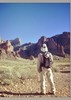
Made it to the junction with the West Baldy trail and took a side trip up to the accessible summit. The views were great, but there was some haze in the air which limited visibility.

From the summit I started down and once I got to the shallower grade in the last 4 - 5 miles I hauled a** to the trailhead. I was feeling great and making great time so, stupid me, thought that the last 7 miles would be a fast walk back into town. I should have known better as the West Fork trail was a nightmare.

Once I found the West Fork trail I was treated to 4 miles of rutted and muddy terrain with nearly zero redeeming qualities. I'm guessing that without the mud it would have been more enjoyable, but in its current state I was really regretting my decision to take this trail. Fortunately the last 2 miles were through a beautifully forested area which almost made up for the prior pain.

Once at the trailhead I was ready for my day to be over, but I still had a 1.75 mile road walk through Greer to get to my truck. What energy I had left was sapped out of me by that walk. Unfortunately, it was a Sunday afternoon and the restaurants I passed were all either closed or not serving. I had been looking forward to a celebratory piece of pie, but that wasn't meant to be.
While quite different than my original plan of a leisurely stroll through the area I think that the fast approach that I took was more appropriate. The overall area is beautiful, but the beauty is punctuated by burned areas and, in the case of this trip, a lot of mud. I imagine that I would have gotten rather bored and frustrated if I had spread it out over any more days. In the future I may make another trip to focus more on the Mount Baldy Wilderness and unburned sections of Burro Mountain but I think I've had my fill of the area SW of Big Lake.

water 1 out of 5water 2 out of 5water 3 out of 5water less than max Buckshot Spring Gallon per minute Gallon per minute
This may have been the highlight of my day. Clean and clear flow out of the pipe.

water 1 out of 5water 2 out of 5water 3 out of 5water less than max Burro Creek Medium flow Medium flow

water 1 out of 5water 2 out of 5water 3 out of 5water less than max Clear Cut Spring Gallon per minute Gallon per minute

water 1 out of 5water 2 out of 5water 3 out of 5water less than max Deadman Spring Gallon per minute Gallon per minute
Hard to tell actual flow, but there was a lot of water in the pool. Film of what was likely and algae bloom on top so gathered drinking water from the spring a 1/2 mile south on the road.

water 1 out of 5water 2 out of 5water 3 out of 5water 4 out of 5 East Fork Little Colorado River Heavy flow Heavy flow

water 1 out of 5water 2 out of 5water 3 out of 5water less than max Government Spring Gallon per minute Gallon per minute

water 1 out of 5water 2 out of 5water 3 out of 5water 4 out of 5 Mount Baldy Spring Gallon + per minute Gallon + per minute

water 1 out of 5water 2 out of 5water 3 out of 5water 4 out of 5 Neck Tank 76-100% full 76-100% full

water 1 out of 5water 2 out of 5water less than maxwater less than max Potatoe Hollow Spring Quart per minute Quart per minute

water 1 out of 5water 2 out of 5water 3 out of 5water 4 out of 5 Trail Spring Gallon + per minute Gallon + per minute

water 1 out of 5water 2 out of 5water 3 out of 5water 4 out of 5 Trail Spring Tank 76-100% full 76-100% full

water 1 out of 5water 2 out of 5water 3 out of 5water less than max West Fork LCR - Upper Tributary Medium flow Medium flow

water 1 out of 5water 2 out of 5water 3 out of 5water 4 out of 5 West Fork Little Colorado River Heavy flow Heavy flow
 
Jun 03 2021
avatar

 Photos 1,217
 Triplogs 206

68 male
 Joined Aug 04 2006
 Mesa, AZ
West Fork Trail #628 - Black RiverAlpine, AZ
Alpine, AZ
Hiking avatar Jun 03 2021
hikemonkTriplogs 206
Hiking4.70 Miles 636 AEG
Hiking4.70 Miles
636 ft AEG12 LBS Pack
 no routes
Linked   none no linked trail guides
Partners none no partners
_____________________
 
Sep 04 2020
avatar

 Guides 2
 Routes 25
 Photos 1,890
 Triplogs 604

41 male
 Joined Sep 13 2009
 Mesa, AZ
West Fork Trail #628 - Black RiverAlpine, AZ
Alpine, AZ
Hiking avatar Sep 04 2020
jochalTriplogs 604
Hiking4.80 Miles 550 AEG
Hiking4.80 Miles
550 ft AEG
 no routesno photosets
1st trip
Linked   none no linked trail guides
Partners none no partners
Hiked in, waded around a bit, had lunch, and hiked out.

Surprisingly few people for a friday before a holiday weekend--I guess everyone is over on Thompson trail? Had the river to ourselves for quite a while, and only saw two other groups the whole time.

Sunny and pretty warm.

Still a beautiful hike, despite all the fire damage.
_____________________
 
Sep 02 2020
avatar

 Routes 144
 Photos 1,145
 Triplogs 1,238

77 male
 Joined Sep 09 2004
 Scottsdale, AZ
West Fork Trail #628 - Black RiverAlpine, AZ
Alpine, AZ
Hiking avatar Sep 02 2020
Sun_RayTriplogs 1,238
Hiking4.60 Miles 561 AEG
Hiking4.60 Miles   2 Hrs   27 Mns   2.09 mph
561 ft AEG      15 Mns Break
 
1st trip
Linked   none no linked trail guides
Partners none no partners
Route Scout Route Recorded  on Route Scout | Pop | Map | Popup | MapDEX
This is the second time we have visited Greer in the last 2 months. We found a reasonable priced cabin that allows dogs. The routine has fallen into hike in the morning (not to early) followed by near by fishing. @outdoor_ lover had posted this hike recently so we checked it out. For the last 5 years or so I’ve limited my hikes to 8000 feet or less. Last time we where in the Greer area I felt fine. This hike was in the 8900 range and while i was slow with baby steps when going up hill I did OK.

Kai has been doing only a mile a day for the last 2 months because of the heat so we cut the hike short. When we could see and hear the river we turned around. At this point it was clear it was all down hill to the river. While it was probably only 69-72* Kai was beginning to run ahead and stopping in the limited shade.

NO other hikers on the trail! Stopped at Big Lake after the hike and Judy landed a 14 inch rainbow!! Her record trout catch.
wildflower observationwildflower observationwildflower observationwildflower observationwildflower observation
Wildflowers Observation Isolated
_____________________
Brian
Monday, Tuesday, Wednesday, Thursday, Friday, Saturday......there is no SOMEDAY!
  3 archives
Aug 26 2020
avatar

 Guides 7
 Routes 72
 Photos 14,456
 Triplogs 627

62 female
 Joined Aug 19 2011
 Scottsdale, AZ
West Fork Trail #628 - Black RiverAlpine, AZ
Alpine, AZ
Hiking avatar Aug 26 2020
outdoor_loverTriplogs 627
Hiking5.00 Miles 600 AEG
Hiking5.00 Miles
600 ft AEG
 
1st trip
Linked   none no linked trail guides
Partners none no partners
Day 3 of the White Mountains. This sounded like an interesting hike and I made a plan to do it and tie in a Black River Loop too. [ Black River 628A - 630 Loop ] Well, the original West Fork Trail was in good shape even though the FS stated that it was unmaintained. Only 1 deadfall on the whole stretch. As far as the loop went, I gave up on finding a clockwise Trail after about 15 minutes of bushwacking. The skies were darkening, so I returned back to the TH with just a few minutes to spare before the rain hit.

The Meadow is going to be really nice someday with all the Aspen coming in. I imagine in a good Wildflower year, it's probably pretty sweet. Just not this year. Saw 2 Coyotes and a few birds. Some of the trail is still through some nice forest. There are definitely some unnamed Springs down towards the bottom, by the river. Met a crazy mountain biker that made it all the way down. Some of that Trail would be nuts on a bike, but he did it. Met more people going back out, I think some of them probably got a bit wet with their later starts.

It was a good trek and I might return in a good wildflower year.
 Flora
 Flora [ checklist ]
[ checklist ]  Harebell
wildflower observationwildflower observationwildflower observationwildflower observationwildflower observation
Wildflowers Observation Light
_____________________
Life is not a journey to the grave with the intention of arriving safely in a pretty & well preserved body, but rather to skid in broadside, totally worn out & proclaiming, "Wow What a Ride!"
 
Oct 06 2019
avatar

 Guides 99
 Routes 1,484
 Photos 16,072
 Triplogs 1,374

male
 Joined Jan 07 2017
 Fountain Hills,
Thompson Trail #629Alpine, AZ
Alpine, AZ
Hiking avatar Oct 06 2019
DixieFlyerTriplogs 1,374
Hiking10.10 Miles 1,006 AEG
Hiking10.10 Miles   3 Hrs   56 Mns   3.19 mph
1,006 ft AEG      46 Mns Break
 
Linked   linked  
Partners none no partners
This is an easy and scenic hike, and I decided to do this hike again before heading back to the VOS.

It was a cold start to the hike: at 7:00 AM my car registered 22 degrees and someone who I was with had 16 degrees. It warmed up fairly fast though -- by mid morning I would have been ok wearing a t-shirt and shorts.

The water flow in the West Fork of the Black River was much less than what it was when I did this hike back in June. That made the hike a bit less interesting, but we were able to cross the river at Deadman Crossing without getting our feet wet.

We started the hike at the Thompson Trail TH, and took the Thompson Trail for about 2.5 miles to Deadman Crossing; then walked across the West Fork of the Black River on a couple of logs; and then followed the West Fork Trail for about 2.5 miles to the West Fork TH; then we reversed course and went back to the starting point. The Thompson Trail goes alongside the river and is relatively flat. There is a bit of elevation gain on the West Fork Trail, but not too much.

There were quite a few yellow aspen leaves, but in another week the explosion of yellow aspens will be much better.

We saw a few deer on the West Fork Trail near Neck Tank, and on the way back we saw a tarantula on the trail.
 Fauna
 Fauna [ checklist ]
[ checklist ]  Tarantula
foliage observationfoliage observationfoliage observationfoliage observationfoliage observation
Autumn Foliage Observation Moderate
There were quite a few yellow aspen leaves for your viewing pleasure; however, in another week there will be even more
_____________________
Civilization is a nice place to visit but I wouldn't want to live there
  1 archive
Sep 03 2019
avatar

 Photos 1,217
 Triplogs 206

68 male
 Joined Aug 04 2006
 Mesa, AZ
West Fork Trail #628 - Black RiverAlpine, AZ
Alpine, AZ
Hiking avatar Sep 03 2019
hikemonkTriplogs 206
Hiking4.70 Miles 636 AEG
Hiking4.70 Miles
636 ft AEG12 LBS Pack
 no routes
Linked   none no linked trail guides
Partners none no partners
_____________________
 
Jun 05 2019
avatar

 Guides 99
 Routes 1,484
 Photos 16,072
 Triplogs 1,374

male
 Joined Jan 07 2017
 Fountain Hills,
Thompson Trail #629Alpine, AZ
Alpine, AZ
Hiking avatar Jun 05 2019
DixieFlyerTriplogs 1,374
Hiking11.10 Miles 1,206 AEG
Hiking11.10 Miles   4 Hrs   47 Mns   2.88 mph
1,206 ft AEG      56 Mns Break
 
Partners none no partners
I had hiked on the West Baldy Trail 0n June 4, and was looking for a hike to do before heading back to the VOS. The Thompson Trail has been on my radar screen for a while, so we decided to hike the Thompson Trail and the West Fork Black River Trail.

What a delightful hike this one turned out to be! I like mountain streams and alpine meadows, and this one has both!

The Thompson Trail is definitely a 5 star trail! It never strays far from the West Fork of the Black River. Along the way there are 2 large rock barriers in the river known as gabions. These are designed to protect Apache Trout (which are one of 2 species of trout native to Arizona) by keeping non-native trout from swimming upstream.

We hiked for 2.7 miles on the trail, and then got our feet wet and crossed the river at Deadman Crossing (the water was about half way up to my knees). Then we went on the West Fork Trail for 2.3 miles to the West Fork TH. This was an enjoyable trail also, although you can see some of the effects of the Wallow Fire in 2011. Fortunately the aspens are coming back, and there are numerous aspen trees that are 6'-15' tall.

While at Deadman Crossing, we went for a ways on the Black River 628A-630 Loop. This was a easy to follow trail for about 1/4 mile or so, and then the route went off trail. After about 1/2 mile we decided that we had seen enough of the trail and reversed course back to Deadman Crossing.

I plan to go back up to the area in the fall and do an out-and-back hike on the Thompson Trail and West Fork Black River Trail -- it should be about 10 miles with 1,000' of AEG, so it is not a difficult hike. It should be a nice hike if we time it right to see the aspen leaves turning.

Here are a couple of videos showing the West Fork of the Black River:
[ youtube video ]
[ youtube video ]

To get to the trailhead, we took FR 116 off of 273, and this forest road is easily the best forest road that I have ever driven on. In fact, it is better than many paved roads.
wildflower observationwildflower observationwildflower observationwildflower observationwildflower observation
Wildflowers Observation Moderate
_____________________
Civilization is a nice place to visit but I wouldn't want to live there
 
May 15 2017
avatar

 Guides 93
 Routes 397
 Photos 4,984
 Triplogs 4,124

49 male
 Joined Jun 20 2003
 Tucson, AZ
West Fork Trail #628 - Black RiverAlpine, AZ
Alpine, AZ
Hiking avatar May 15 2017
fricknaleyTriplogs 4,124
Hiking4.87 Miles 643 AEG
Hiking4.87 Miles   2 Hrs   57 Mns   1.95 mph
643 ft AEG      27 Mns Break
 
1st trip
Linked   none no linked trail guides
Partners none no partners
made the gorgeous drive out to check this hike out. it was cool, in the mid/low 50's and pretty windy. lot of burn damage. the last leg before heading down the canyon to the river is in better shape and very nice. the river is awesome and we spent a good time chilling and having a picnic. warmed up a touch on the way back.

i'm sure this was just spectacular before the fire. lot rougher now
_____________________
hi
 
Aug 01 2015
avatar

 Guides 27
 Routes 61
 Photos 2,620
 Triplogs 700

69 male
 Joined Jan 23 2008
 Phoenix, AZ
West Fork Trail #628 - Black RiverAlpine, AZ
Alpine, AZ
Hiking avatar Aug 01 2015
AZWanderingBearTriplogs 700
Hiking5.10 Miles 565 AEG
Hiking5.10 Miles
565 ft AEG
 
no photosets
1st trip
Linked   none no linked trail guides
Partners partners
AZBeaver
tibber
trekkin_gecko
After hiking the Thompson Trail, we took a lunch break at Big Lake. Did you know that all roads in the White Mountains lead to Big Lake? Neither did I. We watched people paddle and others attempt to lure fish onto their hooks while we munched. Kelly scanned the building thunder boomers as we contemplated our choices for the afternoon. The forecast was 80% chance of afternoon thunderstorms. We decided on the West Fork #628 trail which would take us back to the terminus of the morning’s Thompson hike.

A quick drive took us to the trailhead. The sky was getting darker. After a quarter mile we heard thunder rolling in the not too far distance. We stopped and held council, our first of many for this trip. The collective judgement was to retreat to the truck and see what was going to happen with the weather. Wet hiking isn’t that bad, but no one wanted to risk any being out during any lightening.

After a half hour or so, the darker clouds had gone either east or west of us. We weren’t home free, but thought it safe enough to venture farther down the trail and reassess the situation. We set a system of hiking to a reference point, holding a council, and moving on. While this hike is sort of so-so in my opinion, the four of us bonded pretty well in our decision making process, never a bad thing.

Footing on this trail is pretty good. Many of the burned areas now have burgeoning groves of young aspen. The descent and climb out of the Black River canyon is fairly mild and the prettiest part of the hike. It was fun to drop back down to the end of the Thompson Trail and see that pretty area from the other side of the river. We celebrated quickly and headed back to the truck still looking over our shoulders at the threatening sky.

Once back at the trailhead, it was obvious that heavy rain had fallen there while we were on the trail, yet not a drop had found us. The drive back to the cabin was uneventful and the evening was light and fun with good food and great company.
wildflower observationwildflower observationwildflower observationwildflower observationwildflower observation
Wildflowers Observation Isolated

water 1 out of 5water 2 out of 5water less than maxwater less than max Neck Tank 26-50% full 26-50% full
_____________________
All you have is your fire...
And the place you need to reach
  2 archives
Aug 01 2015
avatar

 Guides 10
 Routes 673
 Photos 7,281
 Triplogs 4,660

67 female
 Joined Nov 17 2008
 phoenix, az
West Fork Trail #628 - Black RiverAlpine, AZ
Alpine, AZ
Hiking avatar Aug 01 2015
trekkin_geckoTriplogs 4,660
Hiking5.00 Miles 591 AEG
Hiking5.00 Miles
591 ft AEG
 no routes
1st trip
Linked   none no linked trail guides
Partners partners
AZBeaver
AZWanderingBear
tibber
second hike of the day after some lunch by big lake
nice to have some options in the same area
indian springs was under consideration, too
skies had clouded up quite a bit and we heard some thunder
made one false start, and stats include that half mile
headed through forest, some burned
passed by two meadows and reached the canyon edge
had several conversations about the weather along the way
decided to go for it, and dropped down into the canyon
reached the point across from where we had stopped at the end of the thompson trail earlier
didn't spend much time there due to threat of rain
hiked up and out and made it back with just a few sprinkles
nice trail, and fun to see how things connect
turns out it had rained quite a bit on indian springs trail, so we were happy with our choice
 Culture
 Culture [ checklist ]
[ checklist ]  Cairn
_____________________
hazhole
 
Aug 01 2015
avatar

 Guides 21
 Routes 1,182
 Photos 36,858
 Triplogs 1,570

69 female
 Joined Feb 26 2004
 Phoenix, AZ
West Fork Trail #628 - Black RiverAlpine, AZ
Alpine, AZ
Hiking avatar Aug 01 2015
tibberTriplogs 1,570
Hiking5.10 Miles 565 AEG
Hiking5.10 Miles
565 ft AEG
 no routes
1st trip
Linked   none no linked trail guides
Partners partners
AZBeaver
AZWanderingBear
trekkin_gecko
after having lunch at Big Lake, we discussed hiking Indian Springs or another trail. We decided we didn't want to do a lot of mileage as Mary Jo wanted to have some energy left to cook our dinner so after reviewing the map for West Fork, that's what we opted to do. In retrospect, I think Mary Jo was saving up for the Baldy assault. ;) The weather continued to be "iffy" but we geared up and headed out with bouts of thunder rumbling from time to time. We got to the open area and pow-wowed, observed the weather around us and decided to go back to the vehicle for 15-20 minutes. Just before we got back to the vehicle it started sprinkling. It was short-lived and after a few more minutes, we decided to try it again.

It's not the most beautiful hike; especially thru the area that seems to have been hit the hardest from the fire and looks like they maybe did some log clearing? We did walk thru a couple lanes with small aspens growing on each side before hitting the Neck Tank drainage. We encountered a couple hikers here who said they enjoyed the hike. They said they got hit with the weather over on Baldy the previous day. Anyway, we discussed the mileage on the sign vs what we had estimated and per usual for today, the sign was wrong as it is only 1.6 miles or so to the River from Neck Tank. The forest sign for Thompson Trail lists the hike as 3.5 to the River and it is only 2.5. I have determined that in this area, the forest service must be relying on Garmin :roll: .

Anyway, we hiked on through the forest. There were still some big aspen standing and a couple green areas and a fern section until we made our way to above the creek. And after another brief pow-wow, we headed on down knowing that it would be a bit of a climb back up. However, the dreaded climb back was not nearly as bad as we thot since the trail is laid out so nicely. You cross over this big scree drainage area and you can hear the water running under the rocks; it's the weirdest sound. Gradually the trail switches back for the final leg down to the River. It was great fun to be at the bottom across from where we were only a few hours earlier. The river is quite wide through here. And right now it's running high and fast. We didn't linger long before heading right back up again. I grabbed my trekking poles.

No one was taking many photos and there were quite a few wildflowers so I obliged :D and took a few extra as well as filming some video. It didn't seem to take very long to get to the top, walk thru different layers of the forest and back to Neck Tank and out into the open area before arriving back at the car.

​On the way back home we stopped at a Scenic Viewpoint. It was scenic looking over the wide expanse in front of you. Kelly and Mary Jo also picked up some trash; always trying to build that karma. On the way home we stopped at Western Drug in Springerville. Once back at the cabin, Mary Jo made us chili and fresh cornbread; might tasty!

Video of the hike to the River and the SR261 Viewpoint: https://youtu.be/iX9BM...
 Named place
 Named place [ checklist ]
[ checklist ]  Greens Peak
 Meteorology
 Meteorology [ checklist ]
[ checklist ]  Fire Burn Area & Recovery
wildflower observationwildflower observationwildflower observationwildflower observationwildflower observation
Wildflowers Observation Isolated
_____________________
For me, sometimes it's just as much about the journey as the destination.
Oh, and once in awhile, don't forget to look back at the trail you've traveled.
 
Jul 28 2013
avatar

 Guides 107
 Routes 249
 Photos 2,067
 Triplogs 514

male
 Joined Nov 18 2005
 Phoenix, AZ
Indian Springs Trail #627Alpine, AZ
Alpine, AZ
Hiking avatar Jul 28 2013
nonotTriplogs 514
Hiking13.60 Miles 2,600 AEG
Hiking13.60 Miles   5 Hrs   55 Mns   2.63 mph
2,600 ft AEG      45 Mns Break20 LBS Pack
 
no photosets
1st trip
Linked   linked  
Partners none no partners
This trail must have been really nice before the fire. Currently, most portions more than a mile from the trailhead in either direction have been burned. They are keeping up trail maintenance, however. Combined with the West Fork Trail, this made for a nice dayhike, with just a little bit of summer rain.

The West Fork of Black River was swollen with monsoon rains and would be difficult to cross. It was about my turnaround time, so I headed back.
wildflower observationwildflower observationwildflower observationwildflower observationwildflower observation
Wildflowers Observation Moderate

water 1 out of 5water 2 out of 5water 3 out of 5water 4 out of 5 Indian Spring Gallon + per minute Gallon + per minute

water 1 out of 5water 2 out of 5water 3 out of 5water 4 out of 5 Reservoir Tank 76-100% full 76-100% full

water 1 out of 5water 2 out of 5water 3 out of 5water 4 out of 5 Spillman Spring Gallon + per minute Gallon + per minute
_____________________
http://hikearizona.com/garmin_maps.php

Hike Arizona it is full of sharp, pointy, ankle-twisting, HAZmaster crushing ROCKS!!
Hike Arizona it is full of sharp, pointy, shin-stabbing, skin-shredding plants!
Hike Arizona it is full of striking, biting, stabbing, venomous wildlife!
 
average hiking speed 2.52 mph
1, 2, 3  Next

WARNING! Hiking and outdoor related sports can be dangerous. Be responsible and prepare for the trip. Study the area you are entering and plan accordingly. Dress for the current and unexpected weather changes. Take plenty of water. Never go alone. Make an itinerary with your plan(s), route(s), destination(s) and expected return time. Give your itinerary to trusted family and/or friends.

helpcommentissue

end of page marker