|
| | | |
| |
|
| Hiking | 11.79 Miles |
2,147 AEG |
| | Hiking | 11.79 Miles | 9 Hrs 10 Mns | | 1.52 mph |
| 2,147 ft AEG | 1 Hour 26 Mns Break | | | |
|
|
| |
| Partners |
|
none
[ show ]
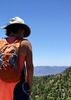
| no partners | | It's WCC season, and we decided to hit up this access point on the north side.
The drive in was fine to the "message board" trailhead for any medium clearance vehicle. Saw a few high clearance 4x4s that ventured all the way down to the Maxwell TH. There are several gnarly rocky sections that would be problematic for lower/mid-clearance vehicles. And getting to the Tramway TH proper is probably just for SxSs and ATVs.
We were content to start from the message board (as the HAZ route suggests) and headed to Tramway first. The road walk is a bit blah, but passed quickly. Notably there is one point at which the trail veers off to the left on a less established track and initially we kept walking down the main road before recognizing our error.
Once at the rim, the descent is quick and steep. But the trail is relatively well defined. At one point, there is a short, semi exposed scramble, but I believe there is a non-exposed work around that we just bypassed.
Once at the creek, the magic begins, with a large pool right at the base across from the prime camping spot. A mother duck and about 10 ducklings were out for a morning constitutional.
We blew up our tubes and began trekking upstream. We considered exploring more downstream, and perhaps will try that next time.
On the way up towards Maxwell, we stopped to admire the impressive petroglyph panel, though it's been marred by more careless recent travelers. There is a camp spot nearby, which no doubt has contributed to the panel deterioration.
Just below the Maxwell junction, we encountered our first company--a couple and a larger group who were on an out and back on Maxwell. A nice campsite is also in this area.
We decided to explore further upstream around the confluence with Wilson Canyon, and were glad we did. Up Wilson are some of the longest and most impressive pools, one of which was around 150 yards long. We also briefly explored up Clover Canyon, which offered a lovely, and crystal-clear turquoise pool with some decent sized fish.
On the way back to Maxwell, we thought we had passed all the swimmers, so deflated our tubes, only to come across a swimmer that we had forgotten about 2 minutes later.  So, it took us awhile longer than it should have to navigate. All good though. So, it took us awhile longer than it should have to navigate. All good though.
The climb out Maxwell was the work of the day, but not too bad. Near the top I made a mental note of a great rappelling spot that would allow repeat access to the top, and would not necessitate bringing ropes up from the bottom.
Great and large open camping area on top at the Maxwell TH.
The road walk back from Maxwell was a little more scenic/foresty.
On the way out, we decided to hit up Wilson Crossing as well. See separate triplog. |
| _____________________
| | |
|
|
|
 Route Editor