 Route Editor

| Guide | ♦ | 223 Triplogs | 5 Topics |
details | drive | permit | forecast | 🔥 route |
stats |
photos | triplogs | topics | location |
| 1.5k | 223 | 5 |
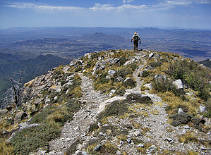
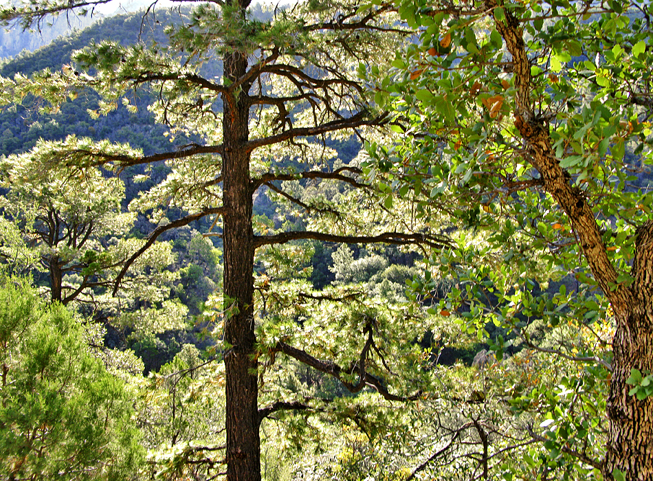
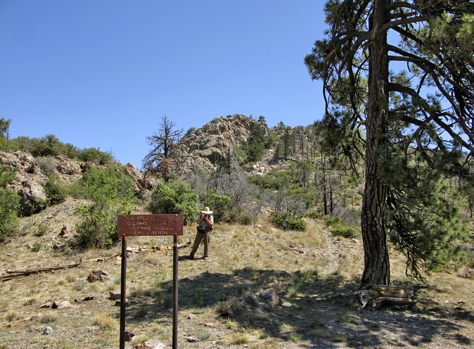
Wright On! by joebartels   Overview OverviewThis figure eight loop combines Old Baldy Trail up to the peak then follows the Super Trail #134 back down. Predominant vegetation consist of oaks, madrone, walnuts, pines and even a few sycamores. 2.3mi up to Josephine Saddle Up slope from the restrooms the trail takes off easy and wide. Soon comes a junction with the Vault Mine Trail, proceed left on Old Baldy. About 1,700 feet up Josephine Saddle is reached at 2.3 miles / 7,100ft. This junction intercepts six paths.
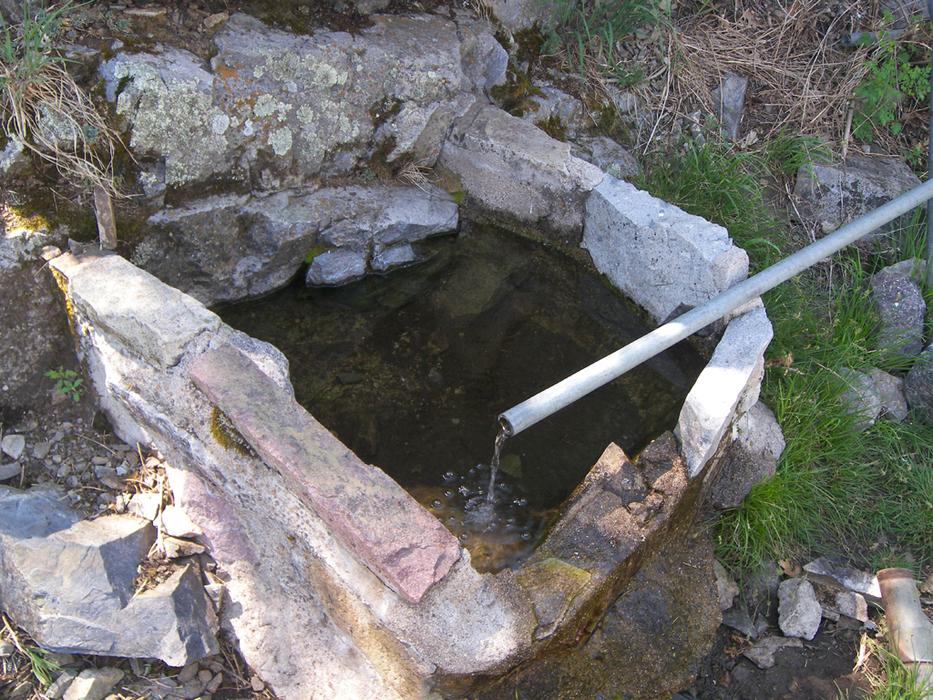
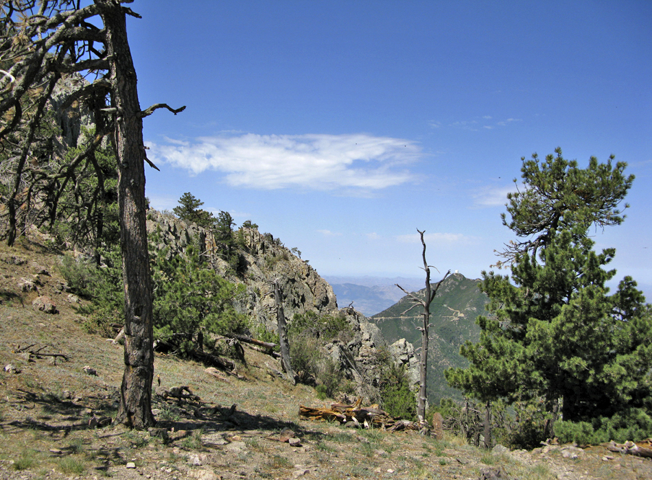
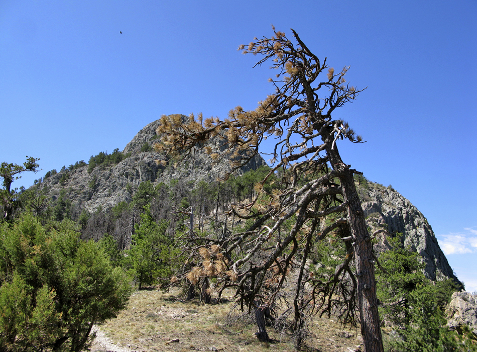
The Super Trail and Old Baldy continue together for less than a quarter mile. Old Baldy continues to the left. Here the vegetation starts to turn. Beautiful pines fill the slope. 1.2mi from Josephine Saddle or 0.6mi before reaching Baldy Saddle you pass Bellow Springs. Soon followed by nearly a dozen tight switchbacks up to the saddle. Views on the saddle open up. 0.9mi up to peak From here it's 0.9mi on the Crest Trail to the peak. The footing gets a little rocky on route. Wide views open up on Mount Wrightson (noted as "Baldy 2" on topo). 0.8mi down to Super Trail Retrace your steps back down. 0.1mi before reaching the saddle, take a right at the signed junction onto the Super Trail. For some odd reason, the signage doesn't mention "Super Trail." 1.5mi to Riley Saddle Here you enter the torched forest skirting the eastern flank over to Riley Saddle. Fortunately, the views are top-notch. To the east-northeast, French Joe Peak hides Benson. To the east-southeast lies Sierra Vista with the Huachucas fanning south. In the far far east horizon lies the Chiricahuas. Continue over a couple of sections of firm scree. Our group debated this may be old mine tailings. Getting closer to Riley Saddle, the brush closes in. It's not a bushwhack yet but could be in future years. From the saddle, I'm sure some go off-trail 0.55mi to Josephine Peak. 1.7mi to Josephine Saddle Views turn to the southern wilderness and the opposing ridge (directly west), Tia Juana Ridge coming down from Mt Hopkins. The pines make a comeback the closer you get to Josephine Saddle. However, the lack of shade over the past four to five miles begins to take its toll. Smiles curl as the towering pines greet you on the lazy switchbacks. 3.4mi to parking Carefully select the proper signed path for the Super Trail #134. Sprung Spring is immediately passed. This hike kicks into overdrive, pampering you down. Albeit slightly sun-exposed, every twist and turn continues to provide exceptional views. The best views of the peak are over your shoulder. McCleary Peak to the northeast practically begs a future visit. Huge and healthy sycamores greet you at the creek. Within a half-hour, you arrive back to the parking lot. Note Data is derived from a combination of GPS and topo map routing.
Coronado FS Details Old Baldy is the shortest and steepest, while the Super Trail is longer but has a more moderate gradient, but both of these trails lead to the 9,543-foot summit of Mt. Wrightson, the highest peak in the Santa Ritas. The trails form a figure eight making it possible to put together a number of different loops using different portions of each. Old Baldy is the most heavily traveled and also remains the coolest of the two by keeping a more northerly aspect and staying in the trees for almost its entire length. The Super Trail stays within the same drainage as its steeper cousin on the lower loop of the “8”, but it follows a more south-facing slope through a high desert environment. Above the midpoint of the “8” at Josephine Saddle, the Super Trail loops around the south side of the mountain through even more arid country, while Old Baldy switchbacks through thickets of New Mexico locust on a west-facing slope to Baldy Saddle. The last mile to the summit of Mt. Wrightson via the Crest Trail #144 is the same no matter which trail you’ve followed to the saddle. The views from the summit are, to say the least, breathtaking. The Santa Catalinas near Tucson, Mt. Graham to the east, and the high peaks of the Huachucas to the southeast combine with sweeping views of the Santa Cruz and San Pedro valleys to form a 360° panorama. Actually, you don’t even have to go all the way to the top to enjoy great views. Many of these landmarks are visible from dozens of overlooks along both trails. And while you’re at it, remember that all that’s worth seeing here is not in the distance. The birdwatchers heaven that exists in Madera Canyon extends up the mountain into this area where, in addition to the birds, you have a chance to see Coues white-tailed deer, black bear and even mountain lion. The trails also boast an impressive potpourri of tree species characteristic of southeastern Arizona including Arizon Check out the Official Route and Triplogs. Note This is a moderately difficult hike. Leave No Trace and +Add a Triplog after your hike to support this local community. | |||||||||||||||||||||||||||||||||||||||||||||||||||||||||||||||||||||||||||||||||||||||||||||||||||||||||||||||||||||||||||||||||||||||||||||||||||||||||||||||||||||||||||||||||||||||||||||||||||||||||||||||||||||


