| | -
-
| 1 label |  |
|
2 |
-
| 1 label |  |
|
2 |
-
-
| 1 label | 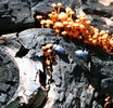 |
|
4 |
-
-
-
-
| 1 label | 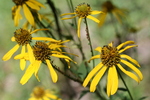 |
|
|
-
-
-
-
| 1 label |  |
|
1 |
-
| 1 label |  |
|
|
-
|
| | |
|
| Hiking | 2.00 Miles |
4,218 AEG |
| | Hiking | 2.00 Miles | 1 Hour | | 2.00 mph |
| 4,218 ft AEG | | | | |
|
|
| |
| Linked |
|
none
[ show ]
| no linked trail guides |
| Partners |
|
none
[ show ]
| no partners | | A preliminary "scouting mission" planning a complete shuttle hike in the near future. I've learned the location of a cliff dwelling along this route and plan to explore these ruins...
Explored the west TH off of FR487 with my daughter Hannah as part of a hike up Aztec Peak. We've previously explored the east TH near Leisure Canyon off of FR203 in Cherry Creek valley. Reference the Sierra Ancha Wilderness map online at the following link;
http://www.fs.fed.us/r3/tonto/wildernes ... erra_A.htm
Logistics for this future hike may prove "challenging". Although the Tonto National Forest Service lists this hike as being 9.5 miles long, there is an additional 3.5 miles to be navigated along FR487 to the road closure barricade. Also to be considered is the shuttle distance the vehicles will have to negotiate between trail heads.
FR487 vehicle travel = 2.5 miles
Hwy 288 vehicle travel = 18 miles
FR203 vehicle travel = 18 miles
TOTAL SHUTTLE DISTANCE = 38.5 miles
Suspect this shuttle distance will take at least 2 hours to navigate between trail heads. Would like to hear from anyone who has recently completed this shuttle hike! |
| _____________________
| | |
|
|
|
|
|
| |
 Route Editor


