username
X
password
register
for free!
help
ArticlesGuidesRoutes
 
Photosets
 
 Comments
triplogs   photosets   labels comments more
Badwater Trail - 9 members in 15 triplogs have rated this an average 3.2 ( 1 to 5 best )
15 triplogs
login for filter options
Feb 19 2023
avatar

 Guides 10
 Routes 673
 Photos 7,281
 Triplogs 4,660

67 female
 Joined Nov 17 2008
 phoenix, az
Death Valley - Badwater Road, CA 
Death Valley - Badwater Road, CA
 
Hiking avatar Feb 19 2023
trekkin_geckoTriplogs 4,660
Hiking9.84 Miles 2,337 AEG
Hiking9.84 Miles
2,337 ft AEG
 no routes
1st trip
Partners partners
johnlp
The_Eagle
up around 0600 as it was just getting light
coffee and breakfast, of course
nice seeing the sun gradually light up the mountains from our valley campsite
we got going around 0800 with a stop at ashford mill ruins
our first hike was sidewinder canyon
we went all the way to where the canyon opened up about 2.5 miles in
then explored several side slot canyons on the return
the hike description has three, but we counted at least five
we went up five, four and two and the return - three was very short and not as interesting
all of the slots featured narrow passages and scrambling - fun :)
two had more climbing with a top out overlooking the basin
we didn't get to the first one
our recommendation would be to hit that one, then the last two and return from there
estimating our mileage at six since my track bounced around
had lunch in the parking lot
next stop was badwater trail with 1000 of our closest friends
the lowest point in the usa is right at the trailhead
a flat walk out on the salt flats with views of the mountains to the east and west
this was a fun stroll even with all the people
we did get past the crowds for a few photos
finished the day with the natural bridge trail
another gravel uphill to an arch
we went past the arch to a dryfall
that section was more scenic and less crowded
camped this time off trail canyon road
rougher road, rocky terrain, weird shenanigans from the neighbors all night
a bit warmer and good star gazing
_____________________
hazhole
  2 archives
Feb 19 2023
avatar

 Guides 41
 Routes 1,626
 Photos 14,983
 Triplogs 2,760

69 male
 Joined Jan 20 2009
 Far NE Phoenix,
Death Valley - Day 2, CA 
Death Valley - Day 2, CA
 
Hiking avatar Feb 19 2023
The_EagleTriplogs 2,760
Hiking11.08 Miles 3,100 AEG
Hiking11.08 Miles   5 Hrs   40 Mns   2.22 mph
3,100 ft AEG      41 Mns Break12 LBS Pack
 
1st trip
Partners partners
johnlp
trekkin_gecko
Route Scout Route Recorded  on Route Scout | Pop | Map | Popup | MapDEX
Day 2 of a planned 7 days.

Split Cinder Cones
.56 Miles
298 AEG

After a cool morning I hiked over to a nearby feature called Split Cinder Cones to warm up.
It fit the bill before packing up.

Ashford Mill Ruins.
We checked out the ruins for a bit before heading our.

Sidewinder Canyon
6.71 Miles
2015 AEG

We hiked to the end of the canyon before hitting the side canyons on the way back.
There are 5 total side canyons that veer off to the South. 5, 4 and 2 are worthy side trips with extraordinarily tight, scenic, fun slots. 3 was a bust, do not waste your time. 1 we did not go into but heard it is also worth the price of admission. Slot 2 has the extra added feature of taking you out of the slot and to the top to get an overview of the canyon. 4 of these 5 slots are a don't miss when you are in Death Valley. Try to do it early before the crowds arive.

Badwater Basin.
2.25 miles
363 AEG.

This on is quite interesting seeing the bright white salt flat contrasting with the dark mountains snowcapped also in white. You can make this one as long or short as you want. IMHO this one is fun to hit mid-day WHEN the crowds are there. A fun one to people watch on. Probably the most popular one in the park. We're guestimating we saw a thousand people on this one. This one is also recommended.
[ youtube video ]

Natural Bridge Trail
1.57 Miles
452 AEG

Another good one to hit when in the area. The Natural Bridge is in about .4 mile. We went in farther to explore the canyon.

After this we went out to Trail Road to look for a dispersed camping spot and spend an interesting evening with the neighbors.
_____________________
There is a very fine line between "hobby" and "mental illness."
Dave Barry 🦅
  1 archive
Feb 19 2023
avatar

 Guides 1
 Routes 14
 Photos 7,202
 Triplogs 5,208

68 male
 Joined Mar 16 2008
 chandler,az
Death Valley - Badwater Road, CA 
Death Valley - Badwater Road, CA
 
Hiking avatar Feb 19 2023
johnlpTriplogs 5,208
Hiking10.50 Miles 2,737 AEG
Hiking10.50 Miles
2,737 ft AEG
 no routes
1st trip
Partners partners
The_Eagle
trekkin_gecko
Day two of our DV tour. Lots of diversity in our hikes this day. Plenty of people at Badwater & Natural Bridge as expected on a three day weekend, not so much in Sidewinder.
Sidewinder has lots of side canyons to be explored besides the main canyon. Some very slotty. Very cool.
Long fun day. :)
wildflower observationwildflower observationwildflower observationwildflower observationwildflower observation
Wildflowers Observation Isolated
_____________________
“Good people drink good beer.” Hunter S Thompson
  1 archive
Dec 29 2021
avatar

 Guides 12
 Routes 192
 Photos 863
 Triplogs 356

42 male
 Joined Nov 30 2015
 Phoenix, AZ
Death Valley meanderings, CA 
Death Valley meanderings, CA
 
Hiking avatar Dec 29 2021
ShatteredArmTriplogs 356
Hiking17.00 Miles 3,654 AEG
Hiking17.00 Miles   5 Hrs   11 Mns   3.28 mph
3,654 ft AEG
 no routes
1st trip
Had the week off, so made my way up to Death Valley. Seemed the right time of year to go. Unfortunately, the weather forecast was a little dreary, but that didn't deter me.

Telescope Peak could be seen pretty much from Mountain Springs in the Spring Mountains, but that would be the best view I got of it until the drive out.

Wednesday

Arrived from the Pahrump side, so it was convenient to visit Dante's View first thing. It wasn't completely socked in at this point, and the view of the valley was phenomenal, but still couldn't see above ~8000ft or so. Cloud ceiling eventually dropped to about 3,000 Thursday evening, so the timing worked out. Walked around just a bit, but some time in the future it might be fun to follow the trail north all the way to Mt. Perry.

Following this, drove down to Badwater Basin, where it was a bit of a zoo. Salt flat was OK I guess, not a super interesting spot, but now I can check off the lowest point in North America. Hooray!

On the way back north, I stopped at Golden Canyon and hiked in about a half mile, then scrambled up between some of the hills by the trail. This was fun, and provided a pretty good view of the canyon. I'll definitely come back to this one in the future to complete the rest of this trail system.

After lunch, I decided to go and set up camp at Mesquite Spring campground, and just spend the last couple hours of daylight relaxing, since I was anticipating rain. It pretty much started right at sunset, and continued to morning. Nothing too heavy though.

Thursday

Chilly breakdown, just basically stuffed everything in the back of my Jeep and headed up to Ubehebe Crater. This place was really bizarre and cool, and one of the highlights of the trip. Black sand everywhere, with pink sand sitting in the bowls. It was a weird landscape. Walked all the way around the crater, with a bit of jogging mixed in. Cold and drizzly, I think there were some snow flurries too. Almost all the way back around, I dipped about half way down into the crater, but decided I already caused myself enough extra work with that, and didn't go all the way to the bottom.

Next stop was Fall Canyon. By this time the rain was over, but it was still completely overcast. It didn't get really interesting until a couple miles in. Jogged most of the way down. This is a one-and-done for me; I almost would've rather walked up the Titus Canyon narrows since it was closed to vehicular traffic at the time.

Lunched in Stovepipe Wells (better than Furnace Creek actually), then headed up to Mosaic Canyon. With its yellow walls and black sand, this one is definitely a must-see.

After that, over Towne Pass in low-visibility conditions (snow on the ground starting at about 4,000 feet), then drove a little ways up the Panamint Dunes road to camp.

Friday

Set up camp and headed over to Darwin Falls for the last little meander of the trip. An oasis in the desert, with the creek flowing the last quarter mile or so. Nothing earth shattering if you've hiked along a perennial creek in AZ, but it's a big departure from any of the other trails in DV.

Left the park via the Panamint Valley, when the clouds finally started clearing just enough that I could see Telescope Peak and the Panamints in their snow-covered glory.

I'll definitely be back, this trip was really just to get a feel for the lay of the land; next time I'll have a more thorough plan.
_____________________
 
Oct 14 2019
avatar

 Guides 1
 Routes 226
 Photos 1,675
 Triplogs 1,867

65 male
 Joined Oct 17 2008
 Phoenix, AZ
Stab at L2H, CA 
Stab at L2H, CA
 
Backpack avatar Oct 14 2019
rcorfmanTriplogs 1,867
Backpack28.19 Miles 5,992 AEG
Backpack28.19 Miles2 Days         
5,992 ft AEG
 
1st trip
Partners partners
SpicedRum
The plan was to hike the Lowest to Highest route. It's about 130 miles from Badwater Basin, Death Valley to the Mount Whitney summit. Lowest to Highest, or L2H, is a route put together by @blisterfree. More information here. I've been interested in doing this for a few years, and when I noticed Spiced Rum was attempting it, I asked to tag along.

Sunday, October 13
We met at the Pannamint Springs Campground, then drove to Stove Pipe where we had dinner with a gal that works there and has hiked L2H a few times. After that, it was back to Pannamint Springs CG.

Monday, October 14
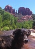
Got up early and drove to Badwater Basin. It's about a one and a half hour drive. We started the walk across the playa about 7:45 am. In the morning shadow, it looked like we were walking on a frozen lake, just not as cold. As we got farther away from the start, the surface formed the classic salt crystal pattern. Eventually, we emerged from the mountain shadow and were in the sun. Across the playa, the surface texture is constantly changing from salt crystals, to pinnacles, to mud and so on. I pointed myself towards the top of the alluvial fan originating out of Hanaupah Canyon. Eventually we reached the end of the playa and started working our way up towards the canyon.

When we reached the West Side road, near Shorty's Well, we met two hikers, Buck 30, and Steady, heading down the road on some Canada to Mexico desert route. Buck 30 hiked the L2H a few years before and the two also hiked the Mogollon Rim Trail this past spring. What serendipity!

Shortly after we started up towards Hanaupah Canyon, we merged onto the road from Shorty's Well. Here the ascent is steady but continuous. It was getting hot, so I took my hat off and opened my umbrella. On the ascent, I was outdistancing the other two so once I entered the canyon, I stopped and waited for them in a rare shady area. Eventually, they caught up and rested with me for a bit. It was almost chilly in the shade.

From there, we continued following the road into the south fork of Hanaupah Canyon. Finally, the sun was blocked from the canyon walls and it was comfortable walking. At this point the "road" was basically heading south or southwest up the canyon, but when the canyon turned west, the road mostly ended and it was the standard wash walking routine from there.

The creek was flowing a bit below Hanaupah spring which was nice. I gathered water and found a place for us to camp near where we would leave the canyon in the morning. It was after dark when the other two arrived.

Tuesday, October 15
I wasn't in a hurry to get going this morning. The day started with a steep 1600' climb up onto a ridge and I didn't want to start before it was light. Also, I knew I was the faster hiker uphill so wasn't worried about starting after the other two. They got going and I was maybe 10 minutes behind them. They went to the right of a bump and I went to the left, and when I came around it, I was pretty much even with them. I continued up and onto the ridge. It was steep and difficult working my way up the scree. I had to take several short breaks along the way. I was happy to finally get on the ridge. From there, there was still a good 4800' of climbing to go to reach the Telescope Peak trail.

I was waiting for them to reach me. I kept looking down the ridge I came up but never saw them. I waited for a half an hour and still hadn't seen them. I was getting worried since it seemed they should at least be in view by then. I wasn't prepared to go forward, because I didn't know where they had cached water earlier and didn't have enough to continue without it. I was wondering if, for some reason, they had turned back, so I decided to start back down the ridge. I figured that if they were coming up, I'd see them.

Well, they continued up and I didn't see them. I have no idea how we could have missed each other, it baffles me. When I got back to the canyon floor I got enough water to camp another night. At this point, I thought they had turned back and would camp somewhere on the way to Badwater and I hoped to catch up to them.

From this point, I was moving strong and steady out of the canyon but as I continued without seeing any trace of them, I was sure they were still going up. Shortly after I was descending the alluvial fan, I got service and called my wife, where she was able to verify they were still going up through their InReach tracker. At this point, the hike was a bust for me, I didn't have enough food to head back up, so I decided to camp down near Shorty's Well, then hike across the playa in the morning.

As I neared Shorty's Well, I noticed a truck at the road. It turns out a gal, Red Feather, was caching some water for her L2H attempt that she was going to start that evening. A friend of hers, Jeff, was shuttling her and heading to Lone Pine after dropping her off at Badwater Basin. Perfect timing, as Jeff gave me a ride back to Pannamint Springs CG.

End Notes
The next day, I was able to get in touch with Spiced Rum and his wife. She was getting nausea all day Tuesday and Wednesday and wasn't able to eat. They didn't make it up to the Telescope Peak trail until late Wednesday afternoon. I met them at the Mohogany Flats CG (Telescope Peak Trailhead) Wednesday evening. She recovered and I dropped them back off at the trailhead Thursday afternoon.

I debated continuing the hike from Pannamint Springs to Whitney with them, starting Friday morning, but at that point I really was ready to head home.
_____________________
Go find a LonelyCache
  1 archive
Aug 02 2019
avatar

 Guides 99
 Routes 1,484
 Photos 16,072
 Triplogs 1,374

male
 Joined Jan 07 2017
 Fountain Hills,
Badwater TrailDeath Valley, CA
Death Valley, CA
Scenic Drive avatar Aug 02 2019
DixieFlyerTriplogs 1,374
Scenic Drive34.00 Miles
 no routes
1st trip
Linked   none no linked trail guides
Partners none no partners
Having hiked Mount Whitney(the highest point in the continental US) the day before, on the way back to the VOS I figured that I'd stop off at Badwater Basin, the low point in the US. Actually, Badwater Basin is also the lowest point on land in the Western Hemisphere.

The trip involved a 34 mile RT detour off of Highway 190. At the parking lot there was a boardwalk that was all of about 50 yards long, so we walked to the end of the boardwalk, and continued a short distance on the salt flats. It was 110 degrees at 11:00 AM, and having done a strenuous hike the day before, we decided not to go exploring out on the salt flats on this trip.
_____________________
Civilization is a nice place to visit but I wouldn't want to live there
 
Jun 24 2019
avatar

 Guides 73
 Routes 176
 Photos 10,174
 Triplogs 2,324

46 male
 Joined Sep 08 2006
 
Badwater TrailDeath Valley, CA
Death Valley, CA
Hiking avatar Jun 24 2019
JimTriplogs 2,324
Hiking2.50 Miles
Hiking2.50 Miles   1 Hour      2.50 mph
 no routes
Linked   none no linked trail guides
Partners none no partners
Much, much hotter for this post sunset hike. Extremely windy, too. Wind, unpleasant wind, has been the theme of this trip. Still salty on the flats, so I ate some, for the pure enjoyment of it. All alone after dark which was nice. The temperature was reading 109 when passing Furnace Creek Ranch, so I drove to a windy night at emmigrant CG. 109 is just too hot to camp!

Cancelled a Charleston North Loop hike due to that wind forecast. I love that hike, but want it to be fun. Bad wind forecast all week at 10k feet. Plus, there is that GD MFing snow. :pout:
_____________________
🍭
  1 archive
Jun 22 2019
avatar

 Guides 73
 Routes 176
 Photos 10,174
 Triplogs 2,324

46 male
 Joined Sep 08 2006
 
Badwater TrailDeath Valley, CA
Death Valley, CA
Hiking avatar Jun 22 2019
JimTriplogs 2,324
Hiking1.00 Miles
Hiking1.00 Miles
 no routes
Linked   none no linked trail guides
Partners none no partners
Hot and salty. You don't say that every day.
_____________________
🍭
  1 archive
May 26 2018
avatar

 Guides 9
 Routes 33
 Photos 780
 Triplogs 4,634

44 male
 Joined Nov 25 2008
 Scottsdale, AZ
Badwater TrailDeath Valley, CA
Death Valley, CA
Hiking avatar May 26 2018
BoonemanTriplogs 4,634
Hiking1.85 Miles
Hiking1.85 Miles      40 Mns   2.78 mph
 no routes
1st trip
Linked   none no linked trail guides
Partners none no partners
The long awaited Badwater Basin. I ventured out far enough to escape the crowds and stood in awe of the vastness.
 Named place
 Named place [ checklist ]
[ checklist ]  Badwater Basin - DVNP
_____________________
 
Feb 17 2017
avatar

 Guides 27
 Routes 61
 Photos 2,620
 Triplogs 700

69 male
 Joined Jan 23 2008
 Phoenix, AZ
Man Plans God Laughs, CA 
Man Plans God Laughs, CA
 
Hiking avatar Feb 17 2017
AZWanderingBearTriplogs 700
Hiking32.00 Miles 4,300 AEG
Hiking32.00 Miles
4,300 ft AEG
 no routes
1st trip
Man Plans, God Laughs

Death Valley National Park is larger than Connecticut. Thus, a well thought out plan is required if you want to see a lot of the various offerings of the Valley without back tracking and driving even more miles. I’d tweaked my plan for several months to make maximum use of our week-long trip. And then it rained!

Friday morning we set out under cloudy skies. The day’s objective was to see a few sites along the way and overnight in Kingman. Went up through Chino Valley and stopped off at the ruins of the Puntenney Lime Kiln dating back to the late 1800s. Lime is still mined near here, well more accurately limestone. We saw a big cloud of dust a few miles before reaching the kiln. Stopped to chat with some of the quarry workers to discover they had just blasted a section of the quarry wall, but all was now clear for us to explore the area. Preservation efforts have slowed the demise of this historic kiln and we enjoyed poking around for a few minutes.

We drove onto Seligman for lunch and to begin our planned drive along old Route 66 into Kingman. Seligman is nothing if not a little odd. We’d planned on a burger at the Snow Cap, but it was closed for repairs. Westside Lilo’s proved a suitable alternative.

Route 66 winds through the countryside and history far slower than its replacement, I-40, to the south. We stopped at a few of the historic roadside establishments that had pumped gas and comic book images of the west at motorized travelers a half century ago. All had signs and t-shirts adorned with poor attempts at humor and outside was the obligatory collection of ORS (old rusty stuff).

We sped through Kingman and stayed on 66 out to Oatman, going up the very very winding shelf road that is Route 66. Oatman is famous for a couple of things. It was a semi-prosperous mining town back in the day. Clark Gable and Carole Lombard spent their wedding night there in 1939. Today, Oatman is a resurrected ghost town and there are burros, descendants of those used by the prospectors, roaming the streets. You can feed the burros from sacks of burro pellets on sale for $1 at any of the fine tourist trap establishments lining main street.

For me the most interesting part of the Oatman story is that the town is named for Olive Oatman, one of the three children who survived the 1851 Oatman Family massacre northwest of Gila Bend, AZ. Olive and her sister were taken captive by Yavapai (often mistakenly labeled Apaches in various accounts). Olive’s brother was thought dead by the raiders and tossed off the side of the mesa where the incident occurred. Olive and her sister were traded to the Mojave tribe. Olive was later ransomed by white settlers. Her sister had died of starvation along with many Mojave a few years earlier. The Mojave treated Olive well and tattooed her chin in their customary way. Olive became a minor celebrity in her time and some miners in search of a name for their new boom town settled on Oatman. Earlier this year I’d visited the Oatman Massacre site, so visiting the town of Oatman closed that loop for me.

The nice lady at the hotel desk in Kingman recommended a restaurant named Oysters. It offered Mexican fare and seafood and “very large margaritas” according to the helpful clerk. We took her advice. I mean, what could possibly go wrong with that combination? It was crowded, surprisingly good, but there wasn’t an oyster to be found on the property.

Saturday found us stopping off at Chloride, yet another ghost town. Chloride was more authentic than Oatman, as in no t-shirt shops, only more ROS and interesting yard sculptures apparently crafted by the residents. Outside of town up a very rutted trail are some murals by artist Roy Purcell. They are nothing if not unique.

We raced through Las Vegas and only stopped once we hit Beatty. We needed gas and wanted to provision up at Nevada’s largest candy store. We knew they’d have just the right snacks for Death Valley. The whole purpose behind breaking up drive to DV into 2 days was to have time to dramatically enter the Park via Titus Canyon, one of the more impressive 4x4 trails in the Park requiring several hours to complete. A quick call confirmed it was closed -- snow, mud, and a rockslide. I sensed my plan was in grave danger. We stopped off at the Rhyolite ghost town and Goldwell Open Air Art Museum, a very strange little place, under dark skies with a light but steady rain.

Our entry into the Park was instead on pavement (how boring). The skies were lifting with only a slow drizzle. We were greeted with a view of a VERY wet valley floor, standing water evident in the normally dry lake beds. We stopped off at Salt Creek to see the rare pupfish. Sort of odd that our first event in DV required driving through deep standing water, wearing rain gear, and walking along a flowing stream. We drove to Stovepipe Wells for dinner, lodging, and some adjustments to the plan. The rain stopped overnight.

Day 3 found us at the Ranger Station checking road closures. It doesn’t take much water to move a lot of mud in Death Valley. Two days of rain (snow in the higher elevations) made the list of open roads much shorter than the closed list. The people working to open the roads and the rangers apparently don’t communicate. The information was incomplete and sometimes misleading. But we slowly began to realize we were seeing something unique. Rain is rare in DV. We were getting to see the whole area change in front of us.

The day was spent on mostly touristy sights -- the old Borax Works, Badwater (282’ below sea level and crowded), hiking Natural Bridge Canyon and the Golden Canyon/Gower Gulch Loop. We did get to drive Mustard Canyon. It was fun sliding in the mud between the orange dunes. Driving back to Stovepipe Wells for the night we met a Ranger in a muddy truck coming out one of the closed roads. We stopped him and asked a few questions about destinations we hoped to still see. He’d just come from Ubehebe and the paved road to there was passable but muddy. We wanted to get to the Racetrack about 27 miles of dirt beyond Ubehebe. He said he had no idea about the road to the Racetrack. We told him we’d give him a report late tomorrow. He grinned and said good luck.

We geared up early on Day 4 and raced past the Road Closed sign headed towards the northwestern portion of the park. The drive to the Ubehebe Crater was easy and we were the only vehicle on the road. Evidence of the somewhat cleared mudflows were numerous. We bypassed Ubehebe figuring we’d hit it on the way back. We stopped long enough to air down the tires. The dirt track to the Racetrack was wet and sloppy in a few places, total washboard everywhere else. Twenty mph was top speed and that was still jaw jarring. But the scenery was great. There was one set of tracks in front of us. Someone else was out here, so we felt confident. Stopped for the obligatory photos at Tea Kettle Junction. The storm had knocked a few kettles off the sign. MJ tied them back in place and emptied rainwater out of any that needed it.

A few miles later we arrived at the Racetrack. A truck was parked on the trail. A Ranger was there to remind people not to walk or drive on the normally dry playa (lakebed). He was going to camp here for a few days to protect the playa since muddy footprints and tire tracks remain for years and years. The Ranger was the most interesting person we’d met so far in the Park. He loved the backcountry portions of the Park and was a fount of knowledge for us. While we didn’t get to walk out and see the trails of the moving rocks that makes the Racetrack such a unique site, the conversation with this guy was a decent substitute. The tracks were under a few inches of water on the south end of the playa anyway, guarded by a lone seagull standing in the muddy water. We sated ourselves by walking around the edges or the Playa and talking about next time.

Being close, we continued on to the old abandoned Lippincott Mine. The drive up was rough and fun. The mine site offered great views back towards the Racetrack and west into Saline Valley. I noticed 4 vehicles below us slowly making their way through the pass on Lippincott Road. We bumped into them a little while later and had a nice conversation. Was a group of 4 young men doing a few days of offroading in the northwestern portion of the Park.

After a bumpy ride back out, we stopped off at the Ubehebe Crater. MJ went to explore and take some photos while I aired the tires back up for pavement. The wind was so strong it knocked me over as I squatted beside a tire. We wanted to spend more time exploring around the volcanic crater, but the clock, wind and cold drove us back into the truck pretty fast. We moved our base camp to Furnace Creek that night, happy after a day more like our original plan.

On Day 5, we slept in a bit after the very full previous day. After a decent breakfast and checking the status of roads (still closed), we opted to hike Mosaic Canyon. While not as pretty as Golden and the Badlands area, this hike was the most fun. There were numerous slick rock waterfalls to climb which quickly winnowed the crowd trailhead crowd down to the real hikers. One major fall required a bypass trail up and over. And eventually you hit an impressive fall that stops most mortals. We wished Kelly was with us knowing she’d try to find a way up. Sliding down the falls on the way back was just plain fun.

With some day left, we decided to make a run for out to Panamint Springs just because. The winding road is fun to drive as it first climbs and then descends into the little “resort” of Panamint Springs. The road crosses a normally dry lakebed. Instead there was a few inches of muddy water on each side of the road with the wind forming muddy waves. The whole thing was rather surreal. The resort part of it wasn’t a place we would have wanted to stay and they had the highest gas prices we saw in a Park renowned for exorbitant gas prices. We’d thought of trying to hike to Darwin Falls, but we had dinner reservations at Furnace Creek Inn so we turned back. Stopped for gas in Stovepipe Wells, the cheapest in the Park at $2.96. As we wheeled up to the pumps, 4 guys jumped out of their trucks waving and grinning -- our 4 buddies from the previous day at Lippincott. They were fueling their bodies and vehicles before heading home. They’d tried to cross the Panamint Mountain Range near the Tea Kettle Junction after we had last seen them. Deep snow had forced a turn around. Their MaxTrax had saved them at least once. One vehicle had suffered some fender damage. They looked pretty beat up, but were in the afterglow of an epic trip in demanding conditions.

Day 6 was our last full day in the Park and we hoped for some good news on the roads. Nothing had changed. The high country was totally socked in. Even the very benign Twenty Mule Team Road was still closed. We opted to hit the Zabriskie and Dante’s Overlooks, along Amargosa Range the east side of the Park. While at Zabriskie, we hiked the Badlands Loop, a very pretty little hike. Dante’s provided a stunning look down at Badwater (the lowest point in North America at 282 feet below sea level) and then across to Telescope Peak, at 11,043 feet, the highest point in Death Valley National Park. The two locations are less than 18 miles apart.

We hiked around some at Dante’s and then chilled at the overlook just soaking in the amazing views. Our trip was coming to a close. It wasn’t the trip we planned, but that just left a reason to come back. Tomorrow would just be a race back home. But for now the sun was shining and the views were never ending. It rained again that night. Plans are overrated.
 Fauna
 Fauna [ checklist ]
[ checklist ]  Pupfish
_____________________
All you have is your fire...
And the place you need to reach
  5 archives
Feb 28 2016
avatar

 Routes 1
 Photos 29,225
 Triplogs 1,447

45 female
 Joined Jan 18 2011
 In the Wild
Badwater TrailDeath Valley, CA
Death Valley, CA
Hiking avatar Feb 28 2016
LucyanTriplogs 1,447
Hiking2.50 Miles
Hiking2.50 Miles
 no routes
1st trip
Linked   none no linked trail guides
Partners none no partners
_____________________
 
Feb 10 2016
avatar

 Guides 1
 Routes 105
 Photos 1,740
 Triplogs 228

33 male
 Joined Feb 26 2015
 Gilbert AZ
Death Valley, CA 
Death Valley, CA
 
Hiking avatar Feb 10 2016
DallinWTriplogs 228
Hiking15.80 Miles 3,038 AEG
Hiking15.80 Miles
3,038 ft AEG
 no routes
1st trip
After watching the sunrise hit the Sierra in Lone Pine, I packed up and headed for Death Valley along CA 190 to see the flowers.

I entered the park and headed for my first hike, the Mesquite Flat Sand Dunes. After arriving at the trailhead and changing into my hiking clothes, I set my sights for the most prominent dune. There are no trails on the dunes, you just kind of wander around and go where you like, which was kind of fun. Hiking in sand was a little more strenuous than I imagined it would be. I had never hiked on dunes before, so this was a new experience and quite exciting. Following the ridgelines was fun and made for plenty of great photo opportunities. Running down the dunes is also fun, as its easy on the knees.

Next I decided to take a ride along Badwater Road to hunt for wild flowers. North of Badwater, the flowers are isolated to light, but below Badwater they are isolated to substantial. There were a few pockets where the entire hillside was yellow, and noticeable from a good distance away. I got out of the truck along the road a few times and ventured out into the fields. Smelled great. Looked awesome. I noticed that there were still a lot of buds coming in that haven't flowered yet, I imagine in a week or two it should be peaked in the areas which are substantial right now.

I made it just below Mormon Point before turning around and heading for Badwater Basin. The flowers seemed to have stopped after that point, but I spotted a few spots across the valley which were very, very yellow.

Badwater Basin was ok. It is probably one of those "one and done" things. I walked out into the basin about a mile and snapped a few pictures before turning around.

It was getting a little late at this point for another hike, so I headed to the Furnace Creek campground and set up camp for the night. I relaxed for a bit, ate some dinner, and then headed to bed. A few people in the campsite next to me insisted on having their headlights on the brightest setting, and constantly point them in the general direction of my camp, so for the first hour of trying to get some shut eye, there was a light show in my tent...

The next morning I woke up pretty exhausted. I hadn't hike too many miles the day before, but the last 3 days of driving and minor sleep deprivation was starting to catch up with me. I packed up camp and headed for Golden Canyon.

When I arrived at the Trailhead there was only one other vehicle, but by the time I got changed into my hiking clothes there were 3 more. I quickly moved into the canyon and was rewarded with complete solitude for the entire hike up until the last 1/4th mile when I finally saw 2 other people heading down from Zabriskie Point. The junctions in this canyon were slightly confusing in a few places. One spot had a laminated paper sign which pointed in one direction and said the Zabriskie Point TH was 0.5 miles away, and another wooden sign nearby which had an arrow pointed in the same direction but said it lead to the Golden Canyon TH (where I started) 2.0 miles away. What?!

After taking a small break at Zabriskie Point with all the people who drove there instead of hiked, I headed back the way I came.

The last hike I had planned was Mt. Perry. I was still feeling pretty exhausted, so I downed a rockstar to see if that would help and headed for Dante's View. Mt. Perry is accessed by continuing along the Dante's View Trail ~3.5 miles past where the Park Service says the trail ends (0.5 mile from the parking lot), and then following the ridge. Although Mt. Perry and the peak 0.5 mile from the parking lot are near the same elevation, the hike along the ridge isn't flat. The ridge drops a considerable amount of elevation before climbing back up to Perry. My research online says the AEG is in the neighborhood of 3000ft, so you're looking at something akin to a Humphrey summit.

The trail is well defined for the first mile and a half before you have to follow cairns when it crosses a boulder field. I made it about half way to Perry before deciding to turn around. The last 3 days were catching up to me and I had a long drive back to Phoenix. It was definitely the right decision, as I struggled a little to make it back up to the parking lot. Before leaving, I meandered a little bit along the opposite side of the Dante's View trail.

Overall I have somewhat mixed feelings about Death Valley. When it's good, it's really good, but a lot of it was kind of bland (sorry, Death Valley lovers). The lower elevations of the park seem more suited for those who like to explore canyons (not me), or people who just want to drive and see the park from behind a windshield. Then again, I may have just set too high expectations for Death Valley. I definitely want to come back, but it'll be either for Telescope, Wildrose, or maybe anther Mt Perry attempt.
wildflower observationwildflower observationwildflower observationwildflower observationwildflower observation
Wildflowers Observation Substantial
Substantial in some areas along Badwater Road. Isolated everywhere else.
_____________________
 
Jul 11 2015
avatar

 Guides 3
 Routes 7
 Photos 514
 Triplogs 94

43 male
 Joined May 21 2004
 Phoenix, AZ
Badwater TrailDeath Valley, CA
Death Valley, CA
Hiking avatar Jul 11 2015
SunDevil3Triplogs 94
Hiking2.50 Miles
Hiking2.50 Miles   1 Hour      3.33 mph
      15 Mns Break15 LBS Pack
 no routes
1st trip
Linked   none no linked trail guides
Partners none no partners
Amazing place to see and to have been. Like most spots along the main drag in DVNP, I found the emptiness and feelings of solitude to be the most powerful so, again like most spots, this one is probably best experience either early or late in the day, when the visitor count is low
 Culture
 Culture [ checklist ]
[ checklist ]  Mascot
 Named place
 Named place [ checklist ]
[ checklist ]  Badwater Basin - DVNP
_____________________
"Being unselfish is a natural high, like hiking or paint thinner."
- Homer J Simpson
 
Feb 09 2011
avatar

 Guides 73
 Routes 176
 Photos 10,174
 Triplogs 2,324

46 male
 Joined Sep 08 2006
 
Badwater TrailDeath Valley, CA
Death Valley, CA
Hiking avatar Feb 09 2011
JimTriplogs 2,324
Hiking0.50 Miles 1 AEG
Hiking0.50 Miles      15 Mns   2.00 mph
1 ft AEG
 no routes
Linked   none no linked trail guides
Partners none no partners
Drove down to -262 and "hiked" out to the salt lake at Badwater. Interesting thing. The sun set behind Telescope peak while I was there and I got to see that with the lake in front of it. My camera battery died, so no pics, which would have been nice as it looked pretty cool. I got 1 from the next day while exiting the park.
 Named place
 Named place [ checklist ]
[ checklist ]  Badwater Basin - DVNP
_____________________
🍭
 
Apr 02 2010
avatar

 Guides 25
 Routes 36
 Photos 2,890
 Triplogs 658

39 male
 Joined May 30 2008
 Peoria, AZ
Badwater TrailDeath Valley, CA
Death Valley, CA
Hiking avatar Apr 02 2010
hippiepunkpirateTriplogs 658
Hiking2.50 Miles
Hiking2.50 Miles
 no routes
1st trip
Linked   none no linked trail guides
Partners none no partners
The reflection of the sun off the white salt flats was impressive. There seems to be a small layer of water that seems to be underneath the thin layer of salt. Got lots of salt splatter on the back of my calves. Walking off the trail past everyone's footprints is definitely rewarding.
 Named place
 Named place [ checklist ]
[ checklist ]  Badwater Basin - DVNP
_____________________
My blog: Mountain Tripper
My book: Arizona: A Photographic Journey
 
average hiking speed 2.37 mph

WARNING! Hiking and outdoor related sports can be dangerous. Be responsible and prepare for the trip. Study the area you are entering and plan accordingly. Dress for the current and unexpected weather changes. Take plenty of water. Never go alone. Make an itinerary with your plan(s), route(s), destination(s) and expected return time. Give your itinerary to trusted family and/or friends.

helpcommentissue

end of page marker