|
| | | |
| |
|
| Hiking | 12.10 Miles |
1,700 AEG |
| | Hiking | 12.10 Miles | 6 Hrs 6 Mns | | 1.98 mph |
| 1,700 ft AEG | | | | |
|
|
| |
| Partners |
|
[ show ]
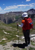
| partners | | Jim made plans to be in town early for the holiday and wanted to do a hike for this weekend. I was set on another Sedona hike. I hadn't ever yet hiked in the central portion of Sedona, probably because that's where most of the crowds are. The Hiline looked like an interesting trail to center around, and get a few others in as well. I was up at 3:30am and out the door by 5. After meeting up at the Happy Valley park and ride and a few stops on the way up, we started hiking at 8am.
From the Courthouse Vista TH, we headed north on the Slim Shady Trail, then took the Hiline westbound. The climb up to the Hiline didn't seem like much, but we had very nice views fairly quickly. Around the bend gave very nice views of Cathedral Rock. At the end of the Hiline Trail, we did a figure 8 with the Baldwin Trail, then headed back to the Slim Shady Trail along the Templeton Trail, then took Slim Shady back tot he car.
Saw only one hiker and one biker along the Hiline, then when we got to the Baldwin Trail, the crowds were out, but nothing too back. The west half of the Hiline Trail was very steep and rugged, making us wonder how the biker was able to get down that. The Templeton Trail was covered with the dead fall foliage, making for scenery you don't normally see much of in AZ.
The crowds really weren't bad, especially considering the weather and how close to the holiday it is. The tourists make it obvious that they're out of town and haven't seen Sedona before, which gives me more of an appreciation of how nice it is to live close enough to be there in 2-3 hours for a dayhike.
The weather started very cool, around 40 degrees, and got warm enough to shed the sweatshirt, but never hot. Very sunny all day, making for great photo conditions.
Got back home around 6pm and spent a good portion of the evening fixing the brakes on my wife's car. Very busy, but very satisfying day. |
| _____________________
| | |
|
|
|
 Route Editor