username
X
password
register
for free!
help
ArticlesGuidesRoutes
 
Photosets
 
 Comments
triplogs   photosets   labels comments more
Pole Hollow Canyon - 6 members in 15 triplogs have rated this an average 3.5 ( 1 to 5 best )
15 triplogs
login for filter options
Apr 27 2025
avatar

 Routes 31
 Photos 4,724
 Triplogs 187

50 male
 Joined Mar 14 2016
 Gold Canyon, AZ
North Peak Loop, AZ 
North Peak Loop, AZ
 
Hiking avatar Apr 27 2025
00blackoutTriplogs 187
Hiking17.55 Miles 3,875 AEG
Hiking17.55 Miles
3,875 ft AEG
 no routes
1st trip
Back in the Mazzies for the second week in a row, wanting to do something 'bigger', and this loop fit the bill perfectly. The road to the Mineral Creek TH is sedan-friendly with just a few smaller ruts to be careful with. Not surprisingly, no one else was at the TH when we started just after 7:30.

North Peak Trail #24
Easy grade for the first 3/4 of a mile. Once the trail goes left, the grade increases as it works its way up to a ridge. Did not check out Mineral Spring, however, there was water running across the trail in the area of the spring. Took a quick break up on the first saddle and continued. The second mile was the steepest. With a steep grade and tons of loose rock, it was a slow crawl up this section, but the views of North Peak are fantastic. From here, the grade moderates as it moves through a forest of Manzanita, which looked like it had some recent maintenance; it was nice and wide open. The last mile and a half is a bit of ups and downs before finally reaching the Park. We thought about heading up to the Summit of North Peak, but the wind started picking up, so we saved it for later date. The trail is in great shape from the start to the Park, no issues with route finding or brushiness.

Mazatzal Divide - AZT #23
We spent some time having lunch and taking in the scenery at the Park before heading east on the Divide trail to possibly putting in some miles on the Willow Springs Trail. Our minds quickly changed once we got to the 'junction'. The only reminder that a trail used to be here is a cairn where it should have started, and it is now the home to a forest of Manzanita. Mother Nature has reclaimed the Willow Springs Trail here. We turned around and started heading west on the Divide, which loses elevation a couple of times, only to climb up again; once right after the Park and the second heading up Knob Mountain. The AZT section of the divide trail is in excellent shape.

Mazatzal Divide Trail #23
By the time we reached the Red Hills junction, the wind was howling. I rarely get cold hiking, but the strong wind hitting the sweat on my back put me there. Past the Red Hills junction, the Divide Trail got brushy, really brushy in some spots for the first couple of miles down. It will need some work in the near future before it gets to be a bushwhack. We moved pretty quickly through the top section, trying to get out of the way of the wind, which we finally did about halfway down. The hike down to City Creek dragged on after a while, feeling like it would never end.

Pole Hollow Canyon
A brief road walk started us down this trail, which was easy to follow for the first 2 miles, as the cows have kept up with the maintenance. The last mile back to Mineral Creek was a fight as the 'trail' disappeared, so it was either fighting through tons of Juniper or walking the creek. When we were in the creek, it was full of downed trees that we had to go over and under time and time again. I was pretty exhausted at this point, so every extra bit of energy that had to be spent doing this was irritating. Finally, the last quarter mile, the trail returned, and it was an easy walk from there.

I'm really enjoying the Mazzies, but dam do they make you work for it. :) Thanks S, for joining me again on another fun filled adventure. :lol:
 Fauna
 Fauna [ checklist ]
[ checklist ]  Gopher Snake
 Named place
 Named place [ checklist ]
[ checklist ]  North Peak  The Park
wildflower observationwildflower observationwildflower observationwildflower observationwildflower observation
Wildflowers Observation Light

dry Mineral Creek Dry Dry


water 1 out of 5water 2 out of 5water less than maxwater less than max Pole Hollow Spring Quart per minute Quart per minute
A couple of small pools in the creek.
_____________________
Hiking is just walking where it’s okay to pee. :y:
 
Apr 27 2025
avatar

 Routes 43
 Photos 2,120
 Triplogs 81

female
 Joined Dec 09 2024
 
North Peak Loop, AZ 
North Peak Loop, AZ
 
Hiking avatar Apr 27 2025
DesertNymphTriplogs 81
Hiking17.55 Miles 3,875 AEG
Hiking17.55 Miles   10 Hrs   33 Mns   1.78 mph
3,875 ft AEG      43 Mns Break
 
1st trip
A fantastically long day out in the Mazatzal Wilderness. Wasn't entirely convinced I'd enjoy that ascent of the North Peak Trail, but I figured it couldn't possibly be worse than Carney Springs 😆, and with the promise of a loop hike, I wouldn't have to descend it.

We met up early, opting to do the hike clockwise out of the Mineral Creek Trailhead. As anticipated, there were no other vehicles at the trailhead, though we saw several cars and a couple of trailers parked along the roadside with camps set up.

The hike starts out pleasantly enough, gently ascending along side the Mineral Creek drainage....after the 3/4-mile warm up, the trail departs the drainage, ascending quickly. It was a slow grind with the steep grade and loose footing, though the views were wonderful. There are a few areas along the ascent where the vegetation gets in close, but there weren't any areas where the trail was completely obscured. In the higher reaches, we entered a manzanita forest that has seen some recent maintenance with the path wide and clear as we made our way onward through the mature (and surprisingly tall) stands. It was nice to see some young pines growing in the area as we passed through...also nice, a break from the relentless climbing, though there was still a bit of up and down before we wandered into the delightfully unburned Park and the junction with the Mazatzal Divide Trail.

We had thought to check out Pete's Pond and the Willow Springs Trail while in the area; however, our quick jaunt down to the Willow Springs junction quickly changed our mind as the intersection was marked with a cairn with no trail in sight. After looking at the topo and evaluating the route to Pete's Pond, we decided to skip it knowing the mileage we still had yet to cover to complete our loop. We took some time to rest for a bit at the park before continuing northward on the Mazatzal Divide Trail / AZT.

We made good time walking along the Mazatzal Divide Trail / AZT as it rambled up and down a couple times before crossing over a shoulder of Knob Mountain and beginning our long gradual descent. After contouring around on an area of reddish colored conglomerate rock and looking down into a pine-filled valley, we met up with the junction for the Red Hills Trail and departed the AZT to continue onward on the Mazatzal Divide Trail towards City Creek.

Once the AZT separated from the Divide Trail, things got a bit brushy in areas, though eventually opened back up again as we continued downward towards the foothills. As we carried on with our descent, we'd catch glimpses of our destined route out in the distance on much lower hillsides while North Peak also featured prominently in our views. We eventually caught sight of the road in the distance as we dropped closer to the city creek drainage though it would still be a bit before we were on it and heading up to follow Pole Hollow Canyon back to the Mineral Creek Trailhead.

The trail in Pole Hollow Canyon starts off as an abandoned two track, quickly narrowing down to an easy to follow single track path that meanders from side to side on the benches of the drainage making for fast walking. Unfortunately, once we hit the area near Pole Hollow spring, the trail evaporated, requiring us to rock hop and negotiate numerous deadfalls. Eventually, the path returned, moving through a bunch of young juniper before dumping out on the road just above the Mineral Creek Trailhead.

Others on the trail: One southbound section hiker passed us near the Park on the AZT. They indicated that they had passed a large group of northbound hikers earlier in the day (who we did not see) and also commented that those hikers noted that folks were working trail maintenance a bit further south on the AZT.

Wildlife: Evidence of bear, elk, a smallish cat observed. Spotted a few lizards, a couple of squirrel, a couple of bluebirds, and numerous other birds - most of which were not photographed. Also encountered a sonoran gopher snake taking in some sun on the trail.

Random notes: For some unknown reason, my watch was really far off on mileage calculation this time (I run it in low power mode on longer days in an attempt to salvage battery life and prevent total data loss). Usually it's pretty close to my hiking partner's RS results, but this time, it granted me an extra 1.75mi and 177ft of AEG... I opted to copy Jason's stats this time, since my numbers seemed too far off to be within a reasonable amount of error.

I'm really enjoying rediscovering the nearby wilderness areas. These long hikes are even more fun with good company. Thanks always for the invitation, J!
wildflower observationwildflower observationwildflower observationwildflower observationwildflower observation
Wildflowers Observation Light
Wildflowers were present, though at a significantly lesser rate than what we observed on the Barnhardt Y-Bar Loop. Alas, some of my photographs didn't turn out great, with the focus grabbing the background rather than the flowers I was intending to capture.

water 1 out of 5water 2 out of 5water less than maxwater less than max Mineral Spring Quart per minute Quart per minute
We didn't go looking for the outlet of the spring though there was decent water flowing across the trail in that area.


water 1 out of 5water 2 out of 5water less than maxwater less than max Pole Hollow Spring Quart per minute Quart per minute
some scummy pools and seeps in the creek
_____________________
Happier when hiking....I may not move fast (and I'm often distracted by wildflowers), but I'll get there eventually 😆
  1 archive
Dec 15 2023
avatar

 Photos 15
 Triplogs 6

male
 Joined Nov 15 2023
 Pine, AZ
Pole Hollow CanyonPayson, AZ
Payson, AZ
Hiking avatar Dec 15 2023
BiotiteMTriplogs 6
Hiking5.62 Miles 357 AEG
Hiking5.62 Miles   3 Hrs   15 Mns   1.73 mph
357 ft AEG   19 Hrs   57 Mns Break
 no routes
1st trip
Linked   none no linked trail guides
Partners none no partners
Despite living in Rim Country for two years, I've never done any hiking around the Doll Baby Area, and I decided to change that by exploring Pole Hollow Canyon. I parked at the pullout at the switchback shortly before City Creek Trailhead. As I crested the rise before dropping to the confluence of Pole Hollow Canyon and City Creek, I had to sidle around some stubbornly unmoving bovines. Eventually, I got past them, and my adventure began in earnest.

On this hike, I elected not to follow the old road like the guide but instead walk along the wash itself. The going is easy, with only a few brief ducks or squats under fallen trees or clambering over small logjams.

About 1.5 miles in is a patch of Cypress that escaped the flames of the Willow(?) fire in 2004. These Cypress dwarf the surrounding dog-hair forest of younger trees and protect a mature forest floor of shrub species described above, a nice place to take a break. Shortly south is a nice small cliff of what I interpret to be an ancient river channel. At the 2-mile mark, the drainage forks and you want to take the righthand one down the smaller-looking wash, it widens up again shortly after.

I eventually picked my way all the way up to Pole Hollow Spring at the confluence of Pole Hollow Canyon and Hill Creek. Hill Creek was completely dry, and the spring was marked by 2-3 small pools of water. Despite the pool floors being coated with emerald-green algae, the water was remarkably clear, and if I had water purification items with me, I wouldn't shy away from drinking from it. the only evidence of wildlife was Deer and Javelina prints in the muddy surroundings, Juncos fluttering amongst the cypress, and water striders skating around on their little fortress of solitude. The spring was discharging enough water that it created a noticeable trickle between the pools and then a tiny outflow that went only 3-4 feet before soaking into the ground.

Pole Hollow Canyon is rather unspectacular terrain-wise, with no big waterfalls or narrows. The most interesting geologic part of the canyon is the small bedrock section right near the confluence with City Creek, where a large 100-foot wall of conglomerate and sandstone rises above you to the east, it reminded me of the terrain in the Verde Valley area.

I'll be honest, I was mostly here for the plants. I've wanted to explore this area for some time due to the abundance of Smooth Arizona Cypress (Cupressus glabra), as well as to see what kind of semi-desert flora and fauna I could find in this arid hollow sandwiched between Payson and the Mazatzals.

The flora of the hike is dominated by a Cypress woodland, as mentioned above. Other upland trees making appearances besides the cypress include Arizona Singleleaf Pinyon (Pinus x fallax), and Junipers (Juniperus spp.). Despite their abundance in the highlands where Payson lies to the east, I saw no large Oaks. However, the shrub layer below the canopy of Cypress was dominated by Sonoran Scrub Oak (Quercus turbinella), with Palmer's Oak (Quercus palmeri) making frequent appearances as well. Other shrubs included Acacia, Mimosa, Silktassels, Manzanita, and Buckthorns.

The most surprising botanical observation I made was the frequent appearance of Coffeeberry practically the entire length of the canyon from the confluence with City Creek up to Pole Hollow Spring. Coffeeberry (Frangula californica is an evergreen shrub typically associated with Pine Oak Habitats, which in our region is Ponderosa Pine/Gambel Oak Forest, the nearest example of which is over 1,000 vertical feet and several miles from here. It should not be shaking hands with Chaparral and desert grassland plants in a pseudo-xeric environment, yet here it was.

Overall, Pole Hollow Canyon was a very rewarding hike and a nice introduction to this area of the region. I will definitely be back to do more exploring.
 Flora
 Flora [ checklist ]
[ checklist ]  Coffeeberry
 Geology
 Geology [ checklist ]
[ checklist ]  Cross-bedding
wildflower observationwildflower observationwildflower observationwildflower observationwildflower observation
Wildflowers Observation None
Everything is in seed.

dry Hill Creek Dry Dry

dry Pole Hollow Canyon Dry Dry
Zip, nada, nothin'

water 1 out of 5water less than maxwater less than maxwater less than max Pole Hollow Spring Dripping Dripping
There was a trickling flow out of the main source pools that went for several feet before soaking into the ground. Conservatively placing it in "dripping" category.
 
May 06 2023
avatar

 Guides 12
 Routes 192
 Photos 863
 Triplogs 356

42 male
 Joined Nov 30 2015
 Phoenix, AZ
City Creek loop, AZ 
City Creek loop, AZ
 
Run/Jog avatar May 06 2023
ShatteredArmTriplogs 356
Run/Jog16.66 Miles 3,764 AEG
Run/Jog16.66 Miles   5 Hrs   46 Mns   3.03 mph
3,764 ft AEG      16 Mns Break
 
no photosets
1st trip
Partners none no partners
With the cool-ish weather forecast in store for the weekend, decided it would be nice opportunity for a loop in the Mazatzals. I had done parts of this loop before, with the biggest unknown being Pole Hollow Creek between City Creek TH and Mineral Creek TH.

Pole Hollow ~3 miles

Much better than expected. Good, clear trail all the way up to the spring, and then just a couple of brushy areas beyond that. Easy going to Mineral Creek TH, with some water in the creek and some nice cypress thickets.

North Peak Trail ~4.5 miles

As expected, there's good water in the creek and solid flow from Mineral Spring. Love the first mile of this trail, and even the next two miles of grinding uphill isn't terrible. Climb was over before we knew it, then the pleasant traverse overlooking the upper part of City Creek. Last time I came through here, the last half mile or so was nearly impossible to follow; no such issue this time, it looks like someone has come through and cleared out some manzanita. As of this writing, North Peak trail has no routefinding required. I kinda like this trail.

AZT Trail - Mazatzal Divide ~3 miles

I misread the contour map and thought there were two climbs. There are actually three. Still, it's pleasant up there. Found a campsite with what seemed to be a hunter's abandoned gear. Some nice stuff, sleeping pad, a nearly full bottle of Crown Royal - fair game if anybody wants it, as far as I'm concerned. Not sure if he's planning on coming back up and retrieving it at some point, but I consider this to be litter.

Mazatzal Divide Trail ~6 miles

Vegetation is encroaching in some areas on the upper part, so running down didn't go as fast as hoped. The spring on the way down still had water. Ran into a couple on their way up, only people we saw all day.

Good day out there, I'd do this loop again.

water 1 out of 5water 2 out of 5water 3 out of 5water less than max Mineral Spring Gallon per minute Gallon per minute
Good flow at the trail crossings.

water 1 out of 5water 2 out of 5water less than maxwater less than max Pole Hollow Canyon Light flow Light flow
Light flow in most areas.

water 1 out of 5water 2 out of 5water less than maxwater less than max Pole Hollow Spring Quart per minute Quart per minute

water 1 out of 5water 2 out of 5water less than maxwater less than max SE 5395 Spring Quart per minute Quart per minute
_____________________
 
Dec 09 2020
avatar

 Routes 154
 Photos 1,505
 Triplogs 266

31 male
 Joined Jun 02 2019
 Phoenix, AZ
North Peak Loop, AZ 
North Peak Loop, AZ
 
Hiking avatar Dec 09 2020
LJWTriplogs 266
Hiking19.53 Miles 4,969 AEG
Hiking19.53 Miles   7 Hrs   24 Mns   2.83 mph
4,969 ft AEG      30 Mns Break
 
Route Scout Route Recorded  on Route Scout | Pop | Map | Popup | MapDEX
I did this loop without the summit in May on a trip to The Park and Pete's Pond. Long wait through the endless summer to have another go. Assuming I couldn't make the drive to Mineral Creek TH, I built the summit into the loop from City Creek TH. Went counterclockwise for a more gradual ascent.

Started on the northern end of the Mazatzal Divide Trail. Best stretch the 3 miles of leveling off after the Red Hills jct 6 miles in. Good shape the whole way to The Park. Didn't take the extra time to saunter that way or down to Pete's Pond.

I found North Peak Trail to be in better shape on the upper end than it seemed in the spring. Had an easier time finding the grade, and there were more ribbons and cairns than I remembered. Still in rough shape. Eventually turned off the trail toward North Peak when it seemed like less of a bushwhack. Bumped back into the trail where it descends down the side of the mountain and left it once again.

I took the ridge from the trail to the saddle SW of North Peak. It was much clearer than expected and about a moderate bushwhack. It is quite steep, however. Small stands of pines survived on the saddle and higher on the ridge. Was about 12 miles to the summit the way I came. Tenth Mazzie summit and to me the views are as good as any in the range shy of Mazatzal Peak or the Four Peaks.

Went down the ridge to the NW. This route is more traveled, and I'd think the way most folks are getting up is using the NW ridge from Mineral Creek TH. Also not such a bad bushwhack with a little, avoidable scrambling.

North Peak Trail down to the trailhead is steep and slippery but all things considered is in good shape. A little water flowing in Mineral Creek.

Connected the two trailheads again with Pollow Hollow. Had an easier time than in May and followed more of the track than the creek. Travels through the longest bit of forest on the route. Got back as the clouds were rolling in and didn't see anyone on the day.

water 1 out of 5water 2 out of 5water less than maxwater less than max Mineral Spring Quart per minute Quart per minute

water 1 out of 5water less than maxwater less than maxwater less than max Pole Hollow Canyon Pools to trickle Pools to trickle
Only by Spring, no water on lower side

dry Pole Hollow Spring Dry Dry
Pools present, no spring flow
  3 archives
May 14 2020
avatar

 Routes 154
 Photos 1,505
 Triplogs 266

31 male
 Joined Jun 02 2019
 Phoenix, AZ
Park and Pond Loop, AZ 
Park and Pond Loop, AZ
 
Hiking avatar May 14 2020
LJWTriplogs 266
Hiking19.81 Miles 4,135 AEG
Hiking19.81 Miles   7 Hrs   32 Mns   3.03 mph
4,135 ft AEG   1 Hour    Break
 
1st trip
Route Scout Route Recorded  on Route Scout | Pop | Map | Popup | MapDEX
Temps in the valley dipped for a day or two, so I wanted to try and summit North Peak. Generally head away from the Mazatzals come summer time, and didn't want to wait. Ended up passing on the summit and stuck with a loop that is enough on its own on a warm day.

The Northern Mazatzals are new to me, though I wouldn't have waited had I known that Doll Baby Ranch Road is paved almost the entire way to City Creek TH. There was some water in the road before the pavement, but it's passible in a sedan. Dirt gets rougher closer to City Creek TH.

Started around 6 with the Divide Trail first. It's a more gradual ascent compared to North Peak Trail. Perfect shape up to the Red Hills junction, after that still good but rocky and faint in parts. Minor deadfall. As with most trails, views get better higher up.

Ended up at The Park. Not what I had envisioned, but a nice place to spend a night. Not what it was pre-Willow, I figure. Northern Mazzies were pretty well scorched. Pete's Pond and the drainage to it still hold the end of Spring's water.

North Peak Trail from the Divide is difficult to follow for the first few hundred yards. Needs to be re-cut and cleared. Once descending it's pretty straightforward, though it's rocky, steep, and slippery. Maybe the best views of the day.

The off trail to the summit is a solid bushwhack. Didn't have the appetite for it. If I had seen the ridge from the East before, I would have gone for it. Once through the initial manzanita growth, it looks like it thins out. Regardless, it's over a 1000ft climb in about a mile.

Pole Hollow Canyon is pretty neat. Old two track takes you down and from there you walk in the rocky drainage no wider than a pair of outstretched arms. Deadfall and rock hopping briefly test patience. Widens out after the spring and is much more enjoyable. Young forest is growing in and is uplifting to see after traipsing the burnt crest of the Mazatzal Divide. Seems like Pole Hollow is mostly used to drive cattle from the ranches by City Creek th to southern pastures.

Ended around 1pm. I had parked on private land, stuck to the main road to keep it above board. Temps ranged from 40s to 80s. Didn't see anyone on the trip.
wildflower observationwildflower observationwildflower observationwildflower observationwildflower observation
Wildflowers Observation Substantial
Heavy on divide, solid in Pole Hollow, light on North Peak
  1 archive
Nov 30 2018
avatar

 Guides 3
 Routes 202
 Photos 3,513
 Triplogs 530

male
 Joined Jan 24 2016
 Arizona
Pole Hollow CanyonPayson, AZ
Payson, AZ
Hiking avatar Nov 30 2018
MountainMattTriplogs 530
Hiking4.49 Miles 705 AEG
Hiking4.49 Miles   3 Hrs      1.87 mph
705 ft AEG      36 Mns Break30 LBS Pack
 
1st trip
Linked   none no linked trail guides
Partners none no partners
Quick little get out in the hills loop trip with no particular destination just some fresh air and exercise.
Lots of hunters out for the late bull elk rifle hunt, I never saw any elk, just a lone coues deer doe.
Great overcast gloomy weather but with no precipitation it was prefect for hiking and enjoying this terrain and scenery.

Always a great time in the mazzies.
 Flora
 Flora [ checklist ]
[ checklist ]  Desert Marigold
foliage observationfoliage observationfoliage observationfoliage observationfoliage observation
Autumn Foliage Observation Isolated
wildflower observationwildflower observationwildflower observationwildflower observationwildflower observation
Wildflowers Observation Isolated

water 1 out of 5water less than maxwater less than maxwater less than max Pole Hollow Canyon Pools to trickle Pools to trickle
Water from recent storm rain in the lower bedrock hit other than that completely dry.
_____________________
 
Sep 16 2018
avatar

 Guides 3
 Routes 25
 Photos 2,216
 Triplogs 237

63 male
 Joined Apr 22 2012
 Fountain Hills,
Pole Hollow CanyonPayson, AZ
Payson, AZ
Hiking avatar Sep 16 2018
KBKBTriplogs 237
Hiking7.26 Miles 679 AEG
Hiking7.26 Miles   4 Hrs   22 Mns   2.16 mph
679 ft AEG   1 Hour    Break26 LBS Pack
 no routes
1st trip
Linked   none no linked trail guides
Partners none no partners
Starting from City Creek TH, my wife and I did an out-and-back hike of Pole Hollow Canyon.

On the way out, I chose to follow the drainage / wash while my wife hiked the trail. This added a bit of distance for me due to the winding nature of the wash. I enjoyed walking in the wash, but my wife wanted to stick to the trail, so eventually I joined her. The trail is straighter and mostly easier to hike than the wash.

My wife's opinion of the trail changed throughout the hike. At first she was happy that I was taking her on a hike that actually had a trail. However, there's quite a lot of deadfall along the way and she didn't much enjoy going over/under/around. She also didn't like the short but steep descents into the wash and then the ascent back up the other side. (The trail crosses the drainage frequently.) I told her that we should perhaps join a parkour gym to get better at moving quickly through obstacles. She didn't appreciate this comment.

All in all, I thought it was fine and I enjoyed the small challenges along the way. I wanted to see what this trail was like in case I decide to incorporate it into a loop: Pole Hollow Canyon - North Peak Trail - MDT.

Route finding was mostly pretty straightforward, though I did get a bit confused somewhere around Pole Hollow Spring. I think I started hiking up Hill Creek for a while, which also increased my total distance. Realizing my mistake, I backtracked and then took yet another side drainage, but did not proceed quite as far up that one. Backtracking again, I saw a log that had been cut for the trail and figured out where to go. For a time near the Pole Hollow Spring area, the trail required a bit of bushwhacking. Then, as it neared the Mineral Creek TH, it suddenly opened up and became a double-track again. And, not long after that, I was at Mineral Creek TH. I didn't stay long there because my wife had stopped about half a mile back.

The trail does seem to get occasional maintenance. I saw small trees that had been cut off near the ground. There were also large logs that had a chunk cut out of them where they had fallen across the trail. However, there's also somewhat more recent deadfall that hasn't been cleared. It's been there long enough to show evidence of other trail users making their way over or around these obstacles.

I saw a number of shallow pools near Pole Hollow Spring. The water is certainly deep enough to filter. I was expecting to see bees around the water and was surprised to not see any. Not wanting to get my feet wet, these pools were another obstacle, though not an especially difficult one.

As for the scenery... The area is pretty, though there's also evidence of fire damage. The canyon has mostly gently sloped vegetated walls/banks, though there are several areas with much steeper walls. That said, it's probably not a hike that I'll do again as an out and back. As noted earlier, I might incorporate it into a loop some day.
 Fauna
 Fauna [ checklist ]
[ checklist ]  Gopher Snake
_____________________
 
Mar 31 2018
avatar

 Guides 264
 Routes 2,797
 Photos 14,494
 Triplogs 5,894

55 male
 Joined Nov 20 1996
 
MDT - Pete's Pond - Pole Hollow Canyon Loop, AZ 
MDT - Pete's Pond - Pole Hollow Canyon Loop, AZ
 
Hiking avatar Mar 31 2018
joebartelsTriplogs 5,894
Hiking17.92 Miles 4,208 AEG
Hiking17.92 Miles   10 Hrs   17 Mns   2.05 mph
4,208 ft AEG   1 Hour   33 Mns Break4 LBS Pack
 
1st trip
Mazatzal Divide - AZT #23
Well maintained. Glad it exists. My least favorite segment of #23. Nice chat w/~28yo NOBO thru hiker named something like trailpants, transplant or transcript. From San Diego, started Mar 9th, previously completed PCT.

Pete's Pond
We crawled 4.5 hrs to the pond. Great lunch break spot!

The Park
Nice to return to one of the few places I've camped.

North Peak Trail #24
Good luck finding the western 0.5 mi end. Great views heading East. That said I'd rather only hike this trail west due to loose footing on steep grades.

Pole Hollow Canyon
Pleasant surprise. The most continuously interesting hiking segment of the day. Much easier to negotiate the terrain than anticipated. Likely most enjoyable descending. Minor route finding and lack of maintained trail will keep the masses out.
 Culture
 Culture [ checklist ]
[ checklist ]  Benchmark
wildflower observationwildflower observationwildflower observationwildflower observationwildflower observation
Wildflowers Observation Isolated
Dichelostemma capitatum, strawberry hedgehog, two white petal onion varieties

water 1 out of 5water 2 out of 5water 3 out of 5water less than max Mineral Spring Gallon per minute Gallon per minute
water report recorded in the field on our app Route Scout Nice clean flow

water 1 out of 5water 2 out of 5water 3 out of 5water less than max Pete's Pond 51-75% full 51-75% full
approx 2 feet below capacity, clean


dry Pole Hollow Spring Dry Dry
water report recorded in the field on our app Route Scout Did not go off trail to spring. Creek is dry. 0.2 miles up creek was plenty to filter, though loaded with algae
_____________________
- joe
 
Mar 31 2018
avatar

 Guides 41
 Routes 1,626
 Photos 14,983
 Triplogs 2,760

69 male
 Joined Jan 20 2009
 Far NE Phoenix,
City Creek TH to Pete's Pond loop, AZ 
City Creek TH to Pete's Pond loop, AZ
 
Hiking avatar Mar 31 2018
The_EagleTriplogs 2,760
Hiking17.88 Miles 4,218 AEG
Hiking17.88 Miles   10 Hrs   16 Mns   2.08 mph
4,218 ft AEG   1 Hour   41 Mns Break14 LBS Pack
 
1st trip
Driving in, I noticed the development at the end of the pavement, where the two covered arenas are, were up for sale.
HAZ retreat? https://www.landwatch.com/Gila-County-A ... /326742102

First time hiking from the City Creek TH. Guess I never realized this is where the northern terminus for the MDT #23 was. The trail is a steady climb for 6 miles but in great shape. Great views all around. At the top, back on the AZT again after passing the Red Hills trail. We rollercoastered southbound on the MDT to the intersection with North Peak Trail. We passed and talked to one AZT'er going Northbound from San Diego. His shoes did not look like he was going to make it much farther, but he was not concerned.

My goal for the day was hitting some new trails, as well as a stop at Pete's Pond. We went off trail westish at the the North Peak Trail junction, and made our way to Petes Pond. (Who is this Pete Guy?) . Petes was a great place for lunch as long as you don't mind being photographed by the two game cameras that are there.

After Lunch we headed down the North Peak trail. As others have noted (which I read after the hike) the western .5 - .75 miles of this trail are hard to follow in spots. a GPS track is great to keep you in the vicinity of the "Trail". Once you drop off the top, the route finding is a piece of cake. It is a steep loose bugger in many spots.

just North of the Mineral Creel TH we followed an old two track/creek bed in Pole Hollow Canyon. This was the gem of the day.

It's obvious is gets traffic from both game and humans and at one time was cleared, cutting out some of the bends in the canyon.
All of the human sign was within 1-2 miles of the Northern TH.

Great weather on the day.

Fauna on the day
1 Elk, 1 Deer, 4 javelina, 1 squirrel, 1 Teva.
wildflower observationwildflower observationwildflower observationwildflower observationwildflower observation
Wildflowers Observation Isolated

water 1 out of 5water 2 out of 5water less than maxwater less than max Mineral Spring Quart per minute Quart per minute
water report recorded in the field on our app Route Scout Creek flowing below spring

water 1 out of 5water 2 out of 5water 3 out of 5water less than max Pete's Pond 51-75% full 51-75% full
Plenty to filter from

dry Pole Hollow Spring Dry Dry
water report recorded in the field on our app Route Scout Dry in creek. Too thick to check out spring area

dry SE 5395 Spring Dry Dry
Nothing in the area of the trail
_____________________
There is a very fine line between "hobby" and "mental illness."
Dave Barry 🦅
 
Mar 26 2017
avatar

 Guides 38
 Routes 182
 Photos 1,602
 Triplogs 232

40 male
 Joined Dec 09 2014
 Gilbert, AZ
City Creek Loop, AZ 
City Creek Loop, AZ
 
Hiking avatar Mar 26 2017
jacobemerickTriplogs 232
Hiking18.41 Miles 4,297 AEG
Hiking18.41 Miles   8 Hrs   48 Mns   2.53 mph
4,297 ft AEG   1 Hour   32 Mns Break
 
1st trip
Snuck out from fatherly duties to knock out a quick loop in the Mazzies. Yay for ditching responsibilities!

Pole Hollow Canyon
As far as connectors go, this one is solid. An old two-track runs along the length of the wash, so there's always the choice between walking the sandy/gravel creekbed or overgrown road. There is plenty of deadfall so I switched between the two frequently. Not sure how much foot traffic this gets, as I didn't see any recent tracks yet there were a few paths trod around some of deadfall. Anyways, water was flowing from the spring. Once I passed that things dried up.

North Peak Trail
Is way more enjoyable than I thought it would be. The first mile played in and out of Mineral Creek and then the climb hit. Steep enough to get the heart pounding, short enough to not outlive its welcome. And big views the whole way - not quite Rock Creek level, but close. Above the climb has been recently trimmed, sometime in the last year or so, and I didn't have any difficulty until the camp on 6178. Manzanita and deadfall took over the path, and while someone had tied pretty pink markers along the path and even knocked down a few bushes, I still lost it and wandered aimlessly in the wash for a bit. Had to use GPS to get back and make it to The Park relatively unbloodied.

Pete's Pond makes for a great lunch spot. Although it has a game cam now, so I guess no midnight skinny dipping for the campers.

Mazatzal Divide Trail
Bumped into the first (and only other) hiker of the day near Wet Bottom on my way out of Pete's Pond. Then it was solo hiking up a new stretch of the Mazzie Divide for me, up and down and up and down. It was a fun, if somewhat tiring, journey to and over Knob Mountain. Every creek crossing was flowing which was pretty cool. Oh, and that cluster of pines just south of Knob was clutch. The descent after AZT fork was gentle enough to only tweak my knee a half-dozen times and long enough to get a bit tedious near the end.

On an aside, used a new piece of equipment this hike: inReach Explorer+. Wife and I have been discussing me using a satellite communicator after an incident in early '16, and with some of my planned outings this year she finally put the foot down. It performed well for communication, so-so as a GPS tracker. Had hooked Route Scout as a backup and it worked admirably. As it usually does.

Mazatzal Miles: 59/274 (21.5%)
 Named place
 Named place [ checklist ]
[ checklist ]  Pete's Pond

water 1 out of 5water 2 out of 5water 3 out of 5water less than max Mineral Creek Medium flow Medium flow

water 1 out of 5water 2 out of 5water less than maxwater less than max Mineral Spring Quart per minute Quart per minute

water 1 out of 5water 2 out of 5water 3 out of 5water 4 out of 5 Pete's Pond 76-100% full 76-100% full

water 1 out of 5water 2 out of 5water 3 out of 5water less than max Pole Hollow Spring Gallon per minute Gallon per minute

water 1 out of 5water 2 out of 5water less than maxwater less than max SE 5395 Spring Quart per minute Quart per minute
_____________________
  1 archive
Mar 04 2016
avatar

 Guides 13
 Routes 38
 Photos 1,651
 Triplogs 577

60 male
 Joined Nov 15 2005
 Jackson, CA
Mazatzal Divide to The ParkPayson, AZ
Payson, AZ
Hiking avatar Mar 04 2016
toddakTriplogs 577
Hiking23.50 Miles 4,500 AEG
Hiking23.50 Miles   10 Hrs   30 Mns   2.24 mph
4,500 ft AEG
 no routesno photosets
1st trip
Pretty nice loop from City Creek trailhead - up MD #23 to The Park, down North Peak to Mineral Creek trailhead, then back north down Pole Hollow Canyon to the start. The climb up MD #23 is excellent, with good trail and big views (but zero shade, start early). Unfortunately the first two miles of North Peak trail leaving The Park are sheer misery - faint, heavily overgrown, downed trees, etc. Thankfully some kind soul has hung literally hundreds of red ribbons to mark the way through the manzanita jungle. Things improve greatly as you head down the ridge, but it will take a major effort to restore the upper section. Pole Hollow Canyon works nicely to connect the trailheads - generally easy hiking either down in the drainage or up on the bench on either side. Also did a side out-and-back from The Park south to Hopi Spring.

Water along the trails:
Plenty of flow in City Creek at the trailhead.
Light flow in Wet Bottom Creek just south of The Park.
Trickles from Hopi Spring.
Light flow in Mineral Creek below the spring.
_____________________
 
Nov 30 2014
avatar

 Guides 107
 Routes 249
 Photos 2,067
 Triplogs 514

male
 Joined Nov 18 2005
 Phoenix, AZ
Mazatzal Divide to The ParkPayson, AZ
Payson, AZ
Backpack avatar Nov 30 2014
nonotTriplogs 514
Backpack23.00 Miles 4,600 AEG
Backpack23.00 Miles2 Days         
4,600 ft AEG
 no routesno photosets
1st trip
Threw together a last minute backpacking loop - did this because Chumley/FOTG's triplogs were the only recent backpacking trips close enough to town.

The park is nice, Pete's pond is cloudy/silty, but a good source. Surprisingly it was about 45-50 degrees at sundown but warmed up to about 60 at midnight to 6AM and dropped back down to 45 around sunrise.

Finished the MDT by trekking out to the Rock creek Trail/Hopi Spring. Some of these areas of the Mazatzals are actually recovering from the fire, but are still decades away from full restoration. Back to camp to pack up and head down the North Peak trail. The first two miles of this trail are pretty terrible. The last 2 to the trailhead are more reasonable. Thanks to Hank and Chris for posting the GPS as I needed it at one point where the trail does the most illogical detour. Neither of the trails has much repeat value.

The mineral creek area is nice but the creek dried up before reaching the trailhead. Favorite part of the trip was seeing a herd of javelina while walking the shortcut back to the car.

dry City Creek Dry Dry

dry Hopi Spring Dry Dry
I did not see any water in the vicinity of the spring.

water 1 out of 5water 2 out of 5water 3 out of 5water less than max Mineral Spring Gallon per minute Gallon per minute
It is flowing nicely near the spring but dries up quickly flowing down the canyon.

water 1 out of 5water 2 out of 5water 3 out of 5water 4 out of 5 Pete's Pond 76-100% full 76-100% full
The pool is silty and clogs filters but tastes fine.

water 1 out of 5water less than maxwater less than maxwater less than max Pole Hollow Canyon Pools to trickle Pools to trickle
There are some pools in this canyon, a few of which look to be of good quality.
_____________________
http://hikearizona.com/garmin_maps.php

Hike Arizona it is full of sharp, pointy, ankle-twisting, HAZmaster crushing ROCKS!!
Hike Arizona it is full of sharp, pointy, shin-stabbing, skin-shredding plants!
Hike Arizona it is full of striking, biting, stabbing, venomous wildlife!
  1 archive
Mar 07 2004
avatar

 Routes 36
 Photos 2,658
 Triplogs 1,347

67 male
 Joined Jul 28 2004
 Scottsdale, AZ
Mazatzal Divide Trail #23Payson, AZ
Payson, AZ
Backpack avatar Mar 07 2004
mazatzalTriplogs 1,347
Backpack34.00 Miles 6,600 AEG
Backpack34.00 Miles4 Days         
6,600 ft AEG
 
Day 1: City Creek TH to Fuller Seep. Jim found a nice axe on the trail and carried it for the next 4 days.

Day 2: Fuller seep to lower Wet Bottom Creek crossing (see profile photo and thank you Jim or wading in and rescuing my hiking socks that had blown into the creek :sl: 
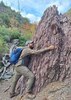
) and then back track to Midnight trail and down to Upper Wet Bottom Creek crossing.

Day 3: Upper WBC to The Park. This stretch of Midnight trail is really cool.

Day 4: Down North Peak trail and along Pole Hollow to City Creek TH.

We were lucky enough to do this incredible loop before the Willow Fire by just 3 months.
_____________________
  1 archive
Dec 20 2003
avatar

 Routes 36
 Photos 2,658
 Triplogs 1,347

67 male
 Joined Jul 28 2004
 Scottsdale, AZ
Pole Hollow Canyon, AZ 
Pole Hollow Canyon, AZ
 
Hiking avatar Dec 20 2003
mazatzalTriplogs 1,347
Hiking6.50 Miles 850 AEG
Hiking6.50 Miles
850 ft AEG
 no routesno photosets
1st trip
Linked   linked  
Partners none no partners
We started from City Creek TH and went along a forest road to Pole Hollow Spring and then continued along the creek bed to Mineral Creek TH. This was an exploratory trip to check this route for a loop backpack from City Creek returning down North Peak TR. It works fine. :)
_____________________
 
average hiking speed 2.14 mph

WARNING! Hiking and outdoor related sports can be dangerous. Be responsible and prepare for the trip. Study the area you are entering and plan accordingly. Dress for the current and unexpected weather changes. Take plenty of water. Never go alone. Make an itinerary with your plan(s), route(s), destination(s) and expected return time. Give your itinerary to trusted family and/or friends.

helpcommentissue

end of page marker