username
X
password
register
for free!
help
ArticlesGuidesRoutes
 
Photosets
 
 Comments
triplogs   photosets   labels comments more
Fraser - Randolph Loop - 17 members in 28 triplogs have rated this an average 3.5 ( 1 to 5 best )
1, 2  Next
28 triplogs
login for filter options
Dec 06 2023
avatar

 Guides 59
 Routes 1,100
 Photos 1,191
 Triplogs 1,290

male
 Joined Jan 01 2023
 Arizona
Fraser - Randolph LoopGlobe, AZ
Globe, AZ
Hiking avatar Dec 06 2023
pseudalpineTriplogs 1,290
Hiking9.94 Miles 1,103 AEG
Hiking9.94 Miles   3 Hrs   36 Mns   2.88 mph
1,103 ft AEG      9 Mns Break
 
1st trip
Route Scout Route Recorded  on Route Scout | Pop | Map | Popup | MapDEX
Meh, an easy and mediocre loop considering the crappy approach drive with all the geriatric snowbird side by siders. Completed in reverse (CCW), descending the uninspiring Randolph Canyon first. Cow feces everywhere, loaded up with dry burdocks, mostly pre-burnt with overgrown, unnecessarily cairned side passages. Every hike can't be great, but I guess no trail should go unhiked. : wink : Dese was with me, so it was an appropriate pick for today, but both of us couldn't wait until this loop ended!
 Fauna
 Fauna [ checklist ]
[ checklist ]  Dog  Rooster
 Named place
 Named place [ checklist ]
[ checklist ]  J F Ranch

water 1 out of 5water less than maxwater less than maxwater less than max Dripping Spring Dripping Dripping

dry Fraser Canyon Dry Dry

dry Randolph Spring Dry Dry
Just pools.

water 1 out of 5water less than maxwater less than maxwater less than max Red Tanks Canyon Pools to trickle Pools to trickle

dry Whetrock Canyon Dry Dry
  3 archives
Jan 08 2022
avatar

 Guides 12
 Routes 192
 Photos 863
 Triplogs 356

42 male
 Joined Nov 30 2015
 Phoenix, AZ
Fraser - Randolph LoopGlobe, AZ
Globe, AZ
Hiking avatar Jan 08 2022
ShatteredArmTriplogs 356
Hiking9.30 Miles 1,100 AEG
Hiking9.30 Miles   4 Hrs   20 Mns   2.66 mph
1,100 ft AEG      50 Mns Break
 no routesno photosets
1st trip
Been meaning to check this out for awhile. The road has gotten quite a bit worse in the past year, but a Subaru Crosstrek can still make it. Barely. Dropped down to Woodbury Trail, which is almost nonexistent at this point. Noticeably more so than a year ago.

Poked around the JF ranch for a little bit. Didn't know there is a fully intact house there. After this point, we decided to disregard the trail altogether since it was covered in catclaw and the creek is nice and clear.

Got down to the confluence in a couple hours and poked around a bit in the Dripping Springs area. Some nice cottonwood trees here; nice spot. Good flow in the creek.

Randolph Canyon was great along Red Tanks trail (which we also ignored in favor of staying in the creek). Upstream from where the trail departs was pretty uninteresting; the canyon is just entirely filled with sand at this point.

Fun adventure overall, and I like seeing all the creeks flowing in the Superstitions. Kinda regret not having seen those canyons before they were filled with sand, though.

water 1 out of 5water 2 out of 5water 3 out of 5water less than max Fraser Canyon Medium flow Medium flow
Good flow up to Whetstone Canyon, intermittent flow from there up past Fraser ranch.

water 1 out of 5water 2 out of 5water 3 out of 5water 4 out of 5 Musk Hog Canyon Heavy flow Heavy flow
Accounted for most of Fraser's flow.

water 1 out of 5water 2 out of 5water 3 out of 5water less than max Randolph Spring Gallon per minute Gallon per minute
Creek was flowing, hard to tell what's actually coming from the spring.

water 1 out of 5water 2 out of 5water 3 out of 5water less than max Red Tanks Canyon Medium flow Medium flow
Good flow, probably equaled the flow from Randolph.

water 1 out of 5water 2 out of 5water 3 out of 5water less than max Whetrock Canyon Medium flow Medium flow
_____________________
  7 archives
Mar 14 2021
avatar

 Routes 93
 Photos 7,758
 Triplogs 1,691

64 male
 Joined Mar 11 2003
 AZ
Fraser - Randolph LoopGlobe, AZ
Globe, AZ
Hiking avatar Mar 14 2021
wallyfrackTriplogs 1,691
Hiking9.90 Miles 1,546 AEG
Hiking9.90 Miles   3 Hrs   48 Mns   2.61 mph
1,546 ft AEG
 no routes
Linked   none no linked trail guides
Partners none no partners
My original intent was to hike up White Mountain. I made it past the hole in the road and up to the Rogers Trough trailhead but the low clods and snow made me change plans. I drove down to the Woodbury trailhead and it was clear. I saw a few guys at the trailhead but didn't see anyone on the hike. I decided on an out and back in Fraser Canyon and hiked beyond the Red Tanks junction to visit an old haunt. The trail good about half way but fallen trees and overgrowth have taken a toll. The temps were nice and solitude was even better.
_____________________
  2 archives
Dec 30 2020
avatar

 Routes 175
 Photos 2,335
 Triplogs 191

44 female
 Joined Jan 21 2019
 Pine, AZ
Bushwhackers Paradise - Supes loop, AZ 
Bushwhackers Paradise - Supes loop, AZ
 
Hiking avatar Dec 30 2020
jillyonanadventureTriplogs 191
Hiking11.68 Miles 1,195 AEG
Hiking11.68 Miles   6 Hrs   42 Mns   1.99 mph
1,195 ft AEG      49 Mns Break
1st trip
Partners none no partners
A nice long loop in the Supes exploring a couple of new {to me} areas, along with some others I’d seen before. Things started off very chilly and windy in the morning, but within an hour or so, layers were coming off. We had a nice trail on the way in, although the Cockscombs were full on Ralphie's Red Ryder to the dogs. :( Be prepared with scissors if bringing dogs (especially any longer haired dogs) into this area. Arriving at Red Tanks was my favorite part of the hike, as that canyon is just so stunningly beautiful. That wasn’t part of our official route, but we did venture down a bit & see some pools of water. Dripping springs looked completely different than the last time I had visited as it was pretty much completely dry. The fall colors were still gorgeous in this area though! We took a snack/drink break here before heading back to the second portion of our loop. I’m not sure if this was just completely destroyed by the fire/draught, but this section was just miles of complete bushwhacking - so much catclaw, foxtails and super easy to lose any type of “trail/path.” We finally got through this section and had a steady climb up to get back to the trailhead. We were all pretty tired by that point and very excited to see the vehicles! During the hike, we only saw one couple at dripping springs (man was carrying a machete!), but on the way out we were pretty shocked by how crowded it was on the Woodbury road, especially towards the beginning. Tons of ATV’s, people shooting, what looked like big set ups for large parties, etc. Despite the bushwhacking and chilly temps, the company was excellent and it was overall an enjoyable day and great escape from all the stress of life. Note: do yourself a favor and wear hiking pants; leggings were a very unwise choice. :sweat:

water 1 out of 5water less than maxwater less than maxwater less than max Red Tanks Canyon Pools to trickle Pools to trickle
water report recorded in the field on our app Route Scout
_____________________
Restless between adventures...
 
Jan 18 2020
avatar

 Routes 5
 Photos 162
 Triplogs 18

31 female
 Joined Nov 26 2018
 Phoenix, AZ
Fraser - Randolph LoopGlobe, AZ
Globe, AZ
Hiking avatar Jan 18 2020
WalworthjordynTriplogs 18
Hiking10.30 Miles 1,027 AEG
Hiking10.30 Miles
1,027 ft AEG
 no routes
1st trip
Linked   none no linked trail guides
Partners none no partners
Did this loop counter-clockwise to get the off-trail done with first. What a pleasant trek Randolph Canyon was, just enough flowing water to not have to get your feet wet but also be able to enjoy the sound and solitude of the canyon. Hit Red Tanks, which felt like deja vu from a month ago when we did the super Red Tanks Loop. Not as much water there as there was but still flowing good! Hit the Coffee Flat Trail, which was rocky in some sections but not nearly as bad as Red Tanks. Woodbury was the most difficult one to follow but still not bad. Was really cool to see the JF ranch, which happens to be my maiden name initials too. We only saw one other truck at the Woodbury TH and followed the footprints for a good while.

What a fun day exploring some of the heart of the burns from the fire, good to see some growth and a lot of cacti that lived!

Time to start catching up on all my trips from the past few months too.
  4 archives
Jan 11 2020
avatar

 Routes 93
 Photos 7,758
 Triplogs 1,691

64 male
 Joined Mar 11 2003
 AZ
Fraser - Randolph LoopGlobe, AZ
Globe, AZ
Hiking avatar Jan 11 2020
wallyfrackTriplogs 1,691
Hiking10.40 Miles 1,215 AEG
Hiking10.40 Miles   5 Hrs   54 Mns   1.76 mph
1,215 ft AEG
 no routes
Partners partners
DarthStiller
A loop in the Supes. The drive in on FR 172 was a little rough but passable with high clearance. The creek crossings are washed out so you need to slow down to get through. The trails are in decent shape and the burn while present didn't change the overall look of the terrain by much. Randolph Canyon was flowing but you could get by if you watched out for soft spots in the sediment. Chris noticed a mine/cave up in the cliff and then about a quarter mile later we saw another one. We stopped but the Red Tanks Coffee Flat junction for a break. I was cold in the shade and the sun felt good once we were moving again. Fraser Canyon was flowing as well and the trail has some fallen trees in a few spots. All in all a good hike on a good day.
_____________________
  1 archive
Jan 11 2020
avatar

 Guides 27
 Routes 669
 Photos 12,096
 Triplogs 856

56 male
 Joined Jul 05 2006
 Mesa, AZ
Fraser - Randolph LoopGlobe, AZ
Globe, AZ
Hiking avatar Jan 11 2020
DarthStillerTriplogs 856
Hiking10.40 Miles 1,215 AEG
Hiking10.40 Miles   5 Hrs   54 Mns   1.90 mph
1,215 ft AEG      26 Mns Break
 
1st trip
Partners partners
wallyfrack
I had never hiked Randolph Canyon, and the last time I hiked the Coffee Flat and Woodbury Trails in Fraser Canyon, it was nearly 17 years ago. With the limited trailhead access the further east you go in the Supes, this seemed like a good hike. I wasn't sure of the road condition or the trail conditions, so I asked Wally if he was interested and/or knew if it was doable hike. The tires on my vehicle are in need of a change soon, so I also asked Wally to drive for this one.

We did the loop counter clockwise, getting the off trail part done first, and also doing that section downhill. this turned out to be a good choice. Randolph Canyon had water running in it the entire way. It was actually very easy to hike, but I would imagine that hiking it uphill would be a bit harder. Silt filled in a lot of the rocks, making the hiking probably easier than normal. some sections were soupy and would result in some very soft footing. the trick seemed to be to stay towards the center of the stream, since that was where the most solid silt was. the water was still pretty shallow for the most part, and the deeper section were always narrow enough to step over.

the fire really didn't seem to harm this area very badly. Even the most cooked spots didn't look really all that different from the rest of the surrounding desert. There really weren't too many dead saguaros, except for some pockets here and there.

We stopped for lunch at the junction of the Red Tanks and Coffee Flat Trails. It was there that we saw the first other hikers all morning, after 3.5 hours. As I sat down for lunch, the one hiker was walking up to us and said, "Hey, you're Wally, right?" Not surprising.

the hike uphill along the Coffee Flat and Woodbury Trails was very rocky, as expected. There were a few flat sections here and there. The offtrail section of the hike was probably easier to hike than the trail section. At the ranch Wally pointed out where he and Denny has seen scores of pottery sherds on a previous hike. it was interesting to check that out and not see any sign of nearby ruins.

The biggest climb was along the Woodbury Trail back up to the Woodbury TH. Finished in just under 6 hours. Nice to have another hike back in the heart of the Supes, haven't been there in a while.
 Named place
 Named place [ checklist ]
[ checklist ]  J F Ranch
 Meteorology
 Meteorology [ checklist ]
[ checklist ]  Moon
_____________________
  1 archive
May 17 2019
avatar

 Guides 116
 Routes 337
 Photos 11,399
 Triplogs 894

63 male
 Joined Dec 20 2010
 Sunnyslope, PHX
Fraser - Randolph LoopGlobe, AZ
Globe, AZ
Hiking avatar May 17 2019
kingsnakeTriplogs 894
Hiking11.45 Miles 1,265 AEG
Hiking11.45 Miles   6 Hrs   6 Mns   1.88 mph
1,265 ft AEG
 no routes
1st trip
Since temps were expected to be very comfortable last Friday, I decided to stay in the Valley. (More or less.)

The furthest I had ever been up rocky, bumpy, FR 172 was Pam's New Year climb up Roblas Butte back in 2016: [ photoset ]

I took my time driving up FR 172, enjoying the views, and taking care in what to me were trickier sections. The last thing I wanted was a flat, or to puncture the oil pan, as FR 172 has no cell reception at all. It took me 1h 15m. I started hiking at 8:30 a.m.

The turn off for Coffee Flat Trail #108, down Fraser Canyon, is just before Woodbury Well, and is marked by a cairn. But first I explored the well. It has a windmill, but it no longer operates the pump, which is now solar-powered. At the base of the windmill was an elevated rubber pipe end, which was giving a steady flow of clear water. Two adjacent large plastic tanks sound like they were both full. (I knocked.) A spring box was dry, but a cattle tank was close to full. There were a number of well-licked salt blocks laying about. 🐄

Coffee Flat Trail #108 would have been a great hike had it not been for the INSANE amount of foxtail on it, particularly below JF Ranch. I'm not joking when I say sometimes the trail disappeared in the foxtail. I suppose I should have followed recommendations and hiked the canyon bottom, but I wanted to lay down an accurate track. 🙄

Fraser Canyon gets pretty tight for the next two miles, past Whetrock Canyon and Musk Hog Canyon, to Dripping Spring. There’s a decent amount of shade, and lots saguaro on the canyon slopes. Near Whetstone Spring, I found an mine adit that went in less than 50 ft.

I took a break at Dripping Spring, contemplating my foxtail riddled shoes & socks. I decided it would take too long to de-foxtail them, and that the existing infestation might somewhat innoculate me against further foxtails I might accumulate in Randolph Canyon. 🤔

After my break, I started up Red Tanks Trail #107, which passed by some pools and pretty purple boulders & slick rock. Along the way, I encountered a gila monster — the first one I’ve seen in the wild since I hiked from the Bronco Trailhead to Cave Creek in 2016.

After a ½ mile, Red Tanks Trail #107 heads north while Randolph Canyon continues northeast. I thought at first I might have found a use trail, but it quickly disappeared. I really did not want to fight catclaw for four miles, so I stuck to the rocky canyon bottom. That got old quick.

Though Randolph Canyon only climbs 500 ft. in the 3.5 miles to JF Trail #106, it felt like I was climbing stairs the whole way. My leg muscles got so tired, I briefly considered turning back, and even had non-sensical thoughts like “drop pack” and “cross country would be easier”. Both would have been bad news. I had to gut it out.

A few minutes before I reached Randolph Spring, I came within 5 ft. of a wetern diamondback sunning itself on a pink boulder. Naturally, I jumped back, but he never did rattle me, or even coil. 😅

Despite mostly staying in the rocky bottom of Randolph Canyon, I still accumulated scads more foxtail, as I occasionally had to work my way around an obstacle, trying to keep my stabby feet dry. (I eventually gave up staying dry.)

Two and a ½ miles up Randolph Canyon, I was dead tired. Naturally, that is when I encountered a 2-3 ft. high fence, across the wash. I’ve seen read that there is a gate in the brush on the side of the wash. Not knowing it at the time, I wondered how I could lift my weary legs over the fence, as there was no room to low crawl it. Even if there was, I did not have the energy to get back to my feet. After contemplating my options for a few minutes, I settled for stepping on the fence, depressing it enough that I was (barely) able to lift my other leg over it.

Finally, after nearly seven hours, I came to JF Trail #106. Though there is a cairn, the trail is faint. If you miss it, and really enjoy rock hopping, JF Trail #106 crosses Randolph Canyon a second time, in another half mile. I opted to climb the 150 ft. out of the canyon, stopping several times along the way for 10 seconds here and 15 seconds there. I was spent. 🚑

About halfway between the Woodbury Well and the trailhead, I got rattled by a second western diamondback*, on the left side of the jeep trail. Surprised, I did the hokey pokey back step. After gathering my senses, I walked around him.
* I almost ran over two more western diamondbacks on my drive back down FR 172! 🐍
I returned to the Woodbury Trailhead at 4:10 p.m., after nearly eight hours of hiking. (I might have taken even more time, if I was not concerned about getting back to pavement before dark.) Cold beer never tasted so good!

In summary, I liked Fraser Canyon, but downgraded it a star due to all the foxtail. Randolph Canyon blew chunks.

Drive to Woodbury TH: https://vimeo.com/490162864
Hike Video: https://vimeo.com/490169304
wildflower observationwildflower observationwildflower observationwildflower observationwildflower observation
Wildflowers Observation Light
Desert Marigold, Ocotillo, Cholla, Flat Top Buckwheat, Desert Lavender, Sacred Datura, Prickly Pear Cactus, New Mexico Thistle, Saguaro, Salt Cedar and -- of course -- Brittlebush.

dry Fraser Canyon Dry Dry
Some water here & there, but not comparable to Randolph Canyon.

water 1 out of 5water 2 out of 5water less than maxwater less than max Randolph Spring Quart per minute Quart per minute
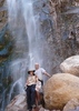
Pools, and flow from trickle to audible pour, both above & below Randolph Spring. Some of the pools decent size. Some with algae, some crystal clear.
_____________________
http://prestonm.com : Everyone's enjoyment of the outdoors is different and should be equally honored.
  1 archive
Apr 12 2019
avatar

 Photos 105
 Triplogs 13

51 male
 Joined Feb 26 2009
 Mesa, AZ
JF-Randolph-RedTanks&Bacon, AZ 
JF-Randolph-RedTanks&Bacon, AZ
 
Backpack avatar Apr 12 2019
Xiled1Triplogs 13
Backpack28.00 Miles
Backpack28.00 Miles3 Days         
40 LBS Pack
 no routes
1st trip
Partners none no partners
We headed out on Friday afternoon for two nights in the Supes. The plan was to loop from Tortilla Pass trailhead through Woodbury, and then back up Red Tanks/Hoolie Bacon. We parked at the road since we only brought the Suby. Next time we're bringing the Jeep and saving 6 miles. We can pack more booze that way. We were not sure of the water situation in the high country so we packed in extra. We hit first water at Clover Spring, pools in the drainage, but did not go to the actual spring. We camped up high for the night, right before you drop down to the Rogers Trough intersection. This section of the trail is mostly overgrown and full of ankle cactus. You can say that for pretty much the entire loop. Lots of loose rock to make it interesting.

The next morning we made our way down the JF to Randolph Canyon and it was flowing strong. It looked too inviting so we decided to take the canyon route instead of the Woodbury/Coffee Flat cow pattie. Typical canyon/water hike, loose rock, deep sand, wet feet and thorns. But it was beautiful and a highlight of the trip. My back and knees disagree though. We hit Red Tanks and started the slog up the hill. Red Tanks is beautiful but its always a test. We made it up, over, and down into the Labarge basin. The water was flowing nicely on the way down, but dried up to just random pools by the time we got to the camp spots. I recommend topping off earlier. We filled up and headed up Hoolie Bacon for about a mile to the summit before Horse Camp Basin and camped there for the night.

Up early the next morning and headed into Horse Camp Basin. Pools at many of the creek crossings there. Lots of camp sites as well. We headed the rest of the way out, up and down for a bit and then through the Tortilla Creek valley; a thankful rest on our knees and back. Plenty of water flow as well. We finished the road hike out and headed for some breakfast.

We'll try and add the pics later. Get out while the water is good.
wildflower observationwildflower observationwildflower observationwildflower observationwildflower observation
Wildflowers Observation Moderate
Desert Mariposa Lily, Poppies, Desert Chircory, Hedgehog Cactus, Blackfoot Daisy, Spreading Fleabane, Brittle Bush, and a few Evening Primrose.
_____________________
 
Mar 16 2019
avatar

 Guides 6
 Routes 183
 Photos 5,612
 Triplogs 1,647

male
 Joined Mar 12 2004
 Scottsdale, AZ
Fraser - Randolph LoopGlobe, AZ
Globe, AZ
Hiking avatar Mar 16 2019
John9LTriplogs 1,647
Hiking10.00 Miles 1,245 AEG
Hiking10.00 Miles
1,245 ft AEG
 no routesno photosets
Met up with Kyle for a nice hike in the Supes. We made the drive to the Woodbury TH and headed in. We opted for a CCW loop starting with Randolph Canyon. There was a quite a bit of water after a couple of winter storms a few weeks prior. We tried keeping our feet dry but it was more of a hassle so we jumped on in. Most of the water was ankle deep with a few knee deep pools. We took a break by the spring with the concrete dam and continued until we reached the Red Tanks Trail. This was the highlight of the hike. We opted to follow the creek down as we headed south and all the water made for a memorable hike. There were several small waterfalls and we really enjoyed this section. We took a break by Dripping Springs and then headed back on the Coffee Flat Trail.

Along this section we had an interesting encounter with a fox. It appeared on the trail and was trotting right towards us. We thought it would flee as soon as it saw us but it kept approaching. I tossed a couple of rocks in its direction but it kept coming at us. Kyle then threw a rock near it and the fox got the hint and ran off into the brush about 12 feet off trail. We didn’t linger as we headed up the trail and got out of there. It was a very weird and unusual encounter. I’m not saying the fox was rabid but something wasn’t right. The rest of the hike was uneventful. We would see the one and only person along the hike near the Woodbury TH. It was an older guy who was doing a multiday backpacking trip. We got back to the jeep soon after and headed back to Phoenix.
_____________________
 
Feb 16 2019
avatar

 Guides 6
 Photos 346
 Triplogs 225

69 male
 Joined May 13 2002
 Tempe, AZ
Fraser - Randolph LoopGlobe, AZ
Globe, AZ
Hiking avatar Feb 16 2019
hikeazTriplogs 225
Hiking9.30 Miles 1,175 AEG
Hiking9.30 Miles   6 Hrs   30 Mns   1.43 mph
1,175 ft AEG
 no routesno photosets
1st trip
Linked   none no linked trail guides
Partners none no partners
It's been too long since I have visited this area.
Hiking clockwise, a couple in the group took loppers and hand clippers, but Fraser (Woodbury/Dripping Trails) did not need too awful much trimming - we still did some major preventive damage though. Then... off to the raging torrent that was/is Randolph Canyon. WOW! What a flow - it was awesome; Randolph along with about every side canyon was flowing - it was a sight to behold. We did considerable catclaw damage in this portion!
Then, just about when we had had enough of the wet-shoe, creek-cross mamba we arrived at the J.F. trail junction for the up-and-over back to Woodbury.

I would suggest a visit soon if you have ever wanted to hike this area; with all the water flow it is an oasis.
wildflower observationwildflower observationwildflower observationwildflower observationwildflower observation
Wildflowers Observation Light
_____________________
"The censorship method ... is that of handing the job over to some frail and erring mortal man, and making him omnipotent on the assumption that his official status will make him infallible and omniscient."
George Bernard Shaw
 
Jan 05 2019
avatar

 Guides 1
 Routes 447
 Photos 4,407
 Triplogs 938

68 male
 Joined Mar 09 2012
 Gilbert, AZ
Fraser - Randolph LoopGlobe, AZ
Globe, AZ
Hiking avatar Jan 05 2019
rayhustonTriplogs 938
Hiking10.28 Miles 1,305 AEG
Hiking10.28 Miles   4 Hrs   41 Mns   2.36 mph
1,305 ft AEG      20 Mns Break
 no routes
1st trip
Partners none no partners
I don't know which I enjoyed more, the drive to the trailhead or the hike itself. Both were certainly worthwhile.

Although I've been to Dripping Spring many times, this is the first time I've attempted it from the Woodbury TH. I was not disappointed. Interesting geology in the creek beds, opportunities to go exploring in the nearly hills that line the creeks and fabulous views. The best part of the hike is the area near Dripping Springs where the canyons come together. I love that area.

I saw two couples out hiking. I met the first not long after I started the hike. I met the other near JF Ranch as I was finishing the hike. I stopped and chatted with both. I finished the hike on the forest road just past JF Ranch. Nice, long uphill boost to finish the hike.

The skies were overcast for the most part with the sun peeking out as I returned along Fraser Canyon. Not much water in the creeks; a few pools here and there. The temps were perfect.

This was a very enjoyable hike.
 Named place
 Named place [ checklist ]
[ checklist ]  J F Ranch

water 1 out of 5water less than maxwater less than maxwater less than max Dripping Spring Dripping Dripping
Had lunch right next to it. I could hear it dripping,

dry Fraser Canyon Dry Dry

dry Randolph Spring Dry Dry

water 1 out of 5water less than maxwater less than maxwater less than max Red Tanks Canyon Pools to trickle Pools to trickle
Not much, but a few clear pools

_____________________
 
Feb 11 2017
avatar

 Photos 188
 Triplogs 163

43 female
 Joined Oct 26 2011
 Tempe, AZ
Fraser - Randolph LoopGlobe, AZ
Globe, AZ
Hiking avatar Feb 11 2017
clairebearTriplogs 163
Hiking9.97 Miles 1,245 AEG
Hiking9.97 Miles   5 Hrs   2 Mns   2.22 mph
1,245 ft AEG      32 Mns Break
 no routesno photosets
1st trip
Partners partners
John9L
juliachaos
Tough_Boots
New trails to explore in the Superstitions ~. It was nice that Liz came out and joined us. From Woodbury TH we hiked a short distance and then turned into Randolph Canyon. We got a scare when Kiva flushed out a large javalina chasing it for a few minutes but she was fine and came back. After our lunch we turned into Fraser Canyon. Later on Kiva found some cows that she found very interesting. Then we exited the canyon and made our way up back passing the JF ranch along the way. Both canyons were interesting and different ~ it was nice to check out a new place. The canyons were also nicely empty with the exception of our group and I thought we would go the whole way without seeing another human until we passed a group near Randolph Spring where we paused for lunch.
_____________________
 
Feb 11 2017
avatar

 Guides 6
 Routes 183
 Photos 5,612
 Triplogs 1,647

male
 Joined Mar 12 2004
 Scottsdale, AZ
Fraser - Randolph LoopGlobe, AZ
Globe, AZ
Hiking avatar Feb 11 2017
John9LTriplogs 1,647
Hiking9.97 Miles 1,245 AEG
Hiking9.97 Miles   5 Hrs   2 Mns   2.22 mph
1,245 ft AEG      32 Mns Break
 no routesno photosets
Partners partners
clairebear
juliachaos
Tough_Boots
Headed out for a nice day in the Supes. Our group of four plus two dogs started hiking from the Woodbury TH around 10am and headed for Randolph Canyon. There was a nice flow of clear and cool water. From there we worked our way down canyon as we rock hopped and pushed through sporadic brush. It's easy going for the most part and very scenic. We took a short break by Randolph Spring and then took our lunch by Dripping Springs. We then started our return up Fraser Canyon. It's easy going again as there is less water and good trail for most part. We passed the JF Ranch and then followed the road back to our TH. We were done by mid afternoon. This was a really nice hike with a great group. We had perfect weather and it was great getting out. Thanks Kyle for driving.
_____________________
  1 archive
Feb 11 2017
avatar

 Routes 67
 Photos 2,708
 Triplogs 755

89 male
 Joined Mar 28 2008
 Phoenix, AZ
Fraser - Randolph LoopGlobe, AZ
Globe, AZ
Hiking avatar Feb 11 2017
Tough_BootsTriplogs 755
Hiking9.87 Miles 1,209 AEG
Hiking9.87 Miles
1,209 ft AEG
 no routesno photosets
1st trip
Partners partners
clairebear
John9L
juliachaos
This turned out to be a really nice day. I thought it was going to get toasty but the clouds stayed above us. The dogs were loving all the water. The water made this a great loop-- I don't think I would do this loop again without it. We did the loop counter-clockwise and had lunch at Dripping Springs where we saw the only other group all day. We short-cut it through the JF Ranch road on the return.
_____________________
 
Feb 02 2017
avatar

 Guides 1
 Routes 169
 Photos 1,616
 Triplogs 218

81 male
 Joined Dec 16 2011
 Mesa,Az
Fraser - Randolph LoopGlobe, AZ
Globe, AZ
Hiking avatar Feb 02 2017
hikingaz2Triplogs 218
Hiking12.17 Miles 1,678 AEG
Hiking12.17 Miles   7 Hrs   5 Mns   1.88 mph
1,678 ft AEG      37 Mns Break12 LBS Pack
 
1st trip
Partners partners
rtaylor3235
Wanted something we hadn't done before and we needed to get out to Eastern Supes. Decided on Fraser - Randolph doing it CCW. Invited Steve for his 1st hike with us, showed up in shorts, :scared: To late now, headed over and down Randolph. Boy was it catclaw heaven, with so much water running we had to cross so many times it made the trip seem a lot longer, and more catclaw to fight. :o Needless to say Steve got initiated to AZ Pin stripping :( Got down to the Dripping Springs area and it was so nice, sat by the waterfalls and had a relaxing lunch before heading up Fraser. This went well and easy compared to Randolph and it's catclaw. Can't wait to return to this area :D
_____________________
 
Apr 05 2014
avatar

 Guides 21
 Routes 1,182
 Photos 36,858
 Triplogs 1,570

69 female
 Joined Feb 26 2004
 Phoenix, AZ
Fraser - Randolph LoopGlobe, AZ
Globe, AZ
Hiking avatar Apr 05 2014
tibberTriplogs 1,570
Hiking10.83 Miles 1,333 AEG
Hiking10.83 Miles   7 Hrs   33 Mns   1.72 mph
1,333 ft AEG   1 Hour   15 Mns Break
 
1st trip
Partners partners
AZLumberjack
trekkin_gecko
JACK'S LEAVING :cry: HIKE

We wanted to get a hike in before the heat and before Jack left. We had a Plan B but it wasn't necessary as the weather cooperated very nicely thank you.
Tonto Jr. would get another test of its ability taking the 172 to Woodbury TH. Seemed to do fine and my confidence in the vehicle is building. We arrived ahead of schedule as the drive in was about 10-15 minutes less than the various maps said. The road is in decent enough shape; especially once you turn off from 172 to Woodbury. We did see a roadrunner that had to fly to get out of the way.


We started our hike heading to the JF Trail. I remembered the entry into Randolph from the catclaw Revenge event back in March 2009. The hike toward the canyon entry is beautiful too. Kelly spotted a couple javelina but all I saw was their rumps. As we got closer to the canyon we spotted quite a bit of water in the drainage :) . THIS was quite a surprise as we expected to see very little if any water.

As we entered the canyon the fun began with the beautiful Randolph rocks :D . We traversed thru the fairly flat canyon enjoying every turn not knowing what was ahead. Jack spotted some "bling" rocks that were coming from a drainage. We went up the drainage a bit to see and found lots more "mica-laden" rocks.

We eventually came to the fence Lee had mentioned in his hike description. I took the long way to the south rather than go under (actually it was just up the embankment and down). We came to some white smooth rock area and a larger pool where we stopped for a break which was about 1/2 way down the Canyon. On the other side of the pool some frogs were spotted so we enjoyed them for a bit. It was cool to hear them un-plop out of the mud.

We continued down the canyon trying to take it all in.
I did end up twisting my ankle. I have never done that in my limited years of hiking. I was able to walk it off; though it was a bit sore and was sore for a couple days :-({|= . It shakes your confidence a little. However, the scenery made me soon forget the incidental pain. This is one time when looking down is not such a bad thing because the rocks are so pretty and different. I have to say I was quite pleased with Randolph Canyon as it lived up to what I thot it would be and more.

We were delighted to get to the red rock section and explored around here a bit. It really is something and there was lots of water :DANCE: including running water with several pools. And before you knew it we were just to this side of Dripping Springs where we finally got to have lunch. It took us a bit longer than I anticipated to reach this 6 1/2 mile point (about 4 1/2 hours with one snack break). It wasn't like we were in a hurry but I always try to guestimate timing.

Now for Part II of our loop: Fraser Canyon. I was pleasantly surprised at what Fraser Canyon threw out at us. It was actually shaded in parts as we came in and out of the creek/drainage. There was lots of varying size flora including some huge prickly pear and some funky saguaros. There was quite a variance in the rock too and you had great views on both sides :y: .... AND, there was actually a trail from time to time. I would start getting tired but then the canyon would re-charge me with the scenery as I filmed my way up.

We started this section at 2 and were done by 4:20ish. However, it was only 4 1/3 miles with the steepest part being that stupid road ](*,) we opted to hike instead of the trail after JF Ranch. As we got in the ranch area the cairn contents were like works of art; just beautiful as we admired almost everyone that we passed. We did do some rock collecting on this trip. Kelly found this beauty that was bigger than her hand that she lugged up the hill (didn't even slow her down :lol: ) as Jack and I would stop now and then to enjoy the view ;) .

I took a lot of video and was disappointed in how the colorful creek/drainage bed looked more white than color. I guess when I do this type of hiking I need to point my camera more down than up and perhaps that will pick up the color bed. Truly, these canyons have colorful rocks to constantly admire.

Thanks Kelly and Jack for indulging me with this loop. It met expectations plus some. And of course being with you two is always so comfortable for me and always a pleasurable experience despite my getting beat up by the various flora along the way :oplz: .

On a side note: (I have to say I'm quite annoyed with Scout II constantly adding mileage. This trip it showed 11.44 miles but Mapsource/HAZ shows 10.83 after I load the route from Scout II: both Kelly and Jack's GPS's were showing closer to what Mapsource/HAZ did. How can I count on Scout II if I need to make a turn or find a location? I know a lot of you have a 450 and don't complain about the mileage difference so I must have a setting screwed up :oops: :x . Guess I'll keep trying.)

Video of Randolph Canyon:

Video 1 was hung up in youtube's stabilizer for 6 days (seems to be taking longer than normal unless this is the new normal as I was pretty shaky hiking down a creek bed). From Woodbury TH to and on JF Trail into Canyonhttp://youtu.be/4um0gj-lY24
Video 2 in the canyon to a little past the stock fence - http://youtu.be/SuC9md5AwCg
Video 3 includes the frogshttp://youtu.be/kOTVhjoT04I
Video 4 http://youtu.be/sCiEmG6SriY
Video 5 deeper into the canyon http://youtu.be/0mGK65rdR3M
Video 6 the red rock and water area http://youtu.be/70f5T9HlJks

FRASER CANYON videos, these turned out pretty nice I think as the sun was behind us and so the color was much better:
Fraser 1 - http://youtu.be/VNA7I1RT50Q
Fraser 2 - including the Fraser canyon gate http://youtu.be/0ZDHm2I3vJc
Fraser 3 - including JF Ranch http://youtu.be/NLBq8qJFqxE
wildflower observationwildflower observationwildflower observationwildflower observationwildflower observation
Wildflowers Observation Isolated
did see some cluster of poppies and desert phlox with occasional hedgehogs blooming.
_____________________
For me, sometimes it's just as much about the journey as the destination.
Oh, and once in awhile, don't forget to look back at the trail you've traveled.
 
Apr 05 2014
avatar

 Guides 4
 Routes 20
 Photos 4,109
 Triplogs 494

84 male
 Joined Feb 17 2010
 Apache Junction,
Fraser - Randolph LoopGlobe, AZ
Globe, AZ
Hiking avatar Apr 05 2014
AZLumberjackTriplogs 494
Hiking10.50 Miles 1,175 AEG
Hiking10.50 Miles   7 Hrs   39 Mns   1.86 mph
1,175 ft AEG   2 Hrs    Break15 LBS Pack
 no routes
1st trip
Partners partners
tibber
trekkin_gecko
t**********Treckkin with the Gecko & Trippin with the Tibber**********

We had several varied reports on this hike especially the Randolph Canyon part where the concerns were about the Catsclaw and the lack of a trail meaning that you were destined to hike the creek bed for the whole distance. Because of this we decided to wear long pants with zip-off legs but opted to keep the legs on for the occasional "work around" at some of the pools.

It was a comfortably cool start to the day and we arrived at the Woodbury TH around 0830 after Angela got "flipped off" once on a blind turn on our way in. Once there, it didn't take too long to get our shoes changed, GPS's reset, packs hitched up and on the trail. We decided to hit Randolph Canyon first as this would be best on "fresh" legs and it's downhill until we meed up with Fraser Canyon on Coffee Flat Trail. This worked out well since it's easier to jump/climb down the occasional boulder than to climb up their slippery surface, also there was water in some pools and some water flowing but not enough to force us to challenge the waiting Catsclaw along the edges.

Kelly, leading, soon spotted two Javelina darting for cover in the thick brush, I was only able to see the rumps as they disappeared and a short distance later we spotted a small Coyote who quickly left the scene. I'm sure we would have seen a lot more wildlife if we weren't making so much noise because each pool we came across had lots of prints fresh in the mud surrounding them.

Rock hopping in the creek bed was not challenging at all because there was a lot of sand/gravel mixed with mud that "cemented" the rocks in place and prevented them from rolling when you stepped on them, unlike a hike down boulder creek :o Then there was the numerous long expanses of smooth, colorful slickrock with etched in patterns from the centuries of erosion that made the creek bed hiking an unexpected treat :D

The scenery all along Randolph Canyon is beautiful and pristine and with the good walking conditions, you can observe the mountains while you're walking & gawking :) We rarely came across signs of previous hikers but there are numerous signs of livestock that have entered the Wilderness Area. Except for small isolated, patches the only flowers blooming was the bright red of the Occotillo, but Spring is in the air so the Cottonwood and Sycamore are leafing out anywhere there's water available.

Before long we were entering the area of Red Tanks Canyon and Kelly was in second heaven, with the colorful rocks, the flowing water, the superb scenery and even a small waterfall to top things off while Angela kept the video "rolling" :GB: This was such a special area that it was hard to keep on going and leave it behind but that only means that it has to be visited again and again. We took our lunch break where the Randolph and Fraser Canyons meet in the area of Dripping Springs, but once again we had to chase some cows out of the area before we could sit down in the shade and have lunch.

Following our pleasant break we now were faced with the uphill stretch of Fraser Canyon where it's a mix of hiking the creek bed and using trails to bypass some of the brushy stretches. Fraser Canyon is by no means boring, but after the sensory overload we had just experienced, it was a bit more of a mundane hike. Lots of giant Saguaro taking on unusual twists and contortions are fairly common along this portion of the canyon and before long we have reached the JF ranch site. Upon exiting the ranch, we should have listened to Kelly and followed the trail but the road looked so tempting that we stayed on it following it up an endless, steep slope back to the trailhead and a patiently waiting Tonto Jr :DANCE:

As we changed out of our hiking gear, Angela provided us with cool refreshing beverages and salty snacks as we compared notes from our respective GPS's..... none of them the same :? Gotta thank Angela and Kelly for being such great and fun hiking partners, this may be our last outing for this season as I'm going to be leaving for Minnesota in a few weeks :( but we can always look forward to next fall and the opportunity to continue from where we left off :)

Just a footnote to this hike. Don't believe everything you've heard about Randolph Canyon, if the creek's not too high and you can hike the creek bed, this canyon offers some outstanding views of a piece of the Superstitions that not many hikers take advantage of and I wouldn't pass on the opportunity to repeat it :y:
 Fauna
 Fauna [ checklist ]
[ checklist ]  Bobcat
 Geology
 Geology [ checklist ]
[ checklist ]  Mud
wildflower observationwildflower observationwildflower observationwildflower observationwildflower observation
Wildflowers Observation Moderate
Occotillo are in full bloom, several patches of white daisy's and small patches of Poppies still blooming.

water 1 out of 5water less than maxwater less than maxwater less than max Fraser Canyon Pools to trickle Pools to trickle
Water is flowing in portions of the creek.

water 1 out of 5water less than maxwater less than maxwater less than max Randolph Spring Dripping Dripping
Some water available in lower pools.

water 1 out of 5water 2 out of 5water less than maxwater less than max Red Tanks Canyon Light flow Light flow
Surprising amount of water flowing and filling the downstream pools.

water 1 out of 5water less than maxwater less than maxwater less than max Whetstone Spring Dripping Dripping
Some water available in surrounding pools.
_____________________
On every trip into the Superstitions, I find another Gold Mine. Today the mine was filled with Memories. I can not wait for the next trip.
 
Apr 05 2014
avatar

 Guides 10
 Routes 673
 Photos 7,281
 Triplogs 4,660

67 female
 Joined Nov 17 2008
 phoenix, az
Fraser - Randolph LoopGlobe, AZ
Globe, AZ
Hiking avatar Apr 05 2014
trekkin_geckoTriplogs 4,660
Hiking10.06 Miles 1,377 AEG
Hiking10.06 Miles   7 Hrs   35 Mns   1.88 mph
1,377 ft AEG   2 Hrs   14 Mns Break
 
1st trip
Linked   linked  
Partners partners
AZLumberjack
tibber
angela and i wanted to get in a good hike with jack before he heads back to minnesooooota
pretty sure angela gets credit for having this one on her wish list
i like canyons and loops, and hadn't hiked anything from woodbury so we thought it would be a good choice
lucked out with cool temps
met along 60, then angela drove tonto jr. out to woodbury
did well on the road, and now i know my truck could make it (especially with new tires :lol: )
so much to see out this way, too
got going around 8:45, heading up jf trail, then heading down randolph canyon
thought we would do the boulder hopping while fresh
right off, jack and i saw two good-sized javelina, and a little later on, a coyote
too quick for pics
there is a wide range of opinions on randolph canyon in the triplogs
we found very little overgrowth, easy route finding, solid footing on the boulders and good scenery throughout
were able to crawl under the fence, and any clogs had a work-around
much more water than any of us expected
one pool had several cute little frogs
near the confluence with fraser canyon, the red bedrock and canyon walls are beautiful
had lunch in a shady spot
i had not hiked this section of coffee flat, and like the part between reed's water and dripping springs, you have a trail at times, and stay in the creek bed the rest
again, little overgrowth, and work-arounds when needed
the trail was easy enough to follow even without some work-of-art cairns, and there was good scenery in this canyon, too
potential for further exploration along the entire loop
came to jf ranch, and took the road back to the trailhead instead of the trail, kind of by accident
enjoyed the day, the weather, and especially the company
jack, i don't know where the winter went
angela, always good getting out with you
looking forward to visiting this area again
 Flora
 Flora [ checklist ]
[ checklist ]  Saguaro
 Culture
 Culture [ checklist ]
[ checklist ]  Windmill
 Named place
 Named place [ checklist ]
[ checklist ]  Byous Butte
_____________________
hazhole
 
Jan 03 2014
avatar

 Guides 37
 Routes 556
 Photos 10,872
 Triplogs 1,052

43 male
 Joined Jan 21 2013
 AZ
Randolph CanyonGlobe, AZ
Globe, AZ
Backpack avatar Jan 03 2014
FOTGTriplogs 1,052
Backpack29.40 Miles 6,138 AEG
Backpack29.40 Miles3 Days         
6,138 ft AEG
 no routes
I did an easy seven mile backpack into Dripping Springs to further explore some caves and overhangs in the area, and explore Randolph Canyon past the intersection with Red Tanks.

I only saw one group of hikers all day on day one, they were camped near Reed's Water. The stretch of trail through Randolph Canyon along Coffee Flats is really a little paradise in the Supes right now with the still trickling water, great views and thriving vegetation. I was intentionally lazy on day one, I only revisited a modest cave-dwelling site that I had come across the week before and then spent the day reading, and enjoying the very warm January day with the dogs. Although, grabbing a fire wood was quite the chore, as there is not much firewood around the campsites near Dripping Springs and I did not want to start hacking off live limbs of trees, as others have resorted to :?

I started Saturday morning off by exploring a cave in Whetrock Canyon that I had spotted with Wally over a month ago. It proved to be a dud, in fact, every overhang, cave and hill I climbed up to on Saturday proved to be a dud. They were also pretty rough on the dogs, lungs, and legs, yet great on views so it was a little quid pro quo I guess. I ran into Dave and his son Ryan while coming down Whetrock Canyon, they had day hiked in from Peralta that morning. The encounter was strange because that is the second time I had ran into those two in some pretty random off-trail spots in Supes. From Whetrock I explored some hills near the JF Ranch, I then made my way to Woodbury TH, where I photo-bombed a trail cam and then headed north on JF Ranch Trail until its intersection with the upper stretches of Randolph Canyon. From there the dogs and I left trail again and made our way down Randolph Canyon to its intersection with Fraser Canyon near our camp at Dripping Springs. Randolph Canyon was not to bad, typical dry creek bed walking, plenty of water, some great views, and a few minor attractions along the route. Dave brought out some great seasoned frozen pork Saturday night, and I think it may have been the dogs and myself's highlight of the weekend. I cooked over a pound of that pork on our fire and shared with Cup and Blanco, it was quite the pleasant surprise for the pups.

Had a late night Saturday, slept in a little Sunday. Was not up for additional exploring though, mainly because Cup had a little bit of a limp. Our leisurely hike Saturday turned into a 13 mile loop with some significant off-trail mixed in and she was feeling it. That coupled with the fact that the dogs and I spent 8 of our last 12 days in the Supes and covered just a hair under 85 miles in that time frame may have had something to do with it. Dave went to Whetrock and I headed to the TH. Perlata was bumping as usual, with over flow lots packed, and people everywhere, further reinforcing my happiness that I only ran into two groups of hikers where I went.
 Geology
 Geology [ checklist ]
[ checklist ]  Mud
 Culture
 Culture [ checklist ]
[ checklist ]  Camp-fire  Campsite

water 1 out of 5water 2 out of 5water 3 out of 5water 4 out of 5 Randolph Spring Gallon + per minute Gallon + per minute
Significant flow, significant pool.
_____________________
  3 archives
average hiking speed 2.08 mph
1, 2  Next

WARNING! Hiking and outdoor related sports can be dangerous. Be responsible and prepare for the trip. Study the area you are entering and plan accordingly. Dress for the current and unexpected weather changes. Take plenty of water. Never go alone. Make an itinerary with your plan(s), route(s), destination(s) and expected return time. Give your itinerary to trusted family and/or friends.

helpcommentissue

end of page marker