username
X
password
register
for free!
help
ArticlesGuidesRoutes
 
Photosets
 
 Comments
triplogs   photosets   labels comments more
Long Canyon Trail #63 - Wet Beaver - 3 members in 18 triplogs have rated this an average 2.3 ( 1 to 5 best )
18 triplogs
login for filter options
May 22 2021
avatar

 Guides 41
 Routes 1,626
 Photos 14,983
 Triplogs 2,760

69 male
 Joined Jan 20 2009
 Far NE Phoenix,
Long Canyon - Bell Trail Loop, AZ 
Long Canyon - Bell Trail Loop, AZ
 
Hiking avatar May 22 2021
The_EagleTriplogs 2,760
Hiking17.68 Miles 2,539 AEG
Hiking17.68 Miles   8 Hrs   5 Mns   2.47 mph
2,539 ft AEG      55 Mns Break14 LBS Pack
 
1st trip
Route Scout Route Recorded  on Route Scout | Pop | Map | Popup | MapDEX
We started at the Long Canyon TH to the most vehicles I've seen at this little used (for hiking) TH.
We headed east to start our loop. All the others parked there were headed a short distance north to the Wet Beaver Creek.

Going CCW on this loop gets the big climb out of the way in the cooler part of the day. With the filtered clouds and gusts up to 50 mph, we were comfortable all day.

The sign on the trail says the trail is hard to follow after 2 miles. It's actually quite easy until you have to veer off an old 2 track. Keep an eye out for the Wire Cage rock cairns. With a careful eye and GPS track, you can follow it until you cross through Long Canyon, just out of the Wilderness. After this, in our 3 trips, we have never been able to confirm that we were on the actual trail. We followed the aprox topo line, taking the path of least resistance.

Making the turn around Roundup Basin Tank Cabin we followed the old 2 track to it's end. Once again, no trail was found until we hit a faint 2 track. I have an idea for next time as to it's actual location.

Finally off the finger, away from the ankle busters and descending towards The Crack, The Tongue and Wet Beaver Creek. These are some of my favorite views of the day. It's a steep descent, but IMHO, the preferred direction.

There were a handful of youth enjoying the water after we crossed Wet Beaver.

Glad to be a a smooth track again we made good time until we crossed the creek for the last time on the way to the car.

We say we probably won't do this loop again, but I have not written it off yet. Maybe even try heading up the actual Long Canyon
 Flora
 Flora [ checklist ]
[ checklist ]  Microseris
 Named place
 Named place [ checklist ]
[ checklist ]  Mingus Mountain
_____________________
There is a very fine line between "hobby" and "mental illness."
Dave Barry 🦅
 
May 22 2021
avatar

 Guides 264
 Routes 2,797
 Photos 14,494
 Triplogs 5,894

55 male
 Joined Nov 20 1996
 
Long Canyon - Bell Trail Loop, AZ 
Long Canyon - Bell Trail Loop, AZ
 
Hiking avatar May 22 2021
joebartelsTriplogs 5,894
Hiking17.01 Miles 2,444 AEG
Hiking17.01 Miles   8 Hrs   6 Mns   2.41 mph
2,444 ft AEG   1 Hour   2 Mns Break18 LBS Pack
 
Route Scout Route Recorded  on Route Scout | Pop | Map | Popup | MapDEX
The rarely used #63 trailhead was full of party recreationalist bypassing paying and cutting off a half-mile for the wet beaver attraction. #63 ascends immediately outta the starting gate, so they don't dare "explore" it far.

Near the top, we witnessed a first; juniper foliage. Unfortunately, brittle dry and giving their life in return for the intriguing morning light color.

The first 3 miles are enjoyable. Miles 3 thru 8 would kill a Y Bar hater. It's a route-finding adventure through ankle buster rock fields. I'm not a fan of pants, but when Bruce questioned the presence of foxtails, I was scared to wear shorts. The nice thing about wearing pants is hiking 4x4 style. The excitement of jumping in live oak wears off quickly, but it sure was good for morale.

Never-ending gale-force wind in my eye along with the terrain/pants-getup was making this semi-exhausting as far flat trails go. This is our third foray, but I couldn't recommend this loop to anybody. Deadwood - Walker Basin Loop just south might be a real horror story but I'd rather hike it than be a pseudo explorer.

Descending #13, you go down some excellent Coconino steps and then a tiny stretch of Coconino sand. Getting back from the Crack, we passed four groups playing music. One of the three was horrible song selection. Overall, it seemed par for course if not better. On my first visit here over two decades ago, it was a trash n toilet paper wasteland. This might be the case next week, but it was virtually trash-free today.

The wind brought uncharacteristically cool weather for late May. Walking home hours later my feet were still wet as the sun was setting. I was shivering but figure that won't happen for another six months in the valley of the admirable sun.
_____________________
- joe
 
Apr 26 2020
avatar

 Routes 137
 Photos 1
 Triplogs 105

44 female
 Joined Oct 21 2016
 Tempe, AZ
Bell Trail #13Camp Verde, AZ
Camp Verde, AZ
Hiking avatar Apr 26 2020
MAPTriplogs 105
Hiking16.08 Miles 2,223 AEG
Hiking16.08 Miles   8 Hrs   30 Mns   1.99 mph
2,223 ft AEG      24 Mns Break
 
no photosets
1st trip
Partners none no partners
Long Canyon Trail is a trail only a mother could love. Bell Trail alone just didn't feel like enough for this 20-20 Challenge canyon (plus I like descending into the deepest canyons vs hiking up from the bottom) so I figured I would give the loop a try.
Here are some fun things I encountered on the Long Canyon #63 part of the loop:
1. Birthing ceremonies protected by cow gangs (beautiful but definitely required a detour)
2. Scavenger hunt for cairns aaand the clues went missing
3. Lots & lots & lots of ankle-rollers and low cactus
4. Woop! No trail, no cairns. Huge thank you to the folks who posted this route because I would've been completely lost without it
5. Bunnies!
6. The view going up from the TH & the view going down into Wet Beaver are both pretty pretty great

I was excited to get to Bell Trail & hike a trail that wasn't trying to kill me! Lots of people on Bell Trail today. I was surprised (because of the whole pandemic thing) buuuuut also not all that surprised. Bell Trail is great. If fields after fields of ankle rollers combined with nonstop hardcore route-finding is your thing...this loop is for you! If you just want to go for a swim and chill, try the Bell Trail.
wildflower observationwildflower observationwildflower observationwildflower observationwildflower observation
Wildflowers Observation None
All the wildflowers!
_____________________
 
Mar 23 2019
avatar

 Guides 41
 Routes 1,626
 Photos 14,983
 Triplogs 2,760

69 male
 Joined Jan 20 2009
 Far NE Phoenix,
Long Wet Beaver - Bell, AZ 
Long Wet Beaver - Bell, AZ
 
Hiking avatar Mar 23 2019
The_EagleTriplogs 2,760
Hiking16.62 Miles 2,966 AEG
Hiking16.62 Miles   9 Hrs   18 Mns   1.99 mph
2,966 ft AEG      58 Mns Break14 LBS Pack
 
Starting at the Long Canyon TH, CCW is the way to tackle this loop.. You get the majority of the climbing out of the way from the get go, you get some nice views up top and hit a old cattlemans/hunting cabin. A GPS track and a good cairn-eye is helpful up top, until you reach your drop to Wet Beaver Creek. We lost the cairns 6 miles in, roughly the same place as the last time we hiked this.

We kicked up 6 big bull elk and a large Jack Rabbit between the cabin and the drop from the rim.

The drop from the rim down to Wet Beaver Creek, begins the real fun and views. We could hear the roar of the water from up top, before we could see it.

When we got to the creek, last time it was an easy bolder hop across. Evident here, and for the rest of the hike, there had been quite the flood event earlier. Before we could even get to the creek, we had to get through the remnants of the flood. The creek water was much higher and faster than the last time we were here 5 years ago. This was the first of 4 crossings, two of which we could only practice safety second.

There was a handful of "Hikers" that came in from the Bell Trailhead and were hanging around "The Crack".

One of my favorite spots on this hike, is the wide red rock area, that usually has a comparative trickle going through. This time we could not cross without getting wet.

[ youtube video ]

Just about perfect weather....
wildflower observationwildflower observationwildflower observationwildflower observationwildflower observation
Wildflowers Observation Isolated

water 1 out of 5water less than maxwater less than maxwater less than max Casner Canyon Pools to trickle Pools to trickle

water 1 out of 5water 2 out of 5water 3 out of 5water less than max Long Canyon Medium flow Medium flow

water 1 out of 5water 2 out of 5water 3 out of 5water less than max Long Canyon Tank 51-75% full 51-75% full

water 1 out of 5water 2 out of 5water 3 out of 5water less than max Roundup Basin Tank 51-75% full 51-75% full

water 1 out of 5water 2 out of 5water 3 out of 5water less than max Trail Tank 51-75% full 51-75% full
_____________________
There is a very fine line between "hobby" and "mental illness."
Dave Barry 🦅
 
Mar 23 2019
avatar

 Guides 264
 Routes 2,797
 Photos 14,494
 Triplogs 5,894

55 male
 Joined Nov 20 1996
 
Long Canyon - Bell Trail Loop, AZ 
Long Canyon - Bell Trail Loop, AZ
 
Hiking avatar Mar 23 2019
joebartelsTriplogs 5,894
Hiking16.94 Miles 2,500 AEG
Hiking16.94 Miles   9 Hrs   18 Mns   1.98 mph
2,500 ft AEG      44 Mns Break
 
Route Scout Route Recorded  on Route Scout | Pop | Map | Popup | MapDEX
Up Long Canyon Trail #63
Thought it would be nice to tackle this one in enjoyable weather pre gnat invasion. The tread and route finding have changed the tune of #63 from the lullaby Ksorensen experienced in 2004. Nothing terrible, just demands your constant attention for the later 3 if not 5 miles. Breaks on the edge of the canyon would probably enhance the experience.

Junipers appeared as green as ever. Bomber cairns keep the course. As plentiful as they are twice as many would be needed to suit the occasional hiker. Bruce did a stellar job spotting shear cut branches to decipher the route at times.

Long Canyon may be interesting but you only see it at the upper shallow origin where you cross the namesake then a tributary branch.

Down Bell Trail #13
The top is a nice double track road that gives way to a cairn hunt to the tip of the peninsula mesa. Where a sign warns you about lack of use. For counter clockwise hikers the back should read congratulations, you made it. From here down the cairn hunt is over. Switchbacks down into Wet Beaver Canyon is my favorite part of the loop.

Lower Bell is a classic Arizona hike. The twist today involved four or five swift creek crossings. We aced 'em all, aka got lucky! Only 8 hikers from the Crack back to square one.

Synopsis
I'll hike this loop or a variation of it again but get the feeling it might be solo...lol
 Named place
 Named place [ checklist ]
[ checklist ]  Roundup Basin Tank
wildflower observationwildflower observationwildflower observationwildflower observationwildflower observation
Wildflowers Observation Light
dozen varieties
_____________________
- joe
 
Aug 05 2017
avatar

 Guides 13
 Routes 38
 Photos 1,651
 Triplogs 577

60 male
 Joined Nov 15 2005
 Jackson, CA
Walker Basin Trail #81 - Camp VerdeCamp Verde, AZ
Camp Verde, AZ
Hiking avatar Aug 05 2017
toddakTriplogs 577
Hiking20.00 Miles 3,500 AEG
Hiking20.00 Miles   10 Hrs      2.00 mph
3,500 ft AEG
 no routesno photosets
Workout day, up to the mesa and back down on four trails. Wanted to do a fifth mesa climb on Bell but WBC was raging from overnight rains, un-crossable.
_____________________
 
Jan 20 2017
avatar

 Guides 13
 Routes 38
 Photos 1,651
 Triplogs 577

60 male
 Joined Nov 15 2005
 Jackson, CA
Bruce Brockett TrailCamp Verde, AZ
Camp Verde, AZ
Hiking avatar Jan 20 2017
toddakTriplogs 577
Hiking20.00 Miles 2,000 AEG
Hiking20.00 Miles   9 Hrs      2.22 mph
2,000 ft AEG
 no routesno photosets
1st trip
Partners none no partners
Started out on the short & sweet BB trail, then up Bell and back down Long. Snow, rain, mud and more mud.
_____________________
 
Nov 18 2016
avatar

 Guides 1
 Routes 13
 Photos 444
 Triplogs 12

76 male
 Joined Nov 10 2014
 Peoria, AZ
Wet Beaver Creek to Crack, AZ 
Wet Beaver Creek to Crack, AZ
 
Hiking avatar Nov 18 2016
HikingBuddyTriplogs 12
Hiking7.14 Miles 629 AEG
Hiking7.14 Miles   4 Hrs   58 Mns   1.67 mph
629 ft AEG      41 Mns Break
 
1st trip
This was a pleasant hike with a couple of friends along Wet Beaver Creek to gauge station/weir then back to Bell trail to the "crack". Still lots of fall color but obvious from all the leafs on the ground and a few bare trees that winter's around the corner. Water flow/level was down but should be real good after rain last couple days.
_____________________
 
May 24 2014
avatar

 Guides 41
 Routes 1,626
 Photos 14,983
 Triplogs 2,760

69 male
 Joined Jan 20 2009
 Far NE Phoenix,
Long Wet Beaver Bell Loop, AZ 
Long Wet Beaver Bell Loop, AZ
 
Hiking avatar May 24 2014
The_EagleTriplogs 2,760
Hiking18.72 Miles 3,244 AEG
Hiking18.72 Miles   9 Hrs   44 Mns   2.24 mph
3,244 ft AEG   1 Hour   22 Mns Break15 LBS Pack
 
The Wet Beaver area has been on my list for a long time. Preferring loop hikes, I decided to tie in Long Canyon #63. Not seeing any published GPS tracks for the Long Canyon trail, I thought this would be a good opportunity to get one out on HAZ. I read about the lack of trails after the fact.

The drive up from the valley takes you through the Verde Valley. We had some concerns when driving through here, since the winds at Slide fire in Sedona had changed directions and filled the Valley with so much thick smoke, it was hard to see and could be tough to breath if hiking in this. Luckily, the closer we got to our trail, the thinner the smoke got. We only smelled it a couple of times on our hike.

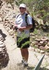
We started our hike in a small lot just off FR618H, just down the street from the Beaver Creek Ranch. Joe tells me this is a house for Bad Kids. (First Hand Knowledge?) This is on the SE side of Beaver Creek.

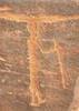
The Long Canyon Trail #63 (not the #122 which is also in Sedona) grabs you right from the beginning with it's uphill. The majority of the elevation is gained in the first 1.5 miles. At the 2 mile mark there is a sign that warns you the trail is hard to follow after this point. Between Rock Basket Cairns and Tr 63 Carbonite signs, we made it in 6.6 miles before losing it.
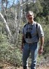
You get some nice high desert views up top, as well as views into Long Canyon. With a drawn up track, we made our way over to the intersection with the Bell Trail and checked out the old out buildings. Joe got his picture taken by a Game Camera.

The Bell Trail #13 at this point follows an old 2 track going to the NW....for awhile. This lasts for a mile, until the two track just ends. We followed the drawn track through what could have been a trail at one time for .75 mile until we once again had trail. Views the closer you get to the Rim in the NW corner of the Mesa are spectacular. I saw some new areas in the Wet Beaver area that I need to explore, east of The Crack looks enticing!

Going down towards The Crack on the Bell Trail, we passed our first hikers of the day. Joe scared them off. We went off trail a couple of times on the way down, to get some views into The Crack area. There were a dozen or so people enjoying the water.

I see why the Wet Beaver area is so popular. There are plenty of opportunities to enjoy the water and the scenery. Joe pointed out one area of Tafoni that was particularly interesting.

We hit the short Wier Trail #85 to get under the Trees and get into the Creek for a bit. Joe played with a Torpedo while looking for his bolt cutters.

We also went off trail crossing the creek, to get back to the truck. There were some red slick rock areas that would be fun to play in with more time. Joe played Tarzan for a bit and we made our way back to the truck.

All in all, a fun day in the Wet Beaver Wilderness.... an area that needs some more attention, especially upstream from The Crack area.

Short Video :next: http://youtu.be/kUN_Qn7Ty2Q
wildflower observationwildflower observationwildflower observationwildflower observationwildflower observation
Wildflowers Observation Light

water 1 out of 5water 2 out of 5water 3 out of 5water less than max Casner Canyon Medium flow Medium flow
Plenty of filterable water

dry Long Canyon Dry Dry
Dry in the upper portions. Not sure about the lower portions.
Noticed some pooling in the very lower portions

water 1 out of 5water 2 out of 5water less than maxwater less than max Long Canyon Tank 26-50% full 26-50% full
I guess you could filter it if you wanted. Too many Bovine and other animals using the area for my liking.

water 1 out of 5water 2 out of 5water less than maxwater less than max Roundup Basin Tank 26-50% full 26-50% full
I guess you could filter it if you wanted. Too many Bovine and other animals using the area for my liking.

water 1 out of 5water 2 out of 5water less than maxwater less than max Trail Tank 26-50% full 26-50% full
I guess you could filter it if you wanted. Too many Bovine and other animals using the area for my liking.
_____________________
There is a very fine line between "hobby" and "mental illness."
Dave Barry 🦅
 
May 24 2014
avatar

 Guides 264
 Routes 2,797
 Photos 14,494
 Triplogs 5,894

55 male
 Joined Nov 20 1996
 
Long Canyon - Bell Trail Loop, AZ 
Long Canyon - Bell Trail Loop, AZ
 
Hiking avatar May 24 2014
joebartelsTriplogs 5,894
Hiking17.70 Miles 2,860 AEG
Hiking17.70 Miles   9 Hrs   44 Mns   2.11 mph
2,860 ft AEG   1 Hour   20 Mns Break14 LBS Pack
 
Bruce engineered this seemingly obvious yet rarely traveled loop. Aside from a couple hours of vicious biting gnats I enjoyed the hike. The stats are reasonable. Route finding even with monster sized caged cairns is challenging for miles. I doubt this loop will appeal to casual hikers.

Long Canyon Trail #63
Climbs vigorously up to a mesa. Look back to catch some nice views heading up. Our view included smoke over Sedona and hanging low in the Verde Valley from the Slide Rock Fire. The first 2.5 miles is medium intriguing. Then it turns into an ever increasingly challenging cairn hunt. Typical Sedona mesa zone... junipers dot the rocky ankle buster landscape with prickly pair accents.

At 4.5 miles a sharp canyon edge intrigues dazed eyes. Distant Sedona views open up. This is where it turns into advance route finding. Caged cairns continue. Keep an eye out for sawed off tree limbs to hopscotch the voids. That game plan works for 1.5 miles. Just after 6 miles in whip out the bible and start praying. It's about 2 more miles to Roundup Basin Tank. If you are lucky you'll cross paths with a few cairns along the way. We did not witness more than a hundred yards of anything that could remotely be called a trail.

Bell Trail #13
Most only hike the very lower 3.3 mile portion near the creek. We tackled the middle third ( 4 to 4.5 miles ), I'd imagine only 3-5% make it here past Bell Crossing. Perhaps 1-1.12% knock out the upper third all the way to FS 214.

From Roundup Basin Tank it's an old road for 1 mile heading down. Raiders of the Lost Cairn Hunt is back in theaters for two miles until you reach the edge overlooking Wet Beaver Creek. Albeit a steep ~1.5 miles down to Bell Crossing I highly recommend this if you enjoy sweet overhead canyon views.

We finished off the lower portion taking in a bit of the Wier 85. It is a gem. While it lacks maples it may get a little more popular now that nearby Oak Creek has been torched. We hit up the undisclosed hidden secrets ( oops I posted a gps track ) to round out the loop.

Fun moderate loop!
wildflower observationwildflower observationwildflower observationwildflower observationwildflower observation
Wildflowers Observation Light
prickly pair with yellow flowers for the most part, Palmer's Penstemon
_____________________
- joe
 
Apr 21 2014
avatar

 Routes 11
 Photos 260
 Triplogs 423

64 male
 Joined Mar 12 2011
 Cave Creek, AZ
Long Canyon Trail #63 - Wet BeaverCamp Verde, AZ
Camp Verde, AZ
Hiking avatar Apr 21 2014
Hiking_FoolTriplogs 423
Hiking10.50 Miles 1,800 AEG
Hiking10.50 Miles
1,800 ft AEG
 no routesno photosets
1st trip
Linked   none no linked trail guides
Partners none no partners
_____________________
 
Jun 05 2010
avatar

 Guides 9
 Routes 98
 Triplogs 284

44 male
 Joined Feb 17 2010
 Moscow, RU
Bell Trail to the Crack - Wet Beaver CreekCamp Verde, AZ
Camp Verde, AZ
Hiking avatar Jun 05 2010
AndreyPTriplogs 284
Hiking7.20 Miles 520 AEG
Hiking7.20 Miles   3 Hrs   10 Mns   2.27 mph
520 ft AEG
 no routesno photosets
1st trip
Linked   linked  
Partners partners
HAZ - Event
FreespiritAZ
Nice afternoon hike&swim in The Crack with FreespiritAZ. We were hiking up at the very heat of the day, so the cool creek water was rewarding. Spent about two hours there swimming, jumping off the 20 ft rock, biting our lunch and being bitten by carnivorous bugs. Hiked back down when the heat went off.
_____________________
 
Mar 20 2010
avatar

 Routes 6
 Photos 303
 Triplogs 36

62 male
 Joined Dec 13 2003
 Perth, Scotland
Long Canyon Trail #63 - Wet BeaverCamp Verde, AZ
Camp Verde, AZ
Hiking avatar Mar 20 2010
georgesteelTriplogs 36
Hiking3.00 Miles 1,290 AEG
Hiking3.00 Miles
1,290 ft AEG
 no routes
1st trip
Linked   none no linked trail guides
Partners none no partners
The start of this hike is steep and can be slippery on the small stones if you come back the same way as we did. We saw a Skunk after the first climb and it did not seem to be bothered by us passing by. The trail was easy to follow with the cairns but very rough in places and you almost had to bolder hop to save the ankles. Coming back down the views across to the Bell Trail parking and White Mesa were good
 Fauna
 Fauna [ checklist ]
[ checklist ]  Skunk
_____________________
 
Nov 29 2009
avatar

 Guides 13
 Routes 38
 Photos 1,651
 Triplogs 577

60 male
 Joined Nov 15 2005
 Jackson, CA
Long Canyon Trail #63 - Wet BeaverCamp Verde, AZ
Camp Verde, AZ
Hiking avatar Nov 29 2009
toddakTriplogs 577
Hiking16.00 Miles 2,000 AEG
Hiking16.00 Miles   6 Hrs   30 Mns   2.46 mph
2,000 ft AEG
 no routesno photosets
1st trip
Linked   linked  
Partners none no partners
Maybe not the most scenic terrain in Arizona, but linking Long Canyon #63 with Bell #13 makes for a good workout loop, with some decent Red Rock views and an always pleasant visit to Wet Beaver Creek. Up on the mesa, the trails are obvious within a mile or two of the rim but after that they are hit and miss (mostly miss). Overall, the navigation is fairly straightforward, but inputting a few key waypoints on the GPS ahead of time will make for more confident trekking. Dropping a mountain bike at the Bell trailhead will save the mile or so road walk back to the start.
_____________________
 
Aug 14 2009
avatar

 Guides 1
 Routes 148
 Photos 9,924
 Triplogs 3,652

63 male
 Joined Apr 02 2005
 Mesa, AZ
Bell Trail to the Crack - Wet Beaver CreekCamp Verde, AZ
Camp Verde, AZ
Hiking avatar Aug 14 2009
Tortoise_HikerTriplogs 3,652
Hiking18.70 Miles 3,700 AEG
Hiking18.70 Miles   9 Hrs   50 Mns   1.90 mph
3,700 ft AEG
 no routes
1st trip
Partners partners
BobP
Bob and I hit the Bell Trail around 6:30am with no set mileage in mind. We made it past the Apache Maid sign and on to the crack. First time there and it does look like fun but we didn't come to swim this time. We did hike down a little further and play in the water. I managed to fall in on my back and Bob wouldn't flip me back over. At least he did't take a picture. From there we headed up Bell trail to see what it looked like up top.Nice views but the warning sign should have stopped us in are tracks. We stopped but just for lunch. The trail did have cairns for awhile but got sporatic at times. We decided to loop it with Long Canyon Trail and the fun began. This is probably the hardest trail to follow I've been on! Thanks to Bob for bringing the GPS and keeping us going in the right direction. About a forth of the way back we found enough water for Bob to filter 4 quarts of water just in case we needed it.(we didn't) We finally found the hike at your risk sign for Long Canyon and the trail was ok after that. Going down Long Canyon back to the creek was pretty steep and Would be quite the workout going up it. We were going to take a dip but were to tired. We headed back to the car and called it a day. I'm sure I'll hike up to Bell crossing again but for the loop :o :scared: :sweat: Thanks to Bob for the trip. :D
 Geology
 Geology [ checklist ]
[ checklist ]  Tafoni
_____________________
Tortoise Hiking. Stop and smell the Petrichor.
 
Aug 14 2009
avatar

 Guides 2
 Routes 251
 Photos 4,593
 Triplogs 3,212

63 male
 Joined Feb 26 2008
 Scottsdale, AZ
Bell Trail to the Crack - Wet Beaver CreekCamp Verde, AZ
Camp Verde, AZ
Hiking avatar Aug 14 2009
BobPTriplogs 3,212
Hiking18.70 Miles 3,000 AEG
Hiking18.70 Miles   9 Hrs   50 Mns   1.90 mph
3,000 ft AEG
 no routes
1st trip
Linked   linked  
Partners partners
Tortoise_Hiker
Back to the TH that still gives me nightmares :scared: We started on Bell Trail at about 630. About two miles in, my middle finger was twitching but never stood at attention. We hiked up to the Crack and Denny was licked by the tongue of the beaver. Long story short, did you ever see a turtle on his back in water. I swear I only laughed when I knew he was ok and didn't wreck his camera. However, no pictures exist. :D

We hiked up the creek a little ways and I slipped on the rocks, but only got my sandals wet. From there, we backtracked and missed our turn and about ten minutes later we figured it out. We crossed at Bell crossing and continued up to the rim for an early lunch(930am). The views were pretty sweet. After our break, we decided to go past the warning sign. :o We decided we'd turn around at about 1100am.

New plan, why not make this a Loop. Denny and I agreed and let the route finding begin. It was a route finding nightmare but we muddled thru it. If you start from Long Canyon it is probably easier to follow. Long Canyon is about 10 miles long. I brought my filter because when I told Denny I wanted to do 5-7 miles of Bell Trail... his reply was isn't Bell trail like 11 miles each way. Going up Long Canyon would be a nice elevation workout... anyone interested?
 Geology
 Geology [ checklist ]
[ checklist ]  Tafoni
_____________________
https://www.seeitourway.org
Always pronounce Egeszsegedre properly......
If you like this triplog you must be a friend of BrunoP
 
May 02 2009
avatar

 Photos 323
 Triplogs 11

male
 Joined Apr 20 2005
 Antelope, CA
Long Canyon Trail #63 - Wet BeaverCamp Verde, AZ
Camp Verde, AZ
Hiking avatar May 02 2009
crispycremeTriplogs 11
Hiking9.50 Miles 1,500 AEG
Hiking9.50 Miles
1,500 ft AEG
 no routes
1st trip
Linked   none no linked trail guides
Partners none no partners
Weather wasn't cooperating so we turned around after about a mile and a half. I had the camera setting for indoor lighting, so 75% of my pictures turned out blue, as you can see on the last image. :( Sigh.

Many types of flowers as you can see. As I figure out what they are, I'll tag 'em.
_____________________
 
Jan 20 2008
avatar

 Photos 7
 Triplogs 177

45 male
 Joined Nov 14 2007
 Phoenix
Long Canyon Trail #63 - Wet BeaverCamp Verde, AZ
Camp Verde, AZ
Hiking avatar Jan 20 2008
kgmolsonTriplogs 177
Hiking9.50 Miles 1,500 AEG
Hiking9.50 Miles   3 Hrs      3.17 mph
1,500 ft AEG
 no routesno photosets
1st trip
Linked   none no linked trail guides
Partners none no partners
_____________________
 
average hiking speed 2.11 mph

WARNING! Hiking and outdoor related sports can be dangerous. Be responsible and prepare for the trip. Study the area you are entering and plan accordingly. Dress for the current and unexpected weather changes. Take plenty of water. Never go alone. Make an itinerary with your plan(s), route(s), destination(s) and expected return time. Give your itinerary to trusted family and/or friends.

helpcommentissue

end of page marker