username
X
password
register
for free!
help
ArticlesGuidesRoutes
 
Photosets
 
 Comments
triplogs   photosets   labels comments more
Maxwell Trail #37 - 27 members in 85 triplogs have rated this an average 3.9 ( 1 to 5 best )
1, 2, 3, 4, 5  Next
85 triplogs
login for filter options
Jun 14 2025
avatar

 Guides 3
 Routes 632
 Photos 8,235
 Triplogs 604

54 male
 Joined Apr 13 2011
 Gilbert, AZ
Tramway Maxwell LoopPayson, AZ
Payson, AZ
Hiking avatar Jun 14 2025
ddgrunningTriplogs 604
Hiking11.79 Miles 2,147 AEG
Hiking11.79 Miles   9 Hrs   10 Mns   1.52 mph
2,147 ft AEG   1 Hour   26 Mns Break
 
1st trip
Linked   linked  
Partners none no partners
Route Scout Route Recorded  on Route Scout | Pop | Map | Popup | MapDEX
It's WCC season, and we decided to hit up this access point on the north side.

The drive in was fine to the "message board" trailhead for any medium clearance vehicle. Saw a few high clearance 4x4s that ventured all the way down to the Maxwell TH. There are several gnarly rocky sections that would be problematic for lower/mid-clearance vehicles. And getting to the Tramway TH proper is probably just for SxSs and ATVs.

We were content to start from the message board (as the HAZ route suggests) and headed to Tramway first. The road walk is a bit blah, but passed quickly. Notably there is one point at which the trail veers off to the left on a less established track and initially we kept walking down the main road before recognizing our error.

Once at the rim, the descent is quick and steep. But the trail is relatively well defined. At one point, there is a short, semi exposed scramble, but I believe there is a non-exposed work around that we just bypassed.

Once at the creek, the magic begins, with a large pool right at the base across from the prime camping spot. A mother duck and about 10 ducklings were out for a morning constitutional.

We blew up our tubes and began trekking upstream. We considered exploring more downstream, and perhaps will try that next time.

On the way up towards Maxwell, we stopped to admire the impressive petroglyph panel, though it's been marred by more careless recent travelers. There is a camp spot nearby, which no doubt has contributed to the panel deterioration.

Just below the Maxwell junction, we encountered our first company--a couple and a larger group who were on an out and back on Maxwell. A nice campsite is also in this area.

We decided to explore further upstream around the confluence with Wilson Canyon, and were glad we did. Up Wilson are some of the longest and most impressive pools, one of which was around 150 yards long. We also briefly explored up Clover Canyon, which offered a lovely, and crystal-clear turquoise pool with some decent sized fish.

On the way back to Maxwell, we thought we had passed all the swimmers, so deflated our tubes, only to come across a swimmer that we had forgotten about 2 minutes later. :roll: So, it took us awhile longer than it should have to navigate. All good though.

The climb out Maxwell was the work of the day, but not too bad. Near the top I made a mental note of a great rappelling spot that would allow repeat access to the top, and would not necessitate bringing ropes up from the bottom.

Great and large open camping area on top at the Maxwell TH.

The road walk back from Maxwell was a little more scenic/foresty.

On the way out, we decided to hit up Wilson Crossing as well. See separate triplog.
_____________________
 
Jul 03 2024
avatar

 Guides 187
 Routes 990
 Photos 12,079
 Triplogs 865

72 male
 Joined Jun 27 2015
 Tucson, Arizona
Maxwell Trail, AZ 
Maxwell Trail, AZ
 
Hiking avatar Jul 03 2024
markthurman53Triplogs 865
Hiking2.10 Miles 853 AEG
Hiking2.10 Miles   2 Hrs   56 Mns   1.29 mph
853 ft AEG   1 Hour   18 Mns Break20 LBS Pack
 
Linked   linked  
Partners partners
mamakatt22
On our last day in Payson we headed up the rim again this time to the Maxwell Trail along Lake Mary Road. Long muddy drive to the trailhead. Steep 1 mile hike to the creek. Good flow in the creek with the water being cool but not cold. No one on the trail nor the road drive in or out. Spent about an hour in the canyon before heading out. Soaked our shirts in water before heading up, temps were in the 90's, at least in the sun. on our drive back to Payson you could see the 4th of July travelers were out in number. Payson was a zoo. Ate at the El Rancho Mexican Restaurant both nights there, best Mexican food in town or a lot of other places for that matter.
_____________________
 
Jun 15 2024
avatar

 Guides 4
 Routes 491
 Photos 10,890
 Triplogs 1,257

55 male
 Joined Nov 20 2012
 Phoenix, AZ
Maxway Tramwell, AZ 
Maxway Tramwell, AZ
 
Hiking avatar Jun 15 2024
BiFrostTriplogs 1,257
Hiking10.27 Miles 1,500 AEG
Hiking10.27 Miles   5 Hrs   56 Mns   2.02 mph
1,500 ft AEG      51 Mns Break
 no routes
1st trip
Partners partners
chumley
Always enjoyable to check out the pools in the WCC. Didn't see too many people until we made the side trip down to Sundance Canyon. After the side trip we returned the same way back towards the Tramway Maxwell exit. However, before the exit we went for a swim in some really nice pools to cool off and even enjoyed a beverage in the pool. Great spot to hang out before the climb out to complete the loop!
_____________________
  1 archive
Jun 15 2024
avatar

 Guides 94
 Routes 840
 Photos 22,055
 Triplogs 1,993

52 male
 Joined Sep 18 2002
 Tempe, AZ
Maxway Tramwell, AZ 
Maxway Tramwell, AZ
 
Hiking avatar Jun 15 2024
chumleyTriplogs 1,993
Hiking10.27 Miles 1,500 AEG
Hiking10.27 Miles   5 Hrs   56 Mns   2.02 mph
1,500 ft AEG      51 Mns Break
 no routes
Partners partners
BiFrost
Decided to get out of the heat and do an easy loop in splashland. Went downstream to Sundance where we encountered several of the daily dozens that had dropped in via the pooeyshow route. Except for that short outnback we didn't encounter any other bipeds on the day. Took a couple of swim breaks and I inflated a floatie and enjoyed a bevvy.
_____________________
I'm not sure what my spirit animal is, but I'm confident it has rabies.
 
Jun 17 2023
avatar

 Guides 110
 Routes 2,246
 Photos 8,982
 Triplogs 2,600

45 female
 Joined Dec 24 2007
 Ahwatukee, AZ
Maxwell Trail #37Payson, AZ
Payson, AZ
Hiking avatar Jun 17 2023
LindaAnnTriplogs 2,600
Hiking5.62 Miles 1,552 AEG
Hiking5.62 Miles   5 Hrs   35 Mns   1.19 mph
1,552 ft AEG      51 Mns Break
 
Linked   linked  
Partners partners
RedChrisB
Route Scout Route Recorded  on Route Scout | Pop | Map | Popup | MapDEX
Original plan was Point Trail, but switched to Maxwell due to closures from the Wilbur Fire. Chris and I met up with his friends Rob and Cindy at their camper in Happy Jack, then we all took their SxS to the Maxwell trailhead.

Short, steep descent down Maxwell, and we were quickly at the water. The creek was full, and the vegetation is thick this year. Debris from a somewhat recent flash was obvious in the trees, stuck a few feet above my head, meaning the water looked to reach a good 7-9’ above the normal creek level.

We headed downstream, knowing Cindy & Rob would turn around at some point. Of course, probably the roughest part of the creek travel was the first half mile west of Maxwell. Minimal path through the vegetation, and some spots where the bank had been completely eroded away, forcing some detours. The water felt cold at first, but was soon refreshing. One large pool to cross was Cindy’s turnaround point. They said they would hang out at the water before heading back up Maxwell, then would drive over to the top of Tramway for me and Chris to meet them there. It was 11 am at that point, so I suggested a 3pm meet time based on the plan for the day.

Chris & I continued downstream, with travel generally getting easier as we headed west. Lots of vegetation to push through though to get around the deeper pools, and we managed to stay on the path most of the time.

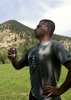
Got to Sundance Canyon, and I was surprised to see the previously deep pool at the entrance to the canyon is now a shallow pool, with a large gravel bar. Many times, I have shuttled my kids across that pool one at a time when they were younger. These days, it’s an thigh-deep pool, lol. Anyway, lunch at Sundance, then headed back upstream to Tramway.

Travel back upstream felt slightly faster since most guesswork had been eliminated. Hot slog up Tramway, which seems to barely exist in places. Not a trail I particularly care for. Popped out up top at 3:05, so my 3pm guess was very accurate. Our ride was waiting for us as promised.

Only saw other people near where Maxwell & Tramway reached the creek, had the rest of the creek to ourselves. Both roads to reach the trailheads are crap, with the road to Maxwell being slightly less terrible. High clearance suggested for Maxwell and mandatory for Tramway. Smoke from the Wilbur Fire was never an issue, and we only noticed it when we were finishing up on Tramway.

Saw tons of crawdads and fish (trout?), and one harmless snake.
_____________________
Stop crying and just go do the hike.
  1 archive
Aug 21 2021
avatar

 Routes 386
 Photos 49
 Triplogs 792

43 female
 Joined Jun 23 2015
 Phoenix, AZ
Tramway Maxwell LoopPayson, AZ
Payson, AZ
Hiking avatar Aug 21 2021
emilystardustTriplogs 792
Hiking7.49 Miles 1,172 AEG
Hiking7.49 Miles   5 Hrs   40 Mns   1.63 mph
1,172 ft AEG   1 Hour   4 Mns Break
 
no photosets
1st trip
Linked   linked  
Partners none no partners
Route Scout Route Recorded  on Route Scout | Pop | Map | Popup | MapDEX
Some nice cloud cover and a short detour to the headwaters of West Clear Creek.
_____________________
  1 archive
Jul 11 2021
avatar

 Routes 175
 Photos 2,335
 Triplogs 191

44 female
 Joined Jan 21 2019
 Pine, AZ
Maxwell Trail #37Payson, AZ
Payson, AZ
Hiking avatar Jul 11 2021
jillyonanadventureTriplogs 191
Hiking2.76 Miles 929 AEG
Hiking2.76 Miles   2 Hrs   23 Mns   1.27 mph
929 ft AEG      13 Mns Break
 no routes
1st trip
Linked   none no linked trail guides
Partners none no partners
Was craving some solitude so I headed up North on Saturday to set up camp near WCC. I wasn’t 100% sure what I wanted to hike, so I just picked a spot in the general area near a couple of routes I’d been interested in.

I was having a blast driving around some back roads I’d never even noticed before. Soon, the skies started looking a bit questionable. I realized I needed to find a good camp option ASAP to brace for the storm. Given I was solo, I wanted to play it safe and a “danger, vehicle damaging hail” alert had just came through… :scared: I try to be so independent but I also don’t want to die, so I texted a knowledgeable friend to get some reassurance about best places to camp. I chose a meadow area where I was nestled under a cluster of nice trees. Basically as soon as I got camp set up, the sky erupted and the hail was coming down HARD! I honestly thought it was going to break the windows in my vehicle it was so loud. I waited the storm out in the back of my 4Runner; despite it being pretty scary, it was rather beautiful to see. When the storm quieted, I went outside and was shocked about the amount of hail and the size of it! The rest of the night was a bit uneventful thankfully.

When I woke up, I took a short walk to check out the road. It was completely muddy and I was a bit nervous. I opted for maxwell trail as I’m familiar with the area and felt good about being able to complete that hike before any additional storms came in.

Getting to maxwell TH was quite the adventure! The roads were super muddy and rutted. I don’t have too much experience driving in thick mud, so I slapped Tessa into 4Low and hoped for the best. She handled all that mud like a champ and I had a blast driving through it!

I had the whole trail to myself which was awesome. The humidity was out of control and the trail was a bit muddy, so my pace was pretty slow and careful given there was no one else out there. I made it down to my favorite rock and took a nice long break enjoying the scenery. The water level was definitely lower than any prior visits and had tons of algae, but still beautiful per usual.

After my break I set out for the climb up. I heard some animal noises and decided to play some music to ease my mind. I made it up to the top before any bad weather started, woohoo! The road hadn’t dried up much so it was a fun, wet ride out. This was the perfect little solo adventure reset to get me ready to tackle the week ahead!
 Named place
 Named place [ checklist ]
[ checklist ]  West Clear Creek Canyon
_____________________
Restless between adventures...
 
Jun 10 2021
avatar

 Routes 154
 Photos 1,505
 Triplogs 266

31 male
 Joined Jun 02 2019
 Phoenix, AZ
Willow ValleyPayson, AZ
Payson, AZ
Canyoneering avatar Jun 10 2021
LJWTriplogs 266
Canyoneering12.00 Miles 2,000 AEG
Canyoneering12.00 Miles   12 Hrs      1.66 mph
2,000 ft AEG   4 Hrs   45 Mns Break
Canyon Hiking - Non-technical; no rope; easy scrambling; occasional hand use
B - Up to light current; wading/swimming; possible wet/dry suit
III - Normally requires most of a day
 no routes
1st trip
Linked   linked  
Partners none no partners
Had never been here or to WCC proper, started with Willow Valley for an intro to the area. Brought a couple friends along and we did the conventional loop from Maxwell Tank. FR81 is solid but 81E to the trailhead requires some clearance, good tires lend peace of mind. Started out a little late, around 7:30 and went clockwise. Willow Valley and this route sort of defy language; it's like a photographer saying pictures don't do a place justice, well it's hard to explain the magic down there and I'm not sure it's possible with ordinary words.

Down from the tank along the drainage bottom is rocky but only a light bushwhack. Some poison ivy that is not worth the effort to avoid. Eventually the drainage falls away and someone has anchored a rope to a tree to help with the climb. Went down and had to come back up to get down farther north. Canyon started dry and we worked around the first pool to the west. There were three unavoidable pools where we had to get in. First two were take-your-breath-away cold. Both combine for maybe 60 yards of swimming. Brought a float to ferry packs and boots across. So damn fun but took a lot of time, especially the pre-swim beers we needed to work up the excitement to get in with the cool morning air.

After the pools the canyon dries up a little before getting wetter and wetter. No more swimming, but our feet stayed wet the whole time. More and more fish and marshy areas where the grass grows over the flowing water. Absolutely sublime. Lots of wildlife, including a black rattlesnake I didn't notice until I'd stepped over it and it got to rattling. Nothing for noise but the whisper of wind and clicking of insects in the firs. Amazing mixed forest of old, huge conifers and deciduous trees that escape my taxonomic knowledge. Some use trails, some creek. It's quite slippery on the bottom and slow going. More numerous and bigger fish closer to Clover Canyon and WCC. Good campsites in the many bends. Diverse scenery along the way and around every corner.

Maxwell trail is flagged with orange tape in the trees and some cairns. It's in great shape and by then we were happy to have a trail. Cut between the roads through the hordes of cows back to the car and made it just as the sun set. Didn't see anyone on the hike, register indicated no one for three days. One car parked by Maxwell trailhead was the only sign of human life. Going back I'd backpack so as to be in no rush. No fewer than twelve hours will do, even if it could be done faster.
wildflower observationwildflower observationwildflower observationwildflower observationwildflower observation
Wildflowers Observation Isolated

water 1 out of 5water 2 out of 5water 3 out of 5water less than max Maxwell Tank 51-75% full 51-75% full
  13 archives
Aug 22 2020
avatar

 Routes 175
 Photos 2,335
 Triplogs 191

44 female
 Joined Jan 21 2019
 Pine, AZ
Tramway Maxwell LoopPayson, AZ
Payson, AZ
Hiking avatar Aug 22 2020
jillyonanadventureTriplogs 191
Hiking10.15 Miles 1,722 AEG
Hiking10.15 Miles   6 Hrs   37 Mns   1.87 mph
1,722 ft AEG   1 Hour   11 Mns Break
 
1st trip
Partners partners
jharvey33
Route Scout Route Recorded  on Route Scout | Pop | Map | Popup | MapDEX
Met up with Brooks and Shelci for a lil WCC exploration. We parked at the Maxwell/Tramway intersection and had a quick road walk down Tramway before getting to the TH and dropping down into the canyon. Pretty views from the top over on a side path worth checking out! It was quite toasty getting down and we all pretty much ran into the water for a dip once we reached the bottom; so refreshing. Peer pressured James into a lil cliff jumping too! : app : Although our end destination was Maxwell, we decided to first explore down the other side of the canyon for a bit first. It was pretty, yet a bit anticlimactic so we headed back towards our intended route. The bushwhacking is pretty mild in this section, so that’s always nice, although I still did manage to rip my pants on a jagged branch :sweat: Finding the petroglyphs was a nice surprise and they were really interesting. Several walls in the canyon are totally covered and I was loving it. We didn’t see many people, but there was a nice group camping at the pool/cave that I personally think looks like a bum! We chatted with them for a bit, swam and explored around before heading back up maxwell. The exit is pretty mild, but still a tad steep in spots. We heard lots of thunder as we exited and were treated with a rainbow at the top of the canyon. We had a couple of miles of fast road walking before getting back to the vehicles. There was some light rain, lots of thunder and lightning in the distance. The road was SUPER muddy and got extremely slippery. It was a heart pumping exit in the Subaru with no 4x4, since we’d spinned around a few times in the mud. We opted not to camp given the weather and saw a spectacular lightning show on the way back to the valley! This is a nice section of WCC; definitely less peopley than point trail.
 Culture
 Culture [ checklist ]
[ checklist ]  Ghost?
_____________________
Restless between adventures...
 
Aug 15 2020
avatar

 Routes 181
 Photos 901
 Triplogs 259

50 female
 Joined Mar 09 2010
 Chandler, AZ
Maxwell Trail #37Payson, AZ
Payson, AZ
Hiking avatar Aug 15 2020
azlaurieTriplogs 259
Hiking6.25 Miles 1,315 AEG
Hiking6.25 Miles   4 Hrs   28 Mns   2.14 mph
1,315 ft AEG   1 Hour   33 Mns Break12 LBS Pack
 
1st trip
Linked   none no linked trail guides
Partners partners
dswitzer3
Route Scout Route Recorded  on Route Scout | Pop | Map | Popup | MapDEX
_____________________
♥ Timing is Everything ♥
  2 archives
Aug 01 2020
avatar

 Guides 12
 Routes 192
 Photos 863
 Triplogs 356

42 male
 Joined Nov 30 2015
 Phoenix, AZ
Clover Creek CanyonPayson, AZ
Payson, AZ
Canyoneering avatar Aug 01 2020
ShatteredArmTriplogs 356
Canyoneering11.42 Miles 928 AEG
Canyoneering11.42 Miles   4 Hrs   22 Mns   2.62 mph
928 ft AEG
 
no photosets
1st trip
Linked   linked  
Partners none no partners
Saw that the monsoon moisture was taking a break, so figured it would be a good opportunity to check out Clover Creek. Dropped off a car at Maxwell TH and started near 87. Pretty good trail for the first two miles, then it gets choked out. There are some social trails in places, but it's all very overgrown and brambly. The plus side is that meant we had some raspberries to snack on along the way.

No major obstacles, just slow going until you get to the bend in the canyon towards Tom's Creek. In that section, which actually had a decent trail in it, we saw and spooked a small bear.

Heading north again, it was just dry wash, nothing difficult. There wasn't any water until the springs about a quarter mile from the confluence with West Clear Creek.

dry Clover Creek Dry Dry
I'm going with "dry" because most of the canyon is dry. Some stagnant pools in the narrow section, and some flow in the last quarter mile before the West Clear Creek confluence.
_____________________
 
Jul 10 2020
avatar

 Routes 61
 Photos 1,008
 Triplogs 224

44 male
 Joined Aug 19 2009
 The Basin
West Clear Creek - Maxwell to Point, AZ 
West Clear Creek - Maxwell to Point, AZ
 
Backpack avatar Jul 10 2020
survivordudeTriplogs 224
Backpack8.00 Miles
Backpack8.00 Miles3 Days         
 no routes
1st trip
Partners partners
HighC480
Another Section of the magical West Clear Creek in the books with my brother from another dimension. Dropped off a vehicle at the Point TH and drove up to the labyrinth that is the road to the Maxwell Trail. Didnt get started until about Noon. Maxwell was great.. super easy going with just a couple switchbacks down to the creek. Jumping in the water that first time is the best. There is not really a trail, but there is a pretty good path through. Mostly stayed out of the water, but you do go knee deep a few times. Made great time as we passed the glyphs and then Tramway. Found a great spot for camp after a long day of hiking (2 hours :lol: ). Did some fishing and hung out on the beach the rest of the day. Hiking over to the point trail in the AM, we passed more people than we saw all the previous day. Every camp spot was taken. Literally 150 people passed us going in and out of the canyon. It was quite the show watching people change their shoes and freak out about getting wet. Hiked up a bit past Bear Canyon and made camp for the night after an exhausting 3 miles. :lol: Needless to say, this section of the canyon is about 3-4x faster moving than downstream of Calloway, with the exception of the last 4 miles of actual trail nearing BullPen. I loved the Point Trail coming out. No switchbacks, just straight to the point and straight up. About 2 miles short of the whole WCC now, gonna finish this year sometime.
 Culture
 Culture [ checklist ]
[ checklist ]  Campsite
_____________________
“There is nothing that exists outside the thought of the immediate moment.”
  1 archive
Jun 20 2020
avatar

 Guides 2
 Routes 127
 Photos 1,478
 Triplogs 129

male
 Joined May 07 2019
 Tempe, AZ
Willow Valley, AZ 
Willow Valley, AZ
 
Hiking avatar Jun 20 2020
mikemcgTriplogs 129
Hiking11.57 Miles 3,785 AEG
Hiking11.57 Miles   9 Hrs   20 Mns   1.73 mph
3,785 ft AEG   2 Hrs   38 Mns Break
 
1st trip
Linked   linked  
Partners none no partners
Route Scout Route Recorded  on Route Scout | Pop | Map | Popup | MapDEX
Our original plan was thwarted by the Bush fire, so we chose to explore Willow Valley, and I'm glad we did! We parked one vehicle at the top of the Maxwell trail, then drove the other one to the Maxwell tank to skip the 3 miles of walking on the forest road. High clearance is definitely required toward the end! It got a little bumpy but not too bad.

The descent from the road to the creek at Maxwell tank is fairly easy. We followed the wash down, watching out for poison ivy, which was present but avoidable. There's a 10 foot drop toward the end, but it was easily climbed down at the left corner, while others in our group went out of sight to the right and found a way down over there. The views and sounds in the canyon are amazing, with the high canyon walls, the many colors, the sun peeking in, and the echoes of the birds as well as our voices.

There was no water in the canyon initially, but we soon encountered 4 deep pools, each about 20-30 yards long, and crossed them in tubes, although one nimble member of our group was able to climb around all 4 of them on the right without getting wet. The water was a little chilly at first but we quickly adapted and enjoyed it.

We then took our time enjoying the views of the canyon. There was a lot of fun rock hopping. The views were amazing throughout, and the pics don't fully capture the experience. I think it was about 8 miles total in the canyon, but all of our GPSs recorded approximately 11 miles. As we went further, more water was present, and eventually the creek was continuous. There were a lot of beautiful swimming holes, but they were easy to go around for those who wanted to avoid them.

About 5 miles in, the canyon widened a little, and we started seeing a few campsites. There were well-worn use trails along the sides at this point, which made the trek much easier, but they were really thorny at times, and there were numerous poison ivy patches (or individual plants) to avoid. It got a little gnarly carrying my tube through the vegetation!

The Maxwell trail to the top was great. It was nice to be on a well-defined trail after all the rock hopping and thorns! That part went pretty quickly.

Overall a beautiful canyon, clear water, awesome people, good times!
wildflower observationwildflower observationwildflower observationwildflower observationwildflower observation
Wildflowers Observation Light
Beautiful yellow flowers in patches. I didn't get any pics of them...
  4 archives
Aug 30 2019
avatar

 Photos 2,351
 Triplogs 99

53 male
 Joined Jan 31 2015
 Chandler, AZ
Maxwell Trail #37Payson, AZ
Payson, AZ
Backpack avatar Aug 30 2019
OdinWiskiTriplogs 99
Backpack
Backpack
 no routes
1st trip
Linked   none no linked trail guides
Partners none no partners
We were glad that we did this little overnighter on Friday. As we came back up late Saturday morning, dozens of people were heading down into the canyon. The rain in the surrounding areas Friday afternoon cooled it off quite a bit. I was dreading the hot and muggy feeling down in the canyon before we went, but was pleasantly surprised by how cool and comfortable it was once we got down there.
_____________________
 
Jul 27 2019
avatar

 Guides 1
 Routes 148
 Photos 9,924
 Triplogs 3,652

63 male
 Joined Apr 02 2005
 Mesa, AZ
Tramway - Maxwell - Willow, AZ 
Tramway - Maxwell - Willow, AZ
 
Hiking avatar Jul 27 2019
Tortoise_HikerTriplogs 3,652
Hiking9.48 Miles 2,050 AEG
Hiking9.48 Miles   5 Hrs   44 Mns   1.92 mph
2,050 ft AEG      47 Mns Break
 no routesno photosets
1st trip
Partners partners
joebartels
The_Eagle
Bruce and Joe let me join them for a Saturday morning outing.I don’t get out with these gentlemen enough! Cool area that I thought I’d been to before. Maybe when I was younger but not to hike. Enjoyable hike and these two always make it fun! Thanks gents, you rock!
wildflower observationwildflower observationwildflower observationwildflower observationwildflower observation
Wildflowers Observation Isolated
_____________________
Tortoise Hiking. Stop and smell the Petrichor.
 
Jul 27 2019
avatar

 Guides 41
 Routes 1,626
 Photos 14,983
 Triplogs 2,762

69 male
 Joined Jan 20 2009
 Far NE Phoenix,
Tramway - Maxwell - Willow, AZ 
Tramway - Maxwell - Willow, AZ
 
Hiking avatar Jul 27 2019
The_EagleTriplogs 2,762
Hiking9.48 Miles 2,050 AEG
Hiking9.48 Miles   5 Hrs   44 Mns   1.92 mph
2,050 ft AEG      47 Mns Break12 LBS Pack
 
1st trip
Partners partners
joebartels
Tortoise_Hiker
Route Scout Route Recorded  on Route Scout | Pop | Map | Popup | MapDEX
We took the Tortoise north to beat 115 of the valley. He'd never been in this area. The views on the Tramway and Maxwell trails, are for sure in my top 10.

Starting on the Tramway Trail, we made our way down to West Clear Creek. I was shocked that prime camp spot at the creek was not occupied.

The travel in and around the creek on the way over to the Maxwell Trail, seems to be getting thicker, but still quite doable. We stayed dry the whole time. We stopped at the petroglyph site to show Denny. The campsite in that area was empty also.

We saw one couple in the creek and a few other groups on the climb out on Maxwell.

We made the short drive over to Willow Crossing. It was getting a tad warm, but the breeze kept it tolerable.

Climbing out of Willow Valley, there was a split in the trail. Joe went one way, Denny and I followed the track. After meeting back up, Joe said he'd found sweet ridgeline. We altered our plans and climbed up to the mesa and down the ridgeline. There were better views of the arch from this perspective. The ridgeline will be added to any future hikes out here.

The planned third hike of the day got taken off the board and was replaced with a drive on some forest roads we'd not been on before.

Good gettin' a hike in with the other 2 stooges again.
wildflower observationwildflower observationwildflower observationwildflower observationwildflower observation
Wildflowers Observation Isolated
_____________________
There is a very fine line between "hobby" and "mental illness."
Dave Barry 🦅
 
Jul 27 2019
avatar

 Guides 264
 Routes 2,797
 Photos 14,494
 Triplogs 5,894

55 male
 Joined Nov 20 1996
 
Tramway - Maxwell - Willow - Pie, AZ 
Tramway - Maxwell - Willow - Pie, AZ
 
Hiking avatar Jul 27 2019
joebartelsTriplogs 5,894
Hiking11.61 Miles 3,374 AEG
Hiking11.61 Miles   6 Hrs   50 Mns   1.95 mph
3,374 ft AEG      52 Mns Break12 LBS Pack
 
1st trip
Route Scout Route Recorded  on Route Scout | Pop | Map | Popup | MapDEX
Tramway Maxwell Loop
Canyon views are the highlight. Crossover along the creek is typically a sauna since this hike usually comes to mind when the mercury is pinging inferno. Walking the creek would undoubtedly be more enjoyable than sweating the forested banks. Stubborn won(?) and stayed dry!

Bruce had it in his mind the ascent up Maxwell is gradual. We took a break midway up gradual =)

Willow Crossing #38
Great add-on hike if in the area. That said I know I like it more than most so don't expect much... Pines on the rolling terrain are the highlight for myself.

Pie
Only 106 out so I got in a lap at the promise land too.
_____________________
- joe
 
Jun 22 2019
avatar

 Guides 110
 Routes 2,246
 Photos 8,982
 Triplogs 2,600

45 female
 Joined Dec 24 2007
 Ahwatukee, AZ
Maxwell Trail #37Payson, AZ
Payson, AZ
Hiking avatar Jun 22 2019
LindaAnnTriplogs 2,600
Hiking3.98 Miles 931 AEG
Hiking3.98 Miles   5 Hrs   16 Mns   0.89 mph
931 ft AEG      49 Mns Break
 
Linked   none no linked trail guides
Partners partners
realm09
watermelonW
The kids wanted to play in water, so this fit the bill. Kind of a slow hike down to the creek since one kid decided to argue with everyone and hold things up. Once we got to the water though, moods improved considerably. We had a snack break, and the kids splashed and swam the entire way as we headed upstream about a mile. We stopped once we reached Clover Canyon and took another break. The kids wanted to keep going, but some clouds were starting to pop up to our west, so we turned around and headed back. Faster progress downstream, but the kids still got to play in the water the entire way. The hike back up Maxwell was a little warm, but not too bad. I had bought the kids cooling towels a few days ago, and those things really do work! Once at the top, it was cloudy and smelled like rain, but it stayed just barely to the north of us. Nice and cool though.

The water through that mile of WCC was generally about knee deep on me, with one short stretch that was about hip deep with a carefully selected path. Lots of evidence of the flooding from a few months ago, but the vegetation was thick—staying in the water was by far the easiest way to hike down there.

The road is not in great condition, it’s definitely rougher than the last time I was on it. 2wd is fine when dry, but there are a lot of rocky sections. Medium clearance would be okay if careful/slow. Mostly trucks & suv’s at the trailhead, but I did see one Toyota minivan—that must have been a very tedious drive for them.
_____________________
Stop crying and just go do the hike.
 
May 10 2019
avatar

 Photos 2,351
 Triplogs 99

53 male
 Joined Jan 31 2015
 Chandler, AZ
Tramway Maxwell LoopPayson, AZ
Payson, AZ
Backpack avatar May 10 2019
OdinWiskiTriplogs 99
Backpack9.46 Miles 1,205 AEG
Backpack9.46 Miles
1,205 ft AEG
 no routes
Linked   linked  
Partners none no partners
We haven't been out for a while between traveling and other commitments. Wanted to do a short overnighter with some water features. This one fit the bill nicely. A few years ago when I hiked this one, I dropped down from Maxwell. This time we took the other side after parking at the fork and road hiking to the Tramway TH.

The big views overlooking the canyon and the creek in either direction on top of Tramway were great. And so were a few views on the way down. Once at the bottom, we took a snack break and explored a whole bunch before continuing through the canyon toward Maxwell. It was lush and green along the creek. Some sections were pretty overgrown and bushwhacking was not fun. At one point, we decided to wade through the creek instead. The water was refreshing at first but soon started to feel cold. We got to the camp site near the bottom of Maxwell and set up camp there. It was a wonderful camp site with no one around. Two day hikers were all we saw earlier and for the rest of our time there. We then explored farther out before dinner. Sleeping right next to the babbling creek was wonderful!

The next morning we took our time getting up and breaking down camp. When we worked our way up Maxwell, the weather was great. Once we got on top though, as we were hiking the road, it got really dark quickly. Then hail sizes of small marbles poured down. And lightning and cracking thunders felt pretty close. It didn't seem like it would pass any time soon. We put on our rain gear and kept hiking back to our truck in the rain, hail and mud. It was a wonderful time!
_____________________
 
Apr 25 2019
avatar

 Guides 1
 Routes 5
 Photos 656
 Triplogs 512

47 male
 Joined Jul 20 2007
 Gilbert, AZ
Maxwell Trail #37Payson, AZ
Payson, AZ
Backpack avatar Apr 25 2019
jtaylorTriplogs 512
Backpack6.00 Miles 1,280 AEG
Backpack6.00 Miles
1,280 ft AEG
 no routes
1st trip
Linked   none no linked trail guides
Partners partners
Chapman
PrestonSands
John flew out to do what has become an annual trip among high school buddies. We had several options on the table but West Clear Creek won-out with the high temps. I was worried about crowds, but the early season, Thursday start, and washed-out roads all gave us the canyon mostly to ourselves. The winter flooding wreaked havoc on the area but left quality campsites with plentiful firewood. And the pools were deep and ice cold and navigation was a little easier without the overgrowth (yet).

We stayed down from Thursday through Saturday afternoon, and then recharged in Prescott via Mexican food and warm showers and beds. Then John and I ran down the hill to get him to the airport. Preston - ever the adventurer - continued on for some more exploring.

One major concern: There was one party who left a smoldering campfire at the base of Tramway Saturday morning, including a log with heated embers outside the fire ring. It was a windy day and it could have been disastrous had we not found it and drowned it. I'm mentioning this in the hopes that - in a world of seven degrees of separation - someone might know these guys and educate them. It was a group of seven high school or college age kids, male and female, party name was Osborne(?) per the registry. They came and left via Maxwell between Friday afternoon (4/26) and Saturday morning (4/27). They drove a blue-grey, early-model Ford Escape. Looking for education; not retribution. We could have lost a treasure.
_____________________
“...wilderness is not a luxury but a necessity of the human spirit, and as vital to our lives as water and good bread.”
-Edward Abbey, Desert Solitaire
  1 archive
average hiking speed 1.73 mph
1, 2, 3, 4, 5  Next

WARNING! Hiking and outdoor related sports can be dangerous. Be responsible and prepare for the trip. Study the area you are entering and plan accordingly. Dress for the current and unexpected weather changes. Take plenty of water. Never go alone. Make an itinerary with your plan(s), route(s), destination(s) and expected return time. Give your itinerary to trusted family and/or friends.

helpcommentissue

end of page marker