username
X
password
register
for free!
help
ArticlesGuidesRoutes
 
Photosets
 
 Comments
triplogs   photosets   labels comments more
Los Burros Trail #631 - 11 members in 25 triplogs have rated this an average 3.9 ( 1 to 5 best )
1, 2  Next
25 triplogs
login for filter options
Aug 31 2025
avatar

 Guides 17
 Routes 297
 Photos 1,808
 Triplogs 276

female
 Joined Mar 11 2002
 Gilbert, AZ
Los Burros Trail #631Alpine, AZ
Alpine, AZ
Hiking avatar Aug 31 2025
VashtiTriplogs 276
Hiking8.36 Miles 689 AEG
Hiking8.36 Miles   3 Hrs   46 Mns   2.55 mph
689 ft AEG      29 Mns Break
 
1st trip
Linked   none no linked trail guides
Partners none no partners
Route Scout Route Recorded  on Route Scout | Pop | Map | Popup | MapDEX
Decided to try this trail as we haven't done it previously. We stayed with friends in Vernon, so the trailhead by the Los Burros campground is super nearby. The trailhead is just on the other side of the campground, by the vault toilet. There is room for about 4 cars in the area by the trail sign.

This trail is pretty uneventful. It is mainly flat with lots of pine trees. There are some burn areas, but not too many. All the junctions are signed, and the trail is marked every quarter mile by white metal diamond trail markers. There are some meadows, but mainly pine forests.

The full loop hike is 13 miles, but there are two shortcuts. One is a trail, and one is a road. None of my family or friends were up for the thirteen loop, so we decided to take the short loop on the south side using the trail connector.

The trail sign says 5.5 miles from trailhead to the shortcut connector junction, and 2 miles from the connector junction to the trail head. This 7.5 miles does not match the 8.4 miles on route scout, but maybe the forest service isn't including the tiny trail connector from the car to the loop.

We saw very few people despite it being a holiday weekend. We saw 2 groups of 2 mountain bikers each. There was one couple camping near a meadow just past reservation tank. Otherwise, we saw no one on the trail. Yippee!

The smell of sun baked pine during the hike was simply delightful. The day was quite warm at 83F, so we were thankful for the shady sections of trail along with some clouds that provided shade towards end of the hike.

There was some stagnant looking water at reservation tank, and absolutely zero water at the bear wallow tank nearer to the shortcut trail junction.
wildflower observationwildflower observationwildflower observationwildflower observationwildflower observation
Wildflowers Observation Isolated
Some isolated flowers (flea bane and some others), but mostly nothing.

dry Bear Wallow Tank Dry Dry
No water at all. Not even much mud.

water 1 out of 5water 2 out of 5water less than maxwater less than max Reservation Tank 26-50% full 26-50% full
Murky water with cows nearby
_____________________
:D
  3 archives
Jun 21 2025
avatar

 Guides 93
 Routes 397
 Photos 4,984
 Triplogs 4,124

49 male
 Joined Jun 20 2003
 Tucson, AZ
Los Burros Trail #631Alpine, AZ
Alpine, AZ
Run/Jog avatar Jun 21 2025
fricknaleyTriplogs 4,124
Run/Jog14.10 Miles 1,526 AEG
Run/Jog14.10 Miles   3 Hrs   14 Mns   4.67 mph
1,526 ft AEG      13 Mns Break5 LBS Pack
 no routes
1st trip
Linked   none no linked trail guides
Partners none no partners
This was plan B after learning much of the forest in the area i was camping had closed. very very nice trail network and i enjoyed this forested loop more than anticipated. felt better than i thought i would after big day prior as well.

great short getaway up to the white mountains, hopefully it won't be so long next time
_____________________
hi
 
Aug 11 2024
avatar

 Guides 12
 Routes 192
 Photos 863
 Triplogs 356

42 male
 Joined Nov 30 2015
 Phoenix, AZ
Los Burros Trail #631Alpine, AZ
Alpine, AZ
Run/Jog avatar Aug 11 2024
ShatteredArmTriplogs 356
Run/Jog14.85 Miles 1,332 AEG
Run/Jog14.85 Miles   3 Hrs   40 Mns   30 Secs4.04 mph
1,332 ft AEG
 
no photosets
1st trip
Linked   none no linked trail guides
Partners none no partners
Needed to do something closer to Pinetop, so I decided to check out the full Los Burros loop. Started at where Chipmunk Connector crosses the Vernon-McNary road, right at the reservation boundary. Outside of a couple short steep sections, ran the whole first nine miles. After this point, I started bonking, and the last five miles became a real slog. The higher areas near Pierce Mountain and Wishbone Mountain were unexpectedly pretty - lush, mixed conifer forest, and some aspens (which are unfortunately dying in this area). Several more cars in the parking area when I got back.
_____________________
 
Jun 07 2023
avatar

 Guides 12
 Routes 192
 Photos 863
 Triplogs 356

42 male
 Joined Nov 30 2015
 Phoenix, AZ
Lake Mountain L.O. SNF 8501Alpine, AZ
Alpine, AZ
Run/Jog avatar Jun 07 2023
ShatteredArmTriplogs 356
Run/Jog6.38 Miles 926 AEG
Run/Jog6.38 Miles   1 Hour   23 Mns   4.97 mph
926 ft AEG      6 Mns Break
 
no photosets
1st trip
Linked   linked  
Partners none no partners
Another morning run with dog, this was a bit far out for a morning run at a 30 minute commute, but wanted to check out something new. Started at Los Burros Campground at like 6am (didn't expect anybody to actually be camping there...sorry!). Chilly at first, but had to move the legs quickly to keep up with the dog. Crossed the road, started the gentle climb up the base of Lake Mtn. After crossing the road, the trail levels off a bit and traverses to the NE corner, then starts a steep climb up. One stretch had a good amount of deadfall.

The lake was a bit of a letdown, although the crater did have a nice green meadow in it. Just not a whole lot of water. Poked around the lookout for a bit (the part along the top is actually the Four Springs trail). Headed down the road at a breakneck pace, this felt a bit reckless with a big strong dog on a leash, but had to give her a chance to really get moving.

Trail back was uneventful, was a little tired at the end. She of course had to walk through the puddle at the very end so as to get as much mud as possible in my vehicle.
_____________________
 
Aug 27 2022
avatar

 Guides 99
 Routes 1,484
 Photos 16,072
 Triplogs 1,374

male
 Joined Jan 07 2017
 Fountain Hills,
Lake Mountain L.O. SNF 8501Alpine, AZ
Alpine, AZ
Hiking avatar Aug 27 2022
DixieFlyerTriplogs 1,374
Hiking6.97 Miles 1,130 AEG
Hiking6.97 Miles   2 Hrs   49 Mns   2.70 mph
1,130 ft AEG      14 Mns Break
 
no photosets
1st trip
Linked   linked  
Partners none no partners
Route Scout Route Recorded  on Route Scout | Pop | Map | Popup | MapDEX
This verbiage is a test to see if my commentary escapes an HAZ black hole this time.

Things seem to be working now so I'll try again.

I was on my way to Colorado so I decided to check this lookout off of my list while I was on my way. I could have done a near drive-up, but I wanted a bit of a hike, so I started from the Los Burros Campground and made my way over to Lake Mountain.

I went up the mountain on the forest road that goes to the summit, and came back down on the Four Springs Spur Trail and the Four Springs Trail, which took me back to the Los Burros Trail.

These were all nice trails to hike on, so I am glad that I did this hike. There were some wildflowers blooming on much of the Los Burros Trail, which was an added bonus.

The lookout is closed for the season, so I was unable to get up in the tower -- the locked gate and fence topped with razor wire discouraged me from climbing up the tower.

Route Scout did not miss a beat today, so I was able to record a good GPS track.

wildflower observationwildflower observationwildflower observationwildflower observationwildflower observation
Wildflowers Observation Light
There was a decent display of wildflowers along the Los Burros Trail.
_____________________
Civilization is a nice place to visit but I wouldn't want to live there
  3 archives
Jul 29 2019
avatar

 Guides 69
 Routes 37
 Photos 3,010
 Triplogs 2,387

55 male
 Joined Oct 24 2010
 Phoenix,Az
Los Burros Trail #631Alpine, AZ
Alpine, AZ
Hiking avatar Jul 29 2019
mt98dewTriplogs 2,387
Hiking14.02 Miles 500 AEG
Hiking14.02 Miles   3 Hrs   10 Mns   4.43 mph
500 ft AEG
 no routesno photosets
1st trip
Linked   none no linked trail guides
Partners none no partners
Day 2 of Pinetop vacation. :y: Headed out to Los Burros to check out the this loop. Directions to the TH are good, though somewhat outdated. The grocery store (and sign) are still there, but are now derelict so these structures may be on their way out. The street, just past the store, is the street that you need to turn on. However, the only sign I saw that confirmed that this was the street was the County road sign 3140. Never saw any signage for FS Rd #224 or for Vernon Rd. The road out there was in good shape; minimal washboarding. There are bathroom at this TH., but no water.

The hike was awesome! Got started just before 6am. Did this hike in CCW direction. The trail starts off flat for the first 3 miles, doing a great job of alternating between road and single track. At about 1.5 miles there was a trail connector called Chipmunk Springs Trail that connect to the Country Club Trail. After 3 miles I did some steady climbing in staggered stages. Climb for 50 ft, then have a nice .5 mile flat stretch, before climbing another 30 ft. Then repeat. All climbs were very gradual. So a "climb" of 50 ft. Might take .2 miles due to switchbacking. I flirted with two mountains: Pierce Mountain and Wishbone Mountain. The trail never really came near the summits, though I feel Pierce would have been very doable with a little effort. I was pretty much enshrouded in the forest for almost the entire hike. I can't recall where I've seen such a wide variety of pine growth; from the foot tall sprout to 80 ft tall "grandpas". It seemed like the saplings were everywhere I looked. The lone exception was a meadow that I crossed around the 2.5 mile mark. About 6 miles in (going CCW) I hit the crosscut. This provides an opportunity to shorten the loop considerable and will take you right back to the start of the loop. Continuing on the loop, there is a little bit of a climb and then I drooped into a very cool, but gloomy section of the trail. I could tell that sunlight didn't hit this area for any duration or intensity. Very green and very shadowed. Unfortunately, with the descent that meant there was going to be another climb as I made my way up to pass between Wishbone and Pierce Mountain. The elevation stabilized for a short time and then started a steady drop around the 9 mile mark. I really enjoyed this section of the trail. A). It was flat or declined and B) it was occurring along the side of the mountain following the contours of the slopes, which were significant both above and below. Very cool stretch. Reminiscent of the Ranch Trail ext. in Prescott, only more "pine-ish". After looping these two mountains I was thinking that I was close to done. :sweat: Sadly there was still close to 4 miles to go. This involved a couple more hills (mild climbs), an old corral, a windmill and watering trough, another trail connection (this was the Four Springs Connector, about 11.5 miles in) and a secondary TH (about 12 miles). This was located adjacent to County Rd 3140. This might actually be a better TH., even though it's a couple of miles further on County Rd 3140. There's plenty of parking and it ties directly into the trail. (With the Los Burros Campground TH there is an entry trail (maybe .15 miles long) before you get to the Los Burros Loop). However there are no bathroom at this TH.

One of the highlights of this hike were the elk. Came across 3 within the first half mile. I had been told that elk do not "bugle" unless they're in season. But these began bu"bugling" with my passing. Perhaps they "bugle" when they are annoyed as well? Then, about a mile later ( at the Bear Wallow Tank) I came across 20 more! Once they had scattered with my approach, I could here more "bugling" coming from several locations. Very cool! That was it for wildlife. I didn't see anyone on trails until I was getting back to the TH, where I encountered 2 parties heading in. Weather was perfect. High 60's for the duration of the hike.
_____________________
  5 archives
Jul 07 2018
avatar

 Routes 386
 Photos 49
 Triplogs 792

43 female
 Joined Jun 23 2015
 Phoenix, AZ
Los Burros Trail #631Alpine, AZ
Alpine, AZ
Hiking avatar Jul 07 2018
emilystardustTriplogs 792
Hiking8.00 Miles 500 AEG
Hiking8.00 Miles
500 ft AEG
 no routesno photosets
1st trip
Linked   none no linked trail guides
Partners none no partners
We started at the campground and walked a couple miles and took the Lake Mountain Lookout trail. The lookout was definitely the highlight. The employee in the fire lookout was very friendly, shared lots of information, and even read us some of his poetry :) We decided just to head out after that, as it was getting a little late. I didn't want to make any more critical mistakes driving back to Phoenix, like I did on the way there (I tried to drive off from the gas station in Show Low with the gas pump hose still in my car :lol: ).
_____________________
 
Aug 05 2017
avatar

 Guides 11
 Routes 2
 Photos 3,776
 Triplogs 334

48 male
 Joined Jun 09 2009
 Mesa, AZ
Los Burros Trail #631Alpine, AZ
Alpine, AZ
Mtn Biking avatar Aug 05 2017
cw50mustTriplogs 334
Mtn Biking14.20 Miles 500 AEG
Mtn Biking14.20 Miles
500 ft AEG
 no routes
1st trip
Linked   none no linked trail guides
Partners none no partners
First time on Los Burros. I've been eyeing it for a while for the mountain bike because its part of the tour of the white mountains course and I wanted to see if I could do it.
The majority of the trail is single track, there are some sections that are old roads, and I could tell there had been some small reroutes here and there. Not sure how recent those are. Trail is well marked, should be no issues staying on course. Started at the trail head in the camp grounds and logged 14.2 miles. Ran into a few hikers at the beginning, one other guy on a bike, a couple people on horses, and a few locals roaming the woods.
The campgrounds seemed nice too, I wouldn't mind staying there down the rd. Weather was great, in the 70s, clouds rolled by most of the day, rain held off until we were on the highway leaving town.

note on my pictures, somehow the settings got messed up on my phone so the pictures came out weird. Looks like I used a filter, but I did not.

Video: [ youtube video ]
_____________________
 
Jun 07 2014
avatar

 Photos 61
 Triplogs 7

55 male
 Joined Apr 05 2011
 Apache Junction,
Los Burros, AZ 
Los Burros, AZ
 
Hiking avatar Jun 07 2014
chicarexTriplogs 7
Hiking8.25 Miles
Hiking8.25 Miles   4 Hrs      2.06 mph
 no routes
1st trip
Linked   linked  
Partners none no partners
My wife and I were looking for a hike around the Pinetop area. We found the Los Burros loop hike. We started out much later than planned, about 9:00. The plan was to do the whole 14 mile loop, so we left the Los Burros camp ground and headed down the trail with our 2 dogs leading the way. The trail was easy to follow and a lot of it was on an old jeep 4x4 road. There were elk tracks and also turkey tracks all over the trail as we went along. We seemed to have the whole trail to ourselves, did not run into any other hikers till about 6 miles in, a mountain bike rider buzzed by as we were taking a break having lunch and there was a cowboy fixing some fence at the 1st water hole "reservation tank" we arrived at. The 2 water tanks we passed had lots of water in them, we actually grabbed some water from the bear wallow tank for the dogs as the temperature was getting pretty hot. The trail crossed a few nice open meadows and did not gain very much elevation, stayed pretty flat the whole way. We decided to take the shortcut trail that headed back to Los Burros C.G. because the dogs looked like they had enough of the heat and hot trail on there paw's. After all said and done we did about 8.25 miles and are planning on coming back and camping at Los Burros so we can do the other part of the loop only much earlier in the morning to avoid the heat.
 Fauna
 Fauna [ checklist ]
[ checklist ]  Dog

water 1 out of 5water 2 out of 5water 3 out of 5water less than max Bear Wallow Tank 51-75% full 51-75% full

water 1 out of 5water 2 out of 5water 3 out of 5water less than max Reservation Tank 51-75% full 51-75% full
_____________________
 
Oct 12 2013
avatar

 Guides 6
 Photos 346
 Triplogs 225

69 male
 Joined May 13 2002
 Tempe, AZ
Los Burros Trail #631Alpine, AZ
Alpine, AZ
Hiking avatar Oct 12 2013
hikeazTriplogs 225
Hiking14.00 Miles 500 AEG
Hiking14.00 Miles   10 Hrs      1.40 mph
500 ft AEG
 no routesno photosets
1st trip
Linked   none no linked trail guides
Partners none no partners
Hiked the northern 'half' on Saturday & the southern 'half' on Sunday. I prefer the northern portion - it is not so 'logged out' as the southern. Overall the trail is well-marked and it would likely be rated 'easy'.
We camped @ Los Burros CG - decent enough camp, although there is wonderful camping nearby on the nearby forest roads as well.

Apparently there was a mountain-bike race the preceding W/E - somehow the riders can seem to carry full GU packs but have an issue with finding room for an empty one -
_____________________
"The censorship method ... is that of handing the job over to some frail and erring mortal man, and making him omnipotent on the assumption that his official status will make him infallible and omniscient."
George Bernard Shaw
 
Jul 14 2013
avatar

 Triplogs 78

female
 Joined Sep 25 2012
 Phoenix, AZ
Los Burros Trail #631Alpine, AZ
Alpine, AZ
Hiking avatar Jul 14 2013
meg_thomas00Triplogs 78
Hiking14.00 Miles 500 AEG
Hiking14.00 Miles
500 ft AEG
 no routesno photosets
1st trip
Linked   none no linked trail guides
Partners none no partners
_____________________
 
Jul 13 2013
avatar

 Routes 8
 Photos 2,243
 Triplogs 204

38 male
 Joined Mar 07 2009
 Colorado Springs
Los Burros Trail #631Alpine, AZ
Alpine, AZ
Backpack avatar Jul 13 2013
ultrazonaTriplogs 204
Backpack14.00 Miles 500 AEG
Backpack14.00 Miles1 Day         
500 ft AEG
 no routesno photosets
1st trip
Linked   none no linked trail guides
Partners none no partners
Pierce Spring was locked but did have two stock tanks that were full. We cached water for the group the night before, rather then pump.
_____________________
 
Jun 01 2013
avatar

 Routes 69
 Photos 3,135
 Triplogs 1,852

72 male
 Joined Jul 24 2009
 Mesa, AZ
Los Burros Trail #631Alpine, AZ
Alpine, AZ
Hiking avatar Jun 01 2013
trailzrusTriplogs 1,852
Hiking8.40 Miles 500 AEG
Hiking8.40 Miles
500 ft AEG
 
Linked   none no linked trail guides
Partners none no partners
 Flora
 Flora [ checklist ]
[ checklist ]  Yellow Salsify
_____________________
 
Jan 02 2013
avatar

 Guides 71
 Routes 98
 Photos 9,967
 Triplogs 1,009

65 male
 Joined May 14 2003
 Ahwatukee, AZ
White Mountains Winter 2013, AZ 
White Mountains Winter 2013, AZ
 
Backpack avatar Jan 02 2013
Randal_SchulhauserTriplogs 1,009
Backpack12.00 Miles 500 AEG
Backpack12.00 Miles2 Days         
500 ft AEG
 no routes
1st trip
White Mountains Winter 2013
I needed to feel some snow beneath my feet - so having heard from my neighbors Terry and Giselle about their New Year's trek to Sunrise Ski Park (check out => [ Sunrise Ski Park ] ), I thought a couple of days in the White Mountains would be "just the ticket". I couldn't take advantage of my Marriott Rewards or Priority Club Rewards booking a hotel since none of their hotels in the vicinity of the White Mountains are "pet friendly". Luckily the Best Western in Eagar AZ will accept dogs in the room, so we had our base camp.

Wednesday 1/2 - Arrived in the White Mountains late morning via Hwy 260 with our first stop near Sunrise Ski Park and FR112 and the Railroad Grade Trail #601 (see => [ Railroad Grade Trail #601 ] ). Lots of snow fun on the slopes of the Railroad Grade. FR117 was unplowed so our afternoon plans to explore Green's Peak and the Four Knolls (see => [ Four Knolls ] ) were thwarted. Our back-up plan was to explore trails near the village of Greer. Mini-hikes on West Fork Trail #94 and Butler Canyon Trail #98 (see => [ West Fork Trail #94 - Greer ] and [ Butler Canyon Trail #98 ] ) and exploring some real estate poking around the village. You can see the scarred forest and how close it came to torching all of Greer from last summer's Wallow Fire (see => https://wildfiretoday.com/2011/06/09/wa ... r-arizona/ and [ Wallow Fire Map 2011-06-27 :: map ] ). We ended the day with a sunset hike of the G&F Grasslands (see => [ White Mountain Grasslands Area ] ). Grasslands lived up to the hype for surefire wildlife encounters as we met up with a herd of mule deer.

Thursday 1/3 - After a frigid night, arrived at the South Fork Trail #97 (see => [ South Fork Trail #97 ] ) trail head with my truck thermometer indicating 19degF (neglected to get photo evidence, but did capture the noon time temperature of 23degF). We hiked the 3 miles to the bridge with the dogs enjoying the snow. Once again scars from the Wallow Fire could be seen along the hiking route. Next up was Pole Knoll (see => [ Pole Knoll Recreation Area ] ). Hiking was challenging post-holing your route beside the set track for cross country skiing. I was very impressed with the skiing conditions at Pole Knoll - makes me want to break out my skis! We Wrapped up our White Mountain tour with some photo ops at Horseshoe Cienega (see => [ Horseshoe Cienega ] ) and Los Burros (see => [ Los Burros Trail #631 ] ). We had a late day dinner in Show Low and returned home via Hwy 60.
:)
 Fauna
 Fauna [ checklist ]
[ checklist ]  Mule Deer
_____________________
 
Sep 09 2012
avatar

 Guides 116
 Routes 337
 Photos 11,399
 Triplogs 894

63 male
 Joined Dec 20 2010
 Sunnyslope, PHX
Los Burros Trail #631Alpine, AZ
Alpine, AZ
Hiking avatar Sep 09 2012
kingsnakeTriplogs 894
Hiking12.78 Miles 1,567 AEG
Hiking12.78 Miles   4 Hrs   39 Mns   2.75 mph
1,567 ft AEG
 no routes
1st trip
Linked   none no linked trail guides
Partners none no partners
Not sure how the 14-mile full loop could be only 500 AEG when I did 800+ on just the 10-mile medium loop ...

Anyway, barely slept on Saturday night. Slept about three hours, then aching knee made it hard to get back to sleep. So, after I finally gave up and got out of bed, I had to make a decision: Do the two schedule 6.5 milers (Ice Cave Trail and Timber Mesa Trail) today and hope the knee help up for the 10+ miles of Los Burros on Monday morning, or do my weekend's main event today. Given the location of this triplog, you know the decision I made. Good one too, as otherwise I would not have gotten back to Phoenix until after 8 p.m. Monday, due to a late start and this hike being so long (for me ... Joe or Booneman might have done laps. ;) ) So, sleepless, blistered and with aching knee, off I went.

Had hash and hashbrowns at Darbi's Cafe, as the trip was as much about trying some new restaurants as it was hiking. Good eats.

Drove past the turn in McNary and had to double back. I don't know how the road usually is, but it is the worst washboarding I have ever experienced. 5-10 mph at best, in a normal car, for all seven miles. (If I had known how bad it would be, I probably would not have gone.) :o

By the time I got to the trailhead, it was about 10 a.m. Nice temps, but sun felt much warmer, maybe because of the thinner air?

Lots of tree clearing going on throughout the whole hike, but especially between Hill 8022, Hill 8304 and Pierce Mountain. Really nice trail surface most of the way, and it showed evidence of MTBs and horses in the 48 hours since the last rain.

Very large elk darted across the trail in the saddle west of Pierce Mountain. Disappeared before I could get a picture. I waited awhile hoping for more elk, but did not see any. (It had no antlers, so I assumed it was female, and I was under the impression females tend to hang out together when not in breeding season.)

Highpoint of the normal 10-mile loop is 8300 feet, on the small ridge .8 miles north of the logging operation. By noon, it had clouded over, and thunder was in the east again. (I found out later from the motel owner, who lives in Eagar, that it was very heavy rain between Pinetop and Eagar.) No rain at all on Los Burros, though. Took my first break, and was disappointed to discover my Darbi's Blondie Bar was missing. :cry: At least I had a Circle K murderwich to get me by.

After eight miles, I arrived at the Lake Mountain split, which is also the connector trail to Four Springs Trail. I was feeling good, knee not hurting, and blister not feeling any worse. (I deliberately walked more on my toes to avoid any excess heel rub.) Since I felt so good, I decided to go up Lake Mountain, which adds about 600 feet to the AEG. In doing so, I set my personal best for high hiking elevation of 8529 feet (at the lookout). No one home, and tower fenced and camera'd. I waved. No water in the lake, which is an obvious volcanic caldera, but great views! Best flower display of the hike was along the gravel road down from the lookout.

Passing over the Hill 8022 ridge, I heard an odd sound. Then realized it was my cell phone. You get great reception out there.

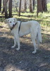
Only saw humans four times the whole way: An old guy trailer camping at the trailhead, some logger/rancher types on ATVs near the logging operation, some guy with a dog and truck on the Brown Wash jeep trail, and a couple on horses going up the gravel road to the Lake Mountain lookout. (Me across wash to Dog & Truck Guy: "Howdy!!!", in the hope if he was shooting he would not think I was a deer coming up the trail.)

Finished at 3:50 p.m. Post hike BP was 129/78, pulse 120. (Scary part was it was still elevated three hours later.) Blister was quarter-sized, but felt no worse, and neither did my knee. Took 35 minutes to drive the seven miles back to McNary, showered and then dinner at Los Corrales. (Great salsa and service.)
wildflower observationwildflower observationwildflower observationwildflower observationwildflower observation
Wildflowers Observation Light
_____________________
http://prestonm.com : Everyone's enjoyment of the outdoors is different and should be equally honored.
 
Jul 21 2012
avatar

 Routes 69
 Photos 3,135
 Triplogs 1,852

72 male
 Joined Jul 24 2009
 Mesa, AZ
Los Burros Trail #631Alpine, AZ
Alpine, AZ
Hiking avatar Jul 21 2012
trailzrusTriplogs 1,852
Hiking5.60 Miles 500 AEG
Hiking5.60 Miles
500 ft AEG
 
Linked   none no linked trail guides
Partners none no partners
_____________________
 
Oct 15 2011
avatar

 Routes 69
 Photos 3,135
 Triplogs 1,852

72 male
 Joined Jul 24 2009
 Mesa, AZ
Los Burros Trail #631Alpine, AZ
Alpine, AZ
Hiking avatar Oct 15 2011
trailzrusTriplogs 1,852
Hiking8.12 Miles 500 AEG
Hiking8.12 Miles
500 ft AEG
 
Linked   none no linked trail guides
Partners none no partners
foliage observationfoliage observationfoliage observationfoliage observationfoliage observation
Autumn Foliage Observation Moderate
_____________________
 
Jul 23 2011
avatar

 Routes 69
 Photos 3,135
 Triplogs 1,852

72 male
 Joined Jul 24 2009
 Mesa, AZ
Los Burros Trail #631Alpine, AZ
Alpine, AZ
Hiking avatar Jul 23 2011
trailzrusTriplogs 1,852
Hiking8.30 Miles 500 AEG
Hiking8.30 Miles
500 ft AEG
 
Linked   none no linked trail guides
Partners none no partners
_____________________
 
Oct 30 2010
avatar

 Routes 69
 Photos 3,135
 Triplogs 1,852

72 male
 Joined Jul 24 2009
 Mesa, AZ
Los Burros Trail #631Alpine, AZ
Alpine, AZ
Hiking avatar Oct 30 2010
trailzrusTriplogs 1,852
Hiking10.40 Miles 500 AEG
Hiking10.40 Miles   4 Hrs   30 Mns   2.31 mph
500 ft AEG
 
Linked   none no linked trail guides
Partners none no partners
 Fauna
 Fauna [ checklist ]
[ checklist ]  Mule Deer
 Culture
 Culture [ checklist ]
[ checklist ]  Windmill
_____________________
 
Aug 21 2010
avatar

 Routes 69
 Photos 3,135
 Triplogs 1,852

72 male
 Joined Jul 24 2009
 Mesa, AZ
Los Burros Trail #631Alpine, AZ
Alpine, AZ
Hiking avatar Aug 21 2010
trailzrusTriplogs 1,852
Hiking10.25 Miles 500 AEG
Hiking10.25 Miles   4 Hrs   10 Mns   2.46 mph
500 ft AEG
 
Linked   none no linked trail guides
Partners none no partners
The full loop of this hike is about 14 miles. We did the longer of the 2 shortcuts this time. We got rained on for about the last 4-5 miles but we just put on our ponchos and just kept walking. For some reason there are very few people on this beautiful trail. It's about 7 miles outside of McNary.
 Fauna
 Fauna [ checklist ]
[ checklist ]  Hoverfly
 Culture
 Culture [ checklist ]
[ checklist ]  Windmill
_____________________
 
average hiking speed 2.32 mph
1, 2  Next

WARNING! Hiking and outdoor related sports can be dangerous. Be responsible and prepare for the trip. Study the area you are entering and plan accordingly. Dress for the current and unexpected weather changes. Take plenty of water. Never go alone. Make an itinerary with your plan(s), route(s), destination(s) and expected return time. Give your itinerary to trusted family and/or friends.

helpcommentissue

end of page marker