username
X
password
register
for free!
help
ArticlesGuidesRoutes
 
Photosets
 
 Comments
triplogs   photosets   labels comments more
Sierra Prieta Trail #366 - 8 members in 18 triplogs have rated this an average 3.5 ( 1 to 5 best )
18 triplogs
login for filter options
Aug 24 2024
avatar

 Guides 2
 Routes 207
 Photos 93
 Triplogs 204

male
 Joined Aug 08 2020
 Phx az
Sierra Prieta Trail #366Prescott, AZ
Prescott, AZ
Hiking avatar Aug 24 2024
ScaredyCatTriplogs 204
Hiking14.71 Miles 1,967 AEG
Hiking14.71 Miles   5 Hrs   14 Mns   3.05 mph
1,967 ft AEG      25 Mns Break
 
no photosets
1st trip
Route Scout Route Recorded  on Route Scout | Pop | Map | Popup | MapDEX
Remote area off dirt roads. Start from view point and evade crowds at Aspen Creek TH. Formed a double loop plus a side route to forest boundary.

Traversed many trails. Was with elite company so had to step up my game. Guess I can hike fast if need be. Who would've thunk it? 🤔 
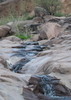
Negative- not much in the way of pics.

Managed to meet at a reasonable time, road trip, knock out serious mileage and return to carpool at 5pm. 😲 Keep in mind much of the AEG is toward the end.
 
Jul 13 2024
avatar

 Guides 3
 Routes 161
 Photos 477
 Triplogs 147

70 male
 Joined Jan 02 2016
 Prescott, AZ
High Valley Ranch to West Spruce, AZ 
High Valley Ranch to West Spruce, AZ
 
Hiking avatar Jul 13 2024
WhifferTriplogs 147
Hiking9.92 Miles 1,579 AEG
Hiking9.92 Miles   4 Hrs   22 Mns   2.33 mph
1,579 ft AEG      6 Mns Break
 
no photosets
1st trip
Route Scout Route Recorded  on Route Scout | Pop | Map | Popup | MapDEX
As reported earlier, the trailhead in the official route for High Valley Ranch Trail #391 is in a gated community; however, there is a trailhead available to the public just before the pavement ends on Copper Basin Road at 34°30'59.5"N 112°31'15.1"W (see photos). This route starts at that trailhead and goes five miles using all of Trail #391, then Old Forest Road #9401J to Sierra Prieta Trail #366 to Sunset Lookout, then downhill on Thumb Butte Road to West Spruce Trail #264 and continuing on Trail #264 until I had hiked five miles, so that the total hike was 10 miles from where I parked at a wide spot slightly past the paved portion of Copper Basin Road where there is room for 2-3 cars. Most of the hike is in the shade of Ponderosa pines and alligator juniper, except about half of #9401J and about half of Thumb Butte Road, as long as you reach it early enough in the morning to be in the shade of the 7000' ridge that Trail #366 crosses. It is almost all uphill to Sunset Lookout in both directions, except for a steep couple hundred feet down from the trailhead on Copper Basin Road to Aspen Creek. Lots of great views (see photos). As an extra treat, there were a half dozen wild turkeys crossing Copper Basin Road in front and behind my car as I was leaving.
wildflower observationwildflower observationwildflower observationwildflower observationwildflower observation
Wildflowers Observation Light
penstemon - mostly upright blue beardtongue plus some firecracker, common yarrow, common mullein, Wright's deervetch, Arizona thistle, threenerve goldenrod, spotted knapweed
_____________________
  4 archives
Oct 30 2021
avatar

 Guides 13
 Routes 38
 Photos 1,651
 Triplogs 577

60 male
 Joined Nov 15 2005
 Jackson, CA
Thumb Butte Trail #33Prescott, AZ
Prescott, AZ
Hiking avatar Oct 30 2021
toddakTriplogs 577
Hiking18.50 Miles 3,500 AEG
Hiking18.50 Miles   8 Hrs      2.31 mph
3,500 ft AEG
 no routesno photosets
1st trip
The Prescott area can be a confusing hodge-podge of trails and roads but HAZ makes it easy to follow routes covering the best trails, like this one from @The_Eagle on 4/20/19. I spent every October weekend in the area and every hike was a winner. Thanks HAZ!
_____________________
 
Sep 04 2021
avatar

 Routes 268
 Photos 2,969
 Triplogs 541

66 male
 Joined Aug 16 2009
 Mesa,AZ
Thumb Miller Loop, AZ 
Thumb Miller Loop, AZ
 
Hiking avatar Sep 04 2021
hikerdwTriplogs 541
Hiking11.91 Miles 1,887 AEG
Hiking11.91 Miles   4 Hrs   19 Mns   2.99 mph
1,887 ft AEG      20 Mns Break
 
no photosets
1st trip
Route Scout Route Recorded  on Route Scout | Pop | Map | Popup | MapDEX
We did a shorter version of this loop in the opposite direction a few years back and really enjoyed it so added a couple new trails to extend it and hiked it in a clockwise direction this time. This is a solid loop.

Thumb Butte Trail #33
And away we go. Nothing like a steep wake up climb to get the blood flow. Blacktop pavement helps get good traction and the switchbacks help keep you going at a nice pace. First time on this trail and better than expected.

Butte Creek Trail #321
This is a great trail. Nicely treed, flowing water in the creek, very nice grade, away from the main trailheads that it seems to not get much use, A+ in my book.

Sierra Prieta Trail #366
Also a first for us. Some climbs but not to bad. Most of the time you are hiking along a ridge. As we were climbing up towards the road a caravan of mountain bikers came at us. Thought for sure there was going to be a collision but I jumped one way and the lead bikers veered off the other direction so the crash was avoided. Let them pass then continued to onward to meet up with Thumb Butte Road. Trail gets high marks.

West Spruce Trail #264
I like this trail a lot. In this direction the grade is generally down so easy hiking and very nice views since your up high. The section we hiked was shorter than I remembered so it ended to soon.

Miller Creek Trail #367
Memory recall is either slipping or this trail has been found by the mountain bike community since our last visit. I had memories of this trail being more remote and less used, i.e. trail was thin and slightly overgrown. Not the case. Trail is very well defined with bike tracks and nothing remote about it. There was a slight flow in the creek so that was nice. Still, a great trail. Saw a small gopher snake crossing the trail so we helped move it along so it wouldn't get run over.

Overall a great loop option for the area. Weather was great on this day and although it was a holiday weekend the trails we hiked offered a lot of solitude.

water 1 out of 5water 2 out of 5water less than maxwater less than max Butte Creek Light flow Light flow

water 1 out of 5water 2 out of 5water less than maxwater less than max Miller Creek Light flow Light flow
_____________________
Expect to self rescue
 
Nov 02 2020
avatar

 Guides 2
 Routes 31
 Photos 902
 Triplogs 50

male
 Joined Sep 19 2020
 Phoenix
Thumb Butte to Sierra Prieta Loop, AZ 
Thumb Butte to Sierra Prieta Loop, AZ
 
Hiking avatar Nov 02 2020
ScottHikaTriplogs 50
Hiking13.30 Miles 2,269 AEG
Hiking13.30 Miles
2,269 ft AEG      15 Mns Break12 LBS Pack
 
1st trip
I have not been to Prescott in November in a while. I first started coming here in the 1980s and have many fond memories. I usually leave before dawn, and hit the trail early. Today I, decided to do something different and take an afternoon/evening hike.

It was a great afternoon under the pines. My original goal was to catch the Sierra Prieta “Sunset Overlook” at sunset. I slept in after HW festivities and hit the road from Phoenix around noon. There was very little midday traffic at the Thumb Butte Rec. lot, which was a plus. The fee is $5 a day unless you have a pass. Thumb Butte is a quick shot in the arm of elevation right out of the gate. There is a nice memorial to the Granite Mountain heroes right at the Butte saddle. I heard birds, saw very little wildlife overall, a few insects, a few more spiders and a mule deer that quickly disappeared. The forest is still recovering after recent fire. There were a few fall colors, mainly oaks turning to yellow. The forest has a maze of cross trails so best to plan a route.

After taking a few connector roads, I soon realized I’d get to the overlook before actual sunset. Sierra Prieta has great views. At the overlook, there was a fair size crowd of young partiers, loud music and off road vehicles. The wonderful sound of motorized vehicles revving their engines and laughter permeated the air. It looked like a lot of fun, but the old guy with four wheel drive feet had other plans. I decided to bag nearby peak 7035. That was a great choice and sitting at the very top, I had a snack and recharged for the trip back. In retrospect, it would have been a lot easier to hit Peak 7035 on the way up. I headed off trail to scramble back to Thumb Butte Rd. I rethought my wisdom while clinging to roots as I descended the steep bank by the road. Please do not follow my route here!

The rest of the way back was cake - all downhill. Once off the thumb trail I only encountered two senior backpackers that wished to be alone, and a friendly biker that slowed to chat for a while. I captured some awesome pictures and of course finished up in the dark. Miller Creek was dry without water and the forest in the dark reminded me of something from long ago.
 Named place
 Named place [ checklist ]
[ checklist ]  Sierra Prieta  Thumb Butte Park
 Meteorology
 Meteorology [ checklist ]
[ checklist ]  Moon  Sunset
foliage observationfoliage observationfoliage observationfoliage observationfoliage observation
Autumn Foliage Observation Isolated
Gambel Oak turning to yellow
  14 archives
Sep 22 2020
avatar

 Routes 8
 Photos 2,243
 Triplogs 204

38 male
 Joined Mar 07 2009
 Colorado Springs
Thumb Butte- Potts Creek to West Spruce Mounta, AZ 
Thumb Butte- Potts Creek to West Spruce Mounta, AZ
 
Run/Jog avatar Sep 22 2020
ultrazonaTriplogs 204
Run/Jog18.90 Miles 2,807 AEG
Run/Jog18.90 Miles   3 Hrs   27 Mns   5.59 mph
2,807 ft AEG      4 Mns Break
 
no photosets
1st trip
Route Scout Route Recorded  on Route Scout | Pop | Map | Popup | MapDEX
Great running route. Lots of great views and empty trails.
foliage observationfoliage observationfoliage observationfoliage observationfoliage observation
Autumn Foliage Observation Isolated
_____________________
 
Apr 20 2019
avatar

 Guides 41
 Routes 1,626
 Photos 14,983
 Triplogs 2,760

69 male
 Joined Jan 20 2009
 Far NE Phoenix,
Thumb Butte - Potts Creek to West Spruce, AZ 
Thumb Butte - Potts Creek to West Spruce, AZ
 
Hiking avatar Apr 20 2019
The_EagleTriplogs 2,760
Hiking17.47 Miles 3,498 AEG
Hiking17.47 Miles   7 Hrs   54 Mns   2.56 mph
3,498 ft AEG   1 Hour   5 Mns Break14 LBS Pack
 
1st trip
Smokin' good day up in the pines on Saturday 4/20.

Warmer temps in the valley had us jonesn' cooler temps and some new trails.

Up the paved Thumb Butte trail to begin, we passed Mary Jane to begin the day. She was one of the few hikers we saw all day. 6 miles to the Sierra Prieta Overlook, we passed over the Potts Creek Trail on the way.

We'd done a small portion of the West Spruce trail before, I wanted to see more, hit West Spruce Mountain. West Spruce is a worthy option if in the area.

We looped back on some well used "Use" trails used by MTB's.

Butte Creek and Miller Creek had plenty of water running

Interestingly, we finished at 4:20 MDT
_____________________
There is a very fine line between "hobby" and "mental illness."
Dave Barry 🦅
  1 archive
Apr 20 2019
avatar

 Guides 264
 Routes 2,797
 Photos 14,494
 Triplogs 5,894

55 male
 Joined Nov 20 1996
 
Thumb Butte - Potts Creek to West Spruce, AZ 
Thumb Butte - Potts Creek to West Spruce, AZ
 
Hiking avatar Apr 20 2019
joebartelsTriplogs 5,894
Hiking17.03 Miles 3,220 AEG
Hiking17.03 Miles   7 Hrs   53 Mns   2.61 mph
3,220 ft AEG   1 Hour   22 Mns Break
 
1st trip
Route Scout Route Recorded  on Route Scout | Pop | Map | Popup | MapDEX
Bruce put together this loop with a couple options. Only 3 hikers heading up Thumb Butte. Which seemed extremely light for 7:30 am on a very nice April Saturday morning.

Butte Creek was running light. Which apparently starts down in the neighborhood. Potts Creek Trail #327 zigs around following Butte Creek for a good stretch but no named place on topo that I could figure out for the name Potts. Fabulous hike through the pines.

Then on an FS road before what the FS declares as Sierra Prieta Trail #366. Not sure but looks like the intriguing detailed guide Preston wrote from a book reference is outdated or the book never had a firm grip on it.

The short FS designated #366 is pretty sweet. We took a break at my request. Lots of mtn bikers out riding this segment. Nearly all acknowledged us and kept us informed of pack traffic. No race #s so maybe practicing for the end of month Whiskey 50 Mountain Bike Race?

Sierra Prieta Overlook wasn't a refueling/aid station either. Graffiti central is covered up. After a short peek of the views we continued on FS373 just under a half mile.

Turned onto West Spruce Trail #264. Hiked the subtle rollercoaster with another granted break request. Then over to the base of West Spruce Mountain for lunch. The energy infused eagle darted up to the peak while I enjoyed a nice break. Several friendly ATV riders went through the gate below my perch.

Just 2 hikers on #264 heading back. Passing a large ant hill I almost gave the colony some of my water. As we all know ants don't have lungs. They may have wicked some up but figured I best not interfere. Lessons learned from a failed ant farm in '79... enough said.

The hike down Miller Creek proper was cool. A trail. Semi primitive to the surrounding network of Thumb Butte area trails. Passing numbered dispersed camping sites The_Angel_Eagle lent his phone to a camper that couldn't get a T-Mobile signal.

Finished out along old familiar favs to wrap up the outstanding mid sixties gift of temps throughout the hike.
_____________________
- joe
 
Jul 31 2016
avatar

 Guides 16
 Routes 11
 Photos 1,006
 Triplogs 410

39 male
 Joined Mar 22 2006
 Phoenix, AZ
Sierra Prieta Trail #366Prescott, AZ
Prescott, AZ
Hiking avatar Jul 31 2016
JoelHazeltonTriplogs 410
Hiking1.00 Miles 100 AEG
Hiking1.00 Miles
100 ft AEG
 no routes
1st trip
Linked   none no linked trail guides
Partners none no partners
Hung out with the parental units and their friends at their house in Prescott Saturday night. Passed out at a nearby campsite a couple miles up Copper Basin Rd from their house. Reluctantly rolled out of the back of my car Sunday morning and did a sunrise hike up Sierra Prieta trail. Not long, just far enough for some nice views and to get a feel for the area. Fun weekend in Prescott.
_____________________
"Arizona is the land of contrast... You can go from Minnesota to California in a matter of minutes, then have Mexican food that night." -Jack Dykinga

http://www.joelhazelton.com
 
Aug 09 2015
avatar

 Guides 69
 Routes 37
 Photos 3,010
 Triplogs 2,387

55 male
 Joined Oct 24 2010
 Phoenix,Az
Sierra Prieta Trail #366Prescott, AZ
Prescott, AZ
Hiking avatar Aug 09 2015
mt98dewTriplogs 2,387
Hiking6.55 Miles 420 AEG
Hiking6.55 Miles   2 Hrs   20 Mns   2.81 mph
420 ft AEG
 no routesno photosets
1st trip
Linked   none no linked trail guides
Partners none no partners
First part of my "Daily Double". Drove up to Prescott to knock off a couple of trails that I had never done before. First up, was the Sierra Prieta Trail. I had done the Aspen Trail several years ago so I knew the TH and had a general idea of how the Sierra tied into the Aspen. The first part of the hike (Aspen Trail) is very nice. It's a gradual climb among the pines (and the shade) to get the ridgeline and to where the Sierra Prieta (9415) starts. As stated in an earlier write up, the name of the trail has changed to the Wolverton Trail, though the trail number 9415 is still the same. Went by the gate and took the path to the left to check out the weather station. I also found a way to the top of Wolverton Peak. About .12 miles past the gate be looking to your left for a cairn and a blue ribbon hanging from a pine tree. Follow this path for .1 miles and you have an easy time getting to the top. Someone has actually built a solid bench (including back and arm rest) that overlooks Prescott. This trail also divides near the top and heads down the east side of Wolverton. Not sure if this is a future trail being planned by the forest service or one that has been created by an active hiker, but once you find it, it is easy to follow. I didn't follow it for long though as my goal was 9415. Returning to the gate, I followed 9415 down a very gradual trail that followed the contours of the hill with a few switch backs thrown in. Approximately 1.75 from the Aspen Trail turn off (not including side trails) I came to another signed junction. Trail 9415, the Wolveton, continues to the south and a little to the east. Trail 9415A, named the Quartz Mountain Trail, heads off in a more southwardly direction. From this junction it is only about .4 miles to the top of Quartz Mountain. On the way back, I followed portions of the old Sierra Prieta Trail that I could find. The climbs were a little steeper, but I probably shaved tenths off my mileage. Wildlife was minimal. Some interesting birds and caterpillars with whitish opaque bodies. Very weird. I'm use to the fuzzy caterpillars. Encountered two couples hiking and a lone biker.

Sadly, I don't believe that Sierra Prieta Trail exists as hiked and described by Preston. The forest service has modified the trail quite a bit and renamed the routes. The beginning and the ending is the same but I wonder if Preston would recognize his hike from 2000.
_____________________
 
Jun 22 2013
avatar

 Guides 47
 Routes 96
 Photos 850
 Triplogs 385

81 male
 Joined Dec 24 2005
 Phoenix, AZ
Sierra Prieta Trail #366Prescott, AZ
Prescott, AZ
Hiking avatar Jun 22 2013
MEWhitemanTriplogs 385
Hiking5.16 Miles 743 AEG
Hiking5.16 Miles   2 Hrs      2.58 mph
743 ft AEG
 
Linked   none no linked trail guides
Partners none no partners
Did this from the Aspen Creek Trailhead to the junction with the new Wolverton Mtn Trail #9415 and the old trail, now called 9415A, which goes down to White Spar and back. I took notes and plan to do the other part of #9415 and post the description of the entire Wolverton Mountain Trail (#9415) on HikeAZ later this summer. The trail has been rerouted as it nears White Spar and the new trail, adding a switchback.
_____________________
 
Jul 20 2011
avatar

 Guides 47
 Routes 96
 Photos 850
 Triplogs 385

81 male
 Joined Dec 24 2005
 Phoenix, AZ
Sierra Prieta Trail #366Prescott, AZ
Prescott, AZ
Hiking avatar Jul 20 2011
MEWhitemanTriplogs 385
Hiking5.65 Miles 835 AEG
Hiking5.65 Miles   2 Hrs   5 Mns   2.71 mph
835 ft AEG
 
Linked   none no linked trail guides
Partners none no partners
Easy hike after a two week layoff. Nice day.
_____________________
 
Aug 25 2010
avatar

 Guides 47
 Routes 96
 Photos 850
 Triplogs 385

81 male
 Joined Dec 24 2005
 Phoenix, AZ
Sierra Prieta Trail #366Prescott, AZ
Prescott, AZ
Hiking avatar Aug 25 2010
MEWhitemanTriplogs 385
Hiking5.60 Miles 900 AEG
Hiking5.60 Miles   2 Hrs   15 Mns   2.49 mph
900 ft AEG
 
Linked   none no linked trail guides
Partners none no partners
A nice hike with comfortable Prescott temperatures, about 30 degrees cooler than north Phoenix. This is a nice hike with official parking at the Aspen Creek trailhead. A cool wooded hike on trail #48 becoming more open as elevation was gained. Once on #9415 it was more open with nice views to the southeast. We explored the side trail to Wolverton Mtn and stopped for some photos near the "weather station". We continued on to White Spar for some 360 degree views. We returned the way we came but followed the old trail down to Copper Basin Rd and back to the car. A nice hike!
 Geology
 Geology [ checklist ]
[ checklist ]  Quartz
_____________________
 
Oct 29 2008
avatar

 Photos 10
 Triplogs 98

73 male
 Joined Jan 19 2008
 Mesa, AZ
Sierra Prieta Trail #366Prescott, AZ
Prescott, AZ
Hiking avatar Oct 29 2008
casadbluTriplogs 98
Hiking4.50 Miles 420 AEG
Hiking4.50 Miles   1 Hour   45 Mns   2.57 mph
420 ft AEG
 no routesno photosets
1st trip
Linked   none no linked trail guides
Partners none no partners
Mar and I and Bailey did this one way hike off of Copper Basin to the base of White Spar(2.5 miles. You then can go back or head down the old spar road to 89 (another 2 miles). We elected to head down. Charlie picked us up at the trialer park. Could walk one mile to Charlie and Joan's house - beautiful hike! Important to walk to the top of White Spar - lots of quartz - can see 360 degrees - parking on copper basin is on the right (weatch for sign) - there is a sign - trail is back down the road and on the other side - want to start off on trail 48. It is hard to find the trail - signs are long skiny brown signs!
_____________________
 
Apr 22 2007
avatar

 Triplogs 1

50 female
 Joined Apr 25 2007
 Prescott Valley,
Sierra Prieta Trail #366Prescott, AZ
Prescott, AZ
Hiking avatar Apr 22 2007
sealyyTriplogs 1
Hiking5.00 Miles 420 AEG
Hiking5.00 Miles   3 Hrs   45 Mns   1.33 mph
420 ft AEG
 no routesno photosets
1st trip
Linked   none no linked trail guides
Partners none no partners
Awesome trail! Very steep at first and had a lot of fallen trees in the path, but will worth the trip! We went all the way to the top of White Spar (with a side trip to the old Forest Service weather station) and ate lunch at the top. LOTS of quartz of deposits. I'd do it again.
_____________________
 
Apr 22 2007
avatar

 Triplogs 2

female
 Joined Jan 24 2005
 Prescott, AZ
Sierra Prieta Trail #366Prescott, AZ
Prescott, AZ
Hiking avatar Apr 22 2007
flynace99Triplogs 2
Hiking5.00 Miles 420 AEG
Hiking5.00 Miles   3 Hrs   45 Mns   1.33 mph
420 ft AEG
 no routesno photosets
1st trip
Linked   none no linked trail guides
Partners none no partners
Lots of fun. Beautiful scenery. Can't wait to go back.
_____________________
 
Dec 26 2006
avatar

 Guides 170
 Routes 148
 Photos 5,914
 Triplogs 2,097

48 male
 Joined Apr 12 2004
 Tucson, AZ
Sierra Prieta Trail #366Prescott, AZ
Prescott, AZ
Hiking avatar Dec 26 2006
PrestonSandsTriplogs 2,097
Hiking4.50 Miles 420 AEG
Hiking4.50 Miles   2 Hrs   15 Mns   2.00 mph
420 ft AEG
 no routes
Linked   none no linked trail guides
Partners partners
Tgsands
Hiked from the Aspen Trailhead to the top of White Spar, then down the White Spar Road aways. Took a cross-country route down into the Timberridge subdivision, where I got picked up.
_____________________
"…you never know when a hike might break out" -Jim Gaffigan
 
Dec 24 2000
avatar

 Guides 170
 Routes 148
 Photos 5,914
 Triplogs 2,097

48 male
 Joined Apr 12 2004
 Tucson, AZ
Sierra Prieta Trail #366Prescott, AZ
Prescott, AZ
Hiking avatar Dec 24 2000
PrestonSandsTriplogs 2,097
Hiking2.90 Miles 420 AEG
Hiking2.90 Miles   3 Hrs      0.97 mph
420 ft AEG
 no routes
Linked   none no linked trail guides
Partners none no partners
My first hike on this trail, with my dad, and brothers Ryan and Alan. We hiked to the weather station on Wolverton Mountain where we had lunch and enjoyed the views. There were a lot more ponderosas along the trail before the bark beetle days of 2002.
_____________________
"…you never know when a hike might break out" -Jim Gaffigan
 
average hiking speed 2.26 mph

WARNING! Hiking and outdoor related sports can be dangerous. Be responsible and prepare for the trip. Study the area you are entering and plan accordingly. Dress for the current and unexpected weather changes. Take plenty of water. Never go alone. Make an itinerary with your plan(s), route(s), destination(s) and expected return time. Give your itinerary to trusted family and/or friends.

helpcommentissue

end of page marker