username
X
password
register
for free!
help
ArticlesGuidesRoutes
 
Photosets
 
 Comments
triplogs   photosets   labels comments more
Palmer Mine Loop - 20 members in 42 triplogs have rated this an average 2.7 ( 1 to 5 best )
1, 2, 3  Next
42 triplogs
login for filter options
Jul 08 2025
avatar

 Routes 93
 Photos 7,758
 Triplogs 1,691

64 male
 Joined Mar 11 2003
 AZ
Jacob's Trail #58Phoenix, AZ
Phoenix, AZ
Hiking avatar Jul 08 2025
wallyfrackTriplogs 1,691
Hiking5.10 Miles 675 AEG
Hiking5.10 Miles   1 Hour   52 Mns   2.73 mph
675 ft AEG
 no routesno photosets
1st trip
Partners partners
Tortoise_Hiker
Denny got away, so we went for a hike. :lol: I suggested the out trails out east. We hiked around until we had 5 miles.
_____________________
  1 archive
Jul 08 2025
avatar

 Guides 1
 Routes 148
 Photos 9,924
 Triplogs 3,652

63 male
 Joined Apr 02 2005
 Mesa, AZ
Jacob's Trail #58Phoenix, AZ
Phoenix, AZ
Hiking avatar Jul 08 2025
Tortoise_HikerTriplogs 3,652
Hiking5.10 Miles 675 AEG
Hiking5.10 Miles   1 Hour   52 Mns   2.73 mph
675 ft AEG
 no routes
Wally and I got out for a leg stretcher on the front of the Supes. Started a little before sunrise to beat the heat, sort of! 🥵😁 It was good to get out! Thanks for the hike Wally! Like HAZ, you rock!
_____________________
Tortoise Hiking. Stop and smell the Petrichor.
  1 archive
Jun 24 2025
avatar

 Routes 93
 Photos 7,758
 Triplogs 1,691

64 male
 Joined Mar 11 2003
 AZ
Palmer Mine LoopPhoenix, AZ
Phoenix, AZ
Hiking avatar Jun 24 2025
wallyfrackTriplogs 1,691
Hiking4.50 Miles 617 AEG
Hiking4.50 Miles   1 Hour   30 Mns   3.00 mph
617 ft AEG
 no routes
Linked   none no linked trail guides
Partners none no partners
Another day another loop in a different direction. Using the easy trails and hills to rest my feet. The easy drive and slightly cooler temps make this location work.
_____________________
  2 archives
Jun 10 2025
avatar

 Routes 93
 Photos 7,758
 Triplogs 1,691

64 male
 Joined Mar 11 2003
 AZ
Palmer Mine LoopPhoenix, AZ
Phoenix, AZ
Hiking avatar Jun 10 2025
wallyfrackTriplogs 1,691
Hiking6.70 Miles 1,094 AEG
Hiking6.70 Miles   2 Hrs   10 Mns   3.09 mph
1,094 ft AEG
 no routes
Linked   none no linked trail guides
Partners none no partners
Early morning hike to check out some side trails. Haven't been by the Palmer mine for a long time. I remember when there was a cover over it and it wasn't filled in with dirt. Nice area to hike inder the shadow of the mountain with only a few only hikers around.
_____________________
  1 archive
May 19 2024
avatar

 Guides 27
 Routes 669
 Photos 12,096
 Triplogs 856

56 male
 Joined Jul 05 2006
 Mesa, AZ
Jacob's Trail #58Phoenix, AZ
Phoenix, AZ
Hiking avatar May 19 2024
DarthStillerTriplogs 856
Hiking8.15 Miles 1,473 AEG
Hiking8.15 Miles   4 Hrs   8 Mns   1.99 mph
1,473 ft AEG      2 Mns Break
 
Headed out towards First Water Road to hike some of the Jacob's Crosscut Trail. on the way out I spotted Wally on his way back early at 5:30am :-k . Turns out he was bailing on some plans with unforeseen circumstances.

From the TH I hiked 3 miles out and turned around, then hiked up Siphon Draw for just over a mile. On the way back down Siphon Draw I took the Palmer Mine Trail over to Prospector's View, then back down to the Crosscut and back to the TH. Hadn't been up or down Siphon Draw in over a decade, so it was nice to see the views getting further up the canyon after so long. It was also nice to chase the shade for a bit to keep hiking in cooler temps as everything was getting warmer everywhere else around me.

Parking lot was nearly empty once I got back, in great contrast to times I've parked there recently in the winter months. It's not really that hot yet, so I was bit surprised, but not disappointed.
_____________________
 
Dec 14 2023
avatar

 Guides 170
 Routes 148
 Photos 5,914
 Triplogs 2,097

48 male
 Joined Apr 12 2004
 Tucson, AZ
Palmer Mine LoopPhoenix, AZ
Phoenix, AZ
 Hiking avatar Dec 14 2023
PrestonSandsTriplogs 2,097
 Hiking3.50 Miles 790 AEG
 Hiking3.50 Miles   1 Hour   13 Mns   3.23 mph
790 ft AEG      8 Mns Break
 no routesno photosets
1st trip
Linked   none no linked trail guides
Partners none no partners
I started off doing Treasure Loop but noticed a social trail or old trail heading south toward the Palmer Mine, which I don’t think I’ve been to in this millennium, so I turned onto that route. Stopped to check out the collapsed mine entrances and the character of the ore on the tailings pile, then continued south to the junction with Siphon Draw Trail, where I had the perfect timing of running into Mike. Chatted with Mike for a couple of minutes and then followed the same route back. Short hike but I had to hurry to Tempe afterward for a family gathering.
_____________________
"…you never know when a hike might break out" -Jim Gaffigan
 
Feb 01 2023
avatar

 Guides 59
 Routes 1,100
 Photos 1,191
 Triplogs 1,290

male
 Joined Jan 01 2023
 Arizona
Peak 4102 - SuperstitionsPhoenix, AZ
Phoenix, AZ
Hiking avatar Feb 01 2023
pseudalpineTriplogs 1,290
Hiking8.23 Miles 4,045 AEG
Hiking8.23 Miles   6 Hrs   52 Mns   1.58 mph
4,045 ft AEG   1 Hour   39 Mns Break
 
1st trip
Route Scout Route Recorded  on Route Scout | Pop | Map | Popup | MapDEX
Instead of the Official Route to Peak 4102, we turned left off of Siphon Draw near Siphon Dome (The Gatekeeper) and ascended the Ripped Shirt or BASE jumpers gully. The route manifests with a few cl.3 ledge scrambles before reaching the Lost Dihedrals hanging valley north of The Three Old Maids. We didn't remember the previous route we'd taken in the past and wandered around within some mildly annoying vegetation, eventually finding a passable gully and topping out on the plateau near the yellow-hued peak. After a short summit break, we hiked southeast, then up, merging into the upper part of the Reverse Flatiron route. There were a few neat areas of verglas on the way to Ironview Peak. After another summit and our first beer, the hiking was considerably easier down to the Flatiron (another beer) and eventually out via Siphon Draw, the Palmer Mine bypass and the east side of the Treasure Loop.
 Named place
 Named place [ checklist ]
[ checklist ]  Superstition Peak 5024
  10 archives
Jan 21 2023
avatar

 Guides 59
 Routes 1,100
 Photos 1,191
 Triplogs 1,290

male
 Joined Jan 01 2023
 Arizona
Flatiron Hike - SuperstitionsPhoenix, AZ
Phoenix, AZ
Hiking avatar Jan 21 2023
pseudalpineTriplogs 1,290
Hiking7.80 Miles 3,279 AEG
Hiking7.80 Miles   5 Hrs   18 Mns   1.82 mph
3,279 ft AEG   1 Hour   1 Min Break
 
no photosets
1st trip
Route Scout Route Recorded  on Route Scout | Pop | Map | Popup | MapDEX
Late start and a mellow meander to/from the Flatiron.
  5 archives
Dec 01 2022
avatar

 Guides 8
 Routes 70
 Photos 3,208
 Triplogs 273

59 male
 Joined Oct 07 2017
 Chandler, AZ
Praying Hands Loop from Crosscut THPhoenix, AZ
Phoenix, AZ
Hiking avatar Dec 01 2022
YoderTriplogs 273
Hiking6.70 Miles 1,137 AEG
Hiking6.70 Miles   3 Hrs   5 Mns   2.39 mph
1,137 ft AEG      17 Mns Break10 LBS Pack
 no routes
Partners none no partners
We wanted a fairly short look that hit the Praying Hands, and pieced one together with the Praying Hands, Palmer Mine, and Massacre Falls loop. Section on the Massacure falls loop a bit after the praying hands faded out or we just lost it somehow so we ended up cutting the hike a bit short by taking another trail we were able to find back to the parking lot.
_____________________
J. Yoder
 
Apr 02 2021
avatar

 Guides 7
 Routes 187
 Photos 2,318
 Triplogs 909

74 male
 Joined Dec 10 2016
 Gold Canyon
Peak 3845 - Superstition MountainsPhoenix, AZ
Phoenix, AZ
Hiking avatar Apr 02 2021
DaytripperTriplogs 909
Hiking6.35 Miles 1,984 AEG
Hiking6.35 Miles   3 Hrs   40 Mns   1.73 mph
1,984 ft AEG
 
Partners none no partners
Arrived early planning to beat the heat and crowds, at least I beat the heat. Steady influx of vehicles from 0600 , I had forgotten a lot of schools closed today. Temperatures were mild and there was lots of cloud cover, hazy day so views were not the best. Hikers were actually fairly spread out along Siphon Draw on the way up either to the basin or Flatiron. I took the less traveled path to head over to 3845. Most deer scat I’ve seen along this route but no live ones spotted despite having this ridge to myself after leaving the saddle above the basin. Rerouted a few folks heading up the drainage toward 4102 instead of Flatiron. Again went for the Palmer Mine Loop and then Treasure loop descent to finish it off. Was just warming up as the sun was breaking through as I finished.
_____________________
Navy31 Army13
 
Mar 09 2021
avatar

 Guides 7
 Routes 187
 Photos 2,318
 Triplogs 909

74 male
 Joined Dec 10 2016
 Gold Canyon
Superstition Peak 5024 - Siphon DrawPhoenix, AZ
Phoenix, AZ
Hiking avatar Mar 09 2021
DaytripperTriplogs 909
Hiking9.40 Miles 3,350 AEG
Hiking9.40 Miles   6 Hrs   30 Mns   1.63 mph
3,350 ft AEG      45 Mns Break12 LBS Pack
 
My hundreds of Instagram followers have been clamoring for some Daytripper selfies from a mountaintop so I decided to oblige today :D Due to ominous looking clouds decided to check my weather app on arrival at the State Park which gave a rain chance at 8%. Unfortunately by time I reached the basin it became 100%, add in some strong cool wind gusts and tiny hail I began to question the sanity of continuing. It only lasted about 15 to 20 minutes but did provide a nice slippery surface for the “few” rocky surfaces required to step on. I managed to pick up a small entourage after dropping into the wash from the saddle a young man from Georgia and two local ladies who were on this for the first time. They all traveled up with me as they were concerned about getting off track , we headed up at a steady if not fast pace. When we topped out of the wash initially they were interested in going to 5024 but decided not to continue after the strong winds became apparent. At that same time four youngsters leaving Flatiron had decided to go on to 5024 and initially were going to follow me but were too inpatient to follow an old guy so they went ahead. They made it to the top before me as I watched them take an unique route. Due to the winds only stayed long enough to take a couple of pictures and then dropped down trying to find a wind free snack spot. Next as I headed down to my wondering eyes appeared Flatiron with no one there. Of course I had to meander around a bit before heading back down the wash, could have done a Scottish selfie if I had my kilt on. Once back in the wash it was slow going to insure good foot placement among so many loose rock hazards. Just as I am getting to the bottom of the wash I noticed a young lady hiking up barefoot, followed by two guys doing the same :o Of course I had to make some comments about their foot wear and got back responses like good price and lifetime guarantee but wasn’t able to glean what the heck they were trying to prove. A little water had gathered at the bottom of the waterfall from the earlier rain but the basin itself was nice and dry. Ran into a couple at the waterfall thinking about retirement from San Fran that were staying in one of the park cabins but also visiting their daughter in Peoria. They followed me through the little maze at the bottom of the the basin to get back on trail and shortly after we started down the trail we were buzzed. The sound was behind me and in front of them , as I was curious about the source when I turned back I saw the snake sliding under a rock but then surprisingly I saw his head emerge from under it and proceeding on across the trail. This portion of the trail is a rocky shelf above a drop off to the wash and on the high side with a couple of boulders and a cliff . Unless your someone who’s willing to step over a snake because it’s not coiled , not me, this effectively blocked the trail. After the snake inched along a little the couple was able to skirt around just below the boulders, now they have a good story to share when back home. Felt pretty good still so I took the Palmer Mine Loop to Prospector then Treasure Loop , it felt good to walk a trail without watching every foot placement. Had a great day after all, was able to get my selfie pose done and finished in less than 12 hours and before dark :D
wildflower observationwildflower observationwildflower observationwildflower observationwildflower observation
Wildflowers Observation Isolated
Chuparosa

water 1 out of 5water less than maxwater less than maxwater less than max Siphon Draw Waterfall Pools to trickle Pools to trickle
_____________________
Navy31 Army13
 
Feb 11 2021
avatar

 Guides 7
 Routes 187
 Photos 2,318
 Triplogs 909

74 male
 Joined Dec 10 2016
 Gold Canyon
North side Supes Meander, AZ 
North side Supes Meander, AZ
 
Hiking avatar Feb 11 2021
DaytripperTriplogs 909
Hiking9.54 Miles 1,776 AEG
Hiking9.54 Miles
1,776 ft AEG12 LBS Pack
 no routes
1st trip
Had been hesitant to return to these areas because of last years fires but finally decided to try it today. Parked in Lost Dutchman Park and started on Treasure Loop then headed down the connector trail to Jacob’s, added a rock to the Tree corral. Along Jacob’s someone decided to decorate a tree limb with a doggie poop bag as if seeing it on the ground isn’t annoying enough, I’m sure they were retrieving it later. Once heading down toward Crosscut TH the burn area appears and persists on this half of the loop. Only 6 cars in the lot at this point, passed one couple at the fence by the old trailhead for Massacre Grounds, another couple carrying a tripod and a group of 4 with two doodle dogs all before the crossing the wash. At the high point of the massacre grounds the distant views are still outstanding as you can ignore the close up charred desert. Wasn’t planning to go over to the falls but the rock face under the falls looked unusual so I headed over that way. I grabbed a couple of photos, still scratching my head but the worst thought occurred first , had someone had dumped white paint down the waterfall, now wondering if soil changes from the fire and then recent water flow over it would discolor the rock face? Perhaps someone in my tiny triplog audience has a theory. Did see it was the same on one of the @DarthStiller photos from last month. I had photos from prior trips when water was flowing and it’s not evident so perhaps I’m not recalling how it looked when it’s dry before. Perhaps I need to get back with nurse Ratchet again because I’m hallucinating again🤪 Moving on couldn’t find any remains of the initial “route” over to Praying Hands but once coming down the big ravine memory kicked back in as well as cairns. Made a brief excursion up the origins of Weekes Wash ,aka Canyon of the Waterfalls, appeared the east side had less burn evidence while the west side look toasted. Saw two young fellas perched on top of Praying Hands then several hikers once back down to Treasure Loop . Passed two guys who feigned insult when I told them if they let me by I wouldn’t take the bench at the Treasure Loop highpoint :D Started down Prospector Trail and finished the day with Palmer Mine Loop and Discovery Trail. Despite the burn area I enjoyed this hike today, maybe I’ll get an invite to hike with the popular kids in San Tan someday : wink : As a history buff liked my final AEG for today too!
_____________________
Navy31 Army13
 
Mar 21 2020
avatar

 Guides 69
 Routes 37
 Photos 3,010
 Triplogs 2,387

55 male
 Joined Oct 24 2010
 Phoenix,Az
Palmer Mine LoopPhoenix, AZ
Phoenix, AZ
Hiking avatar Mar 21 2020
mt98dewTriplogs 2,387
Hiking5.00 Miles 630 AEG
Hiking5.00 Miles
630 ft AEG
 no routesno photosets
1st trip
Linked   none no linked trail guides
Partners none no partners
I'd been eye balling this hike for a while and today seemed a good day to "get er done." Started from the First Water TH side, but used the first parking area as you pull off of 88. This has become my go to spot when I want to hit the west side of the Supes. Got there at 6am so the pre morning sunrise was just starting to illuminate the trails.

I took a user trail in that connects to Jacobs Crosscut. Though the user trail is not signed, it is well used and easy to follow and connects to the Jacobs at one of its signed markers. I took the Jacobs over to where it connects with Siphon Draw. It wasn't even 6:30am yet and already I counted 10 people making their way along Siphon....I had a feeling that this did not bode well for hikers using this trail for the rest of the day and "social distancing". Luckily, I was only on the Siphon for a short time before making the turn onto the unnamed trail that composes part of Palmer Loop. Though unsigned, the trail is a well defined single track that takes off from the Siphon in a northerly direction. The recent rains have caused a growth spurt and some of the foliage is encroaching on the trail but it was still easy to follow. The views from this section of the trail were pretty sweet. There is enough elevation so that I was getting a decent view of the nearby surroundings. The brittlebush were in full bloom. It was like looking out upon a sea of yellow! Early on, on this unnamed trail, it crossed a section that was devoid of vegetation. Really a stark contrast from everything around it. It makes me wonder what process in mining would have kept it so barren. Usually the desert is quick to reclaim what is hers. Eventually this trail connected into the Treasure Loop Trail which I continued to take north. Along this stretch I was pleasantly surprised to find a small rivlet making its way down from the Supes. It was not much more than a trickle and I am sure that by the end of the day it would be gone. I followed the Treasure trail to a point where it made a sharp turn west and it started a descent. At this point I could hear water (much more than a trickle) off to the north. I followed a user trail to the east that split a couple of times, but ended up following a track that paralleled the Treasure Loop trail west. (The wash, where the water was flowing, was overgrown so I never got to the running water). This parallel track eventually joined back into the Treasure and I stayed on the Treasure until I saw another cairned trail take off to the north. (This occurred a couple of hundred yards west of a white bench). This turned out to be decent trail, though it was obvious that it did not get much use, since the trail was covered in low growth. This trail led to a good sized wash (30-40ft deep(?)) that I needed to descend and climb out of. There was a small stream flowing at the bottom that was easily crossed. On the other side of the wash the trail became more faint, but cairns helped me to stay on track. This eventually led to a wide dirt track that went in a northwestardly direction. This track was very straight and well defined, making me believe it had some other function years ago. Met 2 women hiking up this trail and they said that on their phone it was called the "Windgap" trail. This trail took me back to the Jacobs Crosscut and was only a couple of hundred yards from the Jacobs Crosscut TH. I ended up hiking along the road to get back to my car. It was probably around 8am and I noted that all the parking areas were full and as I walked along the road I counted 20 vehicles pass me! I'm glad to see people getting out and enjoying the outdoors, but...... It is a good thing this March with temps in the 70's....I can't see this being a good thing during the summer months. Garmin died around 3.5 miles in, so the mileage is a rough guess.
_____________________
 
Mar 10 2019
avatar

 Guides 1
 Routes 447
 Photos 4,407
 Triplogs 938

68 male
 Joined Mar 09 2012
 Gilbert, AZ
Siphon Draw Trail #53Phoenix, AZ
Phoenix, AZ
Hiking avatar Mar 10 2019
rayhustonTriplogs 938
Hiking6.64 Miles 1,730 AEG
Hiking6.64 Miles   4 Hrs   20 Mns   1.63 mph
1,730 ft AEG      15 Mns Break
 
Myself and a friend from work are the only remaining members of the company hiking club, as it were. Sheri asked if I would take her to the Flatiron today. As it turned out, she was still coughing from a cold and struggled to get to the Basin. I have been struggling with some knee pain and was only too happy to let it go today.

We stopped at the Basin for a bit to watch the others (busy for a Sunday), then dropped back down to the Palmer trail, took that to the Prospector Trail, Treasure Loop, then up to the saddle below the Praying Hands. We had a brief snack at the saddle while we checked out the views. I pointed out some other trails we have been on together in the past. We explored a cool alcove on the way back down from the saddle, then finished on the Treasure Loop trail.

Great day out, even if we didn't achieve our objective today.
wildflower observationwildflower observationwildflower observationwildflower observationwildflower observation
Wildflowers Observation Light
Intermittent, still waiting for the explosion.
_____________________
  2 archives
Oct 20 2018
avatar

 Guides 1
 Routes 447
 Photos 4,407
 Triplogs 938

68 male
 Joined Mar 09 2012
 Gilbert, AZ
Fins Hands Dutchman Loop, AZ 
Fins Hands Dutchman Loop, AZ
 
Hiking avatar Oct 20 2018
rayhustonTriplogs 938
Hiking6.58 Miles 1,235 AEG
Hiking6.58 Miles   2 Hrs   54 Mns   2.31 mph
1,235 ft AEG      3 Mns Break
 no routes
1st trip
This is a nice, easy loop from the parking area just after you turn onto First Water Road. I'm recovering from a cold and wasn't planning to hike, but it was just too nice out. I wanted something easy, so I picked the place where I take my mom when she visits. Easy enough and I can add to it if I want. And I did.

I started around noon on the unnamed trail as you leave the wash, heading SW towards a trail referred to in Carlson's Hikers Guide as Silverlock Prospect. This would eventually take me to the fins. From there I followed another unnamed trail to the Praying Hands, dropped down to Dutchman and picked up the Prospectors Trail. Making things up as I went along, I took the Palmer Mine trail over to Siphon Draw, then the bicycle trail back across the park towards The Treasure Loop trail, then to Jacobs Trail and finally back to the wash.

I had a fun time in spite of the cough/sniffles. The mild weather we've been having gave way to low 90's today, but a nice breeze made it delightful.
 Named place
 Named place [ checklist ]
[ checklist ]  Palmer Mine
_____________________
 
Oct 04 2018
avatar

 Guides 1
 Routes 148
 Photos 9,924
 Triplogs 3,652

63 male
 Joined Apr 02 2005
 Mesa, AZ
Lost Dutchman State Park LoopPhoenix, AZ
Phoenix, AZ
Hiking avatar Oct 04 2018
Tortoise_HikerTriplogs 3,652
Hiking4.40 Miles 850 AEG
Hiking4.40 Miles   1 Hour   52 Mns   2.36 mph
850 ft AEG
 no routes
1st trip
Parked at Cholla day use. Walked over to Discovery Interpretive Trail. Then Siphon Draw, Jacob's, Prospectors,Palmer Mine, Praying Hands, Treasure loop. Great weather! Saw a Tarantula, Gopher Snake, one Mule deer, two Mule deer. :D :y:
 Fauna
 Fauna [ checklist ]
[ checklist ]  Gopher Snake
_____________________
Tortoise Hiking. Stop and smell the Petrichor.
  1 archive
Apr 16 2017
avatar

 Guides 27
 Routes 669
 Photos 12,096
 Triplogs 856

56 male
 Joined Jul 05 2006
 Mesa, AZ
Palmer Mine LoopPhoenix, AZ
Phoenix, AZ
Hiking avatar Apr 16 2017
DarthStillerTriplogs 856
Hiking5.30 Miles 1,020 AEG
Hiking5.30 Miles   3 Hrs   10 Mns   1.67 mph
1,020 ft AEG
 
1st trip
I've been on a roll lately, this is my 3rd weekend in a row hiking, and next will be the fourth. I don't think that's happened since before the kids were born. From two weeks earlier hiking in this area, I noticed some unmapped trails that I wanted to try, and since the weather is just on the cusp of being too hot, I was able to convince Radmila and the kids to go out on a Sunday hike.

We started from the parking lot off of First Water Road right off of AZ88. There's a trail that goes from there and connects to the Jacob Trail. My plan was to take an unofficial trail off the Jacob Trail that connects to the Treasure Loop, but I got sidetracked. Just before that junction, we noticed the "skydivers" from two weeks earlier, right at the same time of day and even from the exact same spot on the trail. I'm thinking now that they're BASE jumpers. We didn't notice any planes, and they were landing in the same spot as two weeks ago, just off the eastern edge of the Supes, by what looks like some jumpable cliffs (if you're into that sort of thing :o ). While we were noticing all of that, we passed the junction and ended up at the junction of the Jacob and Treasure Loop Trails before we knew it.

we headed up on the Treasure loop and took the one unmapped trail that heads south towards the other leg of the Treasure Loop. this trail headed that way and then took a right (west) and then started to fade away. It would fade away and then pick up again and we followed it along a ridge between two small canyons until it was gone and the canyons turned into shallow drainages that we could cross. then we got back on the other leg of the Treasure loop and headed back up again to the Prospector Trail. Not was I had planned exactly, but things happen. on our way, some hikers on their way down warned us of a rattlesnake that we didn't encounter.

Near the junction of the Treasure Loop and Prospector trail, we took a break and then headed along the Prospector trail until the Palmer Mine Trail, and then took that. Along the Palmer Mine Trail, I made my third gila monster sighting in three consecutive weeks! Crazy. and again, it was pointed out to me by someone else. My daughter saw it and it took me almost 5 minutes to finally see it because he kept scurrying and hiding. I do have one photo as proof.

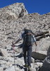
Took the Siphon Draw Trail to Prospector and Jacob for the most direct route back to the car after that. It was getting a little hot and the two climbs up the Treasure loop ended up giving us a total of 1000' AEG for the day on a 5 mile hike, not bad for the kids.

got back to the car with no other noteworthy events and had lunch at the Mongolian Grill in AJ.
_____________________
  1 archive
Mar 25 2016
avatar

 Guides 21
 Routes 1,182
 Photos 36,858
 Triplogs 1,570

69 female
 Joined Feb 26 2004
 Phoenix, AZ
Lookin' for gold - Western Supes, AZ 
Lookin' for gold - Western Supes, AZ
 
Hiking avatar Mar 25 2016
tibberTriplogs 1,570
Hiking4.67 Miles 692 AEG
Hiking4.67 Miles   2 Hrs   7 Mns   2.42 mph
692 ft AEG      11 Mns Break
 
1st trip
Jack put up a pic showing the brilliant brittle bush from the Goldfield Ghost Town so I thot I would stop by and see it for myself after my hike to Fremont Saddle from Peralta TH. I picked up some lunch at McDonalds on Hwy 60 and then ate my way toward my next stop. I thot there was a short cut to Mining Camp Restaurant that Jack took back in 2011 when he picked us up after our Ridgeline hike so I asked Kemosabe to take me there from Mountain View Dr. Well that didn't work as I ended up on the 88 ](*,) and would have ended up taking the regular entrance. Maybe that's the way Jack took us and I just forgot?

But I decided to get at that gold from the Lost Dutchman State Park side so I ended up taking First Water Road and pulled into the first parking area on the southside. I finished most of my food and then began to mount up. Another hiker with a very big knife strapped to his leg told me to make sure I had plenty of water. I thanked him and crossed thru the gate and on my way. I had never been on this trail before. It was a highway I tell ya. One of those hike and gawk trails that are so much fun; especially when you have great scenery to gawk at. It appears this is part of the trail that you can hike to the First Water TH per the trail sign that junctions up with the trail to what someone was calling the Apache Rd TH (that is the parking lot you see when you first pull off of First Water Road).

The cactus and trees along here were quite abundant as I made my way south with the northern part of the Nwestern Superstition Massif staring me down. I eventually came to the Jacob Crosscut/Treasure Loop and continued on Jacob's Trail. The brittle bush is mostly spent so last week was prime. Oh well. I debated which way to tackle this photo trip and decided to go to Siphon Draw Trail and then up and around. There weren't many people out on this part of the trail. However, once I got to Siphon Draw Trail the traffic picked up until I made my turn on the Palmer Mine Trail.

It was a really nice day and the last time I hiked the Palmer Mine Trail was at my birthday bash and that was in the shade. Today I was in full sun but it was a bit breezy up here so pleasant enough as I looked across toward Goldfield Ghost Town and the McDowells and Goldfields. I didn't look forward to that last bit of elevation on the Prospectors Trail but it was short. I decided to stop at the bench at the Jct with Treasure Loop and rest my laurels and finish off my apple snack. Of course the views from here are pretty nice so I did some zooming.

As I looked down on the Treasure Loop trail toward some rather large cholla trees I reflected that this was the only hike my mom did with me in the Supes, actually the only hike she did with me. It wasn't easy for her and we took our time with our friend Rose. I think this was back in my casual hiking days; I just found the picture, it was Mar 12, 2005. My mom loved those large cholla trees :) , I think there are only 3.

Anyway, it was getting later in the day and I still had shopping to do for Easter so I continued down the Treasure Loop Trail where I encountered a few hikers and somehow missed going by those cholla trees or they were further down. I almost hiked past the intersection with the connector trail as I thot it was further down too.

The hike back on this connector trail was real pretty; especially as the trail passes thru the thick cholla forest. I had to look back a couple times at the NWestern Superstitions Massif as the light was changing. Yep, it was a good day as I arrived back to Tonto Jr and quickly changed into my shoes. Two good hikes in the Superstitions on Good Friday... still wished I had brot a beer :lol: . Of course I have video but I'm just finishing up my Sedona videos so it will be a bit.
and six months later, here they are. Once again, this is the way Panasonic supposedly repaired my camera so the quality is not top notch. I did return the camera for them to repair their repair of which Panasonic said they didn't cause but my hiking did. Meanwhile, this is the Searchin for Gold series:
Crosscut, Jacob's Trails - https://youtu.be/SL ... 5IYg
Jacob's, Palmer Mine to Treasure Loop - https://youtu.be/oM ... cFQc
Treasure Loop to Crosscut - https://youtu.be/Ws ... HfFs
wildflower observationwildflower observationwildflower observationwildflower observationwildflower observation
Wildflowers Observation None
waning brittle bush
_____________________
For me, sometimes it's just as much about the journey as the destination.
Oh, and once in awhile, don't forget to look back at the trail you've traveled.
  1 archive
Feb 02 2016
avatar

 Guides 6
 Routes 23
 Photos 1,125
 Triplogs 593

46 male
 Joined May 23 2012
 Mesa, AZ
The GatekeeperPhoenix, AZ
Phoenix, AZ
Hiking avatar Feb 02 2016
syoungTriplogs 593
Hiking3.50 Miles 1,024 AEG
Hiking3.50 Miles   1 Hour   10 Mns   3.00 mph
1,024 ft AEG
 
Partners none no partners
Heading to the mountain I hit the Gatekeeper then meandered around through Palmer Mine Loop and Prospectors Trail for a bit. Just a relaxing stroll.
_____________________
 
Nov 28 2015
avatar

 Guides 6
 Routes 23
 Photos 1,125
 Triplogs 593

46 male
 Joined May 23 2012
 Mesa, AZ
The GatekeeperPhoenix, AZ
Phoenix, AZ
Hiking avatar Nov 28 2015
syoungTriplogs 593
Hiking3.50 Miles 961 AEG
Hiking3.50 Miles   1 Hour   24 Mns   2.50 mph
961 ft AEG
 
Partners none no partners
My son was ready to trek into the Superstitions today so on we went. We made it to the Gatekeeper and I scampered up while I parked him on a boulder on the base. He will have to be much older before I let him attempt that one. He is a bit of a rock hound and wanted to check out some of the side trails and look for some rocks. Overall, a pretty great hike.
_____________________
  2 archives
average hiking speed 2.22 mph
1, 2, 3  Next

WARNING! Hiking and outdoor related sports can be dangerous. Be responsible and prepare for the trip. Study the area you are entering and plan accordingly. Dress for the current and unexpected weather changes. Take plenty of water. Never go alone. Make an itinerary with your plan(s), route(s), destination(s) and expected return time. Give your itinerary to trusted family and/or friends.

helpcommentissue

end of page marker