|
| | | |
| |
|
| Hiking | 14.00 Miles |
4,300 AEG |
| | Hiking | 14.00 Miles | 8 Hrs 20 Mns | | 1.68 mph |
| 4,300 ft AEG | | | | |
|
|
| |
| Linked |
|
none
[ show ]
| no linked trail guides |
| Partners |
|
none
[ show ]
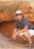
| no partners | | I did this route today, but backwards: I started at the parking lot for Carney Springs, one mile south of the Peralta trailhead parking area. There's a good parking spot there, and it's about .9 miles from there up the wash to the real trailhead (through the fence, just crossing the Lost Goldmine trail).
I like going up the Carney Springs trail. It really climbs steeply from mile 1.7 to mile 2.6. Gets the job done if you know what I mean. From the top of the saddle, it seems that the summit of Superstition Mountain is closer than it actually is. Remind yourself that the hoodoos are 40 feet tall, and that'll give you an idea of how big a hike this is. The trail along the ridgeline is perfectly cairned, easy to follow. It seems to want to go down into West Boulder Canyon, and it's tempting to go off-trail to the left to where the real "ridgeline" would seem to be. Just have patience and you'll see why the trail descends and angles as it does to the northwest. It's worth it!
The summit of Superstition Peak is really the hardest part of the hike, because it's the first time where you have to hold on to the rock to be able to ascend. It's a short, easy climb, though, and the summit is right there. I had "lunch" of crackers and PowerAde on the top, and was feeling very good about my accomplishment. So good, in fact, that I decided to hike on to the Hieroglyphics Trail and descend to the trailhead on that route, then use the Lost Goldmine trail to get back to my car. For some reason I was under the impression that it was about 3 miles from the Heiro trailhead to the Carney Springs trailhead. Turns out that's about three miles underestimated...
Leaving the summit, my fear of heights kicked in and I had to move very carefully to traverse the short (20') steep section on the summit's southeast side. Little did I know that my fear of heights would come into play three more times on this descent. I found that there are very few cairns on the slopes of the peak's summit, and that I just found myself taking a line of course straight towards the Heiro canyon. Honestly, I never saw cairns or any other evidence of the "ridgeline trail" from the peak. I have no idea how a hiker would continue towards the northwest and the Flatiron area; it all seemed like straight-down cliffs to me. Anyway, I picked up some cairns headed towards the Hieroglyphics Trail and soon found myself on the first challenge. Marked with white dots, the descent involves a ten-foot-tall wall, on an excellent boulderfall/crack area that the hikers must manage. It took me twenty minutes, and ended up being very satisfying. Going up, I think it would be easier.
From that cliff, it's an easy walk for about a quarter mile, until another cliff demands a very steep descent. This one does not feel as vertical as the higher one, but it's still demanding and would be a painful (eight-nine feet) fall if you don't negotiate it well. The rock is all volcanic and has excellent traction and very good handholds. These help.
The third steep cliff area is about 1000' below the summit, and is at the top of the drainage area that leads to the first pools at the Heiro area. It's much easier to handle, and I took some liberty with the lower part of the down-climb; I ended up too far to the northwest, I think, following a crack with great footing and handholds. From the bottom of that crack, I couldn't see any cairns (or white dots) in front of me. I could see how steep the descent down the ravine would be, so I angled to the northwest to make one gigantic half-switchback. It worked out great, and I found the cairned path again after about 300 yards.
The "trail" is hard to follow between cairns from the Hieroglyphics pool area up to the base of the first cliffs, so there's a lot of bushwhacking. This is fine. The cholla and the shin daggers are easy to spot, and avoid. Eventually, you get to the pools, and can enjoy that area if you have time.
I didn't, so I kept moving. I had started this hike at about noon and when I left the lower pool area of the Hieroglyphics Trail it was 6:00 and the sun was about an hour from setting. I hiked down to the junction (near the trailhead) with the Lost Goldmine trail, and turned on that. After about 4 miles, I turned on my headlight to see the trail (that was the end of civil twilight, and everything was getting dark quickly). I ended up hiking for about another hour in the real dark (off-trail at about 8:20 p.m.) and I was grateful for the headlight. I slowed down quite a bit after dark, not wanting to hurt myself accidentally at that point (or break my only light!), so it took FOREVER to get back to the Carney Springs parking area.
Great hike, though, on a perfect hiking day in Arizona. I didn't see another person out there, even at the Hieroglyphics Trail pools, and with the s-t-e-e-p sections, it's not really a good (safe) hike to do alone. I was surprised by how hard the Hieroglyphics Trail was, for descending... although all the trip reports do confirm that. I know it took me thirty minutes longer than it should have because of looking for the next cairn on the descent. I was happy for the guidance of the big white spots, telling you where the (only) descent point might be located. Usually, I don't like paint blotches in the wilderness, but today... I understood why they're important sometimes. |
| _____________________
| It is not the mountain we conquer but ourselves. Edmund Hillary |
| | |
|
|
|
 Route Editor