|
| | | |
| |
|
| Hiking | 7.00 Miles |
2,500 AEG |
| | Hiking | 7.00 Miles | 3 Hrs 30 Mns | | 2.00 mph |
| 2,500 ft AEG | | | | |
|
|
| |
| Linked |
|
none
[ show ]
| no linked trail guides |
| Partners |
|
none
[ show ]
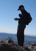
| no partners | | The path to Atascosa Peak (6,422 ft) utilizes the Atascosa Lookout Trail #100. Starting at the lookout, I walked on the lookout deck to it's north side and followed the ridge a short ways northeast to a steep drop-off. Standing at the drop-off, I found a descent route to my left.
Once down the rock, I picked up a use trail which is cairned very well most of the way to the peak. There is a 350 ft descent to the saddle separating the peak from the lookout. Due to the ridge being somewhat narrow, it would be tough to get off-route. No real bushwacking is involved as the vegetation is pretty open. There are a couple of places where hands are needed to get up/down a couple of short cliff bands.
On the summit, the views of Baboquivari and snow covered Mt. Wrightson stole the show. I returned by the same route. Back at the trailhead on Ruby Rd, it seemed like the Border Patrol passed my truck every 10 minutes. Being about 3 miles from the border, my truck was probably safer than at a Phoenix mall. |
| _____________________
| | |
|
|
|
 Route Editor