|
| | | |
| |
|
| Hiking | 18.50 Miles |
3,122 AEG |
| | Hiking | 18.50 Miles | 14 Hrs | | 1.32 mph |
| 3,122 ft AEG | | | | |
|
|
| |
| Linked |
|
none
[ show ]
| no linked trail guides |
| Partners |
|
none
[ show ]
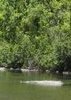
| no partners | | Went out yesterday to do the Weaver's Needle Loop, Peralta to Dutchman to Terrapin to Bluff Spring loop. I left at noon and got back to my car at about 2 AM, just about an hour before the rain, and about three hours after my husband and a friend had left on the peralta trail to come find me. I was expecting a 12.4 mile loop and clocked 18.5 by the time i was done. I got lost the firsttime at the Peralta/Dutchman intersection. Couldn't find the signed junction at first then was going to turn around and go back and couldn't even find the route back down Peralta I was so turned around. After much back and forth, I got onto Dutchman and made it to the Terrapin trail with no problem. At this point its dark and I'm using a headlamp. Around what I think was Bluff Saddle I lost the Terrapin trail completely. I was exhausted after 9 hours of hiking and was at about 14 miles on my GPS. My "Hikers Guide to the Superstition Wilderness" book said the Terrapin was 2.8 from Dutchman to Bluff Spring. I had gone about 4 on my GPS and had no clue where the trail went, but didn't think I had passed the Bluff Spring trail. At this point I decided to take a break, calm down and refocus. I found an existing small fire pit and a few dead plants and made a small fire and laid down for a bit. I was stressing over the fact that my husband and others were undoubtedly worried sick, my stomach was in knots, i was completely drained. After an hour or so with a bit clearer head and slightly rested body, I was able to find the continuation of Terrapin and within about 1/2 mile I hit the junction with Bluff Spring. From here I thought I was in the clear as I had hiked that portion before and thought I knew where I was and where I was headed. Storm clouds were replacing my starry sky and thoughts of flash floods were heavy on my mind as I trekked down the wash. Unfortunately, I mistook a side trail (the Cave Trail or possibly the other trail that goes up through Uppper Barks Canyon to Peralta) and after .5 miles on this trail realized I was definitely heading NW when I should be going south, there was no sign of horse travel, and the trail was not anywhere near as defined as I thought the Bluff Spring should be. I turned around, found my way back to Bluff Spring, continued further down the wash and found the correct turn-off from the wash up and out and back to the trailhead and my vehicle.
...many lessons learned on this one |
| _____________________
| | |
|
|
|
 Route Editor