|
| | | |
| |
|
| Backpack | 21.40 Miles |
6,700 AEG |
| | Backpack | 21.40 Miles | 2 Days 3 Hrs 15 Mns | | |
| 6,700 ft AEG | | 43 LBS Pack | | |
|
|
| |
| Linked |
|
none
[ show ]
| no linked trail guides |
| Partners |
|
none
[ show ]
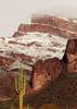
| no partners | | We did the three-day, two-night version and had an amazing time. Our group consisted of eleven men from the Phoenix area, and we saw smoky skies due to wildfires as early as Palm Springs. Tuesday we camped at Lone Pine Campground at the foot of the canyon, and there we first (and last!) smelled the smoke.
Wednesday morning we drove up to Whitney Portal and hit the trail at 8360'. We had access to water all day in the lakes and whenever we came near Lone Pine Creek, so everyone had filters, tablets, etc. We passed Lone Pine Lake, Bighorn Park and Outpost Camp, Mirror Lake, and by about 4 or 5 we were all at or near Trail Camp at about 11,900', and we camped there. There we were above the level of the smoke and haze. None of us slept much or very well that night, presumably due to altitude, but that was about the worst of the altitude's effects on our group.
Thursday we took day packs and all the water we could carry and hit the 99 switchbacks that go up a very steep slope to Trail Crest at 13,600'. At that point we crossed the ridgeline and entered Sequoia National Park. The Mt. Whitney Trail descends for half a mile to its terminus at the John Muir Trail. To the left the JMT drops down thousands of feet and goes eventually all the way to Yosemite. Continuing straight is also considered the John Muir Trail, which ends at the summit. After that bit the trail stays on the west side of the ridge all the way to the top, but it stays high enough to look eastward out many of the "windows" between the giant needles on the ridge. We made it to the summit and had surprisingly robust cell service, enough for video calls. The views were unreal, and still clear of haze in most directions at our height, but the valley floors to the east were mostly obscured. To the SW we could see the source of the haze wall to the south. As we descended to Trail Crest the view to the west became increasingly obscured by the haze. Some of our group got down earlier and had headed down to Outpost Camp at 10,400'. The rest of us got down to our campsite in time for dinner. Afterwards my brother and I decided to break camp and hike 3 miles or so down to Outpost Camp. We stuck with night vision as long as we possibly could, but the last half of that hike was in the dark with headlamps. Both of us slept much better in Outpost Camp.
In the morning we watched the very relaxed deer in our camp until the Trail Camp crew came down to join us. We checked out the stunning waterfall to the south and headed out.
The other hikers we encountered on Mt. Whitney have the best trail etiquette I've seen in a long time. We enjoyed hearing conditions reports from those coming down as we ascended, and we enjoyed giving our report to those coming up as we descended. For example, we heard a ton about really bad winds at Trail Camp the night before we got up there, then had a perfectly still night (though still didn't sleep). We met many people who were finishing 1-3 weeks along the John Muir Trail or High Sierra Trail. One woman was asked what she would drink first when she got out of the mountains. Her reply made us all laugh: "A milkshake!"
We used the bear canisters that we picked up at the Interagency Visitors Center, but never saw a single bear or marmot. We did see a pika, lots of birds, and at least half a dozen deer. The trees at Outpost Camp had a uniform maximum height limit, as if someone had mowed them. The trees gave out entirely at about 11,000', though we had flowering plants along the trail well above 14,000'.
After we got down the mountain back into Lone Pine, ate lunch, and returned our bear canisters, we drove into Death Valley, reaching Badwater, the lowest point in the US, 26 hours after being at the highest point in the contiguous US. It was a great trip! |
|
Wildflowers Observation Isolated
Some yellow dandelion-like flowers were blooming here and there on the highest plants we saw, above 14,000'. |
|
| _____________________
| | |
|
|
|
 Route Editor