|
| | | Barnhardt to Chilson Solo backpack trip, AZ | | | |
|
|
Barnhardt to Chilson Solo backpack trip, AZ
| | |
| |
|
| Backpack | 15.08 Miles |
3,019 AEG |
| | Backpack | 15.08 Miles | 2 Days | | |
| 3,019 ft AEG | | 25 LBS Pack | | |
|
|
| |
| Linked |
|
none
[ show ]
| no linked trail guides |
| Partners |
|
none
[ show ]
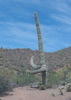
| no partners | | Solo backpacking trip up Barnhardt trail to Chilson camp. Late summer (Aug 30-31) but temps were much hotter than expected. 95 degrees at parking lot (8am) and remained that temp during entire assent (2,200 AEG)… 95 degrees at camp! Fortunately, Chilson Spring cistern was full of filter able water. Unfortunately, camp was very hot, no breeze and I was promptly pestered by several bees looking for water. After 2hours, I decided to pack up camp and hike back to a campsite on the Mazatzals divide trail (about a mile back towards Barnhardt trail). This camp was notable more comfortable, about 10 degrees cooler, breezy and no bees! Had good night, made dinner sipped some whisky, listened to some music and read my book. In bed by 8:30pm. One of the bees found me and buzzed my for about an hour at 2am… never heard of a bee flying around at night… he must have really hated me. Great hike out the next morning, 6.5 miles, all down hill. Met a nice fellow hiker named Macua (?)… he just moved here from Colorado and was scoping out the hiking options in his new AZ home.
Can’t say as I’m sold on solo backpacking. Definitely a bit boring but it was good for me to learn how to relax in nature all by myself. Definitely worth the trip. |
  |
Chilson Spring |
Dripping |
Dripping |
| |  Cistern is full or fairly clear water. I did not see any water flow through pipe so not sure how much was just from recent rains. Cistern is full or fairly clear water. I did not see any water flow through pipe so not sure how much was just from recent rains. |
|
Hawaiian Mist |
Pools to trickle |
Pools to trickle |
| | | Signs of recent flow across trail… I did not climb up to source but suspect very light trickle remaining | | _____________________
| | |
|
|
|
 Route Editor


 . Amazing while it lasted. I look forward to exploring this area more often to see what and which water is reliable for backpacking trips.
