|
| | | Noon Creek - Adams Flat Loop, AZ | | | |
|
|
Noon Creek - Adams Flat Loop, AZ
| | |
| |
|
| Hiking | 7.10 Miles |
1,454 AEG |
| | Hiking | 7.10 Miles | 5 Hrs 6 Mns | | 1.49 mph |
| 1,454 ft AEG | 21 Mns Break | | | |
|
|
| |
| Partners |
|
[ show ]
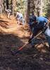
| partners | | Ginny and I headed to Safford again for three days of hiking in the Pinaleno Mountains. We didn’t leave Tucson till around 7:00 so we got a late hike start, about 10:00. We started out at the Noon Creek picnic area and took the Noon Creek Trail #302A, a portion of the Round The Mountain Trail #302, Noon Creek Cutoff Trail and what was supposed to be an old logging road to Adams Flat then back to Noon Creek picnic area. The Noon Creek, Round the Mountain and Noon Creek Cutoff Trails were in good condition from recent maintenance.
On the Noon Creek Cutoff Trail I let Ginny lead, not far into it she got surprised by a snake in the trail. It was a bull snake so it is harmless but it was a good size. Snakes always get your attention when you come across them. After that incident I kept an eye on the trail in front of her to watch for rattlesnakes. On the uphill’s I find it easier to let her set the pace so I don’t get too far ahead, sometimes it’s easier to push than pull.
The hike from the end of the Cutoff Trail down Wet Canyon to Adams Flat was a bush whack, the old logging road doesn’t exist anymore, at least that I could find. The bush whack wasn’t as bad as some of the ones I’ve been on in the Chiricahuas, we managed to find a route through without much bloodshed. Ginny is such a trooper, I had her pushing through, under and over bushes and trees all the while I was claiming the trail was there somewhere. The Adams flat trail was a welcome sight. This trail follows an old abandon irrigation canal. It does not look like a maintained trail and can be a little awkward following as it is a shallow ditch with multiple pipes strung along it, easy to trip or stumble. At the junction with the Butterfly Trail we took the road back to the start point.
There was still a little snow on the peaks of the mountain but not nearly as much as a couple weeks ago when I was here. Noon Creek and Jacobson Creeks had a good flow of water still. Made it back to the start point around 4:00 and time to head to Safford and check into the hotel and get dinner.
video [ youtube video ] |
  |
Wet Canyon |
Pools to trickle |
Pools to trickle |
| | | Trickle in some locations | | _____________________
| | |
|
|
|
 Route Editor