username
X
password
register
for free!
help
ArticlesGuidesRoutes
 
Photosets
 
 Comments
triplogs   photosets   labels comments more
Ash Creek Trail Bypass #307A - 8 members in 15 triplogs have rated this an average 3.1 ( 1 to 5 best )
15 triplogs
login for filter options
Mar 11 2017
avatar

 Guides 37
 Routes 556
 Photos 10,872
 Triplogs 1,052

43 male
 Joined Jan 21 2013
 AZ
Ash Creek Trail #307Tucson, AZ
Tucson, AZ
Backpack avatar Mar 11 2017
FOTGTriplogs 1,052
Backpack18.39 Miles 6,652 AEG
Backpack18.39 Miles2 Days         
6,652 ft AEG
 
Partners none no partners
The goal of this backpack was to escape anything related to 90 degree temperatures, to visit some waterfalls and find some snow. It was successful on all fronts. A tremendous over night trip into the premier sky island, Mount Graham.

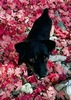
We started our backpack at the lower Ash Creek trailhead. This trail is a climb from the start and it can feel like a real slog at times, especially, when carrying an extra tent and old sleeping bag for the pups. In particular, the 1,000 feet gained between mile four and fivish, is brutal. There were a few newly fallen obstacles along the way and some higher than average creek crossing as well to add to the ardor. After enjoying the falls from the trailside lookout, Jackie stayed with the pups so I could get a "closer" look. After dropping down one viewpoint, I started to realize that although it was very steep and a little dicey looking, one could scramble all the way to the base of the falls, an area that has been on my wish list for awhile. I yelled back to Jackie and let her know I was going down further, she acknowledged and I began the wild descent, which actually went pretty well.

However, about a 100, or so feet from the bottom I kicked up a pretty good rock slide, one that ended with a couple hundred plus pound boulders smashing to the bottom of the raging creek and echoing something thunderous and chilling. I immediately thought Jackie might get worried and yelled back, "I'm ok," even though I knew there was probably no way she could hear me. After that, the base of the falls came pretty easily and I marveled at the cool little area, After exploring and snapping a few pics of the cool little cascades below the falls, I began my crawl up. After reaching the top, I found out pretty quickly from a shook up Jackie that she had been assuming the worst since hearing the rock slide, In fact, she had even sent out a couple of distressed texts to people assuming the worst, after not seeing, or hearing from me in about 45 minutes. The poor girl was about 15 minutes away from collecting her gear, the pups and heading back to the TH to get proper help. I felt horrible for not communicating my intentions to reach the bottom and for not finding away to signal back that I was alright, after the rock slide; a tad humbling seeing how greatly thoughts of your demise might impact someone close to you. In the end though, all was well and nobody was hurt, so we continued on after collecting ourselves a little.

We took the nearly devoid of snow Ash Creek bypass trail over the snowed in route over slick rock. We ended up calling it a day near the old mill site. We found a great site along the robust snow fed creek and set up camp quickly to potentially pursue some exploring up trail. However, that thought devolved into a nap and the usual camp chores. We enjoyed a chilly, but not overly cold night and while the temperatures definitely reached freezing, I do not think they dipped too far below that. The moon never really allowed darkness to take hold, but we still slept well, thanks in part to a tough little day and climb.

We decided to head for Webb Peak Sunday morning, but got turned around by some real deep snow just after clearing 9,500 feet. We had got lucky for most of the hike up and were able to cruise with micro-spikes on some hard crusted 3-4 feet deep snow for large sections, however, as the temperature warmed the post holing began. However, it was still only a minor inconvenience until we got to just under a half a mile from the summit where the snow got really deep and soft, deep enough to lose a dog in deep! We'd had such a good time playing in the snow up until then, that it really did not bother us to turn around. We did the quick hike back to camp, broke camp and started the relentless descent. The trip down seemed to fly by in comparison to the hike up. I visited an old favorite set of falls on the way down and then finally made it to another one I had been meaning to get to. We finished to complaining about the heat and in shorts and t-shirts, slightly different than the wintry conditions we began our day with, Arizona at its finest.

water 1 out of 5water 2 out of 5water 3 out of 5water less than max Ash Creek Falls Medium flow Medium flow

water 1 out of 5water 2 out of 5water 3 out of 5water less than max East Ash Creek - Pinalenos Medium flow Medium flow
_____________________
  4 archives
Nov 10 2016
avatar

 Guides 4
 Photos 4,732
 Triplogs 2,607

55 male
 Joined Sep 29 2004
 Small Town USA
Ash Creek Trail #307Tucson, AZ
Tucson, AZ
Hiking avatar Nov 10 2016
SkyIslander18Triplogs 2,607
Hiking6.80 Miles 1,800 AEG
Hiking6.80 Miles
1,800 ft AEG
 no routes
Partners partners
Abqkathy
weavejd
Haven't been down to the falls in 2 years and my visiting friends have never seen the falls.
This area is now a little "out of season", but that's OK, this trail is awesome anytime of the year!
We headed down Ash Creek #307, quick side trip to the old mill site, then down to the falls overlook with a short off-trail route to a frontal view. I then, as my partners ate lunch, made a decision to once and for all climb down the canyon wall to the base of the falls. Was a bit of a risky path down, but it all worked out and I finally got to look up the falls from the bottom ..... bucket list check!
:y:
We then took the Bypass trail back out completing the lasso loop. The autumn colors are just about all gone now and the creek/falls were flowing a little below average, but that was expected today for this date. Snow will be coming soon and the road in will be closing in 5 days. Ash Creek Trail IMO will always be the gem on top of this mountain and I was very happy to get to show it to my friends before they leave town (they loved it).
Lots of deer sightings today, I believe we counted 12 along the way.
:D
foliage observationfoliage observationfoliage observationfoliage observationfoliage observation
Autumn Foliage Observation Isolated

water 1 out of 5water 2 out of 5water less than maxwater less than max Ash Creek Falls Light flow Light flow
_____________________
https://www.instagram.com/skyislander22/
 
Oct 13 2016
avatar

 Guides 13
 Routes 38
 Photos 1,651
 Triplogs 577

60 male
 Joined Nov 15 2005
 Jackson, CA
Ash Creek Trail #307Tucson, AZ
Tucson, AZ
Hiking avatar Oct 13 2016
toddakTriplogs 577
Hiking19.00 Miles 6,000 AEG
Hiking19.00 Miles   9 Hrs   30 Mns   2.00 mph
6,000 ft AEG
 no routes
1st trip
Partners none no partners
Excellent climb from the lower trailhead at 4700' to the top of Webb Peak at just over 10,000'. The first mile is out in open scrub, but the rest of the hike stays right along the beautiful creek and/or in shady forest. Nicely routed and very well-maintained trail. The last 4 miles of the drive to the trailhead are rough and rocky, with 3 creek crossings. Thanks to chumley and FOTG for the inspiration and some good area info.
_____________________
 
Aug 19 2014
avatar

 Guides 4
 Photos 4,732
 Triplogs 2,607

55 male
 Joined Sep 29 2004
 Small Town USA
Ash Creek Trail #307Tucson, AZ
Tucson, AZ
Hiking avatar Aug 19 2014
SkyIslander18Triplogs 2,607
Hiking6.50 Miles 1,800 AEG
Hiking6.50 Miles
1,800 ft AEG
 no routes
Partners partners
AddSanz
Ooooooooooo Boy, Ash Creek Trail under a heavy monsoon storm :o :scared: :y:

Arrived at Columbine from Riggs Lake to find the entire mountain top now covered in a huge storm cell and starting to produce. Addie, Lauren & myself huddled inside the bathroom for about a half hour waiting for the rain to let up a bit, but it only grew stronger. After a brief talk, we decided that we were all "down" for this! we put on our ponchos and headed down the soaked Ash Creek Trail : rambo :

The rain fell good as we made our way down to the boiler/Webb Peak Y and the trail all the way down to the mill site was flooding, looked like a small river in places. The storm then let up a bit as we toured the mill site then making our way down to the Bypass trail. There was a little concern about hiking the Slick Rock section in the rain, but we were there and just had to do it! The lower section is no longer maintained and was quite an overgrown bushwack down to Slick Rock, but a hell of a lot of fun. Then the monsoon gods decided we had had enough and turned off the rain the entire time between Slick Rock down to Ash Creek Falls. We first viewed the falls from above before off-trailing down to the lower full view and my God ..... the falls were flowing heavy and looked spectacular !!!

We rested a bit before the climb back up agreeing to take the much more easy Bypass Trail out. As soon as we hit the Bypass, low flying clouds came up from the canyon and we were hiking in the clouds the entire route. It was Awesome!
Back at the split, the rain came down again and never let up the entire climb back up to Columbine.

Monsoon rain, lightning, trail flooding, heavy creek & falls flow, the rain soaked rich colors of the flora, canyon & skies, and all of it with my 2 wonderful friends =

GREATEST ASH CREEK HIKE EVER
And one of the most memorable hikes of my life!

Twas also a bittersweet end to my 2 day trip with the girls :(
This was our last trip together as the self named "Roper Lake State Park Ranger Hiking Club".
These last 3 months have produced in one combination or another 39 trips spent outside of work to just hang out on a mountain, in a canyon or across the flatland.
Cherished friends, wonderful experiences & a deep hope that someday we will do it all over again.
Thank you so much Addie & Lauren (I'll still see ya at work ;) )
wildflower observationwildflower observationwildflower observationwildflower observationwildflower observation
Wildflowers Observation Substantial

water 1 out of 5water 2 out of 5water 3 out of 5water 4 out of 5 Ash Creek Falls Heavy flow Heavy flow

water 1 out of 5water 2 out of 5water 3 out of 5water 4 out of 5 Post Creek Heavy flow Heavy flow

water 1 out of 5water 2 out of 5water 3 out of 5water 4 out of 5 West Ash Creek - Pinalenos Heavy flow Heavy flow
_____________________
https://www.instagram.com/skyislander22/
 
Aug 16 2014
avatar

 Guides 1
 Routes 136
 Photos 22,415
 Triplogs 1,041

77 male
 Joined Feb 28 2003
 Tucson, AZ
Ash Creek Trail #307Tucson, AZ
Tucson, AZ
Hiking avatar Aug 16 2014
rwstormTriplogs 1,041
Hiking4.90 Miles 1,400 AEG
Hiking4.90 Miles
1,400 ft AEG
 
Linked   linked  
Partners partners
Take a Hike
madhiker
Joined Charles on his annual Pinaleno camping/hiking trip. Got down there mid afternoon Friday and set up at Columbine Corrals. Others arrived later. We had between 15 and 20 folks for 5 camp sites, so we shared spots. Site 6 in the middle was our campfire/party area. Good times as usual. :) Most folks set out with Charles at 8 o'clock Saturday morning for the big hike down Ash Creek, going past Oak Flat. I headed out around 9 to go as far as the Falls, at a leisurely picture-taking pace. The original route to the slick rock is no longer maintained, so it is very overgrown with lots of deadfall to navigate. Still worth it though, as this is one of the highlights. Took the bypass route on the return to avoid the hassle and made real good time back to camp (beer).

Strong flow in the creek from the summer rains.

Sunday morning some did the short hike up to Webb Peak, while I sat around in camp having breakfast and coffee and slowly packing things up. I was the last to leave at around noon. Storms all around of course, but we lucked out and never got hit by any weather the whole time. There was a lot of lightning Saturday evening, but we never heard thunder. I missed a good storm at my house in Tucson about 5 o'clock Sunday morning that dumped .80 inch rain along with a 40 mph wind gust (that's a little unusual for that time of day). But, I was home to enjoy another storm and more rain Sunday evening. :D

http://youtu.be/-agkAPSy6IY
 Meteorology
 Meteorology [ checklist ]
[ checklist ]  Sunset
wildflower observationwildflower observationwildflower observationwildflower observationwildflower observation
Wildflowers Observation Substantial
_____________________
  2 archives
Jul 12 2014
avatar

 Guides 2
 Routes 512
 Photos 5,579
 Triplogs 4,277

69 male
 Joined Mar 01 2009
 Aztec, NM
Ash Creek Trail #307Tucson, AZ
Tucson, AZ
Hiking avatar Jul 12 2014
PivoTriplogs 4,277
Hiking7.43 Miles 2,619 AEG
Hiking7.43 Miles   4 Hrs   31 Mns   1.91 mph
2,619 ft AEG      38 Mns Break
 
1st trip
Linked   linked  
Partners partners
Baja Arizona Hiking
Floridasunshine
MyRudy
Beautiful hike down the canyon along the creek and up over the bypass, and then back along the creek. The views, wildflowers, and slide rock areas are wonderful.
wildflower observationwildflower observationwildflower observationwildflower observationwildflower observation
Wildflowers Observation Moderate
_____________________
 
Jul 12 2014
avatar

 Photos 3
 Triplogs 106

26 male
 Joined Apr 23 2012
 Tucson, AZ
Ash Creek Trail #307Tucson, AZ
Tucson, AZ
Hiking avatar Jul 12 2014
MyRudyTriplogs 106
Hiking7.43 Miles 2,619 AEG
Hiking7.43 Miles   4 Hrs   31 Mns   1.91 mph
2,619 ft AEG      38 Mns Break
 no routesno photosets
1st trip
Linked   linked  
Partners partners
Baja Arizona Hiking
Floridasunshine
Pivo
_____________________
 
Jul 04 2014
avatar

 Triplogs 3

male
 Joined Apr 14 2014
 
Ash Creek Trail #307Tucson, AZ
Tucson, AZ
Backpack avatar Jul 04 2014
azneonguyTriplogs 3
Backpack9.75 Miles 5,200 AEG
Backpack9.75 Miles2 Days         
5,200 ft AEG
 no routesno photosets
1st trip
Linked   linked  
Partners none no partners
_____________________
  1 archive
May 20 2013
avatar

 Guides 4
 Photos 4,732
 Triplogs 2,607

55 male
 Joined Sep 29 2004
 Small Town USA
Cunningham Loop Trail #316Tucson, AZ
Tucson, AZ
Hiking avatar May 20 2013
SkyIslander18Triplogs 2,607
Hiking14.00 Miles 2,100 AEG
Hiking14.00 Miles
2,100 ft AEG
 no routes
Partners partners
fricknaley
PrestonSands
The Yeti rolled into town last night and after a text & call, I found myself 12 hours later heading up the Swift Trail with Preston & Nick for my first hikes up high on Graham for 2013 :y:

We first hiked up and to the end of Cunningham Spur then off-trailed down along the creek until we dropped onto the Cunningham Loop Trail which we then completed counter-clockwise.
Next we drove a couple of miles down to Columbine where we split with Preston & Nick heading up to loop Webb Peak/Blair-Ash Ridge/Ash Creek and myself going solo down the Ash Creek Trail for the out-n-back to the falls. All the trails looked great and there was good creek flow throughout.

We then met back up at Columbine and drove back down the Swifty ending a great day of hiking on the upper Pinalenos!

Thanks for the invite guys, good times on the big Island !!!
wildflower observationwildflower observationwildflower observationwildflower observationwildflower observation
Wildflowers Observation Light

water 1 out of 5water 2 out of 5water 3 out of 5water less than max Ash Creek Falls Medium flow Medium flow
Good flow today, falls looked spectacular!
_____________________
https://www.instagram.com/skyislander22/
 
Aug 18 2012
avatar

 Guides 1
 Routes 136
 Photos 22,415
 Triplogs 1,041

77 male
 Joined Feb 28 2003
 Tucson, AZ
Ash Creek Trail #307Tucson, AZ
Tucson, AZ
Hiking avatar Aug 18 2012
rwstormTriplogs 1,041
Hiking5.00 Miles 1,600 AEG
Hiking5.00 Miles
1,600 ft AEG
 
Partners partners
Take a Hike
madhiker
Part of the weekend camping trip to the Pinalenos. Started about 1030 Saturday morning. Since we were hiking down into a canyon we weren't too concerned about storms with our late start (however below the waterfall area things could become dangerous with increased stream flow if there was a big storm). Turns out none of this was a factor. The flow in Ash Creek was moderate as you would expect during the monsoon season. Everything was wet and lush. Summer wildflowers were happy as heck. And so was I. This is the magic season!

Everyone went down to the Ash Creek Falls area, with Charles extending his trip much further downstream. There is no way I was going up on that observation rock, but the coward's view just below it to the right wasn't much comfort either. Next time I will hike further down the trail to the vantage point that AzWaterRat found. It gives a nice view of the falls (more head on versus side). Anyway, we took a nice break at the top of the slickrock before heading for the waterfall turn around point. We went back via the bypass route, partly because we didn't want to deal with some of the downed trees along the way. Don't worry, there was more on the upper reaches of the trail too, but the worst spot was near the slickrock. I was taking my time the whole way, savoring the glorious vegetation and taking pictures to my heart's delight! :)
_____________________
 
Aug 17 2012
avatar

 Guides 1
 Routes 136
 Photos 22,415
 Triplogs 1,041

77 male
 Joined Feb 28 2003
 Tucson, AZ
Pinaleno Car Camp, AZ 
Pinaleno Car Camp, AZ
 
Hiking avatar Aug 17 2012
rwstormTriplogs 1,041
Hiking
Hiking
 no routes
1st trip
Hadn't been up into the Pinalenos yet this summer, so when I saw a Phoenix group was going there (and didn't have a ton of people), I signed up. Left Tucson around noon Friday and rolled into Columbine Corral CG about 4 and set up in site #3. Though there was heavy moisture in the air from rains earlier in the day, things were dissipating with just a few sprinkles. Stayed quiet the rest of the night. Parked the truck at 4 o'clock and didn't move it again until I left at noon Sunday! Sure don't do that very often when I'm out and about. It was nice just hanging out in one area for a couple of days.

Relaxed during the evening, grilling sausages and enjoying beer. Walked over to the parking lot by the work center a couple of times after dark to look at the sky. I wondered when the Phoenix contingent would arrive. Thought they might show around 7, but not so. By 9 o'clock I figured they might have cancelled due to low turnout (or the ominous flash flood watch that was in effect at the time). I always get a kick out of those flash flood watches; around here it frequently translates into a non-event. :lol: There was a curious skunk checking out my camp that provided some extra entertainment. I was just about to call it a night when the group rolled in at 10 o'clock. They set up, got a fire going, and we sat around until about 1 AM. Guess the hike to Ash Creek Falls wasn't going to be early. :lol: Fine by me. Right after retiring to the tents, I heard what sounded like a large animal getting into something over by the others. Saw the flashlight beams and heard someone say, "Don't make it mad!" (or something like that) Found out in the morning it was two skunks fighting over some stuff left out right by their tents. :o Luckily no spraying!

Saturday we hiked down to Ash Creek Falls, with Charles going well beyond that solo, while the rest of us returned to camp. Such a pretty hike in the summer. Charles got back to camp in early evening from his long hike (about 4500 feet down and back up). I grilled pork ribs and did a stir fry (with Hatch chiles thrown in for heat) on the stove for my evening meal. After I got everything cleaned up and put away, I walked over to join the others around their fire. Charles had planned on doing a spooky night hike to the Webb Peak tower at 11 PM in the new moon darkness, but nobody else wanted to go. Turns out that wouldn't have worked anyway.

After it got dark we were treated to a heck of a light show from thunderstorms that stretched in the distance from the north to east to southeast! Couldn't see the cloud to ground strikes because of being in the trees, but many cells were really putting out the lightning! It started out clear above us around sundown, but clouds were increasing by the time we headed for the tents (early at about 9 o'clock). About that time thunder could be heard to the northeast, so it was looking like we might get some rain after all. I like it when the storms allow you to get your evening activities in hassle free! :)

The storms cut loose over the mountain between 9 and 11 PM. The lightning was pretty intense (especially "in tents" :lol: ). Normally I get out of the tent and into the vehicle when it gets this bad, but this time I decided to not get soaked, and stayed in the sleeping bag. That was definitely the strongest thunderstorm I ever rode out in a tent. It was a little scary and very exciting! :scared: :o By 1130 the storms were rolling off the mountain toward the southwest. Quiet the rest of the night. Only a few drops of water got in the tent, so that was good. Same for the others. When I got home I checked the weather observations for the Columbine RAWS (over by the nearby work center) and found out we got 0.75 inch of rain. Not bad!

The others broke camp and headed out for Phoenix fairly early Sunday, while I goofed off and made a nice breakfast and slowly put my stuff away. By doing that I was able to get everything dry and save myself extra work when I got home. :y:

This was a very enjoyable camping adventure! :D
wildflower observationwildflower observationwildflower observationwildflower observationwildflower observation
Wildflowers Observation Substantial
_____________________
 
Jun 16 2012
avatar

 Guides 264
 Routes 2,797
 Photos 14,494
 Triplogs 5,894

55 male
 Joined Nov 20 1996
 
Goudy - Grant Creek - Ash Waterfall Loop, AZ 
Goudy - Grant Creek - Ash Waterfall Loop, AZ
 
Hiking avatar Jun 16 2012
joebartelsTriplogs 5,894
Hiking20.22 Miles 5,953 AEG
Hiking20.22 Miles   10 Hrs   38 Mns   2.34 mph
5,953 ft AEG   2 Hrs    Break18 LBS Pack
 
1st trip
Partners partners
The_Eagle
Tortoise_Hiker
Grant Goudy Ridge Trail # 310
Our loop started on #310 which would be the only new territory for myself. I figured this one gets overlooked as most driving the distance are probably looking for pine covered trails up top in the cool temps. It is a little overgrown but not much. It seems well used and well designed. The best part being the views. I was at the back of the pack all the way down taking photos.

Grant Creek Trail #305
5 years ago on a hike with Preston and Nick we saw a bear on a one-way shuttle down. Today with Denny and Bruce going up we didn't get so "lucky". Likely due to wildlife's natural instinct to ascend when encountered. Nevertheless an excellent trail segment in my opinion. You have life zones, canyon shade at the bottom when it's most needed and distant views in the upper end.

Ash Creek Trail #307
This one was lightly penciled in based on time and energy reserves. It is typically deemed one of the favorites. Preston and I enjoyed this in prime six years ago with warm light on a brisk Autumn morning. So for myself this was a let down in hazy afternoon shadows.

Ash Creek Trail Bypass #307A
Stepping off the Ash Creek Waterfall perch I experienced something I haven't felt for some time. Yep you guessed it, the single smacking splat of a heavy rain drop. Anyone that's been around knows the difference between a teasing rain drop and a warning rain drop. This one meant business.

It did offer a small time frame to get the camera(only concern) packed away and head out but not much. My pack soaks through pretty quick so time was of the essence. I decided to forgo the creek route as I didn't want to be anywhere near slippery rock that humbled me back in 2006. Bypass was the ticket. I did what I could. After a mile and a half I decided it was best to hunker down under a tree. There must have been an angel nearby as the rain let up after a short break. Starring at my feet I got off track and found myself in unfamiliar territory. I guess it was the Bible Camp. In the end it all worked out.

Denny Andretti guided the flying focus down the mountain and home safely!
wildflower observationwildflower observationwildflower observationwildflower observationwildflower observation
Wildflowers Observation Light
_____________________
- joe
 
Jun 16 2012
avatar

 Guides 1
 Routes 148
 Photos 9,924
 Triplogs 3,652

63 male
 Joined Apr 02 2005
 Mesa, AZ
Goudy - Grant Creek - Ash Waterfall Loop, AZ 
Goudy - Grant Creek - Ash Waterfall Loop, AZ
 
Hiking avatar Jun 16 2012
Tortoise_HikerTriplogs 3,652
Hiking20.22 Miles 5,953 AEG
Hiking20.22 Miles   10 Hrs   38 Mns   1.90 mph
5,953 ft AEG
 no routesno photosets
1st trip
Partners partners
joebartels
The_Eagle
Bruce had told me not to contact him anymore after we finished the AZT.I was :o when I got the invite for this one. :PMIC: Joe said doing this loop in this derection would give us shade at the right time. :worthy: Nice hike.Great views,healthy looking forest,creek(with trout),cool rock formations,and a nice tree canopy on the climb out.The view from our lunch spot was top notch.This loop finished back at the car about 15 miles later.We grabbed some more water and were off to do our second hike down Ash Creek.The boys picked another dandy.This area is pretty lush and I always enjoy hiking by a creek.We saw stuff from an old sawmill, a small waterfall,some resident lizards,and what looked like a long waterslide.The turn around point was at a viewpoint of a bigger waterfall :GB: .very cool.There was a chance of rain but...AhOh.It started right at our turn around point.It turns out the horse bypass is a good way to go to avoid the slick rocke when there wet.Plus we got to see more trail.Our (I got your back)attitude went to (every man for himself)when the rain,thunder and lighting hit. :scared: :oops: We all made it out and put whatever dry clothes we had on and headed down the mountain.We did see two Deer and two Turkey on this trip.We hit up Arby's for a couple Arby Q's and sang :whistle: all the way home!Thanks boys,for another great trip! :y:
wildflower observationwildflower observationwildflower observationwildflower observationwildflower observation
Wildflowers Observation Light
_____________________
Tortoise Hiking. Stop and smell the Petrichor.
 
Jun 16 2012
avatar

 Guides 41
 Routes 1,626
 Photos 14,983
 Triplogs 2,760

69 male
 Joined Jan 20 2009
 Far NE Phoenix,
Goudy - Grant Creek - Ash Waterfall Loop, AZ 
Goudy - Grant Creek - Ash Waterfall Loop, AZ
 
Hiking avatar Jun 16 2012
The_EagleTriplogs 2,760
Hiking20.88 Miles 5,953 AEG
Hiking20.88 Miles   10 Hrs   49 Mns   2.37 mph
5,953 ft AEG   2 Hrs    Break14 LBS Pack
 
1st trip
Partners partners
joebartels
Tortoise_Hiker
My first time down in this area of Arizona. I sure wish I lived closer to the Pinaleno's.
Out the door at 2am and in Thatcher, just outside of Saford at 5:30. I looked up at Mt. Graham in disbelief that it would take us another hour and a half to get to our TH up there....but it did.

Temps were perfect most of the way around on this day.

The trip down Grant Goudy Ridge #310, was much nicer than expected being under the cover of trees for a large portion. The Pinalino's have a different look than the other Sky Islands I've been to. I can't quite put my finger on why that is? The Views were exceptional!

The Grant Goudy Ridge Trail dead ends on the south end, at Grant Creek #305. This is where we stated the climb back up the 4,000' we'd just lost. The track follows Grant Creek and then Post Creek until it turns to the East to make the final climb to the rim. Moonshine Creek is just a bit to the north, but is never in view. We had a 2.5 mile road walk back to the car to restock for our next segment. I confirmed afterwards that there is another set of falls (Grant Falls) that we missed.

15+ miles down, it was time for the hike to Ash Creek Falls. Lush green all the way down, cool rock formations, remnants of the Mt. Graham Mill Site, and following Ash Creek all the way! The Falls were really cool and I wish we could have spent more time checking them out.

Mother Nature would not let that happen. A couple of big drops of rain hit... Joe's off like a Roadrunner. A crackle of thunder and lightning in my line of site past Denny.... It's time for Denny and myself to pack up and Git. That's about the time that the sky opened up. The Angles started Bowling and the gods threw there lit spears in the skys above. It poured/rained all the way back to the car. I was so glad for the dry set of clothes waiting for me.

A Video at Ash Creek Falls
http://www.youtube.com/watch?v=AF_jM88y-MU&feature=channel&list=UL

A Super big thanks to Denny for Driving!
 Culture
 Culture [ checklist ]
[ checklist ]  HAZ Rides
 Named place
 Named place [ checklist ]
[ checklist ]  Ash Creek Falls
wildflower observationwildflower observationwildflower observationwildflower observationwildflower observation
Wildflowers Observation Light

water 1 out of 5water 2 out of 5water 3 out of 5water less than max Ash Creek - Pinalenos Medium flow Medium flow
Plenty of water from the top to the falls

water 1 out of 5water 2 out of 5water less than maxwater less than max Post Creek Light flow Light flow
Water available in many spots
_____________________
There is a very fine line between "hobby" and "mental illness."
Dave Barry 🦅
 
Sep 05 2011
avatar

 Guides 107
 Routes 249
 Photos 2,067
 Triplogs 514

male
 Joined Nov 18 2005
 Phoenix, AZ
Ash Creek CanyonTucson, AZ
Tucson, AZ
Canyoneering avatar Sep 05 2011
nonotTriplogs 514
Canyoneering7.30 Miles 2,300 AEG
Canyoneering7.30 Miles   7 Hrs   12 Mns   1.01 mph
2,300 ft AEG50 LBS Pack
Intermediate Canyoneering - Difficult or dangerous; Tech Climb; rope reqd; descent anchor; exit technical;
C - Strong current; wading/swimming; waterfalls; possible wet/dry suit
III - Normally requires most of a day
 
no photosets
1st trip
Partners none no partners
Wonderful canyon, enjoyed the waterfalls. :y: Absolutely peaceful with the water rushing past in the slot, having little to do but focus on the task at hand, definitely not recommended as a solo trip though.

Found some leftovers in the canyons - seems like a previous group had some trouble. I picked up some of their rope and some more gear on the hike out - just added more to the load to pack up and out :sweat: - if it's yours, send me a private message with a description. Otherwise it's going in the trash.

I have absolutely no clue what the purpose of the 12-13 mm honker was doing at an easy downclimb, I left that one for future parties to noodle on.

Was a little slow on the climb out due to having all the gear to tote myself. No matter, for it absolutely poured on the way out. I was soaked and cooled off, but with the climbing I didn't really get cold at all.

The Ash Creek bypass isn't on the site yet, I tried to map both accurately (which added a bit of time and distance), will follow up soon.
wildflower observationwildflower observationwildflower observationwildflower observationwildflower observation
Wildflowers Observation Light
_____________________
http://hikearizona.com/garmin_maps.php

Hike Arizona it is full of sharp, pointy, ankle-twisting, HAZmaster crushing ROCKS!!
Hike Arizona it is full of sharp, pointy, shin-stabbing, skin-shredding plants!
Hike Arizona it is full of striking, biting, stabbing, venomous wildlife!
 
average hiking speed 1.92 mph

WARNING! Hiking and outdoor related sports can be dangerous. Be responsible and prepare for the trip. Study the area you are entering and plan accordingly. Dress for the current and unexpected weather changes. Take plenty of water. Never go alone. Make an itinerary with your plan(s), route(s), destination(s) and expected return time. Give your itinerary to trusted family and/or friends.

helpcommentissue

end of page marker