|
| | | Ridgeline Loop - Supps, AZ | | | |
|
|
Ridgeline Loop - Supps, AZ
| | |
| |
|
| Hiking | 26.14 Miles |
5,983 AEG |
| | Hiking | 26.14 Miles | 13 Hrs 24 Mns | | 2.94 mph |
| 5,983 ft AEG | 4 Hrs 30 Mns Break | | | |
|
|
| |
| Partners |
|
[ show ]
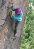
| partners | | Two words for day: Cold and Windy!
On the drive to the TH, I saw two coyotes' and two deer crossing the dirt road.
The three of us started at the Crosscut TH. There was snow and a low hanging cloud on the top layers of the syphon draw.
Fans lead the charge up to the Flat Iron. Once on top the clouds started to break-up and the cold wind started blowing.
Whenever we had a choice of going up or around a ridge, we choose going around staying out of the wind.
We took lunch about a 1/2 mile from the Carney Springs turnoff. We ran into some backpackers that Fan knew. The backpackers were going from Syphon Draw to Canyon Lake. They were new to the Supps and asked about which trails to take.
We headed towards Robbers Roost. We went past the Old West Boulder canyon turn and Fan talked us into taking a new trail to the left. She was certain it was a short-cut to the Peraltra trail. The trail was well cairned and parallel the Robbers Roost trail for a bit, then it bee lined right to Freemont Saddle. The last 1/4 mile was a bunch of drainages and 3 to 5 foot drops. My knees didn't like this part.
We took Peraltra to Dutchman to First Waters TH. It snowed off and on going down the Peraltra. It was warmed now, being lower and out of the wind.
We made it to the Black Mesa trail before turning on the flashlights. The creeks had a good waters flow to them.
The sun was a tease the entire day. We could see AJ had sunshine but, we only had about 10 minutes of sun for the entire day. |
| _____________________
"Everywhere is walking distance...If you have the time"
-Stephen Wright |
| | |
|
|
|
 Route Editor


 In front of this 80 ft rappel is the canyon just below Robbers Roost where we would find the final rappel. We bushwhacked for about 0.5 miles until we reach the 240 ft rappel. Long pants are mandatory as the catclaw is thick. Be careful not to hike over the 240 ft rappel. It is pretty well obscured by brush on the left side.

 It was dark by the time we were all down and pulled ropes but we were fairly close to the lower trail. Some down climbing after that final rappel before hitting some thick bushwhacking. Once down into the flatter area, you'll want to cut west to reconnect with the trail and an easy walk back to the TH.
