|
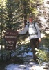
| | | Reavis - Frog Tanks - Rogers Loop, AZ | | | |
|
|
Reavis - Frog Tanks - Rogers Loop, AZ
| | |
| |
|
| Hiking | 33.93 Miles |
5,540 AEG |
| | Hiking | 33.93 Miles | 14 Hrs 8 Mns | | 2.70 mph |
| 5,540 ft AEG | 1 Hour 34 Mns Break | | | |
|
|
| |
| Partners |
|
none
[ show ]
| no partners | | Drove through 2 open gates along AZ-88 (from the Roosevelt side) until I bumped into the block at Apache Lake. There is a small open gate on it, far too narrow for a vehicle, with a sign allowing hiking/biking/horse/atv traffic. Looks fairly permanent.
After parking at the Apache Lake Vista around 5am, swung into the first wash past the blocked AZ-88 and followed Joes (or Wallys?) route cross country. I left the wash too early and was forced to a nearby ridge, which was no fun to navigate in the dark. Took around 40m and definitely warmed me up in the chill morning air. I think I'd rather start earlier and stick to the road on the way up if I do another pre-dawn hike out here. Trailhead was missing the register and a few signs 
Reavis Ranch #109
Fantastic trail to walk in the dark. Some washouts along the way, all easy to hop over. The day gradually waking up over the hills was heckin' beautiful. Castle Dome ridge section had some more serious washouts and overgrowth, nothing a little TLC can't fix. Fire damage got real near Windy Saddle.
Plow Saddle #287
Lack of signed junction and cairns, coupled with fire-damaged tread, made this tough to find, but once it drops off the saddle it is very easy to follow. More fire damage, a few deadfall to work around, and the loosey steepness was annoying. It was sad to see the scorched cottonwoods in that drainage, not sure if any survived.
Frog Tanks #112
Started with a lot of catclaw, which is more bearable past the 4937' ridge. That drop into Fish Creek is just dreamy, huge views. Explored a little by the stone corral before attempting to continue on the trail, which was super tough. Lots of fire damage, lots of catclaw. After fifteen minutes of cursing, bleeding, and crying, I dropped into the creek and stuck to boulder-hopping, which, combined with the trickling water, was incredibly enjoyable. Slow going, but enjoyable. A mile in and the green canopy came back to the canyon and I was in heaven.
Rogers Canyon #110
Looked a bit for the trail and then just kept in the creek. I was initially disappointed by the lack of trickling water, though the huge boulders and surrounding geology made up for the (mostly) dry creekbed. Started to feel a little toasty by the time I reached Angel Basin, and even though I got to meet @Andrewrdc (hi!) I didn't linger long at the ruins, more interested in powering through than looking at rocks on rocks. Trail was super easy to follow upstream of the ruins, passed three groups on the way in. Fire damage showed up again for the last mile.
Reavis Ranch #109
This trail again, this time from end-to-end. Paused for a quick break and then powered up that darn climb, passing another three or four groups on their way out. Was sad to see how scorched the saddle got. Trees began to come back about a mile in, and from then on the damage was sporadic in the valley and mostly visible on the nearby hillsides. Trail was in great shape until AZT branches off (no surprise), then there were a few minor obstacles on the way back to Plow Saddle. Sun set about 20m before I hit trailhead.
Decided to stick to the wash on the way down, which was hard for five minutes and then a simple cruise. Outside of the peeps on Rogers and a few along Reavis (between the grave and valley) there was no other hikers out there. A long, quiet, and fantastic day. |
  |
Paradise Canyon |
Light flow |
Light flow |
| | | Steady and dependable flow along the length of Frog Tanks Trail. |
|
Reavis Saddle Spring |
Quart per minute |
Quart per minute |
| | | Steady flow from spring all along the length of trail. |
|
Rogers Canyon |
Pools to trickle |
Pools to trickle |
| | | Dry at mouth. Some pools / trickles along the length. |
|
Rough Canyon |
Light flow |
Light flow |
| | | Steady flow coming out of the mouth. | | _____________________
| | |
|
|
|
 Route Editor


 No one said I had to wear shorts. The Indians seemed to really like this area. Wally showed me lots of ruins and pot sherds, a cool spring, a nice Mule Deer, and a cool summit with awesome views. Topped it off with 4 meat toppings at Big Daddy's!
  Thanks Wally! Like Haz,


 This was a really nice hike, the weather was perfect and the views fabulous. Plow saddle appears to get very little use, but we had lunch down at a horse trough by the intersection of Plow Saddle & Frog Tanks, then hiked on Frog Tanks back up to Reavis Ranch trail and on out. Gonna really miss Bob, he's been a great hiking partner.
 A lot of rolling hills and washes, that hopefully will give me a little AEG
  The 3 R's are splitting up for a few months, but looking forward to new hikes, new partners and new areas when we return.
  Hot weather is coming so take plenty of water with you, and when it's half gone turn around and head back to the vehicle -- But that's just my
  worth of advice !!
 . The annoyance of makeshift chopsticks, and the thought of repeating it again the next night put the thought into my head to simply hike all the way out the next day. I got an early start, got my fill of the amazing ruins in Rogers Canyon, and made it up to Reavis before noon. A nice cool breeze and nap in the hammock just below the ranch house made for a great start to the afternoon. The hike out was pleasant and poignant. My grandmother, who I started backpacking with as a young child, had been on the cusp of transitioning and I awoke from my nap to the feeling that I would return from this trip to a world without her. Indeed, she had passed earlier that morning. But my wife and daughters happily met me for some Mexican food after receiving a surprise text sent from the side of the mountain. In all a great trip that I will repeat again come fall.