username
X
password
register
for free!
help
ArticlesGuidesRoutes
 
Photosets
 
 Comments
triplogs   photosets   labels comments more
Hot Loop Trail #94 - 8 members in 19 triplogs have rated this an average 3.5 ( 1 to 5 best )
19 triplogs
login for filter options
Aug 20 2022
avatar

 Guides 12
 Routes 192
 Photos 863
 Triplogs 356

42 male
 Joined Nov 30 2015
 Phoenix, AZ
Hot / Jacks LoopSedona, AZ
Sedona, AZ
Run/Jog avatar Aug 20 2022
ShatteredArmTriplogs 356
Run/Jog19.06 Miles 2,820 AEG
Run/Jog19.06 Miles   5 Hrs   58 Mns   3.25 mph
2,820 ft AEG      6 Mns Break
 
no photosets
1st trip
Partners none no partners
Decided to take advantage of a cool-ish weather forecast to do a route that is typically probably very ill-advised during the summer. The warning sign at the trailhead ("NOT A DAY HIKE") was maybe a little exaggerated, but probably some kind of warning was warranted.

Started up Hot Loop, and it was already a bit warm on the climb up to Horse Mesa, but after a few miles some clouds started rolling in, and it was actually quite pleasant with the sun blocked. Trail gets a little hard to follow in places, but I'd say 90% of it was straightforward. The part between about 7 miles in and the climb up the rim, through sandstone and cypress, was quite pretty, and the best 2-ish miles of this loop.

My timing is impeccable so I caught another sunny and hot window just in time for my climb up the rim. Saw a few hunters napping under a tree up top, and this was the only humans I saw all day.

Was pretty tired by the time I got to Jacks Canyon trail, which was pretty in the upper stretches, but very, very overgrown. Evidently this trail gets far more bear traffic than human traffic. I was ready to be done by the time I got to the wilderness boundary, but still had a few miles to go. This was a rough one, but considering it's August, couldn't have hoped for better weather.

water 1 out of 5water 2 out of 5water less than maxwater less than max Jacks Point Tank 26-50% full 26-50% full
_____________________
 
Oct 28 2021
avatar

 Guides 34
 Routes 138
 Photos 931
 Triplogs 111

68 male
 Joined Dec 26 2018
 Phoenix, AZ
Munds Mountain Trail #77Flagstaff, AZ
Flagstaff, AZ
Hiking avatar Oct 28 2021
GrangerGuyTriplogs 111
Hiking7.60 Miles 2,060 AEG
Hiking7.60 Miles   6 Hrs   47 Mns   1.87 mph
2,060 ft AEG   2 Hrs   43 Mns Break15 LBS Pack
 
1st trip
Partners none no partners
On 10/28/2021, I took a day hike to Munds Mountain Wilderness. It was a gorgeous fall day, with lots of reds and yellows of the maples and oaks. I’m sure Oak Creek Canyon (which this looks down on) is overrun with people looking at the “fall colors”, but up here, there is no one!

I took the Schnebly Trail #158 from Schnebly Hill Road to the cloverleaf interchange with Hot Loop Trail #94, Jack’s Canyon Trail #55, and Munds Mtn Trail #77. I then continued the climb up to the summit of Munds, and a ways past along the ridge, before returning much the same way.

The route from Phoenix to the trailhead is about as straightforward as it gets: I-17 north to Schnebly Hill Road, then west about 7 miles to the trailhead. EXCEPT, the last two miles to the trailhead are definitely high clearance 4WD. I was comfortable in my Trail Rated Cherokee, but I don’t think my wife’s Crosstrek is up to it. There is a road crew grading the road from top to bottom, though, and maybe someday it will be better. I had to dodge a fast moving dump truck a couple times on the way out, and I waved to the road grader driver at 2 miles from the trailhead. There is good parking at the trailhead on the opposite side of the road from the Schnebly Trail.

Trail #158 is an old road bed, but it has almost completely returned to single track for much of it’s length. The views from it down to Sedona and up Oak Creek Canyon as far as Humphrey’s Peak are spectacular. You can get your fill of red rock scenery, from a distance, and the trail passes through some very peaceful little forests of red and yellow maples and oaks.

Partway up, the two-track resumes and continues up over the hill, while the trail veers off right, back in and out of more forest and great views.

At a saddle, the trail first intersects the Hot Loop trail which stays on the mesa, and then the Jacks Canyon Trail and Munds Mtn Trail. The wilderness boundary is here.

The Munds Mountain trail ascends the hill aggressively, and it does require some attention to stay on the path and also not to slip. This climb is not for the faint hearted. After a few switchbacks, though, the trail tops out on a ridge and follows it up to the broad summit of Munds. The views from the summit proper are not good. Too many trees, and the summit is more of a mesa.

I found a summit register at the X that marks the summit on the old USGS map. The register is a glass jar with a metal lid, which required some persuasion to open. I wrapped the lid with my ACE bandage to get leverage and wore my cut-resistant gloves, in case I broke the jar. I lubricated the threads when I reassembled it, and put the whole thing in a zip-loc, so maybe the next time it will be easier.

After the summit, I continued on Trail 77 a ways, until I found a sunny rock with good views to stop and eat my sandwich, before working my way back. From here, you can see all the way to Jerome and Cottonwood. Trail 77 continues with more views as far as you wish, but eventually just ends.

The switchbacks back down Munds are easier to spot from above, but it is still slow going, to keep from slipping on loose rock.

Once leaving the wilderness, I stopped at several Geocaches on the hilltop. Also, I took a sample of the muddy water from Committee Tank. I have been thinking lately about how to efficiently use muddy water from those tanks and I wanted a sample to take home to experiment on.

Schnebly Hill Road is popular for the Jeep Tours from Sedona, as I could see from above, but on this journey I saw no one until I was back on the good part of the road, headed toward I-17. That makes it an almost perfect trip.
foliage observationfoliage observationfoliage observationfoliage observationfoliage observation
Autumn Foliage Observation Substantial
Lots of oaks and maples.

water 1 out of 5water 2 out of 5water 3 out of 5water 4 out of 5 Committee Tank 76-100% full 76-100% full
Full but muddy.
 
Oct 13 2019
avatar

 Routes 10
 Photos 466
 Triplogs 680

male
 Joined Mar 10 2008
 Phoenix, AZ
Hot Loop Trail #94Sedona, AZ
Sedona, AZ
Mtn Biking avatar Oct 13 2019
ThoreauTriplogs 680
Mtn Biking7.08 Miles 748 AEG
Mtn Biking7.08 Miles   1 Hour   1 Min   6.96 mph
748 ft AEG
 no routesno photosets
1st trip
Linked   none no linked trail guides
Partners none no partners
jacks canyon, schnebly hill rd and FR801
_____________________
  3 archives
Apr 27 2019
avatar

 Guides 41
 Routes 1,627
 Photos 14,983
 Triplogs 2,762

69 male
 Joined Jan 20 2009
 Far NE Phoenix,
Hot / Jack's Loop, AZ 
Hot / Jack's Loop, AZ
 
Hiking avatar Apr 27 2019
The_EagleTriplogs 2,762
Hiking19.41 Miles 2,942 AEG
Hiking19.41 Miles   9 Hrs   3 Mns   2.45 mph
2,942 ft AEG   1 Hour   8 Mns Break14 LBS Pack
 
1st trip
Partners partners
joebartels
This was long overdue. Can't believe I'd never gotten around to this loop before.

We did this loop of the Hot Loop Trail to Jack's Canyon Trail, going CCW. If I did it again, this is the direction to go. The lower sections of this loop, were busting in flowers. The most Owl Clover I've seen.

The Hot Loop trail is in mainly great shape through Horse Mesa. As others have mentioned, the north end of the trail can use a trimming, but it's short lived. The views of Woods Canyon from Horse Mesa and the climb, were the highlight for me.

It was almost chilly while we took lunch in the shade of a large Juniper on top of the Mesa.

Dropping down on Jacks Canyon Trail from the top was a bit steep and loose, but once again did not last long. The trees and breeze kept the temps nice throughout this hike.

We had the pleasure of parking on I-17 on the way home for an hour because of an accident.
 Named place
 Named place [ checklist ]
[ checklist ]  Jacks Point Tank
wildflower observationwildflower observationwildflower observationwildflower observationwildflower observation
Wildflowers Observation Moderate

water 1 out of 5water less than maxwater less than maxwater less than max Jacks Canyon Tank 1-25% full 1-25% full
water report recorded in the field on our app Route Scout

water 1 out of 5water 2 out of 5water 3 out of 5water 4 out of 5 Jacks Point Tank 76-100% full 76-100% full
water report recorded in the field on our app Route Scout Ready for surfers
_____________________
There is a very fine line between "hobby" and "mental illness."
Dave Barry 🦅
  1 archive
Apr 27 2019
avatar

 Guides 264
 Routes 2,798
 Photos 14,514
 Triplogs 5,895

55 male
 Joined Nov 20 1996
 
Hot / Jacks LoopSedona, AZ
Sedona, AZ
Hiking avatar Apr 27 2019
joebartelsTriplogs 5,895
Hiking19.53 Miles 3,067 AEG
Hiking19.53 Miles   9 Hrs   3 Mns   2.47 mph
3,067 ft AEG   1 Hour   9 Mns Break
 
Partners partners
The_Eagle
Based on my 2014 triplog today was my first counter-clockwise hike. It was bugging me that I thought I'd hiked it with jj but most of upper Horse Mesa felt like a first today. Apparently different scenery CCW with a slower pace makes a difference.

Per usual the humongous parking lot was empty. Just us and one other group. For CCW you need to hike SW through the parking lot. We started off on a trail that heads directly east to Horse Mesa. Interestingly it looks like it goes for a while on satellite. Almost a shortcut up the mesa. Maybe for a seasonal waterfall or ruins, who knows?

In a nutshell the upper 3 miles of Hot Loop Trail #94 then the upper 4 miles of Jack's Canyon Trail #55 is the glory. The 2.5 miles up top that bridges the two is okay. The balance of the 10 lower miles has probably never spawned a like social media.

We started hiking just before 7:30am with nice cool morning air among totally wild flowers. After a short navigation blunder the trail was easy to follow.

Further up Hot Loop Trail #94 large cairns keep you true. Occasional light brush, easy to follow. 7.3 miles in Arizona Cypress Trees make the hike special.

Noticed water trickling and crossed a damp slab of moss at one point. A couple overhead views of Wood's Canyon. Nothing as spectacular as a hike through the canyon. Only small pools of water down in Woods.

The final switchback up Hot Loop Trail #94 needs a clip. Luckily most of the overgrow brush is hiker friendly.

We lunched under a nice juniper on the upper crossover. Chilly after 20+ minutes but obviously warmed up back in the sun. As mentioned above, the upper 4 miles of Jack's Canyon Trail #55 is pretty nice IMO.

The lower section back to the trailhead isn't anyone's favorite. A nice breeze kept the spirits in check.
 Named place
 Named place [ checklist ]
[ checklist ]  Jacks Canyon Tank  Jacks Point
wildflower observationwildflower observationwildflower observationwildflower observationwildflower observation
Wildflowers Observation Moderate
several large dense fields of owl clover among other lighter seasonals
_____________________
- joe
 
Sep 29 2018
avatar

 Guides 69
 Routes 37
 Photos 3,010
 Triplogs 2,387

55 male
 Joined Oct 24 2010
 Phoenix,Az
Hot Loop Trail #94Sedona, AZ
Sedona, AZ
Hiking avatar Sep 29 2018
mt98dewTriplogs 2,387
Hiking9.65 Miles 2,709 AEG
Hiking9.65 Miles   3 Hrs   20 Mns   2.90 mph
2,709 ft AEG
 no routesno photosets
1st trip
Linked   none no linked trail guides
Partners none no partners
Wasn't my initial plan, but due to high congestion and the fact that my seasonal pass had expired I opted for a hike starting from the Jacks Canyon TH. I didn't have time to do the whole trail, but this was nice opening introduction from this area. There is a map at the beginning of the Jacks Canyon that gives a nice, accurate view of the surrounding trails.

I took the Hot Loop Trail (which is at the other end of the parking lot from where the area map is located) south for about 1.6 miles. This section of the trail is easy to follow, though there are several user trails that connect to it from nearby homes. The trail is fairly rocky on the inclines and there is a steady climb as I reached a saddle that divided the two canyons. The view of Oak Creek Village from the saddle is spectacular. I got a great view of the Courthouse and Bell Rock dominating the skyline. The view of the canyon to the south was much less spectacular, but much anticipated. From the saddle the trail descends for about .5 miles until it connects to a Hot Loop junction. I really enjoyed this stretch of the trail. This Trail did some gradual switchbacking, crossed some red rock drainages and interacted with the land nicely. At 1.6 miles in, I reached a "T". Both trails were considered to be part of the Hot Loop Trail. The trail that headed north headed up Horse Mesa into the interior. The other trail headed to the south, which I followed is a steady rocky descent, and connected to the Woods Canyon Trail. Easy to follow, but not much fun to hike. Then took Woods Canyon Trail to the Ranger Station. This trail is also easy to follow, flat and has intermittent shade. There are several dry creek crossings. Views are limited due to the foliage and the surrounding canyon walls. There is a green oasis just prior to the ranger station, with 7 foot tall water reeds that need to be pushed through. The trail is evident but very enclosed. It doesn't last for long, but is very surprising in its suddenness. At the ranger station I got got drink (the water is very good! Nice and cold), got my seasonal pass and returned back along the same route. No wildlife, but I did meet 3 hikers.
_____________________
 
May 03 2017
avatar

 Guides 1
 Routes 57
 Photos 1,122
 Triplogs 64

70 male
 Joined May 29 2013
 Oakland Gardens,
Woods Canyon #93 to Pine Valley Ridge - Sedona, AZ 
Woods Canyon #93 to Pine Valley Ridge - Sedona, AZ
 
Hiking avatar May 03 2017
roaminghikerTriplogs 64
Hiking16.00 Miles 2,875 AEG
Hiking16.00 Miles   7 Hrs      2.91 mph
2,875 ft AEG   1 Hour   30 Mns Break
 
1st trip
Woods Canyon and Beyond

This hike features a moderately rigorous collection of less-commonly-used trail sections, starting at the Woods Canyon trailhead, taking Woods Canyon to the Hot Loop Trail just up the Horse Mesa, traveling back down to pick up Jacks Canyon, then using an fairly obscure connector link to loop through the Pine Valley Ridge and Pine Valley Trails, then backward the same way (skipping Horse Mesa) to the Woods Canyon trailhead. We hike about 16 miles, with an accumulated elevation change, round trip, of about 2900 feet.

The hike offers a bit of everything – open shrublands, rim forests, tree-covered mesas, expansive views, red-rock creek beds, Sedona real estate, the horses at Jacks Canyon trailhead, Courthouse Butte – but not a lot of anyone thing. We get the varied, and a reasonable amount of spectacular.

One item, though, does occur a lot – gates, of all types. After passing, close them, both an obvious courtesy and moreover standard hiking etiquette.

The hike starts at the extreme southern end of the Visitor Center south of Oak Creek village. A trailhead marker near a single boulder announces “Woods Canyon,” followed then by an old-style metal marker with “Trail 93” cutout, then a gate, and tall grasses.

Soon, though, the trail evolves to a mixture of open shrubland of low plants and common Southwest pinyons, juniper and other short trees. This continues as you rise slowly on Woods Canyon trail, the canyon itself formed by mesas to your left and right. The mesas might be considered unremarkable: low, flat, with gently-sloping tree-covered sides – no towering cliffs, only a little of the deep reds or browns or oranges, few bands or striations revealing geologic processes. But this unremarkableness brings a wonder – what would a 300 million year time lapse reveal about why Woods Canyon presents to us tree-covered green, while in a dozen miles Courthouse Butte will present to us a completely different view.

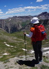
After about 1.8 miles, you reach the Hot Loop junction, marked nicely by a sign post. The ascent pitches up to a moderate incline, bringing you after about .8 miles to another nicely marked “T” junction of Hot Loop, with one leg of the “T” ascending to Horse Mesa. Go right and follow that up (about 1.3 miles) until you judge yourself close enough to the northern rim of the mesa to go north off trail (a short bit) to overlook Jack’s Canyon and the formations beyond. Rest a bit, you will have climbed 1200 feet, but mainly to take in the view and work a few pictures.

Your view across Jacks Canyon provides an expansive panorama of Lee Mountain, Courthouse Butte, and Bell Rock. Beneath you, in Jacks Canyon itself, lies the eastern edges of Oak Creek Village, including estates on roads sufficiently private that no Google street view exists. Far in the background rise Doe, Bear and Black mountains.

Travel back down, to the “T” junction, and now proceed north. This portion of the hike weaves through the wooded slopes of Horse Mesa and the smaller mesa that stood to your left on the beginning of the hike. Of interest, red rock occasionally breaks through the vegetation, hinting that the slopes consist of rock eroded down from strata once above the tops of the mesas.

About 2.8 miles after leaving the viewpoint on Horse Mesa, the hike reaches the horse trailer area at the Jacks Canyon trailhead. With good fortune, you might observe a couple horses being groomed and readied for riding. The estates of eastern Oak Creek village will also appear to the north.

Now pick up the interconnector. This will not be reached by taking the Jack Canyon trail. Rather, look for an unmarked single red trail a couple dozen feet more north than the trailhead for Jacks Canyon. Proceed a short distance on the interconnector, cross the road, pick up the connector again, and proceed up a short hill to a gate. Here, you stand up-close to a large estate, of intriguing architecture. The gate marks the start of Pine Valley Ridge trail and a continued gentle incline.

Proceed about .9 miles, and at the bend of the trail, take a short trek off-trail to the rim for wide view of the escarpment on a southern exposure of Lee Mountain, as well as an angle view on the infamous Rabbit Ears formation. Most of us lack a deep knowledge of geology, but even the casual observer can see the bands, layers and striations in the escarpment, formed as Sedona alternated between sea, beach, river and inland environments circa 275 million years ago.

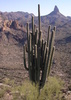
At this point, one can drop down on a relatively uncataloged “Rabbit Ear” trail, or continue on Pine Valley Ridge, to arrive at the eastern side of Courthouse Butte. Again, geology will be evident, as will a bit denser crowds. You can peruse Courthourse Butte and Bell Rock on the typical trails, as you like, but when done take Big Park Loop south to an unmarked junction with Pine Valley Trail (GPS 34.794682, -111.747949). You will travel back about 1.5 miles on Pine Valley, until you “T” into Pine Valley Ridge. Go right, and shortly you will be at the gate to the interconnector. Proceed back to the Visitor Center, but eliminating the spur up to the top of Horse Mesa. Even though you traversed these trail sections earlier, the sun will now be at a different angle, and you view will be from a different viewpoint, and the time will be later in the day. So don’t be in so much of a hurry to not practice a bit more photography, or nature viewing, or geology study, or whatever your fancy.
_____________________
 
Nov 05 2016
avatar

 Guides 3
 Routes 202
 Photos 3,513
 Triplogs 530

male
 Joined Jan 24 2016
 Arizona
Munds Mountain Trail #77Flagstaff, AZ
Flagstaff, AZ
Hiking avatar Nov 05 2016
MountainMattTriplogs 530
Hiking12.81 Miles 1,794 AEG
Hiking12.81 Miles   9 Hrs   47 Mns   2.14 mph
1,794 ft AEG   3 Hrs   47 Mns Break25 LBS Pack
 no routes
1st trip
Linked   linked  
Partners partners
JoelHazelton
It was such an epic day trip with Joel and my dog Payton up to Munds Mountain!

Since Joel and I do not drive monster trucks we both parked right off of Schnebly Hill rd just past FR 801. I believe the jeep road we took may be FR 949, not sure because it's not labeled on the topo but It did help out by cutting out a bit of mileage to the Commitee Tank.
That is where we encountered two hunters which would be the only people we saw all day, it was nice to have a place of solitude within such close proximity to Sedona.
The climb up Munds is steep but very short and over within moments, once atop you're greeted with relatively flat grasslands with some of the healthiest and largest junipers I've ever seen!
We made our way to the edge of the mountain for a beer break and some views and that's when I was astonished on what I was seeing!
My eyes were mesmerized by the dramatic unique scenery from nearly every angle, I certainly underestimated or perhaps was just unaware of what Munds Mountain had to offer.
After that we continued up Munds to a spot that Joel scoped out that I truly now believe provides the greatest views of Sedona I've ever seen.
We set up our camera gear and soon witnessed one seriously astounding sunset shows that was far greater that I had imagined!
The remainder of our hike was of course in the dark and just before our departure off the summit my dog almost darted off in chase to a nearby javelina but luckily I put her on the leash before she took off!
Other than that it was just a nice cool relaxing walk back with a feeling of satisfaction and a memory card full of photos!

Great time in the Munds Mountain Wilderness! : rambo :
foliage observationfoliage observationfoliage observationfoliage observationfoliage observation
Autumn Foliage Observation Moderate

water 1 out of 5water 2 out of 5water 3 out of 5water 4 out of 5 Committee Tank 76-100% full 76-100% full
_____________________
 
Apr 23 2016
avatar

 Photos 418
 Triplogs 169

female
 Joined Jul 22 2016
 Sedona, AZ
Hot Loop Trail #94Sedona, AZ
Sedona, AZ
Hiking avatar Apr 23 2016
xthineTriplogs 169
Hiking6.28 Miles 1,106 AEG
Hiking6.28 Miles   2 Hrs   58 Mns   2.12 mph
1,106 ft AEG
 no routesno photosets
1st trip
Linked   none no linked trail guides
Partners none no partners
This was a hot trail indeed. I recall underestimating the difficulty of this trail.
We did not plan on completing the hike, I think we reached the half way mark. Very rocky trail, great scenery once we reached the mesa. We were not sure where the trail ends so we decided to turn back. We did not encounter anyone else on the trail and the trail head was empty when we started, one other car by the time we finished the hike.
Recommend to complete this hike when the weather is cooler.
_____________________
  2 archives
Sep 21 2014
avatar

 Guides 13
 Routes 38
 Photos 1,651
 Triplogs 577

60 male
 Joined Nov 15 2005
 Jackson, CA
Hot / Jacks LoopSedona, AZ
Sedona, AZ
Hiking avatar Sep 21 2014
toddakTriplogs 577
Hiking24.00 Miles 3,500 AEG
Hiking24.00 Miles   11 Hrs      2.18 mph
3,500 ft AEG
 no routesno photosets
1st trip
Partners none no partners
Started from the Woods Canyon trailhead at the ranger station for a nice lasso route, counterclockwise. Hot Loop is a beautifully routed trail, good views and sandstone scenery. The upper part of Jacks is in pretty poor condition.
_____________________
 
Jul 24 2014
avatar

 Guides 264
 Routes 2,798
 Photos 14,514
 Triplogs 5,895

55 male
 Joined Nov 20 1996
 
Hot / Jacks LoopSedona, AZ
Sedona, AZ
Hiking avatar Jul 24 2014
joebartelsTriplogs 5,895
Hiking18.92 Miles 2,800 AEG
Hiking18.92 Miles   6 Hrs   12 Mns   3.14 mph
2,800 ft AEG      10 Mns Break14 LBS Pack
 
Partners partners
JuanJaimeiii
The Hot Loop trail is not a loop, rather named for branding cattle. Yet you can make a nice loop with Jacks Canyon Trail #55. We hit this clockwise heading up Jack's Canyon. It doesn't irk me as it did in the past. The trail is brush free save maybe a twig or two. It sports a few minor route finding moments crossing the creek. What I enjoy most is how the trees come into play after gaining only 500 feet of gain. By 850 feet up you are in a nice forest with a few of my favorites, the wicked cool Arizona Cypress. The views behind you get pretty red rock sweet as you approach the saddle.

Connecting over to the Hot Loop is a dream these days. Bomber sized caged cairns direct you over. A decade or so ago it was a live oak nightmare wade.

Believe this was my first time doing the Hot Loop Trail #94 as a through hike. It was nicer than memory served. The distant views heading down are outstanding. Last year about this time ( rainier cherry season ) we did a Jacks-Munds-Lee loop. It was cool to see the route we took down off Lee Mountain.

Started w/4 frozen quarts, using 3.75. It was overcast for the entire ascent. Clear yet breezy heading down with puffy clouds accumulating. Only got hot at the end. The humidity on the other hand would make posting this as a swim within reason.

Synopsis A most enjoyable loop. Slightly brushy for a quarter mile tops heading down #94. If Sedona didn't have such a smorgasbord of other awesome hikes I'd rate this much higher. No water anywhere as expected. jj did spot and cool off from a rancher faucet near the corral at the trailhead. Heading in I thought I was going on a fourteen mile stroll, as typical I don't research much. When I saw a sign near the trailhead stating 22 I looked over at jj and said seriously. He said about 19 which was spot on.

posted on an old school desktop
_____________________
- joe
 
Jul 24 2014
avatar

 Routes 596
 Photos 9,610
 Triplogs 2,402

58 male
 Joined Jan 30 2011
 Chandler, AZ
Hot / Jacks LoopSedona, AZ
Sedona, AZ
Hiking avatar Jul 24 2014
JuanJaimeiiiTriplogs 2,402
Hiking18.92 Miles 2,800 AEG
Hiking18.92 Miles   6 Hrs   12 Mns   3.14 mph
2,800 ft AEG      10 Mns Break
 no routesno photosets
1st trip
Partners partners
joebartels
I have been wanting to do this one for a couple years now. I hit Joe up to see if he would be interested and he was down. When we pulled into Oak Creek near Sedona we were pleased to see it was overcast. The hike was a bit humid and by the time we got to the top of Jacks Canyon we were pretty soaked. I suppose that is to be expected this time of year.

I had thought the way down off the plateau would have been much more brushy but not bad at all. This turned out to be a great hike with killer views down into Woods Canyon. I will likely do it again sometime when it is a little cooler.
_____________________
 
Apr 13 2013
avatar

 Guides 4
 Photos 2,275
 Triplogs 128

male
 Joined Jan 16 2004
 Chandler, AZ
Hot / Jacks LoopSedona, AZ
Sedona, AZ
Hiking avatar Apr 13 2013
AZOutdoorsmanTriplogs 128
Hiking21.00 Miles 3,600 AEG
Hiking21.00 Miles   9 Hrs      2.33 mph
3,600 ft AEG
 no routes
1st trip
Partners none no partners
Triplog/ photoset from original hike discription, with optional side trip to Munds Mountain scenic overlook.
_____________________
 
Oct 22 2011
avatar

 Routes 596
 Photos 9,610
 Triplogs 2,402

58 male
 Joined Jan 30 2011
 Chandler, AZ
Jack's Canyon Trail #55Sedona, AZ
Sedona, AZ
Hiking avatar Oct 22 2011
JuanJaimeiiiTriplogs 2,402
Hiking17.00 Miles 2,500 AEG
Hiking17.00 Miles   6 Hrs   50 Mns   2.49 mph
2,500 ft AEG
 no routes
1st trip
Partners none no partners
Well my weekend plans fell through so I switched gears, and after just being in Sedona decided to go back to hit a couple more trails. I mean how can you go wrong in Red Rock Country? Anyway, I did Jacks Canyon and at the Trail Head saw the big sign that showed a map. On the map was Jacks Canyon and what looked like a nice Loop back via the "Hot Loop" Trail. A little ways into the hike I see a sign stating that it is not a Loop Hike but rather a strenuous 22 mile hike of ups and downs that is over grown, etc. This intrigues me but this is not the day for such an adventure. For one I got a late start and two I am wearing shorts.

Jacks Canyon takes off from a nice spot with good parking and works its way back up into the drainage. After a ways I passed a muddy tank and then the trail got much more interesting. It followed the dry creek and crossed it many times. The trees were changing colors which was nice. The trail doesn't get very steep until the last little push up to the saddle. Even then it is very manageable. So back to this "Hot Loop" thing. At the saddle there are three trails that meet the Jacks Canyon Trail. One is the Schnebly Trail which I took out to Committee Tank and back. One is Munds Mountain Trail and the other is the Hot Loop Trail. I wanted to go up to the top of Munds but first let's see where the Hot Loop Trail goes. I followed it across the top to the rim for roughly 40 minutes. It passes a tank that was full of water and then heads for the rims edge. I took it to the edge and even went down the heavily overgrown trail for a short distance. I could quickly see that this was one for another day and for pants and a little extra water. I turned back and meandered accross the plateau which is well cairned. Once back at the saddle I went up the short but steep trail to the top of Munds Mountain. The day was starting to get away from me so time to head back. Ooops, my headlamp is in my new Camelbak and not with me. The last hour of the way out was a slow go as I was in the dark. Luckily my camera helped lead the way when I was in question. Just snap a shot with the flash and back on track.

Side note: Once back at the motel I looked up this Hot Loop/Jacks Canyon Hike and it looks like it is around 18 miles not 22. It goes up and across Horse Mesa and then up the side of the Rim to where I left it. The part going up the side of the rim is very steep and extremely overgrown according to one write up. I am not sure how but they use to take the cattle up this trail to graze. Hmmm, I think this sounds like a great day hike! Anyone interested?
_____________________
 
Sep 15 2010
avatar

 Guides 1
 Photos 151
 Triplogs 181

46 male
 Joined Feb 04 2004
 Patagonia, AZ
Hot Loop Trail #94Sedona, AZ
Sedona, AZ
Hiking avatar Sep 15 2010
airicTriplogs 181
Hiking10.20 Miles 1,000 AEG
Hiking10.20 Miles
1,000 ft AEG
 no routesno photosets
1st trip
Linked   none no linked trail guides
Partners none no partners
Transferring missing hikes to HAZ. Tedious.
_____________________
 
Feb 09 2008
avatar

 Photos 238
 Triplogs 39

male
 Joined Mar 25 2002
 Dewey, AZ
Woods Canyon Trail #93 - SedonaSedona, AZ
Sedona, AZ
Hiking avatar Feb 09 2008
kevin1959Triplogs 39
Hiking10.20 Miles 1,000 AEG
Hiking10.20 Miles
1,000 ft AEG
 no routes
Linked   linked  
Partners none no partners
Hot Loop to Woods Canyon trail. Lots of fresh, cold water following in Woods Canyon. I haven't hiked WC trail in many years and noticed many small rock slides on the trail. Hot Loop trail a bit muddy and therefore slippery.
_____________________
 
Jan 21 2008
avatar

 Photos 7
 Triplogs 177

45 male
 Joined Nov 14 2007
 Phoenix
Hot Loop Trail #94Sedona, AZ
Sedona, AZ
Hiking avatar Jan 21 2008
kgmolsonTriplogs 177
Hiking10.20 Miles 1,000 AEG
Hiking10.20 Miles   3 Hrs   15 Mns   3.14 mph
1,000 ft AEG
 no routes
1st trip
Linked   none no linked trail guides
Partners none no partners
_____________________
 
Jan 08 2006
avatar

 Photos 30
 Triplogs 20

61 male
 Joined Sep 25 2005
 Sedona, AZ
Hot Loop Trail #94Sedona, AZ
Sedona, AZ
Hiking avatar Jan 08 2006
sedonaazTriplogs 20
Hiking10.20 Miles 1,000 AEG
Hiking10.20 Miles
1,000 ft AEG
 no routesno photosets
1st trip
Linked   none no linked trail guides
Partners none no partners
_____________________
 
Jan 21 2002
avatar

 Guides 6
 Photos 1
 Triplogs 36

78 male
 Joined Feb 03 2002
 Montezumawell, A
Hot Loop Trail #94Sedona, AZ
Sedona, AZ
Hiking avatar Jan 21 2002
montezumawellTriplogs 36
Hiking 1,120 AEG
Hiking
1,120 ft AEG
 no routesno photosets
1st trip
Linked   none no linked trail guides
Partners none no partners
This one really ought to be called either 'Horse Mesa' or its geographically correct cousin 'Wild Horse Mesa.' First, there ain't no wild horses up there. Joe's description of this trail is perfectly apt. He is such a good writer. You can't get much better than what he said about it. We followed his directions all the way up to that left turn he missed going out to the middle of nowhere. We went out there and cooked some ramen and had a nice old time. The views are OK if you don't mind looking at a bunch of weird houses. Whoever designed most of these houses would make Frank Lloyd Wright turn over in his whatever. Luckily, it didn't make us toss up our ramen. The trail isn't much to write home about. Just another typical weirdo FS trail. Poorly maintained tread. Poor signage. Poor carins. What can you say? Apparently the Red Rock Pass gets spent paying people to hang out in so-called Visitor Centers giving out Miss Information. But we promised we wouldn't gripe too much. Anyway, we suggest you don't think of this walk if it is wet. Don't even think about it. It was OK on MLK 2002. All we saw was some weird guy with a white horse and a white hat. He was walking his white horse with no water, no food and no apparent reason for being there. The horse was obviously high dollar and had an English dressage saddle. Go figure. These are the kinds of things you see on Sedona-area trails.
_____________________
 
average hiking speed 2.39 mph

WARNING! Hiking and outdoor related sports can be dangerous. Be responsible and prepare for the trip. Study the area you are entering and plan accordingly. Dress for the current and unexpected weather changes. Take plenty of water. Never go alone. Make an itinerary with your plan(s), route(s), destination(s) and expected return time. Give your itinerary to trusted family and/or friends.

helpcommentissue

end of page marker