|
| | | |
| |
|
| Hiking | 15.82 Miles |
2,995 AEG |
| | Hiking | 15.82 Miles | 8 Hrs 55 Mns | | 1.81 mph |
| 2,995 ft AEG | 10 Mns Break | | | |
|
|
| |
| Partners |
|
none
[ show ]
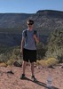
| no partners | | Autumn is my favorite season, and I sorely miss the fruit-loop-esque colored hillsides found in the northeast. With reports of colors past prime in the Flagstaff area (combined with the fact that it seems to be predominantly aspens up that way), I opted to head up to the rim like many others last weekend to see what I could see.
Initially I had planned on hitting up the popular Derrick-Horton loop, but then I figured I may as well get some additional mileage in (and also give myself a chance at more solitude). I arrived at the Horton TH to temps in the 40s and 14 other vehicles parked (there were 3 at the Derrick TH). Guessing that most of those people, if not all of them, were up Horton Creek, I decided to do the loop counter-clockwise, with hopes that by the time I was coming down Horton, the bulk majority would have cleared out.
After gathering my things, I headed up towards the campground to find the Derrick trail. Since there were still folks camped out at several of the camp sites, I headed in the general direction that I expected to find the trail while not entering any of the campsites-proper. I eventually managed to join up with the well trodden trail and was able to get my hike properly underway.
I made excellent time (for me) along the Derrick and Highline portions of the trail...the grade was gradual, there were minimal flora for distraction, and much of the foliage hadn't turned - so I wasn't really stopping for photos. I zipped right on past the junction with the Promontory Trail, but caught my mistake as I found myself questioning the trail as it started descending and getting further away from Promontory Butte. I back tracked and found the the flagged signpost (no sign), heaved a great sigh, and questioned my life choices before continuing on up the much less travelled path.
The Promontory Trail doesn't seem to see much human traffic - all recent evidence of passage was made by wildlife. The path was mostly easy to follow, though I lost track of it at least once after climbing over some deadfall. The grade is no joke, and there were large sections where it would be highly trecherous when wet if the smeared elk prints were any indication. As expected, my split times went by the wayside as I made my climb...I was glad to attain the rim when I finally got there.
Once on the rim, I tried making up what I could of my overall pace - first picking up FR76B, then FR76 before taking a cross country shortcut to find the Rim Road (FR300) and the General Crook Trail. I opted to attempt to stay on the General Crook trail as it ran parallel to the Rim Road in an attempt to escape the dust and traffic. The trail seems to have been rerouted to run mostly on the north side of the road, though I lost it in some places (usually when it entered an area used as a camp site). The tread was fairly distinct in some places, and significantly less so (and completely nonexistant in others) - at first, I was following chevron markers (most often white, sometimes orange), but then hit a stretch where the trail became marked with flagging tape / survey flags before returning back to being marked with chevrons. If you attempt it, but can't find the trail and don't feel like wandering the woods, the option is always there to walk along side 300, but that may be unplesant if there is a steady stream of traffic.
Just as I lost the trail again (another campsite), I popped out to 300 to check the roadsigns, and found myself near my next trail: the Horton Springs trail. As a side note, there isn't really much space to park at the upper trailhead. This trail definitely sees a lot more human traffic than the Promontory trail does - plenty of boot tracks were present. The descent is steep - and I managed to get onto a parallel "trail" in one section that eventually disappeared - I spotted the actual trail further down the hillside, and was able to get back on track relatively easily.
As I approached Horton Spring (as noted by the trail coming adjacent to a barbed wire fence), I heard someone's bluetooth speaker and caught sight of someone dropping trou  - this being something I did not need to witness, I quickly stopped and blocked my view by placing trees in my line of sight. I have nothing nice to say about someone leaving a deposit trailside (literally on the other side of the barbed wire, uphill from the spring area)...and I was especially disgusted to discover it was a deuce and a pile of TP once I proceeded after I caught sight of the culprit heading back downhill properly attired. - this being something I did not need to witness, I quickly stopped and blocked my view by placing trees in my line of sight. I have nothing nice to say about someone leaving a deposit trailside (literally on the other side of the barbed wire, uphill from the spring area)...and I was especially disgusted to discover it was a deuce and a pile of TP once I proceeded after I caught sight of the culprit heading back downhill properly attired.
Since I could not trust myself to behave civilly at the spring (where the trailside pooper continued to hang out), I cut down to some campsites and visited the lower area below the spring before continuing on my way. My pace was reduced a bit on the hike back down the Horton Creek Trail since I took several detours for photo ops. The trail obviously sees a lot of traffic - including that of some cows down below. I was dismayed to catch sight of TP at several campsite areas, some very close to the creek itself suffice it to say, if you decide you need to get water to drink, make sure you're using appropriate purification!
When I made it back to the trailhead, there were 8 cars there...probably all belonging to folk I saw headed up the trail as I was hiking out. Overall, a nice day out. While the loop was great for getting in mileage, there was a lot of road walking (or walking within sight of the road in the case of the General Crook trail) - if I feel the urge to head back up to check See Canyon for colors, I'll have to make sure I go during the week.
Other people: None on Derrick, none on Promontory, 1 SxS and 1 Truck on FR76, none on General Crook (though a fairly steady stream of traffic on the rim road), 2 ascending on Horton Springs Trail as I made my way down, 7-8 groups on Horton Creek Trail heading in as I was on my way out. |
|
Autumn Foliage Observation Moderate
Some colors on the maples in Horton Creek from the spring down to the TH. Oaks are still predominantly green. Other foliage is highly variable, with plenty of green still around. |
|
|
Wildflowers Observation Light
|
|
| _____________________
Happier when hiking....I may not move fast (and I'm often distracted by wildflowers), but I'll get there eventually  |
| | |
|
|
|
 Route Editor


 - this being something I did not need to witness, I quickly stopped and blocked my view by placing trees in my line of sight. I have nothing nice to say about someone leaving a deposit trailside (literally on the other side of the barbed wire, uphill from the spring area)...and I was especially disgusted to discover it was a deuce and a pile of TP once I proceeded after I caught sight of the culprit heading back downhill properly attired.


 . The Derrick Trail was muddy in spots. The steep Promontory and Horton Springs trails were in reasonable shape considering all of the rain up here. The Horton Creek trail was perfect as always. While I saw quite a few campers on Promontory Butte, I didn't see another hiker until I reached Horton Springs.


