username
X
password
register
for free!
help
ArticlesGuidesRoutes
 
Photosets
 
 Comments
triplogs   photosets   labels comments more
LOST - Arnett Canyon Segment - 16 members in 43 triplogs have rated this an average 3.7 ( 1 to 5 best )
1, 2, 3  Next
43 triplogs
login for filter options
Dec 14 2025
avatar

 Routes 74
 Photos 4,441
 Triplogs 123

female
 Joined Dec 09 2024
 
Picketpost CircumferenceGlobe, AZ
Globe, AZ
Hiking avatar Dec 14 2025
DesertNymphTriplogs 123
Hiking13.23 Miles 1,357 AEG
Hiking13.23 Miles   6 Hrs   29 Mns   2.09 mph
1,357 ft AEG      10 Mns Break
 
1st trip
Partners partners
00blackout
One of the early hikes I did when returning back to regular hiking was the Picketpost circumnavigation. The previous time, I hiked it counter clockwise and after a period of substantial drought. This time, we hiked it clockwise, and after a period with substantial rains.

We arrived close to sunrise to find 5 other vehicles in the lot and more arriving as we set off. Temps were cool with a chilly breeze...which sometimes switched to an oddly warm breeze. The day eventually warmed sufficiently so we could shed our long-sleeved shirts.

The biggest observations I have from last time are 1) things were much more lush and green this time around, 2) while there was some sandy walking, there was enough moisture in the ground that it wasn't a dusty mess, and 3) Arnett and Telegraph both saw substantial flow with the big rains that came through this fall. There was obvious evidence of the canyons flashing.

It looks like crews are working to reroute sections of trail in the area, especially sections located close to the drainages - there was flagging tape placed, and in some areas some brushing ahead of the trailcutting had been done...but in others, the brushing was yet to be completed.

It was nice to see the trees in Arnett and Telegraph were decked out in fall colors. Like other places I've been for fall colors this year, there were also still some trees that weren't yet decided on what they wanted to do color-wise. The section with the autumnal foliage isn't particularly long, but it is beautiful. As we made our way around Picketpost, I recalled some features from my previous hike, but completely missed others (I didn't think to look for the palm trees to see how they fared). There was a section of trail I wasn't looking forward to, but I don't think we wound up on it this time around. I took (and submitted) photos to include in the chronograph.io timelapses for the two stations that are positioned on the route.

When we hit the intersection with the AZT, I managed to cajole J into joining me for a bit. Eventually, he opted to take a break while I continued up to a saddle to see what I could see before returning back down to close out the loop.

Other people: unsurprisingly, a decent number of folk were out on the trail - both hikers and equestrians. I lost count of how many - most were in Arnett.
foliage observationfoliage observationfoliage observationfoliage observationfoliage observation
Autumn Foliage Observation Substantial
wildflower observationwildflower observationwildflower observationwildflower observationwildflower observation
Wildflowers Observation Moderate

water 1 out of 5water 2 out of 5water 3 out of 5water less than max Telegraph Canyon Medium flow Medium flow
_____________________
Happier when hiking....I may not move fast (and I'm often distracted by wildflowers), but I'll get there eventually 😆
 
Nov 01 2025
avatar

 Guides 3
 Routes 656
 Photos 8,821
 Triplogs 630

55 male
 Joined Apr 13 2011
 Gilbert, AZ
Arnett-Telegraph-Perlite Explore, AZ 
Arnett-Telegraph-Perlite Explore, AZ
 
Hiking avatar Nov 01 2025
ddgrunningTriplogs 630
Hiking11.15 Miles 1,535 AEG
Hiking11.15 Miles   4 Hrs   51 Mns   2.40 mph
1,535 ft AEG      12 Mns Break
 
1st trip
Route Scout Route Recorded  on Route Scout | Pop | Map | Popup | MapDEX
I've done the Picketpost Circumference through Arnett and Telegraph Canyons previously, but wanted to come in from the Perlite road side and cut right to the most interesting/scenic parts of the canyons. This worked out well.

The drive in to the Perlite was fine for a sedan up to about 0.5 from the TH. Depending on how much you care about your car, you could probably drive all the way, but I opted to park where the road goes downhill and was rutted deeply from the recent rains.

From the actual parking area, I followed the official trail, which performed an elaborate u-turn, but on the way back, I just took the more direct route to the parking area, and I would skip the u-turn if out this way again.

From there, it's an initial walk down Perlite Road, which is more of a SxS track at that point. It ends ina 4x4 parking area.

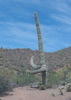
Beyond that, I wandered over to the mine, which has some cool carve outs. It was fun to see lots of "Apache Tears" all around.

From there, I backtracked to the 4x4 parking area and descended to the connection with Arnett Canyon. This is a scenic approach, and Arnett continued the scenery. Still lots of water but it was clear there was a literal deluge running through here a couple of weeks ago.

After reaching the end of the scenic section of Arnett heading west, I bactracked and then headed west. At the Telegraph Canyon junction, I headed left--new territory for me, continuing up Arnett Creek.

There are several horse gates in the area. One on Arnett had been undercut by the flooding, totally exposing the concrete footings and toppling the solid gate.

Where Arnett Canyon crosses the SxS road, I walked the road before dropping back into Telegraph Canyon from the upper end. Lots of good sized pools and evidence of 6+ feet of water flowing through the area after the recent rains. Saw a garter snake and several frogs.

Reconnecting with Arnett, I climbed back up to Perlite road and then did some off trail exploring of the cliff area to the east of the road. At the base of the cliffs are a couple of potential ruins--one looked legit, with typical mud mortar; the other was just stacked stones partially enclosing a rock cavity. Both looked like they had had some homeless occupants.

Down from the ruins is the foundation of a more recent ruin--an old homestead, I presume.

From there, I bypassed the "u-turn" and headed back to my car.

Post-hike, I drove up the canyon beyond Superior to check out the "Atlantis" climbing area beyond the tunnel. Lots of folks out enjoying the crags, and it's a lovely spot. May be back here with family visiting over Thanksgiving.

dry Arnett Canyon Dry Dry
Lots of pools

dry Telegraph Canyon Dry Dry
Lots of pools
_____________________
 
Feb 13 2025
avatar

 Guides 100
 Routes 1,573
 Photos 16,476
 Triplogs 1,462

male
 Joined Jan 07 2017
 Fountain Hills,
Picketpost Mountain SummitGlobe, AZ
Globe, AZ
Hiking avatar Feb 13 2025
DixieFlyerTriplogs 1,462
Hiking4.81 Miles 2,027 AEG
Hiking4.81 Miles   4 Hrs   7 Mns   1.42 mph
2,027 ft AEG      44 Mns Break
 
Partners partners
SecretMtnLover
Route Scout Route Recorded  on Route Scout | Pop | Map | Popup | MapDEX
It had been 2.5 years since I had hiked to Picketpost, so I was a bit overdue.

We got to the TH about 7:15 and the parking lot was empty when we arrived. It was 38 degrees when we started the hike, but we warmed up quickly.

The ascent and descent went well, probably better than the previous 5 times that I have done this hike.

We had the summit to ourselves so we hung out there for a bit. The mailbox is still there.

It was a nice day to do this hike. On the way back down we met a few coming up. There were a few obvious snowbirds -- it's a giveaway when someone asks if you have seen any snakes on a winter morning in the 40's.
_____________________
Civilization is a nice place to visit but I wouldn't want to live there
 
Jan 13 2025
avatar

 Routes 74
 Photos 4,441
 Triplogs 123

female
 Joined Dec 09 2024
 
Picketpost Circumnavigation, AZ 
Picketpost Circumnavigation, AZ
 
Hiking avatar Jan 13 2025
DesertNymphTriplogs 123
Hiking9.14 Miles 815 AEG
Hiking9.14 Miles   4 Hrs   53 Mns   1.94 mph
815 ft AEG      11 Mns Break
 
1st trip
I've summited Picketpost many years past, but never thought to take a wander around the mountain's base. I had anticipated having interesting views of the many faces of Picketpost, but was pleasantly surprised by how scenic the surroundings are. The hike started at Picketpost trailhead, heading south along the Arizona Trail, climbing moderately while affording lovely views of Picketpost rising above a sea of golden grass. Looking north, there are fantastic views of the Superstitions with the unmistakable silhouette of Weaver's Needle rising in the distance.

The trail curves eastward as it rounds the southern portion of Picketpost, and when the Arizona trail veers sharply to the south, this adventure continues onward, roughly following a drainage to connect with FR4. When FR4 hops out of the watercourse, the path continues onward along the Telegraph Canyon Trail, staying alongside the drainage. I was surprised to discover pools of water and even areas where it was flowing well enough to make a bit of noise. Because the area is well shaded and temps have been down to freezing, we even stumbled across a bit of ice! While there were some muddy areas, there wasn't sufficient water to cause any difficulties with keeping feet dry when we had to cross...though if we get some rain, that may well change.

The hike continued down Telegraph Canyon, eventually meeting up with Arnett Creek and the Arnett Canyon Trail which subsequently joins the L.O.S.T Trail, which closes the loop back to the parking area.

While the Arizona Trail was solid and pleasant to walk upon, the areas in Arnett and Telegraph can be loose and dusty. The area is popular for horseback riding, and there is also evidence of cattle grazing so watch your step if you don't care to step in 💩

Saw plenty of saguaro and was surprised by several extremely healthy palm trees. Not much in the way of flowers yet, though I did capture a photo of a happy fleabane. It was interesting to discover a couple chronolog stations placed to monitor the recovery after the Telegraph fire of 2021 (you can go to chronolog.io to view time lapse of submitted photos from the monitor points).

Saw a large group headed out as I was hiking in, got lapped by a group of horses (with riders and a dog) and one other hiker....then encountered a few hikers possibly doing the loop in the opposite direction. Overhead, there was some military jet traffic along with someone enjoying the day in a fixed wing glider.
 Flora
 Flora [ checklist ]
[ checklist ]  Fleabane
 Named place
 Named place [ checklist ]
[ checklist ]  Finger Rock - Arnett Canyon
wildflower observationwildflower observationwildflower observationwildflower observationwildflower observation
Wildflowers Observation Isolated

water 1 out of 5water less than maxwater less than maxwater less than max Telegraph Canyon Pools to trickle Pools to trickle
_____________________
Happier when hiking....I may not move fast (and I'm often distracted by wildflowers), but I'll get there eventually 😆
  3 archives
Dec 29 2024
avatar

 Guides 19
 Routes 312
 Photos 1,968
 Triplogs 291

female
 Joined Mar 11 2002
 Gilbert, AZ
LOST - Arnett Canyon SegmentGlobe, AZ
Globe, AZ
Hiking avatar Dec 29 2024
VashtiTriplogs 291
Hiking6.61 Miles 459 AEG
Hiking6.61 Miles   3 Hrs   3 Mns   2.40 mph
459 ft AEG      18 Mns Break
 
1st trip
Linked   linked  
Partners none no partners
Route Scout Route Recorded  on Route Scout | Pop | Map | Popup | MapDEX
Uneventful hike to finger rock. I tried to convince my kids to do an extra 2 miles so we could do the full loop, but they were absolutely not having it!! 😔😔🤣🤣😥😥

Despite the hike being shorter than desired, it was a beautiful day. Lots of people and horses on the trail. The parking lot was nearing capacity when we arrived at 10a (kids also will not get up early!! 😮😵‍💫😥).

Plenty of big pools of water.
 Named place
 Named place [ checklist ]
[ checklist ]  Finger Rock - Arnett Canyon
foliage observationfoliage observationfoliage observationfoliage observationfoliage observation
Autumn Foliage Observation Light

water 1 out of 5water less than maxwater less than maxwater less than max Arnett Canyon Pools to trickle Pools to trickle
Many big pools of water in Arnett Canyon.
_____________________
:D
 
Nov 29 2024
avatar

 Routes 416
 Photos 49
 Triplogs 824

43 female
 Joined Jun 23 2015
 Phoenix, AZ
LOST - Arnett Canyon SegmentGlobe, AZ
Globe, AZ
Hiking avatar Nov 29 2024
emilystardustTriplogs 824
Hiking9.36 Miles 811 AEG
Hiking9.36 Miles   4 Hrs   11 Mns   2.70 mph
811 ft AEG      43 Mns Break
 
no photosets
1st trip
Partners none no partners
Route Scout Route Recorded  on Route Scout | Pop | Map | Popup | MapDEX
Still a few green trees but fall is out there!
_____________________
 
Nov 29 2024
avatar

 Guides 4
 Routes 230
 Photos 109
 Triplogs 227

male
 Joined Aug 08 2020
 Phx az
Arnett Creek - CanyonGlobe, AZ
Globe, AZ
Hiking avatar Nov 29 2024
ScaredyCatTriplogs 227
Hiking9.80 Miles 969 AEG
Hiking9.80 Miles   5 Hrs   30 Mns   2.04 mph
969 ft AEG      42 Mns Break
 
no photosets
1st trip
Linked   linked  
Partners none no partners
Route Scout Route Recorded  on Route Scout | Pop | Map | Popup | MapDEX
Joined a Meetup 2 days in a row. 10:30 am for 6 miles out n back. Ok, I'm not driving over an hour for that. Planned to continue along multiple Lost trails to double the mileage. No takers out of 25 that came out.

A couple others suggested forming a loop. A few others agreed. Compromise achieved. Didn't have the route ready so had to figure it out on the fly. Not too difficult. Got separated through one section where we took different paths but eventually linked up again.

Fairly chill route. Found an unnamed trail that seemed interesting and allows for some EG. May have to check it out further another time. Waypoint marked. Still several other possible routes out here. Drive fairly straightforward.
 
Nov 09 2024
avatar

 Routes 40
 Photos 64
 Triplogs 43

58 male
 Joined Mar 29 2015
 Chandler, AZ
Picketpost Mnt Circumnavigate, AZ 
Picketpost Mnt Circumnavigate, AZ
 
Hiking avatar Nov 09 2024
AndrewrdcTriplogs 43
Hiking9.04 Miles 872 AEG
Hiking9.04 Miles   3 Hrs   58 Mns   2.49 mph
872 ft AEG      20 Mns Break15 LBS Pack
 
no photosets
1st trip
Linked   linked  
Partners none no partners
Route Scout Route Recorded  on Route Scout | Pop | Map | Popup | MapDEX
Clockwise hike around picketpost mountain. Arnett Canyon was beautiful though no water running. Did see a couple other pools and what was slightly running creek near Telegraph canyon. We really need some rain! Telegraph canyon was easy to follow but the last mile before reconnecting with AZT is a bit tricky. Just make sure you have a map to guide you!
_____________________
 
Feb 03 2024
avatar

 Routes 40
 Photos 64
 Triplogs 43

58 male
 Joined Mar 29 2015
 Chandler, AZ
Arnett Canyon hike, AZ 
Arnett Canyon hike, AZ
 
Backpack avatar Feb 03 2024
AndrewrdcTriplogs 43
Backpack7.37 Miles 649 AEG
Backpack7.37 Miles   6 Hrs   14 Mns   1.73 mph
649 ft AEG35 LBS Pack
 
no photosets
1st trip
Linked   linked  
Partners none no partners
Route Scout Route Recorded  on Route Scout | Pop | Map | Popup | MapDEX
Great weekend exploring Arnett Canyon area to the east of picket post mountain with my buddy Eric. We hiked in after two days of rain so the creeks were running strong which was awesome to see! I’ve hiked the AZT section on the other side of picketpost and this area is so different… canyons, creeks and lots of trees, plus all the water. Unfortunately, by Sunday morning, many of the creeks were no longer running 🙁. Amazing while it lasted. I look forward to exploring this area more often to see what and which water is reliable for backpacking trips.
_____________________
 
Dec 02 2023
avatar

 Guides 3
 Routes 656
 Photos 8,821
 Triplogs 630

55 male
 Joined Apr 13 2011
 Gilbert, AZ
Picketpost CircumferenceGlobe, AZ
Globe, AZ
Hiking avatar Dec 02 2023
ddgrunningTriplogs 630
Hiking14.80 Miles 2,896 AEG
Hiking14.80 Miles   6 Hrs   20 Mns   2.57 mph
2,896 ft AEG      34 Mns Break
 
1st trip
Partners none no partners
Route Scout Route Recorded  on Route Scout | Pop | Map | Popup | MapDEX
Hit the TH around 7:30 am with the original goal of doing Arnett Canyon. Of the two approaches, I prefer the southernmost one. For the first couple of miles, the attraction is the rock formations, as well as views of Picketpost from the north side. About 1.6 miles in, the "pretty section" begins, with trees and flowing water (likely just from the recent rains). There is some fall color, but still a lot of green. This might be a great Christmas hike ....

At the end of Arnett, I decided to continue on and do the Picketpost circumference loop. I saw no one until halfway through Telegraph Canyon, when I came across a solo trail runner, and then began running into a few groups going doing the circumference loop CCW.

The trail through Telegraph Canyon was a little hit and miss, but no worry about getting lost. There is a section of the HAZ route through this section that juts south out of the creekbed before circling back down. I saw no real sign of a taking that jog and just stayed more or less in the creekbed.

Eventually the trail/route connects with a 4x4 road, which the trail follows before peeling off on a trail that connects to the AZ Trail.

When I got to the turnoff for the summit trail, I decided to tack that on as well. Several groups on the trail, but not very many on the summit when I arrived. Temperatures were perfect and visibility was excellent.

After the descent, I circled one more time down the south approach to Arnett, so that I could check out the north approach on the return.

Great day for a hike.
 Culture
 Culture [ checklist ]
[ checklist ]  Balloon
_____________________
 
Nov 29 2023
avatar

 Routes 73
 Photos 3,117
 Triplogs 618

70 male
 Joined Feb 10 2019
 Cave Creek, AZ
Arnett Creek - CanyonGlobe, AZ
Globe, AZ
Hiking avatar Nov 29 2023
LosDosSloFolksTriplogs 618
Hiking7.22 Miles 488 AEG
Hiking7.22 Miles
488 ft AEG6 LBS Pack
 
Linked   linked  
Partners partners
PilatesLady
Route Scout Route Recorded  on Route Scout | Pop | Map | Popup | MapDEX
I did this hike almost year ago to the day to see the autumn foliage. This year it was about a week to 10 days prior to prime color but it was still well worth the drive. My sister from Tucson joined me. The parking lot at the TH was completely full but we each shoehorned our cars into spaces that weren't really meant to be. Her friend cancelled at the 11th hour due to covid and @tibber also cancelled to to illness. So our foursome became two. Get well soon Angela and Esther. : rambo :

As a twosome we took our time and did some exploring on a use trail near Finger Rock heading east down Telegraph Canyon. A very pretty area I had not seen before. For all the cars we saw nobody until we passed Finger Rock where we encountered a couple of senior hiking groups doing the Picketpost circumference. Being the same age as old people is weird. :scared:
After that it was only a girl and her dog. Must have been very busy on the summit trail. :-k Near the end we took the L.O.S.T. Loop Trail #219 to see the carved steps and return to the lot.

Lunch at Los Hermanos in Superior after the hike. Good food and pie! Thanks for joining me Michele.
 Geology
 Geology [ checklist ]
[ checklist ]  Chalcedony
 Culture
 Culture [ checklist ]
[ checklist ]  HAZ Gear
 Meteorology
 Meteorology [ checklist ]
[ checklist ]  Autumn - Color Foliage
foliage observationfoliage observationfoliage observationfoliage observationfoliage observation
Autumn Foliage Observation Moderate

water 1 out of 5water less than maxwater less than maxwater less than max Arnett Canyon Pools to trickle Pools to trickle

water 1 out of 5water less than maxwater less than maxwater less than max Arnett Creek Pools to trickle Pools to trickle

water 1 out of 5water less than maxwater less than maxwater less than max Telegraph Canyon Pools to trickle Pools to trickle
_____________________
Surely not everyone was Kung Fu fighting?
  1 archive
Nov 12 2023
avatar

 Guides 19
 Routes 312
 Photos 1,968
 Triplogs 291

female
 Joined Mar 11 2002
 Gilbert, AZ
Arnett Creek - CanyonGlobe, AZ
Globe, AZ
Hiking avatar Nov 12 2023
VashtiTriplogs 291
Hiking6.84 Miles 479 AEG
Hiking6.84 Miles   3 Hrs   12 Mns   2.33 mph
479 ft AEG      16 Mns Break
 
1st trip
Linked   linked  
Partners none no partners
Route Scout Route Recorded  on Route Scout | Pop | Map | Popup | MapDEX
Easy and enjoyable hike this morning. I have had Arnett Canyon on my list, and I was happy to have made it out there. It is also my first foray onto the Legends of Superior trail system, which I also have been interested to start! :) it was a good choice for today because I was hiking with my kids... Who really don't like hiking! 🤔🤣🤣🤣🤣 But whatever, it was a beautiful day, and I wanted to spend time with them. Actual cognizant time where they were not tethered to electronic devices! Mission accomplished!! 😁😊 It wasn't a hard or long trail, so there was no complaining. And really, the trail is beautiful with all the water in the creek (water appeared about 2 miles in from the picketpost trailhead) and all the magnificent cottonwoods!! We also enjoyed the gigantic saguaros and the odd palm trees! I was impressed by how much water was in the creek. Pools, but big ones, and a lot of them.

We went to Telegraph Canyon and the Finger Rock before turning around. I had desired to do this as a 1-way shuttle hike, but I didn't want to mess around with 2 cars today, so out and back it was! I liked the finger rock, but kids (predictably) were unimpressed! 🙄🤣

Not too many people out. Two groups of horses. 1 big group of about 12 to 14 horses, and one smaller group of 4. For hikers, we saw a couple solo hikers, one pair, and a family with young children. All in all, not too many people on the trail. The parking lot was rather full. Probably a bunch of people in picketpost summit or circumference. We took the alternate, non-horse friendly route back to the Trailhead. Holy carved stone steps! Somebody really did some work there. That was also my same thought mid trail in the cobblestone-lined trail sections.

Beautiful weather on a nice trail... Perfect Sunday!
 Named place
 Named place [ checklist ]
[ checklist ]  Finger Rock - Arnett Canyon
foliage observationfoliage observationfoliage observationfoliage observationfoliage observation
Autumn Foliage Observation Light
wildflower observationwildflower observationwildflower observationwildflower observationwildflower observation
Wildflowers Observation Isolated
A few flowers here and there, but not much.

water 1 out of 5water less than maxwater less than maxwater less than max Alamo Canyon Pools to trickle Pools to trickle
_____________________
:D
 
Jun 11 2023
avatar

 Guides 1
 Routes 15
 Photos 7,285
 Triplogs 5,247

68 male
 Joined Mar 16 2008
 chandler,az
Picketpost Mountain SummitGlobe, AZ
Globe, AZ
Hiking avatar Jun 11 2023
johnlpTriplogs 5,247
Hiking7.33 Miles 2,306 AEG
Hiking7.33 Miles
2,306 ft AEG
 no routes
Partners partners
trekkin_gecko
It's been too long since we have hiked Picketpost. Three years. Should be done annually.
A few more spider trails then the last time we hiked this. We got a bit off track a few times per usual.
Nice breeze and temps on the mountain. Great views.
Checked out the Lost trail into Arnett Canyon until we got to the Canary Island date palms.
Fun day. Thanks for driving Kelly. :)
wildflower observationwildflower observationwildflower observationwildflower observationwildflower observation
Wildflowers Observation Isolated
_____________________
“Good people drink good beer.” Hunter S Thompson
 
Apr 27 2023
avatar

 Guides 42
 Routes 1,732
 Photos 15,354
 Triplogs 2,861

69 male
 Joined Jan 20 2009
 Far NE Phoenix,
Picketpost CircumferenceGlobe, AZ
Globe, AZ
Hiking avatar Apr 27 2023
The_EagleTriplogs 2,861
Hiking8.95 Miles 638 AEG
Hiking8.95 Miles   3 Hrs   31 Mns   2.81 mph
638 ft AEG      20 Mns Break14 LBS Pack
 
1st trip
Partners partners
joebartels
Route Scout Route Recorded  on Route Scout | Pop | Map | Popup | MapDEX
Well this day did not go as planned.

With forecasted temps in the 70's the plan was to hit up the Supes and check out the apple blossoms at Reavis Ranch.

A mile after turning on to the dirt off of Hewitt Station Road, we encountered barricades and a closed road. Evidently they were doing some prescribed burns through the 29th.

Plan B on the fly, ended up being Picketpost Circumference. It had been almost 10 years since I last did this. This would get us done before the heat hit and there is quite a bit of shade in sections.

My favorite sections of this hike are still the shaded southern and eastern portions. Water was running, birds were singing, butterflies were flutterin' and rocks were rocking. There's some interesting geology all the way around on this loop. We took a well deserved break at the creek after 5 grueling miles with triple digit elevation gain.

Back at the TH, a car just pulled up with a big AZT sticker on the passenger door. Out from the back seat popped a backpacker headed north. We chatted for a bit and he was being dropped off by a trail angel. They didn't have those back in the day when we were doing the AZT.

Good to hike with Joe, Joe the wonder chimp again.
wildflower observationwildflower observationwildflower observationwildflower observationwildflower observation
Wildflowers Observation Light

water 1 out of 5water 2 out of 5water 3 out of 5water less than max Telegraph Canyon Medium flow Medium flow
_____________________
There is a very fine line between "hobby" and "mental illness."
Dave Barry 🦅
 
Apr 27 2023
avatar

 Guides 264
 Routes 2,842
 Photos 14,737
 Triplogs 5,941

male
 Joined Nov 20 1996
 
Picketpost CircumferenceGlobe, AZ
Globe, AZ
Hiking avatar Apr 27 2023
joebartelsTriplogs 5,941
Hiking8.68 Miles 631 AEG
Hiking8.68 Miles   3 Hrs   31 Mns   2.79 mph
631 ft AEG      24 Mns Break
 
1st trip
Route Scout Route Recorded  on Route Scout | Pop | Map | Popup | MapDEX
Planned on hiking Reavis to check on the Apple blossoms, yet the road to Rogers Trough was blocked off cuz they're burning the forest down during the windy season through the 29th. These notices are easy to find on the HAZ Forum [ photo ] . In retrospect, we might have been able to get in from the east on FS357-Magnum Hewitt Station Rd as the closure is a tiny area before the turn onto FS172 Hewitt Canyon Rd.

We invested 20 seconds researching an alternative. Not on my top hundred favorites list, but an intriguing hike with plenty of geology and desert flora. Effort to reward is better than average in nice weather. The creek flow was better than anticipated, yet easy crossings.

The current/original HAZ route meanders on old alignments. Bruce had an appointment with his beautician and kept shortening the arduous hike on inner options as we went. For the best, I'm not in prime fitness.

Borderline too warm for most. Seemed like pretty nice weather to me. Good to get out.
wildflower observationwildflower observationwildflower observationwildflower observationwildflower observation
Wildflowers Observation Light
Extreme if you haven't hiked much in the last couple months but I'll go with light based on photos that I've seen others posting recently.
_____________________
- joe
 
Apr 16 2023
avatar

 Guides 4
 Routes 492
 Photos 10,980
 Triplogs 1,279

56 male
 Joined Nov 20 2012
 Phoenix, AZ
LOST - Arnett Canyon SegmentGlobe, AZ
Globe, AZ
Hiking avatar Apr 16 2023
BiFrostTriplogs 1,279
Hiking6.93 Miles 495 AEG
Hiking6.93 Miles   4 Hrs      2.21 mph
495 ft AEG      52 Mns Break
 
1st trip
Linked   none no linked trail guides
Partners partners
slowandsteady
Out and back hike on Arnett Canyon LOST segment from Picketpost Trailhead. Got kind of a late start so it was midday for most of the hike. The usual number on the trail but not too bad. We found a great lunch spot on the section along the creek with nice running water and shade to kill an hour.

After the break we returned the same way. Wildflowers are still going pretty good in the canyon and the Globe Mallow bloom is the biggest I've ever seen.
wildflower observationwildflower observationwildflower observationwildflower observationwildflower observation
Wildflowers Observation None
Globe Mallow, poppies, owl clover and other stuff
_____________________
  1 archive
Mar 19 2023
avatar

 Guides 170
 Routes 148
 Photos 5,914
 Triplogs 2,097

male
 Joined Apr 12 2004
 Tucson, AZ
LOST - Queen Creek Canyon SegmentGlobe, AZ
Globe, AZ
Hiking avatar Mar 19 2023
PrestonSandsTriplogs 2,097
Hiking10.22 Miles 425 AEG
Hiking10.22 Miles   3 Hrs   51 Mns   2.68 mph
425 ft AEG      2 Mns Break
 no routes
Denny and Wally and I had been talking about doing the entire Legends of Superior Trails (LOST) system for a while, and it was worth the wait. Met up at Picketpost trailhead on a windy and cool morning. Left my truck there and Denny drove us to the east end of the LOST at Queen Creek Tunnel. Off into the wind tunnel canyon and down the winding old highway to the floor of Queen Creek. We then walked through downtown Superior, crossed the bridge over Queen Creek at Porters Saloon, and then followed the creek and rolling hills into the site of Pinal City ghost town west of Superior. I broke out my photo collection and gave a quick tour of “downtown” Pinal City before we crossed Queen Creek to continue our journey. Once in Arnett Canyon we cruised westward through my favorite segment of LOST, complete with poppies and lots of water. Saw date palms and a dead cow and calf :sk: as we neared the end of the hike. Capped off a great day with lunch at Porters Saloon. Great day! Thanks guys! :)
_____________________
"…you never know when a hike might break out" -Jim Gaffigan
 
Mar 19 2023
avatar

 Routes 93
 Photos 8,070
 Triplogs 1,745

65 male
 Joined Mar 11 2003
 AZ
LOST - Queen Creek Canyon SegmentGlobe, AZ
Globe, AZ
Hiking avatar Mar 19 2023
wallyfrackTriplogs 1,745
Hiking10.22 Miles 425 AEG
Hiking10.22 Miles   3 Hrs   51 Mns   2.68 mph
425 ft AEG      2 Mns Break
 no routes
1st trip
After hiking almost 20 miles on Saturday, why not add a few more Sunday just to loosen up. This hike had my name on it (lost), so I was in. Denny & Preston had the beta so all I needed to do was walk. The terrain changed from old road to downtown to desert trail to creek crossings with water. The Arnett Creek section was nicest part and the weather cooperated keeping it cool. Preston had photos and stories to go along with the Pinal City area. A fun day out on the trail. Thanks to Denny for driving and Preston for Lunch at Porters Saloon.
_____________________
  2 archives
Mar 19 2023
avatar

 Guides 1
 Routes 149
 Photos 10,107
 Triplogs 3,755

64 male
 Joined Apr 02 2005
 Mesa, AZ
LOST - Queen Creek Canyon SegmentGlobe, AZ
Globe, AZ
Hiking avatar Mar 19 2023
Tortoise_HikerTriplogs 3,755
Hiking10.22 Miles 425 AEG
Hiking10.22 Miles   3 Hrs   51 Mns   2.68 mph
425 ft AEG      2 Mns Break
 
1st trip
Route Scout Route Recorded  on Route Scout | Pop | Map | Popup | MapDEX
Wally, Preston and I had talked about putting the LOST trail segments together and hiking from the old tunnel to Picketpost trailhead. Today was the day. We dropped a car off at Picketpost and drove to the old tunnel and began from there. Great temps and overcast albeit windy at the tunnel.
Wally led while Preston told us about the history of the area with old photos. Very cool. Pinal City sounds like it was an interesting place.
Of course Wally found some pot sherds! LoL
Each section was unique in its own way !
Nice amount of water in Arnett among the cottonwoods with flowers here and there!
Trails were in good shape with a half a dozen creek crossings. Preston treated us to burgers at Porters Saloon to finish off the outing. Thank you!!
A very fun outing! Thanks to Preston and Wally for making it happen. Like HAZ, they rock!!
_____________________
Tortoise Hiking. Stop and smell the Petrichor.
 
Feb 26 2023
avatar

 Guides 2
 Routes 130
 Photos 1,513
 Triplogs 132

male
 Joined May 07 2019
 Tempe, AZ
Picketpost CircumferenceGlobe, AZ
Globe, AZ
Hiking avatar Feb 26 2023
mikemcgTriplogs 132
Hiking9.66 Miles 808 AEG
Hiking9.66 Miles   4 Hrs   49 Mns   2.19 mph
808 ft AEG      24 Mns Break
 
1st trip
Partners none no partners
Route Scout Route Recorded  on Route Scout | Pop | Map | Popup | MapDEX
Started just before 1pm, as the rain was finishing up. Went counterclockwise, saving the best for last. The west part of the trail had excellent views of the Superstitions, with snowy peaks, and a great view of Weaver's Needle in the distance. A little bit of up and down, but not much total elevation change. There were a few cattle along the trail, who looked sideways at us, but otherwise didn't really react. The southern and southeast parts of the trail were ugly and desolate, with a lot of burned areas and thorns.

The northeast and north parts of the route were outstanding. The canyon was colorful and varied. Arnett creek was flowing strong, and the rocks weren't even visible at some of the crossings. We had to wade across, and it was impossible to keep our feet dry. One crossing was 24 inches deep at the middle! The chilly water definitely woke us up, but also washed the mud off our shoes, and felt good on my injured Achilles tendon. There were at least 16 crossings, but I lost count. There was a nice area with several cascades and a 3-4 foot high waterfall where we stopped for a little bit.

There were at least 15 vehicles at the trailhead, with multiple people milling about. We only saw 4 people, 1 dog, and no horses (and a lot of horse poop) on the perimeter trail. The views were excellent throughout, except for the south and southeast parts of the trail. Made it back in time to catch the best parts of the Innings Festival. Overall a fun afternoon.
 Fauna
 Fauna [ checklist ]
[ checklist ]  Cow
wildflower observationwildflower observationwildflower observationwildflower observationwildflower observation
Wildflowers Observation Isolated

water 1 out of 5water 2 out of 5water 3 out of 5water less than max Arnett Canyon Medium flow Medium flow

water 1 out of 5water 2 out of 5water 3 out of 5water less than max Arnett Creek Medium flow Medium flow
See the pictures
  3 archives
average hiking speed 2.34 mph
1, 2, 3  Next

WARNING! Hiking and outdoor related sports can be dangerous. Be responsible and prepare for the trip. Study the area you are entering and plan accordingly. Dress for the current and unexpected weather changes. Take plenty of water. Never go alone. Make an itinerary with your plan(s), route(s), destination(s) and expected return time. Give your itinerary to trusted family and/or friends.

helpcommentissue

end of page marker