username
X
password
register
for free!
help
ArticlesGuidesRoutes
 
Photosets
 
 Comments
triplogs   photosets   labels comments more
Bulldog Saddle Trail - 6 members in 46 triplogs have rated this an average 2.8 ( 1 to 5 best )
1, 2, 3  Next
46 triplogs
login for filter options
Jan 16 2026
avatar

 Guides 100
 Routes 1,573
 Photos 16,476
 Triplogs 1,463

male
 Joined Jan 07 2017
 Fountain Hills,
Peak 3004 - Pass Mountain Combo Loop, AZ 
Peak 3004 - Pass Mountain Combo Loop, AZ
 
Hiking avatar Jan 16 2026
DixieFlyerTriplogs 1,463
Hiking9.55 Miles 1,767 AEG
Hiking9.55 Miles   4 Hrs      2.54 mph
1,767 ft AEG      14 Mns Break
 
no photosets
apparently this member prefers to keep an air of mystery...
Route Scout Route Recorded  on Route Scout | Pop | Map | Popup | MapDEX
wildflower observationwildflower observationwildflower observationwildflower observationwildflower observation
Wildflowers Observation Light
Flowers were light to moderate I suppose.
_____________________
Civilization is a nice place to visit but I wouldn't want to live there
  1 archive
Dec 21 2025
avatar

 Routes 74
 Photos 4,441
 Triplogs 123

female
 Joined Dec 09 2024
 
Pass the Wind Cave Loop, AZ 
Pass the Wind Cave Loop, AZ
 
Hiking avatar Dec 21 2025
DesertNymphTriplogs 123
Hiking13.18 Miles 2,638 AEG
Hiking13.18 Miles   7 Hrs      1.92 mph
2,638 ft AEG      8 Mns Break
 
1st trip
Checking out the Useries...arrived at the Meridian TH a bit before 8am, finding it full (not surprising), with a couple other cars parked along the street already. Gathered my things and started hiking up, opting to hit the Cactus Wren/Meridian Interpretive trail in lieu of the lower section of the Bulldog Saddle Trail. There were a few nice signs placed along the way describing the geology of the area.

The trail was well worn, with evidence of both horse and hiker use...didn't see much wear that would indicate mountain bikes in this area. The trail climbed up to bulldog saddle, then descends to the east of peak 3004 with views of the Goldfields and the Four Peaks in the distance. This north-facing trail was more green and lush, and definitely sees a lot less use than the trail up to the saddle (though it's still plenty clear) - I saw several folk heading down from the saddle as I was on my way up, so I suspect people routinely run up to the saddle and back down for a workout, rather than continuing down the other side. Views to the north were definitely more beautiful than the sprawling views of urban development to the south.

The trail dropped back down to the foothills while circumnavigating 3004 before climbing back up towards Pass Mountain, joining the Pass Mountain loop trail just past a saddle. There were plenty of people hiking along the loop trail. Additionally saw one mountain biker, who surprised me by yielding. Cruised along the pass mountain trail, surprised by the abundant poppies blooming on the eastern side. As I passed what I surmised was the trail heading to the summit, I contemplated taking it and then hiking the ridgeline over to the wind cave trail and back down, but decided instead to stay along the low desert since the logs I'd read about the ridgeline didn't make it sound terribly enticing while travelling solo.

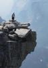
As I closed in on the parking area for the regional park, I was stopped by someone looking for help finding their trail (they were not intending to hike along the pass mountain loop nor were they intending to hike up to the wind cave). Unfortunately, while I was getting them sorted, an extremely large party started heading up the Wind Cave Trail. Once I sent them on their way, I trailed behind the long train of folks with their hand held water bottles. Eventually, as their group started spreading further out, I began lapping the slower ones. Made it up to the wind "cave" area, where it looked to be at capacity, so I continued onward, eventually making the ridgeline and local summit where I stopped briefly to enjoy the solitude and the views before heading back down.

The wind cave area had cleared somewhat by the time I made my way back. I had a quick wander of the alcove, was approached by some tiny beggars hoping for some snacks, and saw a couple of adorably round birbs (unfortunately, they didn't hold still long enough for a photo, and I was unsuccessful in identifying them from my memory) before heading back down and continuing my loop back to my car. The walking was easy, but the day was quite warm, and the last mile or so really seemed to drag.

While I enjoyed the area more than south mountain, I'm not sure I'd seek it out as a hiking destination again when the goldfields and the superstitions are not that much further away.
wildflower observationwildflower observationwildflower observationwildflower observationwildflower observation
Wildflowers Observation Moderate
_____________________
Happier when hiking....I may not move fast (and I'm often distracted by wildflowers), but I'll get there eventually 😆
 
Nov 20 2025
avatar

 Guides 72
 Routes 1,173
 Photos 1,480
 Triplogs 1,524

male
 Joined Jan 01 2023
 Arizona
Backside of the Low, AZ 
Backside of the Low, AZ
 
Hiking avatar Nov 20 2025
pseudalpineTriplogs 1,524
Hiking
Hiking
1st trip
I mean, who doesn't like a reach-around? :-s It couldn't possibly rain all morning. Wrong.

To celebrate backpay payday, I found it warranted to use sick leave to honor the House doing absolutely nothing for a six-week period and felt nauseous about the recent ‘mathing’ being done by supporters of the party currently in power. :sk:

Three pairs of eyes along the MMT were likely deer. Then the fog set in, followed by some sprinkling and then actual rain. I wisely took an hour delay at an overhang before reaching the ridgeline. Once moving again, there was the sound of foamy rapids, mud shoe squishing and twice rattles from within boulder piles being traversed. I didn't see any hippies over near Peak 3195 but that area is such a geologic upchuck. Seemed apt for this sick day. Searching for breccia to climb doesn't rank high on my climbing goals list but perhaps I'll return when there aren't waterfalls cascading down every possible summit route. The broken flagpole was hauled off of Peak 3125 along with some other garbage found along the route. The only sign of others was one set of boot and dog prints once descending from BS. RIP DC.
  20 archives
Oct 03 2025
avatar

 Guides 72
 Routes 1,173
 Photos 1,480
 Triplogs 1,524

male
 Joined Jan 01 2023
 Arizona
Furlough Friday, AZ 
Furlough Friday, AZ
 
Hiking avatar Oct 03 2025
pseudalpineTriplogs 1,524
Hiking
Hiking
1st trip
Decided to go deep into MAGA territory (north Pinal County) on the third day of the silly shutdown to complete two pleasant hikes for ~$175 backpay each.
I guess I’m a professional climber/hiker again…

1. [ Peak 3004 Loop - Goldfield Mtns ]
Overcast ascent up to the Bulldog Saddle via the Meridian Interpretive Trail (on accident, it was dark). Then west from the saddle up and across the ridgeline to 3004 or is it 3005? In the summit log, I dedicated this peak hike to Jimmy Kimmel Live! in honor of 1A. Poor Nexstar and Sinclair folded like cheap suits when they realized they liked making money more than supporting the U.S. Constitution. A short berserker descent NW to link back up with the loop and back down Pass Mountain #282 to the Meridian TH. Near the parking area, an odd guy was audibly listening to I Shot The Sheriff while letting his young pet dusky hawk hunt for rabbit. Apparently, his bird was successful and he thought celebrating with a random stranger was in order. The whole scene just seemed weird. Next time I’ll bring my pet cougar.

2. [ Cat Peaks Loop ]
Sunny and warmer start west over to the Cat Peaks area, passing a much slower Tortoise_Hiker en route (not the HAZ Rocks! one). Perhaps South Cat was first and North Cat was second, each peak dedicated respectively to Jeffries and Schumer because the Affordable Care Act subsidies are worthy. Just a bit of waxing nostalgically about McCain and the skinny repeal failure of 2017. I miss ol’ John. Evidently, I’m not the only one visiting this area who’s trying to save the world. : wink :
 Fauna
 Fauna [ checklist ]
[ checklist ]  Desert Tortoise
 Culture
 Culture [ checklist ]
[ checklist ]  Military Aircraft
 Named place
 Named place [ checklist ]
[ checklist ]  Four Peaks
  20 archives
Feb 01 2025
avatar

 Guides 27
 Routes 699
 Photos 12,467
 Triplogs 883

56 male
 Joined Jul 05 2006
 Mesa, AZ
Pass Mountain Loop Trail #282Phoenix, AZ
Phoenix, AZ
Hiking avatar Feb 01 2025
DarthStillerTriplogs 883
Hiking9.86 Miles 1,448 AEG
Hiking9.86 Miles   4 Hrs   44 Mns   2.10 mph
1,448 ft AEG      2 Mns Break
 
Linked   linked  
Partners partners
adilling
Route Scout Route Recorded  on Route Scout | Pop | Map | Popup | MapDEX
Couldn't really decide where to hike as late Friday night rolled around. Andy had the same problem. Hiking the Pass Mt loop by adding in the Bulldog Pass loop was what we could agree on.

Started from the Meridian TH and hiked the loop CCW. First 2 miles were in the dark. I've never hiked the Pass Mt. Loop CCW, so once we were on that, the views were a little different from what I normally see. Got most of the climbing out of the way in the first 3 miles, after that it was a cakewalk. Foot traffic wasn't too bad, no bikers all day. Weather got warmer towards the end but not hot. Hazy skies kept the sun at bay a little bit.
_____________________
  1 archive
Jan 23 2025
avatar

 Routes 93
 Photos 8,070
 Triplogs 1,745

65 male
 Joined Mar 11 2003
 AZ
Bulldog Saddle TrailPhoenix, AZ
Phoenix, AZ
Hiking avatar Jan 23 2025
wallyfrackTriplogs 1,745
Hiking5.20 Miles 1,222 AEG
Hiking5.20 Miles   2 Hrs   22 Mns   2.20 mph
1,222 ft AEG
 no routes
Linked   none no linked trail guides
Partners partners
Tortoise_Hiker
A short hike with Denny to check out a route. We saw a pass on the ridge but will we try it? I may go back so the other side and see if there's a way over. We checked out a game trail or route and hiked the loop. There's a butte out that way that may need a trip too? A few people out, a little windy but not a bad day. Stopped at Farmer Boys for some burgers.
_____________________
  2 archives
Jan 23 2025
avatar

 Guides 1
 Routes 149
 Photos 10,107
 Triplogs 3,755

64 male
 Joined Apr 02 2005
 Mesa, AZ
Bulldog Saddle TrailPhoenix, AZ
Phoenix, AZ
Hiking avatar Jan 23 2025
Tortoise_HikerTriplogs 3,755
Hiking5.20 Miles 1,222 AEG
Hiking5.20 Miles   2 Hrs   22 Mns   2.20 mph
1,222 ft AEG
 
Linked   none no linked trail guides
Partners none no partners
Wally and I hit the trail around 8am. Half a dozen cars in the lot with a couple sleepers. 😱 We did a loop counter clockwise and a little exploring. It got pretty windy a time or two but we managed to keep our hats on. Temps were pretty good. Trail was as rocky as ever. We only saw 1 group of 5 hikers by the Pass mountain loop going the opposite way for the whole hike. Enjoyable outing and Wally even bought lunch 👍👏! Thanks, my friend! Like HAZ, you rock!
_____________________
Tortoise Hiking. Stop and smell the Petrichor.
 
Oct 05 2024
avatar

 Routes 93
 Photos 8,070
 Triplogs 1,745

65 male
 Joined Mar 11 2003
 AZ
Bulldog Saddle TrailPhoenix, AZ
Phoenix, AZ
Hiking avatar Oct 05 2024
wallyfrackTriplogs 1,745
Hiking5.10 Miles 1,199 AEG
Hiking5.10 Miles   1 Hour   52 Mns   2.73 mph
1,199 ft AEG
 no routes
Linked   none no linked trail guides
Partners none no partners
Headed out toward Hieroglyph trailhead to hike the crosscut trail. The trail access is closed but it's outside the Tonto National Forest so was hoping the closure would be farther up Hieroglyphic trail. May try going in from Peralta road during the week. Plan B was Bulldog Saddle and decided tp loop from there. Started a little later because of the detour but still had shade most of the way. Saw a mule deer and two fawns. A lot of other hikers out but none on the backside of the loop.
_____________________
  3 archives
Jul 06 2024
avatar

 Guides 100
 Routes 1,573
 Photos 16,476
 Triplogs 1,463

male
 Joined Jan 07 2017
 Fountain Hills,
Pass - Bulldog Combo Loop, AZ 
Pass - Bulldog Combo Loop, AZ
 
Hiking avatar Jul 06 2024
DixieFlyerTriplogs 1,463
Hiking9.06 Miles 1,538 AEG
Hiking9.06 Miles   3 Hrs   42 Mns   2.69 mph
1,538 ft AEG      20 Mns Break
 
1st trip
Route Scout Route Recorded  on Route Scout | Pop | Map | Popup | MapDEX
It has been over 4 years since I have done this hike so I figured that it was time to do it again.

This hike is basically a combination of the Peak 3004 Loop and the Pass Mountain Loop.

We started at the Meridian TH and made our way up to Bulldog Saddle. From there we followed the trail that looped around the north side of Peak 3004 before making our way up to the Pass Mountain Saddle. From there we looped around Pass Mountain on our way back to the TH.

This is a pretty decent hike, and it seems more green our here than it does in the McDowell Mountains, where I have been hiking lately.
wildflower observationwildflower observationwildflower observationwildflower observationwildflower observation
Wildflowers Observation Isolated
There were some fruits on saguaros and a few prickly pear.
_____________________
Civilization is a nice place to visit but I wouldn't want to live there
  2 archives
May 20 2024
avatar

 Routes 93
 Photos 8,070
 Triplogs 1,745

65 male
 Joined Mar 11 2003
 AZ
Bulldog Saddle TrailPhoenix, AZ
Phoenix, AZ
Hiking avatar May 20 2024
wallyfrackTriplogs 1,745
Hiking5.15 Miles 1,199 AEG
Hiking5.15 Miles   1 Hour   54 Mns   2.71 mph
1,199 ft AEG
 no routes
Linked   linked  
Partners none no partners
After bailing on the overgrown trail Sunday it seemed like a Monday evening hike would be fun. I started about 4:30 pm which was about an hour early so more hiking in the sun and less shade but that was ok. I only saw 2 other hikers on trail. The return on Pass mountain trail was nice with a cool breeze blowing. This could be my new go to hike in the evening.
_____________________
  2 archives
May 12 2024
avatar

 Guides 2
 Routes 278
 Photos 10,206
 Triplogs 418

62 male
 Joined Dec 02 2014
 Mesa, AZ
Peak 3004 Loop - Goldfield Mtns, AZ 
Peak 3004 Loop - Goldfield Mtns, AZ
 
Hiking avatar May 12 2024
adillingTriplogs 418
Hiking7.64 Miles 1,419 AEG
Hiking7.64 Miles   3 Hrs   51 Mns   2.06 mph
1,419 ft AEG      8 Mns Break
 
1st trip
Partners partners
DarthStiller
mt98dew
Route Scout Route Recorded  on Route Scout | Pop | Map | Popup | MapDEX
I wasn't sure where I would end up hiking this weekend, but Chris invited me to hit this cool little loop. This his "recovery" hike after hitting Mt Wrightson near Tucson the day before.

I have done this loop a few times, but it's been many years since I have been on this one all the way around.

We met up at 630am and started off in counter-clockwise fashion. Chris was there early as was Brian. I have never hiked with him before. Nice to meet you Brian!

I was a slow-poke going up and a semi slow-poke hiking down from the saddle. Brian had to jet as it's Mother's Day and hiking all day is not a good idea when Mom's need attention. He left us in the dust, but we did see him going down the Pass Mountain Trail as we started down the 2nd saddle.

Chris wanted to add some more miles, so we hiked down the Meridian Mystery Trail for a little while and then turned around.

A few critters, but no snakes :( . There was a little horned toad missing his tail at the Pass Mtn Saddle, lots of doves, a few quail, bunnies and ground squirrels, and the ever present lizards darting up and down and across the trail. Most of the blooms that were so beautiful just a few weeks ago have been roasted. But, I saw quite a few saguaro blooms and even a few barrel cacti blooms too.

A nice 7.5 mile loop with a little elevation gain. The trail on the loop was in good shape. Much better than I remembered for sure. The weather was starting to get a little toasty at the end, but it was very nice starting off. In a month, I would gladly take a day like today.

Thanks for the invite Chris, and it's alway awesome meeting up the HAZers on the trail. Let's hike again soon, Brian.
_____________________
"Jobs fill your pockets, adventures fill your soul."

instagram: @andydilling
 
May 09 2024
avatar

 Routes 93
 Photos 8,070
 Triplogs 1,745

65 male
 Joined Mar 11 2003
 AZ
Bulldog Saddle TrailPhoenix, AZ
Phoenix, AZ
Hiking avatar May 09 2024
wallyfrackTriplogs 1,745
Hiking5.15 Miles 1,199 AEG
Hiking5.15 Miles   2 Hrs   15 Mns   2.29 mph
1,199 ft AEG
 no routes
Linked   linked  
Partners partners
Tortoise_Hiker
Denny wanted to start early :zzz: but the cool morning was nice. We stuck to the shadows for most of the hike and it never warmed up. The trail is rocky in sections but as fate would have it Denny trip on a rock in one of the easier parts. He flipped like a pancake but said he was okay. :o Those turtle shells give you a high center of gravity. I sampled some wolfberries and jojoba along the way. Nice hike and goo to catch up with the tortoise.
_____________________
  1 archive
May 09 2024
avatar

 Guides 1
 Routes 149
 Photos 10,107
 Triplogs 3,755

64 male
 Joined Apr 02 2005
 Mesa, AZ
Bulldog Saddle TrailPhoenix, AZ
Phoenix, AZ
Hiking avatar May 09 2024
Tortoise_HikerTriplogs 3,755
Hiking5.15 Miles 1,199 AEG
Hiking5.15 Miles   2 Hrs   15 Mns   2.29 mph
1,199 ft AEG
 
Linked   linked  
Partners partners
wallyfrack
I met Wally around 5am for a morning hike. We did the loop with part of Pass Mountain. Counter clockwise.
Weather was nice at this time. I would say we had shade for over half the hike and never felt warm. Trail was in the normal shape, rocky. :D :y: I did take a spill about half way in. :doh: :oops: Wally resisting taking a pic with my shell knocked sideways. :o It was good catching up with Wally!
Nice temps, trail, and company! Thanks Wally! Like HAZ, you rock!
 Culture
 Culture [ checklist ]
[ checklist ]  HAZ Rides
_____________________
Tortoise Hiking. Stop and smell the Petrichor.
  1 archive
Mar 17 2024
avatar

 Guides 1
 Routes 149
 Photos 10,107
 Triplogs 3,755

64 male
 Joined Apr 02 2005
 Mesa, AZ
Bulldog Saddle TrailPhoenix, AZ
Phoenix, AZ
Hiking avatar Mar 17 2024
Tortoise_HikerTriplogs 3,755
Hiking5.14 Miles 1,183 AEG
Hiking5.14 Miles   2 Hrs   13 Mns   2.32 mph
1,183 ft AEG
 
Linked   linked  
Partners none no partners
Route Scout Route Recorded  on Route Scout | Pop | Map | Popup | MapDEX
I did the loop with Pass Mountain counterclockwise . I thought the sun might come out by the time I arrived. It did not.
Only saw the sun for about 5 minutes the whole hike. Not a ton of flowers but nice variety although the Poppies refused to talk to me. I added a second layer for the first half then was fine with a short sleeve shirt after that. Some nice clouds and Four Peaks had snow again. Temps, clouds, views, made for an enjoyable outing! 😁👍
 Flora
 Flora [ checklist ]
[ checklist ]  Fairy Duster
_____________________
Tortoise Hiking. Stop and smell the Petrichor.
 
Feb 10 2024
avatar

 Guides 4
 Routes 230
 Photos 109
 Triplogs 227

male
 Joined Aug 08 2020
 Phx az
Bulldog Saddle TrailPhoenix, AZ
Phoenix, AZ
Hiking avatar Feb 10 2024
ScaredyCatTriplogs 227
Hiking9.14 Miles 1,607 AEG
Hiking9.14 Miles   4 Hrs   38 Mns   2.56 mph
1,607 ft AEG   1 Hour   4 Mns Break
 
no photosets
1st trip
Linked   linked  
Partners none no partners
Route Scout Route Recorded  on Route Scout | Pop | Map | Popup | MapDEX
10 am Meetup was chilly standing outside waiting for the no shows. Rained all the way there but stopped just before arriving. Didn't start again till just after finishing. 😃

Group kept a strong pace on the early uphill section. Loop was only 5 miles so added 2 mile trail each way. This jct does now have signage. Thatconfirmed this is in the Sups and not the goldfields.

Be aware there is confusing signage further in that denotes the lower trail to be 303. However, this is wrong. There is what appears to be the end of the trail further down. Some apps reflect this. HAZ shows it continuing so we were able to spot the reduced trail that continues onward. Toward the actual end are a couple more jcts that don't show on any maps I have.
 
Dec 17 2023
avatar

 Guides 27
 Routes 699
 Photos 12,467
 Triplogs 883

56 male
 Joined Jul 05 2006
 Mesa, AZ
Gold Link - Meridian Mystery TrailPhoenix, AZ
Phoenix, AZ
Hiking avatar Dec 17 2023
DarthStillerTriplogs 883
Hiking9.70 Miles 993 AEG
Hiking9.70 Miles   4 Hrs   25 Mns   2.20 mph
993 ft AEG
 
Sunday morning hike just to get some miles in instead of my usual morning jog. Started from the Meridian/Bulldog Pass TH just before dawn and didn't need a headlamp. Headed east on Meridian Mystery until the sun hit the horizon and then turned around and headed into Usery Park and did a loop and then back to the car. New numbered trail markers are at the Meridian Mystery and other trails outside of Usery. Also 2 new interpretive signs showcasing the geology of the area. Saw one hiker outside of Usery, and a few more inside. Surprisingly not many bikers. Overall traffic was rather low, which is surprising considering how nice the weather was.
_____________________
 
Mar 09 2023
avatar

 Guides 1
 Routes 149
 Photos 10,107
 Triplogs 3,755

64 male
 Joined Apr 02 2005
 Mesa, AZ
Bulldog Saddle TrailPhoenix, AZ
Phoenix, AZ
Hiking avatar Mar 09 2023
Tortoise_HikerTriplogs 3,755
Hiking5.10 Miles 1,197 AEG
Hiking5.10 Miles   2 Hrs   30 Mns   2.04 mph
1,197 ft AEG
 
Linked   linked  
Partners none no partners
Route Scout Route Recorded  on Route Scout | Pop | Map | Popup | MapDEX
Midday hike. Counterclockwise. I went up Bulldog, down the back, back up to Pass Mountain Saddle, then back down to Meridian and my car. Although the trail does have some smooth stretches, I would count this loop as rocky . The brush is cut back where need be and shorts are fine. The bulldog trail had a variety of flowers but few. The Pass Mountain trail had less of a variety but way more. I believe Poppies led with Lupine a distant second. 3/4 overcast was nice. Enjoyable outing!
wildflower observationwildflower observationwildflower observationwildflower observationwildflower observation
Wildflowers Observation Moderate
_____________________
Tortoise Hiking. Stop and smell the Petrichor.
 
Feb 24 2023
avatar

 Photos 2
 Triplogs 6

male
 Joined Jan 02 2020
 Wauconda il.
Bulldog Saddle TrailPhoenix, AZ
Phoenix, AZ
Hiking avatar Feb 24 2023
SwifthuntTriplogs 6
Hiking1.40 Miles 686 AEG
Hiking1.40 Miles   4 Hrs      0.35 mph
686 ft AEG7 LBS Pack
 no routes
1st trip
Linked   none no linked trail guides
Partners none no partners
First time in this area, met up with Chip at Meridian trailhead he offered to have me shadow him went up through bulldog pass, came around Pass mountain to loop back to trail head, beautiful day Mexican poppies are popping. Thanks Chip..
wildflower observationwildflower observationwildflower observationwildflower observationwildflower observation
Wildflowers Observation Moderate
Poppies
 
Jan 02 2023
avatar

 Photos 99
 Triplogs 872

male
 Joined Mar 18 2012
 Goodyear, AZ
Bulldog Saddle TrailPhoenix, AZ
Phoenix, AZ
Hiking avatar Jan 02 2023
MikeSTriplogs 872
Hiking5.40 Miles 1,155 AEG
Hiking5.40 Miles   2 Hrs   13 Mns   2.44 mph
1,155 ft AEG
 no routesno photosets
1st trip
Linked   none no linked trail guides
Partners none no partners
Bulldog Saddle/ Pass Mountain Loop. Such perfect weather today with water running down the backside.
_____________________
Subscribe to my adventure videos at: [ youtube video ]

Follow my adventures on Instagram at: adventures_az
 
Dec 27 2022
avatar

 Photos 21
 Triplogs 2

male
 Joined Jan 01 2020
 Chandler,AZ
Peak 3004 Loop, AZ 
Peak 3004 Loop, AZ
 
Hiking avatar Dec 27 2022
bhawkinsTriplogs 2
Hiking5.85 Miles 1,228 AEG
Hiking5.85 Miles   3 Hrs      2.24 mph
1,228 ft AEG      23 Mns Break20 LBS Pack
 
1st trip
Partners none no partners
Route Scout Route Recorded  on Route Scout | Pop | Map | Popup | MapDEX
The first section is not steep although it does get steeper as you approach the first saddle. I accidentally went to far to the right after the saddle but managed to get back on track. Although the trail is narrow after the first saddle, it seems easier to follow than when I did this hike a couple of years ago. Approaching the second saddle it can be rocky at times. There is a short section with a small drop off that can be intimidating if you struggle with heights. Heading down from the second saddle the rocks can be loose at times. Near the end I started to head towards the Wave Cave but then I realized it would add about 5 miles so I turned around and heading back to the trailhead.
 
average hiking speed 2.32 mph
1, 2, 3  Next

WARNING! Hiking and outdoor related sports can be dangerous. Be responsible and prepare for the trip. Study the area you are entering and plan accordingly. Dress for the current and unexpected weather changes. Take plenty of water. Never go alone. Make an itinerary with your plan(s), route(s), destination(s) and expected return time. Give your itinerary to trusted family and/or friends.

helpcommentissue

end of page marker