username
X
password
register
for free!
help
ArticlesGuidesRoutes
 
Photosets
 
 Comments
triplogs   photosets   labels comments more
Blue Ridge - AZT #27 - 35 members in 130 triplogs have rated this an average 3.6 ( 1 to 5 best )
1, 2, 3, 4, 5 ... 7  Next
130 triplogs
login for filter options
Jun 27 2025
avatar

 Guides 10
 Routes 673
 Photos 7,281
 Triplogs 4,660

67 female
 Joined Nov 17 2008
 phoenix, az
Blue Ridge South, AZ 
Blue Ridge South, AZ
 
Hiking avatar Jun 27 2025
trekkin_geckoTriplogs 4,660
Hiking15.47 Miles 2,227 AEG
Hiking15.47 Miles   5 Hrs   9 Mns   3.14 mph
2,227 ft AEG      13 Mns Break
 
1st trip
Partners partners
johnlp
Route Scout Route Recorded  on Route Scout | Pop | Map | Popup | MapDEX
john and i took off from camp just before 0700, again following the connector trail to the azt
this time we went south to the intersection with fred haught trail and returned the same way
a little more elevation gain on this part
hiked the fred haught part of the trail with @tibber two years ago, so that makes four times i've done the entire blue ridge azt section
nice hiking on pine needle covered single track in ponderosa forest
convenient going from rock crossing campground
_____________________
hazhole
 
Jun 27 2025
avatar

 Guides 1
 Routes 14
 Photos 7,202
 Triplogs 5,208

68 male
 Joined Mar 16 2008
 chandler,az
Blue Ridge South, AZ 
Blue Ridge South, AZ
 
Hiking avatar Jun 27 2025
johnlpTriplogs 5,208
Hiking15.47 Miles 2,227 AEG
Hiking15.47 Miles   5 Hrs   9 Mns   3.14 mph
2,227 ft AEG      13 Mns Break
 no routes
1st trip
Partners partners
trekkin_gecko
Hike #3 of our Rock Crossing camping trip. Today we took the connecter to the AZT and hiked south to the Fred Haught trail intersection. A little more interesting and strenuous than the northern part of segment #27. Another fine day in the pines. Thanks Kelly! :)
_____________________
“Good people drink good beer.” Hunter S Thompson
 
Jun 26 2025
avatar

 Guides 10
 Routes 673
 Photos 7,281
 Triplogs 4,660

67 female
 Joined Nov 17 2008
 phoenix, az
Blue Ridge North, AZ 
Blue Ridge North, AZ
 
Hiking avatar Jun 26 2025
trekkin_geckoTriplogs 4,660
Hiking10.69 Miles 934 AEG
Hiking10.69 Miles   3 Hrs   21 Mns   3.24 mph
934 ft AEG      3 Mns Break
 
1st trip
Partners partners
johnlp
Route Scout Route Recorded  on Route Scout | Pop | Map | Popup | MapDEX
john and i left camp around 0715, taking the little campground trail to the blue ridge azt trail
we went north to the end of the segment near highway 87 and returned the same way
the only real elevation change was just south of blue ridge campground so easy hiking
nice morning and good to be in the pines
thanks, john
_____________________
hazhole
  1 archive
Jun 26 2025
avatar

 Guides 1
 Routes 14
 Photos 7,202
 Triplogs 5,208

68 male
 Joined Mar 16 2008
 chandler,az
Blue Ridge North, AZ 
Blue Ridge North, AZ
 
Hiking avatar Jun 26 2025
johnlpTriplogs 5,208
Hiking10.69 Miles 934 AEG
Hiking10.69 Miles   3 Hrs   21 Mns   3.24 mph
934 ft AEG      3 Mns Break
 no routes
1st trip
Partners partners
trekkin_gecko
Hike #2 of our Rock Crossing camping trip. We hiked from camp north on the AZT to the end of segment #27 and back. There is a AZT signed connecter trail from the campground, stretching 1/3 mile to the AZT.
Nice day. Fun hike. Thanks Kelly! :)
_____________________
“Good people drink good beer.” Hunter S Thompson
 
Aug 20 2024
avatar

 Routes 85
 Photos 3,718
 Triplogs 486

female
 Joined Oct 15 2002
 Rimrock, Arizona
Blue Ridge - AZT #27Payson, AZ
Payson, AZ
Hiking avatar Aug 20 2024
cactuscatTriplogs 486
Hiking6.00 Miles 700 AEG
Hiking6.00 Miles
700 ft AEG
 no routes
1st trip
Linked   none no linked trail guides
Partners none no partners
First trip of my two-week furlough was camping at Rock Crossing CG and hiking part of AZT #27.

After setting up camp and visiting the reservoir, I hiked north from the 751 trailhead for about a mile to 751B, then looped back on the road. Absolutely gorgeous trail and weather. Birds were pretty good, and I saw a lovely Gopher Snake. Checked out some good dispersed campsites along 751B, and got a nice rain shower along the way.

Started out early the next morning southbound from 751 to the East Clear Creek crossing and back. More excellent trail, more great weather. Heard some elk and found five baby short-horned lizards.

Saw zero people on either trail.
 Named place
 Named place [ checklist ]
[ checklist ]  CC Cragin Reservoir
wildflower observationwildflower observationwildflower observationwildflower observationwildflower observation
Wildflowers Observation Light
_____________________
  1 archive
Jun 15 2024
avatar

 Guides 93
 Routes 397
 Photos 4,984
 Triplogs 4,124

49 male
 Joined Jun 20 2003
 Tucson, AZ
Blue Ridge - AZT #27Payson, AZ
Payson, AZ
Hiking avatar Jun 15 2024
fricknaleyTriplogs 4,124
Hiking9.10 Miles 850 AEG
Hiking9.10 Miles
850 ft AEG
 no routes
Linked   none no linked trail guides
Partners none no partners
Got Michelle out on the AZT for a few miles :y:

She loved it. Warm day but tolerable with a decent breeze. We had a great picnic in the pines
_____________________
hi
 
May 12 2024
avatar

 Routes 386
 Photos 49
 Triplogs 792

43 female
 Joined Jun 23 2015
 Phoenix, AZ
Blue Ridge - AZT #27Payson, AZ
Payson, AZ
Hiking avatar May 12 2024
emilystardustTriplogs 792
Hiking18.54 Miles 2,601 AEG
Hiking18.54 Miles   8 Hrs   4 Mns   2.49 mph
2,601 ft AEG      37 Mns Break
 
no photosets
1st trip
Linked   none no linked trail guides
Partners none no partners
Route Scout Route Recorded  on Route Scout | Pop | Map | Popup | MapDEX
The plan was to do 26/27 this weekend, but decided on a day trip for 27 instead, due to Pine TH being closed, smoke from the fire, and getting up there a little later. Surprisingly didn’t encounter any smoke or challenging breathing conditions on that side of the 87, despite driving through quite a bit on the way up and back dropping off the shuttle car. Clouds provided enough relief to make most of the hike pleasant.
_____________________
 
Jul 29 2023
avatar

 Triplogs 19

40 male
 Joined Apr 22 2020
 Phoenix
Blue Ridge - AZT #27Payson, AZ
Payson, AZ
Hiking avatar Jul 29 2023
jrich0085Triplogs 19
Hiking12.00 Miles
Hiking12.00 Miles
20 LBS Pack
 no routesno photosets
1st trip
Linked   none no linked trail guides
Partners none no partners
This hike was a section of the Blue Ridge Passage 27 of Arizona Trail. It was not the entire passage.

Visiting Battleground Ridge on the Mogollon Rim has been on my bucket list a while. This monument can be driven to via Rim Road (FR-300) and FR-123. However, hiking to it from the Rock Crossing area of the Arizona Trail is also a very doable 11.5 - 12 mile day hike.

I parked at the Arizona Trail parking area on the side of FR-751. If you continue down FR-751, it leads to Rock Crossing Campground and eventually down to Blue Ridge Reservoir.

This segment of Arizona Trail begins in forest that is rocky grassland. One area of minor fire damage led to stepping over some downed trees, but it was nothing too challenging. Eventually this hike begins steeply descending into Clear Creek Canyon.

The trail reaches the fine, rocky bed of Clear Creek, which it traverses at well-marked crossings. Clear Creek is completely dry in this area right now, and you're a little way upriver from where the waters of Blue Ridge Reservoir officially start.

The climb out of Clear Creek is equally steep. In fact, the vast majority of elevation change during this hike occurs climbing up and down the sides of Clear Creek Canyon. Despite the tough elevation change, it's worth taking your time to look around. On the north side of Clear Creek are some cool rock formations and volcanic remnants. On the south side you'll enjoy some of the most varied conifer forest this hike offers.

Once up and over the creek, the trail becomes an old road. It's also fairly level. I studied the possibility of a shortcut around an area called Battleground Tank. All Trails map even indicates a trail in this area. In reality, there's no trail. In fact, looking at the topographic map indicated I'd have to traverse at least one, if not two, ravines. These were likely steep and in thick forest. I opted to stick to the sure thing and follow the trail.

The old road doubling as Arizona Trail intersects FR-123, which has utility lines running parallel to it. Those lines eventually run up to a Blue Ridge Reservoir pumping station. At FR-123-E there's a signed junction. The pumping station is to the right and Battleground Ridge is to the left, each about two miles from the where the road forks.

I followed the road up to Battleground Ridge. I was surprised to see some people had setup camp up there. I paused at the monument and read the placards on both sides. I also hiked around the area a little bit, as I know from the map that you're on a ridge that overlooks the lake. For the most part all I found were near-vertical drop offs that would eventually lead down to the lake. The forest and foliage were far too thick to see through. However, I did find one vantage point where I could see the lake. I even saw a kayak go paddling by on the water far below.

My return was the via the way I came in. It was now almost noon and thunderstorms were beginning to build in. My return hike involved a lot of hustling and pushing myself to go faster, constantly outrunning the dark, thundering clouds that seemed to be chasing me. I guess my strategy worked...I was back to the truck just as the rain started coming down.

I drove down the rim and into Strawberry for a much-deserved after-hike treat at Pie Bar.
wildflower observationwildflower observationwildflower observationwildflower observationwildflower observation
Wildflowers Observation Isolated
 
Jun 26 2023
avatar

 Guides 21
 Routes 1,182
 Photos 36,858
 Triplogs 1,570

69 female
 Joined Feb 26 2004
 Phoenix, AZ
Fred Haught Trail #141Payson, AZ
Payson, AZ
Hiking avatar Jun 26 2023
tibberTriplogs 1,570
Hiking7.26 Miles 877 AEG
Hiking7.26 Miles   3 Hrs   51 Mns   2.17 mph
877 ft AEG      30 Mns Break
 
Partners partners
trekkin_gecko
Route Scout Route Recorded  on Route Scout | Pop | Map | Popup | MapDEX
Slept okay I think but my mattress did deflate somewhat which messed with my side sleeping; however, I did figure out a way to work with the air that was left.  It was a nice morning and Kelly made me some delish Ethiopian coffee and I tried a new Grits breakfast meal; perhaps more savory than I thought it should be in the morning.  We took our time packing, still admiring our surroundings.

We crossed the creek in a little easier area this time and headed up the hill, to the TH, and down the hill through the ferns and by the lupine to FR 95.    The scenery on the road was very pretty with cool geology, roses and ferns.  We once again admired the drop off to get around the fallen road and culvert.  It is fairly steep on both sides getting down and then up.  Once you get off the road it levels off for a bit before the climb to the Ridge.  Still complained about there not being one switchback on there as it seems a long climb.

We hung out at a log near the clearing area and had a snack. We could hear the tractor working in the distance to the south of us.  We made our way through the heavily ferned area to Quien Sabe Draw.  We decided to see how long it was; I figured a mile.  It really is a beautiful draw to enjoy with the tall trees and scattered ferns throughout.  A little over 3/4 mile later you arrive at what appears to have been a road at one time.  The temp would get hot once in a while which I thot was surprising for the morning.  Needless to say, when the breeze picked up, so did I :) .

We passed by Fred Haught spring area and saw some hikers across the way. We were going to stop and get water here but ended up going farther.  I wanted to see if the new energy powder I had would help me with my energy level as the previous afternoon, I could have stopped and taken a nap way too easily.  We finally found an area and I loaded my Pina Colada energy powder into my container and took a couple big swigs.  We would stop a little later and finish it off.  I don't know if it helps, but my energy level stayed fairly steady; although my legs were getting a little worn out the last couple miles.

We continued to admire the scenery we had passed through yesterday alongside the water which was now constantly present.  There was one area that we got to do the log balance beam across.  It was easy with the poles.  This time it was Kelly's turn to smell the vanilla.  I saw the perfect 7 foot Xmas tree but my picture didn't turn out very well.  In fact, I didn't like a lot of my photos :( ; the light just wasn't good.  I should be pulling out my Pany when there is such harsh light.  I will have to remember to do that in Glacier.  We had one more uphill to go but not before going through a heavily ferned area.  The hill has a nice enough grade and then you hit that rock area that's so cool.  It's weird that it doesn't last long and then goes back to forest.

Tonto 3 was waiting where we left it; always a good thing.  I got us our beers and we sat on a log that had a small silver metal tag on it that said, "do not remove", how odd.  The area around the cabin was pretty active.  We changed our clothes and then headed west on FR300.  It was a nice drive, though very windy.  The New Mexico Locust was blooming in many places along the way.  There was less traffic so that was good.  We had lunch at Las Casita in Camp Verde and headed back for Phx.

Thanks to Kelly for helping me practice for my trip.  I'm so glad I did the backpack trip, but didn't feel like I did very well; so I was a little dejected and was wondering if I could do the full six-nites at Glacier.  We shall see. It could turn into a 3-nite trip in the Belly River and 2 nites in the Cut Bank Valley... due to bear activity and I think secretly, I'd like that. My pack is 40 lbs :o including a litre of water. (A lot of the weight is my electronics, and food of course)


Video from our hike from Pinchot campsite to Gen'l Springs Cabin: [ youtube video ]

Watch from the north end of Quien Sabe Draw to TH 9:49AM-12:18PM, 4.55 miles, 7270-7515 elevation.  132 avg bpm/150 max.  28% zone 5 max, 54% zone 4 anaerobic, 16% zone 3 aerobic burning 982 calories. 
Watch from campsite to Quien Sabe Draw 8:26-9:31AM, 1.75 miles, 7150-7439 elevation. 127 avg bpm/151 max burning 393 calories.
Temp 83.8 sunny and 9% humidity, little to no breeze.
 Culture
 Culture [ checklist ]
[ checklist ]  Tree Tags
 Named place
 Named place [ checklist ]
[ checklist ]  Fred Haught Ridge
wildflower observationwildflower observationwildflower observationwildflower observationwildflower observation
Wildflowers Observation Light
LOTS of ferns, a couple Heal All/Self-Heal among others I couldn't quite ID. We saw some Fleabane and of course, the Flagstaff Ragwort on the AZT part.
_____________________
For me, sometimes it's just as much about the journey as the destination.
Oh, and once in awhile, don't forget to look back at the trail you've traveled.
  1 archive
Jun 25 2023
avatar

 Guides 21
 Routes 1,182
 Photos 36,858
 Triplogs 1,570

69 female
 Joined Feb 26 2004
 Phoenix, AZ
Fred Haught Trail #141Payson, AZ
Payson, AZ
Hiking avatar Jun 25 2023
tibberTriplogs 1,570
Hiking8.16 Miles 721 AEG
Hiking8.16 Miles   4 Hrs   45 Mns   1.92 mph
721 ft AEG      30 Mns Break
 
Linked   linked  
Partners partners
trekkin_gecko
Route Scout Route Recorded  on Route Scout | Pop | Map | Popup | MapDEX
Practice. Plan B.
I had done part of this trail when we did the AZT in 2019 on an overcast morning. I watched my 3-part video from that; it was actually pretty good. I remembered the ferns and that one huge ponderosa along the way plus a lot of water; nothing has changed there. This time, however, the sun was out full time and I had a 32lb overnite pack on my back; and ya, that makes a big difference. I'm still having difficulty with the one corner of the metal sticking into my backside. We finally used my folded up buff as a cushion to provide space between the backpack and my backside; can't seem to get that corner to lay a little flatter without worrying about breaking it.

We came across the same flowers that I saw in 2019. I tried to ID them on google but there are too many choices. I took some more photos anyway. The butterflies were flitting about too. We did notice a few trees that had several trunks growing from about 1/2 way up. The ferns were tall and some had not yet finished leafing out yet. We did a few water crossings including one that involved a little balance work.

We did encounter a couple backpackers. And in this area there were two slim tree trunks criss crossing over the AZT part of the trail; easy enough to get under or around. It was nice to walk near the water from time to time and it was especially nice walking in the shade which is off and on as you go in and out of the forest. We sure could tell when the AZT part of the trail ended. We decided to have lunch at Fred Haught's Fireplace. Fortunately, Kelly was familiar with the area and we crossed the creek and found the path to it.

We continued the hike hitting upon the long Quien Sabe Draw and then hangs an east and up and out to the top of the Fred Haught Ridge near FR 95. Up here we could see where they were doing some clearing work and we saw the tractor over to the southeast. We would stay on top as we weaved our way northeast across the Ridge. I was starting to get a little worn by this point and we still had a little less than a few miles to go. Fortunately, part of it was downhill. It was a pretty sharp downhill on part of it; don't know why they couldn't put in one little switchback. If they aren't going to fix the road, perhaps they could do a little trail work in this area.

We got to the FR 95 and headed down to where the washout is. I've seen pictures of it but you really can't appreciate the scale of what happened here; it must have been quite something when it happened. Getting down and around is also a little slippery, especially with a heavy pack. Once again, if they aren't going to fix the road, perhaps the work around would be a good option. I believe this area sees a good deal of hikers. However, it is pretty down here. We finished off the road part of the hike and headed up toward the Cabin through part of the fern-covered ground. There were some lupine too but I was too tired to get a few pics of them.

Coming up to the TH we saw a couple vehicles parked and we would see two hikers as we got near camp. Coming down the hill on the old cabin road makes for a pretty entry to the campsite and it is a nice one, stone table along with water running right by.

We both got to test our new filtering system: Kelly's CNOC and me and my BeFree/CNOC. Needless to say, I was pretty exhausted, thus I wonder how I am going to do with a pack full of 6 days of food and some extra clothes and power banks. We thought this was supposed to be around 7 miles max but it was a little over 8; altho we had the detour at Fred Haught's fireplace. I did have to fix my route as it glitched during the return from the fireplace.

As the evening went on we had a little happy hour and dinner (I tried a new Coconut Curry chicken dinner which tasted great but too much chicken for me). We kept adding clothing layers until it got dark.


I shot more video than I thot thus we have a two-parter:
[ youtube video ] (about to the 3 mile mark)
[ youtube video ] including Fred Haught area, Quien Sabe Draw and camp

WATCH 10:58AM-3:44PM, 7.24 miles, 7099-7431 elevation. 126 avg bpm/158 max. 23% Zone 5 max, 42% Zone 4 anaerobic, 22% Zone 3 aerobic, 10% Zone 2 Weight Control burning 1783 calories. Temp 83.8 sunny 9% humidity.
 Named place
 Named place [ checklist ]
[ checklist ]  Quien Sabe Draw
wildflower observationwildflower observationwildflower observationwildflower observationwildflower observation
Wildflowers Observation Isolated
_____________________
For me, sometimes it's just as much about the journey as the destination.
Oh, and once in awhile, don't forget to look back at the trail you've traveled.
 
May 19 2023
avatar

 Guides 4
 Routes 491
 Photos 10,890
 Triplogs 1,257

55 male
 Joined Nov 20 2012
 Phoenix, AZ
Miller - East Clear Creek - AZT, AZ 
Miller - East Clear Creek - AZT, AZ
 
Hiking avatar May 19 2023
BiFrostTriplogs 1,257
Hiking7.60 Miles 573 AEG
Hiking7.60 Miles   3 Hrs   39 Mns   2.27 mph
573 ft AEG      18 Mns Break
 
1st trip
Linked   linked  
Partners partners
John9L
We car camped on Battle Ground Ridge near Blue Ridge/Cragin Res. Arriving there was a light rain but we setup camp before heading out on the hike.

Most of the hike was off trail including down to Miller Canyon. Reaching Miller there was a really nice flow for a creek that is dry a good part of the year. Relatively easy stroll down canyon on a gravel creek bottom. Eventually we hit the confluence of Miller and East Clear Creek and went up stream to see more of East Clear.

After seeing enough we headed back to the confluence and downstream on East Clear Creek to where the AZT crosses the creek. However, curious as to how much the reservoir had filled from the winter we ventured down stream to check it out. It wasn't long as we probably only hiked about 500 feet before hitting the water line. We turned around and hiked back to the AZT and took a break.

Break over we followed the AZT back to camp about 2 miles or so. Great hike even with light rain at the beginning but the sun managed to peak out on the second half. Also great to see all the water flowing in all creeks which are often dry by this time of year :D

water 1 out of 5water 2 out of 5water 3 out of 5water less than max East Clear Creek @ AZT #27 Medium flow Medium flow
good flow at the crossing. Also the start of the reservoir was only 500 feet down stream
_____________________
  1 archive
Sep 08 2022
avatar

 Routes 11
 Photos 236
 Triplogs 14

40 male
 Joined Jul 01 2013
 Payson, az
Blue Ridge - AZT #27Payson, AZ
Payson, AZ
Hiking avatar Sep 08 2022
guyinthewoodsTriplogs 14
Hiking18.75 Miles 1,798 AEG
Hiking18.75 Miles   6 Hrs   55 Mns   2.88 mph
1,798 ft AEG      25 Mns Break15 LBS Pack
 
1st trip
Linked   none no linked trail guides
Partners none no partners
My main goal in hiking is to become total hiker trash and do a bunch of thru hikes. In the past my longest days of hiking have all been around 14 or 15 miles, and on any thru hike I should probably be able to extend my daily distance a bit past that. So I chose this section of the AZT as a personal challenge to push beyond my standard comfort zone on a mostly unfamiliar length of trail that was fairly close to home.

After leaving my vehicle at the Washington park trailhead and getting shuttled way up highway 87 by my very supportive wife, I started my southbound hike from the northern end of AZT #27 at about 8am. The first couple miles were very easy going, with signs indicating I needed to take a right turn at a junction a little over 1/4 mile into the hike, and another right turn at an AZT gate just past Elk tank roughly a half mile later.

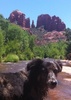
I passed the very nicely kept Blue Ridge campground and started the first climb of the day. It was rough and rocky, but over quickly after about 400 feet of elevation gain. Once on top of the mesa, the trail smoothed out and I was able to make a good pace all the way to the edge of the canyon above East Clear creek. There were a few rough spots where a herd of cattle had traversed the trail after a rainstorm, leaving stretches of heavily potholed trail that made me step carefully.

Dropping down into the canyon, the trail got a little rough again and I had a few minor slips and stumbles on some loose rock, but nothing close to taking a fall. I was wearing my new pair of Altra Lone Peak hikers and the tread is thankfully very grippy on this type of stuff, compared to my last pair of shoes. As I approached the bottom it looked dry at first, but getting closer I was able to notice some pools of water that were suitable for filtering. Not knowing how far it would be until the next water source, I topped my 4L container off with about a liter and continued up the trail on the opposite side of the canyon, which was easy to spot.

The climb up and away from East Clear creek was the last "big" ascent of the day, but at only 300ish feet it was not very strenuous and I was at the end of FR123A before I knew it. At this point I had covered 7 miles and the recurring cramp in my left hip socket started to be noticeable, so I welcomed the next mile of easy road walking along FR123A. Just before it meets FR123, you'll have to be paying attention because the only indication the trail goes back into the trees is a small cairn with a very faint path leading away from the dirt road.

Now I was back on the singletrack and walking through some nice ponderosa forest again. The serenity of this was fleeting due to the fact that the trail here parallels FR123 for quite a distance, and the sounds of UTV traffic flying up and down the road permeated the air despite me being down below a long hill and unable to see the road itself. Oh well, I just tell myself they have just as much of a right to be there as I do, and I can still enjoy nature with other people nearby.

After crossing FR123 at the 10 mile mark, I noticed rake marks along the trail indicating some very recent trail maintenance. Continuing about a mile further, I passed through an open gate and began to descend the set of switchbacks going down into General Springs canyon. About halfway down, I encountered the trail stewards for this section, with their rake, moving loose rocks and smoothing the trail. I didn't get their names, but they were very nice people who wished me well as I resumed hiking after our brief conversation. I'm thankful there are folks out there who spend their time to ensure others have a nice experience in the outdoors.

Just a little past the bottom of the switchbacks, I hit the junction with Fred Haught trail, and I was back in familiar territory. I hadn't been on Fred Haught since a few years back, and I was happy to see there was just as much water in the canyon as the last time I visited. Not much flow to speak of, but the water was fairly clear and would be a great source to filter from along most of the length of upper General Springs canyon. It was about 12:30, and I stopped on a nice rock to have a quick snack and load back up on electrolytes.

The rest of the way down the trail to General Springs cabin was probably my favorite trail section of the day. Lots of ferns and soft sand on the path that felt nice on my feet that were starting to ache a bit. I encountered just one other hiker who was heading north, the only other person I saw on trail besides the trail stewards for the entire day. The trail crosses over the creek 3 or 4 times in this section, but it's easy to hop across the rocks and avoid stepping in water or mud.

Walking past the cabin at the end of the trail, I had finished Blue Ridge passage 27, my first fully completed passage of the entire AZT. I've been all over the AZT between Mazatzal Peak and the Rim in the last several years, but this was my first segment fully hiked end to end in its entirety. I didn't have much desire to pause and reflect on that, since some degree of pain was starting to set in and there was still about 2.5 miles between me and my car. It was pretty slow going as I started down the Rim, but after a few minutes I passed the junction for the railroad tunnel trail and I was on the home stretch.

I didn't want to just follow the power line directly to the trailhead so I kept my eye out for the Col. Devin trail branching off to the left toward the headwaters of the East Verde. Sure enough, about 1.25 miles down from the edge of the rim, there was a sign directing me onto the desired trail. I was in a bit of a rush to finish so I didn't spend too much time enjoying the nice riparian scenes as I descended, but since I live pretty close I can always come back to hang out and wander around the creek and nearby Pieper Hatchery spring, which is a nice shady hillside with trickles of water surrounded by tons of Vinca plants totally covering the ground. Very lush and jungle-y.

Anyway the last push to the car featured a strong finish, with me hobble-jogging the last 1/4 mile over the bridge and up to the trailhead. I got there a few minutes before 3pm, giving me a total time on the trail of just under 7 hours to walk from highway 87 to Washington park. I'm planning on hiking the entire Highline trail about a month from now, so this was a good warm up to prepare me for the 14 miles x 4 days that it'll take me to go from 260 trailhead to Pine, and onward to other longer thru-hikes from there. I've got my sights set on the Long trail in 2023, tune in to find out if I can pull it off.
wildflower observationwildflower observationwildflower observationwildflower observationwildflower observation
Wildflowers Observation Light
Scattered occurrences of several brightly colored species

water 1 out of 5water less than maxwater less than maxwater less than max East Clear Creek @ AZT #27 Pools to trickle Pools to trickle
At trail crossing, a few clear puddles with floating algae

water 1 out of 5water 2 out of 5water 3 out of 5water less than max East Verde River - Source Medium flow Medium flow
Typical flow along Col. Devin trail, clear cool water
_____________________
 
Aug 27 2022
avatar

 Routes 137
 Photos 1
 Triplogs 105

44 female
 Joined Oct 21 2016
 Tempe, AZ
Blue Ridge - AZT #27Payson, AZ
Payson, AZ
Hiking avatar Aug 27 2022
MAPTriplogs 105
Hiking15.31 Miles 1,251 AEG
Hiking15.31 Miles   6 Hrs   31 Mns   2.44 mph
1,251 ft AEG      14 Mns Break
 
no photosets
1st trip
Linked   none no linked trail guides
Partners none no partners
I'm sure it's not always like this but I have never seen as many different crazy colored and shaped mushrooms in my whole life combined, let alone over one hike! This was the most fun hike with shroomy surprises along every other step in some sections. Beautiful beautiful hike with water everywhere, mostly easy and flat, but enough "ups" to get a good sweat going.

water 1 out of 5water 2 out of 5water less than maxwater less than max East Clear Creek @ AZT #27 Light flow Light flow
_____________________
 
Aug 13 2022
avatar

 Guides 12
 Routes 192
 Photos 863
 Triplogs 356

42 male
 Joined Nov 30 2015
 Phoenix, AZ
Cabin Loop - Mogollon RimPayson, AZ
Payson, AZ
Run/Jog avatar Aug 13 2022
ShatteredArmTriplogs 356
Run/Jog22.50 Miles 3,327 AEG
Run/Jog22.50 Miles   5 Hrs   59 Mns   4.01 mph
3,327 ft AEG      22 Mns Break
 
no photosets
Originally was gonna go camping but was too lazy, so I headed up to Washington Park to run a cabin loop with some friends. Probably have done this one at least a half dozen times, but it's always worth another go. Started at around 8:30 am hoping to get done before the storms hit, but wasn't confident in that.

I always like to get the Rim Rd section over with first; luckily with the recent rain it wasn't too dusty. Tried to follow the Gen Crook trail tread a couple of times, but it's spotty.

Everything is nice and green now, some of the small drainages on Houston Bros had water, but surprisingly there wasn't any more water at Aspen Spring or Pinchot Cabin than there was a month or so ago. Started hearing thunder at Bear Canyon or so, but the storms seemed to be moving in a favorable direction, and we managed to avoid them. Didn't get any rain until after we left the trailhead.
_____________________
  1 archive
Jul 07 2022
avatar

 Guides 4
 Routes 29
 Photos 1,691
 Triplogs 467

male
 Joined Sep 08 2002
 Ahwatukee, AZ
Blue Ridge - AZT #27Payson, AZ
Payson, AZ
Hiking avatar Jul 07 2022
SredfieldTriplogs 467
Hiking6.40 Miles
Hiking6.40 Miles
 no routes
Linked   none no linked trail guides
Partners none no partners
We had an enjoyable and rewarding trip in the cool pine trees along AZT Passage 27, from General Springs to a mile or two past FR 123.

Removing the aging and mostly superfluous fiberglass signposts has been a nagging task, and the Eagle Scout candidates weren’t biting on this chore, so this was the day to pull them out. Being fiberglass and sitting in the AZ elements for maybe 15+ years, they were fading and delaminating; the stickers intended to convey a message were faded and chipping away. Their sell-by date has come and gone, so out they come. The tool for this weighs 20 pounds, more then we care to lug the 6 miles, so we used a pick. Swat the sharp end through the sign just below ground, then pry it out. We carried the spoils to the nearest road, dropped them, and picked them up on our way out.

The bonus was a 20-inch deadfall across the trail. Switching off between us on the saw made short work of it.

Cloudy pools along the canyon, gooey thick green stuff in the cattle tanks.

Another fine day on the AZT.
_____________________
Shawn
The bear went over the mountain to see what he could see.
 
Jul 04 2022
avatar

 Guides 1
 Routes 61
 Photos 604
 Triplogs 79

male
 Joined May 28 2019
 Phoenix, AZ
Blue Ridge - AZT #27Payson, AZ
Payson, AZ
Hiking avatar Jul 04 2022
kyleGChikerTriplogs 79
Hiking48.39 Miles 8,570 AEG
Hiking48.39 Miles
8,570 ft AEG20 LBS Pack
 
1st trip
Linked   linked  
Partners none no partners
The purpose of this section was to hike Passages 27 and 28 on the AZT. My mom and I went up early and hiked from Middle of No Where, AZ to Mormon Lake TH. That was the first day, 18.3 miles. Dad and sister picked us up at Mormon Lake TH, and then we all camped near FR751B just north of Blue Ridge reservoir. The next day was another day of hiking for the two of us, and we went back north to Middle of No Where, AZ where our car was, 14.7 miles. The last day, we left a car at camp on FR751B, drove the other car to the Battle of Big Dry Wash (FR300). Dad dropped us off there to hike back to FR741B, 12.5 miles, and he took the scenic way home (he didn't feel like hiking on this trip). In between all the hiking were lots of great memories made in the tent, around the table, and under the stars.

The hike itself was amazing and to me captures everything I love about the vast ponderosa pine forests of northern AZ. Going for endless miles, sometimes through heavy forests, sometimes through light forests, sometimes through meadows, sometimes passing wildlife tanks, just enjoying every bit of the experience along the way. The soft pine needles under the feet, discussing the life cycle of a fern and how it's different than most plants, occasionally some great views like on the Mogollon Rim looking out, and watching the butterflies daintily landing on flowers. God's creation is truly wonderful, and there's nothing quite like passages 27 and 28 bring that to the forefront.
Enjoy the photoset!
 Flora
 Flora [ checklist ]
[ checklist ]  Common Mullein

water 1 out of 5water 2 out of 5water less than maxwater less than max Box Canyon Light flow Light flow
Plenty of water through here

dry East Clear Creek @ AZT #27 Dry Dry
No water in CC Cragen here.

water 1 out of 5water 2 out of 5water less than maxwater less than max General Springs Quart per minute Quart per minute
I didn't investigate super closely, but there was definitely water by the cabin.
 
Jun 10 2022
avatar

 Routes 3
 Triplogs 3

62 male
 Joined Dec 23 2019
 Phoenix, AZ
Partial cabin loop, AZ 
Partial cabin loop, AZ
 
Hiking avatar Jun 10 2022
kgustinTriplogs 3
Hiking28.14 Miles 2,996 AEG
Hiking28.14 Miles   44 Hrs   44 Mns   2.20 mph
2,996 ft AEG1 Day   7 Hrs   55 Mns Break36 LBS Pack
 
no photosets
1st trip
Route Scout Route Recorded  on Route Scout | Pop | Map | Popup | MapDEX
0.03 miles - 4:04 pm
Water flowing along Fred Haught here. Saw large herd of mule elk and calfs-10
 
May 30 2021
avatar

 Guides 3
 Routes 7
 Photos 514
 Triplogs 94

43 male
 Joined May 21 2004
 Phoenix, AZ
Blue Ridge - AZT #27Payson, AZ
Payson, AZ
Backpack avatar May 30 2021
SunDevil3Triplogs 94
Backpack18.60 Miles
Backpack18.60 Miles   22 Hrs   30 Mns   2.40 mph
30 LBS Pack
 no routesno photosets
1st trip
Linked   none no linked trail guides
Partners none no partners
My oldest daughter needed to be dropped off at sleep-away camp in Happy Jack on Memorial Day... lo and behold, the camp was less than one short mile from the Northern terminus of Passage 27. You mean, my wife HAS to be .72 miles from an AZT trailhead on a work holiday? Sign from the Gods received! Time to get Passage 27 in the books.

My Jeep's reliability has waned rapidly in the past six months and stalling at a stoplight the day before my trip enticed me to rent a car in the madness that is post-COVID rental cars on a holiday weekend at Sky Harbor. Hold your gasps-- it was all fairly painless-- and I was ready for a 5AM departure from Chandler in my fancy-dancy Kia Forte rental! I think it was Stephen Wright who said, "Nothing says off-roading like a rental agreement in the glove-box" and I did my best to make good on that statement this past weekend. FR300/Rim Road from 87 to the Southern TH was a bit further than I had guessed. The Kia made it just fine but I did use caution on my way over some of the larger ruts.

Hit the trail NB by 8:15AM and a good pace. Water was pretty plentiful during the first 1-2 miles but dried out quickly and permanently for the rest of the passage thereafter. I did not see much wildlife aside from a few various lizards and birds. About 8 miles in I hit the steep descent to the creek where I stopped for a rest and map check. I tried to figure out how the trail proceeded up the opposite bank on the topo but saw only two small switchbacks in an otherwise straight ascent. Well, that was correct, and it was a very steep ascent indeed. Not too long, but it had me breathing heavy for sure.

After that climb it was pretty level or gradual downhill the rest of the way to the Northern TH where I arrived around 2:45PM. I only saw four other groups totaling eight people the entire day. :D

My blister prevention skills still suck and my feet were burning so I hiked about one half mile into Passage 28 and found a camp spot off the trail and over a small ridge under some pines. I would have gone a bit further in to avoid the noise from 87 but was happy just to get my boots off and rest for a bit. Overnight was peaceful and quiet and only got down to about 45F so not too chilly either.

In the morning, I threw my boots back on my sore feet and grabbed some water for a quick jaunt further up Passage 28. I only ventured about 1.5 miles North before turning back to relax in the tent and read a bit before my ride arrived at 10:30AM. I met the family for camp dropoff and quickly turned back down 87 to retrieve the Kia. Storm clouds had rolled in about 40 min before they picked me up and I did not like the prospect of getting the Kia 12 miles out FR300 on wet dirt (sometimes known as mud.) Luckily, the storm held off save for a few sprinkles and the adventure ended successfully.

Passage 27 (and a teeny bit of 28) are done!
_____________________
"Being unselfish is a natural high, like hiking or paint thinner."
- Homer J Simpson
 
May 23 2021
avatar

 Photos 9
 Triplogs 7

30 male
 Joined May 09 2018
 Phoenix, Arizona
Blue Ridge - AZT #27Payson, AZ
Payson, AZ
Hiking avatar May 23 2021
lhalloranTriplogs 7
Hiking13.80 Miles
Hiking13.80 Miles   4 Hrs   24 Mns   3.39 mph
      20 Mns Break10 LBS Pack
 no routesno photosets
1st trip
Linked   none no linked trail guides
Partners none no partners
Out and back day hike from 87 to Clear Creek, slowly but surely completing another section hike of the AZT.

Trail is really nice, easy to follow, but completely bone dry including Clear Creek, which was 8 feet across and 4 inches deep last month. Doesn't make any sense that's not listed as a water source on this hike so I went ahead and added it. If that's verboten, let me know which gulag to report to.

dry Elk Tank Dry Dry
completely dry
 
May 22 2021
avatar

 Triplogs 43

70 female
 Joined Jan 01 2019
 Sierra Vista
Blue Ridge - AZT #27Payson, AZ
Payson, AZ
Hiking avatar May 22 2021
clyde_joelleTriplogs 43
Hiking15.40 Miles
Hiking15.40 Miles   9 Hrs      1.71 mph
 no routesno photosets
1st trip
Linked   none no linked trail guides
Partners none no partners
Hiked this Passage in 2 day hikes (5/22 & 5/23) North to South in conjunction with Pass. FR751 near Rock Creek CG to FR 300 on 5/22 and Blue Ridge TH to FR 751 on 5/23. Used moon-walk shuttle with RAV and Jeep
 
average hiking speed 2.27 mph
1, 2, 3, 4, 5 ... 7  Next

WARNING! Hiking and outdoor related sports can be dangerous. Be responsible and prepare for the trip. Study the area you are entering and plan accordingly. Dress for the current and unexpected weather changes. Take plenty of water. Never go alone. Make an itinerary with your plan(s), route(s), destination(s) and expected return time. Give your itinerary to trusted family and/or friends.

helpcommentissue

end of page marker