|
| | | Heliograph-Webb-Clark, AZ | | | |
|
|
Heliograph-Webb-Clark, AZ
| | |
| |
|
| Hiking | 11.00 Miles |
2,399 AEG |
| | Hiking | 11.00 Miles | | | |
| 2,399 ft AEG | | | | |
|
|
| |
| Partners |
|
[ show ]
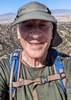
| partners | | I had never been to the Pinaleno Mountains, so I decided that now would be a good time to go. My main goal was to bag a couple of 10,000 foot peaks that I haven't hiked: Webb and Heliograph. While I was out there, I figured that I would go ahead and bag Clark also. I managed to talk Tracie, my favorite and intrepid hiking companion, out of hiking Silly Mountain and to come to the Pinaleno's instead. She was glad that she did!
Our first hike was to Heliograph Peak. We decided to do the peak the short way via Shannon Campground. We took SR 366 (the Swift Trail) to the turnoff for the campground, and we parked at the turnoff just before a locked gate. SR 366 was narrow and curvy, but it was paved all the way to the campground turnoff. We had intended to do a loop hike that would take us to the Heliograph summit about half-way through the loop. However, it was VERY foggy, and visibility was limited to no more than 200', so we just did an up-and-back hike on the easy-to-walk on forest road. We saw 3 deer near the summit, and came across some nice fall foliage while walking the road. However, with the fog, we could only see the trees that were right in front of us. Fog also kept us from seeing much of anything at the summit.
Second up was Webb Peak, which we did via Soldier Creek. By the time that we got back to my truck after coming down from Heliograph, it started to rain -- and it was a wet ride to our parking spot for Webb Creek. To get there, we continued on SR 366 (which became unpaved just past the Shannon Campground turnoff). SR 366 eventually becomes FR 803, which is also unpaved. Even though the road is unpaved, it is very well maintained and virtually any vehicle can drive on it. We continued to FR 88 (Webb Creek Rd), where we turned right and parked a short distance before you come to a gate. It was still raining so we sat in the truck for a few minutes until the rain stopped. It was still very foggy, so we again decided to do an up-and-back hike to the peak on the forest road. I had originally thought about doing a loop by coming back down on the Ash Creek Trail, but several recent triplogs cited lots of deadfall on the Ash Creek Trail, and we didn't want to deal with it in the rainy weather. There were quite a few yellow-leaved aspens along our hike to the summit, but with the fog we could only see what was right in front of us. When we got back to my truck we saw 4 deer a short distance away.
Our third and last hike was to Clark Peak. From our parking spot for Webb peak, we drove about 5 miles to the end of FR 803 and parked. It was still foggy, and we started out on the Clark Peak Trail but we were going downhill and I thought that we might not be going the right way. So we backtracked a bit and walked on FR 730. By this time the fog had lifted and we got to see lots of fall foliage on FR 730. We then backtracked again back to my truck, and this time followed the Clark Peak Trail to Clark Peak, where we had to do some off-trail scrambling to get to the summit. Now that the fog had lifted, we finally got to enjoy some nice views atop Clark Peak.
Mileage and elevation gain for the 3 peaks:
Heliograph: 4.6 miles; AEG of 962'
Webb: 3.6 miles; AEG of 712'
Clark: 2.8 miles; AEG of 725'
The mileage and elevation gain above is the sum for the 3 peaks.
I enjoyed this area, and plan to go back again! |
|
Autumn Foliage Observation Substantial
There were quite a few yellow aspen leaves, and now is a good time to go and check them out. |
|
| _____________________
| Civilization is a nice place to visit but I wouldn't want to live there |
| | |
|
|
|
 Route Editor