username
X
password
register
for free!
help
ArticlesGuidesRoutes
 
Photosets
 
 Comments
triplogs   photosets   labels comments more
Weaver's Needle Summit - 21 members in 63 triplogs have rated this an average 4.8 ( 1 to 5 best )
1, 2, 3, 4  Next
63 triplogs
login for filter options
Mar 18 2023
avatar

 Guides 3
 Routes 633
 Photos 8,249
 Triplogs 605

54 male
 Joined Apr 13 2011
 Gilbert, AZ
Weaver's Needle SummitPhoenix, AZ
Phoenix, AZ
Hike & Climb avatar Mar 18 2023
ddgrunningTriplogs 605
Hike & Climb11.40 Miles 3,748 AEG
Hike & Climb11.40 Miles   10 Hrs   38 Mns   1.51 mph
3,748 ft AEG
 
1st trip
Partners none no partners
Route Scout Route Recorded  on Route Scout | Pop | Map | Popup | MapDEX
Weaver's Summit has been on my to-do list for years, but I've kept putting it off until I could go with someone more experienced. But this weekend, I just decided to go with my own experience ....

I did invite a friend to come along, though he has less experience than I do.

On to the adventure ...

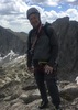
We arrived at Peralta TH around 7 am. Still a fair number of spots in the main parking lot at that time, but I was a little surprised how busy it was that early--not just at the TH but all along Peralta Road.

That said, on the trail itself, there wasn't much traffic at that time. We made it to Fremont Saddle and took a few photos before dropping into East Boulder Canyon. I hadn't hiked through here since the fire. Lots of regeneration, but it's going to be awhile for the larger stuff.

We turned off the trail at a cairned spot, even though it was a bit sooner than my downloaded RS route. It worked out fine, and as we began to scramble up to the base of the Needle, we gradually veered toward and then joined the HAZ route. On the return, we took the HAZ route all the way back to the trail, which I would recommend (though curiously, there is no cairn where the HAZ route connects to Peralta trail).

There is a nice, large saguaro on the side of the climb that provides a good landmark for the approximate route. I'll include in the photos.

The scramble is steep, but not a bushwhack, and it went by faster than I thought it would--particularly with all of our climbing gear and rope.

Arriving at the base of the notch/saddle between the north and south Needle summits, we encountered a group of three that just finished descending after spending the night on top, and another group of 3 gearing up for the climb.

As per the description, there are 4 pitches. The first two are a continuous climb up the initial chute. At the top of pitch 1 are bolted anchors and chain, which have replaced what used to be a pipe in the rock. The group in front of us roped up for pitch one. We just scrambled up this section, and I didn't view it as particularly technical.

As it turned out, pitch 2 was the only one we roped up for. I lead climbed it, placing 3 anchors along the way. At my experience level, it was plenty technical :scared: . I was happy to arrive at the chockstone, which I navigated underneath. Next time, I'll try the right or left side, both of which are more technical.

I top-roped belayed my partner's climb from the bolted anchor with rings above the chockstone. As he was coming up, a group of two more arrived at the base of the climb.

The third pitch is right next to the chockstone, and involves a short, 15-foot (ish) climb that navigates around a slightly protruding rock face on the left. Because the protrusion forces you right--towards the exposure--it can be slightly unnerving without protection, but with one or two moves, it's not a problem. We free climbed it. Just above pitch 3 was an anchor (webbing and a ring), which we used to short rappel on the way back down.

From the top of pitch 3 to the bottom of pitch 4 is a semi-lengthy--and fun!--scramble. Some exposure, but not crazy.

The bottom of pitch 4 is just beyond the slick rock face over which we would rappel on the way down.

As noted, pitch 4 has significant exposure, but is easily climb-able, due to the plentiful jugs--great foothold and handholds. As long as you don't let the head games get to you, it's basically like climbing a ladder. We free climbed this one as well.

At the top of pitch four, the bolted/chained anchor for the rappel is just off to the right, and there is a final, relatively gentle scramble to the summit.

The group of 3 in front of us were starting their rappel down, as we popped out of the climb up pitch 4. We wished them well, and went on to enjoy the summit in solitude.

The two campsites at the summit are small but well protected, and other than the pain of carrying up more gear, I'd love to watch the sunset/sunrise from this vantage point.

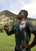
After taking in the vistas and grabbing lunch, we began the descent after 20-30 minutes on top.

The first rappel was great--straightforward and sheer, without obstacles. At the base of the rappel, I was able to look down to the chockstone at the top of pitch two and saw that the group of two who trailed us were STILL on pitch 2. I hoped they were ok.

We scrambled down to pitch 3, to find that the group of two were still making their way up pitch 2, and the group of three in front of us were also waiting to be able to descend. So, it was a bit of a traffic jam, with all three climbing groups of the day converging on one spot.

We hung out above pitch three until the ascending group got up pitch 2 and 3. Then, we coordinated with the group in front of us for the rappel. They fixed their anchor and used the full length of their rope to rappel all the way to the base of the climb; then we used their rope as a pull and rappelled down our rope. It was nice not to have to set up an additional rappel.

From the base of the climb, we scrambled back down the approach slope and were happy to be back on an actual trail. On the return, there was very little traffic, and we enjoyed beautiful--and very clear--skies and afternoon sunlight. Great for photos.

The last part of the trail (as is often the case) seemed longer than I remembered, but plentiful water in the creekbed and nice views made the return trip great.

Glad to check this one off my bucket list, finally. And glad to have gained some additional climbing experience in the process.
_____________________
  1 archive
Feb 10 2023
avatar

 Guides 59
 Routes 1,100
 Photos 1,191
 Triplogs 1,290

male
 Joined Jan 01 2023
 Arizona
Weaver's Needle Summit - East c4 RoutePhoenix, AZ
Phoenix, AZ
Hike & Climb avatar Feb 10 2023
pseudalpineTriplogs 1,290
Hike & Climb8.62 Miles 3,303 AEG
Hike & Climb8.62 Miles   7 Hrs   1 Min   2.18 mph
3,303 ft AEG
 • 4th
 
Route Scout Route Recorded  on Route Scout | Pop | Map | Popup | MapDEX
Windy & mellow day, timed perfectly to pickup the kiddos at three.
  7 archives
Mar 19 2022
avatar

 Routes 137
 Photos 1
 Triplogs 105

44 female
 Joined Oct 21 2016
 Tempe, AZ
Weaver's Needle SummitPhoenix, AZ
Phoenix, AZ
Hike & Climb avatar Mar 19 2022
MAPTriplogs 105
Hike & Climb7.61 Miles 3,301 AEG
Hike & Climb7.61 Miles   12 Hrs   47 Mns   0.60 mph
3,301 ft AEG
 
no photosets
1st trip
Linked   linked  
Partners none no partners
Whew what a day! The approach and return are probably the most exhausting part carrying gear, water, rope, etc. The trail heading up to the chute is much better marked than the last time I came though so I was grateful for not having to add trail finding to the list of exhausting parts.

(Pitch 1) Once we reached the base of the chute, all four of us climbed up pretty easily to the first set of anchors. A couple of us needed a little help on a short smooth section of rock but the rest is all easy to walk up. (Pitch 2) My friend led the second pitch and I believe she placed two pieces of pro, as recommended in the original guide. She went up the right side of the chute. The climbing is easy and straightforward but there is a small section just before reaching the chockstone that throws you out at a weird angle and feels pretty awkward and exposed (even though I was on belay so it was more of a head trip than a risk). My husband climbed up the right side to help guide my friend but he didn't have a rope and felt comfortable going up solo (he is not a solo kind of person so I was pretty surprised by his comfort level). There was another group who got to the chute around the same time as us and started climbing but they went to the left of the chockstone. Apparently, there had been some miscommunication because we were all climbing at the same time and it was challenging to understand who was calling to who and ropes all over...wouldn't recommend in such a small space.

(Pitch 3) Once we all got to the chockstone the two climbers in our group went up the short 15' climb and belayed myself and our other friend. There is an anchor immediately at the top of the 15' climb that they used. Again, there is nothing difficult about this short section but the exposure can be a head trip and we were all about safety first.

At the top of the 3rd pitch, the "trail" is extremely gravely and pretty steep at first. It is an obvious trail but less of a trail and more of a series of scrambles with a few steps of gravel between each one. Between pitch 3 and the base of pitch 4 there is nothing exposed but there are a few spots people may need a hand or lift if they have shorter legs.

(Pitch 4) We reached the base of pitch 4 as the other group was rappelling down. My husband climbed up with the rope so he could belay the rest of us from the top. He said he felt comfortable and didn't feel like the exposure was much. Honestly, I didn't feel like the exposure was as bad at that point either and I am pretty scared of heights and way scared with exposure. Of course, I was on belay & I may be singing a different tune if I wasn't but I remember feeling like the rope was just in the way at that point. The first maybe 15'-20' of the climb are on a piece of rock that sticks out a little but after that the climb goes to the side of a protected crack. And then, short scramble aaaaand THE TOP!

WOW. WOW. WOW. How incredibly cool to be on top of the beautiful needle that is our beacon from everywhere in the valley. It was perfect. We signed the summit log and explored all the views. The campsites are well protected with little walls and there are 2 ammo boxes filled with all kinds of emergency supplies - snacks, emergency blankets, condoms - everything a person may or may not need if they got stuck at the top of Weaver's Needle! :DANCE: The campsites aren't big though and seem more suited to sleeping bags vs tents. My friend had camped up top before but I really didn't want to haul any more gear than I had to up exposed areas and, after being up top, I was happy about our decision. We enjoyed as many moments as possible up top and decided it was time to head down so we could time our hike out to beat the heat and hopefully give us some time hiking in the dark. I think the temps were low 80's but we had been feeling that sun and were ready for a break from it.

The rappel anchors are easy to spot and to reach. The rappel ends at the base of pitch 4 and heads down a straightforward vertical wall. Other descriptions talk about it being "overhanging" but I wouldn't use that term for this. Your feet leave the wall for a minute towards the bottom but the wall is mostly vertical with a slight inward slope in one section.

We scrambled down to the top of pitch 3 and I think we all rappelled down this short section because the exposure is much more visible coming from the top. Then onto the final rappel down the chute. Two of us went down on a single rope to make sure the rope was long enough for the others to use a double rope and retrieve. It wasn't. We had a 60m rope and, with it doubled, it ended maybe 15' above the lowest anchor. The two girls made it work though and used the bolt to the left of the lowest anchor to re-set the rope. I'm sure someone could climb down that small section too but we preferred to re-set the rope.

We headed down Weaver's slope, waved goodbye, gave our thanks & our cheers and all the good stuff. We talked with a group camped at the base who were planning to climb in the morning. Seems like a pretty good stream of people are climbing Weavers regularly now. We wished them luck and headed back on the main trail to watch the sunset as we hiked out. It was a pretty perfect day. We took it super slow and enjoyed ourselves at every turn. I think a group of confident climbers could be in and out if they wanted to do it fast but I was actually surprised at our time given how much we just hung out at every opportunity. Overall amazing adventure!
_____________________
 
Jan 29 2022
avatar

 Guides 1
 Routes 269
 Photos 613
 Triplogs 1,360

50 male
 Joined Dec 22 2003
 Tucson, AZ
Weaver's Needle SummitPhoenix, AZ
Phoenix, AZ
Hike & Climb avatar Jan 29 2022
RedwallNHopsTriplogs 1,360
Hike & Climb8.10 Miles 3,414 AEG
Hike & Climb8.10 Miles   8 Hrs      1.01 mph
3,414 ft AEG
 no routesno photosets
Linked   none no linked trail guides
Partners none no partners
Fun times. Shelley hadn't done it so I had her lead it. Brought a light rack and she placed a handful of gear.
_____________________
 
Mar 27 2021
avatar

 Guides 37
 Routes 556
 Photos 10,872
 Triplogs 1,052

43 male
 Joined Jan 21 2013
 AZ
Weaver's Needle SummitPhoenix, AZ
Phoenix, AZ
Hike & Climb avatar Mar 27 2021
FOTGTriplogs 1,052
Hike & Climb20.06 Miles 4,288 AEG
Hike & Climb20.06 Miles   14 Hrs   48 Mns   1.57 mph
4,288 ft AEG
Onsight II  • Trad • Not good
 
Pro: a few small cams
I finally decided to give the west side of Weavers a try and then after Weavers, Katie and I continued on for a bit of a western Supes super loop.

We met Jordyn at the Peralta Trailhead just after six and were on our way to the west chimney shortly after. I don’t know why I thought approaching Weavers from Terrapin would be a good idea, but that is what we went with and it definitely added some work to the approach as we had to complete a sometimes attention getting high traverse around Weavers northwest corner. I was not happy about the added time, but we did come across some pretty intriguing caves/old mines along the way.

From the base of the obvious west chimney we roped and “racked” up at the chains that mark the beginning of the second pitch. The first pitch is an easy class four scramble. I placed a few small cams and exited out the left side of the chock stone for the 5.4 finish. Going under the chockstone is rated at easy 5th class and going to the right is rated 5.2. We left the ropes at the rap anchors above the chockstone and we soloed the standard route to the top.

After realizing how close Peralta was, we chose to scramble back down to Peralta for our descent vs traversing back around Weavers NW corner. From Peralta, Jordyn took our rope and small rack and headed back to the trailhead. Katie and I then headed towards the Dutchman Trail, which we took all the way to Charlebois Spring. There were several backpackers camped along the trail to Charlebois and near the spring. After an extended break at the spring, we continued on with our loop. We made a quick detour up Music Canyon along the way out and finished just before 9:00 p.m. to a bright full moon.

A nice 20 mile jaunt through the Supes with an iconic summit along the way. The lack of water out there was a little depressing, but there is enough to backpack, the desert is green and it feels like spring out there. We encountered a hillside of poppies on our descent to Peralta and encountered significant poppies lining the trail and hillside along the trail shortly after beginning the gradual climb from the LaBarge Spring area.
wildflower observationwildflower observationwildflower observationwildflower observationwildflower observation
Wildflowers Observation Isolated
A hike into La Barge Spring right now would net you a modest wildflower show along the trail as you approach the intersection of the Dutchman and Red Tanks Trail. Its short, but sweet.

water 1 out of 5water less than maxwater less than maxwater less than max Barks Canyon Pools to trickle Pools to trickle

water 1 out of 5water 2 out of 5water 3 out of 5water 4 out of 5 Charlebois Spring Gallon + per minute Gallon + per minute
full as usual, no fire damage near.

water 1 out of 5water less than maxwater less than maxwater less than max Music Canyon Pools to trickle Pools to trickle

water 1 out of 5water 2 out of 5water less than maxwater less than max Music Canyon Spring Quart per minute Quart per minute
A few nice pools and some trickling water

water 1 out of 5water 2 out of 5water less than maxwater less than max White Rock Spring Quart per minute Quart per minute
A few small pools of standing water
_____________________
  3 archives
Jan 31 2021
avatar

 Guides 37
 Routes 556
 Photos 10,872
 Triplogs 1,052

43 male
 Joined Jan 21 2013
 AZ
Weaver's Needle SummitPhoenix, AZ
Phoenix, AZ
Hike & Climb avatar Jan 31 2021
FOTGTriplogs 1,052
Hike & Climb8.10 Miles 3,414 AEG
Hike & Climb8.10 Miles
3,414 ft AEG
Lead II  • Trad • 5.1 Not good • 1 Pitch
 
The 6th time was a charm.

We did not see many hikers on the way in, or the way out. Barks Canyon was flowing nicely and there was a light flow along Terrapin Trail. The final approach and off trail navigation to the base is considerably easier now due to the lack of vegetation. No bushes to whack. From Bluff Springs Trail to the base of the Needle, it was 100 percent devastation for the most part, which was a little tough to see. But the long scramble and iconic summit still elicited some nostalgia and brought us joy.

It took us 7.5 hours car to car.

water 1 out of 5water 2 out of 5water 3 out of 5water less than max Barks Canyon Medium flow Medium flow
_____________________
  2 archives
Mar 31 2020
avatar

 Guides 59
 Routes 1,100
 Photos 1,191
 Triplogs 1,290

male
 Joined Jan 01 2023
 Arizona
Miners and Weavers Needles, AZ 
Miners and Weavers Needles, AZ
 
Hike & Climb avatar Mar 31 2020
pseudalpineTriplogs 1,290
Hike & Climb13.15 Miles 3,970 AEG
Hike & Climb13.15 Miles
3,970 ft AEG
 • 4th
 
no photosets
1st trip
Solo trip of Miners Needle Regular Route that traverses narrow, exposed cl.4 ledge above The Pick's lower pitches. Final scramble to main summit is on the south face. Afterwards, hiked over and climbed the east side Hiker's Route of WN to the summit, then rapped West Chimney route and hiked out to Peralta TH.
  11 archives
Mar 21 2020
avatar

 Guides 1
 Routes 12
 Photos 17
 Triplogs 80

35 male
 Joined Oct 05 2017
 Tucson, AZ
Weaver's Needle SummitPhoenix, AZ
Phoenix, AZ
Hike & Climb avatar Mar 21 2020
jladderudTriplogs 80
Hike & Climb10.80 Miles 3,414 AEG
Hike & Climb10.80 Miles   6 Hrs   22 Mns   2.22 mph
3,414 ft AEG
Solo I  • Trad • 5.2
 no routesno photosets
1st trip
Linked   none no linked trail guides
Partners none no partners
I've been eyeing this one for a while. I did it solo via the West Chimney, using a 70m rope to rappel down. If I were to do this again, I would still take a helmet and shoes; but leave the rope at home. It made for a heavier pack and more awkward climbing. The rope was nice; but I'd be willing to trade the exposed down-climbing in exchange for the lighter pack. I'm a 5.10 lead climber, so take the previous sentences with that in mind. This was my first time in the Superstitions, and golly are they beautiful! I will say, at the risk of calling the kettle black, that there were tons of people out hiking--not all of them socially distanced. I counted at least 100 cars at the Peralta TH and estimate that 95% of those hikers were on the Peralta Trail between the TH and the Fremont Saddle. I didn't see anybody after the Freemont Saddle until I came down from the summit. I took the Terrapin and Bluff Springs Trails back and found them to be much less crowded. I also noticed a peregrine falcon flying around the southern spire of the Needle. We're coming into nesting season, so be mindful to not disturb the falcons.
_____________________
 
Nov 24 2019
avatar

 Guides 37
 Routes 556
 Photos 10,872
 Triplogs 1,052

43 male
 Joined Jan 21 2013
 AZ
Weaver's Needle SummitPhoenix, AZ
Phoenix, AZ
Hike & Climb avatar Nov 24 2019
FOTGTriplogs 1,052
Hike & Climb8.10 Miles 3,414 AEG
Hike & Climb8.10 Miles
3,414 ft AEG
Lead II  • Trad • 2 Pitches
 
Partners partners
NicholeP
Pro: Placed a .4 and a 1 on the way up.
Fifth time is a charm. Met Nichole and some of her friends for a Sunday scramble up the Needle.

We all hiked to the base of the Needle with our pack of dogs, but only Katie, myself and Nichole summitted. Pretty standard trip up the Needle. It was kind of nice to place a little protection for a change when climbing this thing. In fact, I am questioning my decision making process for choosing to free solo this in the past. We only roped up for the first part of the climb and freed the route from below the chockstone to the summit.
 Culture
 Culture [ checklist ]
[ checklist ]  Risky

water 1 out of 5water 2 out of 5water 3 out of 5water less than max Barks Canyon Medium flow Medium flow
_____________________
  1 archive
Nov 14 2019
avatar

 Guides 59
 Routes 1,100
 Photos 1,191
 Triplogs 1,290

male
 Joined Jan 01 2023
 Arizona
Weaver's Needle Summit - East c4 RoutePhoenix, AZ
Phoenix, AZ
Hike & Climb avatar Nov 14 2019
pseudalpineTriplogs 1,290
Hike & Climb8.62 Miles 3,140 AEG
Hike & Climb8.62 Miles
3,140 ft AEG
 • 4th
 
  5 archives
Jan 25 2019
avatar

 Guides 1
 Routes 5
 Photos 656
 Triplogs 512

47 male
 Joined Jul 20 2007
 Gilbert, AZ
Weaver's Needle SummitPhoenix, AZ
Phoenix, AZ
Hike & Climb avatar Jan 25 2019
jtaylorTriplogs 512
Hike & Climb8.10 Miles 3,414 AEG
Hike & Climb8.10 Miles
3,414 ft AEG
 no routes
1st trip
Linked   none no linked trail guides
Partners none no partners
Finally had the weather and the time to do this. And the courage. Since high school I figured summiting Weaver's Needle was the stuff of myth and lore...or at least insanity. When Sam proposed it a couple months ago I decided this is a bucket list item. So off we went, he anxious with the responsibility of my safety; and I naive and starry-eyed. Reality for me hit for the first time at the chalk stone. By the time we reached the insane exposure of the last pitch, it was too late to turn around. Not sure how Sam led, but I know I never will. Two inches is a far enough fall for me.

We ultimately made the summit. I'm sure this is small potatoes for you regular climbers. But for a simple hiker with a fear of heights, this was epic. It was epic for conquering my fears. And it was epic to see my beloved Superstitions from the perspective of a boyhood landmark. That said, I'm good and don't need to do it again!

The descent and return hike took an eternity, but the burger and beer at Handlebar were heaven.

As a side note, there was tons of water in East Boulder Canyon, several poppies in bloom, and some lupines not far behind.
_____________________
“...wilderness is not a luxury but a necessity of the human spirit, and as vital to our lives as water and good bread.”
-Edward Abbey, Desert Solitaire
 
Aug 11 2018
avatar

 Guides 4
 Routes 491
 Photos 10,890
 Triplogs 1,257

55 male
 Joined Nov 20 2012
 Phoenix, AZ
Weaver's Needle SummitPhoenix, AZ
Phoenix, AZ
Hike & Climb avatar Aug 11 2018
BiFrostTriplogs 1,257
Hike & Climb11.85 Miles 3,713 AEG
Hike & Climb11.85 Miles   8 Hrs   53 Mns   1.60 mph
3,713 ft AEG
 no routes
1st trip
Headed into the Supes with Lee with the hope of double summit starting with Weaver's and then Bluff Mountain. Starting about 6am from Peralta we hit Bluff Spring Trail to Terrapin and eventually off trail to the base of Weaver's Needle. Lee had already climbed it a few times and knew what to expect but it was my first attempt. From the previous triplogs it sounded like using a rope was 50/50 proposition. Lee went up right away and I made a few attempts on the rock getting about 1/2 way up just below the most difficult section. Going up seemed to be ok but I was concerned about coming back down. Ultimately I decided this was not my day for a summit and could always return with the proper rope for the downclimb. I waited at the base as Lee hit summit so at least had a nice break with a view!

After Weaver's we continuted off trail down the east side and then across Terapin Trail to the Bluff approach. Went up the west ridge of Bluff Mountain to the main ridgeline and at the summit relativley easily. Lots of gnats or flying ants as others have noted so we didn't stay long. Then down the Ely Anderson trail to Bluff Springs Trail and a quick stop by Bluff Spring. Nice little rattlesnake hanging out at the spring but it didn't seem to mind our presence. Took a short break and then continued back to the trailhead. Temps were a bit warm the last few miles but we had enough water to say well hydrated. Fun hike...just need to go back and get Weaver's!
_____________________
  1 archive
Aug 11 2018
avatar

 Guides 37
 Routes 556
 Photos 10,872
 Triplogs 1,052

43 male
 Joined Jan 21 2013
 AZ
Weaver's Needle SummitPhoenix, AZ
Phoenix, AZ
Hike & Climb avatar Aug 11 2018
FOTGTriplogs 1,052
Hike & Climb12.30 Miles 4,100 AEG
Hike & Climb12.30 Miles   8 Hrs   53 Mns   1.61 mph
4,100 ft AEG
 
I made a visit to my old stomping grounds with Karl today. The plan was Weavers Needle and Bluff Mountain. Initially, there were some high hopes for running water out there and we even wondered if it would be running across the road on the way in, as we both thought we saw some pretty decent rain coming down out there last night on radar and because Phoenix got hit so hard. But alas this quickly faded as we hit the dry dirt road on the drive in. But no worries we were there to bag some summits, not swim.

The early morning conditions were great out there to start, low humidity with a little breeze. There was trickling water in Barks Canyon and at the intersection with Terrapin. We also ran across some random puddles on the way to the Needle and a couple of very lightly flowing spots along Bluff Springs Trail later in the day. Karl was not feeling the climb when we got to the base of the needle and after a little mulling it over, he decided it would not be in the cards for him today, so I went ahead and bagged it on my own. However, I will admit that I nearly bowed as well, as I was a little shaky in my legs and a little more anxious than usual on the tricky part. I think some of it was dealing with a lot less strength than the last few times I had did it and worrying about my surgically repaired shoulder more than I should have been. Nevertheless, I was able to take a little breather, calm my nerves and it started to come back to me. I ended up taking more time than I should have and a few parts that seemed very easy last time, took more time and attention to detail this time around, but I eventually made the summit. There was a crazy gnat infestation on the summit, so I did not stay long, or even open any of the three summit registers, but I was still able to enjoy the nice moment on top of the symbol of the western Supes. I found the anchor I could not find on the way up and Karl contemplated another attempt with a handline in place, but it barely reached the tricky spot, so it was not going to be much use to him. But eventually we both agreed a return in winter with the right rope was probably the best option and after a little guiding from Karl I completed the down climb.

From Weavers it was on to another western Supes icon, Bluff Mountain. We took a cross country route from the base of the needed to almost the exact spot we would be leaving the Terrapin Trail for our climb up the backside of Bluff. The climb was a little warm at times, but the travel was pretty easy. There was another gnat infestation on the top of Bluff so our stay was short. However, we did have enough time to look over the register and reminisce about all the HAZers in it. That log book up there is seriously 75 percent HAZ users! From the summit it was on to the Ely Anderson Trail and our descent. The fire damage on Bluff from a few years back is almost non existent and it was nice and green up there. After we descended, we made a quick detour to Bluff Springs, as I was curious to if it was flowing and it was. It was a light flow, but steady enough to fill a one gallon bucket in a relatively quick amount of time. We shared our break spot with a nice polite rattler who agreed not to mess with us, if we did not mess with him. It was a bit of an oven at times on our way back to the trailhead, but we made decent time, with only a quick stop to filter some refreshing lukewarm water.

Overall a great day in the Supes! It was really nice to reconnect a little with that area after spending my summer on the road. Even with the slightly cooler day, it was probably a little warm out there for most mortals. Thank you for the cold beverages and driving Karl.


 Named place
 Named place [ checklist ]
[ checklist ]  Weavers Needle

water 1 out of 5water less than maxwater less than maxwater less than max Barks Canyon Pools to trickle Pools to trickle
More pool than trickle, but a decent amount of water.

water 1 out of 5water less than maxwater less than maxwater less than max Bluff Spring Dripping Dripping
Approximately one gallon per 8-10 minutes.

dry Crystal Spring Dry Dry

_____________________
  1 archive
Nov 23 2017
avatar

 Guides 3
 Routes 569
 Photos 11,976
 Triplogs 1,634

50 female
 Joined Sep 18 2009
 Tucson, AZ
Weaver's Needle SummitPhoenix, AZ
Phoenix, AZ
Hike & Climb avatar Nov 23 2017
GrottoGirlTriplogs 1,634
Hike & Climb8.10 Miles 3,414 AEG
Hike & Climb8.10 Miles2 Days         
3,414 ft AEG
 
Linked   none no linked trail guides
Partners partners
spaceholder
Four of us headed out Thanksgiving day to climb Weavers Needle. We backpacked in and have our Thanksgiving dinner. I brought Turkey, sweet potatoes, stuffing and cranberry sauce for Pete’s and my dinner. It was awesome!

The next morning we started out and followed the well trod and cairns route up to the climb. I wore approach shoes. Pete led the pitch from the pipe to the chockstone as one long pitch. We went to the right side which was the hardest move on the trip.

After that we free climbed the rest of the way up. The feet and hands for the climbs were solid and big. I didn’t feel the exposure was too great.

We had lunch at the top and then rappelled off the top and scrambled back to the chockstone. Then we did the final rappel. I remember my first attempt on weavers and how scary the rappel seemed. With my Canyoneering and caving experiences it seems easy now!

We got home in time to eat at the new Sies on River in Tucson.
_____________________
 
Mar 03 2017
avatar

 Photos 490
 Triplogs 190

69 male
 Joined Feb 06 2012
 Mesa, AZ
Weaver's Needle SummitPhoenix, AZ
Phoenix, AZ
Hike & Climb avatar Mar 03 2017
DennisWilliamsTriplogs 190
Hike & Climb8.10 Miles 3,414 AEG
Hike & Climb8.10 Miles   12 Hrs   24 Mns   0.78 mph
3,414 ft AEG25 LBS Pack
 no routes
1st trip
Linked   none no linked trail guides
Partners none no partners
Well now. That was a peach!

Prior to last summer I had never worn a climbing harness. My buddy Jack took me for three practice climbs in the last few weeks to get ready for this one. We did some climbs at Papago Park and also the North McDowells. Gardeners Wall and the Girlie-Man Wall. Hey, I didn't name it. West-side Phil rounded out our climbing trio.

Funny how Weaver's seems so much bigger when approaching with the intent to climb. The trip stats of 8.1 miles and 3400' AEG don't do it justice for sheer exertion. Make no mistake, this is a long, hard day. As so many other trip reports have written, the 45 degree scree slope approach to the base of the Needle and then the return down the slope afterwards are the least fun part of it. Humping up and down all the gear and such. We found the cairned use trail north of Fremont Saddle and that did make it easier so I won't disparage Cairn Builder Man this time. The climbing was pretty much as advertised. Solid foot and hand holds everywhere, though there were times it was tough finding spots to place protection. Jack ran out a 30+ foot lead before taking the chock-stone on the left. I was happy I didn't have to do that without protection. Above the chock-stone we used rope only for the rappel on the way down from the very top. We could have down-climbed this part but we had the rope and the free hanging rappel off the summit was cool.

Some climb the whole thing without rope, even the western route. I guess I can see how that's done but it would take some nerve. I won't do it, at least not from the west. If the east side is easier I might harbor the possibility as a stretch goal. A really big stretch that is. Truthfully, you never have to look for more than 5 seconds to find an excellent hand or foot hold that will comfortably support your weight and you don't have to plan quick moves ahead. Even for the down-climbs you can take your time and look for the next hold with confidence and move only when you are ready. Exposure is in the mind and there isn't any if you don't look down (says the tyro with next to zero climbing experience). The only problem ( ! ) is that if for some goofy reason you did fall, there are many stretches where the consequences would be the most extreme imaginable.

It was a real thrill to finally get up there. Have been looking at it for 50 years. Profoundly humbled, I see it now with new eyes. No silly notion of conquest involved. As with all such adventures Weaver's simply deigned to let me get away with it. Aeons after the last human being has lamented the passing of our species it will still be there, a mighty obelisk erected by nature in celebration of it's own majesty and human-kind's insignificance.
 Culture
 Culture [ checklist ]
[ checklist ]  HAZ - Selfie
_____________________
"Aequanimitas."

- Antoninus Pius
 
Feb 08 2017
avatar

 Guides 8
 Routes 70
 Photos 3,208
 Triplogs 273

59 male
 Joined Oct 07 2017
 Chandler, AZ
Weaver's Needle SummitPhoenix, AZ
Phoenix, AZ
Hike & Climb avatar Feb 08 2017
YoderTriplogs 273
Hike & Climb8.10 Miles 3,414 AEG
Hike & Climb8.10 Miles2 Days         
3,414 ft AEG75 LBS Pack
Lead II G  • Trad • 5.4
 no routes
1st trip
Linked   none no linked trail guides
Partners none no partners
I'm getting to old for this stuff. This one just about killed me. Hike with all this weight was about my limit. The actual technical climbing was easiest part of the hike, but I've been climbing for over 20 years. The climbing was a relief for the legs. Allowed my hands to actually do something.

I'll never do this again, but I'm glad I finally did it. Just should have done it 10 years earlier.
_____________________
J. Yoder
 
Jan 15 2017
avatar

 Guides 37
 Routes 556
 Photos 10,872
 Triplogs 1,052

43 male
 Joined Jan 21 2013
 AZ
Weaver's Needle SummitPhoenix, AZ
Phoenix, AZ
Hike & Climb avatar Jan 15 2017
FOTGTriplogs 1,052
Hike & Climb15.87 Miles 5,035 AEG
Hike & Climb15.87 Miles
5,035 ft AEG
 
The plan was Weavers and then Bluff Mountain summit from the southwest ridge, back to Eli Anderson, Bluff and TH. Jackie and the pups came along for this one, however, with the expectation of being spectators for Weavers. It was apparent from the start that this was going to be a wet foggy day, however, I still held out hope that Weavers would be dry enough to summit.

Weavers was in fact dry enough and someone left a line behind making the difficult first part of the climb pretty harmless. The scramble up was slick in a few spots, but never felt in danger. Chilly, windy and zero visability on the summit. In fact, throughout the entire hike to the Needle, we never saw it until we got to its base. I kept thinking the wind might blow the fog out of there, but it never did and the fog lingered the entire day. No worries though, as I enjoyed the little climb and scramble up Weavers. After meeting back up with Jackie and the relieved dogs, we backtracked to Terrapin. I then realized that I did not upload the route of Bluff via the SW ridge, but not to be deterred, I suggested we at least walk down to that area and look for something indicating a route up. We turned off the trail at some cairns and found a few more, but I was not overly confident it was the route and felt we were most likely on the wrong ridgeline, from turning off too early. After that wasted endeavor, it was to a fun little set of waterfalls off Terrapin, where I then proposed we just complete the Dutchman, Peralta Loop since we had gone so far down Terrapin already. I told Jackie that, "I could not imagine the loop leading to more than a 12 mile day." We came in just under 16 miles after taking Terrapin down to the Dutchman and then across to the Peralta Trail for our return to the TH.

Despite the higher than expected miles and wet conditions (on and off light showers) we enjoyed the loop. We were finally able to enjoy some nice views of the relative surrounding area and the Needle around 3 p.m., the opening in the fog lasted about two hours and then it was back to 50 feet of vision for the descent down to the TH. We finally broke at 6:10 p.m. and put our head lamps on for the final few minutes on the trail.

In the end it was really nice getting out to an area in the Supes where it is hard to go wrong when there is flowing water. It could have been a little dryer, but we prevailed, however, spent several minutes discussing our regret in not bringing our rain pants. We only ran into a couple of hikers all day and never passed a person on Peralta. The loop may have been long and the conditions not ideal, but it was nice to achieve solitude in such a popular area of the Supes. The SW approach to Bluff looks cool, will probably be out there shortly, but with a route.

water 1 out of 5water 2 out of 5water less than maxwater less than max Barks Canyon Light flow Light flow

water 1 out of 5water 2 out of 5water less than maxwater less than max Peralta Canyon Light flow Light flow

water 1 out of 5water 2 out of 5water less than maxwater less than max Peralta Creek at #102 Crossing Light flow Light flow
_____________________
  2 archives
Dec 26 2016
avatar

 Photos 188
 Triplogs 163

43 female
 Joined Oct 26 2011
 Tempe, AZ
Weaver's Needle SummitPhoenix, AZ
Phoenix, AZ
Hike & Climb avatar Dec 26 2016
clairebearTriplogs 163
Hike & Climb8.10 Miles 3,414 AEG
Hike & Climb8.10 Miles
3,414 ft AEG
 no routesno photosets
Partners partners
juliachaos
I was more than happy to hike up the Needle again and for the first time with Liz and Will. We got a not too terribly early start because of "climber time", but it still worked out ok in the end. Once there we made good time to the saddle and paused for the views/ pics of the needle. From there we continued on Peralta trail keeping our eyes out for the cairns that would lead us towards the Weavers. The 1st large cairn is the incorrect cairn as this leads toward the large hoodoo jungle mess. Second cairn is the proper one leading us up a steep rugged route to the base. It was well cairned and easy to follow.

The trail drops you off at a gully that doesn't get much sunlight and some of the rock was still wet and slippery. We made it up without difficulty scrambling over some slick rock walls. Will placed the gear and Liz and I followed up to the chockstone. We wouldn't need the rope for anymore climbs so it was transformed into a backpack lol. From the chockstone we scaled another short but vertical wall and I was happy to be back in sunshine and out of the gully. There are a few more walls to climb/scramble up but they have excellent hand and foot holds. I was only really aware of exposure on the last climb before reaching the summit.

Upon the summit we took pics, found a bit of snow and signed the summit log. And then the downclimb... We had one rappel and a lot of downclimbs to get back to the chockstone. I found the downclimbing to be far more sketchy than the asending lol. The vertical wall just above the chockstone was my least favorite but it was much appreciated to have Will spot me. We set up another rappel from the chockstone and two more after that until we were back on mostly flat ground lol. I remember watching the sun go down behind the ridgeline and feeling happy to be done with technical aspects for the day. As we headed down the rugged trail towards Peralta in the waning light a herd of Bighorn ran past us. It was an awesome sight~ 1st Supes Bighorn sighting!! :D :y:

Once back at Peralta Saddle we stopped for some food and a beer under the stars. We could make out the outline of the needle against the dark sky and it felt like we were the only people around for miles. As we approached the car I felt very satisfied with the day and tried to remember the last time I made it back to the trailhead in darkness ( with the exception of intentional night climbs).

I wish that we had more time and thought to go under the chockstone to check it out. I remember though from last time its a bit claustrophobic. Thank you so much Liz for driving and providing the rope. Maybe next time check out the C4 route!
_____________________
 
Dec 26 2016
avatar

 Routes 37
 Photos 2,160
 Triplogs 627

43 female
 Joined Mar 01 2010
 Phoenix, AZ
Weaver's Needle SummitPhoenix, AZ
Phoenix, AZ
Hike & Climb avatar Dec 26 2016
juliachaosTriplogs 627
Hike & Climb8.10 Miles 3,414 AEG
Hike & Climb8.10 Miles
3,414 ft AEG
 no routes
1st trip
Linked   none no linked trail guides
Partners partners
clairebear
I've wanted to do the Needle for a while, and things just sort of ended up coming together. Claire was able to join in as well, and really helped out since she's done it before!

We got going early-ish but not too early... basically figuring that we are all pretty solid hikers and climbers, so it shouldn't take that long. Hahaha. We hiked on out and followed a friend's advice to not turn off the main trail to the Needle until you were pretty much dead center of it, or slightly past. We skipped turning at the first set of cairns, which I believe is where some people end up getting into a bushwhacky mess among the shorter hoodoos there. We checked out the second set (pictured in the photoset), but decided to keep going farther on the main trail just to be sure. Walked another half mile and never saw more cairns, so went back to the second set and crossed the creek.

The "trail" up is fairly well-marked. Cairns in various places just showing you the easiest way up. End goal is the gully between the two loaves of the Needle. We worked our ways up.. it took a while (I think some of us were still full of holiday treats), but then got up to the scrambly sections. This might technically be where the "first pitch" is, but really it was never truly obvious where any of the pitches were until you're in the section below the chockstone. It was pretty darn wet in the gully, and the rock was very slick. Will was more confident, so he belayed us up the worst section above the slung tree, then we set up for a roped pitch. Will went up first, placed some gear (couple of small to medium cams) and set up a belay on the chock, after doing the 5.2 section on the right side over the chock. It's good to note that for belay purposes, it's best to go left or right of the chock and not under it, to avoid stressing out the rope with an unnecessary 90-degree angle. He belayed Claire up on a bight, and then I simul-TR'ed at the end of the rope. None of us fell or weighted the rope at any point, but I was glad to be tied in. Probably should have had helmets on too. Twice when I weighted a foothold, it blew right off the wall and crashed down into the gully.

Once on top of the chock, we turned the rope into a backpack and climbed up the 3rd-4th class sections until we finally got to the top. The exposure was something else, so I didn't look down. The climbing was nice and easy, and usually pretty straightforward. And now everything was in the sun, so it was dry. :)

At the top, we signed the log and took some pictures, then set up a rappel on the huge obvious chains at the edge of the cliff. Rapped down a short way to the lower section, then downclimbed everything down to the chock. It sounds like there used to be more rap bolts somewhere along this route, but we never saw any. Rapped off the chock and then again off the slung tree since it was wet and slick down the final portion. Followed the cairns back to the trail and hit Peralta before dusk. Quickly hiked back to the saddle and had a saddle beer just after darkness fell. On our trek back down the final portion of trail, we talked to two guys who were on their way up and looking for the Cave Trail. We lent them advice to leave it for the daylight, especially since it was their first time. They continued up to the saddle. Not sure if they followed the advice, so hopefully everything turned out well for them.

Getting back to the car is usually a joyous occasion at the end of a long day... well, when a tire goes flat it can get exhausting. Fought with various troubles for an hour and a half (not gonna get into details... it was not good), then eventually got out of there on a donut. So, cheers to a long day of awesome adventuring, and still getting to sleep in your own bed at a reasonable enough hour! :y:
_____________________
 
Dec 11 2016
avatar

 Routes 3
 Photos 182
 Triplogs 11

46 male
 Joined Nov 28 2016
 Chandler, AZ
Weaver's Needle SummitPhoenix, AZ
Phoenix, AZ
Hiking avatar Dec 11 2016
decepticonjonTriplogs 11
Hiking9.30 Miles 3,414 AEG
Hiking9.30 Miles   6 Hrs   10 Mns   1.51 mph
3,414 ft AEG
 no routes
1st trip
Linked   none no linked trail guides
Partners none no partners
Super early morning hike out from Peralta trailhead. We hiked in with some climbers who made the summit and we hiked all the way up to the saddle at weavers and then back out. It was gorgeous and the weather was perfect and the last mile into the saddle is one of the most brutal difficult hikes I've done in quite some time

water 1 out of 5water less than maxwater less than maxwater less than max Peralta Spring Dripping Dripping
_____________________
 
average hiking speed 1.46 mph
1, 2, 3, 4  Next

WARNING! Hiking and outdoor related sports can be dangerous. Be responsible and prepare for the trip. Study the area you are entering and plan accordingly. Dress for the current and unexpected weather changes. Take plenty of water. Never go alone. Make an itinerary with your plan(s), route(s), destination(s) and expected return time. Give your itinerary to trusted family and/or friends.

helpcommentissue

end of page marker