|
| | | Hardscrabble Alder Lasso Loop, AZ | | | |
|
|
Hardscrabble Alder Lasso Loop, AZ
| | |
| |
|
| Hiking | 12.25 Miles |
1,842 AEG |
| | Hiking | 12.25 Miles | 5 Hrs 54 Mns | | 2.36 mph |
| 1,842 ft AEG | 42 Mns Break | | | |
|
|
| |
| Partners |
|
[ show ]
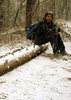
| partners | | The weather is cooling off, but before we get back to hiking more in the lower deserts, we decided to head north again this weekend and chose a loop off Hardscrabble Road in Pine. Driving through the residential area near the pullout where we parked, we saw a few elk among the houses, then got a quick glimpse of a coyote (or maybe a fox?) around the next bend...nice to see some wildlife before even starting the hike.
It was a mostly cloudy morning with comfortable temperatures in the mid-50s, and we started clockwise on Oak Spring Trail from Hardscrabble Road. It was mostly flat, easy hiking past Bear Canyon, and we took the short spur to Oak Spring--the concrete basin was full and there was quite a bit of water in the low areas. From there, Walnut Trail had a steady incline to the top of the mesa, where the views of the rim and the Mazatazals started to open up a little more. There are a lot of tanks along the route--we passed Ridge Tank first, then took a little detour off Walnut Trail and followed the forest roads past East Tank before reconnecting with our originally planned route.
On our way to the out-and-back spur to Alder Ridge, we passed Bee Tree Tank, which was further off the trail but appeared to have quite a bit of water. The stretch on Alder Ridge ended up being one of the most beautiful parts of the hike--that area was covered in yellow wildflowers and offers even better views of the Mazatzals. We saw a large tarantula there and ended up seeing two more later in the loop portion of the hike--first a baby, and another full-size but dead tarantula in the road.
The sun finally broke free from the clouds for good, and we eventually decided to turn around and head back to complete the loop since we had some other stops we wanted to make around Pine after the hike. We passed two more tanks along FR 1654 that weren't on the map, the second of which had a sign labeling it as Turkey Tank, along with a game camera and some cattle nearby.
We hadn't see anyone all day, but we started to encounter a lot of people as we approached Pine Ridge Tank and reconnected with Hardscrabble Road. That tank has a large corral next to it, and we passed a few people with ATVs near that intersection, then a few campers, vehicles, and off-roaders along Hardscrabble. The final stretch was noisy with traffic and workers clearing brush with chainsaws, but the views overlooking Pine were nice. Overall, it was a pleasant, easy hike--nothing jaw-dropping or overwhelmingly beautiful, but consistently nice views and weather. After the hike, we headed to some Native American ruins in a residential area in Pine, then to Naco Paleo site along Highway 260. |
  |
Oak Spring |
Quart per minute |
Quart per minute |
| |  Full basin and water in the low areas Full basin and water in the low areas | | | |
|
|
|
 Route Editor