|
| | | La Barge Mountain and LA BARGE, AZ | | | |
|
|
La Barge Mountain and LA BARGE, AZ
| | |
| |
|
| Hiking | 9.50 Miles |
2,800 AEG |
| | Hiking | 9.50 Miles | 7 Hrs 30 Mns | | 1.90 mph |
| 2,800 ft AEG | 2 Hrs 30 Mns Break | | | |
|
|
| |
| Partners |
|
none
[ show ]
| no partners | | My curiosity got the best of me - I had to hike up La Barge Mountain 5077 to satisfy that curiosity.
HAZ only had two triplogs and photosets for the hike to the top of La Barge Mtn, and neither triplog mentioned anything about benchmark disks, plus neither of the two photosets included any photos of the little disks.
(That, in itself isn’t a revelation actually, as not many acknowledge the little disks or take photos of them - Understood).
Also, all maps I reviewed, including the various ones on HAZ, do not display a benchmark ‘symbol’ on LaBarge Mtn - (No little ‘triangle’ symbol).
So what’s my curiosity?
My curiosity is - As I’m looking at the maps with no symbol on La Barge, and viewing the triplogs and photosets with no mention of a benchmark, I am also holding in my hand, an official datasheet for USGS ‘La Barge Triangulation Station’ (1946), with a Lat/Long locating it on the mountain’s high point. Surely someone must have come across either the benchmark disk or one of its two reference marks, but no one mentioned their existence. Plus, no map symbol?
So …. Off I go to find out for myself.
I started at the Woodbury Trailhead and hiked out on the JF Trail to Tortilla Pass.
Once at Tortilla Pass, I turned left about 120 degrees and proceeded off-trail and up, near a fence line. You cannot see La Barge Mtn yet, but staying near the fence for the first portion of the ‘up’ keeps you out of the thicker vegetation for awhile.
There are a couple serious ‘downs’ while you’re hiking ‘up’ to the mountain top. All that effort used going up, just to be erased by a couple big ‘down’ segments, is always a pain. In this case, you have no choice as there’s a huge, deep valley to avoid, with Tortilla Creek running through it. You’re basically navigating to stay south of that valley, and forced to hike up on the sides of other smaller mountains and hills, on your way to the top of La Barge.
(The original surveyors did traverse that deep valley, but they were on horses).
My route has groves of very healthy agaves lurking all over the place, ready to stab me.
Once atop La Barge Mtn, my trusty GPS led me directly to the high point and ‘location’ of the benchmark, right on the western edge of the mountain top. No disk was there.
Since the area was all rock, there was no need (or ability) to dig down to try to possibly unearth it. It just wasn’t there.
Reference marks #1 and #2 locations were found, but no disks were found for them either.
No wonder the two previous HAZ visits didn’t mention the disks. You can’t photograph whats not there, and with no symbol on TOPO maps, no one would be encouraged to even look for the disks.
What I did find was evidence of ‘where’ the benchmark was placed, in that ‘high-point’ boulder.
The same with the two reference marks. The rock on this mountain is very flaky, crumbly and scaly. Cracks and fissures are all over the boulders.
I assume vandals easily dislodged the disks from the flaky boulders sometime after 1946, and now have souvenirs.
I found the wood used for the Height of Light and all the wires that were used to support it.
They were laying just below the high point on a lower ledge.
By the way, I have no explanation as to why the benchmark symbol is not depicted on maps.
An anomaly in map making?
A summit log was located under some large boulders, and dated back to 30 March, 2002. Ironically, that happens to be 13 years to the day, prior to my hike. The mountain had a flurry of Tucson hikers, in 2002/2003, then about one login every other year after that.
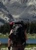
Wildlife encountered included cattle, rabbits, butterflies, bees, the close “rattle” of a rattlesnake (no visual), and a couple Mule Deer. I asked the Mule Deer to ‘give-me-a-profile-shot’ and one of them obliged.
With my curiosity satisfied that there actually was, once, a benchmark up there, I left the mountain and backtracked to the TH. Going down the mountain to the JF Trail was slow going, mostly in my attempt to avoid the stabbing agave. I only got stabbed once on the way down, so I consider I won the battle. |
| _____________________
Not All Those Who Wander Are Lost
J.R.R.TOLKIEN |
| | |
|
|
|
 Route Editor


 Thanks for the beer - wow does that taste good at the end of a hike,

 ! Peeked out a window and saw a vehicle outside, looked at my phone and saw Bob had called.