Took this day off so I could go hiking with good friend Chris. He had planned this hike a few weeks ago, but we were not sure if it was going to happen because of the weather forecast. Initially, we were going to throw on Freemont Peak as well, but Chris discovered that the peak is off limits to help preserve some type of endangered plant.
Got to the TH around 6:30am. We took the trail for about 1.7 miles through some beautiful aspens getting some gradual elevation gain with some nice switchbacks. This brought us to the Waterline Trail (basically a very nicely graded road). We took this road for about .5 miles to where the Inner Basin Trail split off from the Waterline and headed in a westward direction. At this juncture there were several structures, one of which, was a noisy, smelly generator/water pump. The trail continued to be a usable road that brought us into the inner basin. Most of the hike up until this point had been in pretty, but forested slopes with very limited views. When we got to the basin, we were able to see three of the peaks ( Doyle, Freemont, and Agassiz) framed by blue skies. Humphrey was initially obscured by trees so I did not get to see until we hiked further into the basin. After we had crossed the basin, passing another water pump the road started to convert back into an authentic trail. Initially this involved a steady, straight climb up the side of a hill. Probably the ugliest part of the hike, due to the erosion and the the fist sized rocks that I needed to contend with. Also, because of the elevation and the steepness of the slope, the "views" kind of took our breath away. Kind of funny - Chris who had been here several years ago (when the 552 was closed) had hiked up to this section in the snow. Because he and friends had to hike 3 miles just to get to Lockett Meadow, this was as far as they got. Before he and his friends turned around, they "summited" at the rock outcropping just to the north of the trail. He pointed it out to me through breaks in the trees. This was dubbed as "Stoic's Peak". The last .5 miles of the Inner Basin Trail were switchbacks. Very similar to what I experienced at the beginning of the trail, just without the aspens.
At about 4 miles the Basin Trail "T"ed with the Weatherford Trail. We made a left at this juncture, heading towards Schultz Tank. The views of Humphrey and Rees were truly spectacular as we made our way in out of pines. The trail was narrow at times with a fairly steep drop off into the basin, so I had to be a little conservative in my gawking. We actually lost a little elevation as we hiked a mile to reach the Doyle/Freemont saddle. The saddle provided a nice view of the surrounding area. We had our first view of Flagstaff, (we could see NAU in the distance), we had a great view of the Inner basin and the surrounding peaks and of course, an up close view of Doyle, the peak we wanted to summit. This part was off trail and involved choosing what looked to be the easiest path. Luckily, Chris and I had different views on what this was, because half way up I sent (at least) a 60pd boulder tumbling down the slope.

It didn't come near him, but he said he could feel the vibrations in the earth.
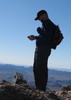
The summit was nice, but the views were not quite as good as I was hoping for. This was primarily because the peak was forested and large and flat. So to get a view in any direction, I had to walk a ways to see through the trees. This allowed Chris and I to discover both registers (who knows, there may be more than the 2 we found). The first register was in the stone/metal/wood abode just to the south of the false summit. The true summit, which was a little further to the east and about 30 feet higher (11430) at the base of a dead tree. (More like a 5 ft. tall stump.). We ate some lunch and watched the clouds begin to gather and darken to the west of Agassiz, before we headed back down.
Trip back was uneventful. Got a little bit of rain in the last five minutes of the hike. Only one nice blast of lightning/thunder, otherwise it was just distant rumblings. Saw 1 hiker going in as we were coming out. His trail head log said that he planned on staying the night on Humphrey Peak.

No wildlife to speak of, though we did see a squirrel working over a peach core that Chris had discarded on our way up the trail. Timing is everything! Six hours ago Chris had "recycled" the peach into a nearby drainage ditch. Six hours later, the squirrel literally posed for us on a boulder, peach core held is in two little paws. It just goes to show, one mans biodegradable trash is another mans (squirrels) treasure.

Great hike! Thanks for the planning and driving!
 Route Editor


 did you build a cairn and put a register here?
 ](https://hikearizona.com/dex2/images/smilies/eusa_wall.gif "Brick wall") Seriously. People are dumb.
Seriously. People are dumb. 
 (Not bad for August in Arizona!)