username
X
password
register
for free!
help
ArticlesGuidesRoutes
 
Photosets
 
 Comments
triplogs   photosets   labels comments more
17 triplogs
login for filter options
Sep 23 2015
avatar

 Photos 186
 Triplogs 17

62 male
 Joined Jun 13 2010
 Bradenton, FL
Stony Brook State ParkCentral, NY
Central, NY
Hiking avatar Sep 23 2015
KwaiChangTriplogs 17
Hiking2.50 Miles 250 AEG
Hiking2.50 Miles
250 ft AEG
 no routesno photosets
1st trip
Linked   none no linked trail guides
Partners none no partners
Finally got around to posting this triplog. I have hiked Stony Brook several times - there are several trails that are usually very well traveled during the summer months. I chose a day in the middle of the week and I was rewarded with very little company. An easy hike up the gorge - there are MANY gorges in NY and then I had a decision - hike down the same way or the opposite side - I wimped out and hiked down the easy way, the main trail, way I came up.

All in all a fun lil hike with 3 decent sized waterfalls and 2-3 minor ones that were smaller but still cool. Only regret was leaving my phone in the car and being too lazy to retrieve it.

At the beginning of the hike is a large natural/man made pool. Natural in that the sides are all rock, man made in that it was dammed up creating the pool. A decent place to jump in if the temps warrant it.

Very easy hike - I have seen many many kids and older folks who have done it and were pumped to see what it has to offer.
foliage observationfoliage observationfoliage observationfoliage observationfoliage observation
Autumn Foliage Observation Moderate
Trees were just starting to turn - was a colorful mix of reds, yellows and mostly green
_____________________
Out of all the things I've lost I miss my mind the most.....
 
Apr 26 2014
avatar

 Photos 186
 Triplogs 17

62 male
 Joined Jun 13 2010
 Bradenton, FL
Bright Angel TrailNorthwest, AZ
Northwest, AZ
Hiking avatar Apr 26 2014
KwaiChangTriplogs 17
Hiking9.80 Miles 4,390 AEG
Hiking9.80 Miles   4 Hrs   30 Mns   2.45 mph
4,390 ft AEG      30 Mns Break
 no routesno photosets
1st trip
Linked   none no linked trail guides
Partners none no partners
First time on Bright Angel - last hike of our seemingly never ending trip. All in all we racked up close to 70 miles on foot and almost 2,000 miles on the rental. Not too shabby for a bunch of city folks. ;)

We rolled outa bed at Oh Dark Thirty - I am never a fan of early rising so I was less than happy to discover it was already drizzling a bit on the way to the Ranch for breakfast :tt: .....chow was good :DANCE: - ate up and then headed back to the dorm to gear up. Stopped back in front of the Canteen and took a few pixs and then shoved off at 6:30.

The drizzle let up a bit and the early morning fog was pretty cool to look at as it hovered at the South Rim.....was in almost total solitude on the hike up to Indian Gardens - made it up there fairly quickly we thought. The Devils Corkscrew switch backs were real easy we thought - not too much to them. Just a shade under 2 hours and that included stopping for Ansel to take a few parting pixs - since this was a new trail he HAD to make SURE he had plenty of Image Representation. He. Did. Not. Fail. We managed to get some real cool pixs of Cheops as it was waking up with the sun shining on it. That was just nature tweaking me!

Right before we hit Indian Gardens we ran into our first folks heading down to the bottom. All total only 9 folks passed us on the way down. Stopped at Indian Gardens - had some of the sack lunch - used the facilities and then shoved off again......

About a half mile from the Gardens it starts to rain.....we stop and put our back pack condoms on and I slipped on a waterproof shell. By the time we got to 3 mile rest house it was really coming down - no one passed us at all on the way down. The shelter at 3 mile was PACKED. It was raining and cold and I thought to myself NO WAY am I stopping at here to get cold. :scared: We soldiered onto the 1.5 mile rest house.....by now my pants felt like they weight 10lbs :( - we stopped to use the facilities at 1.5 mile and I changed my socks :y: a much happier Kwai was back on the trail heading up - what ticks me off was I totally forgot to check where the spot to head over to Battleship was - ugh! ](*,)

Now we start to see the rain turn to sleet - the thermometer at 1.5 mile was pinned at 33 degrees......then the sleet turns to snow then WHAMMO! It all stops - like someone threw a switch. From 3 mile on up we ran into numerous folks heading down. I liked the idea that I was heading up to the lodge and BEER!!! :sl:

When we had like maybe a little less than a half mile left another WHAMMO and the snow kicked in nice - very cool looking - I forgot I was wearing freezing cold soaking wet pants and marveled at what nature was throwing at us.....crested the rim at 11am and headed into the Lodge for a brew and a celebratory shot of 1800. 4 hours from the Ranch to the top if you take out the roughly 30 mins of food stop and pixs. I was quite happy with that. :wlift: NOTHING like the Bataan Death March up North Kaibab, NOTHING! [-X

So all in all - my feet looked like something out of a war zone - 8 blisters total, 7 of them on one foot - memo to self - buy 2 pairs of shoes - one wide one normal.....lessons learned. As I type this I think I am going to keep the two toe nails that I thought for SURE I was going to sacrifice. So now we are cooking up :STP: the next adventure. Ansel wants to explore more states - after Utah I almost agree with him but the Canyon has soooo many places I want to see - I am thinking of going it alone in the Canyon next time as Ansel just can't handle the down part - up no problem - down no soap.

Drove to Flag - stayed overnight, slept in and then drove straight to Arizona Wilderness for an awesome meal and a few brewski's! :GB:

Until next year - GRAND CANYON - You ROCK! :worthy: :thanx:
_____________________
Out of all the things I've lost I miss my mind the most.....
 
Apr 25 2014
avatar

 Photos 186
 Triplogs 17

62 male
 Joined Jun 13 2010
 Bradenton, FL
South Kaibab TrailNorthwest, AZ
Northwest, AZ
Hiking avatar Apr 25 2014
KwaiChangTriplogs 17
Hiking6.15 Miles 4,790 AEG
Hiking6.15 Miles   3 Hrs   45 Mns   2.05 mph
4,790 ft AEG      45 Mns Break30 LBS Pack
 no routes
Linked   linked  
Partners none no partners
Well after 18+ months of planning and 1600+ miles on the car - just from Phoenix! - with another 50+ miles on the feet in the previous 9 days we began our intended adventure. Cheops Pyramid - he we come..... :y:

This was the 3rd time below the rim for both of us and already we were behind the 8 ball. Missed the 6am hikers shuttle so now we had to wait for the 7am shuttle - 7:25am we FINALLY head down SK which will now be known only as the Hippy Trail in my mind, that female warrior has gone down and up that trail more than I have drank water!! :worthy:

We were making what I would say was an excellent pace for an old fat guy, until the tip off - my buddy started seriously laboring :stretch: as his knees were suffering from our previous exploits - sadly we hit the river at 11am....at the pace we were now going I knew it was futile to try to attempt the Pyramid - additionally I am not so certain I had the ability to pull it off even tho we had secured a nite at Phantom. Dang it all!!! My sincere appreciation goes out to the Hazer's who have not only bagged this but done it in one day AND drove back to Phoenix after doing it!! :worthy: It is one thing to read the triplogs and say WOW! Quite another to actually try to do it and realize - holy crap - I am not even in the same zip code as these folks are who have done this. I used to think of myself as a pretty decent hiker - not so much any more. :o Reality bites!

After checking in to Phantom I managed to cajole my buddy into attempting the Utah Flats Route. Joe - you would be proud of me - I got that Doohickey GPS kinda sorta figgered out. So up the UFR we went. Again - my awe over the folks who did this all in one day! We made it up to Piano Alley, started to get up the alley and realized quickly that we would be throwing away our $48 dollar steak dinner [-( so we resigned ourselves to some awesome and I mean AWESOME views from atop what I will call Piano Alley Mesa....pretty cool lil area - certainly was interesting in that it looked like there were multiple lightening strikes that have charred the rocks up there.....found two spaces cleared out for sleeping purposes nicely hidden from any ranger views from down below at Phantom....heck one spot even had his and hers rock nightstands!!

Lots of things in bloom! Ansel Adams - aka my hiking partner was in his glory - so was my wife as he sent many many images back home to her whenever he could - vicariously she was with us. Sadly with Ansel - one pix opp becomes a long long adventure. :oplz: The Colorado was in nice shape - a picture perfect green river - saw awesome amounts of the river from where we were. after MORE than a few pixs Ansel and I headed back down to the bridge - holy crap! It is straight down! I mean STRAIGHT DOWN! Sheesh! I walked more like slid about 2/3rds of the way down. Almost to the end I am sliding along and WHAMMO my right knee catches some kinda cacti. Now I have several clusters of small tiny needles in my knee and sticking out of my shorts....they in turn proceed to embed themselves in me.....a week later and I am still picking these lil devils outa me!!! :-k WTH!

Made it back to PR with time to spare for a brew in the cantina - a quick shower and then my $48 dollah dinner. Yum! Took some time to walk around during the super windy conditions - saw several mule deer wandering around the Ranch area - was surprised to find out that they hang there because they know the cougars won't. Smart deer! Also saw some kinda fox - not sure of the name but he was a busy creature.....

Left the next morning up BA......separate triplog and pixs to follow this....

Many many thanks to BobP and Joe for all the answers to the many questions I had. :thanx: Bob - you are glad you didn't go with us!! Next time I return - I will be hearing AND in shape to bag Cheops.
_____________________
Out of all the things I've lost I miss my mind the most.....
 
Apr 23 2014
avatar

 Photos 186
 Triplogs 17

62 male
 Joined Jun 13 2010
 Bradenton, FL
Goblin ValleyCentral, UT
Central, UT
Hiking avatar Apr 23 2014
KwaiChangTriplogs 17
Hiking2.50 Miles 140 AEG
Hiking2.50 Miles   2 Hrs      1.25 mph
140 ft AEG
 no routesno photosets
1st trip
Linked   none no linked trail guides
Partners none no partners
End of the day lazy hike through out Goblin Valley - before we went out we stopped into the Park Entrance and asked the Rangers about the best hike for the time we had remaining - they sent us out into what I would call the main "field" of Hoo Doos. As I asked the question I could see the smile starting - I asked - "Isn't this where those 3 fools knocked over the Hoo Doo?" He smiled, laughed and said we are not specifically sure which one it was that was knocked over but yes it is.

We spent about 2 hours walking around exploring the hoo doos and had a time of it. No real trails and we were told you can pretty much walk wherever you want just pay attention to the ground under your feet - sure enough in a few spots the ground was a little less than stable - nothing that would cause death or anything like that but it was amusing when a shift or two happened.

Was an easy fun little walk.....
_____________________
Out of all the things I've lost I miss my mind the most.....
 
Apr 23 2014
avatar

 Photos 186
 Triplogs 17

62 male
 Joined Jun 13 2010
 Bradenton, FL
Bell and Little Wild Horse Canyons LoopCentral, UT
Central, UT
Hiking avatar Apr 23 2014
KwaiChangTriplogs 17
Hiking8.50 Miles 860 AEG
Hiking8.50 Miles   4 Hrs      2.43 mph
860 ft AEG      30 Mns Break
 no routes
1st trip
Linked   none no linked trail guides
Partners none no partners
This was the first of two planned hikes today. The drive there was like entering someone’s back yard – a really really huge and deserted back yard! Initially we planned to hike this as the intended loop but after speaking with the Ranger at Goblin Valley State Park Entrance where we paid our admission he stated he always hikes back the same way as the loop canyon, Bell Canyon is in his words, is boring, compared to Little Wild Horse Canyon.

We left the Rangers station for the trailhead – an easy 5 mile or so drive – saw some just absolutely mind blowingly cool campsites tucked up near the high walls of rocks on the way there….just way too cool. At the trailhead there was a sign in sheet – not everyone was signing in tho. I began to wonder if the fee we paid wasn’t necessary?? Since we were going back to hike Goblin Valley anyways it really didn’t make a difference to us. We got there fairly early and that WAS a bonus. A couple of Aussie ladies had started out about 30 minutes before we did and there were 2 older dudes who started out about when we did.

We came to our first decision point. A basically 6-7 foot dryfall with a small piece of driftwood in it to assist decent and a few small rocks to assist in ascent. My buddy Matt hopped down and I followed – he then kinda shimmied himself up the first part of the dry fall and I threw his pack up to him – I tossed my pack to him and then tried to get my old short fat arse up there and with a helping hand from him I was able to make the first part – then there was another scramble again about 6-7 feet that I tried my level best to make my way thru but there was just no way. As I stood looking at this obstacle :-k I suddenly noticed the two older dudes just walking on by about 50 or so feet above me!!! ](*,) Obviously I am not old enough to gain wisdom!! :doh: We later chatted with them and they said they watched me do the first dryfall and decided there had to be a better way. Sure enough just to the left of the dryfall is a faint trail that heads up and along the dryfall and eventually descends down to the beginning of either Little Wild Horse (to the right) or Bell Canyon (to the left).

So down back into the dryfall I go and back out the way I came in – I find the trail and I get almost to the top of it and realize, hey my pants are wet! I look down and sure enough in my scrambling I managed to get my very first hiking injury! Cool!!! :o I get to use this stinking first aid kit I been hauling around all over the state of Utah!!! :D I clean up two small scrapes that gave up a fair amount of blood and patched em up. Head down and met up with Matt and off we went up Little Wild Horse.

It starts out kinda bland – I was wondering what all the fuss was and then it got fun. Lots of small scrambles over medium and large sized rocks and then……..the first actual slot canyon – the walls were carved out like a master sculptor had been working on this for several lifetimes. The width varied from less than shoulder width to about 10+ feet. My camera was exploding as was Matts. Then it opened up a bit and then it closed right down again and again and again…..I would guesstimate the canyon walls were at least 100+ feet high in some spots maybe even higher in others and my mental DVR just popped a breaker. :worthy: I reset it and then popped another. Quite honestly the best hike I have ever experienced so far. The length was only maybe 4 miles or so from trailhead to the end of the Canyon – quite possibly the craziest and coolest 4 miles I have ever walked. No forget that it WAS the coolest. : app :

Along the way we passed the Aussie ladies and that was it – we had the whole dang thing to ourselves and it was heaven. Too bad it was slightly overcast or the images would have even made Ansel happy! We finally reached the end and took a short break for some food – we were loaded to bear and could have easily done this without the day packs we had. I am sure if it was warmer it would have been a different story.

As we headed back it all seemed totally different – the mental DVR that had been reset just exploded again. Going back was like hiking a whole new canyon – each bend was different than the one before it. The water rushing through this canyon has created an awesome Natures Masterpiece. Sadly as we headed back we ran into multiple groups of people so the solitude was lost but the initial hike in was A-1. :y:

A number of firsts – my first injury, my first slot canyon, my first mental DVR explosion and my first OMG I AM SO COMING BACK HERE MOMENT. While the Grand Canyon does hold its sway over me my first slot canyon was a wild and unforgettable experience.

FINALLY almost 2 years later - I added the images.....
_____________________
Out of all the things I've lost I miss my mind the most.....
  1 archive
Apr 22 2014
avatar

 Photos 186
 Triplogs 17

62 male
 Joined Jun 13 2010
 Bradenton, FL
Delicate ArchSoutheast, UT
Southeast, UT
Hiking avatar Apr 22 2014
KwaiChangTriplogs 17
Hiking3.00 Miles 480 AEG
Hiking3.00 Miles   2 Hrs      2.00 mph
480 ft AEG      30 Mns Break
 no routes
1st trip
Linked   none no linked trail guides
Partners none no partners
Simple little stroll out to the Arch.....the various descriptions said there was exposure?? I must have missed it. :)

Very nice peeps here - everyone was SUPER courteous about taking pixs under the Arch. Folks would literally RUN to sit/stand/dance under the Arch - hang there - have their pixs taken and then RUN back out of the way - stayed here for about an 1/2 an hour watching and participating in that parade taking place.

Def one of the easier hikes we did - we then headed over to the circus called the North and South Arch....didn't even get out of the car - WAY too many peeps there. :o

Wish the weather would have been a wee bit better - all in all tho - made it to the Famous Arch and took our pixs.....
 Named place
 Named place [ checklist ]
[ checklist ]  Delicate Arch
_____________________
Out of all the things I've lost I miss my mind the most.....
 
Apr 21 2014
avatar

 Photos 186
 Triplogs 17

62 male
 Joined Jun 13 2010
 Bradenton, FL
Devil's Garden - Primitive Loop - Arches NPSoutheast, UT
Southeast, UT
Hiking avatar Apr 21 2014
KwaiChangTriplogs 17
Hiking8.00 Miles 1,000 AEG
Hiking8.00 Miles   4 Hrs      2.46 mph
1,000 ft AEG      45 Mns Break
 no routes
1st trip
Linked   none no linked trail guides
Partners none no partners
Our trek through Utah continues. I have no idea how to capture this other than to stick it here. On the way from Bryce to Moab we decided to drive on Rt 12 to Rt 24 and then up to the main highway, maybe 70?. Would NEVER want to do this in the Winter!!! :scared:

I HIGHLY recommend this driving route to ANYONE. It added about maybe an hour to the trip but it was CRAZY worth it. The views, the desolation and the drive were stunning. At one point we were at almost 11,000 feet - driving thru a winding road of a forest. Then we began descending - but not until we drove on a knife edge ridge for quite awhile with no guardrails to protect you from veering off the road and several hundred feet to a certain death - just too cool. Ansel even said I was more worried driving that road than I was going up and down Angels landing with all the crazies! Just an awesome drive.

We pulled into Arches early - stopped at Fiery Furnace to gaze upon it and then headed over to the Devils loop - managed to see 8 natural arches - 7 up close and the Dark Angel spire rising out of the desert. We were treated with 2 people ascending the spire so we stopped and had a bite while watching them.....better than TV by far!

Even though it was early there were loads of people out and about - most of the Arches we were the only people there but they must have been following us!! Because they would gather round once we stopped to take pixs. At each Arch we wandered around a bit exploring the area. The sun was full on and it felt awesome - we had plenty of water and the hike was short so I wasn't worried. What did worry me was the amount of parents dragging totally uninterested small children around - we saw a few near misses of kids almost tumbling off a ridge. Not too cool parents! [-X

About 1/4 of the hike was through sand and the remaining was either rock or slick rock. About 1/2 way to Dark Angel there was a decent fun section of slightly exposed slick rock - had some peeps turning around but really wasn't anything too crazy. - took the primitive route back after we went out to Dark Angel.

A fun lil hike with a bit o slip rock included!
_____________________
Out of all the things I've lost I miss my mind the most.....
 
Apr 20 2014
avatar

 Photos 186
 Triplogs 17

62 male
 Joined Jun 13 2010
 Bradenton, FL
Navajo LoopSouthwest, UT
Southwest, UT
Hiking avatar Apr 20 2014
KwaiChangTriplogs 17
Hiking1.50 Miles 531 AEG
Hiking1.50 Miles   2 Hrs      1.20 mph
531 ft AEG      45 Mns Break
 no routes
1st trip
Linked   none no linked trail guides
Partners none no partners
BRYCE CANYON!! EASTER SUNDAY! After we did an assessment of all the hikes we decided that this was the most visually stunning of them all. Got here nice and early - again - Free Parks day so we saved $50 between here and Zion! :y: I still think the foreign visitors should pay no matter what. Our Parks - our taxes. ;)

We walked around at the top for a short while and then descended down the Navajo Loop - sadly Wall Street area was closed due to recent rock falls and wash outs - bummer! :( But even with that out of the options we were just blown away by the sheer beauty. Strolled by Thor's Hammer as we made our way to the Canyon Floor.

For my Easter Sunday I meditated in a cave - what did you do? Had fun on this little stroll on the Canyon floor - went off path quite a bit exploring the many areas, found natural bridges, caves and generally cool things to stop and ponder. As we were fortunate to have arrived early the crowds were minimal until we started to head up the trail.

I am not a huge fan of the mule rides but the one path they have at Bryce looked kinda cool - I would do it if I found myself back there.

All in all a nice lil Canyon - visually stunning - the sun was still rising so most of my pixs are washed out but the views were awesome. : app :
 Named place
 Named place [ checklist ]
[ checklist ]  Thors Hammer
_____________________
Out of all the things I've lost I miss my mind the most.....
 
Apr 19 2014
avatar

 Photos 186
 Triplogs 17

62 male
 Joined Jun 13 2010
 Bradenton, FL
Angel's LandingSouthwest, UT
Southwest, UT
Hiking avatar Apr 19 2014
KwaiChangTriplogs 17
Hiking5.00 Miles 1,700 AEG
Hiking5.00 Miles   2 Hrs   30 Mns   2.50 mph
1,700 ft AEG      30 Mns Break
 no routesno photosets
1st trip
Linked   none no linked trail guides
Partners none no partners
Well - scratch this one off the bucket list - after trying in vain to get a permit to the Wave we decided to knock this one off. We went to Zion on the Free Parks day - first mistake. We got there about 10am - second mistake.

Can't say anymore about this hike than whats already been said and there are no unique pixs to post.

Seemed like there was a gajillion people on this hike - waited at several choke points on the way up with the chains for people to pass - many many people should NOT have been on this hike - the sheer look of fear on peoples faces as they descended was sobering to me. We actually off trailed it a few times to get around people so we could get to the top.

Once there it was Disney Land galore with peeps.....kinda sad as it would be nice to have been there with about 120 less people on the top. One poor child had a tampon jammed in her nose due to elevation nose bleed I suppose - sad her parents would drag her up there like that. All about them I guess.

All in all tho - nice views from the top. The drive out of Zion was awesome - many views to take in and many pixs were taken.

My :SB: rant - since the parks are in the US and we pay for them thru our taxes shouldn't our foreign visitors still have to pay to get in? Sadly what became a recurring theme was the absolute RUDENESS of anyone French we encountered. ANYONE else was super friendly and we met many nationalities while we did our 9 hikes in UT and AZ - the French are supremely rude people. Sad - I just wish I would have encountered one nice French person to counteract the many rude French hikers we saw - a simple Hello would have been nice.....must be those freedom fries! Off my :SB: now...
_____________________
Out of all the things I've lost I miss my mind the most.....
 
Apr 18 2014
avatar

 Photos 186
 Triplogs 17

62 male
 Joined Jun 13 2010
 Bradenton, FL
Wahweap HoodoosSouthwest, UT
Southwest, UT
Hiking avatar Apr 18 2014
KwaiChangTriplogs 17
Hiking10.00 Miles
Hiking10.00 Miles   4 Hrs   30 Mns   2.86 mph
   1 Hour    Break
 no routes
1st trip
Linked   none no linked trail guides
Partners none no partners
OK - first hike of our 12 day odyssey of Utah and Arizona. This trip has been a lil over 18 months in the planning phase. Flew into Phoenix late on the 16th - drove to the intersection of NO WHERE and NO WHERE in the town of NO WHERE in the district of NO WHERE also known as Kanab. On the way we stopped in Flagstaff to get supplies and the we stopped again at Lake Powell - got some good pixs there.

We took the traditional route to the Hoodoos by way of Big Water - sure wish I would have seen Rick's images and triplogs BEFORE we did our hike - a long slog in up the wash complete with many many cow pies and in our case some very unstable wet ground. It was cloudy out and threatening rain so we had that working against us. We stopped and chatted up the Rangers at the Paria Contact Station right across the road from where the road to the trailhead is. You need to drive in about a mile or so past the fish hatchery to the trailhead. We stopped right where the cattle pen was as the ground was very sandy and the threat of rain had us a lil worried about getting the rental Jetta out of there.....memo to self - rent a 4x4 next time! :oops:

We hiked across the wash to the actual trail head and then up the wash to the hoodoos. Not until I searched this hike did I know about the shorter but better payoff hike. Anyways - I digress. The hike was kinda boring but the payoff was worth it. We actually blew past where the white - did I mention white? hoodoos were. We were seeing some hoodoos but NOTHING like what we saw hiding behind the tree grove that was kinda protecting the hoodoos.

Like Rick says - it is AMAZING! As anyone who has read any of my previous triplogs knows I personally hike with Ansel Adams - well not THE Ansel - but his protege. A simple three hour hike can morph into 4, 5 or 6 hours depending on the scenery. Thankfully really not too much to be seen - there were some cooooool holes in the canyon walls created by the wash when the water was high - would have been cool to actually see it running. So other than some pretty cool holes in the walls and of course the obligatory awesome 24x7 scenery that is Utah it was sorta a bit of a slog to the hoodoos. Of course we didn't do ourselves any favors by blowing right by the Hoodoos and then taking the "oh I blew past the Hoodoos trail" back to the Hoodoos. Very cool they were! :D

As soon as Ansel sends me his images I will post the better pixs - until then we have to suffer with my images :scared: - trust me they do NOT do it justice like Rick's images do. All in all tho - as we recounted our trip at the end of our journey - we rated this as a nice payoff but a slog to get there. Next time we take the shorter route thru Cottonwood Canyon.
 Culture
 Culture [ checklist ]
[ checklist ]  HAZ Gear
_____________________
Out of all the things I've lost I miss my mind the most.....
 
May 21 2011
avatar

 Photos 186
 Triplogs 17

62 male
 Joined Jun 13 2010
 Bradenton, FL
Doe Mountain Trail #60Sedona, AZ
Sedona, AZ
Hiking avatar May 21 2011
KwaiChangTriplogs 17
Hiking3.60 Miles 550 AEG
Hiking3.60 Miles   2 Hrs   30 Mns   1.44 mph
550 ft AEG
 no routesno photosets
1st trip
Linked   none no linked trail guides
Partners none no partners
My Buddy Matt and I hit this hike on our last day in Sedona. Wow! The views from the top were great - the weather was just perfect a slight sweat was worked as we went up Doe and then the slight breeze cooled us right off at the top.

We primarily stayed on the outer edge of the Mesa for the entire time. As I mentioned the views were very cool. We gazed over at Bear that we had done two years earlier and reminisced about that hike just wishing it afforded the same 360 views we were drinking in now. The HUGE cairn that was located at the south west edge of the Mesa was pretty cool. A couple of lizards were playing around on it when I walked up to it. It had to be almost 9 feet in height!!

What was striking was the house/compound that was being developed on the southern edge of the Mesa. Looks like it will be somebodys play thing for sure!! Also it looks as if some serious climbing anchors were embedded into the top of the Mesa on the South East corner......lots of anchors. Tons of Prickly Pear cactus up on top - made me thirsty! ;)

All in all a decent lil hike that just about anyone can do and SHOULD do!!!!
_____________________
Out of all the things I've lost I miss my mind the most.....
  2 archives
May 20 2011
avatar

 Photos 186
 Triplogs 17

62 male
 Joined Jun 13 2010
 Bradenton, FL
Red Mountain Trail #159Flagstaff, AZ
Flagstaff, AZ
Hiking avatar May 20 2011
KwaiChangTriplogs 17
Hiking2.50 Miles 400 AEG
Hiking2.50 Miles   1 Hour   15 Mns   2.00 mph
400 ft AEG
 no routesno photosets
1st trip
Linked   none no linked trail guides
Partners none no partners
A quick and easy unexpected hike that occurred as my buddy wanted to pull off and take some pix of Red Mountain. He was hobbled so it was a solo effort - spent some time checking out the scree and the cool interior of the volcanic rocks....was nice. Heard some dogs (coyotes?) barking so I made my way back to the car. No one else was out so I have no idea what I heard out there. Will post pixs soon.
_____________________
Out of all the things I've lost I miss my mind the most.....
 
May 17 2011
avatar

 Photos 186
 Triplogs 17

62 male
 Joined Jun 13 2010
 Bradenton, FL
North Kaibab TrailNorthwest, AZ
Northwest, AZ
Hiking avatar May 17 2011
KwaiChangTriplogs 17
Hiking14.00 Miles 5,760 AEG
Hiking14.00 Miles   9 Hrs   30 Mns   1.47 mph
5,760 ft AEG53 LBS Pack
 no routesno photosets
1st trip
Linked   none no linked trail guides
Partners none no partners
Well best laid plans have been laid to rest - we eat breakfast and collect our lunch and Matt heads down to the Ranger station to get taped up. He is actually moving around pretty good so the copious amounts of ibuprofen and the river soaking have paid off in spades. I walk down to the BA creek from our dorm and meet several folks who inquire about our plans - "yup - we are hiking out the NK!" I see the incredulous look on some of the folks faces and I am thinking to myself they probably think they are going to read about us in the paper!!! While on the way down to the creek I look up and see this big ole deer about 15 feet away from me - it freezes, I freeze. I get my camera out and actually get a few good pixs - my wife was impressed at how close I really was. At any rate the deer end up bounding off and I walk to the creek and hang for a bit.

We are off! Leaving about 7:45am, late! Matt is keeping a good pace in front of me - of course HIS pack is quite a bit lighter than MY pack is right now. Actually it really wasn't that bad at all - I would guess I was probably only about 50-55 lbs now. One of the cool things that I was really looking forward too on this adventure was to walk around and touch and feel the energy of these incredibly old Vishnu Schist rocks. I told anyone who would listen to me about doing that. I was given a quarter by a friend of mine who wanted me to stash it for her at the bottom of the Canyon. This I did - I actually made a small cairn over the quarter - took pixs and then took a small rock that was lying next to it to give to my friend. Her husband will think I am nuts she will adore me for life!!

So we make our way through the dreaded Box and we are at Ribbon Falls before I know it - DANG IT! I could have done this hike yesterday and hung out at the falls - DANG IT! Next time this I will do. At any rate we really do not want to push our luck so we decide not to hike over to the falls. The views were real cool and the falls seemed to be very energetic. Can not wait to go back to this spot. The day was kinda overcast in the morning so it really was a great day to hike. The colors in the Canyon were way cool. We steadily make our way to Cottonwood, stop and eat our sack lunch. While we were there a few other folks also stopped so we had dining companions.

We shoved off and headed up towards the pump house. Kind of a strange site the pump house - signs all over the yard that stating this is not your toilet! The house actually seemed abandoned in that it was overgrown and deserted looking. Sort of a bummer. We kept the pace and soon we could hear Roaring Springs, soon after that we could see it. Pretty wild site to behold as all the spring runoff made for a loud and spectacular sight. In addition to the main spring there were several other springs located to the right - all in all I counted at least 6 springs. What was really bizarre was the steps leading up and almost into the spring ltself. Pretty cool! Stayed here and took a few hundred images at least.

As we continued up the trail for what seemed like forever we finally hit the bridge - what an awesome view from the middle of the bridge - just awesome. Not too much longer after that was the Supai Tunnel. Another hour and a half and we were finally at the trail head. Sadly the amount of mule poo and pee really diminished the hike at this point. All we talked about that last hour was mule steaks and mule cutlets. UGH! Now it really hits us.....we are pretty beat up and tired and we still got to walk another 2.2 miles to get to the lodge. Ohhh no - I stuck my thumb out and the second car driving by pulls over and presto our chariot to the lodge!!!

The Lodge was open for only the third nite of the season - as such it was pretty well disorganized except for the bar! We checked in - threw our gear in the room and headed straight for the bar. A few brews later and we were off to dinner - while we were walking to dinner the snow started. Dinner was an interesting experience but the folks at Forever resort did come thru in the end and what was initially an unpleasant experience turned out quite well.

Two days we stayed at the North Rim Lodge - at this point I am charged up again and would have just loved to hike down NK and up BA and meet my buddy who is taking the shuttle back to the SR. Well the snow sorta took care of that idea. Figgering I really didn't need to hike the NK alone and I really didn't need to do it in the snow for the first hour or so I reluctantly decided to take the shuttle back. - UGH!! $85 for the longest 4 hour drive I ever been in my life - I would not wish that on my worst enemy.

So concludes my virgin Canyon hike - we will be back - less pictures and lighter packs for sure. As well as better prepared for foot ware, clothes and provisions. A GIANT lesson learned and memories that will last a lifetime. I envy those who have the opportunity to hike this mighty hole in the ground as often as they do.

I WILL BE BACK! :y:
_____________________
Out of all the things I've lost I miss my mind the most.....
 
May 17 2011
avatar

 Photos 186
 Triplogs 17

62 male
 Joined Jun 13 2010
 Bradenton, FL
River Trail - Grand CanyonNorthwest, AZ
Northwest, AZ
Hiking avatar May 17 2011
KwaiChangTriplogs 17
Hiking1.00 Miles 150 AEG
Hiking1.00 Miles   1 Hour      1.00 mph
150 ft AEG38 LBS Pack
 no routesno photosets
1st trip
Linked   none no linked trail guides
Partners none no partners
Picking up from the South Kaibab descent - a few unrelated trail events one that was a little disturbing - as we hung out outside the Phantom Ranch Cantina after we arrived and checked into our dorms we witnessed more than a few people doing the rim to rim to rim deal in one day. To each his own I guess - one older couple - late 50's early 60's I would guess - stopped at the picnic table to fill up on water - we chatted with them for about 10-15 minutes while they proceeded to unpack their packs of food and fuel up their water with electrolytes. Totally understandable as they had come down SK, up NK, back down NK and were headed up BA. The not so understandable part was the fact that they left behind at least 7 energy bars, numerous energy drink mixes and a split open bag of some type of nuts - way uncool. WAY! [-X In the same vein - there was a group of mommies who stayed in a cabin - all 8 of them - basically doing the same deal with food - they brought enough to feed an army. We were the lucky recipient of some snacks and the rest they very thoughtfully gave to the folks in Phantom. :A1: What is it about carry in/carry out that these folks DO NOT understand? We then went inside the cantina and stuck up conversations with several other folks - the typical "what trail did you come down what trail you going out on" type of thing. We discussed our intention to go out the NK with a guide who was at a table with his group. This guy proceeds to tell us we are nuts to hike out the NK in one day - we had better leave before dawn and he hopes we have lights! Then we tell him we are planning on hiking down the NK and out the BA in one day - he dang near died on the spot blubbering about how that was just impossible blah blah blah. Talk about trying to fleece your group you are guiding.....wow, just wow. [-(

So my bud Matt is hobbling around the Ranch with more than a few people asking if he is OK? - we had the steak dinner - expensive but darn good - we sleep the first nite - get up for the early breakfast and then claim our sack lunch - the original plan - if you have read my other triplogs you can tell that NOTHING went to plan - was that we would hike up to Ribbon Falls and back. Well not with his ankle. So we craft our new plan, no longer are we going to do the NR to SR in one day hike as we had planned ? and we are going to ditch the dang Vasque boots that killed both of us in favor of our Merril hiking sneaks. So to test our theory we decide to hike the River Trail and of course take pixs. :bdh:

We leave the Ranch and slowly make our way to the Silver bridge stopping at many spots along the way and taking in the scenery. Since it had snowed that nite on the NR and it was early in the season Bright Angel creek is running very fast and that just added to the ambiance of the walk. Note: walk - NOT hike. :cry: We pass the buildings on the way to the bridge - we stop to admire the differences of construction between the two bridges and begin to traverse our way to the South side of the river. One thing I thought that was real cool was the Colorado - yes the mighty muddy Colorado. As we went over the suspension bridges the river seemed fast - not overly so but man when we were down level with it I got a whole new appreciation for fast. As we walked across the bridge I thought I felt it swaying - sure enough it was - total cool!!! The closer I got to the South side I kept noticing the huge VW and larger sized boulders all piled up like pebbles in a stream at the bend in the river - wow - would it have been sweet to observe the river current that moved those babies. Actually the entire time I was below the rim I often felt like I was in the land of the giants and all those huge boulders that were so precariously placed all over the landscape were the giants toys that never got put away. The many many images that we took will most likely never really convey that feeling but it was wild to see the larger than houses boulders all lined up in a row from an evident fall at some point (when?). We meet some other hikers coming down from BA and they ask for us to take their pixs - again very cute girls - I am really beginning to think that the Canyon is the world's best kept "singles meeting place" secret! :lol:

We hike the river trail amazed that we couldn't see it at all when on the North side. NO idea where we would have been hiking at all. NONE. We make our way again to the entrance carved out in stone to the Black bridge - a lot of engineering there! As I am watching Matt - I am beginning to think "man there is just now way this dude is hiking up NK - just ain't gonna happen". :scared: He is barely walking let alone being able to hike up the NK for 14 miles. :stretch: I make mention to him that maybe he might want to see the Ranger about this - we make our way to the Cantina - several more people comment on his hobble and he says alright eff it I will go see the Ranger. He heads back after visiting the Ranger and says we need to get to the river ASAP... OK - we head to the river - as we walk towards the river I tell him I am going to quick ask the Ranger where the easiest point of egress is so we do not end up as fish food! While talking to the Ranger he is telling me he is worried about Matt making it out the NK. I tell him I agree 110% - we chat for a quick bit and then Matt and I head to the river - why are we going to the river? Well it is 41 degrees and better than a bag of ice! After Matt soaks for a few sessions we go up and get dinner - steak again - again pretty dern good! We chat with a few of the other hikers and we are starting to gain a gathering of people who want to know what we are planning on doing since Matt is hobbling so badly. At this point I am getting really worried - after dinner we again head to the Rangers office to see what time he will be there so he can tape up Matt's ankle for the hike out. As we are walking there I tell him that in no way would I be bummed if we do not make it as planned since most of the plans have been scuttled so far anyways!

Matt is adamant that he is hiking out the NK - in his defense I know I would have been too - the Ranger even offers to put us up at Indian Garden for a nite so we can leisurely hike out over the course of two days. Informs us that they will provide tent, sleeping bags and women! Well just kidding about the women but as I ask how much it would cost he smiles and says "your tax dollars at work!" Sheesh!!! I wanted to take him up on it - kinda! We proceed to chat up the Ranger a little more - real nice guy - seemed pretty lonely as I am sure that job can be at times. At any rate - plans were made for Matt to visit him for the taping bright and early the next morning and oh yeah the massive weight transfer from his pack to mine!!! We then head back down to the river for some more soaking......that concludes the River Hike - sorry so long but just some funny stuff I wanted to capture. :thanx:
_____________________
Out of all the things I've lost I miss my mind the most.....
 
May 15 2011
avatar

 Photos 186
 Triplogs 17

62 male
 Joined Jun 13 2010
 Bradenton, FL
South Kaibab TrailNorthwest, AZ
Northwest, AZ
Hiking avatar May 15 2011
KwaiChangTriplogs 17
Hiking7.00 Miles 4,790 AEG
Hiking7.00 Miles   7 Hrs      1.00 mph
4,790 ft AEG
 no routes
Linked   none no linked trail guides
Partners none no partners
Calibration hike done - damage? One blister each - wussies!!! :doh:

Used the Hikers Shuttle to ferry ourselves over to the South Kiabab trailhead. Saw some really HUGE elk wandering through the Grand Canyon Village - glad I was in the bus! ;)

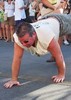
What a cool feeling standing at the trailhead - 13+ months of preparation and planning finally all coming together. :y: We exchange cameras with other folks as we all take pixs of each other before we dip below the rim. Even though technically we had been below the rim yesterday this seems like the real deal. As we begin down the switchbacks it hits me that this is going to take forever to get to the bottom. Why? Pix. My buddy Matt is taking pix like there is no tomorrow - before exiting on the North Rim he will take just north of 1600 images! :o

We trek our way down and then BAM! The Stink! The Horror! MULE POO! Not as much mule pee but loads and loads of mule poo - UGH! :scared: I begin to rapidly understand why some people avoid the corridor trails and now knowing this I believe this will be my future plans too. Stoopid me I was under the impression that the SK was closed to the stinky beasts. Not only was the supply line running for Phantom but there were several groups of people riding the trails. Sorry folks but color me as one of the people whom is adamantly opposed to the Mules. They pee, poo and GRIND the trail into dust. This is helpful how????

At any rate we make our way to Oh Ah point - OH AH indeed! 8) I lie prone on one of the rocks and gaze down the canyon to the east - what a cool view. I lay there for quite awhile until 2 young ladies arrive and ask if I will take their pix for them. One thing I gotta say - if yer single it seems like the Canyon is a great pick up spot!!! Never did I see so many seemingly single hot looking females hiking either alone or with another hot looking female!!! Wow!!! :GB: Ladies?? YOU ROCK!!! :worthy:

As we head down towards Cedar Ridge my buddy turns and asks if I am throwing stones at his ankle. I am thinking OK - the views are overwhelming him and he is losing his mind. No he assures me that it feels like something it tapping him on the back of his ankle. Not a good sign. He continues down to Cedar Ridge. We arrive at Cedar ridge and I am blown away by another observation - the foot ware of people whom have hiked down this far - I see sneakers, open toed designer sandals, flip flops and then the people who seem to have a brain, hiking shoes/boots.

As we hang at Cedar - taking pix what else? - I strike up a conversation with a woman who was part of a guided Ranger tour from the rim to Cedar. She inquires of our plans and I tell her we are planning on going to Phantom - staying two nites then hiking out to the North Rim, staying two nites then hiking back down the NK and up Bright Angel in one day. She is alllll over this. Immediately she starts to ask how much to stay at Phantom? Mind you this woman has next to no water, a small backpack with very little as far as provisions go. Now it seems she has decided that you need to do something crazy in life (aka stoopid in my opinion) ](*,) and she is asking if she can hike down with Matt and I. I look at him, he looks at me and I say well ya might want to check with the Ranger over there and see what he says. I tell her that I have heard that if you do not have a room that the rangers basically make you leave the area and head towards the rim. Dunno if that is true but she as heck I didn't need no head case, middle age crisis whack job on my conscious! :yuck:

Thankfully common sense kicks in and she decides well - maybe not a good idea. Matt and I continue down to Skeleton. Again - Matt says ya know something is going on with my ankle - it just feels funny - NOT GOOD! Little did I know. We get to Skeleton - enjoy the views and then make our way to the tip off. We availed ourselves the use of the facilities and then headed down the tip off. While going down I am noticing that Matt is heavily favoring his ankle.....since we seem to stop just about every 100 to 150 yards and take pix I really didn't pick up on it as I am either looking down at my feet to see where those lil bad boys are going next or soaking up the awesome views. What really impressed me the most were the drop offs and exposure situations that we encountered on the way down. Wow just way cool. I am normally a person who really doesn't handle heights very well but for some reason this didn't bother me very much. The views were top notch - sadly a million images cannot convey what my eyes and brain processed. I really need to keep coming here as much as I can. :DANCE:

We reach the River Trail sign and trudge over to the Black Bridge. I begin to realize that I was not eating enough - I drank enough but my energy is waning big. We make our way over the bridge - again awesome views up. I feel bad for the people who will never see this sight. Still do not like the MULES tho!! We begin to make our way to Phantom - I am a history aerobic-instructor so I am stopping at the old Indian sites and soaking up all the info. We walk past the campground and I am shocked by this oasis at the bottom of the Canyon!! Awesome! Finally we locate the cantina and check in. We stagger over to the dorm - claim our bunks and then head back over to the cantina for some Tecate's! : app :

We met some real nice people at the cantina. Spoke with a guide - now I do not know if he was trying to justify his pay but he was seriously blown away that Matt and I were hiking out the NK in one day and even more blown away that we were going to do the rim to rim in one day. I kinda agreed with him on the rim to rim as I know that is a little ambitious but the hike out the NK in one day? Hmmmmm I guess we would find out.

First real hike into the Canyon - damage?

Me - blisters on both ankles, 3 blisters on the toes and a toe jam on the big toe. Oh toe nail, I did like you!

Matt - blisters on both ankles, toe jam on his big toe - much worse than mine, some blisters on his toes and the kicker - a sprained Achilles tendon! Fricking boots!!!!!

More to follow.........River trail next....
 Named place
 Named place [ checklist ]
[ checklist ]  Sumner Butte
_____________________
Out of all the things I've lost I miss my mind the most.....
 
May 14 2011
avatar

 Photos 186
 Triplogs 17

62 male
 Joined Jun 13 2010
 Bradenton, FL
Waldron TrailNorthwest, AZ
Northwest, AZ
Hiking avatar May 14 2011
KwaiChangTriplogs 17
Hiking1.85 Miles 1,070 AEG
Hiking1.85 Miles   4 Hrs   30 Mns   0.41 mph
1,070 ft AEG38 LBS Pack
 no routes
1st trip
Linked   none no linked trail guides
Partners none no partners
Talk about best laid plans....sheesh! The plan was to hike Hermits to Dripping Springs with full packs on to gauge how our several months of conditioning had prepared us for hiking the canyon. Ha! As I found out after hiking South Kaibab to Phantom and then out the North Kaibab - NOTHING prepares you for a hike in the Canyon! :scared:

Lumberyard IPA derailed our virgin hiking adventure Friday nite! A good diversion though!! :y: The plan was to leave Flagstaff at the crack of dawn Saturday morning. Well that got pushed to 7ish......not the end of the world though. My hiking partner Matt and I drive up to the gates of the Grand Canyon South Rim with anticipation of starting our first Canyon hike.

We drive over to the back country office to request the code for the lock at Hermits so we can drive closer to the trail. Not. Going. To. Happen. :o The ranger was adamant that A: no one has ever been given the code without a Camping Permit and B: she wasn't about to start. [-( UGH! I explain my position about what I am doing and that I have reservations at Maswik for the nite - still a no go. She then begins to explain that we could drive down a dirt road to another dirt road (Horsethief road) and take the Waldron trail to Hermits to connect to Dripping Springs. Hmmmm - that had some possibilities! :DANCE:

Off we go.....first we blow by Horsethief, get ourselves oriented and the back to Horsethief only to blow by the correct turn (right by the way) to get to the trailhead. After speaking to the backcountry office by phone to describe that we were looking at a gate that said "DANGER! No unauthorized personnel allowed" they finally said oh yeah - you should have turned right not left at the fork. They musta thought, "We are defiantly going to have to rescue these clowns!" :pray:

Finally we are at the gate with .7 miles to trek to the trailhead. So far so good - we hike to the trailhead and begin the slow descent. Soon it turns into a steeper descent but nothing too crazy we think. Finally we are down at Hermits trail - have not seen a soul yet. I am thinking this is awesome!! No people! Little did I know. We trek a lil way down Hermit to the Dripping Springs sign and begin that trail - soon we are about 50-75 yards above the Hermit trail taking pictures....I look down and see an Asian woman walking by with a 16oz empty bottle of water - about 5 minutes later I see her son screaming at the top of his lungs MOM! He too has an empty 16 oz water bottle - WTF people!!!! Maybe they couldn't read English but I just have to believe that signs were prevalent at the Hermits TH about water and the like. [-X

Some people do not get it. At any rate we then venture along the Dripping Springs trail - very cool how it sorta curves its way thru two deep canyon walls to get around to the Spring. We meet a hiking party with 8 people. In the party was this elderly woman who looked to be on the verge of death itself. Over the course of the next 5 days I did not see anyone who looked as bad as she did. My buddy and I were very worried for her. :stretch:

Exposure wasn't as bad as I expected but it makes the heart beat a lil faster if yer afraid of heights. Many excellent pix opportunities as we gazed into the heart of the Canyon. Sadly we made it to Dripping Springs and as far as I could tell - no drips! Bummer!! :cry: I did see a sight that blew me away - I am sure the more experienced of you have encountered this but my buddy and I were shocked that anyone would leave a used tampon right in the middle of the trail - talk about inconsiderate!!! :gun:

Hike back was somewhat easy and uneventful, personally and my buddy agreed - up is easier than down - if only the dang hiking boots that I shelled out so much for and spent 5 weeks wearing everywhere I went hadn't sprung blisters on me it would have been perfect. Again - little did I know. We did spend an inordinate amount of time taking pictures so it really took much longer to make the hike than if we didn't.

So - first hike in the bag - pack weight was at maximum - we are fully confident of our abilities to tackle our next few hikes.....first of which is South Kaibab to Phantom. :D
_____________________
Out of all the things I've lost I miss my mind the most.....
 
Jan 23 2008
avatar

 Photos 186
 Triplogs 17

62 male
 Joined Jun 13 2010
 Bradenton, FL
Bear Mountain Trail #54Sedona, AZ
Sedona, AZ
Hiking avatar Jan 23 2008
KwaiChangTriplogs 17
Hiking5.00 Miles 2,100 AEG
Hiking5.00 Miles   4 Hrs      1.25 mph
2,100 ft AEG
 no routesno photosets
1st trip
Linked   none no linked trail guides
Partners none no partners
Totally unprepared for what I was getting into my wife and I descended upon Sedona. Having no idea what I was going to do until I saw them - the Red Rocks. Wow I exclaimed to my wife who was in town for a Crystals class - I know what I am going to do. After some baby hikes around Bell Rock, Cathedral Rock and Munds Wagon Pass I decided to give the Bear a go.

I started from the trailhead with no idea where or what I was getting myself into - about 2/3rds of the way up to the first summit I happened upon 2 older gents doing some trail maintenance. I stopped and chatted and asked if i was near the top - after wiping the tears from their eyes they proceeded to inform me that I hadn't even breached the first summit yet. I naively asked well then how many summits before I get to the top? After informing me of the fact that I would spend a significant amount of time going down rather than up I would reach the top @ the third summit. OK I think - just how hard can it be? I continue on up to the first summit - great views! I then begin to head towards the second summit - being a novice I probably was thinking OK there could be a few more cairns but so far no problem = the snow was kinda dicey in spots but no ice.

1/2 way up to the second summit I sit down and rest for a bit and take in the views - pretty soon I hear some laughter and I turn to see 2 young ladies heading down the trail - one of the stopped and patted me on the shoulder and said "It's OK not everyone makes it to the top!" Now with my pride bruised I am determined - I push off and head towards the second summit. No problems so far and the views keep getting better and better. I make it about 1/2 way up the face of the third summit when I hit what I am thinking will turn me back - a section of sheer ice - I turn around, walk 15 paces and say screw it - I can do this - Nike sneaks and all. I carefully maneuver past the icy section and then continue to the top - about 100-150 yards from the top I hit a section where the path got quite narrow - sorta scary but more fun that scary - I work past that and was rewarded with the final summit - AWESOME!! I shared the top with several others who were just about to leave. I marveled at the trees that had been struck by lighting and looked like giant over sized burnt matchsticks. I called my wife and told her I was on top of the world - to this day I was amazed that I got cell coverage.

All in all an awesome hike and my buddy and I returned to do it in 2009.
_____________________
Out of all the things I've lost I miss my mind the most.....
 
average hiking speed 1.82 mph

WARNING! Hiking and outdoor related sports can be dangerous. Be responsible and prepare for the trip. Study the area you are entering and plan accordingly. Dress for the current and unexpected weather changes. Take plenty of water. Never go alone. Make an itinerary with your plan(s), route(s), destination(s) and expected return time. Give your itinerary to trusted family and/or friends.

helpcommentissue

end of page marker