 Route Editor

| Guide | ♦ | 93 Triplogs | 6 Topics |
details | drive | permit | forecast | 🔥 route |
stats |
photos | triplogs | topics | location |
| 1k | 93 | 6 |
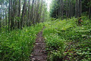
A segment to remember by SScheumann   Notice NoticeNo dogs are allowed in Coronado National Memorial south of the pass / Montezuma Canyon Road. Dogs are allowed north of the road on the Crest Trail #103. Be careful not to allow one paw to step off-trail or all hell breaks loose. From Montezuma Pass use the hiker-only access to the southern start of the AZ Trail by taking the Coronado Peak Trail (500 ft.), then Joe’s Canyon Trail to the Yaqui Ridge Trail, which descends steeply to the Mexican border and ends at an international boundary marker. Returning to Montezuma Pass the route takes the Crest Trail #103 from the Coronado National Memorial up into the Miller Peak Wilderness. After this steep and strenuous ascent, the trail continues as it passes a junction with the Lutz Canyon Trail #104 and soon reaches the Miller Peak Spur Trail (#105). After passing the spur, the trail follows a ridgeline over to Tub Spring (some maps show as Bathtub Spring), then almost immediately goes left and uphill at the signed Miller Canyon (#106)/Crest Trail junction and left and uphill again at the signed Carr Peak (#107)/Crest Trail junction. The trail continues past the Oversite Canyon Trail (#112) junction, past Bear Saddle and Granite Peak, and then goes left at the signed junction with the Sunnyside Canyon Trail (#117) near Pat Scott Peak. It follows this trail down into Sunnyside Canyon, passes the Copper Glance Trail junction, and runs downstream to the wilderness boundary. Here it joins a dirt road (FR 4758) for a short distance and then turns right at the AZT sign onto the Scotia Canyon Trail (#127). It crosses FR 4759, then turns south into Scotia Canyon, and works its way down to FR 48. After crossing this road the trail turns west and reaches the Parker Canyon Lake Trailhead on FR 194 with a parking lot just north along FR 194 overlooking Parker Canyon Lake.
Northern Trailhead: Parker Cyn Lake Check out the Official Route and Triplogs. Note This is a moderately difficult hike. Leave No Trace and +Add a Triplog after your hike to support this local community. One-Way Notice This hike is listed as One-Way. When hiking several trails on a single "hike", log it with a generic name that describes the hike. Then link the trails traveled, check out the example. | ||||||||||||||||||||||||||||||||||||||||||||||||||||||||||||||||||||||||||||||||||||||||||||||||||||||||||||||||||||||||||||||||||||||||||||||||||||||||||||||||||||||||||||||||||||||||||||||||||||||||||||||||


