| | -
| |  |
|
1 |
-
-
-
-
-
-
-
-
-
-
-
-
-
-
|
| | |
|
| Hiking | 7.66 Miles |
295 AEG |
| | Hiking | 7.66 Miles | 4 Hrs 19 Mns | | 1.80 mph |
| 295 ft AEG | 4 Mns Break | | | |
|
|
| |
| Linked |
|
none
[ show ]
| no linked trail guides |
| Partners |
|
[ show ]
| partners | | We headed south of Tucson for a hike in the Las Cienegas National Conservation Area to hike along the Cienega Creek. We started along the Fortynine Wash Road off of Empire Ranch Road and headed north along the creek to the Narrows. The plan was to drive to Fortynine Wash and hike the 3 miles to the Total Wreck pump site. The Fortynine Wash road was torn up a bit where North Canyon comes in so we opted to park under some large cottonwood trees and hike from there. The road condition really wasn't that bad any high clearance vehicle could make it but we decided to walk it. As a result we only made it to the Narrows, slow going in the creek. We started this hike at 1:00 and wanted to make sure we were back at sunset.
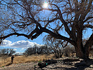
The first mile was along the Fortynine Wash Road is quite scenic, some very large cottonwood trees. Many of these gargantuan trees were dead, looks like the river coarse changed and they died from lack of water or the water table changed, not sure. The ones in the creek were doing fine. Just before Fortynine Wash we dropped into Cienega Creek. There are no trails here but the game/cattle trails work fine, they know the area well and usually don't lead you into a trap. You just have to watch out for the occasional trail that heads out of the creek bed to some grazing or bedding area. The water flow was moderate making for easy navigation along the creek. The vegetation was light as the spring growth hasn't started. The difficult or not as easy section was from Stevenson Canyon coming in from the west, Empire Mountains, to wood Canyon coming in from the east, Whetstone Mountains. This section is one of a few areas that this creek gets its name, very marshy, no easy way to avoid walking in the muck. Later in the year when the water is higher and the vegetation is thicker alternate routes have to be found (at least there are no alligators). Once past Wood Canyon the walking along the creek is easier all the way to the Narrows.
On the return trip I opted to stay more on the east side of the creek thinking I would avoid the marsh but this route involved more walking through heavy brush that would pinch out in marsh land. The first opportunity we Had we climbed up the east bank on to the higher flat ground. Not always easy to get out of the creek due to the 20 to 40 foot mud cliffs. Fairly easy walking even though it was through waist high grasses in a mesquite tree forest (glad it wasn't rattlesnake season). My plan was to walk this a ways and then hit the creek. I spotted the tall cottonwoods and headed in that direction (not much visibility in this area). When I got to the Cottonwood trees I encountered a 30 to 50 foot drop off with the creek going in a different direction than anticipated and didn't recognize the creek below, I was confused. Consulted my GPS that is like looking at an elephant through a straw and that didn't show this creek at all and Cienega creek was to the west, now I'm really confused. I used the GPS to get a better reading but depending on how you hold the GPS depends on where north is (I've had this issue before). It was after 4:00 and was getting a little concerned thinking I have to get back to the road at least before dark, don't want to be wandering around in the dark through this mesquite forest. After getting out of the little panic mode and cussing out the damn GPS I had a moment of clarity and remembered the sun is to the west just head in that direction. I really need to carry a topo map with me or a lap top GPS that you can actually see where you are. Eventually I made it to Cienega creek and followed along the rim to where there was a break in the cliff to get down. I didn't figure out until I got home and looked at Google Earth that the other creek I came up on was Wood Canyon that parallels Cienega creek for a while before entering it. This creek doesn't show up until you zoom way in on the GPS and becomes kind of useless for orientation. Lesson learned from this was that it was much easier to walk through the muck than it was to bypass it.
Great hike though and am looking forward to doing the section north of the Narrows. This is the time of year to do the Cienegas because the water isn't too high and the vegetation manageable. Other than a few cows we had the creek to ourselves.
[ youtube video ]
|
| _____________________
| | |
|
|
|
|
|
| |
