|
| | | Central Sierra Ancha Tour, AZ | | | |
|
|
Central Sierra Ancha Tour, AZ
| | |
| |
|
| Backpack | 30.17 Miles |
6,712 AEG |
| | Backpack | 30.17 Miles | 2 Days | | |
| 6,712 ft AEG | | 25 LBS Pack | | |
|
|
| |
| Partners |
|
none
[ show ]
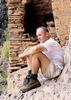
| no partners | | Someone once told me that there were more than just two wildernesses in Arizona. After a derisive scoff I spent the next three years exploring the Superstitions and Mazatzals. Finally headed out to the Anchas last weekend and boy howdy it was pleasant.
FR 410 & FR 235
Necessary evil to make a loop in this area. As far as road hikes go it was rather nice, shaded by ponderosa pines and frequent deer distractions. The climb up FR 235 (?) was a bit relentless. Culvert work referenced in https://hikearizona.com/x.php?x=144483 is finished, road is drivable. View from Billy Lawrence Trailhead is jaw-dropping.
Center Mountain #142
Quick jog on an old two-track (Lucky Strike #144) to the start of Center Mountain Trail. Climb is immediate and steep, though the fantastic trail construction makes it enjoyable. Once the steep section is done it's a gentle rise over the rounded dome of the mountain, where the trail is straight and easy to follow. Open meadow gets a bit annoying to track, though the views over Reynolds Creek and Baker Mountain are worth the extra time hunting cairns. Soon its back under the pines, a few more good views east over Cherry Creek, then a gentle drop towards Reynolds Creek.
Things get a bit confusing here. There are two connector routes to Reynolds Creek and a third route that climbs up to 7677'. I think the third route is the continuation of #142, not sure. Anyways, did all three for completionist sake. Upper connector climbs a bit (unexpected) and is clear and easy to follow, lower connector is starting to get overgrown by short plants with angry thorns. Think that's going to be the name of my band: Short Plants with Angry Thorns.
Time to climb. Getting up to 7677' was a pain, trail seemed to be mostly washed out. This was my last big climb of the day so I was also mentally checking out. Didn't get much better on top, cairns seem to be randomly placed around without any intention of guiding a hiker in a certain direction. Views were amazing. Near the summit an old road showed up to guide my feet down to the junction w/ Reynolds Creek #150. A magical mile later and it was time to descend to the rim.
Murphy Ranch Trail #141
Lots of variety over the short trail. Shade, berries, and exposed burnt land. I liked the berry section the best, as did some of the local fauna, judging by the scat and prints. A good rain and the sad little raspberries would plump right up. Trail was well-defined and descended in a knee-friendly manner.
Rim Trail #139
Junction worried me a bit: north looked clear, south looked brushy. For today I only had to worry about north. Trail quickly swung into the dreamy Cold Spring Canyon. Some fire damage, still amazing. Creek was barely a trickle. Next mile dragged in comparison, all exposed with thorny sections (am now intimately familiar w/ New Mexico Locust), and when I got within a few hundred yards I bee-lined to Edward Spring to filter up. Checked out the great views, setup camp, and eventually drifted off to sleep.
Note about hammock: my original campsite was down by the fire pit. As soon as I set it up I realized how dumb this was, as I'd be in a potential cold-collecting spot within a stone's throw of the spring, so I relocated to some of the trees on the ridge above. Kept warm all night, was out of the wildlife corridor, and enjoyed eery views of Pueblo Canyon in the moonlight.
Woke up the next morning, packed and filtered in the predawn, and quickly backtracked down Rim Trail. View of the early morning sun in Cold Spring Canyon will be permanently etched in my head. Trail wasn't that bad after the Murphy Trail junction, either. Helpful cairns were tall, obvious tread. Spent some time looking for a few springs, Hunt and Armor Corral, no luck. Worst overgrowth is still near Armor Corral, though @CannondaleKid's work was apparent and appreciated. The views down Devil's and Deep and the unnamed canyons were good, just not as awesome as Pueblo or Cold Spring. Views down Coon Spring were depressing, so much fire damage. At the end I hauled up Parker Creek Trail to reach FR 487.
FR 487 to Workman Creek Falls
While in the area... road seemed steep, both down and uphill. Falls were barely running. Wondered if there was a way to get down there - for today I was happy staying up on the road. Backtracked to Peterson TH.
Abbey's Way #151
Meadow is quite pleasant, some flowers along trail and orchard across the way. Obvious recent trail maintenance, clearing brush and cutting deadfall, even new cairns, made the steep hike up a breeze. Well, as much of a breeze as it could be with the 23 miles behind me. Last switch was fully exposed and quite hot. Reached the top, stumbled around to take some photos, and then found some shade to eat a quick lunch. After lunch I took FR 487 & 487A down to Murphy/Haldi Ranch.
Reynolds Creek #150
Home stretch. The first mile was a gradual climb under wonderful shade, not much breeze until I crested the saddle. Next few miles were great, distracting enough that I forgot to look for Knoles Hole. Trail construction is on point, especially the section near the falls, though the creek was dry here. In fact, most of the creek was dry with only a few stagnant pools of water. Forgot about the nettles near the trailhead, not sure if I avoided them or crashed right through. Reached the trailhead exactly 24 hours after leaving it the day before.
Didn't see another soul on the trail. Think I'll be back up here fairly soon.
Sierra Ancha Miles: 17.7/59.1 (29.9%) |
  |
Cienega Spring |
Gallon per minute |
Gallon per minute |
| | | Not sure where all this water is coming from, but pipe was flowing and trough was topped off. |
|
Edward Spring |
Dripping |
Dripping |
| | | Spring itself was deep enough to dip a cup in for filter, overflow has been mauled/fouled. |
 |
Hunt Spring |
Dry |
Dry |
| | | Searched area, did not find anything besides a dry drainage. |
|
Trailside Spring |
Dry |
Dry |
| | | Dry at trail, did not attempt the ridiculous bushwhack to check exact coordinates. | | _____________________
| | |
|
|
|
 Route Editor


 . Got to Cold Spring Canyon, went off track to view Canyon, pretty sketchy but absolutely amazing. Only 4+ miles, but in the Anchas... it's no walk in the park! Had our corn nuts at the canyon and called it a day.


 (which has gone by frighteningly fast
  ). Still, most of those miles have been within the Phoenix metro area
  .
.
 . The dew soaking our shoes and legs make the decision easier in terms of the fire danger threat


 Don't take your future wife to Devil's Chasm or Sierra Ancha Treasure during the first couple hikes you do cause every time you suggest a hike it will be met with extreme distrust and hesitation. She enjoyed the hike and was interested in planning a trip in the area as long as we don't enter the Sierra Ancha by way of Cherry Creek.
 ](https://hikearizona.com/dex2/images/smilies/eusa_wall.gif "Brick wall") I was not able to get as far down the canyon as I had hoped. The views were great. The trail passes directly above where I found the large ice waterfall. I could hear water and could see the choke stone, but could not get a picture with the shadows. The water seemed to be coming from an underground source. The burnt trees and immense thick variety of sharp plants made it nearly impossible to get to the edge at least pain free. There was a little bit of relief walking along the edge, but then I had to exit back to the trail. The bushwack and exploration added about 1000 feet and 1 + miles to the hike. Good times although it was much windier/colder than I expected. I'm glad I denied the request to join me on the bushwack otherwise there would have been no future backpack with the fandamily.
I was not able to get as far down the canyon as I had hoped. The views were great. The trail passes directly above where I found the large ice waterfall. I could hear water and could see the choke stone, but could not get a picture with the shadows. The water seemed to be coming from an underground source. The burnt trees and immense thick variety of sharp plants made it nearly impossible to get to the edge at least pain free. There was a little bit of relief walking along the edge, but then I had to exit back to the trail. The bushwack and exploration added about 1000 feet and 1 + miles to the hike. Good times although it was much windier/colder than I expected. I'm glad I denied the request to join me on the bushwack otherwise there would have been no future backpack with the fandamily. 

